Tag Archives: featured

China’s Maritime Silk Road Gamble

This is republished from the Johns Hopkins SAIS Foreign Policy Institute.

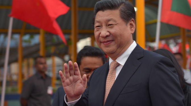
Ever since Xi Jinping announced the creation of a Maritime Silk Road in an October 2013 speech to the Indonesian parliament, China’s vision for “one road” running through Southeast and South Asia has driven a significant portion of Chinese foreign policy in its periphery. This has led to both the controversial Asian Infrastructure Investment Bank (AIIB) (announced in the same speech) and complementary investment funds such as the Maritime Silk Road Bank, as well as high-level diplomatic visits by Chinese leaders to countries in the region. In addition, China sees its “Silk Road Economic Belt” among its Central Asian neighbors as indivisible from the “21st Century Maritime Silk Road,” as seen by China’s slogan 一带一路 (“one belt, one road”) and its public diplomacy effort to promote both policies together. All of this indicates that, like many Chinese foreign policy initiatives, the “21st Century Maritime Silk Road” is multi-pronged: it is intended to serve diplomatic, economic, and strategic purposes.

First and foremost, the Maritime Silk Road is designed to pacify neighboring countries threatened by China’s aggressive territorial claims in the South China Sea. Curiously, China has attempted to both aggravate tensions among its Southeast Asian neighbors and soothe them at the same time, contrary to its normal pattern of swinging back and forth between aggressive brinksmanship and diplomatic rapprochement (such as in China’s relationship with Taiwan or its cutting off and then reestablishing of military to military ties with the United States). Despite the idealistic claims of ‘peaceful economic development absent political strings’ made by Chinese leaders and state media about the Maritime Silk Road, China has continued unabated to strengthen its unilateral claim to vast maritime territory in the South China Sea, turning reefs and other undersea maritime features into full-fledged islands, complete with airstrips that could be used by the People’s Liberation Army.

Conversely, the Maritime Silk Road is also designed to cement relationships with countries that are tacitly friendly to China such as Malaysia, Cambodia, Sri Lanka, and Pakistan. This will be accomplished primarily through economic incentives like infrastructure development and trade deals. In this sense, the Maritime Silk Road not only stands side by side with the Silk Road Economic Belt, but also as part of a historical continuum that includes China’s past investment in maritime-related infrastructure, which has been referred to by some as a “String of Pearls” policy. If one wants to know what kind of infrastructure projects China will fund in the future, look to what it has done in the past: oil and natural gas links to Myanmar’s port in Sittwe, ports in Sri Lanka such as the Hambantota and Colombo Port City projects, and the Pakistani port in Gwadar. Indeed, China and Malaysia have already announced a joint port project in Malacca. Meanwhile, China, which is already the largest trading partner for most countries in Southeast and South Asia, is also signing new free trade agreements with countries such as Sri Lanka.

Chinese infrastructure investment, intended primarily to strengthen China’s energy security and increase trade between China and its neighbors, will now get a huge boost with the creation of both the AIIB and more specialized investment vehicles such as the Maritime Silk Road Bank and the Silk Road Fund. While the AIIB has had the flashiest rollout with China contributing $50 billion USD to a planned $100 billion USD in capital, the other two funds are no slouches: the Silk Road Fund has plans for $40 billion USD in capital, while the Maritime Silk Road Bank hopes to attract $100 billion RMB in investment.

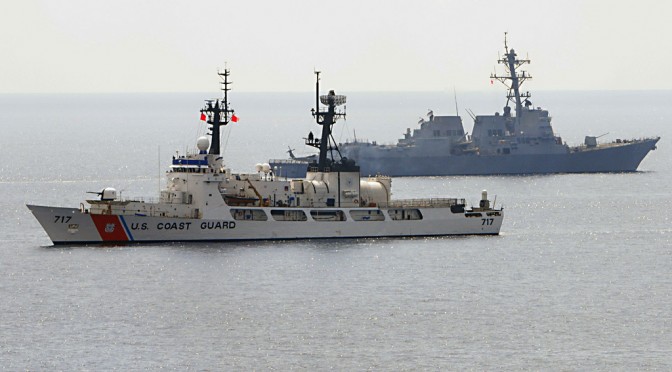
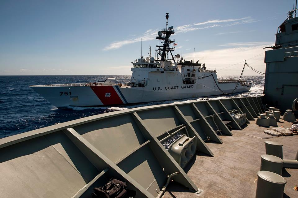
Finally, unmentioned in authoritative Chinese sources is that the Maritime Silk Road, and especially Chinese infrastructure investment, is implicitly intended to facilitate more frequent People’s Liberation Army Navy (PLAN) deployments in the Indian Ocean and beyond. The PLAN needs reliable logistics chains across Sea Lines of Communication (SLOCs) throughout Southeast and South Asia; ships cannot go far without a reliable supply of fuel, food, and armaments. But for the foreseeable future, China is at a serious disadvantage in this regard: the US Navy and allied navies have such a preponderance of force and ability to project power throughout the region that the PLAN is ill-equipped to compete. Given the PLANs current capabilities, China’s logistics capacity would only be dependable during peacetime; they would not survive in a contested environment, particularly if the US decided to close off key chokepoints like the Malacca and Sunda Straits. Therefore, the first step to strengthen the PLAN’s capabilities is to build reliable logistical infrastructure in key friendly states, such as the aforementioned projects in Malaysia, Sri Lanka, and Pakistan. These logistical links would still be quite vulnerable in a conflict scenario, given the tenuous relationship China would have with even putatively friendly countries if China went to war. Therefore, the primary benefit for the PLAN is to demonstrate presence in peacetime, and to show that it can operate far from its own shores.

The Maritime Silk Road, along with the attendant Silk Road Economic Belt, is truly a multi-headed dragon, so large that it is difficult to disaggregate its many parts. The most difficult challenge for China, however, will not be building infrastructure and signing trade deals—these are no doubt massive undertakings, but they are fundamentally instrumental tasks that will not receive much opposition from countries in the region. The more difficult objective for China is translating investment and trade into building a coalition of states in the region that align their values and foreign policy goals with those of China, and indeed identify with China at the expense of competitors like the US. China will likely find this kind of bandwagoning hard to pull off—when it comes down to it, the Maritime Silk Road may wash away like sand.

William Yale is the Director of Operations at CIMSEC, an Adjunct Fellow at the American Security Project, and a Research Associate at the SAIS Foreign Policy Institute.

A Retired Coastie’s Perspective on the Revised Strategy

AN OVERVIEW:

IHMAS Success refuels USCGC Waesche RIMPAC2014n considering this strategy, it is clearly not a strategy for war; it is a strategy for maintaining the peace, the sometimes violent peace that has become the new norm. As such, it assumes the Coast Guard will continue exercising its normal peacetime priorities. Still I feel it should provide a guide for transition to a wartime footing. Unless it is in the classified annex, that guidance is missing, in that it does not define Coast Guard wartime roles or suggest how the Coast Guard might be shaped to be more useful in wartime.

The Coast Guard is, potentially, a significant Naval force. It currently has more personnel than the British Royal Navy. Effectively, the Coast Guard is the low end of the American Naval Forces’ High/Low mix, bringing with it significant numbers of patrol vessels and aircraft. At little marginal cost, it could be made into an effective naval reserve that would serve the nation well in an intense conventional conflict.

If you look at the title, “A Cooperative Strategy for 21st Century Seapower: Forward, Engaged, Ready,” the words cooperative, forward, and engaged are particularly relevant in describing the thrust of the strategy.

It expects US naval forces to cooperate and engage with allied and friendly forces both to improve relations and strengthen and encourage those friendly forces. The Coast Guard has a major role in this, in bringing expertise in a board range of governance functions that friendly navies and coast guards can relate to.

The Navy also expects to have a substantial part of its force “forward.” Not only forward but also geographically widely distributed. This violation of the Mahanian maxim to keep your battle force concentrated has been the norm for decades, but it has been a reflection of the preponderance of the US Navy that may be eroding. It is a calculated risk that, the benefits of working with and assuring allies and being on scene to deal with brush fires, outweighs the potential risk isolated, forward deployed Carrier Strike and/or Amphibious Ready Groups might be overwhelmed in a first strike by a concentration of hostile forces.

The strategy talks about surge forces, but frankly the potential is far more limited than it was when the Navy was larger. For the Coast Guard this “forward” strategy, combined with the apparently ever increasing concentration of US Navy forces in only a few homeports, including foreign ports, has important implications. There are long stretches of the US coast that may be hundreds of miles from the nearest US Navy surface combatant.

If a suspicious vessel is approaching the US, that must be boarded to determine its nature and intent, the boarding is most likely to be done by a Coast Guard cutter, and not by a National Security Cutter, but most likely by something much smaller. The cutter is also unlikely to have any heavily armed backup.

WHAT IS INCLUDED IN THE STRATEGY?

The strategy recognizes and explicitly states an intention to exploit, “…the Coast Guard’s unique legal authorities…(to)…combat the illegal drug trade, human trafficking, and the unlawful exploitation of natural resources…”

In several places there is recognition of the Coast Guard’s potential for capacity building with navies and coast guards of friendly nations.

There is also an apparent commitment to an improved and shared Maritime Domain Awareness.

The apparent intent to increase the availability of modular systems provides a means of quickly adapting Coast Guard assets to wartime roles, but thus far I have seen no official interest in exploiting this possibility.

The Middle East Section seems to suggest that the six Coast Guard patrol boats and their augmented crews, currently stationed in Bahrain, will remain there and, given their age, they may require replacement as the new Webber Class WPC, Fast Response Cutters, come on line. In fact these Webber class patrol craft could be very effective in combatting piracy off Somalia.

These patrol craft essentially fill the same role and face the same threats as the Navy’s Cyclone class patrol craft. Will they receive any of the weapons upgrades that the Navy’s Cyclone class PCs have been given?

WPC Kathleen_Moore

A Webber Class WPC, Fast Response Cutter

Looking at the section on the Western Hemisphere, there is a commitment to, “…employ amphibious ships and other platforms, including Littoral Combat Ships, Joint High Speed Vessels, Afloat Forward Staging Bases, hospital ships, other Military Sealift Command ships, and Coast Guard platforms, to conduct humanitarian assistance and disaster response missions. We will also employ maritime patrol aircraft such as the P-8A Poseidon and unmanned aerial vehicles. Other ships and aircraft will provide periodic presence for recurring military-to-military engagements, theater security cooperation exercises, and other missions.” But there is no specific commitment to employ Navy vessels for drug enforcement. Was this omission intentional?

512px-Antarctica_CIA_svg
Competing claims in the Antarctic

Looking at section on the Arctic and Antarctic,  There is no specific commitment by the Navy, although the DOD does have an Arctic strategy that includes better hydrography and Maritime Domain Awareness. It looks like the Navy is content for the Coast Guard to be the face of US naval presence in the Arctic. There is reference to the use of the Nation Security Cutters (NSC) in the Arctic, but surprisingly no mention of the planned 25 Offshore Patrol Cutters (OPC) even though the OPCs will be ice-strengthened, while the eight planned NSCs are not.

IMG_4135

A model of Eastern’s proposal for the Offshore Patrol Cutter. Eastern is one of three shipyards still in contention to  build the 25 ships planned.

In the Deterrence section, the strategy states, “The Coast Guard maintains a continuous presence in our ports, internal waterways, along our coasts, and offshore, providing an additional layer of defense against maritime threats.” But there is no definition of what threats the Coast Guard is expected to respond to and no definition of the capabilities the Coast Guard is expected to provide to deal with these threats.

A Major Omission:

USCGC_Owasco_(WHEC-39)_conducting_UNREP_Market_Time
Cutter Owasco (WHEC-39) unreps while engaged in Operation Market Time off the coast of Vietnam.

In the Sea Control section there is no mention of a Coast Guard role in Sea Control. There should be. Sea Control frequently involves Visit, Boarding, Search and potentially Seizure of non-military vessels, e.g. merchant and fishing vessels. The Coast Guard is ideally suited for this role and has conducted this type of operation in war zones in the past, notably the Market Time Operation during the Vietnam War. In fact, the common Coast Guard missions of drug and alien migrant interdiction are forms of sea control that potentially protect the US from non-state actors. The strategy does address these particular elements of Sea Control in the Maritime Security section.

When it comes to counting assets that might be used to exercise sea control, the Navy has roughly 110 cruisers, destroyers, frigates, LCS, and patrol craft and most of these, particularly the 85+ cruisers and destroyers, will almost certainly have higher priority missions. The Coast Guard includes over 100 patrol boats and about 40 larger patrol vessels that routinely exercise sea control on a daily basis.

121203-G-XX000-001_CPO Terrell Horne

EVALUATION:

From a Coast Guard perspective, this strategy has largely canonized the status quo and the existing recapitalization program of record. It recognizes the Coast Guard’s unique authorities and its ability to contribute to capacity building. It seems to promise greater integration of a multiservice Maritime Domain Awareness.

On the other hand it does nothing to define Coast Guard wartime missions or how the Coast Guard might transition to a wartime footing. The force structure section does nothing to inform the design of Coast Guard equipment so that it might be more useful in wartime. It also does nothing to help that Coast Guard patrol boat I talked about at the beginning that is about to attempt to stop and board a potential hostile vessel that may be about to make an unconventional attack on a US port.

This is only the second iteration of the three service cooperative strategy. It is a marked improvement in specificity over the previous document. Hopefully there will be a process of continual improvement in succeeding editions.

This post appeared in its original form at Chuck Hill’s CG Blog. Chuck retired from the Coast Guard after 22 years service. Assignments included four ships, Rescue Coordination Center New Orleans, CG HQ, Fleet Training Group San Diego, Naval War College, and Maritime Defense Zone Pacific/Pacific Area Ops/Readiness/Plans. Along the way he became the first Coast Guard officer to complete the Tactical Action Officer (TAO) course and also completed the Naval Control of Shipping course. He has had a life-long interest in naval ships and history.

CALL FOR ARTICLES – Policy & Analysis Document Reviews

BJ Armstrong, author of 21st Century Sims, those who wish to understand or pontificate, we must “do our homework.” CIMSEC embraces that ideal, so we are putting out a general call for articles on the policy & analysis documents that often guide or inspire our discussion on maritime security.

There is a wide variety of material to pull on, both historical and current. Many have already reviewed the US Navy’s revised Cooperative Strategy for 21st Century Seapower. However, there is a vast body of policy documentation produced – from CNA to the PLA, individuals to institutions – available for review, not to mention the many analyses of maritime regions and peoples to go along with questions of maritime strategy and military capability.This is a chance to learn, do a reality check on policy-driving documents, or even assess good/poor communication methods.

Reviews should be from 700-1400 words – because let’s be serious, if folks wanted to read more than 1400 words, they’d just read the document itself. Email your ideas and articles to:
nextwar (at) cimsec.org

For faster processing, CIMSEC members should upload any articles/material directly through their wordpress account.

March 24, A Very Significant Day For Mariners

John-HarrisonIf you were aware of the grounding of the British fleet, and the deaths of over 2000 sailors, off the Isles of Scilly, west of Cornwall, in October 1707, then you are either the rare supercentenarian or you are a maritime history geek such as myself. All of this begs the question, why is this date in maritime history so important?

Well since you’re wondering, it took those deaths to get the attention of the Admiralty in solving one of the biggest conundrums in ocean navigation, accurately measuring longitude.  Seven years later in 1714 Parliament passed the Longitude Act,  [they] convened a Board of Longitude to examine the problem and set up a £20,000 ( $2.5 Million 2015) prize for the person who could invent a means of finding longitude to an accuracy of 30 miles after a six week voyage to the West Indies. It also made minor awards for discoveries and improvements to the general problem. (Citation from The Royal Naval Museum) 

John Harrison undertook this challenge with no formal education or training. By Jove he was just a self taught clock maker! John’s belief was that time would prove the correct measurement of Longitude. He was going head to head with the Astronomer Royal, Nevil Maskelyne, the most prominent proponent of an astronomy-based method.  Maskelyne wholeheartedly believed that longitude could be calculated using lunar charts and tables, and that using a mechanical piece was irrelevant.  

The prize offered by the Board of Longitude was a tempting one for Harrison and he set out to make a sea-going timekeeper that could keep accurate time to claim the prize. It became his life-long work. The idea was to be able to compare local time to that of the pre-determined Greenwich time (which the timekeeper or chronometer would be set to), and thus find the longitudinal position of the ship.

After years of development and five versions of his time piece, H-1 to H-5, it was a copy of H-4 that accompanied Captain Cook’s h1_smsecond voyage (1772-1774). The Captain was so impressed with the chronometer that he was able to accurately chart the South Sea Islands. He eventually took the chronometer on his third and final voyage. 

John, however did not win the entire prize. During the periods of 1765 and 1773 he was awarded a little more than half. In 1774 the Parliament set new standards for winning the prize; all entries must be submitted in duplicate, undergo testing for one year at Greenwich, be further tested on approved voyages by the board. h4

John Harrison died on his 83rd birthday on March 24, 1776 at Red Lion Square, London. He was buried in a vault in Hampstead church. A tomb was later erected by his son, William. In 1879, the London Company of Clockmakers reconstructed it as a mark of respect for his achievements- even though Harrison had not been one of its members.

So please, on this day March 24th lift a glass to the man who made a navigators heroes since 1772.

sailors-beer1

Cheers John!