

Iran War Series Concludes on CIMSEC

By Dmitry Filipoff

In the last two weeks, CIMSEC featured writing submitted to our Call for Articles on maritime conflict with Iran. 

Authors covered a wide range of topics, including strategic differences between allies, new paradigms in warfare, and underappreciated yet decisive dimensions of the conflict. The maritime domain has prominently featured in this conflict and exerted a major influence over the terms of war termination. The broader impacts of the war still remain to be seen, but could include a wider degradation of freedom of the seas and lesser readiness for great power conflicts. This war deserves the most careful examination from navies and maritime forces to better understand how the changing character of warfare and global connectivity is evolving the security maritime domain.

Below are the articles and authors that featured in the series. We thank them for their contributions.

The Price of Doubt: Sea Control in the Strait of Hormuz,” by James Jackson

“The strait was open when the bombs fell. On March 4, Iran closed the strait in response to the strikes. What had been a campaign against Iranian military power became, by consequence, a campaign to reopen a waterway the United States had helped shut.”

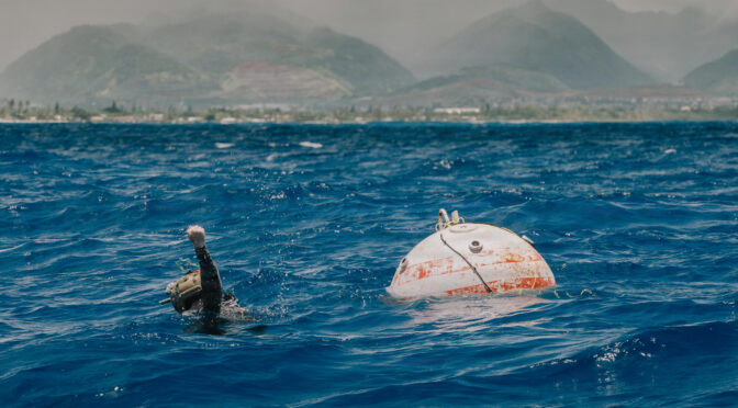
Hormuz and the Era of Asymmetry: Sea Mines, Unmanned Systems, and the Redefinition of Naval Power,” by Admiral Massimo Vianello (Ret.) and Master Chief Petty Officer Giovanni Giorguli (Ret.)

These threats, once categorized as one-off tactics employed in isolation, are now weighted by indigenous industrial capacities and employed at scale by Iran and its proxy networks. They are systematically integrated with cyber operations and strategic disinformation campaigns designed to destabilize financial markets, energy security, and global communication architectures.”

The Insurance Chokepoint: War-Risk Pricing as an Instrument of Maritime Coercion,” by Bruce Randolph Tizes

Most analysis of the U.S.-Iran maritime war will focus on carrier strike group positioning, IRGC small-boat tactics, Marine Corps Stand-in Forces, and the operational lessons of contested chokepoints. Those analyses are necessary. They also miss a dimension Iran has built as deliberately as its mine and drone programs, one that will outlast any ceasefire: the commercial and insurance layer through which maritime trade is priced and governed.”

The Hormuz Closure and the Limits of Sanctions: How Russia Benefited from Iran’s Chokepoint Weapon,” by Rustam Taghizade

When the Trump administration granted India a 30-day waiver on March 5 to purchase Russian oil, the formal justification was straightforward: stabilize global energy markets after Iran effectively closed the Strait of Hormuz. Yet beneath the surface, a deeper story unfolded. The waiver revealed a tension between two pillars of contemporary U.S. strategy—the use of maritime power to secure global chokepoints and the use of economic sanctions to punish adversaries.”

Asymmetric Alliance Strategy: An Israeli Maritime Perspective on the Iran War,” by Ehud Eiran

For the United States, however, the restoration of maritime order gradually became an objective in its own right. This did not produce an open alliance dispute, but it did create different hierarchies of priorities. Israel viewed the sea primarily as another theater through which Iran could be weakened. The United States viewed the sea as both a theater of war and a strategic system whose disruption could undermine wider political and economic interests.”

Chokepoint Hormuz: Epic Fury and Italy’s Mediterranean Strategy,” by Rear Adm. Roberto Domini (Ret.)

The closure of Hormuz must be read through this framework — not as a regional crisis to be observed from a safe distance, but as a challenge that ‘cannot be delegated to others.’ This analysis traces the evolution of the conflict, assesses its geopolitical and operational consequences, and highlights Italy’s maritime vulnerabilities, which if left unaddressed, could lead to the loss of its relevance in the Mediterranean.”

The Iran War Highlights New Realities and Changing Paradigms,” by Paul Viscovich

To effectively impact Iran’s ability to launch similar attacks in the Strait of Hormuz, the U.S. would have to seize and hold the coastline from where these strikes originate. If the landings are successful, occupation of these coastal regions would force Iran to move its drone and ASCM launch sites further inland, increasing the reaction time for forces to target and engage, while exposing Iranian weapons to ground fire enroute to their targets at sea. However, this carries significant risks of its own.”

The Hormuz Strait Crisis Confirms Nodal Control Will Dominate Maritime Geopolitics,” by Ludvico Domini

The 2026 Strait of Hormuz crisis exposes the inadequacy of some classical geopolitical frameworks. Alfred Thayer Mahan’s sea power, centered on blue-water naval supremacy, and Halford Mackinder’s land power, which focuses on Eurasian continental hegemony, are framed in a dualistic tension with one another. This framing proves insufficient in an era of advanced globalization and asymmetric warfare.”

Convert Merchants into Unmanned Ships to Manage Risk in the Strait of Hormuz,” by Alexander Lott, Kristjan Tabri, and Angela Sooba

Would it be possible for ships to undertake the passage through danger zones, such as the Strait of Hormuz and the Persian Gulf, autonomously via shore-based control centers? Could crew members disembark for the inbound transit and then board the outbound ships in the ports far from the theater of war? Such a method could substantially change the risk calculus affecting commercial shipping and the safety of navigation in dangerous waters.”

American Naval Mines Can Be Decisive Against Iran,” by Ronald Stewart and Scott Truver

The conventional bombs carried by the Navy’s aircraft carriers could easily be converted to unconventional ‘Quickstrike’ naval mines to be planted in water as well as on dry land for offensive and defensive requirements, generating strategic, operational, and tactical implications.”

Dmitry Filipoff is CIMSEC’s Director of Online Content. Contact him at Content@cimsec.org.

Featured Image: March 12, 2025 – Naval vessels take part in a joint Iranian-Russian-Chinese military drill in the Gulf of Oman. (Iranian Army photo)

American Naval Mines Can Be Decisive Against Iran

Iran War Topic Week

By Commander Ronald E. Swart, United States Navy (Retired) and Scott C. Truver, PhD

President Donald J. Trump on March 9, 2026 declared that the United States “will not allow Iran’s terrorist regime to stop global oil supply. The Strait of Hormuz is going to remain safe. We have a lot of Navy ships there. We have the best equipment in the world inspecting for mines,” hinting that Iran had already deployed in the main channel about 80 of its estimated 6,000 mines. “Most of their ships are down at the bottom of the sea,” Trump asserted. “But we will hit them so hard that it will not be possible for them or anybody else helping them to ever recover that section of the world.”

Since February 2026, the spectrum of violence stemming from the conflict in the Strait of Hormuz has been expansive. It was not uncommon to see vessel masters playing “chicken” for better positions among many vessels anchored in the waterway. It included suicide attacks by small fast craft and patrol boats armed by Islamic Revolutionary Guard Corps fighters brandishing small arms and lightweight mines. Five-inch guns and anti-ship missiles were fired from U.S. surface warships and tactical aircraft and attack-helicopters. The U.S. fast-attack submarine USS Charlotte (SSN 766) torpedoed the Iranian frigate Dena in international waters, killing 104 crewmembers.

Six weeks after launching Operation Epic Fury against Iran, Trump ordered the Navy to blockade Iranian ports and to clear the area of any Iranian mines. Vice President J.D. Vance accused Iran of “economic terrorism” by closing the Strait and defended the U.S. blockade of Iranian ports as an equal response: “They basically threatened any ship that’s moving through the Strait of Hormuz.”

On May 3, Trump announced yet another plan to guide ships through the Strait, Project Freedom, which would search for and locate mines to be avoided but not to render them safe. Mine-hunting and sweeping would come later.

In all of this, there has been no indication that U.S. Central Command (CENTCOM) or U.S. Navy planners have seriously considered using American-made naval mines to neutralize what was left of the Iranian navy and other vessels attempting to make runs into and out of Iran’s ports. Minefield objectives that could inform U.S. planning are listed in the Barriers, Obstacles, and Mine Warfare for Joint Operations, Joint Publication 3-15:

  • Disrupt: A minefield is used to alter enemy formations and tempo, interrupt enemy timetables, cause the enemy to conduct MCM operations, or some combination.
  • Fix: A minefield is designed to slow or stop targets to create a target-rich environment for friendly forces in an engagement area. Ideally, this field would inhibit the enemy’s capability to defend itself against friendly forces.
  • Turn: A minefield is intended to divert enemy formations from their intended transit onto one that is advantageous to friendly units.
  • Block: A minefield is emplaced to stop maritime traffic along a specific avenue of approach. Blocking minefields should be able to withstand enemy MCM techniques, including clearance through attrition, using creativity, technology, mine density, or some combination to overcome enemy efforts. While all minefields can be integrated with joint/integrated fires, blocking minefields benefit the most.

The conventional bombs carried by the Navy’s aircraft carriers could easily be converted to unconventional “Quickstrike” naval mines to be planted in water as well as on dry land for offensive and defensive requirements, generating strategic, operational, and tactical implications.

A Proven Weapon

Naval mines have been a constant for the United States since David Bushnell’s semi-submersible Turtle attacked General William Howe’s HMS Eagle on September 6, 1776. More recently, in the early 1960s the Navy bought conversion kits for more than 4,000 Mk-36 Destructor (DST) magnetic-influence bottom mines (maximum operational depth of 300 feet) fashioned from standard-issue Mk-82 500-pound bombs. The DSTs were the provenance of the Mk-62/63 Quickstrike mines that entered service in 1980.

In 1972-1973 Operation Pocket Money, the United States dropped thousands of mines against North Vietnamese ports and waterways, shutting down the port of Haiphong and energizing North Vietnam to return to the Paris Peace Talks. On May 9, 1972, Navy attack aircraft began minelaying strikes against Haiphong harbor. Thirty-six mines were planted, and, to limit provocation of the Soviets, Chinese, and other third parties, the mines were set with a 72-hour delay before they became active.

U.S. President Richard M. Nixon explained:

“All entrances to North Vietnamese ports will be mined to prevent access to these ports and North Vietnamese naval operations from these ports. United States forces have been directed to take appropriate measures within the internal and claimed territorial waters of North Vietnam to interdict the delivery of any supplies. Rail and all other communications will be cut off to the maximum extent possible. Air and naval strikes against military targets in North Vietnam will continue.

Nixon’s announcement gave other nations’ ships three days to escape the port before becoming trapped. Nine ships departed Haiphong safely, while twenty-seven vessels remained “swinging on the hook.” Several merchant ships headed toward Haiphong turned away because of the mine threat. The Navy continued to reseed the minefields in Haiphong and at other North Vietnamese ports throughout 1972.

43 Years and Counting

The most recently designed mines reached the fleet in 1983. The Mk-65 aircraft-laid bottom mine consists of a thin-walled, purpose-built mine case, nose faring, and tail section adaptable to a parachute option. The Mk-65 is used against submarines and surface targets. The Mk-60 CAPTOR (enCAPsulatedTORpedo) mine was armed with a Mk-46 Mod 4 lightweight homing torpedo. CAPTORS, which were decommissioned in 2001, were able to detect, target, and attack submarines at long ranges, about 17,000 yards.

Since then, some 15 new-design concepts, including foreign navy candidates, never saw the light of day.

As of 2026, U.S. surface warships and special-mission surface craft cannot deploy mines, while only a handful of the 2,000 pound Mk-67 Submarine-Launched Mobile Mines (SLMMs) and the traditional thin-walled air-delivered Mk-65s remain in service. The three-boat Seawolf (SSN 21) nuclear-powered fast-attack submarines and some 26 Virginia (SSN 774)-class boats can deploy mines, should such weapons be used.

The aircraft-deployed shallow-water (about 150 feet) Quickstrike mines are the Navy’s only high-volume mines, and the remaining SLMMs can be launched only by aging Los Angeles-class (SSN 688) attack submarines. Of note, the Navy has repurposed SLMM Mk-13 warheads for the new clandestine delivered mines program.

The Quickstrikes also provide rapid-response capability. Because the Mk-62 500-pound and Mk-63 1,000-pound mines are bomb-conversion weapons, aircraft carrier air do not need to store them in special magazines reserved only for mines. A Mk-62/63 conversion-kit can be applied to a standard dumb bomb to create a naval mine.

The Mk-62 Flounder and Mk-63 Skipjack mines use the general-purpose Mk-82 (500-pound) and Mk-83 (1,000-pound), dumb bomb bodies. The smart bomb includes a variable-influence Mk-57 target detection device (TDD). These mines target submarines and surface ships and are capable of numerous arming delay, target sterilization, self-destruct, and other operational settings. The Mk-57 TDD uses magnetic and seismic influences for target detection and can be set to require combined magnetic and seismic influences of specific magnitudes.

In September 2014, U.S. Pacific Command (PACOM) demonstrated the extended-range Mk-62 Quickstrike-ER, a modification of the 500-pound winged Joint Direct-Attack Munition (JDAM)-ER. Dropped from a B-52H strategic bomber, this was the first-ever deployment of a high-accuracy, razor-sharp-precision, long-standoff aerial mine.

Subsequently, another joint effort between PACOM, the Navy, and the Air Force successfully dropped a 2,000-pound Mk-64 Quickstrike-JDAM-ER launched from a B-52H. It was effective out to ranges of 300 nautical miles, and from cruise altitudes at up to 40,000 feet, and landed with precision at desired drop points.

PACIFIC OCEAN (May 30, 2019) the Quickstrike-ER (QS-ER) Naval mine project drops towards the Pacific Ocean from a B-52 Stratofortress during an operational demonstration. (U.S. Navy photo by Mass Communications Specialist 1st Class Holly L. Herline)

The Air Force has also planned anti-ship “Quicksink” weapons in future loadouts. In July 2024, the Air Force and allied air forces tested sinking a large surface ship at long range, including for the first time using a U.S. Air Force B-2 Spirit stealth bomber. The test of the weapon occurred on 19 July, when a B-2 participated in sinking the ex-USS Tarawa (LHA-10), a retired amphibious assault warship the size of a small aircraft carrier. Quicksink warheads of some 2,000 pounds could give the Air Force bombers the anti-ship capability of a submarine-launched torpedo without exposing a submarine to risk from detection and targeting.

In 2026, the Navy was upgrading the Quickstrike mines to the Mk-71 TDD, a state-of-the-art firing mechanism. The Mk-71 senses magnetic, seismic, and pressure signatures and can be programmed with sophisticated target-processing and counter-countermeasures algorithms. This enables the Navy’s miners to optimize performance against different target classes and to counter future targets. In short, the Quickstrike mines are not simple devices but rival even the Navy’s cruise missiles in complexity and sophistication.

Analysis of the American experience with naval mines reveals that it took about three decades to approve the Mk-71 TDD for fleet operations. It is little surprise that in the competition for resources the Navy mine warfare community is often regarded as the service’s forgotten capability.

Blockading Iran

A blockade of Iran’s Hormuz ports, both inside and outside the Strait, could be accomplished with the use of American mines, assuming that U.S. minefield plans are updated and the mine hardware is ready to use. Stopping Iran’s minelayers, many of which are very small and can be deployed from numerous ports or caves along the Iranian littoral, will not be trivial. The job of keeping these threats in ports­­ will be challenging enough.

As soon as the decision to lay U.S. mines is received, the Navy’s carriers could immediately launch Quickstrike-armed attack aircraft. Quickstrike TDDs can be set to such a sensitivity that they can detect and detonate on a wide range of surface and subsurface vessels, including Iran’s small-vessel signatures. Once U.S.-Iran War hostilities are exhausted, the deployed Quickstrike mines, already pre-set to self-destruct at a predetermined time, will self-clear, eliminating an additional hazard for U.S. and other navies’ mine countermeasure force efforts to ensure safe passage. Strait of Hormuz commercial and naval ship traffic will return to normal transits. Still, when hostilities in the Strait and Persian Gulf and Hormuz finally wind down, the dangerous and difficult task of clearing mines must begin.

As The Commander’s Handbook on the Law of Naval Operations NWP 1-14 (Hague Convention 1907) explains, nations that laid mines must remove them when hostilities end and must notify the positions of mines to the other belligerents. This is an extremely burdensome task. For example, following the cessation of Operation Desert Storm in 1992, it took a dedicated multi-navy coalition mine countermeasure force more than a year to clear the ten mine danger areas in the northern Persian Gulf.  U.S. Navy mine counter-measure operations continued into 1997.

Similarly, mine countermeasures vessels participating in various NATO exercises in the Baltic and North Sea have continued to find and destroy World War I- and World War II–era mines. To date, they have discovered between 50,000 and 80,000 mines. In mid-2026, should the United States decide to blockade Iran’s waters with sea mines, the challenges for U.S. miners would be to develop and plant effective minefields quickly and accurately. Estimates of the time it would take mine-sweepers and -hunters to sanitize a Hormuz waterway ran from a month to more than a year.

Into the Fight

Mine warfare is not easy, quick, or career-enhancing. Since 1776, only a handful of Navy flag officers (RDML/RADM) commanded mine warfare forces. Reaching Captain (O-6) was considered stellar performance. Multiple back-to-back mine warfare tours assured sitting in the last pew. As mine warfare historian Tamara Moser Melia recognized,  “By the end of World War I, most U.S. naval officers probably agreed with the assessment that mine sweeping [and mine hunting] remained merely unpleasant work for a naval man, an occupation like that of rat-catching.” The sentiment holds true today.

The U.S. Navy’s Quickstrike bottom influence mines will be critical to success. Despite the cost it will take to clear them when the war truly ends, their effects will be decisive in bringing the conflict to a conclusion. It is past time to get them into the fight.

CDR Ronald E. Swart, USN (Ret.) is the Principal Advisor to the Mine Warfare Association (https://minwara.org). He has 32 years of experience in naval minefield planning and mine readiness.

Dr. Scott Truver, also a Principal Advisor at MINWARA, has worked in support of U.S. Navy mine warfare since 1990 and is the co-author of Weapons that Wait: Mine Warfare in the U.S. Navy (2nd ed, Naval Institute Press).

References

Brad Lendon, “How the US Navy could Blockade Iran’s Port and Sweep Mines from the Strait   of Hormuz,” CNN World, 13 April 2026, https://www.cnn.com/2026/04/13/middleeast/us-iran-hormuz-blockade-minesweeping-explainer-intl-hnk-ml. Brad Lendon, “The U.S. Says It Has Successfully Practiced Using a Low-Cost Bomb to Sink a Major Surface Ship: China is Taking Note,” Navy Strategy News, 29 July 2024.

Brad Lendon, “The U.S. Says It Has Successfully Practiced Using a Low-Cost Bomb to Sink a Major Surface Ship: China is Taking Note,” Navy Strategy News, 29 July 2024.

Bryan Clark, “’Shoot and Kill’” Orders Made on Mine-Laying Boats in the Strait, Hudson Institution, CNN, April  2026 shttps://www.hudson.org/missile-defense/shoot-kill-orders-made-mine-laying-boats-strait-bryan-clark.

Jessie Yeung, “Day 45 of Middle East conflict––US Navy starts Blockade on Iranian ports,” CNN World, 14 April 2026.

Edwards, “Preparing Today for the Mines of Tomorrow,” Naval War College Review, Vol72, No3, 2019, 12, https://digital-commons.usnwc.edu/nwc-review/vol72/iss3/5/.

Mine Warfare Plan: Meeting the Challenges of an Uncertain World. Washington, DC: Office of the Chief of Naval Operations, OP-00/OP-03, 29 January 1992. Mimeo.

Riley Cedar, “The US has counter-mine ships homeported in the Middle East. Are they effective?” Navy Times, 23 March 2026, https://www.navytimes.com/news/your-navy/2026/03/23/the-us-has-counter-mine-ships-homeported-in-the-middle-east-are-they-effective/.

Commander’s Handbook on the Law of Naval Operations NWP 1-14 (Washington, DC: Office of the Chief of Naval Operations, March 2022, NWP­_1-114M.pdf)/.

Tamara Moser Melia, Damn the Torpedoes: A Short History of U.S. Naval Mine Countermeasures, 1777–1991, (Washington, DC: Naval Historical Center, Department of the Navy, 1991).

Tony DiGiulian, Owner, Naval Weapons Systems (NavWeaps, http//www.NavWeaps.com) military database. Accessed 3 June 2026.

“Trump Announces Plan to help ‘Guide’ Ships Out of the Strait of Hormuz, The Maritime Executive, 3 May 2026.

Featured Image: A Mk-63 Quickstrike Mine is mounted on a P-3 Orion aircraft. (US Navy photo)

Convert Merchants into Unmanned Ships to Manage Risk in the Strait of Hormuz

Iran War Topic Week

By Alexander Lott, Kristjan Tabri, and Angela Sooba

Introduction

Reportedly, approximately 20,000 seafarers on board some 2,000 ships, including tankers, bulk carriers, cargo ships, and cruise ships, were stranded in the Persian Gulf due to Iran’s closure of the Strait of Hormuz. The United Nations warned that given that the Strait of Hormuz is used for the transport of a fifth of global oil and liquefied natural gas (LNG), as well as a third of fertilizer components, its closure to international navigation would result in a global economic crisis.

Would it be possible for ships to undertake the passage through danger zones, such as the Strait of Hormuz and the Persian Gulf, autonomously via shore-based control centers? Could crew members disembark for the inbound transit and then board the outbound ships in the ports far from the theater of war? Such a method could substantially change the risk calculus affecting commercial shipping and the safety of navigation in dangerous waters.

Potential Use of Unmanned Ships in War Zones for the Protection of Seafarers

Most of the stranded ships fly a neutral flag. In the context of the naval warfare between the United States and Iran, neutral merchant vessels are legally entitled to continue navigating through the Strait of Hormuz under the right of transit passage.

There is a mismatch between what the shipping companies can do legally and what they have decided to do in practice. The seafarers need to return home and international trade needs to resume flowing. Yet the shipping companies have mostly decided to avoid entering the Strait of Hormuz. This is due to the risk of Iran’s attacks on merchant vessels and the danger of striking a naval mine in the suspected Iranian minefield in the international traffic separation scheme (TSS) located in the Omani part of the Strait of Hormuz.

In this context, there is a great danger to seafarers’ right to life. In the shipping companies’ risk-reward calculus, this seems to serve as one of the key factors that deters them from entering the Strait of Hormuz despite the promise of lucrative trade. The insurance companies have confirmed that the shipping companies’ reluctance to transit through the Strait is not due to the insurance companies withdrawing coverage, but rather due to concerns about the safety of the crews. One insurer stated clearly that “The reason ships are not moving is not through a lack of insurance; it is a question of the risk to crew and vessel safety being assessed by the ship masters and owners as too high.”

Convertible unmanned merchant vessels can change this risk calculus and make these transits more favorable. No crew means no hostages or casualties. Removing the crew from the equation also removes the most direct form of political leverage. The vessel, its cargo, and the commercial interests involved would still be at risk – but the immediate threat to human life no longer. The risk that unmanned ships strike a mine or are attacked by Iranian naval or air drones remains. But the fact that such risk does not accompany a threat to life might be worth taking and could still promise profitable trade.

The term “unmanned ship” is used here to cover both remotely controlled vessels and, where communication cannot be guaranteed, vessels with a degree of autonomous capability if communication is lost. How could this method work in practice in the Strait of Hormuz to safeguard human life while enabling the safe transit of trade?

Navigator’s Operational and Technical Perspective

The International Maritime Organization (IMO) has established a Traffic Separation Scheme (TSS) in the Strait of Hormuz – essentially a set of designated traffic corridors that keep inbound and outbound vessel traffic separated. A standard transit route through this sector consists of three legs and two waypoints, both of which fall inside a designated mine danger zone. The total distance of this specific transit is approximately 16 nautical miles (around 30 kilometers). For an unmanned transit, a reduced speed of around 10 knots (roughly 18 km/h) is advisable, giving an estimated transit time of approximately 96 minutes. The slower speed improves shore-based monitoring and reaction time, gives the vessel’s automated systems more opportunity to respond if communication is lost, and reduces the impact should the ship strike a mine.

From a navigator’s perspective, the idea of using remotely controlled and/or autonomous ships for this transit is technically possible. Most modern merchant vessels already have track-control or track-mode capability, meaning the ship can follow a pre-programmed route automatically. A slower speed is not necessarily a problem. In narrow and high-risk waters, it may actually improve monitoring, control, and reaction time.

A weakness to consider is the well-documented GPS-spoofing in the Strait of Hormuz. This phenomenon refers to feeding a vessel’s navigation system with false position data by an external signal. On a crewed vessel, the officer on watch can usually detect it by cross-checking the GPS position against radar, visual observations, the Automatic Identification System (AIS), compass heading, speed, and the planned route. On an unmanned vessel, that human cross-checking function would need to be replaced by redundant positioning systems, automated sensor comparison, and continuous monitoring from shore.

Unmanned ships do not yet have a recognized legal status under the International Regulations for Preventing Collisions at Sea (COLREGs) – the rulebook that regulates how vessels behave around one another at sea. These rules assume there is a human being onboard making decisions and bearing responsibility. An unmanned vessel cannot meet that requirement as the rules currently stand.

In a busy, mixed-traffic environment like the Strait of Hormuz TSS, this creates both legal and practical safety problems. Until COLREGs are updated to address unmanned vessels, fully authorized unmanned transit remains off the table – regardless of what the technology can already do. But the rules are about to change. Indicatively, the IMO adopted the International Code of Safety for Maritime Autonomous Surface Ships (MASS) in May, and the Code will take effect in respect of cargo ships on July 1, 2026.

The use of unmanned ships in danger zones does not make the risk disappear. The mine threat, drone threat, seizure risk, insurance exposure, and political consequences remain. However, the key point is that the current commercial deadlock is caused mainly by the unacceptable risk to human life, not by financial risk. If the crew is removed before the high-risk transit and re-boards after the vessel exits the area, the risk-reward calculation changes significantly.

Can Merchant Ships Be Temporarily Converted for Unmanned Transit?

From a technical perspective, the idea of conducting unmanned merchant vessel transits through the Strait of Hormuz is no longer purely theoretical. The industry already possesses many of the core technologies required for remotely controlled or partially autonomous navigation. The challenge lies less in inventing entirely new ships and more in rapidly adapting existing vessels for temporary unmanned operations in a high-risk conflict environment.

In practical terms, the envisaged unmanned transit would likely rely primarily on remotely controlled operation. It would correspond to the IMO’s definition of a Degree Three MASS, which stands for a remotely controlled vessel operating without seafarers onboard.

However, because communication in wartime conditions can never be guaranteed, the vessel would also require limited autonomous capability corresponding to Degree Four MASS concepts, enabling the ship to continue safe navigation independently if the communication link to shore is interrupted. Three technical components are critical for such operations, including reliable situational awareness, resilient communications, and control over propulsion and steering systems.

Situational Awareness in an Electronic Warfare Environment

Modern merchant vessels already carry extensive navigation sensor suites, including radar, GPS receivers, Global Navigation Satellite System (GNSS) receivers, AIS, gyrocompasses, echo sounders, Electronic Chart Display and Information System, and increasingly camera-based monitoring systems. Together, these systems provide the situational awareness necessary for both remote operation and autonomous navigation.

The challenge is not the lack of sensors, but integrating them into a temporary remote control architecture capable of securely transmitting data to a remote operations center. Rather than deeply modifying existing bridge systems, a more practical crisis-time solution could involve installing standalone modular sensor packages dedicated to unmanned transit operations.

However, the Strait of Hormuz presents a uniquely hostile electromagnetic environment. GPS spoofing and GNSS jamming have already become common in the Persian Gulf region. This means that unmanned vessels cannot rely solely on satellite navigation. Reliable communication between the vessel and the remote operations center is perhaps the single greatest operational challenge in a danger zone. Conventional satellite communications systems remain vulnerable to jamming, cyber interference, and signal degradation during military operations. Potential solutions include multi-layered communication architectures combining satellite links, tactical radios with frequency hopping, line-of-sight systems, and mesh-networked relay communications. Yet no realistic system can guarantee uninterrupted connectivity throughout the transit.

This fundamentally changes the operational concept. The ship cannot depend entirely on continuous steering by humans from shore. Instead, it must be capable of entering a degraded autonomous mode whenever communication is temporarily lost. In practical terms, this could mean the vessel continues following a pre-approved navigation corridor at reduced speed while independently maintaining collision avoidance and route-keeping functions until communication is restored. This concept already resembles the operational logic used in autonomous military systems and unmanned aerial vehicles operating in contested electromagnetic environments.

Future-ready solutions increasingly combine radar mapping, inertial navigation systems, visual navigation, bathymetric matching, and sensor fusion algorithms capable of detecting inconsistencies between navigation inputs. Several commercial maritime autonomy systems are already moving in this direction. Kongsberg, Maritime Robotics, MindChip, Kraken, Sea Machines and several others have all demonstrated remote and autonomous vessel technologies using integrated sensor fusion and shore-based monitoring systems.

Ship Control Integration: The Real Engineering Bottleneck

The most difficult aspect of temporary vessel conversion is likely integration with propulsion and steering systems. Although modern ships increasingly rely on digital control systems using standards (National Marine Electronics Association, Controller Area Network bus architectures, etc.), every vessel possesses unique propulsion layouts, engine automation logic, steering interfaces, and alarm systems. No universal “plug-and-play” autonomous control package currently exists for merchant shipping. Traditionally, adapting autonomous control systems to each vessel individually would require lengthy engineering work, making rapid crisis deployment unrealistic.

This is an area where artificial intelligence and machine learning may significantly reduce the integration burden. One emerging concept is the so-called Self-Adaptive Artificial Captain (SAAC) developed by Estonian deep-tech company MindChip. Rather than manually programming every vessel-specific control logic, the system observes normal crewed operations and learns the relationship between helm commands, propulsion inputs, and the vessel’s physical response. In essence, the ship develops a behavioral model of itself. During ordinary manned voyages before entering the danger zone, the autonomous layer could silently record navigation actions and correlate them with the vessel’s movement, speed changes, turning behavior, and environmental conditions. Over time, the system builds an operational model capable of reproducing the required maneuvers autonomously or under remote supervision. This approach could dramatically shorten the time required to prepare vessels for unmanned transit in danger zones.

Conclusion: Technology is No Longer the Main Obstacle

Significant obstacles remain. Legal uncertainty under COLREGs, cybersecurity risks, insurance liabilities, rules of engagement, and political considerations all remain unresolved. Nevertheless, the core technologies required for temporary unmanned merchant transit already exist in various forms across the commercial maritime, defense, and autonomous systems sectors. The technical and engineering viability of the use of converted unmanned ships in danger zones is possible. The main problem that remains unanswered is whether states, insurers, and shipping companies are prepared to accept a fundamentally different balance between commercial risk and human risk in danger zones.

Alexander Lott is an Associate professor of international law and the law of the sea at the University of Tartu, Estonia and a Research professor (forsker I) at the Norwegian Centre for the Law of the Sea at the UiT – The Arctic University of Norway. He is the author of the books Hybrid Threats and the Law of the Sea: Use of Force and Discriminatory Navigational Restrictions in Straits (Brill, 2022) and The Estonian Straits: Exceptions to the Strait Regime of Innocent or Transit Passage (Brill, 2018), as well as the editor and co-author of the anthology Maritime Security Law in Hybrid Warfare (Brill De Gruyter, 2024). He is co-editor-in-chief of the book series International Straits of the World (Brill, 2026).

Kristjan Tabri is a tenured Professor of Marine Technology at Tallinn University of Technology (TalTech), where his research focuses on the structural response of marine systems subjected to complex loading conditions, including accidental impacts, hydrodynamic loads, and ice–structure interaction. In recent years, he has expanded his research to autonomous surface vessels, intelligent navigation, and self-adaptive control systems for maritime applications. He has authored more than 50 peer-reviewed scientific publications. He is a member of the International Ship and Offshore Structures Congress (ISSC), serves on the board of the Estonian Association of Marine Industries, and is a board member of MEC Engineering Solutions. He is also a founding member and board member of MindChip, a deep-tech company developing intelligent control systems for autonomous vessels.

Angela Sooba is an active seafarer and licensed unlimited Master Mariner with over 20 years of international seafaring experience across a wide range of vessel types and trading areas worldwide, with an additional background as a senior Vessel Traffic Service operator. She has served as Head of Fleet and Head of Maritime Bureau at the Estonian Police and Border Guard Board, overseeing national maritime border security and JRCC Tallinn. She is currently a PhD researcher at Tallinn University of Technology (TalTech), focusing on the modernization of COLREGs for the safe integration of MASS and Dynamic Positioning vessels, combining regulatory analysis with the development and testing of practical engineering solutions.

Featured Image: Arrival of the ship CMA CGM Seine at Port 2000 in Le Havre on its maiden voyage. (Photo via Wikimedia Commons)

The Hormuz Strait Crisis Confirms Nodal Control Will Dominate Maritime Geopolitics

Iran War Topic Week

By Ludovico Domini

Introduction

The 2026 Strait of Hormuz crisis exposes the inadequacy of some classical geopolitical frameworks. Alfred Thayer Mahan’s sea power, centered on blue-water naval supremacy, and Halford Mackinder’s land power, which focuses on Eurasian continental hegemony, are framed in a dualistic tension with one another. This framing proves insufficient in an era of advanced globalization and asymmetric warfare. This conflict demonstrates how a regional power can neutralize a conventional navy through Anti-Access/Area Denial (A2/AD) systems, making control of a chokepoint more decisive than fleet superiority.

This essay introduces the concept of archipelagic-reticular power: whoever governs strategic straits and logistical nodes dominates Nicholas Spykman’s Rimland, or the densely populated, resource-rich coastal strip that encircles the Eurasian landmass. And whoever dominates the Rimland, controls the destinies of Eurasia. Grounded in the geopolitical theories of François Gipouloux, Guiseppe Fioravanzo, and Parag Khanna, this article proposes a modern rewriting of Spykman’s maxim: Who controls the chokepoints and the nodal hubs rules the Rimland; who connects Eurasia commands the destinies of the world.

Hormuz as a Theoretical Testing Ground

The Mahan-Mackinder dichotomy has shaped maritime politics for over a century. Mahan identified three pillars of sea power: commanding the open ocean to deny its use to adversaries, achieving fleet supremacy through decisive battle, and controlling maritime lines of communication and chokepoints to protect one’s own trade while blockading the enemy’s.

For Mahan, therefore, “…the control of the sea, and especially of those great lines of communication along which the trade of a nation or of the world passes, is the central element of maritime power,” and, based on these assumptions, we could say that the third point represents a fraction of what today might be defined as part of archipelagic-reticular power.1

Mackinder, on the contrary, entrusted the destiny of the world to the control of the Eurasian Heartland, a continental fortress theoretically inaccessible to naval power. For Mackinder, “Who rules East Europe commands the Heartland: Who rules the Heartland commands the World-Island: Who rules the World-Island commands the World.2

China’s Belt and Road Initiative challenges traditional territorial dominance, reinterpreting Mackinder’s Heartland not as a physically controlled fortress but as a network of strategic nodes and communication lines.

While Mahan saw the sea as the path to global power, Mackinder recognized that railways and land transport could match or surpass maritime mobility, making continental reach equally decisive. This dualism defined great power strategy throughout much of the 20th century, functioning as a foundational formula for geopolitical competition.

The Cold War marked a turning point when Spykman’s Rimland theory superseded Mackinder’s Heartland model. Rather than the continental interior, Spykman assigned strategic primacy to Eurasia’s coastal fringes, or a zone of friction between sea and land power. Controlling the Rimland meant containing continental powers and denying them ocean access, forming the theoretical backbone of America’s Cold War containment strategy against the USSR.

Yet Spykman’s framework remained fundamentally anchored to maritime supremacy, summarized as, “Who controls the rimland rules Eurasia; who rules Eurasia controls the destinies of the world”.3

Are we still at this point today, or do the events that unfolded in Hormuz confront us with questions that old benchmarks cannot help us answer? Spykman himself had theorized that, “the rimland of the Eurasian land mass must be viewed as an intermediate region, situated as it is between the heartland and the marginal sea. It functions as a vast buffer zone of conflict between sea power and land power.”4 Yet today the Rimland is no longer a buffer zone. It represents strategic centrality itself.

Advanced globalization, the digital revolution, and urbanization have fundamentally eroded traditional geopolitical paradigms. Power no longer stems from territorial possession or naval patrolling, but from designing, managing, and protecting interconnected networks of strategic nodes. This is the logic of archipelagic-reticular power.

Operation Epic Fury, launched on February 28, 2026, transformed the Strait of Hormuz into a living geopolitical laboratory. Within a corridor barely thirty kilometers wide, through which roughly one-fifth of global crude oil and one-quarter of LNG transit, the crisis offers precise empirical validation of archipelagic-reticular theory. This is no anomaly. It signals a definitive paradigm shift.

The node worth more than a fleet: the crisis of Mahanian strategic doctrine

Mahan’s doctrine equates naval supremacy with global power. The strongest fleet controls the seas and, with them, world trade. The Hormuz crisis has empirically and brutally exposed the inadequacy of this assumption.

Iran, without a competitive conventional navy, demonstrated that controlling one strategic node suffices to neutralize U.S. power projection. Through A2/AD assets such as fast attack craft, drone swarms, mines, and electronic warfare,  it rendered Hormuz transit economically unsustainable, effectively checkmating the world’s most advanced fleet.5

The most telling data lies in the cost ratio. Each Shahed drone, with a price tag fluctuating between twenty thousand and fifty thousand dollars, consumed a PAC-3 interceptor missile valued at approximately four million dollars, resulting in a multiplier of 130 to 1. In forty days, the Pentagon expended an estimated 28 to 35 billion dollars on weapons and ammunition.6

Hormuz reveals a paradigm crisis. Classical naval power was conceived to dominate open spaces, not to defend a bottleneck where the very geometry of the operational theater nullifies the advantages of qualitative superiority. In a thirty-kilometer corridor, the size of the fleet does not matter: what matters is who controls the node. 7

The theoretical construction of archipelagic-reticular power

The literature on archipelagic power, through the distinct formulations of François Gipouloux, Giuseppe Fioravanzo, and Parag Khanna, had already identified the structures that the events in Hormuz have brought to light. The thought of these three authors is synthesized below.

François Gipouloux

French economist François Gipouloux offers one of the most systematic explanations of archipelagic-reticular power. He identifies a transnational maritime corridor stretching from Vladivostok to Singapore, encompassing the Yellow Sea, South China Sea, and Celebes Sea. He describes it not as a geopolitical periphery, but as an interconnected archipelago of city-states and port hubs.

Gipouloux contrasts two models of power. The first is continental power, characterized by rigid territorial control, autarky, and bureaucratic centralization. The second is archipelagic power, defined by flexibility, local autonomy, commercial flows, and trade institutions built organically from below. In this framework the city-state,  governed by adaptive financial systems, emerges as a compelling alternative to the centralized nation-state.

For Gipouloux, archipelagic-reticular power represents the triumph of maritime fluidity over territorial rigidity. Sovereignty is no longer measured in square kilometers of controlled land, but in a node’s capacity to connect to global networks of goods, capital, and information. Applied to the Hormuz crisis, this framework proves remarkably prescient: strategic chokepoints and urban-commercial hubs, rather than vast territories or battle fleets, determine who truly commands the arteries of global power.

According to François Gipouloux, a reticular power system can be defined as, “…that power in which sovereignty and influence are not exercised through the homogenous control of vast land borders, but rather through the capacity to connect autonomous urban ‘islands’ and port hubs arranged along a maritime corridor. This power is fueled by the fluidity of flows (mercantile, financial, and migratory), coordinated by transnational trust networks (such as diasporas), and manifests itself through the competition and complementarity of major hub-cities capable of evading, or reshaping, the bureaucratic constraints of territorial empires.”8

Giuseppe Fioravanzo

In a 1943 text, Admiral Giuseppe Fioravanzo, an officer of profound strategic culture within the Italian Navy, developed the theory of the “four Mediterraneans.” He based his premise on the evaluation of the Mediterranean as a universal geopolitical category, specifically a closed or semi-closed sea, hemmed in by large continental landmasses, which acts as a hinge for global trade and fleets. Through this lens, he sought to identify common features in three other similar seas. For him, these became the American Mediterranean, the Australasian Mediterranean, and the Japanese Mediterranean. According to Fioravanzo, control of these maritime hinges determines global supremacy. Whoever dominates the compulsory passages (chokepoints) of these seas, controls the global lines of communication.

In the case of the Mediterranean, Fioravanzo’s vision was entirely innovative, as the Red Sea and the Persian Gulf were treated as integral and constituent parts of what he termed the “Latin Mediterranean” (or the Euro-Asiatic-African maritime system), which the Italian Navy today defines as the “Wider Mediterranean” (Mediterraneo Allargato).

For Fioravanzo, a sea qualifies geopolitically as a “Mediterranean” if it meets specific criteria: it must be a closed or semi-closed sea, encompassed by continental masses, whose entry and exit points are regulated by chokepoints.

Thus, the Red Sea represents a narrow maritime corridor between two continents (Africa and Asia), locked by Suez to the north and Bab el-Mandeb to the south, becoming a natural and indispensable extension of the classical Mediterranean after the cutting of the Suez Canal. Meanwhile, the Persian Gulf is a semi-closed basin, a strategic dead end sealed by the Strait of Hormuz, which represents the nexus of the energy and commercial resources of the Eurasian landmass.9

Parag Khanna

Parag Khanna’s Connectography (2016) represents the contemporary theoretical apex of reticular geopolitical thinking. Where Gipouloux applied network logic to Asian history and Fioravanzo mapped global maritime geometries, Khanna reframes the entire world order: states are no longer defined by rigid borders but by their capacity to attract, move, or block flows of goods, data, energy, and people.

In Khanna’s framework, territorial sovereignty becomes secondary to connectivity. What matters is not how much land a state controls, but whether it can guarantee the continuity and speed of its connections. Pipelines, trade routes, submarine fiber-optic cables, and digital highways increasingly outweigh national frontiers as determinants of power. True dominance belongs to those who govern the nodes and cables through which contemporary civilization flows.

The Hormuz crisis provides perfect empirical validation. Hundreds of stranded vessels, millions of barrels removed from global markets within days, and a sharp spike in Brent crude prices collectively demonstrate that disrupting a single chokepoint triggers not a local incident but a systemic global shock. This is the logic of “supply chain warfare.” Such conflicts are not fought to occupy enemy capitals, but to disrupt, divert, or monopolize the vital flows upon which adversaries’ economic survival depends.

From this emerges Khanna’s pivotal concept of nodal power, which supplants traditional territorial hegemony: power accrues to whoever controls the compulsory transit points of the interconnected global ecosystem. The nodes through which the modern world inevitably passes become key sources of global strength. The Strait of Hormuz, in this light, is not merely a waterway but the ultimate expression of nodal power in action. Khanna expresses it thusly: “The capacity of a geopolitical actor or an infrastructural hub (global city, port, technology district, maritime strait) to exercise global systemic influence not through territorial sovereignty, but through its position of centrality, density, and irreplaceability within global networks and supply chains.”10

Nodal power belongs to those controlling the crossroads where global flows of goods, capital, data, and energy converge. Rather than dominating surrounding territory, nodal powers accelerate, redirect, or block globalization’s flows, making other network nodes structurally dependent. Consequently, connectivity surpasses size. Small states can wield disproportionate influence, diversification builds resilience, and deep supply chain integration generates leverage, bargaining power, and geopolitical attraction.

Archipelagic-reticular power: a definition

After analyzing three thinkers who have outlined a series of interesting theories, it is also worth referencing the thought published in a book edited by the Italian Navy, Mediterranei globali (Global Mediterraneans), which synthesized several concepts of immense strategic significance.11

The view of “mediterraneans” represent the pulse of the transition toward a multipolar world. They are spaces saturated with friction where asymmetric threats and symmetric competitions between great powers coexist. These narrow seas are configured in such a way that if a single point becomes destabilized, the effects reverberate on a global scale. The maritime dimension merges with cyber, terrestrial, and energy domains, and strategic control can only be achieved by managing the complexity of the geopolitical interactions present within the basin.12

The world’s great “mediterraneans” (the Euro-Afro-Asian, the Caribbean, the South China Sea, etc.) are not merely geographical or mercantile spaces, but actual regional security complexes. This means that the defense structures and threat perceptions of the states bordering them (or projecting power into them) are so inextricably interconnected that the security of one cannot be separated from that of the others.

Moreover, a paradox of globalization emerges: while economic flows are global, security dynamics are becoming heavily regionalized. Mediterraneans become the primary arenas in which this regionalization crystallizes. The “Wider Mediterranean” (Mediterraneo allargato) is no longer just an operational guideline for the Italian Navy, but the scientific description of a regional security complex that links the historical Mediterranean to the Red Sea, the Persian Gulf, and out into the Western Indian Ocean. Within this space, geopolitical anarchy forces actors to forge fluid alliances and confront shared threats, transforming the basin into a barometer of global stability.13

In light of the analyses conducted thus far, the concept of archipelagic-reticular power can be defined as the capacity of a geopolitical actor to exercise systemic influence not through the strategic management of nodes and chokepoints positioned along interconnected maritime and terrestrial corridors.

This power is fueled by the fluidity of flows (mercantile, financial, energy, and informational), solidifies through the node’s position of centrality and irreplaceability within global networks, and expresses itself in the ability to accelerate, redirect, or block the supply chains upon which the economic survival of adversaries depends.

Sovereignty, within this logic, is measured not in square kilometers but in connectivity: whoever controls the compulsory crossroads commands the flows. Whoever commands the flows governs the system.

Conclusions

The Strait of Hormuz crisis has done more than disrupt global energy markets. It has exposed the structural obsolescence of the strategic frameworks that governed great power competition for over a century. Mahan’s battle fleet, Mackinder’s Heartland, and even Spykman’s Rimland were conceived for a world where power was measured in territory controlled and tonnage deployed. That world no longer exists.

Robert Kagan has warned that Washington is heading toward total defeat in its confrontation with Iran, a setback he describes as one that, “… can neither be repaired nor ignored.” The admission is remarkable precisely because of its source: a lifelong architect of American military primacy acknowledging that if Iran ends this conflict in control of the strait, it completely changes the situation in the Gulf, giving Tehran enormous leverage not only with the United States but with the rest of the world.14

This outcome is not an anomaly. It is the logical consequence of a paradigm shift that the theoretical framework of archipelagic-reticular power had already anticipated. Iran did not need a blue-water navy to checkmate the most advanced fleet in history. It needed only to control one irreplaceable node. With control of the strait, Iran emerges as the key player in the region, the roles of China and Russia are strengthened, and the role of the United States substantially diminished.

The concept of archipelagic-reticular power proposed in this essay is not merely a theoretical rewriting of Spykman. It is a response to an empirical reality that classical frameworks cannot explain. A regional power, armed with drones costing tens of thousands of dollars, has neutralized billions in conventional military investment. This validates Gipouloux’s fluidity over rigidity, Khanna’s nodal power over territorial sovereignty, Fioravanzo’s chokepoint centrality, and the Italian Navy’s regional security complexes as the true arenas of 21st-century competition.

Whoever controls the chokepoints and the nodal hubs rules the Rimland. Who connects Eurasia commands the destinies of the world. Hormuz has turned this proposition from theory into fact. The paradigm has shifted. The question now is whether Western strategic thought is ready to follow.

Ludovico Domini is a Senior Civil Servant and Lieutenant Junior Grade, Italian Navy Reserve. He holds a Master of Laws from the University of Bologna, and a postgraduate Master in Strategic Studies and International Security from Venezia Ca’ Foscari University.

He is co-founder of the Center for Geopolitical and Strategic Maritime Studies (CESMAR), where he continues to serve as an analyst in operational planning, national logistics, lawfare and research assistant in naval power, geopolitics and international security.

During his career in the Navy, he served on board Cavour aircraft carrier as legal assistant of the Commander-in-Chief Naval Fleet, at the Navy Historical Office as researcher and at the Naval Staff College in Venice as assistant to the Director of Courses.

References

1.The sentence represents a concise paraphrase of Mahan’s thought, developed on the basis of the Italian edition published by the Historical Office of the Italian Navy (Ufficio Storico della Marina Militare, 1994), specifically within the introductory chapters and the discussion on maritime trade. Mahan, Alfred Thayer, L’influenza del potere marittimo sulla storia (1660–1783) [The Influence of Sea Power Upon History, 1660–1783], Trans. from English by Admiral Antonio Flamigni. Rome: Ufficio Storico della Marina Militare, 1994.

2. Mackinder, H. J., Democratic ideals and reality: A study in the politics of reconstruction, London, UK, Constable and Company, 1919, p. 23.

3. Spykman Nicholas J., The Geography of the Peace, Harcourt, Brace and Company, New York, 1944, p.43.

4. Ibid.

5. Galdorisi, Jerry, e Paul McLeary. 2026. «Iran’s Anti-Access and Area Denial Strategy Is Cruder Than China’s But Still Dangerous». War on the Rocks, 7 aprile 2026.

6. Cancian, Mark F. 2026. Last Rounds? Status of Key Munitions at the Iran War Ceasefire. Washington, DC: Center for Strategic and International Studies (CSIS), 21 aprile 2026.

7. Ibid.

8. Gipouloux François, La Méditerranée asiatique. Villes portuaires et réseaux marchands en Chine, au Japon et en Asie du Sud-Est, XVIe-XXIe siècle, CNRS Éditions (Centre national de la recherche scientifique), Parigi, 2009, pp. 15-23.

9. Fioravanzo, Giuseppe, Il Mediterraneo centro strategico del mondo, Roma, Ministero della Marina, 1943.

10. Khanna, Parag, Connectography: Le mappe del futuro ordine mondiale, Roma, Fazi Editore, 2016.

11. Various Authors, Mediterranei globali. Politiche e strategie per i «mari ristretti», Rome, Edizioni Nuova Cultura, 2025.

12. Ibid., pp. 71-83.

13. Ibid., pp. 263-291.

14. Kagan, Robert, Checkmate in Iran, The Atlantic, may 10 2026.

Featured Image: A satellite image of the Strait of Hormuz. (Wikimedia Commons)

Fostering the Discussion on Securing the Seas.