Tag Archives: Gray Zone

Russia’s Irregular Maritime Statecraft in the Baltic Sea

By Joe Durigan and Craig Whiteside

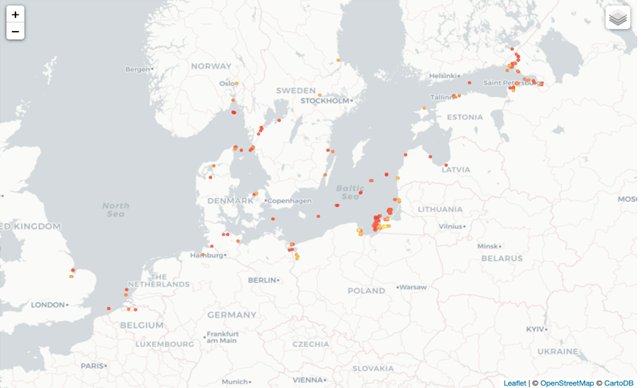
Since 2022, Russia has sharply increased its employment of illegal/coercive/aggressive/deceptive (ICAD) maritime tactics in the Baltic Sea, often loosely referred to as “gray zone” activities. Assessing Russian hostility toward Europe, new NATO chief Mark Rutte recently noted that “Russia is already escalating its covert campaign against our societies” and that the alliance must be prepared for a Russian attack within five years. Whether Rutte’s assessment is correct is hard to judge, but could the dramatic increase in ICAD maritime tactics be the cause for this perception? Is Russian aggression imminent in the Baltic Sea region?

Our analysis of Russian illicit maritime tactics in the Baltic Sea since 2022 leaves us skeptical of any escalation. We argue that Russia employs irregular maritime statecraft to offset declining conventional naval power, sustain sanctioned energy exports, and pressure NATO without triggering open conflict. These nefarious activities—shadow fleet operations, undersea infrastructure sabotage, and electronic interference—are disruptive but strategically limited. While effective at harassment and signaling, they cannot deliver decisive political outcomes and increasingly risk attribution, backlash, and escalation. Putting aside Russia’s robust capabilities and malign behavior in other domains, its maritime “gray zone campaign” is a defensive, compensatory strategy chosen out of weakness, not a pathway to strategic advantage. NATO’s real challenge is managing persistent disruption without over or under-reacting—the strategic analog to the Goldilocks rule.

Russian Maritime Strategic Culture and its bad hand in the Baltic Sea

Russia’s maritime behavior in the Baltic Sea is best understood through the constraints imposed by strategic culture and geography rather than through explanations of deliberate escalation or doctrinal mastery. Historically a land‑centric power, Russia has struggled to convert naval forces into reliable political leverage, particularly in confined maritime spaces. Unlike its confidence in ground operations or information warfare, Moscow has long treated the sea as an exposed domain—one where visibility is high, control is fleeting, and conventional superiority is difficult to sustain. As a result, Russia has tended to favor ambiguity, deception, and indirect methods at sea over overt demonstrations of naval power.

That discomfort has become more pronounced since 2022. Russia’s inability to move naval forces through the Turkish Straits, its lack of reliable sea lines of communication, and a shipbuilding sector that cannot replace aging vessels—combined with the Kremlin’s persistent relegation of the maritime domain to the bottom of its strategic priorities—have all contributed to this increasingly apparent weakness. These factors, combined with NATO’s expansion to include Finland and Sweden, have transformed the Baltic from a contested maritime space into one that is effectively NATO‑enclosed. At the same time, Russia’s growing dependence on seaborne energy exports has raised the strategic importance of uninterrupted maritime access through a region where its freedom of action is sharply constrained. Moscow thus faces a paradox: it must preserve the Baltic as an economic lifeline while lacking the conventional forces needed to dominate or defend it.

In response, Russia has not developed a sophisticated maritime gray zone doctrine so much as defaulted to familiar tools often employed when power projection is risky and escalation control matters. The use of civilian vessels, deniable electronic interference, and legally ambiguous undersea activity reflects adaptation under pressure rather than confidence or strategic ambition. These methods enable harassment, signaling, and limited disruption while avoiding open confrontation, but they are poorly suited to producing durable political outcomes. Russia’s irregular maritime statecraft in the Baltic is therefore best understood as a holding action—an effort to manage decline and preserve room for maneuver from a constrained strategic position, rather than a pathway to maritime advantage.

Russia’s Three-page Playbook of Maritime Irregular Statecraft

Russia’s maritime irregular statecraft in the Baltic Sea relies on a narrow, repeatable playbook optimized for deniability and persistence rather than control or coercive leverage. Far from demonstrating doctrinal sophistication, this approach reflects the limited options available to a constrained actor operating in a NATO dominated maritime environment. At its core are three mutually reinforcing tools: the shadow fleet as both economic lifeline and operational cover, selective disruption of undersea infrastructure to exploit political sensitivity and attribution delays, and low-cost electronic interference to degrade the maritime picture in the Baltic. Together, these tactics enable harassment and signaling below the threshold of armed conflict while minimizing immediate escalation risks—but they do not scale into durable strategic advantage.

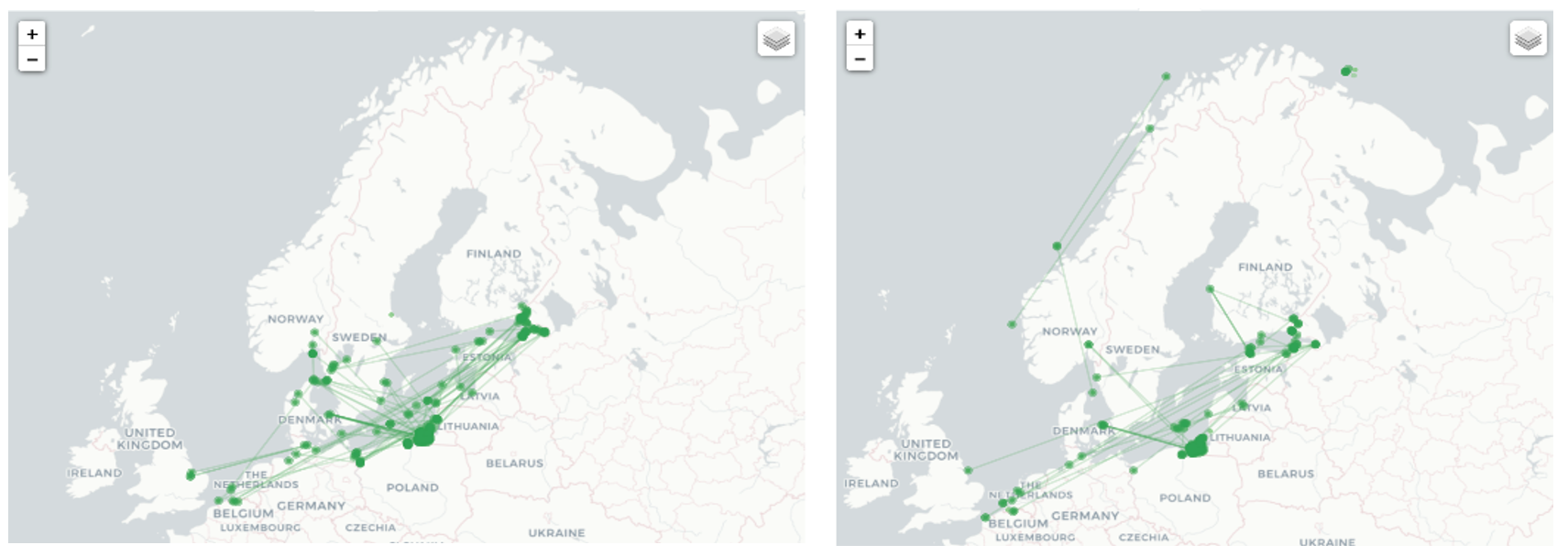
The shadow fleet sits at the center of this playbook. Economically, these vessels are indispensable to sustaining Russia’s war effort by moving sanctioned energy exports through the Baltic. Operationally, they offer deniable platforms that exploit legal ambiguities, mask movements, and complicate enforcement. Yet this dual use is inherently self-limiting. The same ships Russia depends on for revenue are increasingly visible, tracked, and exposed to interdiction, legal action, and seizure. Aggressive employment of the shadow fleet for coercive purposes therefore risks undermining the very economic lifeline it is meant to protect. As a result, the fleet functions less as a tool of escalation than as a constraint on how far Russia can push its maritime campaign.

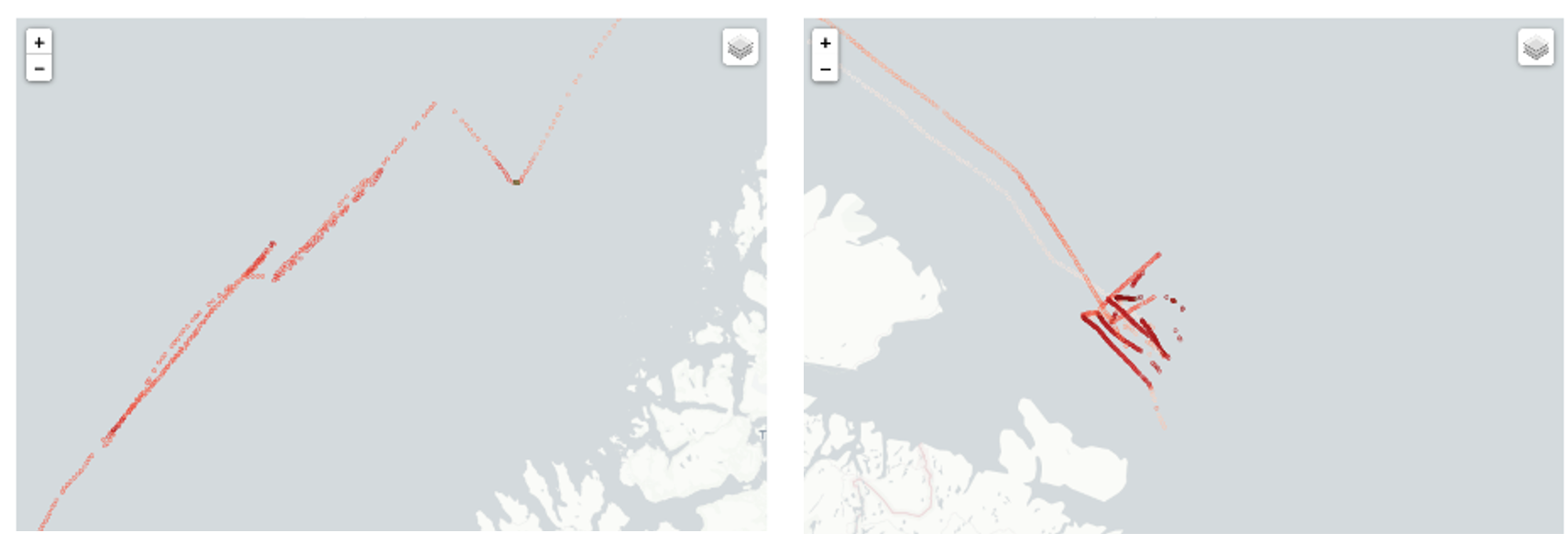
Undersea infrastructure disruption and electronic warfare act as force multipliers within this constrained approach, but they exhibit clear diminishing returns. Pipelines, power cables, and fiberoptic links are attractive targets primarily because they are exposed and politically sensitive components of energy systems and lines of communication, not because they provide decisive leverage. Damage is typically repairable, escalation tends to remain bounded, and repetition of these tactics steadily generates political backlash alongside improved monitoring and faster attribution. Electronic interference—particularly ship based Global Positioning System (GPS) and Automatic Identification System (AIS) jamming—reinforces these dynamics at low cost by degrading maritime safety and complicating enforcement in congested waters, yet such effects are fleeting and increasingly detectable. Over time, the operational signatures that these activities leave behind erode deniability rather than preserve it.

Taken together, this narrow and self-limiting playbook enables disruption without control and visibility without leverage—a strategy of management rather than momentum that raises a more fundamental question: whether Russia’s maritime gray zone campaign represents a durable form of competition with options for escalation or the early signs of strategic exhaustion.

Whither the “Gray Zone”?

Three years into Russia’s irregular maritime campaign, its strategic gains are limited and diminishing as they invite stronger legal and political backlash. These tactics do not scale well into operational advantages, and work better when maritime conventional forces can back them up. The best example of this is the Chinese navy’s support for its Coast Guard and Maritime Militia harassment of neighboring fishing vessels in East and South China Seas. Russia’s maritime capabilities are too weak to integrate power in this fashion. The backlash in Europe is producing a balancing effect, as efforts to improve attribution and legal charges against perpetrators limit Russian efforts. NATO states have boarded suspicious vessels, seized vessels involved in sabotage (e.g. MV FITBURG), and increased maritime domain awareness to identify and document future attacks. ICAD tactics are best suited for harassment, signaling, and economic necessity; they are poor tools for reversing Russia’s strategic woes.

Advocates of the gray zone concept a decade ago predicted it would eventually become the prevalent method of undermining the status quo and be difficult to combat. This does not make it an inherently low-risk strategy. The accumulation of ICAD events and the attention given to them in the post-Ukraine invasion era make it impossible for Russian acts to fly “below the radar.” Instead, the very escalation that these tactics seek to avoid becomes more likely as states react to the constant drumbeat of malign behavior.

How should NATO leverage the growing visibility of irregular maritime tactics and the certainty that Russia is behind them? First, accelerate efforts to determine attribution and expose these tactics immediately in a coordinated fashion with NATO partners. Increased maritime domain awareness at all levels is a priority; this includes investing in seabed monitoring, AIS/Global Navigation Satellite System (GNSS) analytics, and forensic investigation capacity. Rapid and credible attribution enables legal action, sanctions, interdiction, and future deterrence by exposure.

Secondly, NATO should transition from passive monitoring of Russia’s “shadow fleet” to a posture of active maritime containment. Under NATO’s 2025 Alliance Maritime Strategy (AMS) to uphold freedom of navigation and secure strategic trade routes, NATO should no longer treat these vessels as mere commercial anomalies. Instead, the Alliance should designate uninsured or AIS-spoofing vessels as “Navigational and Environmental Hazards,” providing the legal predicate for mandatory boardings and inspections within territorial and contiguous waters. By continuing to work towards active maritime containment, NATO can normalize interdictions that raise the insurance premiums and operational costs for Moscow’s economic lifelines, transforming its primary source of revenue into a point of strategic vulnerability.

Thirdly, NATO should operationalize its “Digital Ocean Vision” to secure critical undersea infrastructure. The defensive posture of the past three years—characterized by slow attribution and repair—is obsolete. Following the framework of Operation Baltic Sentry, NATO should scale Task Force X to deploy a persistent, autonomous undersea maritime infrastructure resiliency initiative. By integrating uncrewed underwater vehicles (UUVs) with high-resolution acoustic sensors, NATO can create a real-time “networked ocean” that detects anomalies—such as the 2024 Motor Vessel Eagle S incident—as they occur. This capability moves NATO from a “forensic” response to a “preventative” one, utilizing automated interceptors to escort suspicious vessels away from critical nodes before damage is sustained.

Finally, NATO should institutionalize friction-as-deterrence by centralizing command authority and multi-domain surveillance within MARCOM. Russia’s irregular tactics thrive on the organizational seams between the Baltic and Arctic theaters; closing these gaps requires resourcing MARCOM to function as the singular operational hub for the Northern Flank. Under the 2025 Alliance Maritime Strategy, MARCOM should be empowered to fuse its recognized maritime picture with real-time data from the NATO Commercial Space Strategy and “Digital Ocean” uncrewed sensors, allowing the Alliance to immediately out-signal Russian electronic interference and GPS jamming. By utilizing high-intensity exercises like Freezing Winds 2025 to wargame integrated, rapid-response ICAD counter-tactics, NATO ensures that every Russian hybrid act is met with an immediate, pre-authorized operational pushback. This centralized posture shifts the burden of escalation back to the Kremlin, forcing Moscow to choose between a conventional naval confrontation it cannot win or a strategic retreat from a monitored and controlled maritime gray zone.

This is already happening in Hong Kong of all places, where Finland has pressured China to detain and prosecute civilian ship Captain Wan Wnguo, accused of dragging one of the ship’s anchors across several underwater cables in 2023 and causing $41 million in damage. Ironically, the ship had just completed the first run from China to Kaliningrad along the Northern Sea Route, a potent symbol of Russian and Chinese cooperation. China has cooperated with Finland to date, and the trial is set for this month.

Conclusion

Russia’s expansion of maritime irregular statecraft in the Baltic Sea Region is a compensatory strategy born of weakness, not strength. As Russia’s conventional naval power has eroded, accelerated by maritime losses in the Black Sea and NATO’s expansion, Moscow has turned to deniable, low-cost, maritime subversion to protect its economic lifelines, pressure NATO, and shape escalation dynamics without triggering open war.

Russia’s activities in the Baltic are best understood as a holding action by a constrained power. It enables disruption and delay but not control. These ICAD tactics at sea might provoke below thresholds of war, but they say more about managing decline, protecting lifelines, and shaping escalation in a world where ambiguity is shrinking, not increasing as gray zone proponents claim. While disruptive and tactically clever, these methods cannot compensate for declining conventional power and become less effective as NATO improves attribution, coordination, and resilience. This in turn will frustrate Russia’s ability to play a weak hand as it prioritizes provocative tactics over creating an effective strategy to improve its strategic and economic position in a post-Ukraine War future.

Joseph P. Durigan is a Surface Warfare Officer in the United States Navy and a recent graduate of the Naval Postgraduate School in Monterey, California. His master’s thesis was titled “The Gray Zone Surge: Russian Maritime Subversion in the Baltic Sea.”

Craig Whiteside is a professor of National Security Affairs for the US Naval War College resident program at the Naval Postgraduate School. His recent book is titled Nonstate Special Operations: Capabilities and Effects and he has written on the strategic failures of the gray zone concept.

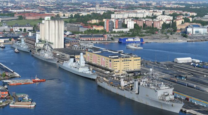
Featured Image: Baltic Sea Exercise 2023. (U.S. Navy photo)

Mapping Gray Maritime Networks for Hybrid Warfare

By Chris Callaghan, Rob Schroeder, and Dr. Wayne Porter

Introduction 

In light of the current National Security Strategy and the 2018 National Defense Guidance, the impact of hybrid warfare and ‘gray-zone’1 maritime activity in support of great power competition among nations has become an increasing area of concern. This includes the need for an increased focus on the identification and tracking of vessels of interest (VOI) and their associated owners, operators, and activities. Traditionally, maritime domain awareness (MDA) has consisted of intelligence, surveillance, and reconnaissance of activities at sea with limited cross-domain link analysis2 of events, carriers, and sponsors (Wallace & Mesko, 2013). While this methodology enables analysts and operators to sift and structure vast data from increasingly complex systems, it fails to consider how ties between similar entities create gray (non-transparent) shipping networks capable of supporting state-directed hybrid warfare. 

This is not to say that a network perspective has been absent from the maritime domain. Researchers from diverse analytic disciplines have conceptualized various constructs as networks, such as historic trade routes (Rivers, Evans, & Knappett, 2016; Wang, Notteboom, & Yang, 2016), global shipping patterns (Ducruet, Rozenblat, & Zaidi, 2010), cruise ship itineraries (Rodrigue & Notteboom, 2014), and logistics involved in global shipping (Ducruet & Lugo, 2013). Yet, much of the focus behind this work has been on understanding transparent (licit) networks.3 For their part, network researchers leveraged social network analysis to gain an understanding of dark networks – that is, covert and/or illicit organizations (Raab & Milward, 2003). This has included, for example, the study of terrorist groups (Krebs, 2002; Roberts & Everton, 2011), narcotic distribution networks (Morselli & Petit, 2007), street gangs (Papachristos, Hureau, & Braga, 2013), and cyber criminals on the dark web (Dupont, 2014) to name a few. 

We drew on network analysis (NA) to examine gray maritime networks (alternately operating licitly and illicitly) in relationship to two NATO-led exercises in 2018: BALTOPS and Exercise Trident Juncture. As previously demonstrated through research focused on mapping gray maritime networks in the South China Sea (Porter, et al., 2019), NA methods can be leveraged to develop longitudinal network depictions of vessels loitering in sensitive or disputed areas. Here, we leverage commercially available geo-temporal data, open-source databases, and home range detection algorithms to generate depictions of the subgroups of owners and operators associated with gray activities.

Although methodology driven, this research was not intended to provide solely an academic contribution but also to demonstrate how NA can improve real-time awareness and tracking for operational purposes. The methods and analysis presented here should enable a rich discussion of current and future methods for enhanced MDA. As such, we begin with a description of our data collection and methods then proceed to discuss findings and practical implications for MDA. Finally, we conclude with a series of recommendations for further research. 

Generating Networks: Data and Methods 

We use commercially available ship tracking data as the cornerstone of our analysis; specifically, in the process of identifying and tracking VOIs. Our team collected the feeds from commercial automatic identification system (AIS) transceivers from 13 March 2018 through 7 January 2019.4 These data points are particularly salient as AIS transmitters are required as navigation and anti-collision systems for all vessels exceeding 300 gross tonnage operating internationally, any vessels exceeding 500 gross tonnage not conducting international voyages, and all passenger ships regardless of size. To narrow the scope of our data set, we geofenced our data to include the Baltic Sea and the North Atlantic Ocean. The resulting daily AIS tracking logs provided both spatial and temporal variables relevant to our analysis; namely, a VOI’s date and time of transmission, maritime mobile service identity (MMSI) number, speed over ground, longitude, and latitude.  

Once the data was decoded and filtered, we proceeded to explore traffic patterns using the Time Local Convex Hull (T-LoCoH) method originally developed for the study of movement patterns in GPS-tracked ranging animals. T-LoCoH integrates time with space into the construction of local hulls (geometric shapes containing a location distribution within a home range) while accounting for an individual animal’s speed, which facilitates the use of metrics for revisitation and loitering duration (Lyons, Turner, & Getz, 2013). In our work, the AIS data that tracks vessel traffic over time and space is analogous to the GPS data used to analyze ranging animals. As such, we leveraged the application of this method to identify spatio-temporal patterns of ships loitering in areas proximal to NATO-led military exercises.  

To reduce traffic noise, we only included AIS transmissions for non-NATO nation commercial vessels transponding with a speed over ground less than or equal to two knots. We then generated spatial loitering polygons which may represent ports, anchorages, or other areas where a VOI loitered during the window of research (see Figure 1). As expected, areas exhibited differing loitering densities with some being dense (depicted as yellow on Figure 1) and others less dense (depicted in red). These loitering polygons served as the basis for developing a list of VOIs using their MMSI identification numbers as unique identifiers.

Figure 1. Loitering isopleths during BALTOPS (click to expand)

Matching loitering isopleths with the original AIS transmissions used to generate them yielded a ship-to-loitering location table (see Table 1) with a ship’s unique identifier, the AIS message date and time, and the loitering polygon identity. 

MMSI  Date-time  Polygon 
123456789  T=1  Polygon A 
987654321  T=1  Polygon A 
123456789  T=2  Polygon B 
123456789  T=3  Polygon C 

Table 1. Sample ship-to-loitering location table

From this table, we extracted a location-to-location network where loitering areas were interconnected if a VOI traveled from one location to the other location. Next, to examine the underlying organizations linked to the VOIs, the team gathered open-source information on the companies who own and/or operate these ships using the Lexis Nexis Advance Research Database. This corporate information was then joined to the ship data. The corporate information was used to create connections between companies if they were tied to the same ship, one was a subsidiary of the other, one had a major financial stake in the other, shared the same physical address, or had members of their boards of directors in common. The findings and analysis of these data follow in the subsequent section.

Analysis: Shedding Light on Gray Maritime Networks

From the AIS data on ship movements we extracted two networks for further analysis: the location-to-location network composed of loitering areas observed during BALTOPS (31 May 2018 through 16 June 2018) and loitering areas observed during Operation Trident Juncture (22 October 2018 through 25 November 2018).  Most of the VOI activity was concentrated within the Baltic Sea (see Figure 2). These findings are to be expected considering the geographic range of operations. While most VOIs in the sample set remained in the Baltic Sea, a few were also observed loitering off the coast of Norway during NATO exercise Trident Juncture.

Figure 2. Location-to-location networks during BALTOPS (left) and Operation Trident Juncture (right) (click to expand)

Upon closer examination, the VOIs active off the coast of Norway during Trident Juncture appear to have loitered near sensitive military locations and displayed abnormal movement patterns. For instance, Figure 3 illustrates the movements of two VOIs with abnormal tracking patterns. The first is an oil tanker owned by the Russian government and operated by a registered shipping company in that country. The second is a commercial chemical products tanker registered in the Marshall Islands, a country often used as a flag of convenience, shown loitering north of Norway.

Figure 3. Abnormal shipping patterns off the coast of northern Norway during Operation Trident Juncture, a Russian owned oil tanker (left) and chemical products tanker registered to the Marshall Islands (right) (click to expand)

Finally, Figure 4 is a network representation of connections between the companies associated with identified VOIs. In this graph, we see that many of the companies are related to each other, with the three largest components colored in blue, green, and orange. For instance, the large blue cluster on the right-hand side of the sociogram contains many small companies, all operating from the same address in northern Russia, each with connections to at most a few ships. The large orange component on the bottom left contains clusters of VOI-associated companies interconnected by sharing some of the same board members. In the green component, shipping companies associated with VOIs are connected by sharing parent, subsidiary, or holding companies. Companies occupying an apparent position of structural brokerage are depicted by larger nodes. One such shipping company (highlighted with an arrow), for instance, was connected to the broader family of like-companies, while also being linked to a large multinational oil company through partial ownership ties (Schelle, 2018).

Figure 4. Company-to-company network. The three largest components are colored and nodes are sized by brokerage potential.

Conclusions and recommendations for further research 

This analysis highlights the value of NA in real-time awareness and tracking of stakeholders associated with suspected gray maritime activities in a strategic era of great power competition. Using commercially available geospatial data, our team identified 56 VOIs loitering in areas proximal to NATO-led exercises in the Baltic Sea and North Atlantic. These vessels were then linked to over 196 state-owned and private companies/entities. Analysis such as this provides insight into a network of stakeholders that may support hybrid warfare, or so-called grey-zone activities, not directly attributable to a specific nation.

The use of the network analysis methodologies discussed here and the tools developed at the Naval Postgraduate School to identify, map, and track gray maritime networks can be applied to any number of threats. While our earlier research into Chinese reef enhancement activity in the South China Sea has already been cited, Maritime Operations Center (MOC) operators and MDA analysts could adapt this toolset to track and assess maritime and terrestrial networks associated with narcotics trafficking, terrorism, Illegal and Unregulated Fishing (IIU), arms and human trafficking, and other security concerns. Integrating these tools into existing MDA systems would also provide for enhanced awareness of how these networks overlap in multiple geographic areas and in malign activities. Further, and perhaps most significantly, they could provide operators timely and actionable information.   

Our research is not without room for improvement. Future iterations of this work should include a richer dataset of state/corporate linkages. This should include a deeper dive into state-sponsored (and military supported) parent-subsidiary company relationships and board memberships, or proximal geographic associations among companies, offices, and ships. Further research is also being considered through the application of system dynamics modeling, wargaming, campaign analysis, and discrete events modeling. 

Acknowledgment  

The authors would like to acknowledge that this research benefited immensely from the partnership between the Common Operational Research Environment (CORE) Lab and Littoral Operations Center at the Naval Postgraduate School, with the Norwegian Defense Research Establishment (Forsvarets Forskningsinstitutt, FFI). This research builds on a joint effort to integrate network analysis methodologies into the maritime domain, which won the 2019 NCI Agency’s Defense Innovation Challenge aimed at accelerating technological solutions in support of NATO C4ISR and cyber capabilities.

With more research and interest, these methods can help us better understand the non-linear relationships and feedback mechanisms that contribute to the complexity of great power competition and its manifestations in the maritime domain.

Chris Callaghan is a Research Associate in the Defense Analysis Department’s CORE Lab at the NPS. His work leverages open-source data analytics for understanding and modeling a variety of national and homeland security problems. 

Rob Schroeder is a Faculty Associate for Research in the CORE Lab within the Defense Analysis Department and a PhD Student in the Information Sciences Department at the Naval Postgraduate School (NPS). He is currently researching how to use open-source information gathered largely from social media in order to understand and map the changing dynamics in conflict areas and exploring the use of network analysis to analyze maritime traffic patterns. He has presented some of this research at conferences (INFORMS and INSNA).

Dr. Wayne Porter, CAPT, USN (ret.) is a Senior Lecturer in the Defense Analysis and Systems Engineering Departments of the Naval Postgraduate School, where he also serves as Co- Director of the CORE Lab and Director of the Littoral Operations Center.  He holds a Ph.D in Information Sciences and two Masters of Science degrees – in Computer Science and Joint C4I Systems Technology – from the Naval Postgraduate School.  Military duty included Japan, England, Italy, the Balkans, Bahrain (COMFIFTHFLT ACOS Intelligence and MOC Deputy of Operations in the Persian Gulf/East Africa), and three tours on the personal staff of ADM Mike Mullen, including Special Assistant for Strategy to both the Chief of Naval Operations (N00Z) and Chairman of the Joint Chiefs.  He subsequently served as Chair, Systemic Strategy and Complexity at Naval Postgraduate School in Monterey, California and retired from the Navy in July 2014 after 28 years of active service.  Dr. Porter has contributed to a number of DoD and USN Strategy projects, including serving as systems analyst for the SECNAV’s Strategic Readiness Review.

The views expressed in this paper are those of the authors and do not reflect the official position or policies of the United States Navy or the Department of Defense.

Endnotes

1. The opaque area in which illicit of malign activity co-exist with licit activity.

2. An analytical method for interactively curating and querying relational databases (Cunningham, Everton, & Murphy, 2016). In a link diagram, different types of entities (e.g., ports, events, ships, operators, and personnel to name a few) are tied to each other explicitly with the goal of describing the environment.

3. Those operating overtly and legally.

4. All collected AIS logs were encoded in AIVDM (data received from other vessels)/AIVDO (own vessel information) sentences and required decoding for further analysis.

References

Cunningham, D., Everton, S. F., & Murphy, P. (2016). Understanding Dark Networks: A strategic framework for the use of social network analysis. Lanham: Rowman & Littlefield.

Ducruet, C., & Lugo, I. (2013). Structure and dynamics of transportation networks: models, methods and applications. In J. Rodrigue, T. Notteboom, & J. Shaw, The SAGE Handbook of Transport Studies (pp. 347-364). London: SAGE Publications, Ltd. Retrieved from: http://sk.sagepub.com/reference/hdbk_transportstudies/n20.i1734.xml

Ducruet, C., Rozenblat, C., & Zaidi, F. (2010). Ports in multi-level maritime networks: evidence from the Atlantic (1996-2006). Journal of Transport Geography, 18(4), 508-518. Retrieved from: https://www.sciencedirect.com/science/article/abs/pii/S0966692310000372

Dupont, B. (2014). Skills and Trust: A Tour Inside the Hard Drives of Computer Hackers. In C. Morselli, Crime and Networks (pp. 195-217). New York, N.Y.: Routledge. Retrieved from: https://papers.ssrn.com/sol3/papers.cfm?abstract_id=2154952

Krebs, V. E. (2002). Mapping networks of terrorist calls. Connections, 8(2), 43-52. Retrieved from: http://citeseerx.ist.psu.edu/viewdoc/download?doi=10.1.1.192.4165&rep=rep1&type=pdf

LexisNexis. (2019, 09 01). Lexis advance research. Retrieved from LexisNexis: https://advance.lexis.com/

Lyons, A., Turner, W., & Getz, W. (2013). Home range plus: A space-time characterization of movement over real landscapes. BMC Movement Ecology, 1(2), . Retrieved from: https://movementecologyjournal.biomedcentral.com/articles/10.1186/2051-3933-1-2

Morselli, C., & Petit, K. (2007). Law-enforcement disruption of a drug importation network,. Global Crime, 8(2), 109-130. Retrieved from: https://www.tandfonline.com/doi/full/10.1080/17440570701362208

Papachristos, A., Hureau, D., & Braga, A. (2013). The Corner and the Crew: The Influence of Geography and Social Networks on Gang Violence,. American Sociological Review, 78(3), 417-447. Retrieved from: https://journals.sagepub.com/doi/10.1177/0003122413486800

Porter, W., Schroeder, R., Callaghan, C., Barreto, A., Bussell, S., Young, B., . . . von Eiff, J. (2019). Mapping Gray Maritime Networks. Connections, 39(1). Retrieved from: https://www.exeley.com/connections/doi/10.21307/connections-2019-006

Raab, J., & Milward, H. B. (2003). Dark networks as problems. Journal of Public Adminstration Research and Theory, 13(4), 413-439. Retrieved from: https://arizona.pure.elsevier.com/en/publications/dark-networks-as-problems

Rivers, R., Evans, T., & Knappett, C. (2016). From oar to sail: The role of technology and geography in the evolution of Bronze Age Mediterranean networks. In C. Ducruet, Maritime Networks: Spatial structures and time dynamics(pp. 63-76). New York: Routledge.

Roberts, N., & Everton, S. (2011). Strategies for Combating Dark Networks. Journal of Social Structure, 12(2). Retrieved from: https://www.cmu.edu/joss/content/articles/volume12/RobertsEverton.pdf

Rodrigue, J., & Notteboom, T. (2014). The geography of cruises: itineraries, not destinations. Applied Geography, 38(1), 31-34. Retrieved from: https://www.sciencedirect.com/science/article/abs/pii/S0143622812001373?via%3Dihub

Schelle, S. (2018). Kartlegging av maritime hybride trusler: Kan bruk av stordata og sosial nettverksanalyse bidra til økt maritim situasjonsbevissthet? [Survey of maritime hybrid threats: Use of big data and social network analysis to help increased maritime situational awareness?]. Retrieved May 06, 2020, from https://fhs.brage.unit.no/fhs-xmlui/bitstream/handle/11250/2583966/2018%20Masteroppgave%20Schnelle%20Stian.pdf?sequence=1  

Wallace, T., & Mesko, F. (2013, September 30). The Odessa Network: mapping facilitators of Russian and Ukrainian Arms Transfers. Retrieved 09 2019, from C4ADS.org: https://static1.squarespace.com/static/566ef8b4d8af107232d5358a/t/56af8a2dd210b86520934e62/1454344757606/The+Odessa+Network.pdf 

Wang, L., Notteboom, T., & Yang, L. (2016). British and Japanese Maritime Networks in China in the 1920s. In C. Ducruet, Maritime Networks: Spatial structures and time dynamics (pp. 112-133). New York: Routledge.

Featured Image: OSLO, Norway (Nov. 13, 2018) Sailors and Marines man the rails as the Wasp-class amphibious assault ship USS Iwo Jima (LHD 7) arrives in Oslo, Norway, for a scheduled port visit Nov. 13, 2018. (U.S. Navy photo by Mass Communication Specialist 3rd Class Daniel C. Coxwest/Released)

Why Unmanned Systems Are The Go-To Option for Gray Zone Ops in the Gulf

Securing the Gulf Topic Week

By Heiko Borchert

Introduction

Current incidents in the Arabian Sea should be seized as an opportunity to advance naval conceptual thinking about unmanned maritime systems in gray zone operations. Gray zone activities are an astute object for concept development, as they “creep up on their goals gradually,” rather than involving decisive moves, as Michael Mazarr has argued. In response, Mazarr contends, gray zone operations will “call for a greater emphasis on innovation” as these operations take different forms and intensities and thus require varied responses. This coincides with the general need to devote more attention to concepts development that drives the use of new naval technologies such as unmanned systems.

Applying Unmanned Systems to Gulf Security

Maritime stability in the Arabian Sea has deteriorated significantly over the past couple of weeks. In response to the Iranian seizure of the Stena Imperio, a Swedish oil tanker under British flag, London reached out to different European capitals in view of establishing a maritime protection mission escorting commercial vessels through the Strait of Hormuz.

This incident and prior events in the Arabian Sea such as harassing commercial vessels with speedboats and assaults on commercial vessels are a perfect illustration of so-called gray zone activities. Located between war and peace, gray zone activities involve “coercive actions to change the status quo below a threshold that, in most cases, would prompt a conventional military response,” as Lyle J. Morris and others have suggested.

These activities raise an obvious question: How best to respond? Staying out of the region for an interim period, as the British government has advised U.K. shipping, has been interpreted as a watershed moment “when the UK admits it can no longer protect its merchant vessels.” But even if political support for the maritime protection mission matured, the question would remain if there were enough adequate platforms to do the job.

Deploying big capital ships or surface combatants to escort merchant vessels might send a strong message of resolve to Iran, but doubts remain if this approach is adequate. Past experiences in the Arabian Sea have made it clear that naval vessels remain vulnerable to speedboats operating at a high tempo in distributed maneuver operations. While this is certainly only one method of attack, it is most important for strategic communication. Small boats successfully attacking or deterring prestigious naval ships delivers a message that all gray zone actors want to convey.

It is time to supply navies with an additional option using unmanned systems. Unmanned maritime systems (UMS) have been developed and used for quite some time, but right now, the majority of unmanned maritime systems are used for mine countermeasures. There is an obvious operational need to do the job, concepts of operations are in place, and technology is mature. This makes a perfect fit, but more can be done.

Unlike gray zone activities in the South China Sea that involve the building of artificial islands to underline sovereignty claims and the use of naval militia and the coast guard to intimidate neighbors, Iran’s actions are of a different quality. In the Arabian Sea, mosaic defense emphasizes mass, speed, and surprise. Unmanned maritime systems would be ideal to respond because they can be built to be lost. This levels out current asymmetries between speed boats and big capital ships and denies the adversary the offensive on strategic communications. This attrition-like role is only one mission UMS could play in future maritime protection missions. Overall, the mission envelope could be much broader.

First, assuming that a maritime protection mission depends on persistent situational awareness and understanding, unmanned systems can be used to collect intelligence and provide reconnaissance. For this mission the emphasis should be on closing the sensor chain from seabed activities through the undersea world to the sea surface into airspace and space. In all of these domains unmanned systems are already in use, but more needs to be done to fuse data to augment the existing Recognized Maritime Pictures (RMP), for example to detect anomalies stemming from adversarial behavior at sea.

Second, unmanned systems at sea can push the defense perimeter out. Forward deployed unmanned surface vehicles (USV) could be used to intimidate an adversary’s embarking speed boat fleet thus delaying the launch of operations and creating “noise” that would send alarms to the RMP. A more wicked though not yet technically mature option would focus on very small, mine-like unmanned underwater vehicles (UUV). These assets could be deployed covertly by submarines or by air assets. These UUV could turn into a sort of adhesive explosives that stick to boats running over them, thus rendering them dysfunctional.

Third, unmanned maritime systems could be used for deception operations. A swarm of USV could enter a theater of operation disguised as a big capital ship on the adversary’s sensors. As the adversary prepares to counter the ship the USV swarm would disperse into many different smaller platforms thus out tricking the adversarial defense posture. A similar mission can be envisaged for the underwater domain where UUV are already used to imitate the signature of submarines.

Fourth, USVs could constitute the outer ring of maritime protection missions. Robust platforms could be equipped with remote-controlled weapon stations, like the Protector USV developed by Rafael Advanced Systems, to engage incoming speed boats or flying platforms. In addition, USV could be used to deploy electronic counter-measures, for example, to jam adversarial sensors and take out communications between unmanned aerial assets and the respective control units. 

Conclusion

While some of these ideas are closer to reality than others, what matters most is that concepts and operational requirements need to drive the use of unmanned maritime systems in gray zone operations. So far, the discussion about UMS mainly focuses on providing solutions to meet the needs that emerge in naval warfare areas such as mine countermeasures, anti-submarine warfare, or anti-surface warfare. However, gray zone activities cut across all of these tasks. Adequate responses need to adopt a more horizontal approach, as well looking at the technological building blocks that can be used for all missions. Here, the most recent decision of Belgium and the Netherlands to develop a toolbox of unmanned systems for mine-countermeasures shows the way to the future. This approach could be turned into a holistic concept to deal with UMS for maritime gray zone activities.

Putting extra emphasis on innovation and concepts development also opens up avenues for fruitful cooperation with the Gulf states that step up efforts to expand their own naval capabilities while at the same time ramping up efforts to establish a local naval industrial base. Involving them from the start would make sure that specific regional requirements could be adequately addressed while at the same time contributing toward building up local technology expertise in important  areas and incentivizing the establishment of local capabilities and concepts. In the long run this joint approach could help shoulder the burden to provide maritime stability in one of the world’s most pivotal regions.

Dr. Heiko Borchert runs Borchert Consulting & Research AG, a strategic affairs consultancy.

Featured Image: A Bladerunner craft fitted with the MAST system. (Wikimedia Commons)

From the Azov Sea to the Black Sea: Russia’s Maritime Campaign

By Jonathan Hall

Almost five years following the Minsk Agreements, the war in Ukraine has claimed the lives of over 13,000 individuals. While much of the attention has been on the annexation of Crimea and continuous fighting throughout the Donbas region, Russia has more recently added a maritime component to its campaign with aggressions in the Sea of Azov. The Secretary of the National Security and Defense Council of Ukraine, Oleksandr Turchynov, sees the possibility of the region being used as a “springboard for further expansion,” a land invasion of Mariupol being his greatest concern. While many may fear expansion into the land environment, the far more likely scenario is westward progress by Russian naval forces, furthering their disruptive campaign off Ukraine’s coastline.

Linking the Seas

Western defense planners and analysts often refer to the Black Sea and the Sea of Azov as independent entities. Distinct in their own rights, the latter largely unknown until recent events, what is important to note is the Russian government views them as inextricably linked. In 2003, President Putin reiterated this in stating, “the Azov-Black Sea basin as a whole…the zone of our strategic interests.”

Within this context, a useful analytical framework of inspection would be Russia’s “Boa Constrictor Strategy” (Тактика Удава). Attempting to economically strangle the Ukrainian government, the blockade of the Kerch Strait serves as the first example to do so in the maritime environment. Hamstringing shipment to and from the port cities of Mariupol and Berdyansk, located in the Sea of Azov, Russia is likely to continue these economically disruptive and militarily aggressive activities in the greater Black Sea region. The object of such operations would invariably be the littoral waters near Ukraine’s western port city – Odessa. While maintaining the status quo – relative restraint in deploying land forces – the Kremlin could similarly hamper maritime commerce, endanger sea lines of communication (SLOC), and therefore dissuade future investment in the region. Loss of industry and access to the sea via de facto Russian control of the remaining Ukrainian coastline could both financially cripple Kyiv’s economy and, in effect, landlock the country.

Fighting in the Gray Zone: From Land to Sea

Discussions of Russia’s operations often refer to its “gray zone” approach to warfare. Defined as, “Those covert or illegal activities of non-traditional statecraft that are below the threshold of armed organized violence; including disruption of order, political subversion of government or non-governmental organizations, psychological operations, abuse of legal processes, and financial corruption as part of an integrated design to achieve strategic advantage.”

In the Sea of Azov, there are already observed Russian gray zone methods in the maritime domain. Therefore, while the threat of a Russian land invasion should be considered, the threats facing Odessa – and the Ukrainian coastline writ large – likely will remain in the Sea. For several reasons, these incrementally disruptive hostilities, akin to ongoing naval tactics being employed by the Chinese in the South and East China Seas, should be Kyiv’s greatest worry.

First, an overt incursion on Odessa would necessarily involve Russia telegraphing the movement of its Black Sea Fleet – serving as host to a sizeable contingent of sea and land forces. Due to the augmented defensive capabilities installed by the Ukrainian military – its newly developed anti-ship “Neptune” cruise missile and modernized S-125 Neva/Pechora surface-to-air missile system – Kremlin strategists would likely advise against such a move. Although Ukraine’s personnel and equipment in the region would not ensure victory over a would-be invading Russian force, they provide the conventional deterrence required to allay concerns that Moscow believes it can quietly seize the region.

Route of Ukranian vessels seized by Russian vessels in late 2018 near the Sea of Azov (BBC)

Second, despite doubts regarding open invasion, concerns abound that Russia may attempt similarly subversive activities in Odessa to what occurred in Crimea and throughout Donbas. The tactics used in the early years of the conflict – in annexing the Crimean Peninsula and creating the so-called Donetsk and Luhansk People’s Republics – were both geographically and demographically dependent and unlikely to be as successful if applied in western Ukraine.

In Crimea, the Kremlin’s “little green men” were able to assume control without widespread violence due to favorable conditions which do not exist in Odessa. The political environment on the peninsula, conducive for a Russian takeover, hosted a citizenry which was, for the most part, either emboldened by Russia’s sudden presence, indifferent, or silenced by fear.

Throughout Donbas, the disinformation campaign and political saboteurs were able to stoke the flames of discord required to launch the creation of the so-called autonomous republics. With Russian-backed separatists, private military contractors, and Russian regulars all taking part, control was effectively fractured from Ukraine’s federal government.

Geographically proximate to the Russian border, the Kremlin was able to either leverage the political environment preexisting in Crimea or, in the case of Donbas, fabricate one through its disinformation campaign, funding of separatist fighters, and covert transportation of Russian regulars across the border. According to a 2015 study by the International Republican Institute, roughly 25 percent of Odessa’s citizenry are ethnic Russians, with 78 percent citing Russian as the primary language spoken at home. The presence of ethnic Russians, often referred to as a fifth column – or minority group which can be leveraged – in Odessa has sparked concerns that a similar situation which unfolded in the east could be incited. However, the geographic conditions and element of surprise required are missing. Additionally important to note, the general political situation in the country was diametrically different to what it is today. When Crimea was annexed, and subsequent fighting in Donbas began, Ukraine’s federal government was dysfunctional and divided. Following the Euromaidan protests and deposition of then-president Yanukovych, several top officials abandoned their posts. Among them were the Ministers of Defense and Internal Affairs, the commander of the Internal Troops of Ukraine, and the commander of the Ukrainian Navy in Crimea (who convinced over 5,000 Ukrainian sailors to defect with him).

Finally, one possible reason for escalations in the Sea of Azov – Russia’s first major foray into the maritime environment against Ukraine – would be the Kremlin’s decision that further subversion on land would be either impossible due to increased Ukrainian resilience, or inadvisable due to international backlash. Regardless, the fact Moscow has chosen to add this maritime component to continue its incrementally aggressive gray zone approach supports the argument that any activities to Ukraine’s west – a “harder target” in military parlance – would similarly remain offshore.

Russia’s Black Sea Fleet

Russia’s Black Sea Fleet, after suffering two decades of decline following the collapse of the Soviet Union, has undergone more than a decade of serious reform, doubling its offensive capabilities since 2014. Prior to the annexation of Crimea, Russia had a basing agreement with the Ukrainian government. However, this agreement stipulated categorical limitations on personnel and equipment. Along with access to the port of Sevastopol, Moscow was allowed to garrison 25,000 troops, in addition to 132 armored combat vehicles, 22 military aircraft, and 24 pieces of artillery. In 2013, Russia was stationing 12,000 troops, zero tanks, 24 pieces of artillery, and 22 military aircraft. By 2018, those numbers rose to 32,000 troops, 40 tanks, 174 pieces of artillery, and 113 military aircraft – in addition to S-400 anti-aircraft missile systems, Bastion and Bal coastal defense missile systems, and Iskander short-range ballistic missile systems.

The Fleet, also host to several new advanced surface combatants and submarines – along with many warships transferred from the Caspian Sea Flotilla – is fulfilling the guiding principles highlighted in Russia’s 2015 maritime doctrine: “In the Black and Azov Sea, the foundation of the National Maritime Policy is the accelerated modernization and comprehensive reinforcement of the strategic position of the Russian Federation.”

These tenets were further discussed in the 2017 Naval Fundamentals document, emphasizing improvement of combat capabilities and joint operability with other branches of the military in Crimea. Moscow’s recent development of its Special Operations Forces (SSO) command is the most likely suspect to be used in a combined arms operation in the Black Sea. An example can be seen with the oil derricks near Odessa, which were illegally seized by special operations forces and are subsequently being guarded by several small warships – preventing any attempt by the Ukrainian military to retake them. While a less severe example, this low-risk operation represents one of many lessons for the Kremlin that this sort of incremental approach pays dividends. These “stealth seizures,” i.e. annexation of Crimea, naval blockade of the Sea of Azov, and the capture of the oil derricks are the hallmark of Russia’s approach in the region but by their nature are limited in scope.

Area of Operations: The Black Sea

Unlike the proximate waters of the Sea of Azov, the Black Sea is busy with international activity and with all parties involved interested in keeping the sea lines open for trade and joint military cooperation. In addition to the western littoral states (Romania, Bulgaria, and Turkey), the navies of the United Kingdom and United States have operated in the Black Sea in recent months. The Royal Navy’s HMS Echo entered the Black Sea and arrived at Odessa on 19 December, 2017. The UK’s Defense Minister, Gavin Williamson, later announced joint exercises would take place with the Ukrainian Navy in early 2019. In early January, the USS Fort McHenry (LSD-43) made a regularly scheduled sail through the Black Sea. The Fort McHenry, an amphibious ship, equipped with defensively oriented weapons, was followed more recently by a visit to Georgia by the USS Donald Cook (DDG-75), an Arleigh Burke-class guided-missile destroyer – sending a much more clear message to the Kremlin. Backing up this show of resolve, the U.S. announced it would send additional lethal aid to the Ukrainian military.

While international presence in the region is a possible deterrent, many factors complicate the helpfulness of foreign vessels in the region. First and foremost, there is a perennial question mark in regard to what form(s) of Russian aggression will incite a Western response. And even then, showing diplomatic support of the situation is of little good to an embattled Ukrainian military. Second, the Montreux Convention Regarding the Regime of the Straits, an agreement signed in 1936, presents a logistical impossibility to an ever-present U.S. Navy in the Black Sea. The agreement stipulates that an aggregate tonnage of all non-Black Sea warships in the Black Sea cannot exceed 30,000 tons (or 45,000 tons under special conditions), and they are permitted to stay in the Black Sea for no longer than twenty-one days. Russia, undoubtedly monitoring the U.S. Navy’s days at sea, could conceivably coordinate an operation during a lull of U.S. activity.

Defending Ukraine

The onus of defense, therefore, falls on the Ukrainian military. Prior to the aggressions in the Sea of Azov, for all intents and purposes the Ukrainian Navy lacked a coherent maritime doctrine within the overall military strategy. Suggested to have a “continental mindset,” the greatest cause for concern is always from the next impending land invasion. The most recent example was the build-up of Russian forces in its Western Military District, from which came no invading force. Rather than an abnormal development, prior to the annexation of Crimea, roughly 40,000 troops were amassed on Ukraine’s eastern border – used for purposes of intimidation and to mask subsequent asymmetric operations, rather than to be conventionally deployed.

Despite these issues of threat assessment, the Ukrainian Navy has maintained steady success in developing itself into a competent fighting force, notwithstanding losing the majority of its assets during the annexation of Crimea. The guiding principle toward renewed maritime capacity building in the Ukrainian Navy can be seen in the “mosquito fleet” concept first proposed by Captain Andriy Ryzhenko, the Navy’s deputy chief of staff for Euro-Atlantic integration. His idea is that despite budgetary pressures the navy should plan for “near-term procurement of small, fast, low-signature, well-armed boats and craft for various purposes.” The highly mobile proposed flotilla would serve well in the face of uncertainty presented by Russia’s subversive maritime activities.

Toward this goal, the Ukrainian Navy plans to commission two Gyurza-class armored boats and two Centaur-class fast assault craft sometime in 2019, and to assume command of two U.S.-built Island-class patrol cutters this summer. These efforts toward naval capacity building are the key component of the “New Strategy of the Naval Forces of the Armed Forces of Ukraine to 2035,” introduced by the Commander of the Naval Forces of Ukraine, Admiral Ihor Voronchenko in November 2018.

Moving Forward

As this gray zone approach continues to permeate the maritime environment, these aggressive asymmetric operations must remain an integral component of Ukraine’s military calculus. They are incremental in their approach, and below the threshold of war in their character. For these reasons they will be difficult to predict, deter, and defend against. However, the Ukrainian military has been and will continue to undergo reform with these very tenets in mind. Analyzing the tactics used in the Sea of Azov by Russia, similar operations in the South and East China Seas by China, and how they may be adapted to fit the Black Sea is the most advantageous starting point toward an effective plan of defense. As the Ukrainian military remains resilient, and its allies supportive, the defense of Western ideals and international rule of law will come through the sober realization that these low-scale acts of force and subversive maneuvers are here to stay both within Ukraine’s borders and off its coast.

Jonathan Hall is a security and political risk analyst focused on Eurasian geopolitics, military affairs, and emerging technologies. He can be found on Twitter @_JonathanPHall.

Featured Image: Military base at Perevalne during the 2014 Crimean crisis. (Wikimedia Commons)