Tag Archives: geostrategy

The Arctic is a Strategic Distraction

By T.X. Hammes

Over the past five years, numerous articles have called for increased U.S. defense resources focused on the Arctic. This is a strategic mistake, a distraction.

This article will outline the reasons proponents feel the high north has increased value, examine the actual strategic value of each, and show that none is sufficient to divert scarce resources from higher value theaters. Strategy should serve as an appetite suppressant to keep the nation from committing to peripheral missions at the expense of critical ones.1

The 2024 Department of Defense (DOD) Arctic Strategy was justifiably “prudent and measured,” limiting DOD actions to enhancing domain awareness, communications, intelligence, surveillance, and reconnaissance capabilities. It planned to work with Allies and partners to uphold deterrence and homeland defense.2 The 2025 U.S. National Security Strategy did not mention the Arctic.3 In contrast, proponents agitate for the United States to dedicate increased defense assets to maintain access to its vast natural resources, exploit the increased economic and shipping opportunities, and provide for national defense.

Unfortunately, the Joint Force is already overtasked in trying to meet its global and domestic missions while rebuilding the force. It is therefore prudent to examine the actual value of the far north before committing scarce resources to what is, at best, a strategic distraction.

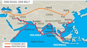
A potential new trade route

The most exaggerated claim concerns the value of the Arctic as shortened and hence cheaper shipping routes between Asia and Europe. Many stories tout the speed and value of the shorter route for Asia to Europe shipping.4

While factual, these stories exaggerate both the volume and the value of shipping using the northern routes. To evaluate the real value of these routes, it is essential to understand their current usage and the limits that geography and oceanography impose. Figure 1, below, illustrates both routes.

Figure 1: Arctic Sea Routes. (Photo source: Arctic Council Arctic Marine Shipping Assessment 2009 Report.)

The Congressional Research Service notes:

“The Northern Sea Route (NSR, a.k.a. the ‘Northeast Passage’), along Russia’s northern border from Murmansk to Provideniya, is about 2,600 nautical miles in length…Most transits through the NSR are associated with the carriage of LNG from Russia’s Yamal Peninsula…The Northwest Passage (NWP) runs through the Canadian Arctic Islands…potentially applicable for trade between northeast Asia (north of Shanghai) and the northeast of North America, but it is less commercially viable than the NSR.”5

While this description sounds promising, it is important to understand the current and potential flow of shipping, the nature of containerized shipping, and the impact of oceanography on its future growth.

Almost all of the Northwest Passage lies within Russia’s exclusive economic zone (EEZ). Russia also claims that key straits on the route lie within its internal waters.6 See Figure 2, below.

Figure 2: Northern Sea Route in Russian Waters. (Photo source: Andrew Todorov, “New Russian Law on Northern Sea Route Navigation: Gathering Arctic Storm or Tempest in a Teapot?” Belfer Center for Science and International Affairs, Harvard Kennedy School, March 9, 2023.

Thus, almost all transits must pass through straits Russia claims as internal waters. Russia has assigned responsibility for managing the NSR to Rosatom, the state-owned nuclear power monopoly, which complicates obtaining the required permission for internal passage. In 2022, Russia also claimed the Lomonosov Ridge, a subsea mountain range, as part of its continental shelf. This pushes its claimed EEZ boundaries to the edge of those areas claimed by Greenland and Canada. See Figure 3, below.

Figure 3: Arctic Nations Territorial Claims. (Photo source: Ian Birdwell, “Rival Claims to a Changing Arctic,” Maritime Executive, August 15, 2016.)

The percentage increase in shipping along these routes may sound very impressive, but only because the baseline was miniscule. Actual shipping remains minimal. The Centre for High North Logistics recorded only 97 voyages on the NSR during 2024.7 See Figure 4, below.

Figure 4: NSR Transits by Type in 2024. (Photo source: “Main Results of NSR Transit Navigation in 2024,” Centre for High North Logistics, NORD University, November 28, 2024)

Despite continued official Chinese and Russian efforts to promote the route, as of August 31, 2025, only 52 vessels had transited the NSR. Container freight represented only 20 percent of the total. See Figure 5, below.

Figure 5: NSR transits by type through August 31, 2025. (Photo source: “Overview of Transit voyages along the Northern Sea Route as of August 31, 2025,” Centre for High North Logistics, NORD University, September 1, 2025.)

Further restricting traffic growth, in October 2025, four of the world’s five biggest container shipping companies — MSC Mediterranean Shipping Company, A.P. Moller-Maersk A/S, CMA CGM SA and Hapag-Lloyd AG — stated they will not use the NSR due to environmental, safe navigation, and transit issues. The fifth company, Cosco Shipping, a Chinese company, has not made a statement.8

The Northwest Passage supports even less shipping than the NSR. As the 2024 shipping season concluded only 18 ships completed the full journey – eight cruise ships, nine cargo ships and one tanker.9

Factors restricting the value of shipping via NSR or NWP

Several major and enduring factors – draft restrictions, unpredictable sea ice, the requirement for ice breakers, and higher cost per container–reduce the economic viability of these routes.

Draft restrictions

Arctic hydrography is particularly restrictive for commercial shipping. The NSR has a controlling draft of 12.5 meters and the NWP is limited to 10 meters. This means the Panamax-class (5,500 TEU maximum) is the largest that can use the NSR but they draw too much water for the NWP. In addition, ships may not have a beam of more than the ice breaker escorting them, or about 30 meters maximum.10

In August 2025, the NEWNEW company proudly announced it had increased its NSR traffic from 7 voyages in 2024 to 13 voyages in 2025. In those 13 trips, it carried a total of around 20,000 TEUs.11 For comparison, the Inira-class carries over 24,000 TEUs on a single voyage. From January 2022 to April 2024, over 800 ships per week transited the Cape of Good Hope and Suez Canal,12 for a yearly total of over 41,000 transits. More ships pass the Cape every 11 hours than use the NSR in a year and many are much larger than the Panamax-class.

Unpredictable Sea Ice

While Arctic Sea ice is steadily receding, this does not mean passages are necessarily or predictably clear. Sea ice moves with prevailing currents with thicker multi-year ice moving into areas where one year ice has melted. As such, moving multi-year ice often stacks up in restricted waters. The NASA image (Figure 6 below) shows how the melting ice on the NWP flows east and closes the route despite major reductions in total ice coverage. It led NASA to conclude:

“Despite overall declines in the thickness and extent of Arctic sea ice, shipping routes along the northern coast of North America have become less navigable in recent years.”13

Figure 6: Sea Ice Chokes the Northwest Passage. (Photo source: “Sea Ice Chokes the Northwest Passage,” NASA Visible Earth, August 8, 2024.

The fact that the sea ice floats means it is very difficult to predict exactly where the passage will be blocked. This problem is not limited to the NWP. As late as September 2025, “a non ice-class Suezmax oil tanker has been forced to wait several days due to ice conditions before proceeding along Russia’s Northern Sea Route…at very slow speeds in close proximity to the shoreline to find a route through the ice.”14 Even ice rated ships are often delayed, the Buran, an Arc4 rated Liquid Natural Gas tanker “reached the Northern Sea Route north of the Bering Strait on October 29 and for the past three days has been struggling to find a path through early winter sea ice.”15

Compounding the problem of drifting ice, the routes have notoriously shallow water. The channels are not well marked and still surprise mariners. On September 7, 2025, the Thamesborg, a Dutch bulk freighter, ran aground in the remote Franklin Strait of the NWP. It required three salvage ships to refloat the Thamesborg.16 The vessel was not unloaded and refloated until October 9 a delay of 33 days. Canadian Coast Guard inspections also revealed damaged ballast tanks.17

In addition to ice, Arctic weather ranging from storms to heavy fog often slows transiting ships. While delays are not a significant problem for bulk shipping, they have major impacts on the timeliness required for container freight.

Icebreaker requirements

Paradoxically, as the arctic ice cap is melting, the demand for icebreakers is surging. Russia has 47 in service with 15 under construction. Canada is funding two dozen new ones. Both nations require numerous ice breakers to support domestic industries in their EEZs.

In contrast, the United States currently has two icebreakers with one of those used primarily as a research vessel. The U.S. Coast Guard has also purchased a used icebreaker and hopes to have it in operation by 2026.18 Although the Coast Guard analysis indicated it would only need three heavy and three medium icebreakers, on October 10, 2025, the Department of Homeland Security announced the United States and Finland have signed a Memorandum of Understanding for a Finnish company to produce four icebreakers with the next seven being produced in U.S. shipyards.19Given only 18 NWP passages in 2024, it is unclear why the United States needs to increase its icebreaker fleet from two to 11. 

Cost

Proponents of Arctic shipping routes note that shorter northern routes will mean lower costs. Unfortunately, several factors mean the cost of shipping individual containers will often be higher. Draft restrictions, lack of ports enroute, slow emergency response, stricter construction requirements, specialized crew training, ice breaker escorts, and insurance costs all contribute to higher cost per container. While the cost of an individual ship’s voyage may be less on a shorter route, the Thamesborg and Lynx show a shorter route does not necessarily mean it is cheaper or even faster.

Bulk cargo is usually shipped point to point so can benefit from a shorter route. Obviously, it makes sense to ship coal, LNG, and oil that is produced in northern Russia to China or India via the NSR. However, due to economies of scale, bulk cargo originating elsewhere may be cheaper to ship via the much larger ships that can transit southern routes. Not only are Arctic-capable ships much smaller, but they must also meet strict construction, outfitting, and crew training requirements which make them more expensive to purchase and operate. Due to the route hazards, insurance rates are also higher. Further inflating the cost per voyage is the requirement for ice breaker escorts. Both Canada and Russia charge each vessel for icebreaking services.20

For its part, container shipping has different cost factors. The most important metric is the cost per container rather than the cost of the voyage for an individual ship. Thus, scale is an important factor.

A second critical metric for container freight is timeliness. Unlike either northern route, southern routes can be part of a shipping network. This is critical for on-time delivery and economy of scale. The desired standard for on-time delivery for containerized freight is 99%. To achieve this goal, container ships operate in networks with “strings” or routes of many ports serviced by multiple ships on a steady schedule. For example, a US east coast to Southwest Asia route taking 42 days round trip serviced by six ships means regular weekly service out of the ports serviced on that route.21

The network described limits delays to a week. Today, much of the global economy consists of subcomponents built in one country, shipped to a second for final assembly of the subcomponents, and then on to another country for inclusion in the final product. Such supply chains are based on just-in-time delivery. As the Covid-19 pandemic demonstrated, failure to deliver on time means production lines must be idled, making reliable delivery time critical. As noted, the unpredictable sea ice, infrequent sailings, and often brutal weather on the northern routes reduce reliability. Given the northern routes cover 2,500 miles with minimal infrastructure or support services, weeks-long delays are not unusual.

Access to natural resources

Minerals, particularly those yielding rare earth metals, are often touted as the primary resources of interest in the north. In fact, the Geological Survey of Norway estimated the value of rare earth minerals in the Arctic alone is $1.5-2 trillion.22 However, most of the minerals lie within the Exclusive Economic Zones of the six nations bordering the Arctic — Russia, Norway, Denmark, Canada, the United States, and Iceland. Any exploitation will be done by those nations, and so there is no special urgency to secure them against competitors. Figure 3 shows how only a small slice of the Arctic Ocean lies outside national EEZs. A paper from the Institute for Security & Development Policy also noted:

“Overall, the High North’s … resources have long attracted global interest, but their exploitation is technologically difficult and capital-intensive, and often faces local resistance due to risks to nature-based livelihoods and cultural heritage. … In short, the Arctic’s mineral wealth is both enormous and yet largely untapped…”23

Just as important, rare earths are not rare. The High North is estimated to hold only 15 percent of the world’s supply.24 In fact, in the last year major deposits have been found in Wyoming and Arkansas; these deposits have the obvious advantage of easier access. The issue is not the ore but the refining process. Currently most rare earth minerals are shipped to China for refinement into rare earth metals. If the United States continues to invest in refining facilities, supplies of rare earths will not be an issue.

Oil is another driver of interest. According to the U. S. Geological Service “roughly 22 percent of the undiscovered, technically recoverable fossil fuel resources in the world” may remain in the Arctic with 84 percent of it outside the Exclusive Economic Zones of Arctic nations.25

However, the high production cost of High North oil meant the United States government received no bids in the January 2025 Alaska Wildlife Refuge lease sale.26 Apparently, oil firms have decided it makes no economic sense to invest in very high-cost production when there is still oil in fields with much lower production costs. Russian firms are the obvious exceptions. As state-controlled firms, they must continue to invest onshore in the north of the country. Oil revenues are essential to the Russian economy and government budget.

National Security

Two threads emerge from the discussion of the need for U.S. defense of the High North. The first is the need for surveillance to detect any Russian attack coming over the pole. The second concern is the security of Greenland, Svalbard, and the protection of shipping routes.

During the Cold War, the United States and Canada operated the Defense Early Warning (DEW) radars from 1957 to 1985 to provide warning of Soviet bomber and missile attacks over the pole. From 1985 to 1988, DEW transitioned to the North Warning System (NWS). The NWS provides surveillance for the atmospheric defense of North America. Today, the United States and Canada are working to improve the surveillance element of missile defense. Re-establishing the radar system in the High North will be an extremely difficult, very expensive, and time-consuming project.27 A potential alternative is space surveillance. The Pentagon is already exploring deploying space-based sensors as part of the Golden Dome. If this very expensive project continues, it will provide the surveillance aspect of the DOD tasks.

The sudden concern that the United States must field and deploy forces to physically defend Greenland, Svalbard, and the new shipping routes is a bit puzzling. By holding the Greenland-Iceland-UK Gap, NATO credibly defended the western exit from the High North throughout the Cold War against a highly capable Soviet Navy. Even with global warming, the Gap will remain Russia’s best exit to the west. In the east, the Bering Strait is about 50 miles wide with two islands in the middle.

In fact, the most significant change since the Cold War has been the steady decline of the Russian forces in the region. “Decades of attrition, neglect, and resource depletion have left Russia’s Arctic capabilities outdated and functionally broken.”28 Against the degraded Russian air and sea forces, land-based missiles and drones can provide an affordable option. There is no requirement for U.S. or allied forces to penetrate the NSR. Containerized land-based missiles, drones, radar, command and control systems integrated with space-based surveillance can allow U.S. and allied forces to engage surface ships and aircraft transiting the Arctic. In short, the United States and its allies can control traffic that attempts to leave the Arctic. These systems can also support the most challenging mission – tracking and, if needed, engaging Russian submarines.

Conclusion

Strategy should provide discipline to guide the investment of limited defense resources. Proponents of investing in capabilities focused on the High North point to defending Greenland and Svalbard; balancing the increased Chinese and Russian interests in the region; maintaining access to its vast natural resources; and taking advantage of the shortened shipping via the Northern Sea Route and the Northwest Passage. Yet, the vastly increased range of land-based missiles supported by pervasive surveillance means it is easier and cheaper to defend the chokepoints at the exits to the Arctic Ocean than during the Cold War. And they will do so against vastly reduced Russian forces. The vast natural resources lie within the EEZs of the Arctic nations, so access requires diplomacy and businesses willing to make arrangements for western firms to exploit them. Military resources will not improve access. Finally, the shipping routes will, even with massive growth, never amount to more than a minor fraction of global trade. So, while there is some value in investing in High North capabilities, those resources will have to be taken from already under-resourced theaters with much higher strategic value. Strategy requires allotting scarce assets to priority missions – the High North is not one of them.

While there is essentially no need for major military investment in the High North, the United States should continue to engage concerning environmental issues and apply sanctions against violators. It should also reduce its icebreaker contract to the maximum of six suggested by the Coast Guard. While the current two icebreakers may be insufficient, the proposed buy is much too large. It will take shipbuilding resources away from the Navy at a time when the fleet is understrength and has no path to sufficient numbers of ships. The U.S. can continue to maintain a defense of the High North using the same terrain and maritime chokepoints used during the Cold War. The investments in new generations of cruise missiles and long-range drones necessary to support the priority theaters will also provide a flexible force to defend the north if needed. Lastly, it should not allocate limited DOD assets to the region because high-priority theaters like Indo-Pacific, Europe, and the Middle East are already under-resourced. These measures can effectively manage Arctic interests within the appropriate context of focused national strategy.

T.X. Hammes is a Senior Research Fellow at the Institute for National Strategic Studies at the National Defense University in Washington, DC. He served 30 years in the U.S. Marine Corps.

Endnotes

1. Frank G. Hoffman, “Strategy as an Appetite Suppressant,” War on the Rocks, March 3, 2020, https://warontherocks.com/2020/03/strategy-as-appetite-suppressant/.

2. U.S. Department of Defense, “2024 Arctic Strategy,” https://media.defense.gov/2024/Jul/22/2003507411/-1/-1/0/DOD-ARCTIC-STRATEGY-2024.PDF.

3. Donald J. Trump, “United States National Security Strategy, November 2025,” https://www.whitehouse.gov/wp-content/uploads/2025/12/2025-National-Security-Strategy.pdf.

4. “Arctic Shipping Update: 37% Increase in Ships in the Arctic Over 10 Years,” Arctic Council, January 31, 2024, https://arctic-council.org/news/increase-in-arctic-shipping/ and Malte Humpbert, “Chinese Containership ‘Istanbul Bridge’ Reaches UK via Arctic Route in Record 20 Days,” gCaptain, October 13, 2025, https://gcaptain.com/chinese-containership-istanbul-bridge-reaches-uk-via-arctic-route-in-record-20-days/?subscriber=true&goal=0_f50174ef03-5ee6139183-381157581&mc_cid=5ee6139183&mc_eid=64e8ec0a99.

5. “Changes in the Arctic: Background and Issues for Congress,” Congressional Research Service, Updated July 2, 2025, https://www.congress.gov/crs-product/R41153.

6. Cornell Overfield, “Wrangling Warships: Russia’s Proposed Law on Northern Sea Route Navigation,” Lawfare, October 17, 2022, https://www.lawfaremedia.org/article/wrangling-warships-russias-proposed-law-northern-sea-route-navigation.

7. ”Main Results of NSR Transit Navigation in 2024,” Centre for High North Logistics, NORD University, November 28, 2024, https://chnl.no/news/main-results-of-nsr-transit-navigation-in-2024/.

8. Brendan Murray and Danielle Bochove, “China Turns to Arctic Shortcut While Major Carriers Steer Clear,” gCaptain, October 3, 2025, https://gcaptain.com/china-turns-to-arctic-shortcut-while-major-carriers-steer-clear/. 

9. “International Voyages on the Northwest Passage in 2024,” Aker Arctic, November 13, 2024, https://akerarctic.fi/news/international-voyages-on-the-northwest-passage-in-2024/.

10. Stephen M. Carmel, “Taking a Round-Turn on Reality: Commercial Shipping through the Arctic,” email to author.

11. Malte Humpert, ”Chinese Companies Dispatch Multiple Container Ships Along Arctic Route for Faster European Trade,” High North News, August 4, 2025, https://gcaptain.com/chinese-companies-dispatch-multiple-container-ships-along-arctic-route-for-faster-europe-trade/.

12. ”Ship crossings through global maritime passage: January 2022 to April 2024,” Office of National Statistics, https://www.ons.gov.uk/businessindustryandtrade/internationaltrade/bulletins/shipcrossingsthroughglobalmaritimepassages/january2022toapril2024.

13. ”Sea Ice Chokes the Northwest Passage,” NASA Visible Earth, August 8, 2024, https://visibleearth.nasa.gov/images/153166/sea-ice-chokes-the-northwest-passage.

14. Malte Humpert, “Sanctioned Suezmax Oil Tanker Without Ice Protection Stuck for Days on Russia’s Arctic Northern Sea Route,” gCaptain, September 15, 2025, https://gcaptain.com/sanctioned-suezmax-oil-tanker-without-ice-protection-stuck-for-days-on-russias-arctic-northern-sea-route/?subscriber=true&goal=0_f50174ef03-245bcea0f7-381157581&mc_cid=245bcea0f7.

15. Malte Humpbert, ” Russia Pushes ‘Shadow Fleet’ to Limit as LNG Carrier Struggles Through Early Arctic Ice on Northern Sea Route,” gCaptain, November 3, 2025, https://gcaptain.com/russia-pushes-shadow-fleet-to-limit-as-lng-carrier-struggles-through-early-arctic-ice-on-northern-sea-route/.

16. Malte Humpbert, ”Two Salvage Vessels Arrive in Canadian Arctic to Begin Refloating of Grounded ‘Thamesborg’,” gCaptain, September 23, 2025, https://gcaptain.com/two-salvage-vessels-arrive-in-canadian-arctic-to-begin-refloating-of-grounded-thamesborg/?subscriber=true&goal=0_f50174ef03-a458a9f7c7-381157581&mc_cid=a458a9f7c7&mc_eid=64e8ec0a99.

17. Malte Humpbert, ” Arctic Cargo Ship ‘Thamesborg’ Refloated AIS Data Show, Awaiting Company Confirmation,” gCaptain, October 9, 2025, https://gcaptain.com/arctic-cargo-ship-thamesborg-refloated-ais-data-show-awaiting-company-confirmation/?subscriber=true&goal=0_f50174ef03-400f2f7a4e-381157581&mc_cid=400f2f7a4e&mc_eid=64e8ec0a99.

18. Stew Magnusen, ” The Icebreaker Numbers Game,” National Defense, January 13, 2025, https://www.nationaldefensemagazine.org/articles/2025/1/13/the-icebreaker-numbers-game.

19. ”DHS Celebrates Purchase of New Coast Guard Icebreakers as President Trump Signs Deal with Finland,” Department of Homeland Security, October 10, 2025, https://www.dhs.gov/news/2025/10/10/dhs-celebrates-purchase-new-coast-guard-icebreakers-president-trump-signs-deal.

20. Nouman Ali, “The Cost of Icebreaking Services,” SeaRates, Jun 11, 2020, https://www.searates.com/blog/post/the-cost-of-icebreaking-services.

21. Stephen M. Carmel, “Taking a Round-Turn on Reality: Commercial Shipping through the Arctic,” email to author.

22. Mark Rowe, ”Arctic nations are squaring up to exploit the region’s rich natural resources,” Geographical, August 12, 2022, https://geographical.co.uk/geopolitics/the-world-is-gearing-up-to-mine-the-arctic.

23. Mia Landauer, Niklas Swanström, and Michael E. Goodsite, ”Mineral Resources in the Arctic: Sino-Russian Cooperation and the Disruption of Western Supply Chains,” Niklas Swanström & Filip Borges Månsson, editors, The “New” Frontier: Sino-Russian Cooperation in the Arctic and its Geopolitical Implications, September 2025, Institute for Security and Development Policy, https://www.isdp.eu/wp-content/uploads/2025/09/SP-Arctic-Sep-2025-final.pdf.

24. Ibid, p.109.

25. Mark Rowe, ”Arctic nations are squaring up to exploit the region’s rich natural resources,” Geographical, August 12, 2022, https://geographical.co.uk/geopolitics/the-world-is-gearing-up-to-mine-the-arctic.

26. ”Arctic National Wildlife Refuge: Status of Oil and Gas Program,” Congressional Research Service, updated July 24, 2025, https://www.congress.gov/crs-product/IF12006#:~:text=On%20January%208%2C%202025%2C%20DOI,the%20lease%20sale%20discouraged%20participation.

27. Sune Engel Rasmussen, ” Inside the West’s Race to Defend the Arctic,” Wall Street Journal, October 11, 2025, https://www.wsj.com/world/inside-the-wests-race-to-defend-the-arctic-0f04ca7a?gaa_at=eafs&gaa_n=ASWzDAi4UrfELbN8TNIpkiANQ9qkJ409UcY7ybn1KHm71Es8FzKPdjCv2Sk3_6eJxEI%3D&gaa_ts=68efa5d0&gaa_sig=X9bLexZswY1r8pD8-BgF7-BUcPWUSkNZB5DFNXcqGswh-PVRHJkHIZ_O-GK6LEEDyK8b2uDpyvgFayIxLxTHnA%3D%3D.

28. Michael S. Brown, ”Rethinking the Arctic Threat Landscape,” Proceedings, November 2025, https://www.usni.org/magazines/proceedings/2025/november/rethinking-arctic-threat-landscape?utm_source=newsletter&utm_medium=email&utm_campaign=PWNov6-25&utm_id=PWNov625&utm_source=U.S.+Naval+Institute&utm_campaign=f01c9a3224-Proceedings_This_Week_2025_6_November&utm_medium=email&utm_term=0_adee2c2162-f01c9a3224-223022301&mc_cid=f01c9a3224&mc_eid=e0ac270dd4.

Featured Image: The icebreaker USCGC Healy (WAGB 20) keeps station while conducting crane operations alongside a multi-year ice floe for a science evolution in the Beaufort Sea, Aug. 9, 2023. (U.S. Coast Guard photo by Petty Officer 3rd Class Briana Carter)

A Tale of Two Seas: The Caribbean and South China Sea in Great Power Perspective

By Akshat Patel

The South China Sea is to China as the Caribbean Sea is to the United States. Just as the United States repeatedly thwarted European powers from the Caribbean throughout the nineteenth and twentieth centuries, China intends to thwart an American presence in the South China Sea in this century.1 In 1962, the ambitions of two superpowers reached a crescendo in the form of the Cuban Missile Crisis. Along the same lines, the ambitions of two of today’s great powers are resulting in skirmishes across the South China Sea. In the same way that the clash in the Caribbean was a deciding factor in who the victor of the Cold War would be, American maritime superiority will be decided in large part by who the reigning power in the South China Sea will be.

The parallels between Soviet-U.S. relations vis-à-vis the Caribbean and China-U.S. relations vis-à-vis the South China Sea are as striking as they are instructive. The Red Navy’s mistakes in its transatlantic ventures serve as salutary course corrections for the U.S. Navy’s transpacific undertakings today.

Then, as Now

By the twentieth century, the United States had established itself as the dominant power in the Americas. Politically stable and economically vibrant, the United States overshadowed the smaller republics of the Caribbean. Blessed with two adjacent oceans and two peaceful neighbors, the United States was virtually immune to a land-based invasion. The only way for a foreign power to establish a foothold in the American hemisphere was through the Caribbean. While “the Caribbean was the natural maritime extension of the continental United States, it was also the part of America’s security environment most vulnerable to European attack,” notes Robert Kaplan, senior fellow at the Center for a New American Security.2

In October of 1962, the Soviet Union attempted to exploit this potential American vulnerability through Cuba. The Soviets wanted to establish a naval base and station land-based nuclear missiles on the island nation. President Kennedy ordered an embargo around Cuba to expunge Soviet ambitions from the Caribbean and compelled Khrushchev to blink in the ultimate staring contest. In exchange for withdrawing nuclear missiles from Cuba, the Soviets extracted a public promise to not invade Cuba and a private promise to withdraw American nuclear missiles from Turkey.3 Both sides avoided direct conflict by reaching an agreement that neither desired. The Soviets surrendered their Caribbean aspirations and the United States surrendered its Cuban advances. 

China enjoys many of the same benefits of geography as the United States. Surrounded by natural barriers to aggression such as frigid Siberia, the Gobi Desert, the impenetrable Himalayas, and the lush forests of Vietnam and Laos, China is largely shielded from terrestrial attack. Just like the United States, China’s vulnerability is to the southeast. Not only do most Chinese live near the coast, but the South China Sea serves as their primary economic lifeline.4 The straits of Malacca, Makassar, Sunda, and Luzon all pour into the South China Basin and control both China’s energy supplies from the Middle East and its exports to the West.5 Just as the Caribbean is littered with small island nations eclipsed by a colossal United States, the South China Sea is peppered with littoral states over which China casts a large shadow.

The fallout over control of an American sea of 1.5 million square miles foreshadowed the rest of that great-power competition – the Cold War. Similarly, the contest for an Asian sea of comparable proportions will act as a bellwether for the great-power competition taking place today. Five claimants occupy almost 70 different atolls and have built more than 90 different outposts in the South China Sea.6 With 20 outposts in the Paracel Islands, 7 in the Spratly Islands, and 3,200 acres of newly constructed land, China is by far the most aggressive player in the area.7 Malaysian, Philippine, Taiwanese, and Vietnamese maritime claims have been brushed to the wayside while China charges forward to secure its “blue national soil.”8 China is aware of its vulnerability to the southeast and stands to gain immensely by shielding against it. By turning the South China Sea into a Chinese enclave, Beijing would not only safeguard the lives and livelihood of its citizens, but would also create a strategic disadvantage for the United States. The South China Sea is a conduit linking the Western Pacific to the Indian Ocean and Chinese control of that critical juncture would jeopardize American maritime dominance. Lucrative global trade routes would cease to be international common grounds and the redoubts of allied nations would fall under a Chinese penumbra. American merchants would be subject to harassment by the Chinese coast guard and the U.S. Navy would no longer be able to crisscross the Indo-Pacific theater with impunity.

To circumvent China’s efforts to dominate the South China Sea, American naval policy is rightly learning from Soviet efforts. By maintaining naval bases in South Korea, Japan, and Guam while simultaneously encouraging a naval buildup in Singapore, Taiwan, and the Philippines, the United States is building a multilateral coalition to check Chinese forays into the Pacific.9 As the Soviet Union attempted to tamp down American influence in the Americas through Cuba, the United States is curbing Chinese influence in Asia through Association of Southeast Asian Nations (ASEAN) nations.

Empowering the Right Platform

When Che Guevara expressed concern at the Soviet gambit in the Caribbean, Soviet Minister of Defense Rodion Malinovsky replied, “There will be no big reaction from the U.S. side.”10 The Soviet defense minister expected little retaliation from the United States because, as he viewed it, he was exercising soft power by bringing Cuba into the fold. As the term “Cold War” reminds us, neither side was ever interested in a full-fledged, direct, violent conflict; instead, the Cold War was a great-power competition in which both sides tried to undermine the other through maximum power projection while suffering minimal losses. To project this power, the Soviets wanted to permanently station an entire fleet in the Caribbean: two cruisers, four destroyers, eleven diesel electric submarines, and two submarine tenders.11 But, at the last minute, the Soviets changed their plans. Instead, they sent forth four covert Foxtrot-class diesel submarines as the vanguard of the Red Fleet.12

The reigning Soviet naval doctrine prioritized submarines over surface ships. In 1956, Khrushchev stated that “submarines were the most suitable naval weapon and they would receive emphasis in the future development of the Soviet Navy.”13 As a result, new construction of major surface vessels was virtually terminated under his premiership.14 According to a 2017 CIA analysis of the Soviet Navy, “Khrushchev declared surface naval forces…no longer useful and predicted they would soon become obsolete.”15 Motivated by advances in technology, the Soviets wanted to reduce overall military manpower and costs by replacing a large surface fleet with a more effective, smaller submarine fleet.16 In other words, they prioritized a denser more capable force over a more numerous, less capable one.

By attempting a transatlantic overture to the Caribbean, the Soviets made the right geopolitical decision. By sending submarines, they made the wrong tactical decision. Submarines are mobile, undersea intelligence gatherers packed with brutish lethality. They are about “sheer aggression,” not power projection.17 They are best suited to spy and wreak havoc, not as conspicuous icons of power. By deploying covert submarines to the Caribbean, the Soviets were guaranteed to alarm Americans and provoke a strong response. President Kennedy ordered a maximum Anti-Submarine Warfare (ASW) effort to track and surface the submarines.18 The Soviets were not harmlessly posturing by deploying submarines within sailing distance of Florida while simultaneously stationing land based nuclear missiles at America’s doorstep. They were committing an act of belligerence that the Unites States met with force. The Atlantic Fleet mobilized to detect and ferret out the furtive aggressors. As Defense Minister Malinovsky’s comment suggests, the bold step to Cuba was never supposed to culminate into the hair-raising crisis that it did. His intention was to assert Soviet dominance without causing an international scene. This is exactly the United States’ objective in the South China Sea today.

To maintain American primacy in the South China Sea, Chinese maritime ambitions must be curtailed without devolving into the grand standoff that occurred in the Caribbean. Submarines should not be the U.S. Navy’s primary tools in this great-power competition. Because of the raw aggression that submarines communicate, they are ill-suited for missions that display military power and best suited for missions that exercise military power. The surface fleet’s strengths are altogether opposite.

Aircraft carriers, simultaneously symbols of national power and of national prestige, are excellent tools for communicating power, but a ruinously costly platform to lose.19 Losing a symbol of national pride would deal irreparable damage to the national psyche. The U.S. Navy must look to its destroyers and cruisers as the primary combatants of this great-power competition. While not as awe-inspiring as an aircraft carrier, they are still an excellent form of communication. The U.S. Navy has rightly increased destroyer and cruiser freedom of navigation operations (FONOPs) in the South China Sea, and it must continue this upward trajectory.20 By regularly challenging expansive Chinese claims, Washington must continue to signal Beijing that the South China Sea is not a Chinese lake. Frequent FONOPs through contested sea lanes go much farther in projecting maritime strength, communicating intentions, and deterring aggression than stealthy submarine deployments. To do this effectively, and not repeat Soviet mistakes, the United States needs a larger surface fleet.

The battle of ‘capability vs. numbers’ is a perennial struggle that has haunted the minds of American naval policy wonks for decades. Examined holistically, there is a clear winner. “The trend towards fewer, more capable ships is both unarguable and . . . inexorable,” notes Admiral John Ellis, former Commander of United States Strategic Command.21 Over the past twenty-five years, the number of ships in the U.S. Navy has decreased by nearly half while the demands placed on the American fleet remain the same.22 “Today, that means twice the percentage of the fleet is deployed than was at the height of the Cold War,” notes ex-Chief of Naval Operations Admiral Gary Roughead.23 At the same time, the Congressional Budget Office recently determined that the Navy is only able to fulfill 60 percent of deployments requested by combatant commanders.24 In short, at some point, numbers do matter. Simple math dictates that if the U.S. Navy has fewer ships, either they need to be deployed more often or they must be asked to execute fewer missions. The Navy must stem its unrelenting pursuit of a leaner, cutting-edge fleet. Naval budgeteers must be willing to substitute a pricey aircraft carrier for a dozen more destroyers or cruisers. Vulnerable aircraft-carriers and stealthy submarines will not be the heroes that secure American maritime superiority, it will be destroyers and cruisers.

Together, not Alone

The Cuban missile crisis of 58 years ago stands as the most studied event of the nuclear era—so much so that there are essays about why we should stop writing essays about it.25 Yet, until fall 2002, American national security experts were not aware that the four Foxtrot-class diesel submarines deployed to Cuba had been armed with nuclear-tipped torpedoes.26 The CIA’s four intelligence reports on Soviet arms buildup leading up to the Cuban Missile Crisis categorically ruled out the presence of nuclear weapons in the Caribbean.27 Instead of preparing Americans for the possibility of nuclear catastrophe, intelligence reports based on complacent assumptions made the discovery of this fact all the more shocking. In short, the Soviet Union caught the United States flat-footed.

Handicapped by the technology of the time and oblivious to the presence of tactical nuclear weapons, the U.S. Navy decided to release a Notice to Mariners (NTM) detailing how depth charges would be used to peacefully signal the submarines to surface. Moscow never sent an acknowledgement of receiving the NTM.29 Upon detecting the nuclear torpedo laden B-59, American naval forces started dropping depth charges in accordance with the NTM. Unaware of American intentions, suffering from inhospitable conditions and agitated by the subsurface explosions, Captain Savitsky gave the order to ready the nuclear torpedo: “We’re gonna blast them now! We will die, but we will sink them all—we will not become the shame of the fleet.”30 It is because cooler heads prevailed on the B-59 that day that the Caribbean was not subject to a nuclear explosion. Second Captain Vasily Arkhipov overruled Captain Savitsky and prevented the opening shot of a nuclear war.

Now as then, complacency continues to surprise and compel the United States into ad hoc, reactive measures. In 2012, both China and the Philippines swarmed a collection of rocks and reefs known as Scarborough Shoal. Up until then, both countries claimed the Shoal as theirs, but it was under de facto Philippine control. 550 nautical miles from the closest Chinese land mass and 124 nautical miles from the main Philippine island of Luzon, the Scarborough Shoal episode exemplifies China’s ambitions in the South China Sea.31 To mediate their dispute, the United States hastily brokered a bilateral agreement for both sides to retreat and, in effect, return control to the Philippines. Only one side held to its word. China used the agreement to deceive the Philippines into retreating while maintaining its presence. Without American reprisal or condemnation, China has since then controlled Scarborough Shoal.

The United States must not let the People’s Liberation Army (Navy) bully China’s neighbors. Unlike Khrushchev’s about-face with Castro, the United States must stand steadfast beside its allies. Despite increased FONOPs in the South China Sea, a recent public opinion poll of ASEAN citizens indicated that almost two-thirds of respondents believed U.S. engagement with ASEAN nations had declined. Another one-third said they had little to no confidence in the U.S. as a strategic partner and provider of regional security.32 The United States must reaffirm its commitment to the South China region through military sales, combined exercises, and economic empowerment. It is much harder to reverse a change in the status quo than to maintain it through deterrence. By turning the cause of American maritime dominance into a multilateral quest, China’s unilateral offensives will be rendered moot. 

One More Time

The Soviet Union was not defeated through armed conflict; it was defeated through persistent coercion. As the United States negotiates its presence in the South China Sea, and by extension its maritime dominance, it must rely on the same strategy that overwhelmed the Soviet Union while not resurrecting Soviet mistakes. The Soviet decision to forsake their surface fleet and their allies precipitated their withdrawal from the Caribbean, which in turn forecasted their global retreat and eventual downfall. The United States must simultaneously lean on its surface fleet and its ASEAN allies to maintain its position as the bailiff of the world’s saltwater commons.

Sun Tzu pithily remarked that the supreme art of war is to subdue the enemy without fighting. We have done it once before, now we must do it again.

LT Akshat Patel is a Submarine Warfare Officer in the U.S. Navy. The views expressed here are those of the author alone and do not represent those of the Department of Defense. 

Endnotes

1. John J. Mearsheimer, The Tragedy of Great Power Politics, (W. W. Norton, New York, 2001), 401.

2. Robert D. Kaplan, Asia’s Cauldron: the South China Sea and the End of a Stable Pacific (New York: Random House, 2015), 278.

3. Noam Chomsky, “Cuban Missile Crisis: How the US Played Russian Roulette with Nuclear War,” The Guardian, Guardian News and Media, October 15, 2012, https://www.theguardian.com/commentisfree/2012/oct/15/cuban-missile-crisis-russian-roulette.

4. George Friedman, The Next 100 Years: A Forecast for the 21st Century (New York: Random House, 2009), 153.

5. Ibid.

6. “Occupation and Island Building,” Asia Maritime Transparency Initiative (Center for Strategic and International Studies), accessed April 25, 2020, https://amti.csis.org/island-tracker/

7. “China Island Tracker,” Asia Maritime Transparency Initiative (Center for Strategic and International Studies), accessed April 25, 2020, https://amti.csis.org/island-tracker/china/

8. Kaplan, Asia’s Cauldron, 60.

9. Ibid., 75.

10. Svetlana V Savranskaya, “New Sources on the Role of Soviet Submarines in the Cuban Missile Crisis,” Journal of Strategic Studies 28:2 (April 2005): 236, doi: 10.1080/01402390500088312.

11. Raymond Garthoff, “New Evidence on the Cuban Missile Crisis: Khrushchev, Nuclear Weapons, and the Cuban Missile Crisis,” Cold War International History Bulletin 11 (Winter 1998): 253.

12. Ryurik A Ketov, Captain 1st Rank, Russian Navy (retired), “The Cuban Missile Crisis as Seen Through a Periscope,” Journal of Strategic Studies 28:2 (April 2005): 218, doi: 10.1080/01402390500088304.

13. Soviet Navy: Intelligence and Analysis During the Cold War (Central Intelligence Agency, 2017), 12.

14. Ibid., 7.

15. Ibid., 12.

16. Ibid., 8.

17. Kaplan, Asia’s Cauldron, 71.

18. Svetlana V Savranskaya, “New Sources on the Role of Soviet Submarines in the Cuban Missile Crisis,” 249.

19. “Aircraft-carriers are big, expensive, vulnerable – and popular,” The Economist, November 2019; Jeff Vandenengel, “Too Big to Sink,” Proceedings, May 2017.

20. Zack Cooper et al. “America’s Freedom of Navigation Operations Are Lost at Sea,” Foreign Policy, January 2019.

21. James O. Ellis, Admiral, U.S. Navy (retired), “Rightsize the Navy,” Hoover Digest (Summer 2018): 49.

22. Gary Roughead, Admiral, U.S. Navy (retired), “A Stretched Navy and A Fiscal Disconnect” Strategika 47 (January 2018).

23. Ibid.

24. Ellis, “Rightsize the Navy,” 51.

25. Eliot A. Cohen, “Why We Should Stop Studying the Cuban Missile Crisis,” National Interest, Winter 1985/86.

26. Svetlana V Savranskaya, “New Sources on the Role of Soviet Submarines in the Cuban Missile Crisis.”

27. Amy B. Zegart, “October Surprises,” Hoover Digest (Fall 2013): 50.

28. Svetlana V Savranskaya, “New Sources on the Role of Soviet Submarines in the Cuban Missile Crisis,” 249.

29. Ibid., 250.

30. Ibid., 246.

31. Gordon G. Chang, “A China Policy That Works – For America” Strategika 41 (May 2017).

32. Jack Kim et al. “Southeast Asia wary of China’s Belt and Road project, skeptical of U.S.: survey,” last modified January 6, 2019, https://www.reuters.com/article/us-asean-singapore-idUSKCN1P00GP.

Featured Image: A P2V Neptune U.S. patrol plane flies over a Soviet freighter during the Cuban missile crisis in 1962. (Photo via Wikimedia Commons)

The Concept of ‘Reach’ in Grasping China’s Active Defense Strategy: Part II

This publication was originally featured on Bharat Shakti and is republished with permission. It may be read in its original form here.

By Vice Admiral Pradeep Chauhan AVSM & Bar, VSM, IN (Ret.)

Editor-in-Chief’s Note

Part I of this two-part article introduced the geoeconomic and geostrategic imperatives that shape China’s geopolitical drives. It also presented the overarching concept of “reach” as an aid to understanding the international import of China’s military strategy. Read Part I here.

In this second and concluding part of the article series the author explores Chinese strategic intent and its ramifications. The article provides an account of the naval facilities China is promoting or constructing on disputed islands among littoral states of the Indian Ocean; assesses China’s economic linkages with African nations; and projects the growth curve of the Chinese Navy, all of which are important to keep in view while analyzing the trajectory of Chinese geo-strategic intent.

By emphasizing the factor of temporal strategic-surprise (in contrast to spatial surprise), the author offers clues to understanding the links between China’s military strategy and her geopolitical international game-moves as they are being played out within a predominantly maritime paradigm. As in the famous Chinese game of Go—perhaps a more apt analogy than chess—the People’s Republic is putting in place the pieces that will shape her desired geopolitical space. The author explores the spatial and temporal dimensions of the Chinese strategy and the related vulnerabilities of the opposing Indian establishment.

In his 2006 dissertation written at the US Army War College then-Lt. Col Christopher J. Pehrson, USAF, termed the Chinese geostrategy the “String of Pearls.” This expression, first used in January 2005 in a report to U.S. military officials prepared by the U.S. consulting firm of Booz Allen Hamilton, caught the attention of the world’s imagination. Pehrson posited China as a slightly sinister, rising global power, playing a new strategic game, as grandiose in its concept, formulation and execution as the “Great Game” of the 19th century. Despite vehement and frequent denials by Chinese leadership of any such geostrategic machinations designed at the accumulation of enhanced geopolitical and geoeconomic power and influence, the expression rapidly embedded itself into mainstream consciousness.

Image Courtesy: Chinausfocus.com
China’s One Road, One Belt economic infrastructure initiative. (Chinausfocus.com)

As a net result, for over a decade, China has chafed under the opprobrium heaped upon it for a concept that (to be fair) it had never once articulated by the state. However, in a brilliant rebranding exercise by Beijing in 2014, the world’s attention is being increasingly drawn away from the negative connotations associated with the phrase String of Pearls and towards the more benign-sounding 21st century Maritime Silk Route Economic Belt, also known as “One Road, One Belt.” This presents an alternative expression, while it nevertheless covers essentially the very same geostrategic maritime game-plays that Colonel Pehrson explained a decade ago. The new expression emphasizes transregional inclusiveness and evokes the romance of a shared pan-Asian history with the implied promise of a reestablishment of the economic prosperity that the Asian continent’s major civilizational and socio-cultural entities, namely China and India, enjoyed until the 18th century.

Each “pearl” in the String of Pearls construct—or in more contemporary parlance, each “node” along the Maritime Silk Route—is a link in a chain of Chinese geopolitical and geostrategic influence. For example, Hainan Island, with its recently upgraded military facilities and sheltered submarine base, is a pearl/node.

It is by no means necessary for a line joining these pearls/nodes to encompass mainland China in one of the concentric ripples typified by the Island Chains strategy. In fact, since the Maritime Silk Route is a true maritime construct, it is highly unlikely that the nodes would do so.

Image Courtesy: chinahighlights.com
The location of Hainana Province, China. (chinahighlights.com)

Other pearls/nodes include the recent creation of artificial islands in the Paracel and Spratly islands incorporating, inter alia, the ongoing construction/upgrade of airstrips on Woody Island—located in the Paracel Islands, some 300 nm east of Vietnam—as also on Mischief Reef and Fiery Cross Reef in the Spratly Islands. Additional pearls/nodes have been obtained through Chinese investments in Cambodia and China’s continuing interest in Thailand’s Isthmus of Kra.

China’s development of major maritime infrastructure abroad—the container terminal in Chittagong, Bangladesh; the Maday crude oil terminal in Myanmar’s Kyakpyu port; the development of ports such as Hambantota in Sri Lanka, Gwadar in Pakistan, Bagamoyo in Tanzania, Beira in Mozambique, Walvis Bay in Namibia, Kribi in Cameroon, the Djibouti Multipurpose Port (DMP), and the offer to even develop Chabahar in Iran (checkmated by a belated but vigorous Indian initiative), along with the successful establishment of a military (naval) base in Djibouti—all constitute yet more pearls/nodes. The development of an atoll in the Seychelles, oil infrastructure projects in Sudan and Angola, and the financing of newly discovered massive gas finds in offshore areas of Mozambique, Tanzania and the Comoros, are similarly recently acquired pearls/nodes. Even Australia yields a pearl/node, as does South Africa, thanks to Chinese strategic investment in mining in general and uranium-mining companies in particular, in both countries.

Chinese maritime policing vessel.
Chinese maritime policing vessel. (SCMP.com)

From an Indian perspective, China’s new strategic maritime-constructs (by whichever name) are simultaneously operative on a number of levels, several of which are predominantly economic in nature and portend nothing more than fierce competition. At the geostrategic level, however, the economy is at its apex and is China’s and India’s greatest strength and greatest vulnerability, at the same time; therefore, the economy is the centerpiece of the policy and strategy of both countries. This is precisely why, as the geographical competition space between India and China coincide in the Indian Ocean, there is a very real possibility of competition transforming into conflict, particularly as the adverse effects of climate change on resources and the available land area becomes increasingly more evident.

“Reach” has both spatial and temporal dimensions. The spatial facets of China’s geopolitical moves are evident, as illustrated in the preceding String of Pearls discussion. It is critical for India’s geopolitical and military analysts to also understand the temporal facets of this construct. The terms short term, medium term and long term are seldom used with any degree of digital precision. A nation tends to keep its collective “eye on the ball” in the short term and, by corollary, tends to assign far less urgency to something that is assigned to the long term. This ill-defined differentiation is how strategic surprise may be achieved in the temporal plane. For instance, in China, the short term generally implies 30 to 50 years. This is an epoch that is far in excess of what in India passes as the long term. Consequently, India fails to pay as close attention to developments in China as she might have were the developments to unfold in a duration corresponding to India’s own short term of 2-5 years. This distinction permits China to achieve strategic surprise, and this is as true of military strategy as it is of grand strategy and geoeconomics.

On the one hand, it should be remembered that these strategic constructs are not only about maritime infrastructure projects, involving the construction of ports, pipelines and airfields, though these developments constitute their most obvious and visibly worrisome manifestation. The strategy is equally about new, renewed or reinvigorated geopolitical and diplomatic ties between the People’s Republic of China and nation states across a very wide geographical swath (including the African littoral and the island nations of both the Indian Ocean and the Pacific Ocean). On the other hand, China’s strategic maritime constructs have some important military spin-offs, which closely align to the furtherance of geostrategic reach. Thus, by developing friendly ports of call (if not bases), facilities and favorable economic dependencies in the various pearls/nodes, the logistics involved in the event of an engagement in maritime power-projection are greatly eased.

1_091223153841_1
Type 904 (Dayun Class) Transport Ship (globalmil.com)

Supplementing the pearls/nodes are the Chinese Navy’s five impressive stores/ammunition supply ships of the Dayun Class (Type 904) and six underway replenishment tankers of the Qiandaohu Class (Type 903A). In addition, China requires ground control stations to meet her satellite-based needs of real-time surveillance. Unlike the United States, China simply does not have adequate ground control/tracking stations within the Indian Ocean to affect requisite ground control and real-time downlinking of her remote-sensing satellites. This forces her to deploy a number of ships (the Yuanwang Class) for this purpose. These constitute a severe vulnerability that China certainly needs to overcome. One way to do so is to establish infrastructure and acceptability along the IOR island states and along the East African littoral, as China is currently attempting to do.

The principal lack in the Chinese strategy to provide military substance to the country’s geoeconomic and geostrategic reach comes in the form of integral air power through aircraft carriers. China is rapidly learning that while one can buy or build an aircraft carrier in only a couple of years, it takes many more years to develop the human, material, logistic and doctrinal skills required for competent and battle worthy carrier-borne aviation. For nearly a decade now, China has demonstrated her ability to sustain persistent military (naval) presence in the Indian Ocean—albeit in a low threat environment. Combat capability is, of course, quite different from mere presence or even the ability to maintain anti-piracy forces, since the threat posed to China by disparate groups of poorly armed, equipped and led pirates can hardly be equated with that posed by a powerful and competent military adversary in times of conflict.

Despite the impressive growth of the Chinese Navy and the vigor of the Chinese military strategy, China may not, in the immediate present, have the combat capability to deploy for any extended period of time in support of its geoeconomic and geostrategic reach were they to be militarily contested by a major navy. However, as James Holmes points out, if India were to continue to cite shortfalls in current Chinese capability and conclude that it will take the PLA Navy at least fifteen years to station a standing, battle worthy naval squadron in the Indian Ocean, this would lull Indians into underplaying Chinese determination and the speed of that country’s military growth. This would carry the very real consequent possibility of India suffering a massive strategic surprise. Is that something that India can afford?

Vice Admiral Pradeep Chauhan retired as Commandant of the Indian Naval Academy at Ezhimala. He is an alumnus of the prestigious National Defence College.