Category Archives: Capability Analysis

Analyzing Specific Naval and Maritime Platforms

Countering Chinese Expansion Through Mass Enlightenment

By James E. Fanell and Ryan D. Martinson

From Newport to New Delhi, a tremendous effort is currently underway to document and analyze China’s pursuit of maritime power. Led by experts in think tanks and academia, this enterprise has produced a rich body of scholarship in a very short period of time. However, even at its very best, this research is incomplete—for it rests on a gross ignorance of Chinese activities at sea.  

This ignorance cannot be faulted. The movements of Chinese naval, coast guard, and militia forces are generally kept secret, and the vast emptiness of the ocean means that much of what takes place there goes unseen. Observers can only be expected to seek answers from the data that is available.

The U.S. Navy exists to know the answers to these secrets, to track human behavior on, above, and below the sea. While military and civilian leaders will always remain its first patron, there is much that USN intelligence can and should do to provide the raw materials needed for open source researchers to more fully grasp the nature of China’s nautical ambitions. Doing so would not only improve the quality of scholarship and elevate the public debate, it would also go a long way to help frustrate China’s current—and, to date, unanswered—strategy of quiet expansion. Most importantly, sharing information about the movements and activities of Chinese forces could be done without compromising the secrecy of the sources and methods used to collect it.

The Constellations are Visible…

The basic story of China’s maritime aggrandizement is printed in black and white, no need to read tea leaves. There exists a public life in China, even if highly circumscribed. Chinese journalists are paid to write articles that satisfy the urges of an inquisitive and patriotic public. Chinese scholars spend careers trying to understand the intentions and capabilities of their own country—like academics elsewhere, they banter back and forth in defense of “truth,” and bruised egos. Government agencies release reports that catalog their achievements, outline key objectives, and mobilize their personnel for the new tasks at hand. The Chinese military, communicating through service publications, seeks to inculcate a collective consciousness of what it does and why it does it. All of these sources are open to the foreign observer.

The available information provides important clues about the nature and extent of Chinese activities at sea. This is true for all three of the sea services: the coast guard, the maritime militia, and the PLA Navy.  

The movements of the Chinese coast guard are particularly amenable to open source analysis. China does not operate a single maritime law enforcement agency analogous to the United States Coast Guard. It instead funds several different civilian agencies, each with a different mission. Prior to the creation of the China Coast Guard in 2013, the agencies most active along China’s maritime frontier were China Marine Surveillance (CMS) and Fisheries Law Enforcement (FLE). Both agencies released surprising amounts of information through official newspapers, annual reports and yearbooks, and other channels.
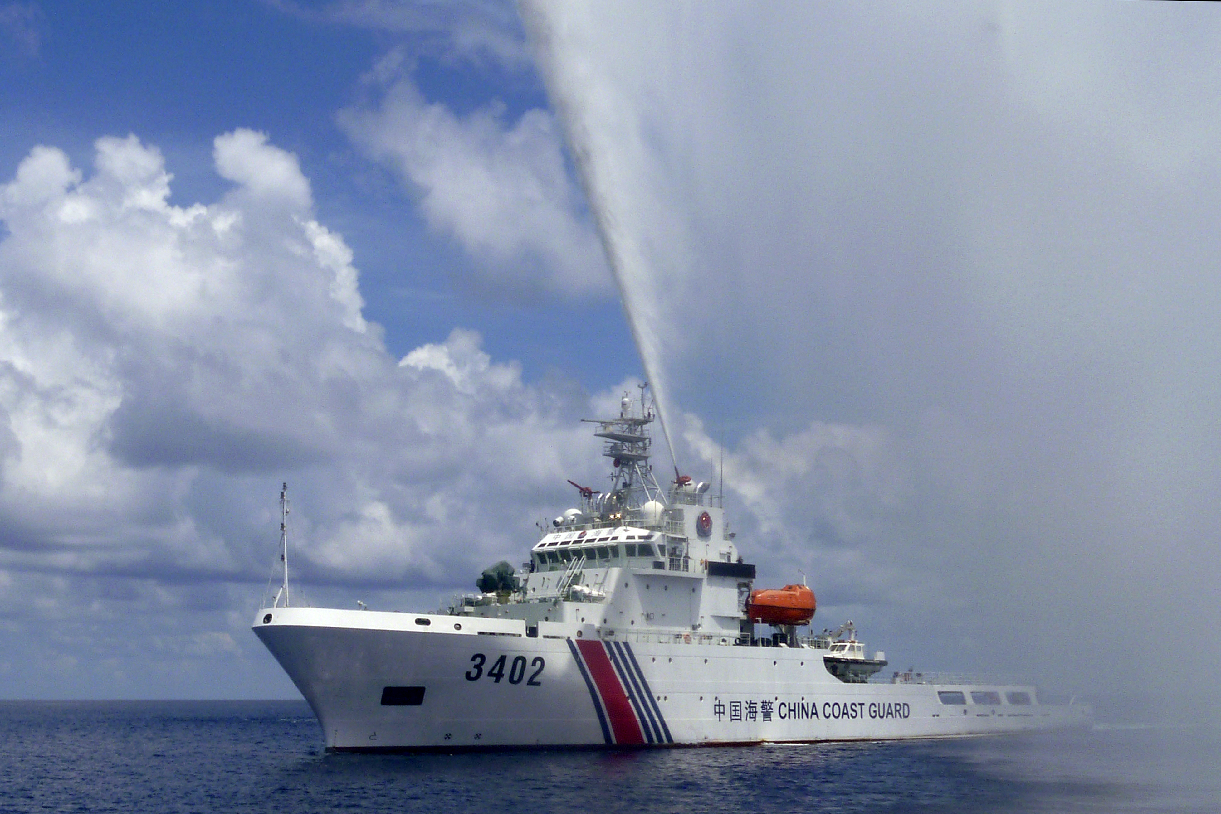
In this Sept. 23, 2015, photo, provided by Filipino fisherman Renato Etac, a Chinese Coast Guard boat sprays a water cannon at Filipino fishermen near Scarborough Shoal in the South China Sea. A landmark ruling on an arbitration case filed by the Philippines that seeks to strike down China's expansive territorial claims in the South China Sea will be a test for international law and world powers. China, which demands one-on-one talks to resolve the disputes, has boycotted the case and vowed to ignore the verdict, which will be handed down Tuesday, July 12, 2016, by the U.N. tribunal in The Hague. (Renato Etac via AP)
Sept. 23, 2015. A Chinese Coast Guard boat sprays a water cannon at Filipino fishermen near Scarborough Shoal in the South China Sea. (Renato Etac via AP)

These sources include significant quantitative data. For instance, it is possible to track the expansion of CMS presence in disputed waters that started in 2006. In that year, CMS began to regularize its sovereignty—or “rights protection”—patrols, first in the East China Sea, then in the Yellow Sea and South China Sea. Each year, the State Oceanic Administration (SOA) published data on these operations. In 2008, CMS conducted a total of 113 sovereignty patrols. These missions, which covered more than 212,000 nm, established CMS presence in all of the waters over which China claims jurisdiction. Four years later, in 2012, the service conducted 172 sovereignty patrols (>170,000 nm) just in the South China Sea alone.

Qualitative data also abounds. Before 2014, both CMS and FLE regularly invited Chinese journalists aboard ships operating in disputed areas. These civilian scribes chronicled China’s campaign to reclaim “lost” land and sea. While primarily designed to inspire and titillate Chinese audiences, their work provides excellent source materials for the foreign observer. For instance the eight-part Chinese television documentary that aired in late 2013 showed extensive footage of CMS and FLE ships operating in the South China Sea, including during hostile encounters with Indonesian and Vietnamese mariners.

Chinese sources also provide raw materials for understanding the activities of the second major instrument of Chinese sea power—the maritime militia. This force is comprised of civilians trained to serve military and other state functions. In peacetime, a segment of the militia, mostly fishermen, constitutes an important tool in Chinese maritime strategy. It sails to disputed waters to demonstrate Chinese sovereignty and justify the presence of the Chinese coast guard and navy. The militia also harasses foreign vessels, and helps protect China’s own.
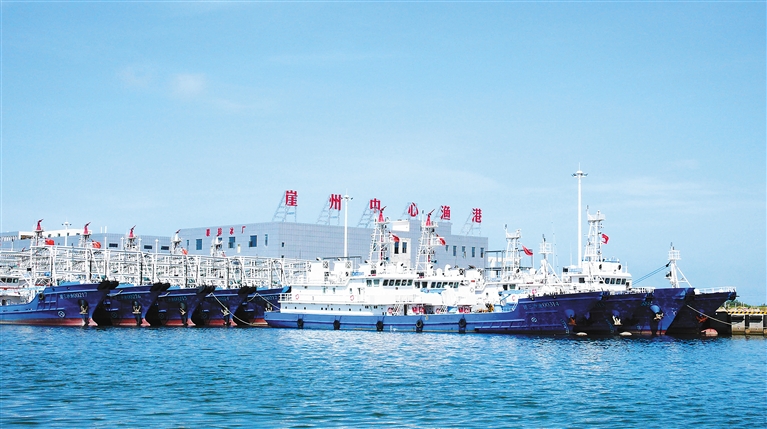
18 June 2016: Newly-built fishing vessels for Sansha City moored at Yazhou Central Fishing Harbor. Note the exterior hull reinforcements and mast-mounted water cannons. (Hainan Government)

China’s maritime militia is particularly active in the South China Sea. The Chinese press eagerly covers their activities in disputed waters, often revealing ship pennant numbers and the names of key militiamen. Websites owned by provincial, municipal, and county governments also highlight their local contributions to the “people’s war” at sea. Using such sources, Conor Kennedy and Andrew Erickson have tracked the militia’s activities at places such as Mischief Reef and Scarborough Shoal, and deciphered its role in pivotal events such as the 2009 assault on the USNS Impeccable.

The PLA Navy also releases information about where, when, and how it is operating. Air, surface, and undersea deployments are called “combat readiness patrols” (zhanbei xunluo). Service publications regularly report on these patrols—including, perhaps surprisingly, those conducted by China’s “silent service.” For instance, one October 2014 article in People’s Navy recounts a story of Song Shouju, a submarine skipper from the PLA Navy South Sea Fleet (SSF), whose diesel electric boat was prosecuted by a foreign maritime patrol aircraft and a surveillance vessel during one combat readiness patrol. According to Song, his boat was subjected to 80 hours of active sonar, placing him on the horns of a dilemma. If he surfaced, it would mean a mission failure and “put Chinese diplomacy in an awkward position” (suggesting the submarine was not operating where it should have been). But if he remained below, the boat would risk the consequences of depleting its battery. In the end, the captain decided to stay submerged until the threat had passed, which it ultimately did.1

The PLA Navy is particularly forthcoming about patrols taking place beyond the “first island chain.” These are regularly reported in the Chinese press, both in English and Chinese. In May 2016, for example, six vessels from the SSF—including three destroyers, two frigates, and an auxiliary—completed a 23-day training mission that took them through the South China, the Indian Ocean, and the western Pacific by means of the Sunda Strait, Lombok Strait, Makassar Strait, and the Bashi Channel. At least one Chinese journalist was onboard to cover the 8,000 nm voyage. Again, the available data is not limited to the movements of surface combatants. For instance, a January 2014 People’s Navy article revealed that since 2009, 10 submarines and 17 aircraft from the ESF had traversed the first island chain to conduct “far seas” operations.2 Sources like these have enabled foreign researchers such as Christopher Sharman to trace the connection between Chinese actions and its declared naval strategy.
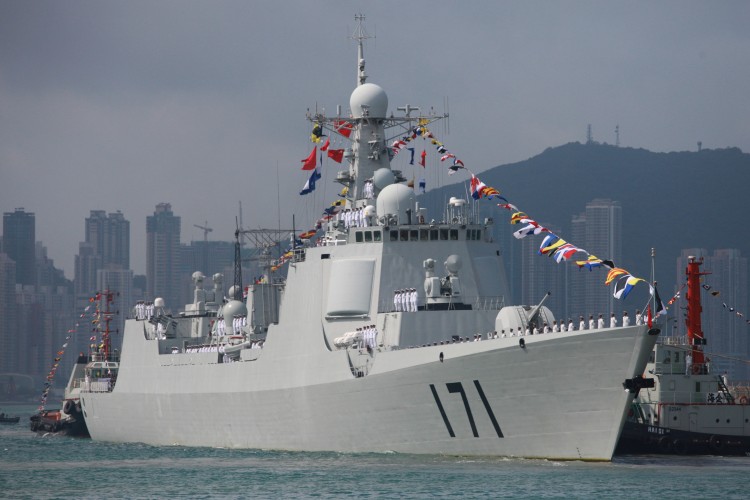
Chinese missile destroyer Haikou (171) is seen while docking in Hong Kong on April 30, 2012. (Aaron Tam/AFP/Getty Images)

To follow Chinese activities at sea, one need not rely on Chinese sources alone. Foreign governments also sometimes release data. Often this information is associated with a particular incident. For instance, in mid-2014, the Vietnamese press published numerous articles in English covering China’s provocative deployment of an advanced new drilling rig (HYSY-981) in disputed waters south of the Paracel Islands. More recently, Indonesia released useful information about its response to illegal Chinese fishing and coast guard activities taking place near Natuna Island.

For its part, Japan systematically issues data on Chinese presence in the waters adjacent to the Senkaku Islands. Graphical depictions of these data vividly show Chinese expansion over time, from the inaugural intrusion of two CMS vessels in December 2008 to the regular patrols that started in September 2012 and continue today. Indeed, the quality and consistency of this data has enabled foreign analysts to use quantitative methods to test theories about shifts in Chinese diplomacy.

…But Darkness Still Prevails

The information described above, while useful, nevertheless presents many problems. This is true even in the case of data on Chinese coast guard operations, which are easily the richest available to the open source researcher. A “rights protection” patrol can mean anything from a two-day sweep of the Gulf of Tonkin to a several-month mission to the southern reaches of the Spratly Archipelago. Thus, while the available data unmistakably capture the broad trends of Chinese expansion, they lack the fidelity needed for closer examination of deployment patterns. With the creation of the China Coast Guard, all this is now moot. The Chinese government no longer publishes such data, and Chinese journalists are now seldom allowed aboard ships sailing to disputed waters.

The problem is much worse in the case of the maritime militia. No Chinese agency or department systematically tracks and releases information on militia activities. Because only a portion of fishermen are members of the militia, fishing industry data is a poor proxy. Thus, there is no way to scientifically track the activities of irregular forces operating along China’s maritime frontier. We generally only learn about particular incidents, remaining largely ignorant of the context in which they take place.

Consistent data on PLA Navy activities in disputed and sensitive waters is simply not available. We do know that in recent years the service “normalized” (changtaihua) its presence in the Spratly Archipelago, but Chinese sources provide no definition of what that term means. Thus, while it is clear that the PLA Navy has augmented its surface ship patrols to these waters, we have no means to gauge the scale of that augmentation.3 In the East China Sea, Chinese sources do speak candidly about hostile encounters with the Japanese Maritime Self Defense Force. However, the open source researcher has few options for gauging the extent of PLA Navy presence east of the equidistant line.

There is a more fundamental problem that must be reckoned with: in most cases, the foreign observer often lacks the means to validate deployment data found in Chinese sources. Ultimately, one must take the word of the Chinese government, which naturally considers political factors—both internal and external—when issuing such content. Information released by other governments can be valuable, but foreign statesmen have their own motives. Sometimes they seek to downplay differences. For example, it is likely that for many years China and at least some Southeast Asian states had a tacit agreement not to publicize incidents at sea.

In sum, the available open source data can account for only a tiny fraction of what Chinese maritime forces are doing at sea. Moreover, the validity of information that is available must be seen as suspect. This is where naval intelligence can help.

Sharing the Spotlight

Naturally, U.S. naval intelligence professionals, particularly those in the Pacific, pay close attention to the comings and goings of Chinese maritime forces. To this end, they employ a wide variety of sources, from highly sensitive national technical means to visual sightings made by U.S. and allied forces at sea. They also optimize other resources of the U.S. intelligence community to support their mission requirements.4 Suffice it to say, the naval intelligence community is well aware of the disposition of China’s naval, coast guard, and militia forces.

The foundation of this effort is the Pacific Fleet Intelligence Federation (PFIF), established in September 2013 by then United States Pacific Fleet Commander, Admiral Cecil Haney. The PFIF “provides direction for the organization and collaboration of the Pacific Fleet’s intelligence and cryptologic resources to support the maritime Operational Intelligence (OPINTEL) mission” of “tracking adversary ships, submarines and aircraft at sea.” It represents a level of focus and systematization not seen since the Cold War.

The PFIF is a true collaborative enterprise, involving “coordination from Sailors across multiple organizations at various echelons, afloat and ashore, working in unison 24 hours a day, seven days a week providing the most precise maritime OPINTEL to our afloat forces.”5 Efforts are “federated” across nodes in Japan, Hawaii, San Diego, and Washington D.C.6 Relevant data collected by regional allies are also included. The result is the adversary Common Operational Picture (RED COP). Through RED COP, the PFIF provides Fleet Commanders and deployed forces precise geo-coordinate level intelligence regarding the location of maritime platforms across the Pacific Fleet area of responsibility. It also contains a detailed pedigree of the sources used to identify the location of an adversary unit.

How might the USN translate RED COP into information that is valuable to the public  yet does not risk sources and methods? The answer lies in the format of the transmitted product. While American forces require the detailed information contained in the RED COP, the U.S. public does not. Therefore, the USN could issue a standardized series of PowerPoint graphics that contain generic depictions of PRC maritime force disposition across the Indo-Pacific region, if not the rest of the world. Since the technology used today by PFIF watch-standers can automatically produce this type of graphic, this would involve no new burden for naval intelligence professionals.

Some may argue that placing an adversary unit in a location where there is no “plausible deniability” could expose a source or method of intelligence collection. Four factors eliminate this risk. First, the generic placement of an adversary platform on a PowerPoint graphic would, by definition, not contain the level of fidelity required to determine the source of the contact. Second, as mentioned above, nearly all locations of maritime forces at sea are derived from multiple sources. This fact further complicates the task of determining any one particular source. Third, generic graphics would be published monthly, or biweekly at the most. This would dramatically reduce the potential risk to sources and methods. Fourth, and most importantly, there may be times when the Fleet Director of Intelligence (or higher authority) may deem the location of a particular ship, submarine or aircraft to be too sensitive. In such instances, they can simply remove the platform(s) from the briefing graphics. This would provide a final, fail-safe check against revealing any sensitive intelligence collection sources or methods. Together, these four factors would eliminate the possibility of compromising sources and methods, even with sophisticated algorithms of “pattern analysis.”

Such an initiative would not be entirely without precedent. The Office of Naval Intelligence (ONI) already produces the “World Wide Threat to Shipping” and “Piracy Analysis Warning Weekly” reports, which provide graphic and textual laydowns of the global maritime domain as derived from unclassified sources. The recommendations outlined in this essay would represent an expansion of current efforts under the auspices of ONI, using the PFIF’s all-source data as the primary source.
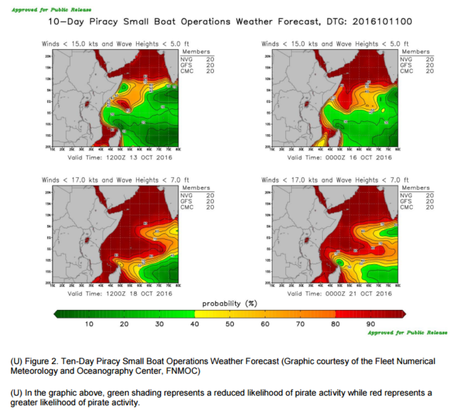
Office of Naval Intelligence (U) HORN OF AFRICA/GULF OF GUINEA/ SOUTHEAST ASIA: Piracy Analysis and Warning Weekly (PAWW) Report for 6 - 12 October 2016
10 Day Piracy small boat operations weather forecast from Office of Naval Intelligence (U) HORN OF AFRICA/GULF OF GUINEA/SOUTHEAST ASIA: Piracy Analysis and Warning Weekly (PAWW) Report for 6 – 12 October 2016.

The Rewards of Mass Enlightenment

Releasing such data would immediately benefit efforts to understand Chinese maritime strategy. It would open up whole new swaths of scholarship. Chinese actions could be directly correlated to Chinese words. Incidents could be placed in their correct context. Theories about China’s pursuit and use of sea power could be proposed and tested with new levels of rigor.

Better open source analysis would also benefit the intelligence community itself. The strengths of academic scholarship—such as understanding strategic and organizational culture—could be applied to the same questions that preoccupy USN analysts, perhaps yielding fresh insights. Efforts to contextualize the activities of China’s maritime militia, for example, would be especially welcome, given its peculiar social, cultural, and political roots.

While scholarship is valuable in and of itself, the ultimate purpose of such an initiative would be to improve the ability of our democracy to respond to the China challenge. Elected officials, who ultimately decide policy, take cues from public discourse. Thus, if wise policies are to be crafted, the broader American public must be fully aware of the threat that China’s pursuit of maritime power poses to American interests. This is especially important given that any proper response would require the whole nation to bear costs and accept risks. Unlike Russia, China’s actions are carefully calibrated not to arouse a somnolent American public. This places a very high premium on information about the actions that China is taking.  

To be sure, information is not an antibiotic. Ingesting it in the right quantities at the right frequencies may not cure the disease. Indeed, there is already enough data in the public domain for Americans to see the key trends. Yet there remain some very smart people who cannot, or will not, recognize the perils we face. Even so, the correct antidote to intellectual biases is ever more information; as data accumulates, the naysayers must either alter their theories or risk self-marginalization.

Sharing facts about Chinese activities at sea is not just good for democracy, it is also smart diplomacy. At this point, merely shining the spotlight on Chinese maritime expansion is unlikely to persuade China to radically alter its strategy. The China of Xi Jinping is less moved by international criticism than the China of Hu Jintao or Jiang Zemin. However, releasing detailed data on Chinese activities at sea would likely have an impact on foreign publics, who will use it to draw more realistic conclusions about the implications of China’s rise. Moreover, making such information widely available would help counter spurious Chinese narratives of American actions as the root cause of instability in the Western Pacific. Both outcomes are in our national interest.

To adopt the approach advocated in this essay would require a political decision. On matters of national policy, naval intelligence professionals must yield to civilian leaders.7 In the end, then, this essay is for the politicians. And so is its last word: share with the scholars.

James E. Fanell is a retired U.S. Navy Captain whose last assignment was the Director of Intelligence and Information Operations for the U.S. Pacific Fleet and is currently a Fellow at the Geneva Centre for Security Policy.

Ryan D. Martinson is a researcher in the China Maritime Studies Institute at the U.S. Naval War College. The views expressed are those of the author and do not reflect the official policy or position of the U.S. Navy, Department of Defense or the U.S. Government.

1, 周卓群, 李克一 [Zhang Yuannong, Zhou Zhuoqun, and Li Keyi] 潜航深海磨利刃 [“Sailing Submerged in the Deep Ocean to Sharpen Our Blade”] 人民海 [People’s Navy], 8 October 2014, p. 3.

2.  [Gu Caohua]   中抓建,造深蓝铁 [“Seize on Construction While in Action, Mold a Blue Water Iron Fist”] 人民海 [People’s Navy] 8 January 2014, p. 3.

3. 李唐 [Li Tang] 海化巡覆盖万里海疆 [“Normalized Naval Patrols Cover the Maritime Frontier”] 人民海 [People’s Navy] 23 June 2014, p. 1

4. James E. Fanell, Remarks at USNI/AFCEA conference panel: “Chinese Navy: Operational Challenge or Potential Partner?”, San Diego, CA, 31 January 2013.

5. James E. Fanell, “The Birth of the Pacific Fleet Intelligence Federation”, Naval Intelligence Professionals Quarterly, October 2013.

6. Ibid. James E. Fanell, “The Birth of the Pacific Fleet Intelligence Federation”, Naval Intelligence Professionals Quarterly, October 2013.

7.The authority for conducting an effort such as this would require approval from the Director of National Intelligence and the various “Original Classification Authorities” as outlined in Executive Order 1352. “Executive Order 13526- Original Classification Authority”, The White House Office of the Press Secretary, 29 December 2009, https://www.whitehouse.gov/the-press-office/executive-order-original-classification-authority

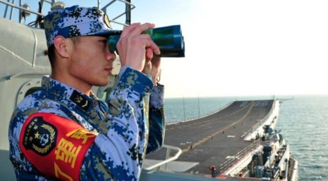
Featured Image: A sailor of the Chinese People’s Liberation Army Navy aboard the aircraft carrier Liaoning. (REUTERS/XINHUA)

Entering the Bear’s Lair: Russia’s A2/AD Bubble in the Baltic Sea

The following article originally featured on The National Interest and is republished with permission. Read it in its original form here

By Bret Perry

On the cold, cloudy afternoon of March 18th, 2018, the 22nd Marine Expeditionary Unit (MEU) and its Amphibious Readiness Group steamed through the Baltic Sea about 100 miles south of the Swedish island of Gotland, just west of Lithuania and Latvia. With its full squadron of three amphibious assault ships, including the USS Bataan Landing Helicopter Dock, and three Arleigh Burke-class destroyers, this impressive US military presence in the Baltic Sea was unprecedented. In response to unusual Russian military activity near Estonia, including the presence of ‘little green men’ in the border town of Narva, the new White House administration was determined to send a message to Moscow.

Two US Marine Corps F-35Bs, flown by call sign Yukon and his wingman Zeus, surged off the deck of the USS Bataan to conduct a combat air patrol (CAP) to reinforce the NATO presence in the area. Banking south, Yukon heard the NATO E-3 Sentry Airborne Early Warning and Control (AWACS) operator Showboat say through his thick Dutch accent, “Yukon, Showboat, you have a pop-up group of two Bogeys, Bullseye 207 degrees for 150 kilometers, 1,300 meters.”

“Copy, Showboat. Intercepting,” Yukon responded as he throttled his jet up to Mach 1.6. Another aggressive Russian flyby, he thought.

About four minutes later, Yukon and Zeus had positioned their aircraft about 250 feet behind the two Su-30SM Flanker-C bandits. But unlike previous intercepts of Russian fighter over Baltic Sea, the Su-30s were clearly armed with more than the typical, short range Archer (R-73) air-to-air missiles.

“Zeus, any idea what they’re carrying?” Yukon asked his wingman.

“Negative, but they’re not playing around today,” she responded.

“Copy. Take a closer look for me.”

“Roger,” Zeus responded. She slowly began to creep her aircraft closer to the Su-30 on the left.

“Showboat, Yukon, tally-ho on two Flanker-Cs. We think…” Yukon’s voice trailed off as he watched a disaster unfold in an instant.

As Zeus approached the bandits, one of the Su-30s tried to barrel-roll over her F-35B. But as Zeus held steady 100 feet from the Flankers, the Su-30 pilot misjudged the maneuver, and slammed the Russian jet into the right wing of Zeus’ F-35B. The wing snapped off, sending Zeus spinning, while the Su-30 pitched over into a nosedive.

“Eject! Eject! Eject!” Zeus yelled into the radio.

In response to the chaos, the remaining Su-30 banked right, and bugged out. When Yukon looked to his left, he felt relief and horror at what he saw.

He could see Zeus’ parachute. But… there was no sign of the Russian pilot.

Although the aforementioned vignette is fictional, it captures the increasingly worrisome military implications of Russia’s posture in Kaliningrad. The presence of Russian ground, naval, and air forces in Kaliningrad is not new, but Russia has essentially transformed the tiny area into a major “pop-up” Anti-Access/Area-Denial (A2/AD) zone from what had been a Cold War-era Soviet outpost. Despite traditionally being associated with the Asia-Pacific or even the Persian Gulf, Russia’s deployments in Kaliningrad reflect the potential for the emergence of localized A2/AD zones in Europe. Not only is A2/AD now a critical component in European security dynamics, but it is also a global phenomenon that has truly ‘broken out’ of the Pacific’s First Island Chain. With NATO’s eyes on the defense of its Baltic members and a growing view that Poland is NATO’s new center of gravity in the East, a Kaliningrad A2/AD zone projects advanced ground, naval, and air threats, creating significant security challenges.

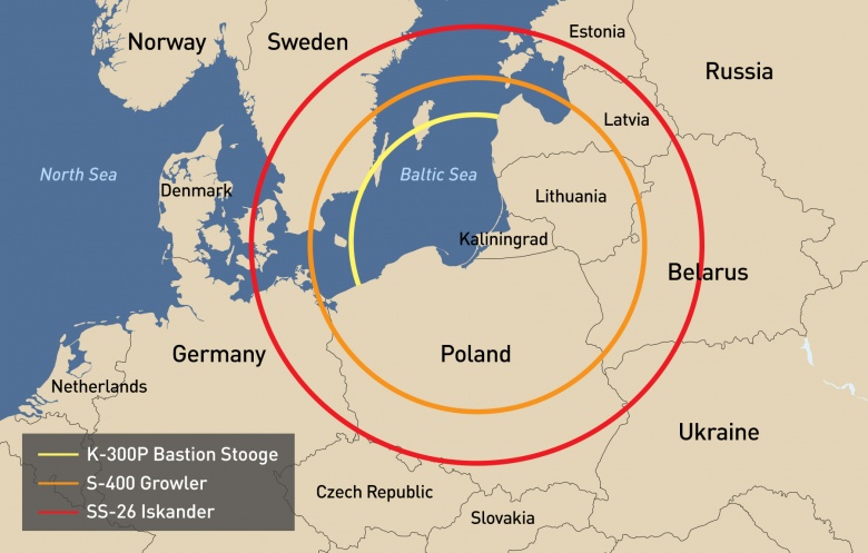
visualizing_a2_ad_map_300dpi_beige_rgb1
Range rings of Russian missile systems in Kaliningrad. (Avascent)

Achieving Integrated Air and Missile Defense (IAMD) and air dominance is a critical component in countering A2/AD zones. Although Russia’s defense industry faces challenges with upgrading the state’s fighter fleet, both the Russian Aerospace Forces and Russian Naval Aviation possess formidable 4G and 4.5G tactical aircraft capable of executing advanced air-to-air combat and challenging NATO’s air dominance. In Kaliningrad, two Naval Aviation fighter regiments maintain several squadrons of Su-27 fighters and Su-24 bombers out of two separate air bases. As Russian Naval Aviation purchases at least 50 new Su-30SMs by 2020, the forward deployment of these units to Kaliningrad would significantly sharpen Russia’s sword in the Baltic airspace. Specifically, Kaliningrad’s position provides Russian forces with the ability to scramble their tactical aircraft within close proximity to NATO forces while under the protection of extensive Russian air-defense systems.

15 minutes later, Yukon continued circling, waiting for the other Su-30SM to return and hamper the USS Bataan’s search and rescue efforts. Suddenly, he heard Showboat shout over the radio.

“Unidentified track, Bullseye 163 degrees for 380 kilometers, 2,300 meters, hot!”

Yukon saw the new contact marked by Showboat on his Tactical Situation Display (TSD) located on the front left of his F-35B’s cockpit. It was tagged as unknown, but moving rapidly across the screen at 4,500 mph towards Showboat. Yukon’s gut told him something was wrong, so he quickly switched his APG-81 radar onto “active” mode.

In a second, the Active Electronically Scanned Array (AESA) radar on Yukon’s F-35B scanned the object and autonomously identified it as a Russian 40N6 missile. As the F-35B’s datalink automatically transferred its identification to Showboat’s AWACS and other forces in the area, he said, “Showboat, Yukon, Bullseye, 230 degrees for 340 kilometers, 5,000 meters, SAM launch! Break left! Break left!”  

But the 40N6 surface-to-air missile (SAM), flying at over 4,500 mph, was too fast.

Within 10 seconds, Yukon heard Showboat shout “Break…Mayday! Mayday! May…!” All what was left was static. On his TSD, the icon denoting Showboat’s AWACS was gone from his display.

Launched from an S-400 “Growler” SAM launcher near the small coastal town of Yantarny in Kaliningrad, the 40N6 missile is a long-range weapon with an active- and semi-active seeker designed to destroy high-value targets, such as AWACS, electronic warfare, and other special mission aircraft. In 2012, Russia began outfitting at least two battalions in Kaliningrad with its new S-400 SAM system. The S-400s joined Kaliningrad’s S-300 SAMs, also an important threat.

Moscow’s deployment of S-400 missiles to Kaliningrad was key in transforming the outpost into an effective A2/AD zone. With a maximum range of 250 miles (although the system most likely can only detect advanced stealth aircraft with much smaller radar cross-sections, such as the F-22, at closer ranges), Kaliningrad’s S-400s are capable of turning the airspace over much of the Baltic Sea, Latvia, Lithuania, and half of Poland (including the capital, Warsaw), into a no-fly zone at the flip of a switch. General Frank Gorenc, the commander of US Air Forces in Europe, explained that Moscow’s SAMs and other systems “creates areas that are very tough to get into.” Although an assortment of stealth aircraft, electronic warfare capabilities, and long-range strike weapons can neutralize the S-400, strikes in Kaliningrad carry strategic consequences due to the risk of Russian escalation, ultimately making the suppression of enemy air defenses a complex challenge.

Without Showboat, Yukon and the naval forces accompanying the 22nd MEU were in the dark without any early warning capability. Yukon’s F-35B acted as the eyes and ears of the fleet with its AESA radar. But as he was miles south of the MEU and the closest AWACS replacement was in Germany, the decision was made to have one of the escort destroyers turn on its radar’s “active” mode. This decision would give away the MEU’s precise location, but was necessary to establish a 360-degree view of the deteriorating situation.

The USS Truxtun powered on its SPY-1D radar and Mk 99 fire control system to restore awareness. Although the Truxtun could now detect targets over 100 miles away, Yukon’s F-35B continued to play a role with its powerful AESA radar.

But within a minute of firing up its radar, “Overlord,” Truxtun’s operations specialist announced “10 unidentified tracks, Bullseye 187 degrees for 280 kilometers, and closing fast.”

Yukon looked down on his TSD and saw the unidentified tracks appear near the top edge of the screen. They were moving quickly down the display at an angle towards the MEU, but not as fast as the S-400 missile’s earlier observed path. At the current pace, they would reach the fleet in about 410 seconds. Yukon banked his plane and burned towards the unknown contacts.

About a minute later, Yukon’s AESA radar picked up all ten of the contacts, identifying them as P-800 Oniks anti-ship cruise missiles. The F-35B’s computer immediately transmitted the data to the Truxtun and other NATO forces in the immediate area. Within less than a second, the Truxton’s AEGIS Combat System processed the threat information and autonomously launched 20 SM-2 SAMs towards the incoming Oniks missiles, targeting each Oniks with two SM-2s.

Yukon burned towards the Oniks missiles, prepared to intercept. But Overlord was wary of Yukon going “winchester,” or running out of missiles, especially if additional Russian aircraft emerged.

About 150 seconds later, the Truxton’s SM-2s reached the incoming Oniks missiles. Four of the missiles struck their targets, but debris from their impact knocked the Truxton’s remaining SAMs off course. Detecting its error, the Truxton’s AEGIS system automatically launched 12 new SM-2s towards the remaining Oniks missiles.

“Overlord” ordered Yukon to engage one of the Oniks even though they were nearly out of range. The nervousness in Overlord’s voice was unmistakable. Yukon acknowledged the command, responding with “Fox Three” as one of his AIM-120 Advanced Medium-Range Air-to-Air Missiles (AMRAAM) dropped out of the F-35B’s weapons bay, firing towards the Oniks.

90 seconds later, the Truxton’s second wave of SM-2s reached the remaining Oniks missiles. They knocked two Oniks missiles out of the sky, but four more remained. 10 seconds later, Yukon’s AMRAAM smashed into an Oniks, leaving three. The Truxton’s AEGIS Combat System immediately launched six of its RIM-162 Evolved SeaSparrow Missiles, which were tailored to counter supersonic maneuvering anti-ship missiles such as the Oniks.

Within 60 seconds, the RIM-162s found their targets. Two of the Oniks were hit, but a sudden last-minute maneuver by the last Russian missile kept it airborne.

10 seconds later, this final missile struck the Truxton’s bow at supersonic speeds, delivering a crippling blow to the American warship.

Responsible for launching the Oniks, the K-300P Bastion is one of the most advanced anti-ship cruise missile systems fielded. With a range of 186 miles, this system is capable of launching supersonic missiles that can fly as low as 15 feet and conduct evasive maneuvers to counter a target’s anti-missile defenses. Impressed by its capabilities, Russian and Indian engineers used the Bastion’s P-800 Oniks missiles to form the basis for the jointly-developed BrahMos, the world’s fastest anti-ship cruise missile in operation. Essentially, the Bastion not only lets its operators engage distant naval targets, but also allows them to launch advanced missiles capable of overwhelming sophisticated anti-air defenses systems.

Although Russia has not yet equipped its coastal missile regiment based in Kaliningrad with the advanced Bastion anti-ship missile system (the regiment in Kaliningrad is reportedly deployed with the less advanced SSC-1 ‘Sepal’ missiles), the aforementioned scenario is important as it still showcases how easily Russia can assemble the necessary elements in Kaliningrad to deny access to the Baltic Sea. Further, as Moscow already decided to deploy the Bastion to controversial areas, such as the Kuril Islands in the Pacific, and Crimea in the Black Sea, Kaliningrad forces could also soon be armed with the Bastion as Moscow continues to pursue A2/AD in Europe. Coastal missile forces aside, Kaliningrad’s three diesel-electric submarines, two destroyers, and assortment of smaller vessels provide Russian forces with enough maritime power to contest a NATO naval presence in the Baltic Sea. As commander of US Army Europe, Lieutenant General Ben Hodges, explained, Russia “could make it very difficult for any of us [US] to get up into the Baltic Sea if we needed to in a contingency.”

About 25 minutes later, Yukon was about 50 miles north of Kaliningrad, flying low. Miles behind him, five other F-35Bs had taken off from the Bataan and were en route to join him.

It was time to strike back.

But Yukon and his fellow Marine aviators would not be leading the strike. That was the job for the Polish Air Force.

Committed to NATO, Poland activated contingency plans to scramble a squadron of F-16s to conduct a Strike/CAP tasking soon after Showboat’s F-35B went down. In response to heavy usage, Poland had just upgraded its F-16s to be some of the most advanced aircraft of that type anywhere. Equipped with AESA radars, a next-gen datalink pod, and advanced strike munitions, the Polish F-16s would deliver the punch against Russian forces in Kaliningrad.

Specifically, the Polish F-16s were equipped with AGM-158 Joint Air-to-Surface Standoff Missiles (JASSM) that could strike targets as far as 230 miles away. The Polish squadron was split into two, flying “nap-of-the-earth” to avoid Kaliningrad’s Growler SAMs. In support were Bataan’s F-35Bs, which would engage any Russian air threats with their AMRAAM missiles and jam their sensors and communications with their electronic warfare systems. Since Yukon was closer to Kaliningrad, he would provide the Polish pilots with targeting information via a secure next-gen datalink that wouldn’t give away their positions, unlike legacy Link-16 systems. At this point, his AESA radar was switched to passive mode, allowing the stealthy F-35B to fly undetected towards Kaliningrad.

When Yukon was 45 miles from the shore, still unseen by Russian radar operators, he powered on his advanced Electro-Optical Targeting System (EOTS). Since the miniaturized EOTS sensor was built into the F-35’s nose, he didn’t have to worry about the sensor eroding his aircraft’s stealth profile. On the screen Yukon steered towards the target into a “bump-up” position.

Yukon’s display showed several Growler SAM’s in their “slanted-E” revetments. He was about to confirm the target when he noticed something else—a skinny object standing up.

It was an Iskander “Stone” transporter erector launcher (TEL) in firing position.

The Iskander, also referred to as the SS-26, is a modern short-range ballistic missile system capable of launching missiles with conventional high-explosive fragmentation warheads, fuel-air explosives, bunker buster, and electromagnetic pulse payloads. Additionally, the Iskander’s maximum range of 310 miles makes it a potent system. But the Iskander’s most lethal trait is its ability to launch nuclear warheads with as much power as 50,000 tons of TNT.

In 2015, Russia began rotating its newest Iskander-M systems in Kaliningrad in response to NATO’s renewed commitment to Eastern European defense. Moscow may permanently deploy the missiles to Kaliningrad by the end of the decade. Also troubling, some NATO partners believe that Moscow is secretly stockpiling tactical nuclear warheads in Kaliningrad for use atop the Iskanders. The Kaliningrad deployments were a surprise as Moscow previously used threats to position these missiles in Kaliningrad as a bargaining tool to reduce NATO’s European missile defense deployments. Even though the Iskander is just a tactical missile system, its deployment in Kaliningrad has strategic implications for NATO attempts to “deflate” an A2/AD bubble there. With or without nuclear warheads, Kaliningrad’s Iskanders have the ability to strike an array of key NATO positions in the Baltics. Morever, the confusion whether an Iskander system is armed with conventional or nuclear payloads by itself could foul NATO’s crisis decision making.

40 minutes later, Yukon was just a couple miles away from “Banker,” a Dutch KC-10 Extender aerial refueling tanker aircraft. The joint USMC-Polish retaliatory strike had been called off as pressure from several NATO partners and other states forced the US to step back and resolve the crisis diplomatically. The Russian propaganda machine was in full swing, asserting that its Kaliningrad forces acted entirely in self-defense. Russian Deputy Prime Minister Boris Vorshevsky claimed that Zeus deliberately crashed her F-35B into the Russian Su-30 and that Kaliningrad’s military commanders had no choice but to launch “a couple” Oniks missiles when the “trespassing” US forces turned on their fire control systems. Vorshevsky’s comments were retweeted and broadcasted around the world.

Waiting to refuel from the Dutch tanker, Yukon reflected on how close he’d come to attacking Russian forces. All he could think about was that he’d back up flying a CAP the next day and who knew what the Russians had in store tomorrow.

Again, this scenario is fictional and some liberties were taken for narrative purposes. As well, the reality of such a scenario unfolding would be even more complex, especially in the political domain. But the point that US forces will struggle to maneuver in new European A2/AD bubbles is unquestionable.

“Popping” Russia’s European A2/AD bubbles wherever they may be established is ultimately a tough challenge without easy answers for NATO. Purely surging an overwhelming amount of force into the bubble is simply not feasible due to resource constraints and the risk that Russia would respond with tactical nuclear weapons. However, by making its forces more survivable, the US and NATO allies can naturally degrade the potential effectiveness of Russia’s A2/AD zones and establish some credible level of conventional deterrence.

There are examples worth considering for inspiration, such as the US Navy’s Naval Integrated Fire Control-Counter Air (NIFC-CA) capability. NIFC-CA is a US Navy concept using an array of advanced data links to transform a carrier air wing and carrier battle group into a larger network of distributed ‘sensors’ and ”shooters.” Created to counter the air-breathing threat elements of Chinese A2/AD in the Asia-Pacific, NIFCA-CA is a redundant, “networked-enhanced” system capable of functioning even if a handful of sensors are neutralized or jammed. Essentially in NIFC-CA, every aircraft and destroyer is linked directly to each other to make the force more survivable.

A NIFC-CA-like capability scaled for the European theater is a crucial step for defeating Russia’s European A2/AD bubbles through neutralizing air-breathers and broadly enabling more effective air operations. Simply, NATO cannot expect to conduct SEAD, CAS, or other types of air operations to ‘pop’ Russia’s A2/AD bubble without removing the air-breather threats. Although critics rightfully point to Russia’s advanced EW capabilities (as demonstrated in the Ukrainian conflict) as a key challenge, this only reinforces the need for NATO to invest in a more networked, resilient force.

The “NATO Integrated Fire Control-Counter Air” concept must be service agonistic (e.g., not just a Navy concept, but inclusive of Air Force assets as well) as conflict in the European theater will not solely revolve around the carrier air wing; the appropriate air, naval, and relevant ground platforms should be incorporated. Furthermore, this integrated fire control concept must include the systems of non-US NATO members. In Europe, the US has partners—some of which are positioned within Russia’s emerging A2/AD bubbles—with platforms already in place that can provide immediate support. Challenges associated with information assurance, interoperability, and 5G-to-4.5G communications make developing a ‘common datalink’ a difficult task, but one that is crucial to maximize the effectiveness of NATO’s air assets.

Whether it is turning an American US Air Force F-15C/D, USMC F-35B, or Polish F-16 C/D into sensors and shooters networked directly with each other, a ‘NATO IFC-CA’ would diminish the potency of Russia’s A2/AD zones. But ultimately, Russia’s new way of operating in Europe requires the US and NATO to increase their investments in the appropriate capabilities, hone joint multinational operations through regional exercises, and most importantly, assess how their current strategy, doctrine, and tactics match up against this evolving threat.

Bret Perry is an analyst at Avascent, an aerospace and defense consulting firm. The opinions and views expressed in this article are those of the author alone and are presented in his personal capacity. They do not necessarily reflect those of any organization.

The author would like to thank August Cole, Dominik Kimla, Alex Chang, Steve Ganyard, Jacqueline Phan, and Cate Walsh for their advice and comments.

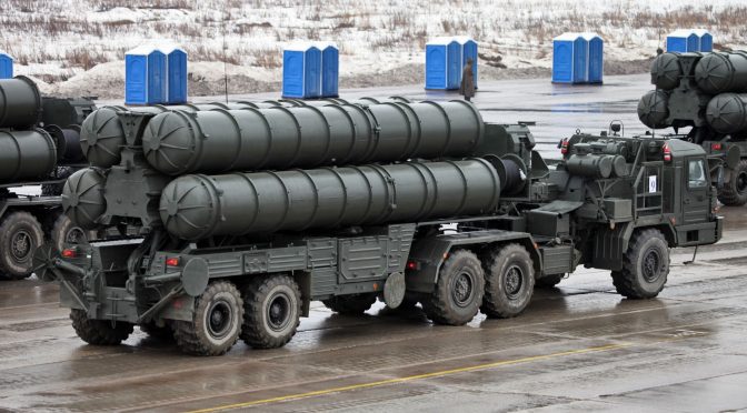
Featured Image: S-400 Triumf air defense systems from Russia (defencetalk.com)

The UNCLCS Ruling and the Future of the Uruguayan Navy

The Southern Tide

Written by W. Alejandro Sanchez, The Southern Tide addresses maritime security issues throughout Latin America and the Caribbean. It discusses the challenges regional navies face including limited defense budgets, inter-state tensions, and transnational crimes. It also examines how these challenges influence current and future defense strategies, platform acquisitions, and relations with global powers.

“The security environment in Latin America and the Caribbean is characterized by complex, diverse, and non-traditional challenges to U.S. interests.” Admiral Kurt W. Tidd, Commander, U.S. Southern Command, before the 114th Congress Senate Armed Services Committee, 10 March 2016.

By W. Alejandro Sanchez

Uruguay’s continental shelf control has been extended to 350 nautical miles. On 30 August, the United Nations Commission on the Limits of the Continental Shelf (UNCLCS) ruled in favor of the South American nation’s request to extend its maritime territory by 83,000 square kilometers. While this is a major diplomatic victory for the Uruguayan government, the new territory will need to be properly patrolled, which means additional pressure on the Uruguayan Navy that currently operates with an aging fleet.

The author of this commentary argues that Uruguay’s new maritime territory should be a starting point for a greater discussion about the future of its Navy, both in terms of its future fleet composition and missions.  

A Brief History

It is important to stress that the Uruguayan military has not been in an inter-state conflict in over a century. Its last major confrontation was the War of the Triple Alliance (1864-1870). In the 20th century, Uruguay supported the Allies in World War II (the 1939 Admiral Graf Spee incident occurred in Uruguayan waters). The only other major challenge to Uruguayan sovereignty occurred in the late 1960s to early 1970s when Uruguayan security forces battled the Tupamaros, a local insurgent movement.

In the 21st century, Uruguay has only had one small international incident. Between 2005-2010, the Uruguayan and Argentine governments had a diplomatic and legal dispute regarding the construction of a pulp mill in the Uruguay River, which serves as a border between the two states. Even though no conflict ever occurred, former Uruguayan President José Mujica famously declared in 2011 that he had contemplated the possibility of a war with Argentina over the pulp mill and had met with his military’s commanders about possible scenarios.

The Navy’s Current Platforms

Nowadays the Uruguayan military, and the Navy in particular, is in a dire state given limited budgets which prevent the acquisition of new heavy platforms.

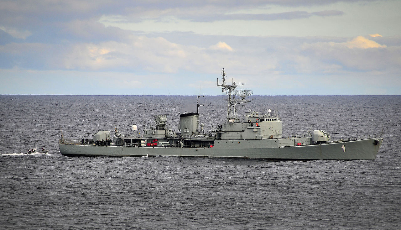
In August, Admiral Leonardo Alonso, commander of the Uruguayan Navy, declared that the fleet has 12 operational sea platforms. The fleet composition includes a Joao Belo-class frigate, the ROU Uruguay; two Kondor II-class minesweepers, the ROU Temerario and the ROU Audaz (the ROU Fortuna was retired in 2014); the oceanic patrol vessel ROU Maldonado the support vessels ROU General Artigas and ROU Vanguardia. Additional vessels include the tugboat ROU Banco Ortiz; the oceanographic ship ROU Oyarvide; the ROU Sirius; and the patrol boats ROU Colonia, ROU Rio Negro, and the ROU Paysandu. According to Uruguayan media, the average age of the fleet is 50 years (e.g. the Joao Belo frigate was constructed in the late 1960s).

1280px-thumbnail
ATLANTIC OCEAN (March 7, 2010) A rigid-hull inflatable boat assigned to the guided-missile cruiser USS Bunker Hill (CG 52) approaches the Uruguayan navy frigate Uruguay (ROU 1) for a passenger transfer. (U.S. Navy photo by Mass Communication Specialist 2nd Class Daniel Barker/Released)

A strongly worded op-ed in the daily El Observador op-ed published on 20 August, provocatively titled “Who Needs the Armed Forces?” stresses how the Navy is “bankrupt, not only because of its aging fleet, its lackluster training and small budget, but due to corruption scandals in recent years that have affected the morale.”

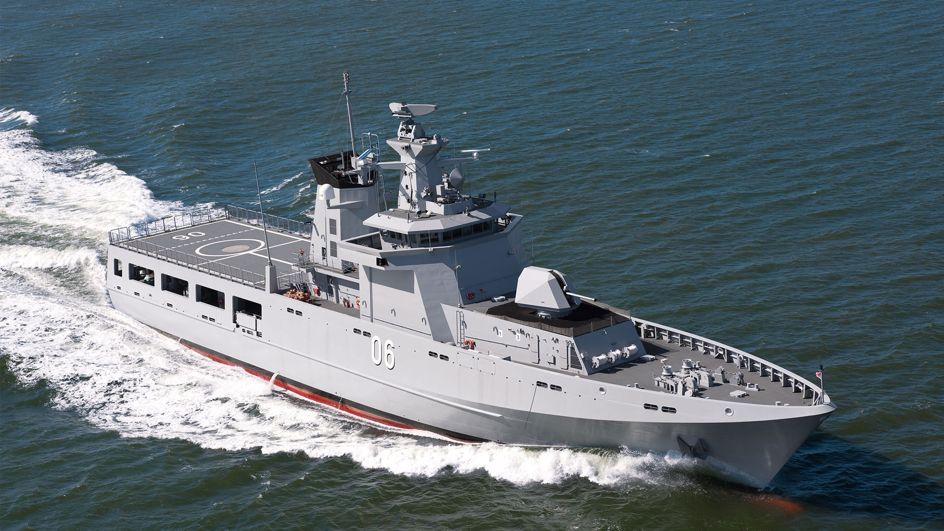
For the past couple of years, the Uruguayan military has attempted to purchase modern offshore patrol vessels (OPVs), which will be the cornerstone of the future fleet. The Navy has apparently selected Lurssen’s OPV 80 model and reportedly plans to procure three platforms in a deal which will cost an estimated USD $250 million. To date, no contract has been signed yet as the government appears to lack sufficient funds to purchase the vessels. 

The Uruguayan Navy has been lobbying the government for new funds and the approval of the OPV-deals in order to properly monitor the country’s growing sea. Admiral Leonardo Alonso has declared to the Senate that on any given day the Navy detects around 350 ships in Uruguayan waters “but we only see the ones that wish to be detected, which have their equipment on and are identified by our sensors,” which means that the country is vulnerable to “piracy, maritime accidents, pollution, drug trafficking, smuggling, and illegal fishing.” In an e-mail interview with the author, an Uruguayan naval officer explained that “in Uruguayan waters there is an average of 200 vessels (cruising or anchored) carrying out different tasks. This volume means that without proper control of maritime traffic, the probability of accidents and incidents escalates.” The officer also highlighted the necessity of a coastal surveillance network for Vessel Traffic Services (VTS) to aid the activities of the (yet to be acquired) OPVs and their support helicopters.

While this analysis is focusing on the Uruguayan Navy’s platforms and equipment, it is necessary to briefly mention personnel woes. The Uruguayan officer explained to the author that it is also vitally important “to retain our personnel and prevent a migration to the private sector as they seek salary improvements.” The problem of preventing qualified military personnel from migrating to better paid (and less dangerous) positions in the private sector is an issue that affects many militaries across the world.

The UNCLCS Ruling

It is in this problematic situation that the UNCLCS’s ruling enters the equation. Montevideo first requested the UNCLCS to expand its continental shelf beyond 200 nautical miles in 2009. “Uruguay has a special interest in expanding its continental shelf rights since it is currently involved in the search for oil and gas in the so called Punta del Este basin,” explained a September 2009 report by MercoPress.

According to Uruguayan media, a Uruguayan delegation met with a UNCLCS commission 21 times to argue its case between 2011 and 2015. The aforementioned naval officer also highlighted the role of the oceanographic vessel Oyarvide and the Navy’s Oceanographic, Hydrographic, and Meteorological Service in contributing to the case made to the UNCLCS.

In 2016, Uruguay presented its case to the plenary of the UNCLCS and the Commission decided in favor of Montevideo’s request to expand its continental shelf to a total of 350 nautical miles on 30 August. According to IHS Jane’s Defense Weekly, “the new territory grants mineral and resource rights over the continental shelf (sea floor) but it does not grant fishing rights over the new area.” Meanwhile, the Uruguayan daily El Observador explains that the country now has more maritime territory than dry land.

The UNCLCS’s decision has been a massive victory for the administration of President Tabaré Vázquez. In fact, the Uruguayan Minister of Foreign Affairs, Rodolfo Nin Novoa, has declared “nobody can do anything [in these waters] without Uruguay’s authorization.” The minister’s statement was perhaps too bold as the aforementioned Admiral Alonso has highlighted the problematic situation of the Navy while Defense Minister Jorge Menendez has stressed the need for USD $250 million to upgrade the fleet (namely to acquire the OPVs).

One Possible Way Forward

The expansion of Uruguay’s continental shelf should serve as a starting point for a discussion about the future of its Navy. Given the lack of an external security threat (the author has discussed South Atlantic geopolitics in a 17 February commentary for CIMSEC, “How Peaceful is the South Atlantic?”), particularly as the pulp mill diferendum with Argentina appears to have been solved, the Uruguayan armed forces have had to reinvent themselves in recent decades to justify their existence. Case in point, the country is a major supplier of peacekeepers to the United Nations – as of 31 August, Uruguay has a contingent of 1,457 troops participating in UN peacekeeping missions.

Regarding the Navy, its current and future challenges are transnational and irregular in nature. Rather than worrying about the Brazilian nuclear or Scorpene submarines appearing on its coast, the major maritime security threats include drug trafficking, illegal fishing, maritime pollution, as well as search and rescue operations.

Illegal fishing is a major problem for governments around the world, and the South Atlantic already has the precedent of the March incident between the Argentine Coast Guard and an illegal Chinese fishing fleet that highlights the need for a well-equipped and modern fleet that can chase and detain (or sink, if violence is necessary) illegal fishing vessels. To this point, the Uruguayan daily El Pais has noted that the country’s waters have fish species like merluza (a cod-like fish), the pescadilla (whiting) and the corvina, which must be protected from illegal fishing.

Another task for the Navy’s future will be to protect future oil platforms that may be constructed in Uruguay’s maritime waters. As a matter of fact, France’s Total company (with U.S. ExxonMobil and Norway’s Statoil as partners) has been looking for oil in Uruguayan and South Atlantic waters, though unsuccessfully so far. The South Atlantic does not have a piracy problem in the sense of oil platforms being at risk of criminal attack. However, if a Deepwater Horizon-type accident were to occur in one of these new wells, the Navy must have capable vessels able to rescue workers in peril and contain potential oil spills and other destruction. It is worth noting that just in late September the aforementioned Audaz and Artigas had to assist the Fortune Harmony, a tanker that had a fire aboard while 20 miles off Piriapolis, Uruguay.

KD Darussalam, the first of the four OPVs built by Lurssen for the Royal Brunei. (luerssen-defence.com/)
KD Darussalam, the first of the four OPVs built by Lurssen for the Royal Brunei. (luerssen-defence.com)

For these operations, the Navy requires new sea platforms, namely OPVs, to support and eventually replace the antiquated vessels it currently operates,  as well as a coastal monitoring network. While this author is not qualified to properly discuss the training of Uruguayan naval officers as well as the budgetary issues, the problem of preventing well-trained personnel from migrating to the private sector affects the Uruguayan Navy like in other defense forces across the world.

Final Thoughts

Proper surveillance of the extended continental shelf is a critical task for the Uruguayan Navy and will be the cornerstone of its maritime strategy going forward. Incidents like the March clash between Argentina and illegal Chinese fishing vessels (illegal fishing), or the recent Fortune Harmony incident (disasters at sea and possible pollution) are reminders of why it is a priority for a nation with a large continental shelf to have a modern fleet capable of adapting to different scenarios.

With that said, Uruguay’s history and current South Atlantic geopolitics argue that the possibility of inter-state warfare is minimal. Hence, Uruguay must upgrade its Navy, not just in terms of new platforms, radars and helicopters, but also its mission in the 21st century.

W. Alejandro Sanchez is a researcher who focuses on geopolitical, military, and cyber security issues in the Western Hemisphere. Follow him on Twitter: @W_Alex_Sanchez.

The views presented in this essay are the sole responsibility of the author and do not necessarily reflect those of any institutions with which the author is associated.

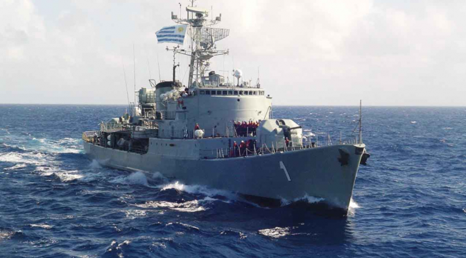
Featured Image: Uruguay navy ship. (aeromarine.com.uy)

Alternative Naval Force Structure Week Concludes on CIMSEC

By Dmitry Filipoff

This past week CIMSEC hosted a topic week on alternative naval force structures. Contributors proposed new fleets with hypothetical warship designs with an eye towards future threats and technological opportunities. Others analyzed historical examples of attempts to overhaul naval force structure, and many authors applied imaginative thinking to see how the U.S. Navy can make the most of its existing fleet. The topic week’s Call for Articles may be read here. We thank our contributors for their excellent submissions.

The Perils of Alternative Force Structure by Steve Wills

“Even the best alternative force structure that meets strategic needs, is more affordable than previous capabilities, and outguns the enemy could be subject to obsolescence before most of its units are launched. These case studies in alternative force structure suggest that such efforts are often less than successful in application.”

Unmanned-Centric Force Structure by Javier Gonzalez

“The conundrum and implied assumption, with this or similar future force structure analyses, is that the Navy must have at least a vague understanding of an uncertain future. However, there is a better way to build a superior and more capable fleet—by continuing to build manned ships based on current and available capabilities while also fully embracing optionality (aka flexibility and adaptability) in unmanned systems.”

Proposing A Modern High Speed Transport –  The Long Range Patrol Vessel by Tom Meyer

Is the U.S. Navy moving from an era of exceptional “ships of the line” – including LHA’s & LPD’s, FFG’s, CG’s, DDG’s, SSN’s and CVN’s – to one filled with USV’s, UAV’s, LCS’s, CV’s, SSK’s and perhaps something new – Long Range Patrol Vessels (LRPV’s)? But what in the world is an LRPV? The LRPV represents the 21st century version of the WWII APD – High Speed Transports.

No Time To Spare: Drawing on History to Inspire Capability Innovation in Today’s Navy by Bob Hein

“Designing and building new naval platforms takes time we don’t have, and there is still abundant opportunity to make the most of existing force structure. Fortunately for the Navy, histories of previous wars are a good guide for future action.”

Enhancing Existing Force Structure by Optimizing Maritime Service Specialization by Eric Beaty

“Luckily, the United States has three maritime services—the Navy, Coast Guard, and Marine Corps—with different core competencies covering a broad range of naval missions. Current investments in force structure can be maximized by focusing the maritime services on their preferred missions.”

Augment Naval Force Structure By Upgunning The Coast Guard by Chuck Hill

“The Navy should consider investing high-end warfighting capability in the Coast Guard to augment existing force structure and provide a force multiplier in times of conflict. A more capable Coast Guard will also be better able to defend the nation from asymmetrical threats.”

A Fleet Plan for 2045: The Navy the U.S. Ought to be Building by Jan Musil

“2045 is a useful target date, as there will be very few of our Cold War era ships left by then, therefore that fleet will reflect what we are building today and will build in the future. This article proposes several new ship designs and highlights enduring challenges posed by the threat environment.”

Closing Remarks on Changing Naval Force Structure by CAPT Wayne P. Hughes Jr., USN (Ret.)

“The biggest deficiencies in reformulating the U. S. Navy’s force structure are (1) a failure to take the shrinking defense budget into account which (2) allows every critic or proponent to be like the blind men who formulated their description of an elephant by touching only his trunk, tail, leg, or tusk. To get an appreciation of the size of the problem you have to describe the whole beast, and what is even harder, to get him to change direction by hitting him over the head repeatedly.”

Dmitry Filipoff is CIMSEC’s Director of Online Content. Contact him at [email protected]

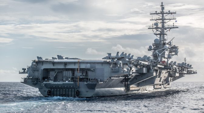
Featured Image: PHILIPPINE SEA (Oct. 2, 2016) The Nimitz-class aircraft carrier USS Ronald Reagan (CVN 76) underway in the Philippine Sea. (U.S. Navy photo by Lt. Cmdr. Tyrone Pham/ Released)