The following article was originally featured by the Pacific Forum-CSIS’s PacNet series and is republished with permission. Read it in its original form here.
By Abhijit Singh
Recently, editorial columns in Indian newspapers have become a battleground for strategic commentators to debate the merits of India’s defense logistics pact with the United States. Despite a public declaration by the Indian government regarding the “non-military” nature of the Logistics Exchange Memoranda of Agreement (LEMOA), the pact hasn’t resonated favorably with a section of India’s strategic elite, who reject the idea of providing the US military with operational access to Indian facilities. New Delhi might have much to gain from the LEMOA, which could be critical in establishing a favorable balance of power in Asia.
The critics argue that the arrangement does not benefit India in the same way that it advantages the US military. As a leading Indian defense analyst put it, “the government seems to have been guided more by the fear of being accused of succumbing to pressure from Washington and less by an evaluation of whether this might benefit India’s military.” As a result, Indian defense ministry officials find themselves under pressure to explain why they believe an agreement with the US on military logistics is in India’s best interests.
New Delhi’s stock response has been that the pact is strictly “conditional,” and allows access to supplies and services to the military forces of both countries only when engaged in a specific set of predetermined activities. At a press conference in Washington after the signing of the agreement, Defense Minister Manohar Parrikar was at pains to explain that the agreement has nothing to do with the setting up of a military base. “It’s only about logistics support to each other’s fleet” he averred, “like supply of fuel, supply of many other things which are required for joint operations, humanitarian assistance and many other relief operations.”
And yet there is little denying that in today’s maritime environment, every ‘place’ that provides logistics support essentially performs the role of a peacetime military base, albeit in limited ways. This is because operational logistics is the life-blood of contemporary maritime missions. Any ocean-going navy that can secure logistical pit-stops can guarantee itself a wider operational footprint in distant littorals. In fact, leading maritime powers, including the United States, Russia and China, are reluctant to set up permanent bases in distant lands because what they aim to achieve in terms of strategic presence is made possible through low-level repair and replenishment ‘places.’ To be sure, with over 800 foreign military installations, the US still has a globe-girdling presence, but few of its existing overseas facilities are permanent military bases.
To better appreciate why foreign military bases do not enjoy the same appeal as in earlier times, one must study the history of their evolution. The permanent naval base was a product of 19th-century politics when Britain, the leading maritime power, set up a network of military basesaround the world to sustain its global supremacy. In the latter half of the 20th century, Britain was replaced by the United States, which soon came to dominate the world’s economic and strategic landscape. The US system of military bases consisted of several thousand installations at hundreds of basing sites in over 100 countries. The logic of the military basing system was intimately related to the dynamics of conflict. A military base was seen as a forward deployment position to enforce a denial regime on the enemy. It was a useful way of keeping the pressure on adversaries, and it allowed the US military to dominate the international system and prevent the rise of another hegemon.
But the logic of overseas bases has eroded. The absence of a real war in the intervening years has seen the law of diminishing returns kick in vis-à-vis foreign military bases, and an attenuation of their animating rationale. After struggling with rising domestic opposition to its military presence in Asia, the United States has been looking for more pragmatic options.
Since prolonged military presence on a foreign land isn’t a practical solution to any of its strategic problems, the US has been prioritizing logistics pacts that involve continuing support of rotational troops but no permanent deployments. These are variants of the “Acquisition and Cross-Service Agreements”(ACSAs)– or logistical arrangements for military support, supplies, and services (food, fuel, transportation, ammunition, and equipment) – that the United States shares with many of its NATO partners. And yet, despite being avowedly in support of peacetime operations and regional humanitarian contingencies, these pacts have not changed the public perception that US military presence overseas advance America’s imperialist ambitions.
A case in point is the recent Extended Defense Cooperation Agreement (EDCA) with Manila, which provides the US military access to five military bases in Philippines. Even though the agreement was signed in 2014, strong domestic opposition within Philippines from civil rights groups resulted in a legal stalemate at the country’s Supreme Court. In January this year, when the courtfinally ruled in the pact’s favor, its decision seemed motivated mainly by the China-factor – the increased threat posed by China in the Philippines’ near-seas.
While the defense pact has a limited objective – enabling US troops to rotate through the Philippines, ensuring a persistent but intermittent presence – the new military facilities in Philippines aren’t expected to be any less potent than the United States’ erstwhile permanent bases in the country. The infrastructure will facilitate a spectrum of peacetime missions in the South China Sea, including training and capacity building, area patrols, aerial surveys, and fleet exercises. It will also enable the Philippines to call upon the US for critical military assistance in the event of a crisis.
The United States isn’t the only country to depend on military logistics pacts to achieve broader strategic objectives. Increasingly, China is resorting to the same means. The PLA’s logistical base at Djibouti doesn’t just provide support for China’s anti-piracy missions, but also enables a round-the-year naval presence in the Indian Ocean. What is more, China’s recent commercial facilities in the Indian Ocean Region seem more in the nature of dual-use bases, which can quickly be upgraded to medium-grade military facilities in a crisis.
New Delhi must come to terms with the fact that LEMOA’s utility lies in facilitating greater US-India operational coordination in Asia. Notwithstanding Parrikar’s assurances to the contrary, closer maritime interaction between India and the US will increasingly involve operational access to each other’s bases for strategic purposes. Even if the necessary cooperation is cleared on a case-by-case basis and driven mainly by regional capacity building and HADR needs, the Indian Navy and the US Navy might find themselves acting increasingly in concert to achieve common strategic objectives in the regional commons.
This does not mean LEMOA promotes US geopolitical interests at India’s expense. If anything, the pact empowers the Indian Navy to expand its own operations in the Indo-Pacific region. It is an aspiration that the Navy professed to recently when it released a map for public viewing that showed Indian naval deployments over the past 12 months, spread across the Indian Ocean and the Pacific region.
Given the fraught nature of security in the Asian commons, India has been looking for ways to emphasize a rules-based order in the region. To consolidate its status as a crucial security provider, the Indian Navy will need to act in close coordination with the US Navy, the leading maritime power in Indo-Pacific, to ensure a fair, open, and balanced regional security architecture.
Abhijit Singh (abhijit.singh27@gmail.com), a former Indian naval officer, is Senior Fellow and Head, Maritime Policy Initiative at the Observer Research Foundation (ORF) in New Delhi. You can follow him on Twitter at @abhijit227.
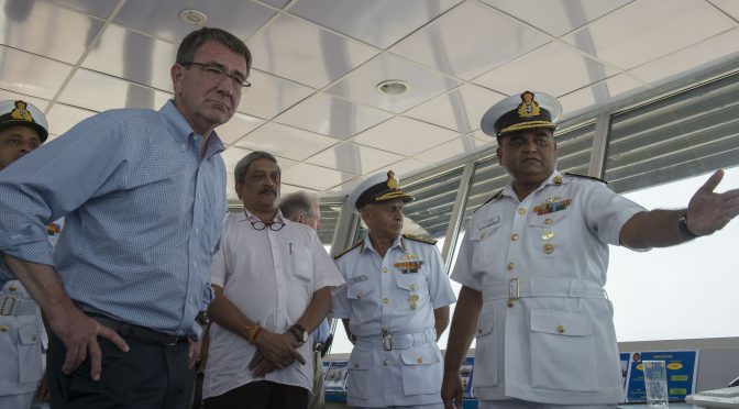
Featured Image: Secretary of Defense Ash Carter speaks with Indian Naval Officers as he tours Indian Naval Station Karwar as part of a visit to the Indian aircraft carrier INS Vikramaditya, April 11, 2016. Carter is visiting India to solidify the rebalance to the Asia-Pacific region.(Photo by Senior Master Sgt. Adrian Cadiz)(Released)
The following article originally featured at the National Maritime Foundation and is republished with the author’s permission. Read it in its original form here.
By Gurpreet S. Khurana
On 29 August 2016, during the visit of the Indian Defence Minister Manohar Parrikar to Washington DC, India and the United States (U.S.) signed the Logistics Exchange Memorandum of Agreement (LEMOA). Essentially, LEMOA is only a ‘functional’ agreement ‘to account for’ the essential supplies and services that one country would provide (at its port or airport facility) to the visiting military force of the other – an arrangement that the U.S. has made with over a hundred countries worldwide. Nonetheless, the significant symbolic and strategic import of the agreement cannot be ignored. Also, while the proposal was initiated in 2002, it has fructified at a crucial time. Never before in recent history has Asia’s geopolitical and security environment been so tenuous; or the strategic interests of India and the U.S. so convergent. Understandably, therefore, the signing of LEMOA has grabbed much attention, and raised the multitude of questions and speculations. This essay attempts to clarify a few key issues, and appraise LEMOA in terms of its strategic implications.
In the past, India and the U.S. have transacted military logistics, but on an ad hoc basis and largely during combined exercises. LEMOA would change the nature of transactions. Hitherto, each transaction was considered as a separate case and on every occasion, paid for in cash by the side using the supplies or services. LEMOA would entail both sides maintaining a ledger for the transactions, such that much of the debit would be defrayed against the credit, and only the residual balance owing to whichever side would be paid for at the end of the fiscal year. Notably, as a standing agreement, LEMOA is indicative of the expectation on both sides that logistic transactions would increase in the coming years, and expand from combined exercises to coordinated operations.
Even under LEMOA, India would be able to exercise its strategic autonomy. The agreement would not restrict India’s strategic options since it is a ‘tier-two’ agreement. This implies that only if and when the Indian government agrees to a U.S. proposal to conduct a combined military exercise or operation (entailing a logistics exchange), will LEMOA come into play. For instance, since the India-U.S. Malabar naval exercise is a standing arrangement approved by the Indian government, LEMOA will apply on all occasions that such exercises are conducted. As another instance, if hypothetically, the U.S. seeks to undertake a coordinated military operation with India to flush out a terrorist group in a neighboring country, based on many factors, India may decide turn down the U.S. proposal, with no obligation to offer the U.S. forces access to Indian logistic facilities. Furthermore, as the Indian Ministry of Defence (MoD) Press Release specifically states, the agreement does not provide for setting up of a U.S. military base on Indian soil.
The above leads to a pertinent question: Does LEMOA give the right to the U.S. and Indian armed forces to use each others’ military bases? According to the Indian MoD Press Release, LEMOA pertains to reciprocal ‘access’ rights to military forces for logistic supplies and services comprising “food, water, billeting, transportation, petroleum, oils, lubricants, clothing, communication services, medical services, storage services, training services, spare-parts and components, repair and maintenance services, calibration services and port services.” Even at present, some of these supplies and services would be available only in the military base of the host country. In the coming years – given the existing trends – when a substantial proportion of Indian military hardware is of U.S. origin, the visiting military force may seek to replenish even ammunition, missiles, and torpedoes from the host country. LEMOA may then become analogous to the reciprocal use of military bases.
The signing of LEMOA has led to apprehensions amongst a few analysts in India that the benefits of the agreement weigh heavily in favor of the U.S.. Such perception may not be true. The US possesses numerous globally-dispersed overseas military bases and access facilities. In an operational contingency, therefore, the U.S. would expect India to provide essential supplies and services to its military forces only if the contingency occurs in geographic proximity of the Indian sub-continent. Such logistics may also be required for an inter-theatre shift of U.S. forces in an emergency – such as the Persian Gulf crises of 1990, when C-141 transport planes transiting from the Philippines to the Gulf were refueled in Indian airfields – but such occasions would be rare. In contrast, India has no overseas military base, and yet its areas of interest are fast expanding much beyond its immediate neighborhood – notably, the Persian Gulf, southern Indian Ocean and the western Pacific – where its ability to influence events is severely constrained by stretched logistic lines. Access to U.S. military bases in these areas, facilitated by LEMOA, would provide useful strategic alternatives to India.
In sum, therefore, while LEMOA may be a functional agreement meant to facilitate military operations and exercises, it would enhance the strategic options of the involved parties; and thus pose a credible strategic deterrence to actors – both state and non-state – that seek to undermine regional security and stability. However, to address the possibility of its negative perception in terms of India’s ‘policy polarization,’ New Delhi may consider entering into similar agreements with other major powers with whom its strategic interests converge.
Captain Gurpreet S Khurana, PhD, is Executive Director at National Maritime Foundation (NMF), New Delhi. The views expressed are his own and do not reflect the official policy or position of the NMF, the Indian Navy, or the Government of India. He can be reached at gurpreet.bulbul@gmail.com.
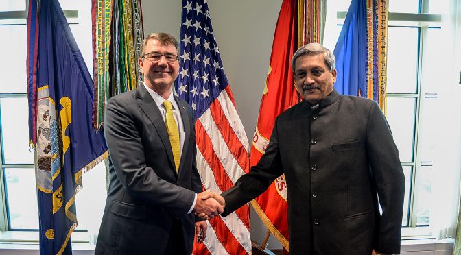
Featured Image: Secretary of Defense Ash Carter and India’s Minister of Defense Manohar Parrikar take a photo before their bilateral meeting at the Pentagon on Dec. 10, 2015. (DoD photo by U.S. Army Sgt. First Class Clydell Kinchen)
From Newport to New Delhi, a tremendous effort is currently underway to document and analyze China’s pursuit of maritime power. Led by experts in think tanks and academia, this enterprise has produced a rich body of scholarship in a very short period of time. However, even at its very best, this research is incomplete—for it rests on a gross ignorance of Chinese activities at sea.
This ignorance cannot be faulted. The movements of Chinese naval, coast guard, and militia forces are generally kept secret, and the vast emptiness of the ocean means that much of what takes place there goes unseen. Observers can only be expected to seek answers from the data that is available.
The U.S. Navy exists to know the answers to these secrets, to track human behavior on, above, and below the sea. While military and civilian leaders will always remain its first patron, there is much that USN intelligence can and should do to provide the raw materials needed for open source researchers to more fully grasp the nature of China’s nautical ambitions. Doing so would not only improve the quality of scholarship and elevate the public debate, it would also go a long way to help frustrate China’s current—and, to date, unanswered—strategy of quiet expansion. Most importantly, sharing information about the movements and activities of Chinese forces could be done without compromising the secrecy of the sources and methods used to collect it.
The Constellations are Visible…
The basic story of China’s maritime aggrandizement is printed in black and white, no need to read tea leaves. There exists a public life in China, even if highly circumscribed. Chinese journalists are paid to write articles that satisfy the urges of an inquisitive and patriotic public. Chinese scholars spend careers trying to understand the intentions and capabilities of their own country—like academics elsewhere, they banter back and forth in defense of “truth,” and bruised egos. Government agencies release reports that catalog their achievements, outline key objectives, and mobilize their personnel for the new tasks at hand. The Chinese military, communicating through service publications, seeks to inculcate a collective consciousness of what it does and why it does it. All of these sources are open to the foreign observer.
The available information provides important clues about the nature and extent of Chinese activities at sea. This is true for all three of the sea services: the coast guard, the maritime militia, and the PLA Navy.
The movements of the Chinese coast guard are particularly amenable to open source analysis. China does not operate a single maritime law enforcement agency analogous to the United States Coast Guard. It instead funds several different civilian agencies, each with a different mission. Prior to the creation of the China Coast Guard in 2013, the agencies most active along China’s maritime frontier were China Marine Surveillance (CMS) and Fisheries Law Enforcement (FLE). Both agencies released surprising amounts of information through official newspapers, annual reports and yearbooks, and other channels.
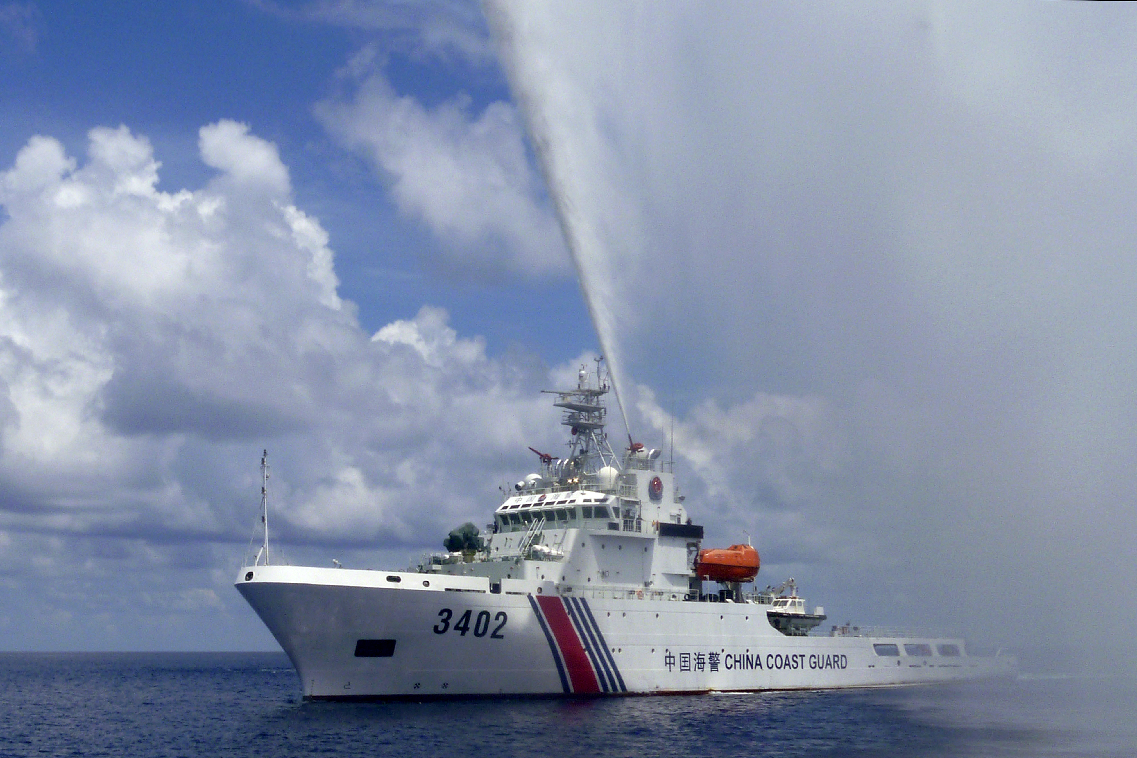
Sept. 23, 2015. A Chinese Coast Guard boat sprays a water cannon at Filipino fishermen near Scarborough Shoal in the South China Sea. (Renato Etac via AP)
These sources include significant quantitative data. For instance, it is possible to track the expansion of CMS presence in disputed waters that started in 2006. In that year, CMS began to regularize its sovereignty—or “rights protection”—patrols, first in the East China Sea, then in the Yellow Sea and South China Sea. Each year, the State Oceanic Administration (SOA) published data on these operations. In 2008, CMS conducted a total of 113 sovereignty patrols. These missions, which covered more than 212,000 nm, established CMS presence in all of the waters over which China claims jurisdiction. Four years later, in 2012, the service conducted 172 sovereignty patrols (>170,000 nm) just in the South China Sea alone.
Qualitative data also abounds. Before 2014, both CMS and FLE regularly invited Chinese journalists aboard ships operating in disputed areas. These civilian scribes chronicled China’s campaign to reclaim “lost” land and sea. While primarily designed to inspire and titillate Chinese audiences, their work provides excellent source materials for the foreign observer. For instance the eight-part Chinese television documentary that aired in late 2013 showed extensive footage of CMS and FLE ships operating in the South China Sea, including during hostile encounters with Indonesian and Vietnamese mariners.
Chinese sources also provide raw materials for understanding the activities of the second major instrument of Chinese sea power—the maritime militia. This force is comprised of civilians trained to serve military and other state functions. In peacetime, a segment of the militia, mostly fishermen, constitutes an important tool in Chinese maritime strategy. It sails to disputed waters to demonstrate Chinese sovereignty and justify the presence of the Chinese coast guard and navy. The militia also harasses foreign vessels, and helps protect China’s own.
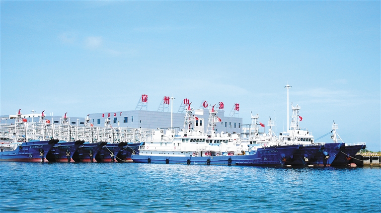
18 June 2016: Newly-built fishing vessels for Sansha City moored at Yazhou Central Fishing Harbor. Note the exterior hull reinforcements and mast-mounted water cannons. (Hainan Government)
China’s maritime militia is particularly active in the South China Sea. The Chinese press eagerly covers their activities in disputed waters, often revealing ship pennant numbers and the names of key militiamen. Websites owned by provincial, municipal, and county governments also highlight their local contributions to the “people’s war” at sea. Using such sources, Conor Kennedy and Andrew Erickson have tracked the militia’s activities at places such as Mischief Reef and Scarborough Shoal, and deciphered its role in pivotal events such as the 2009 assault on the USNS Impeccable.
The PLA Navy also releases information about where, when, and how it is operating. Air, surface, and undersea deployments are called “combat readiness patrols” (zhanbei xunluo). Service publications regularly report on these patrols—including, perhaps surprisingly, those conducted by China’s “silent service.” For instance, one October 2014 article in People’s Navy recounts a story of Song Shouju, a submarine skipper from the PLA Navy South Sea Fleet (SSF), whose diesel electric boat was prosecuted by a foreign maritime patrol aircraft and a surveillance vessel during one combat readiness patrol. According to Song, his boat was subjected to 80 hours of active sonar, placing him on the horns of a dilemma. If he surfaced, it would mean a mission failure and “put Chinese diplomacy in an awkward position” (suggesting the submarine was not operating where it should have been). But if he remained below, the boat would risk the consequences of depleting its battery. In the end, the captain decided to stay submerged until the threat had passed, which it ultimately did.1
The PLA Navy is particularly forthcoming about patrols taking place beyond the “first island chain.” These are regularly reported in the Chinese press, both in English and Chinese. In May 2016, for example, six vessels from the SSF—including three destroyers, two frigates, and an auxiliary—completed a 23-day training mission that took them through the South China, the Indian Ocean, and the western Pacific by means of the Sunda Strait, Lombok Strait, Makassar Strait, and the Bashi Channel. At least one Chinese journalist was onboard to cover the 8,000 nm voyage. Again, the available data is not limited to the movements of surface combatants. For instance, a January 2014 People’s Navy article revealed that since 2009, 10 submarines and 17 aircraft from the ESF had traversed the first island chain to conduct “far seas” operations.2 Sources like these have enabled foreign researchers such as Christopher Sharman to trace the connection between Chinese actions and its declared naval strategy.
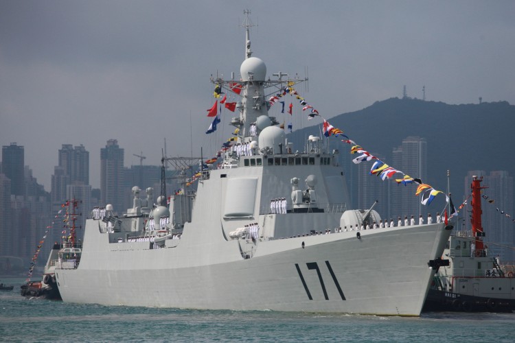
Chinese missile destroyer Haikou (171) is seen while docking in Hong Kong on April 30, 2012. (Aaron Tam/AFP/Getty Images)
To follow Chinese activities at sea, one need not rely on Chinese sources alone. Foreign governments also sometimes release data. Often this information is associated with a particular incident. For instance, in mid-2014, the Vietnamese press published numerous articles in English covering China’s provocative deployment of an advanced new drilling rig (HYSY-981) in disputed waters south of the Paracel Islands. More recently, Indonesia released useful information about its response to illegal Chinese fishing and coast guard activities taking place near Natuna Island.
For its part, Japan systematically issues data on Chinese presence in the waters adjacent to the Senkaku Islands. Graphical depictions of these data vividly show Chinese expansion over time, from the inaugural intrusion of two CMS vessels in December 2008 to the regular patrols that started in September 2012 and continue today. Indeed, the quality and consistency of this data has enabled foreign analysts to use quantitative methods to test theories about shifts in Chinese diplomacy.
…But Darkness Still Prevails
The information described above, while useful, nevertheless presents many problems. This is true even in the case of data on Chinese coast guard operations, which are easily the richest available to the open source researcher. A “rights protection” patrol can mean anything from a two-day sweep of the Gulf of Tonkin to a several-month mission to the southern reaches of the Spratly Archipelago. Thus, while the available data unmistakably capture the broad trends of Chinese expansion, they lack the fidelity needed for closer examination of deployment patterns. With the creation of the China Coast Guard, all this is now moot. The Chinese government no longer publishes such data, and Chinese journalists are now seldom allowed aboard ships sailing to disputed waters.
The problem is much worse in the case of the maritime militia. No Chinese agency or department systematically tracks and releases information on militia activities. Because only a portion of fishermen are members of the militia, fishing industry data is a poor proxy. Thus, there is no way to scientifically track the activities of irregular forces operating along China’s maritime frontier. We generally only learn about particular incidents, remaining largely ignorant of the context in which they take place.
Consistent data on PLA Navy activities in disputed and sensitive waters is simply not available. We do know that in recent years the service “normalized” (changtaihua) its presence in the Spratly Archipelago, but Chinese sources provide no definition of what that term means. Thus, while it is clear that the PLA Navy has augmented its surface ship patrols to these waters, we have no means to gauge the scale of that augmentation.3 In the East China Sea, Chinese sources do speak candidly about hostile encounters with the Japanese Maritime Self Defense Force. However, the open source researcher has few options for gauging the extent of PLA Navy presence east of the equidistant line.
There is a more fundamental problem that must be reckoned with: in most cases, the foreign observer often lacks the means to validate deployment data found in Chinese sources. Ultimately, one must take the word of the Chinese government, which naturally considers political factors—both internal and external—when issuing such content. Information released by other governments can be valuable, but foreign statesmen have their own motives. Sometimes they seek to downplay differences. For example, it is likely that for many years China and at least some Southeast Asian states had a tacit agreement not to publicize incidents at sea.
In sum, the available open source data can account for only a tiny fraction of what Chinese maritime forces are doing at sea. Moreover, the validity of information that is available must be seen as suspect. This is where naval intelligence can help.
Sharing the Spotlight
Naturally, U.S. naval intelligence professionals, particularly those in the Pacific, pay close attention to the comings and goings of Chinese maritime forces. To this end, they employ a wide variety of sources, from highly sensitive national technical means to visual sightings made by U.S. and allied forces at sea. They also optimize other resources of the U.S. intelligence community to support their mission requirements.4 Suffice it to say, the naval intelligence community is well aware of the disposition of China’s naval, coast guard, and militia forces.
The foundation of this effort is the Pacific Fleet Intelligence Federation (PFIF), established in September 2013 by then United States Pacific Fleet Commander, Admiral Cecil Haney. The PFIF “provides direction for the organization and collaboration of the Pacific Fleet’s intelligence and cryptologic resources to support the maritime Operational Intelligence (OPINTEL) mission” of “tracking adversary ships, submarines and aircraft at sea.” It represents a level of focus and systematization not seen since the Cold War.
The PFIF is a true collaborative enterprise, involving “coordination from Sailors across multiple organizations at various echelons, afloat and ashore, working in unison 24 hours a day, seven days a week providing the most precise maritime OPINTEL to our afloat forces.”5 Efforts are “federated” across nodes in Japan, Hawaii, San Diego, and Washington D.C.6 Relevant data collected by regional allies are also included. The result is the adversary Common Operational Picture (RED COP). Through RED COP, the PFIF provides Fleet Commanders and deployed forces precise geo-coordinate level intelligence regarding the location of maritime platforms across the Pacific Fleet area of responsibility. It also contains a detailed pedigree of the sources used to identify the location of an adversary unit.
How might the USN translate RED COP into information that is valuable to the public yet does not risk sources and methods? The answer lies in the format of the transmitted product. While American forces require the detailed information contained in the RED COP, the U.S. public does not. Therefore, the USN could issue a standardized series of PowerPoint graphics that contain generic depictions of PRC maritime force disposition across the Indo-Pacific region, if not the rest of the world. Since the technology used today by PFIF watch-standers can automatically produce this type of graphic, this would involve no new burden for naval intelligence professionals.
Some may argue that placing an adversary unit in a location where there is no “plausible deniability” could expose a source or method of intelligence collection. Four factors eliminate this risk. First, the generic placement of an adversary platform on a PowerPoint graphic would, by definition, not contain the level of fidelity required to determine the source of the contact. Second, as mentioned above, nearly all locations of maritime forces at sea are derived from multiple sources. This fact further complicates the task of determining any one particular source. Third, generic graphics would be published monthly, or biweekly at the most. This would dramatically reduce the potential risk to sources and methods. Fourth, and most importantly, there may be times when the Fleet Director of Intelligence (or higher authority) may deem the location of a particular ship, submarine or aircraft to be too sensitive. In such instances, they can simply remove the platform(s) from the briefing graphics. This would provide a final, fail-safe check against revealing any sensitive intelligence collection sources or methods. Together, these four factors would eliminate the possibility of compromising sources and methods, even with sophisticated algorithms of “pattern analysis.”
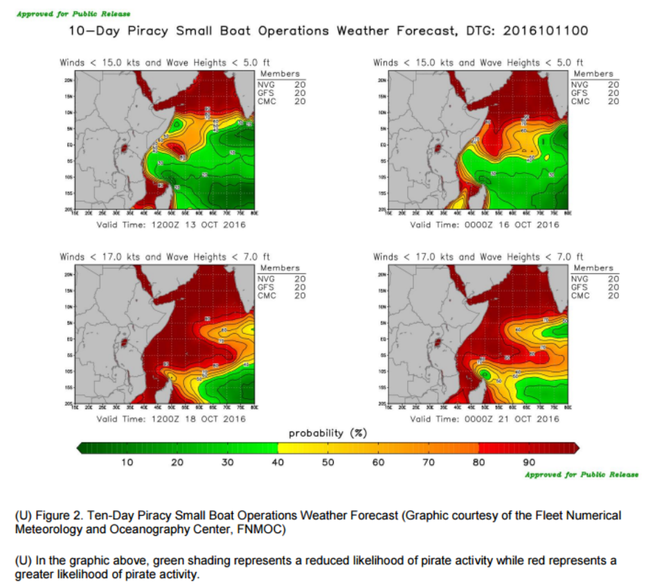
Such an initiative would not be entirely without precedent. The Office of Naval Intelligence (ONI) already produces the “World Wide Threat to Shipping” and “Piracy Analysis Warning Weekly” reports, which provide graphic and textual laydowns of the global maritime domain as derived from unclassified sources. The recommendations outlined in this essay would represent an expansion of current efforts under the auspices of ONI, using the PFIF’s all-source data as the primary source.
10 Day Piracy small boat operations weather forecast from Office of Naval Intelligence (U) HORN OF AFRICA/GULF OF GUINEA/SOUTHEAST ASIA: Piracy Analysis and Warning Weekly (PAWW) Report for 6 – 12 October 2016.
The Rewards of Mass Enlightenment
Releasing such data would immediately benefit efforts to understand Chinese maritime strategy. It would open up whole new swaths of scholarship. Chinese actions could be directly correlated to Chinese words. Incidents could be placed in their correct context. Theories about China’s pursuit and use of sea power could be proposed and tested with new levels of rigor.
Better open source analysis would also benefit the intelligence community itself. The strengths of academic scholarship—such as understanding strategic and organizational culture—could be applied to the same questions that preoccupy USN analysts, perhaps yielding fresh insights. Efforts to contextualize the activities of China’s maritime militia, for example, would be especially welcome, given its peculiar social, cultural, and political roots.
While scholarship is valuable in and of itself, the ultimate purpose of such an initiative would be to improve the ability of our democracy to respond to the China challenge. Elected officials, who ultimately decide policy, take cues from public discourse. Thus, if wise policies are to be crafted, the broader American public must be fully aware of the threat that China’s pursuit of maritime power poses to American interests. This is especially important given that any proper response would require the whole nation to bear costs and accept risks. Unlike Russia, China’s actions are carefully calibrated not to arouse a somnolent American public. This places a very high premium on information about the actions that China is taking.
To be sure, information is not an antibiotic. Ingesting it in the right quantities at the right frequencies may not cure the disease. Indeed, there is already enough data in the public domain for Americans to see the key trends. Yet there remain some very smart people who cannot, or will not, recognize the perils we face. Even so, the correct antidote to intellectual biases is ever more information; as data accumulates, the naysayers must either alter their theories or risk self-marginalization.
Sharing facts about Chinese activities at sea is not just good for democracy, it is also smart diplomacy. At this point, merely shining the spotlight on Chinese maritime expansion is unlikely to persuade China to radically alter its strategy. The China of Xi Jinping is less moved by international criticism than the China of Hu Jintao or Jiang Zemin. However, releasing detailed data on Chinese activities at sea would likely have an impact on foreign publics, who will use it to draw more realistic conclusions about the implications of China’s rise. Moreover, making such information widely available would help counter spurious Chinese narratives of American actions as the root cause of instability in the Western Pacific. Both outcomes are in our national interest.
To adopt the approach advocated in this essay would require a political decision. On matters of national policy, naval intelligence professionals must yield to civilian leaders.7 In the end, then, this essay is for the politicians. And so is its last word: share with the scholars.
James E. Fanell is a retired U.S. Navy Captain whose last assignment was the Director of Intelligence and Information Operations for the U.S. Pacific Fleet and is currently a Fellow at the Geneva Centre for Security Policy.
Ryan D. Martinson is a researcher in the China Maritime Studies Institute at the U.S. Naval War College. The views expressed are those of the author and do not reflect the official policy or position of the U.S. Navy, Department of Defense or the U.S. Government.
1. 张元农, 周卓群, 李克一 [Zhang Yuannong, Zhou Zhuoqun, and Li Keyi] 潜航深海磨利刃 [“Sailing Submerged in the Deep Ocean to Sharpen Our Blade”] 人民海军 [People’s Navy], 8 October 2014, p. 3.
2. 顾曹华 [Gu Caohua] 动中抓建,铸造深蓝铁拳 [“Seize on Construction While in Action, Mold a Blue Water Iron Fist”] 人民海军 [People’s Navy] 8 January 2014, p. 3.
3. 李唐 [Li Tang] 海军常态化巡逻覆盖万里海疆 [“Normalized Naval Patrols Cover the Maritime Frontier”] 人民海军 [People’s Navy] 23 June 2014, p. 1
4. James E. Fanell, Remarks at USNI/AFCEA conference panel: “Chinese Navy: Operational Challenge or Potential Partner?”, San Diego, CA, 31 January 2013.
5. James E. Fanell, “The Birth of the Pacific Fleet Intelligence Federation”, Naval Intelligence Professionals Quarterly, October 2013.
6. Ibid. James E. Fanell, “The Birth of the Pacific Fleet Intelligence Federation”, Naval Intelligence Professionals Quarterly, October 2013.
7.The authority for conducting an effort such as this would require approval from the Director of National Intelligence and the various “Original Classification Authorities” as outlined in Executive Order 1352. “Executive Order 13526- Original Classification Authority”, The White House Office of the Press Secretary, 29 December 2009, https://www.whitehouse.gov/the-press-office/executive-order-original-classification-authority
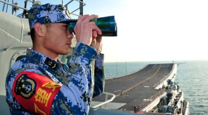
Featured Image: A sailor of the Chinese People’s Liberation Army Navy aboard the aircraft carrier Liaoning. (REUTERS/XINHUA)
The following article is part of our cross-posting partnership with Information Dissemination’s Jon Solomon. It is republished here with the author’s permission. Read it in its original form here.
By Jon Solomon
There was a pretty lively debate in the comments to Chris Mclachlan’s post last month about the Combat Logistics Force. No one took issue with his observations that the CLF might be undersized for sustaining high-tempo forward U.S. Navy operations in the event of a major Sino-American war. Nor did anyone contest his argument that our replenishment ships lack the basic self-defense capabilities their Cold War-era predecessors carried. Instead, the debate focused on Chris’s assertion that CLF ships ought to be escorted during wartime by a small trans-oceanic surface combatant possessing medium-range anti-air and anti-submarine capabilities.
Needless to say, I agree with Chris’s view. Such an escort would be a necessary part of the overall combined arms solution set to protecting not only CLF assets but also the shipping that would surge reinforcements and materiel to embattled U.S. allies in East Asia, provide steady logistical sustainment to the U.S. and allied forces deployed to or based in those countries, and maintain the flow of vital maritime commerce to and from those countries. One rarely sees any of these four critical tasks acknowledged in discussions within the security studies community. I believe that represents a dangerous analytical oversight, as an American failure to adequately protect its own and its allies’ sea lines of communications in a war with China would be strategically disastrous. In today’s post, I’m going to outline China’s ability to threaten these lines in a notional major war. On Thursday, I’ll outline how the U.S. and its allies might offset that threat.
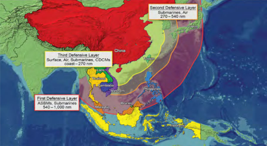
Chinese Active Defense Layers (Office of Naval Intelligence graphic). Note that the range lines reflect where PLA aircraft and submarines might be expected to operate in wartime based on evidence to date. While PLA aircraft would be unlikely to fly further east from the second layer’s line if U.S. and allied air coverage from bases along the Second Island Chain was strong, the same might not be true for PLAN SSNs. Also note that the maritime approaches to Luzon and the northern/central Ryukyus fall within the PLA’s middle layer, and Taiwan and the southern Ryukyus within the inner layer.
Let’s first look at the strategic geography of the problem. The sea lanes in question pass through the waters between the First Island Chain and the line stretching from Hokkaido through the Bonins and Marianas to the Palaus (e.g, the “Second Island Chain”). I’ve recently written about the PLAAF’s effective reach into the Western Pacific, and it’s been widely understood for years that late-generation PLAN submarines possess the technological capability to operate for several weeks in these waters before having to return to port. China would be hard-pressed to achieve localized sea control anywhere within this broad area; its own surface combatants and shipping would be just as vulnerable to attack. It wouldn’t need sea control, though, to achieve its probable campaign-level objectives of bogging down (or outright thwarting) an effective U.S. military response, or perhaps inflicting coercive economic pain upon one or more embattled American allies. The use of PLA submarines and strike aircraft to pressure U.S. and allied sea lines of communications would be entirely sufficient. And as Toshi Yoshihara and Martin Murphy point out in their article in the Summer ‘15Naval War College Review, these kinds of PLA operations would be consistent with the Mao-derived maritime strategic theory of “sabotage warfare at sea,” albeit at a much greater distance from China’s shores than the theory originally conceived. Such operations have been widely discussed in Chinese strategic literature over the past two decades.[i]
It bears noting that our East Asian treaty allies like Japan, South Korea, and the Philippines would have inherent roles and responsibilities defending their sea lines of communication. Nevertheless, they probably would not be able to fulfill the mission entirely on their own given their maritime forces’ sizes and capabilities. There would probably need to be a geographical line of responsibility similar to what the U.S. and Great Britain worked out in the Atlantic during the Second World War; shipping protection west of the line would primarily be the ally’s responsibility, and the U.S. would be primarily responsible for shipping protection east of the line. Even so, the U.S. would probably still need to contribute escorts and supporting forces to assist the ally in protecting sea lanes that were within some threshold distance of the Chinese mainland. Shipping protection in the approaches to the Ryukyus, Taiwan, or western Luzon particularly come to mind.
While it is true that U.S. and allied forces could probably pressure the PLA’s ability to push submarines and aircraft through the Ryukyus’ various straits or the Luzon Strait in a war, they would probably not be able to fully seal those doors—at least not during the conflict’s early phases. The biggest reason for this would be the straits’ sheer proximity to the Chinese mainland: PLAAF/PLAN fighters would be readily able to escort their strike aircraft brethren out into the Western Pacific and back, not to mention threaten any U.S. or allied anti-submarine aircraft or surface combatants patrolling the straits. Granted, Chinese fighters would be exposed to any sea-based and mobile land-based area air defense systems covering the straits and their approaches. They might also be confronted by U.S. or allied fighters operating from austere island bases in the vicinity of the straits, or from aircraft carriers or land bases located at various distances “over the horizon” to the east. U.S. and allied defenders could additionally use any number of countertargeting tactics to reduce their susceptibility to attack.
However, even if the PLA could not damage or destroy many of these forces per raid, it could still take actions that effectively suppressed the straits “guardians.” One tactic might be to salvo land-attack or anti-radar missiles to distract the defenders or induce them to keep their “heads down” shortly before or during a straits transit. Another might be to damage runways or austere airstrips as possible in order to constrain the defenders’ air operations; repairs could take precious hours. Electronic attacks and tactical deception could also be used to screen transiting PLA aircraft and submarines. Periodic PLA suppression raids would neither be small undertakings nor without risk to the forces performing them, but they might be sustainable on an as-needed operational tempo for several weeks or months at minimum.
The other factor that would make it impossible to hermetically seal the First Island Chain barrier would be the difficulty in maintaining persistent U.S. or allied submarine coverage in all of the requisite straits. The U.S. presently has thirty-one non-special-purpose SSNs stationed in the Pacific; three are homeported in Guam and twenty in Pearl Harbor. Only a small number would be deployed at sea within quick steaming of the straits, though, unless timely indications and warning of an impending crisis or conflict were received and then acted upon by U.S. leaders. The high-readiness Guam boats would be able to arrive on scene fairly rapidly once sortied, but it would take several more days for them to be reinforced by Pearl Harbor boats—not all of which might be immediately surgeable due to inter-deployment maintenance. Japan could surely contribute a number of its sixteen modern SSs in active service, but again not all of them might be surge-ready at any given time. And while the U.S. and Japanese fleets will be receiving additional boats over the coming decade, it will not be at a rate and scale that would dramatically change the straits coverage math. Hypothetical seabed-mounted sonar arrays in these straits or their approaches might help improve these odds by cueing available U.S. or allied submarines (or other anti-submarine forces) to a PLA submarine transit. The probability of a friendly submarine intercepting a PLA submarine detected this way, though, would depend upon the time between when the cue was broadcast and when it was received by the friendly sub, how the friendly sub’s effective sonar ranges in those waters affected its ability to redetect the trespasser, and whether the friendly sub could cover the distance from its starting point to have a chance at redetection before the cueing data “aged out.” More than one boat might be required to cover any particular strait with a certain margin of confidence; this would be especially true for the wider straits. Nor would anti-submarine patrols in the straits be the two sub fleets’ sole mission at the beginning of a major war: there would be equal if not greater demands for land-attack strikes, anti-submarine and anti-surface patrols inside the First Island Chain, anti-submarine patrols between the two island chain lines, special forces insertion/extraction, and far-forward intelligence/surveillance/reconnaissance. U.S. and Japanese submarine coverage of the straits simply could not be absolute.
It would be excellent if U.S. and allied forces could attrite the PLA forces making or supporting straits transits by a few percent each time without suffering equivalent attrition; the cumulative effects on the PLA’s overall warmaking capacity would be significant. But it would take weeks if not months for those effects to really show. That’s why the ability to logistically sustain the land-based forces waging the protracted frontline fight would be so crucial to U.S. war strategy. If the PLA were to inflict enough pressure on these logistical flows, the barrier defense would eventually wither on the vine.
It’s also important to remember that this imperfect barrier would only function in an open war—not during a crisis. Any PLAN submarines sortied prior to the outbreak of open hostilities could in theory patrol between the two island chain lines for campaign-significant amounts of time before having to hazard a trip back through the First Island Chain gauntlet. Modern PLAN SSNs like the Type 093 and its Type 095 follow-on would have an obvious endurance advantage over Air-Independent Propulsion (AIP) boats like the Type 041, but even the latter could probably remain underway for a few weeks before requiring a return to port. During that time, the mere fact that PLAN submarines were unlocated in the Western Pacific would undoubtedly affect U.S. operations (and tempo) in theater. The Royal Navy’s experience coping with a single unlocated Argentine submarine during the Falklands War is instructive on that point.
It would not take many PLAN submarines to generate such effects. For instance, let’s assume that the PLAN allocated its Type 041s, Type 093s, and Type 095s for war-opening operations between the two island chain lines while simultaneously holding its Type 035A/B/G, Type 039, and Kilo-class diesel-electric boats back for operations within the East and South China Seas. Let’s also assume China had its planned twenty Type 041s and five Type 093s in commission, plus perhaps five Type 095s as well, when a conflict erupted. Lastly, let’s assume that these boats’ material conditions of readiness were high enough to sortie two-thirds of them into the Western Pacific as the crisis phase peaked. Thirteen AIP boats and six SSNs might not seem like a lot within such a broad expanse. However, as Julian Corbett pointed out a century ago, the most “fertile” areas for hunting ships are “the terminals of departure and destination where trade tends to be crowded, and in a secondary degree the focal points where, owing to the conformation of the land, trade tends to converge.”[ii] If the PLAN followed Corbett’s logic, it might position its submarines in waters the U.S. and its allies would have to traverse to access (or break out of) selected major ports along the First Island Chain during the war’s first weeks. Or it might assign those duties to the Type 041s and deploy its SSNs in the waters just west of the Marianas that shipping from Guam, Hawaii, or the continental U.S. might seek to traverse. Or if the Chinese Ocean Surveillance System’s (COSS) coverage between the island chain lines remained adequate after the war started, China might try to steer its SSNs into mid-transit contact with U.S. or allied shipping.[iii] What’s more, the lingering effects of a PLA conventional first strike against major U.S. and Japanese bases in the Japanese home islands and Okinawa, subsequent PLA suppression operations against U.S. or allied straits-guarding forces along the Ryukyus-Luzon line, and in-theater U.S. and allied anti-submarine-capable forces’ sheer combat load prior to the arrival of reinforcements from the U.S. suggest that at least some PLAN submarines could complete at least one full cycle from their patrol areas to port for replenishment and then back into the Western Pacific before the “happy time” window began to close. This would especially be true for PLAN submarines patrolling the approaches to the Ryukyus, Taiwan, or Luzon.
Add the PLAAF/PLAN strike aircraft threat back into the mix and it should be apparent that U.S. and allied use of the Western Pacific’s surface between the two island chain lines would likely be opposed early in a notional war. The key variables driving China’s anti-shipping potential within these waters would be COSS’s ability to provide PLA aircraft and submarines with actionable targeting cues despite intense U.S. (and possibly allied) efforts to degrade and deceive this system-of-systems, the PLA’s ability to push those forces through contested First Island Chain straits when and where needed, and the operational range and endurance of those forces.
Jon Solomon is a Senior Systems and Technology Analyst at Systems Planning and Analysis, Inc. in Alexandria, VA. He can be reached at jfsolo107@gmail.com. The views expressed herein are solely those of the author and are presented in his personal capacity on his own initiative. They do not reflect the official positions of Systems Planning and Analysis, Inc. and to the author’s knowledge do not reflect the policies or positions of the U.S. Department of Defense, any U.S. armed service, or any other U.S. Government agency. These views have not been coordinated with, and are not offered in the interest of, Systems Planning and Analysis, Inc. or any of its customers.
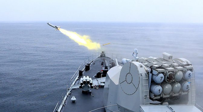
Featured Image: QINGDAO, CHINA – JULY 02: (CHINA OUT) CNS Harbin DDG-112 frigate fires a missile during live-fire drill on Yellow Sea on July 2, 2015 in Qingdao, Shandong Province of China. Naval vessels and soldiers mainly from China people’s Liberation Army Navy North Sea Fleet and part of soldiers of China people’s Liberation Army Navy East Sea Fleet, the Second Artillery Force of the PLA, Chinese PLA Shenyang Military Region and Chinese PLA Jinan Military Region attended the live-fire drill on Yellow Sea on Thursday. (Photo by VCG/VCG via Getty Images)