Category Archives: Chokepoints and Littorals Week

Thinking Like a Pirate: Contesting Southeast Asia’s Chokepoints

Chokepoints and Littorals Topic Week

By Drake Long

 In one part of the Southeast Asian epic Sejarah Melayu, the 15th century Malacca Sultanate receives a lavish gift from the distant emperor of China, then ruled by the Ming Dynasty. The Ming Emperor sent to Malacca a ship filled with precious golden needles, one from each of his subjects, that represented not only China’s vast wealth but also the immense manpower the Emperor held at his disposal. The note accompanying the needles made it clear China had heard about the upstart Malacca Sultanate and wanted to see whether it was a potential rival by requesting tribute in kind for the Ming court that could display Malacca’s power. Much to the Ming Emperor’s surprise, Malacca sent back a ship overflowing with grains from the sago tree, with its emissary declaring that one grain represented one subject. The Ming Emperor concluded that the Sultan of Malacca clearly presided over a populous and powerful country, equal to his own. The addendum to all this is that one sago tree actually produces over a thousand grains at once. These grains, unlike golden needles, are therefore worthless.

This story, while almost certainly fictionalized, illustrates an important lesson for observers watching how certain Southeast Asian states interact with China – flattery is not the same as acquiescence. But it could just as well symbolize the confidence a middling power can have when dealing with a maritime power like the Ming Dynasty, so long as it controls vital, geostrategic waterways – like the Malacca Strait. No one knew this better than the Ming, who gave defense guarantees to Malacca when the Sultanate was threatened by Siam, and whose famed admiral Zheng He frequently stopped in Malacca on his way west.

The might of a treasure fleet, or any fleet for that matter, is mitigated tremendously when the primary route for trade and transportation could be easily shut down. Stability and a cordial relationship with the controller of that chokepoint is paramount. This has not changed in the modern day. The Malacca Strait is absolutely vital to global trade – roughly 25 percent of all goods pass through it – and most any country, including China and the United States, have a vested interest in its security and openness.

The current fear of China is a U.S.-instigated blockade of the Malacca Strait that would starve China of resources and trade – described by Hu Jintao in 2003 as the “Malacca Dilemma.” China has revised its maritime strategy to reflect this. Yet an effective blockade of the Malacca Straits seems unlikely. For one, any blockade would not just affect China, but every country that trades through Southeast Asia. Those neighboring the strait would especially not want to see trade rerouted through the south of Indonesia.

Furthermore, China is hardening itself in the event of a blockade, by seeking out other passages and methods to receive resources. The current pipeline project in Myanmar is one such way China will mitigate its dependence on the Malacca Strait. Overland routes running through Central Asian and Russian parts of the Belt and Road Initiative represent another method.

The Malacca Strait may not actually be the most likely flashpoint in a regional wartime scenario. It is increasingly likely that far from being the target of a blockade, China will be able to impose a blockade instead to isolate an American ally or the U.S. itself and weather the consequences.

However, the unique situation of Southeast Asia is that it holds numerous chokepoints, with Malacca merely being the most expedient of those connecting Southeast Asia to the Indian Ocean. What are these other chokepoints, and what value do they hold for the Chinese and U.S. Navies?

Consideration should be paid to the tail-end of the Malacca Sultanate’s reign. There was one naval power the Malacca Sultanate couldn’t stave off, even with its advantageous position. Malacca was ultimately toppled by the Portuguese Empire in the early 16th century. However, while Malacca was a prime trading post for the Portuguese, they learned the hard way about the consequences of disturbing the peace of this strategic chokepoint. Malacca’s resistance against the Portuguese continued on – but in the form of piracy, denying Portugal the ability to fully benefit from its new conquest.

Going to the present, if a modern wartime scenario pushes the U.S. Navy outside the First (and maybe Second) Island Chain, knowledge and an approach to the straits and chokepoints of Southeast Asia will be vital. No navy in Southeast Asia can operate comfortably without access to these littorals, and no presence guarding them is safe if there is anarchy or hostile actors on the coastlines. These are the areas where land-based, mobile forces can hurt enemy navies in disproportionate ways.

The Marine Corps’ Commandant’s Planning Guidance calls for the creation of “tactical dilemmas” for any enemy navy, and envisions a highly mobile, amphibious force that does not rely on safe escort into a contested area. In practice, that has meant the Marine Corps adopting long-range missile systems that can be moved quickly from shore to shore after firing. In the future, the Marine Corps will likely adapt to a wide-range of vessels, hopping from whatever is available in contested areas to become the “Stand-In Force” envisioned by the Commandant’s Planning Guidance. The chokepoints and littorals surrounding Indonesian and Philippine waters would make for excellent forward positioning for a Marine Corps stand-in force. It would provide a critical bulwark for U.S. force posture in the Pacific by facilitating access for follow-on forces from allied Australia, and access into the South China and Philippine Seas.

Thinking Like a Pirate

In the modern day, pirates exist in the strategic chokepoints of Southeast Asia. A cursory look at where piracy is most active shows how the Malacca Straits and the Sulu Sea stand out as centers for an unusual (but manageable) uptick in maritime crime over the past year. But to be clear, very few incidents meet the legal definition of piracy. Most are more accurately called armed robberies at sea, where they involve coastal attacks or petty burglary of ships in port.

The motivation for these crimes is the same no matter the definition. These chokepoints have heavy traffic in goods and oil, and economic opportunities for coastal communities are relatively scarce. The pattern of piracy throughout the region provides a blueprint for which parts of Southeast Asia are the most strategically vital and provide the best cover for groups on land to attack targets out at sea without repercussion. In the case of the Sulu Sea, the southern Philippines that adjoins it has presented major challenges for law enforcement’s surveillance and human intelligence abilities, not least because of its long-running insurgency. These characteristics kept insurgent groups such as Abu Sayyaf alive and operating transnationally up to the modern day.

In short, the nature of these chokepoints allow non-state actors like pirates to pose a plausible threat to more capable forces, and this provides a blueprint for how the U.S. Marine Corps in particular could approach the PLAN and contested areas. Consider the example of the Sulu Sea.

Shipping routes through Southeast Asian littorals (MarineTraffic.com)

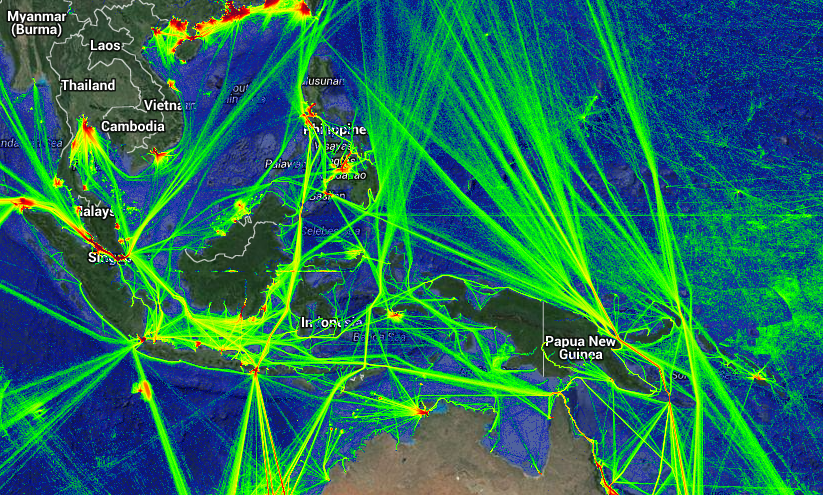
Around $40 billion worth of trade passes through the Sulu Sea annually, predominantly from Indonesia and Australia. There are few good alternatives to this sea when delivering goods or supplies out of certain centers of commerce and ports, which is why trade continues even when a spate of kidnappings and robberies breaks out in its waters. For Australia, the Sulu Sea is a thread connecting it to Southeast Asia, and as such it has participated in numerous joint patrols and regional anti-piracy efforts.

More pressingly, in the event of the U.S. being pushed out of the First Island Chain by force, the U.S. alliance and facilities on the territory of Australia make that country a likely staging ground for a push back into Southeast Asia’s maritime commons, or wherever the fighting may be. The route for that thrust would likely go through the Celebes and Sulu Seas in the northwest. The U.S. Marines at Darwin will find themselves at the vanguard of this push. This was previously seen during the U.S. offensive on Imperial Japan’s territories during the Second World War, preluded by the Solomon Islands campaign and the Battle of the Coral Sea.

The particular issue is China knows this as well. It is extremely likely that isolating Australia would be a paramount objective for the PLAN in any major wartime scenario, if only to coerce Australia into not hosting additional U.S. forces. This is, among other reasons, why China is pursuing the low-risk high-reward strategy of getting a base or some kind of facility to operate out of in the South Pacific. Threatening Australia’s sea lines of communication going toward Northeast Asia would be a deathblow to Australia’s economy, and narrowing its access to a regional conflict would put pressure on any U.S. and allied forces staged there.

A PLAN blockade or presence near the Sulu Sea is thus likely, as it gives China the ability to economically coerce a trade-dependent and allied maritime state like Australia. It would also keep the pressure on another U.S. treaty ally, the Philippines, whose facilities the U.S. may not even be able to use during wartime or in the beginning stages of a conflict.

However, the areas most trafficked by pirates generally have the safest littoral bases for them to operate out of, and while relevant countries have greatly stepped up their maritime domain awareness in recent years, the PLA may suffer a deficit in intelligence of what is happening beyond the coastline and within densely forested islands. “Hit-and-run” attacks would be difficult to retaliate against effectively, especially if Marine Corps vessels and vertical lift are sufficiently quick enough to lift units and their long-range precision fires out of harm’s way. In addition, borders are infamously porous in these areas where pirates operate, complicating efforts to neatly find their bases, catch them in the act, and apply pressure to their hosts.

Navy ships cannot enter the waters of these chokepoints easily – the Sibutu Passage at the southern end of the Sulu Sea is only about 18 miles wide. If the Navy keeps its distance, merchant marine and smaller vessels are easily threatened without consequence, creating something of a dilemma on when and where to intervene. Terrain knowledge of coastal areas requires knowledge of their communities, which a hostile or occupying force will not get easily or quickly, and the areas around these specific chokepoints like the Sulu Sea are veritable vacuums of information even for law enforcement agencies.

Even in a less ideal scenario, an enemy navy would need to go ashore or be bogged down in the dilemma of dealing with land-based threats to those assets necessary for surveilling the area or an effective blockade. That detracts from other objectives, and would involve a disproportionate amount of resources. Arriving to one end of the Basilan Strait, only to discover the Marines have hopped to the other end, would be immensely frustrating.

One assumption being made is that the future Marine Corps will have some unmanned surface vessels or unmanned underwater vessels as part of its toolkit for operating in a contested domain. The core capabilities of those USVs and UUVs should be ISR and communications. The disadvantage of areas like the Sulu and Celebes Seas is that Marines will face information problems as well. A superior land-based, low-risk ISR capability would lend Marines the ability to target ships at sea, but a strong HUMINT relationship with coastal communities would similarly go a long way toward eluding the enemy and operating effectively in a contested area where the U.S. Navy may be nowhere nearby. It is worth noting these same coastal communities were key to Allied ISR efforts in the Second World War.

Conclusion

The Marine Corps’ future method toward strategic chokepoints and littorals could be taking the pirate’s approach and ramping it up with new weaponry, ships, superior ISR, and tactical creativity. This is not anything regional navies are suited to deal with, and definitely not something an organization like the PLAN would be comfortable responding to given it would require flexibility and initiative at the tactical level that the command-and-control obsessed PLA does not actively nurture.

Taking piracy a bit more literally, Marines could board enemy merchant marine ships operating in the area and inflict material damage to the enemy. However, the ultimate goal for the Marines in a regional conflict where the U.S. lacks sea control will be to use land-based assets to punch a hole through an enemy navy’s sea control, and then facilitate access for a friendly navy to move onto the battlefield. In this vein, the Marine Corps will find a viable operating ground in Southeast Asia’s littorals and chokepoints.

Drake Long (@DRM_Long) is an analyst and reporter covering the South China Sea and Southeast Asian maritime issues for RadioFreeAsia. He is also a 2020 Asia Pacific Fellow for Young Professionals in Foreign Policy.

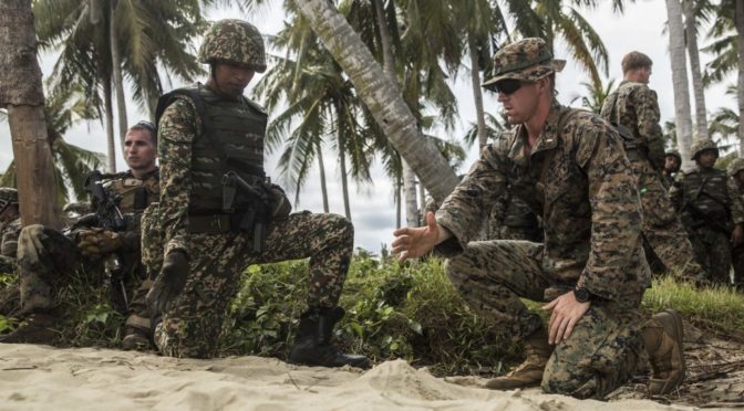
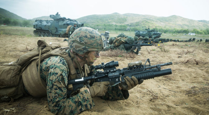
Featured Image: HAT YAO BEACH, Thailand (Feb. 28, 2020) – A U.S. Marine with Alpha Company, Battalion Landing Team, 1st Battalion, 5th Marine Regiment, 31st Marine Expeditionary Unit, sets security alongside Royal Thai Marines during an amphibious landing for exercise Cobra Gold 2020 at Hat Yao Beach, Kingdom of Thailand, Feb. 28, 2020. (U.S. Marine Corps photo by Sgt. Audrey M. C. Rampton) 200228-M-IP473-1063

Chiseled in Space: Temporary, Non-Geographic Chokepoints in the Battle of the Atlantic

Chokepoints and Littorals Topic Week

By Heather Venable

Foreign Policy’s list of the “five top global choke points” includes the well-known maritime chokepoints of the Strait of Hormuz, the Strait of Malacca, and the Suez Canal, in addition to two-land based resource bottlenecks: the Abqaiq Oil Processing Facility and the Druzhba Pipeline.1 These chokepoints “potentially could play an outsized role in strategic competition.”2

Ultimately, the intent of identifying a chokepoint is to find an efficient shortcut to victory. As such, at times it can function as a kind of intellectual “silver bullet.” As one naval officer recently insisted regarding the importance of a Bering Strait chokepoint in an Arctic conflict, for example, it is the “operational imperative that will win any future Arctic conflicts.”3 But securing victory tends to be far more complex and challenging, and controlling chokepoints provides no guarantee of winning, although it certainly may make the process easier.

Institutional proclivities and culture, moreover, may prevent the right chokepoint from being identified, as can be seen in the Battle of the Atlantic. The longest-lasting operations of World War II occurred in the Atlantic Ocean, as German U-boats squared off against a vast array of Allied sea and, increasingly, air power. The Battle of the Atlantic also manifested itself as a war of ideas, with many naval officers and airmen advocating offensive action against U-boats in a manner that threatened to take away from the air and sea power that was being used to defend convoys and escort merchant shipping.

In seeking to defeat the U-boats through offensive tactics, some leaders focused on what they considered to be the key chokepoint: the alluring Bay of Biscay, the area that almost all U-boats transited on their way to the Atlantic’s hunting grounds before returning back to their ports for refitting and resupplying. Commander of the Royal Air Force’s Coastal Command John Slessor, for example, sought to “fell the tree by cutting through its trunk.”4

These offensive operations did pay dividends, forcing the U-boats to travel through the bay underwater, which cut significantly into the time they could spend at sea.5 But it is important to determine, as much as is possible, how efficiently and effectively the Coastal Command and others used these assets in comparison to assets doing convoy duty. 

Despite his reputation for offensive action, Alfred Thayer Mahan had explained in the nineteenth century that convoys provided greater success “than hunting for individual marauders—a process which, even when most thoroughly planned, still resembles looking for a needle in a haystack.”7 Technological changes in the intervening years had not upended this claim’s validity. The Royal Navy and others, however, tended to disagree. During the interwar period, the Royal Navy insisted that ASDIC, or an underwater detection device, had made antisubmarine warfare relatively easy.8

Military culture, moreover, tended to favor aggressive approaches. 9 Finding, much less killing U-boats, in even the relatively restricted Bay of Biscay proved challenging to say the least. From June to December of 1941, an offensive in the bay sank one submarine after thirty-one submarine sightings.10 Even as technology improved, those flying in the bay from June to September 1942 saw one U-boat per 164 flying hours. The anti-submarine warfare crews of October 1942 to February 1943 suffered even more boredom, spotting one U-boat for every 312 tedious hours of flying. During Operation Gondola, which lasted from February 6 to 15 of 1943, the Allies sought to destroy the 78 U-boats that sailed through the area in that timeframe. Aircraft, though, only saw 18 U-boats. And, of the seven attacked, only one did the Allies the favor of sinking.11

January 1944, Atlantic Ocean: Spotted on the surface a few yards from another German U-Boat, this U-boat became the target of  depth bombs and strafing from an American fighter and torpedo bomber off an escort carrier in the mid-Atlantic. (Naval History and Heritage Command)

It did not help that almost 70 percent of the time, U-boats spotted planes first, giving them time to dive to safety.12 Meanwhile, the number of U-boats in the Atlantic rose from 358 in August of 1942 to 420 by May of 1943 as German factories continued to churn them out and huge concrete ports continued to protect them. Yet Coastal Command’s patrols in the Bay of Biscay only killed about 42 submarines during an even longer timeframe from July 1942 to December 1943.13 New trees shot up faster than Slessor could make dents in the trunk.

Figure 1 below demonstrates the U-boat kills by aircraft providing convoy escort in the Atlantic versus those flying air patrols over the Bay of Biscay during sixteen months from March 1942 to July 1943. During this timeframe, aircraft escorting convoys sank 59 U-boats while aircraft flying patrols in the bay sank 32. Aircraft on convoy duty sunk more U-boats every month except for two, one in which aircraft in the Bay of Biscay sunk two U-boats and aircraft on escort duty sank none (July 1942), and another month in which they tied (August 1942).

Moreover, merchant ships’ safe arrival served as a better measure of effectiveness than the number of U-boats killed, as long as U-boats could be kept to a manageable number and shipping could be replaced, which it could. Throughout the Battle of the Atlantic, the real chokepoint was not a single geographical area, but wherever the convoys were.14 Slessor got it wrong, in part because the war was too complicated to be reduced to simple solutions, however tempting or seemingly logical.

These numbers are generous toward the Bay of Biscay patrols, including one unknown cause of sinking in March of 1943, one unknown cause of an Italian U-boat sunk in August of 1942, and another “possible” sinking of an Italian U-boat in May of 1943. Numbers from 1942 to May 1943 are drawn from S.W. Roksill, Appendix J, The War at Sea, 1939-1945, II: The Period of Balance, https://www.ibiblio.org/hyperwar/UN/UK/UK-RN-II/UK-RN-II-J.html. The other numbers for the summer of 1943 can be found in S.W. Roskill, The War at Sea, 1939-1945, III: The Offensive, Part I (London: Her Majesty’s Stationary Office, 1960), pp. 355-356.

The U-boats’ limitations, more so than fixed geographical chokepoints, shaped the Battle of the Atlantic’s nature. As mentioned, U-boats had to sink merchant shipping to have any strategic effect. To sink shipping, U-boats had to reveal themselves around the convoys. And as soon as they revealed themselves, they became highly vulnerable. The primary responsibility of Allied aircraft and ships, by contrast, was to provide enough prosaic protection to get the required amount of resources safely across the Atlantic.

Viewed from the other side, the Germans did not have a strategic chokepoint defined by geography in the Battle of the Atlantic. Instead, their strategic chokepoint was found in the area that Allied aircraft could not reach until the spring of 1943 known as the “gap.” U-boats took advantage of the outsized effect in the “gap” because they could attack shipping safe from aircraft. Once the Allies devoted the less than 50 very-long-range aircraft needed to patrol this area, the Germans’ strategic chokepoint simply disappeared, a stretch of ocean about six hundred miles from north to south by three hundred from east to west now no longer a viable hunting ground (see Figure 2 below).15

A map depicting the mid-Atlantic Gap (Royal Air Force)

In light of this case study, it is worth thinking about the world’s far better known geographic and resource chokepoints, especially in light of how technological changes over the next thirty years might result in the oceans becoming “transparent” enough that even submarines can be detected relatively easily. Making matters worse, given the current Western advantage in submarine technology, some researchers also believe that developing counter-detection technology capable of hiding submarines will be unlikely.17 As such, they conclude the “strategic importance of geographic chokepoints in the ocean is likely to decline.”18

Much can be gained, then, by conceptualizing chokepoints more broadly as areas of temporary advantage that may be created or destroyed through the application of either new capabilities or existing ones in ingenuous ways to create an outsized advantage. In the case of the Battle of the Atlantic, these types of chokepoints resulted in the greatest strategic effect. Ultimately, chokepoints might have the most outsized effect when leaders, as Clausewitz instructs us, can interact within the “play of chance and probability within which the creative spirit is free to roam.”19

Heather Venable is an associate professor of military and security studies in the Department of Airpower at the United States Air Force’s Air Command and Staff College. As a visiting professor at the U.S. Naval Academy, she taught naval and Marine Corps history. She received her Ph.D. in military history from Duke University. She is also a member of the Marine Corps University’s Krulak Center Non-Resident Fellows Program. The views here are her own and do not necessarily reflect those of the U.S. Air Force, the Command and Staff College, or the U.S. Department of Defense. You can follow her on Twitter @Heather_at_ACTS and Linkedin

References

1. “The List: The Five Top Global Choke Points,” Foreign Policy, 8 May 2006; https://foreignpolicy.com/2006/05/08/the-list-the-five-top-global-choke-points/. I am grateful to Ryan Wadle, Josh Howard, and Tyler Morton for reading and commenting on this article.

2. Valerie Jackson, “Chokepoints and Littorals Week,” https://cimsec.org/chokepoints-and-littorals-week.

3. LCdr Tod O’Connell, “The Bering Strait—Strategic Choke Point,” Naval War College thesis, 2016; https://www.jcs.mil/Portals/36/Documents/Doctrine/Education/jpme_papers/oconnell_t.pdf?ver=2017-12-29-142153-567.

4. Sir John Slessor, The Central Blue: Recollections and Reflections (London: Cassell and Company Limited, 1956),, pp. 511-512.

5. Brian McCue, U-Boats in the Bay of Biscay (Washington, D.C.: National Defense University Press, 1990), p. 17.

6. Duncan Redford, “Full Spectrum Anti-Submarine Warfare—The Historical Evidence from a British Perspective,” Journal of Strategic Studies, p. 26, DOI: 10.1080/01402390.2019.1623029.

7. Mahan, Influence upon French Revolution, 2:217 quoted in R.A. Bowling, “Mahan’s Principles and the Battle of the Atlantic” in To Die Gallantly: The Battle of the Atlantic, eds. Timothy J. Runyan and Jan M. Copes, eds. (Boulder: Westview Press, 1994), p. 233.

8. Christina J.M. Goulter, A Forgotten Offensive: Royal Air Force Coastal Command’s Anti-Shipping Campaign, 1940-1945. New York: Frank Cass, 1995, pp. 38-39.

9. See, for example, Trent Hone, Learning War: The Evolution of Fighting Doctrine in the U.S. Navy, 1898-1945 (Annapolis: Naval Institute Press, 1918).

10. Duncan, “Full Spectrum,” p. 13.

11. Max Schoenfeld, Stalking the U-Boat: USAAF Offensive Antisubmarine Operations in World War II (Washington, D.C.: Smithsonian Institution Press, 1995), pp. 45-46.

12. Schoenfeld, Stalking the U-Boat, p. 8.

13. Duncan, “Full Spectrum,” p. 14; Tim Benbow, “Brothers in Arms: The Admiralty, the Air Ministry, and the Battle of the Atlantic, 1940–1943″” in Decision in the Atlantic: The Allies and the Longest Campaign of the Second World War, eds. Marcus Faulkner and Christopher M. Bell (Lexington: University Press of Kentucky, 2019): pp. 78-124: p. 86.   

14. Marc Milner, “The Battle of the Atlantic” in Decisive Campaigns of the Second World War, ed. John Gooch (London: Frank Cass, 1990), p. 58 and p. 46; Buckley, “Coastal Command,” p. 183; also see Redford, “Full Spectrum,” pp. 7-8..

15. Richard Goette, “Britain and the Delay in Closing the Mid-Atlantic” Air Gap” During the Battle of the Atlantic.” Northern Mariner 15, no. 4 (2005): 19-41; Christopher M. Bell, “Air Power and the Battle of the Atlantic: Very Long Range Aircraft and the Delay in Closing the Atlantic “Air Gap” in Journal of Military History 79, no. 3 (2015).

16. Hilary St. George Saunders, The Royal Air Force 1939-1945, Vol. III: The Fight is Won, online at https://www.ibiblio.org/hyperwar/UN/UK/UK-RAF-III/UK-RAF-III-2.html.

17. However, Claire Chennault insisted before radar was developed that the bomber would not be “the first exception to the ancient principle that for every weapon there is a new and effective counter weapon.” The principle remains possible for counter-detection efforts.

18. Roger Bradbury, Scott Bainbridge, Katherine Daniell, Anne-Marine Grisogono, Ehsan Nabavi, Andrew Stuchbery, Thomas Vacca, Scott Vella, and Elizabeth Williams, “Transparent Oceans: The Coming SSBN Counter-Detection Task May be Insuperable,” May 2020, https://t.co/xwRtITPyOU?amp=1.

19. Michael Howard and Peter Paret, eds., Carl von Clausewitz on War (Princeton University Press, 1984), p. 89.

Featured Image: National Archives, colorized by Paul Reynolds)

The Strategic Littoral Geography of Southeast Asia

Chokepoints and Littorals Topic Week

By Pete McPhail, Arthur Speyer, Bret Rodgers, Steve Ostrosky, Jesse Burns, and Dan Marquis

Military decision-makers instinctively think in geographic terms. Southeast Asia’s complex economic, military, political, legal, and environmental layers are best portrayed visually. By spatially portraying information, troops can work their way through geography to comprehend the interaction of these complex layers.  

The INDOPACOM AOR continues to be a primary focus of U.S. naval forces, and the area is of central importance to China. The strategic chokepoints and littorals of the region, such as the Malacca Strait, have major military and economic significance. Each chokepoint has different environmental factors, from size, location, and depth. Additional regional factors, such as piracy, are also strongly related to geography. 

This map describes the strategic importance of Southeast Asian littoral geography to China’s interests. By studying the map the user sees correlations between China’s diplomatic and economic investments and chokepoint geography. This map may be used as a starting point for wargames and discussing policy options.

Click on the map below to view it more closely and hone in on the strategic chokepoints of the region.

The research team is an inter-disciplinary team of civilian Marine Corps regional analysts and geographers affiliated with the Marine Corps Intelligence Activity.

Featured Image: TANDUO BEACH, Malaysia (Nov. 11, 2015) U.S. Marine 1st Lt. Erik Glynn discusses troop movements with a Malaysian army platoon commander prior to rehearsing amphibious operations during Malaysia-United States Amphibious Exercise 2015. (U.S. Marine Corps photo by Sgt. Emmanuel Ramos/Released)

An Emerging Strategic Geometry – Thawing Chokepoints and Littorals in the Arctic

Chokepoints and Littorals Topic Week

By Robert C. Rasmussen

“There are two types of Arctic problems – the imaginary and the real. Of the two, the imaginary are the most real.” –Vilhjalmur Stefansson

 This century will be a transformative one, where rules taken for granted in the international system have begun to rapidly evolve. One of the most fundamental evolutions that is occurring is the transformation of physical geography from climate change and the resulting geopolitical implications. Nowhere is this more apparent than in the thawing Arctic. The ongoing transformation of the Arctic from an inaccessible frozen wasteland to an accessible and untapped reserve creates not only a new contested space, but will create new strategic chokepoints and littoral operating environments. The United States, in concert with its allies, will need to invest in the ability to access and secure this environment in order to maintain sovereignty and security in this new world.

The Changing Arctic

The emerging Arctic will be radically different than the one that has permeated human history. Historically, the Arctic is a frozen ocean surrounded by continental landmasses that have tundra and polar desert biomes along the coastal plains and islands.1 What keeps the Arctic frozen has been partially attributed to the planetary climate patterns that keeps cold air and weather at the poles, the season-long polar night,2 and the fact that snow and ice frozen for multiple years has an extremely high albedo – it reflects sunlight and heat.3 

The difference now is that the planet is warming, and those changes are the most dramatic at the poles. This affects the Arctic Ocean and its littorals in many ways. The first notable effect is on sea ice. Sea ice expands and contracts seasonally, with a core of permanent sea ice, or multi-year ice, being augmented by younger ice, which is less than two years old. The multi-year sea ice is thicker and reflects more sunlight which makes it harder to melt. The younger sea ice is less thick and darker, making it easier to melt. The average extent of the permanent sea ice has been contracting continuously since 1978,4 and according to the International Panel on Climate Change, the Arctic will be ice-free or at least navigable in the summer season between the 2030s and the 2050s.5 

The New Arctic Geography – Trade Routes, Chokepoints, and Inland Waterways

 The reality of this environment is that it is increasingly warming and accessible. This produces rapid change which encourages various actors to compete for control of new sea lanes, prospecting for new resource reserves, and inevitably settlement of the Arctic by populations pushed to the north by climate change. These emerging issues will create the potential for conflicting sovereignty claims and access rights, as well as the assurance of those rights through the exercise of national power. There are four distinct geopolitical regions where fresh access, opportunity, and potential for conflict will occur. They are the Open Arctic Ocean, the North American Arctic Littoral environment, the Eurasian Arctic Littoral Environment, and the Arctic Seafloor.

The Open Arctic Ocean has one critical potential sea lane and two major chokepoints. The major sea lane, which will not be open until the Arctic is at least seasonally ice free, is the Polar Sea Lane. This route spans from Europe to Asia and bisects the Arctic passing over the North Pole. The two major chokepoints here are the Greenland-Iceland-United Kingdom (GIUK) Gap – long famous as a planned line of defense against the Soviet Northern Fleet’s access to the Atlantic Ocean during the Cold War,6 and along the Bering Strait and Sea between Alaska (United States) and the Chukotka Peninsula (Russian Federation).7 The GIUK Gap sees a line cast between the islands of Greenland (Denmark), Iceland, the Faroe Islands (Denmark) and the Shetland and Orkney Islands (Scotland, United Kingdom),8 the Norway-Svalbard Gap, and the Svalbard-Greenland Gap serving as strategic chokepoints.9 Within the Bering Sea, both the Bering Strait and the Aleutian Islands can serve as chokepoints that can control access between the Arctic and the Pacific.10

Arctic maritime shipping routes (Susie Harder, “Arctic Council- Arctic Maritime Shipping Assessment 2009,” United States Department of Commerce, National Oceanic & Atmospheric Administration)

The North American Littoral Environment has two distinct regions. The first is in the eastern portion, characterized by a large number of islands and seaways, which consist of the island of Greenland – an autonomous territory of Denmark, and the Canadian Arctic Archipelago, largely contained in the federal territory of Nunavut, but also the Northwest Territories. The second, western portion, is one where coastal plains meet open ocean along Canada’s Yukon Territory, and the U.S. state of Alaska. The strategic trade route in this operating environment is the fabled Northwest Passage, which is rapidly becoming a reality with a seasonally ice-free or low-ice environment. The strategic chokepoints for this route start with the Labrador Sea and Barton Bay between the western coast of Greenland and the eastern/northern coast of the Canadian Arctic Archipelago’s largest island, Baffin Island.

The Eurasian Arctic Littoral is categorized as being largely coastal with the Eurasian mainland, but with a handful of Arctic Ocean islands which can serve as chokepoints, which are largely controlled by the Russian Federation, the exception being Svalbard – an archipelago controlled by Norway.

How the new Northern Sea route compares to the Suez Canal route for shipping from Rotterdam, Netherlands, to Dalian, China. (Wall Street Journal)

The strategic trade route in this region is the Northern Sea Route, which hugs the northern coast of Eurasia and provides a connection between Europe and Asia, and which is shorter than travel through the Suez Canal and Strait of Malacca. Chokepoints along this route include the Barents Sea gap between Norway and Svalbard, with Bear Island at the midpoint, and multiple chokepoints between Russian islands and archipelagos.

The Northern Sea Route is largely in operation already. A portion is open year-round to support domestic Russian commerce, and a remainder is open during the summer season which allows for trade between Europe and Asia. This route is open due to open waters and additional support from the Russian Federation’s fleet of 14 nuclear-powered icebreakers. China has also invested heavily into what they refer to as their Polar Silk Road, as part of their larger Belt and Road Initiative, including the construction of two more icebreakers. As the Arctic melts, this corridor will be able to accommodate significantly larger traffic flows. Such a shift will be fundamentally transformative to the Russian economy, allowing for Russia to achieve its centuries-old dream of holding blue water ports and subsequent access to global commerce.

An additional transformation to the Russian economy will be with inland waterways. The major inland waterways leading to the Arctic are the Ob’ River, the Yeinsei, and the Lena.                            

Fig. 16- The Lena River Drainage Basin (Source: Wikimedia Commons)

Access to blue water ports and commercial routes for these rivers will be fundamentally transformative to the Russian economy. Siberia is the most resource rich region within the Russian Federation, but extraction is oftentimes cost prohibitive, as the physical geography makes the construction of lengthy transportation corridors over land extremely difficult. Conversely, the implementation of large scale river transports moving from the heart of Russia to Arctic ports would dramatically lower the cost and risk of resource extraction, which will open up this traditional backwater to global commerce.11 With increasing commerce and infrastructure, this region will likely also see a population boom. Additionally, landlocked, but also resource-rich Kazakhstan and Mongolia will also have access to these inland waterways and Arctic ports, where this type of access would otherwise not exist.

The last region in the Arctic will be the seafloor itself, with potential fishing rights, crude oil, and other mineral resources at stake. Fundamental to this region is that it has never properly been mapped, and mapping the seabed is instrumental for states with Arctic coastlines to be able to claim sovereignty and exclusive access to these resources. Under the UN Convention on the Law of the Sea (UNCLOS), territorial waters are limited to 12 nautical miles (nm), except for archipelagoes which are considered internal waterways, Exclusive Economic Zones (EEZs) are limited to 200 nm for exploiting resources in the water such as seafood, and lastly rights to access mineral resources are limited by the continental shelf or the 200 nm EEZ, whichever is further.12 A lack of internationally recognized mapping of the Arctic seafloor has in the past and will in the future lead to conflicting claims, and possibly armed conflict itself.

One example for potentially conflicting claims was when the Russian Federation claimed sovereignty over the North Pole for mineral rights access in 2007. This claim was made based on the Russian assertion that the underwater Lomonosov Ridge, which runs across the Arctic seafloor between the East Siberian Shelf off the coast of the Russian Federation and the Lincoln Shelf off the coast of Greenland, was actually an extension of the East Siberian Shelf and thus subject to Russian sovereignty. Once this region is more accessible it will become a race to stake claims.

A shot from a video shows the view out of the porthole of a Russian miniature submarine as its robotic arm plants the Russian flag on the seabed 14,000 feet below the North Pole on August 2, 2007. (Reuters)

Policy Recommendations

The United States should continue with its longstanding policy of promoting clear international norms and standards when it comes to the emerging Arctic. The current risk is that peer competitors such as Russia and China will seek to exploit ambiguous norms, standards, or situations in order to make gains in economic or political power in the region. Bearing that in mind, the United States needs to be ready to leverage all tools of national power to protect U.S. interests. Part of that is building on and leveraging existing strengths.

The first most important policy the United States can pursue is by increasing funding for scientific research in the Arctic region, with a specific focus on international cooperation and recognition of results. Scientific research should focus on understanding the bathymetry (seafloor mapping) of the region that can be utilized as a diplomatic tool for international recognition of sovereignty claims as well as use of international waters. Promoting consensus prevents room for conflict.

The second policy the United States should pursue with its allies is full investment in the economic development of the Northwest Passage, bringing it into competition with the Northern Sea Route. This economic development would entail the economic development of ports in the Canadian arctic archipelago and development along the MacKenzie and Yukon River corridors. There would also be a need to invest in the construction of both a merchant and military icebreaker fleet, in order to facilitate and secure strategic trade routes. This development would provide an attractive alternative to the Northern Sea Route for the global shipping industry as the Arctic thaws.

The third policy the United States should pursue with its allies under the aegis of NATO is ensuring military superiority over the major strategic chokepoints in the Arctic. The primary focus would be on the GIUK Gap and the Aleutian Islands in particular, as routes that peer competitors Russia and China would have to rely upon converge at those two points. The GIUK, Norway-Svalbard, and Svalbard-Greenland Gaps being mostly open ocean would require a substantial naval blockade and air support to shut down traffic, similar to planning that defensive line during the Cold War, while the Aleutian Islands can rely on a chain of small outposts of anti-ship missiles with patrols preventing passage between the islands. The threat of force from NATO territory could serve as a deterrent from conflict, and as leverage in diplomatic negotiations in future conflicts that may arise. In this same vein, the United States should advocate for the establishment of a NATO Joint Forces Command – Arctic focused on consolidating NATO’s collective military power in the Arctic, coordinating the security of the Northwest Passage, and serving as a deterrent to conflict in the region.

Conclusion

The Arctic is evolving as the climate changes, and it is a change that will result in new opportunities for states to develop, as well as opportunities for regional conflict. Other actors have already taken action in the region, and the United States along with its allies cannot afford to be late to the game. The United States needs to rise to the challenge by promoting peaceful development through the promotion of international norms and standards, as well as ensuring the security of strategic trade and national sovereignty in coordination with allies.

Robert C. Rasmussen is a Foreign Affairs Specialist with the U.S. Department of Energy’s National Nuclear Security Administration, and holds an MA in International Relations from Syracuse University’s Maxwell School of Citizenship and Public Affairs, as well as a BA in International Relations and Geography from the SUNY College at Geneseo. He actively served in the New York Guard (State Defense Force) from 2010-2016, including participation in the response to Superstorm Sandy in 2012. He has long had an interest in the Arctic stemming from his childhood experiences while his family was posted to Fort Wainwright in Fairbanks, Alaska. The views expressed in this article are the author’s alone, and do not necessarily reflect the views or policies of the National Nuclear Security Administration or the U.S. Department of Energy.

References

1. UC Museum of Planetology, “The World’s Biomes,” University of California, Berkeley,

https://ucmp.berkeley.edu/exhibits/biomes/index.php, Acc: 3 May 2020.

2. Leibowitz, Kari, “The Norwegian Town Where the Sun Doesn’t Rise,” The Atlantic, 1 July 2015,

https://www.theatlantic.com/health/archive/2015/07/the-norwegian-town-where-the-sun-doesnt-rise/396746/, Acc: 3 May 2020.

3. National Snow & Ice Data Center, “Thermodynamics: Albedo,” University of Colorado- Boulder,” 3 April 2020, https://nsidc.org/cryosphere/seaice/processes/albedo.html, Acc: 3 May 2020.

4. National Snow & Ice Data Center, “Arctic Sea Ice News & Analysis,” University of Colorado- Boulder, 3 May 2020, http://nsidc.org/arcticseaicenews/, Acc: 3 May 2020.

5. American Geophysical Union, “Ice-Free Arctic Summers Could Happen on the Earlier Side of Predictions,” 27 February 2019, https://phys.org/news/2019-02-ice-free-arctic-summers-earlier-side.html, Acc: 3 May 2020.

6. Alison, George, “What are Norwegian F-35s Doing in Iceland?”  UK Defence Journal, 3 March 2020, https://ukdefencejournal.org.uk/what-are-norwegian-f-35s-doing-in-iceland/, Acc: 3 May 2020.

7. Alaska Seas and Watersheds K-12 Program, SeaGrant Alaska, “Map of Aleutian Islands and Bering Sea,” University of Alaska, Fairbanks,

http://aswc.seagrant.uaf.edu/grade-4/investigation-1/map-of-aleutians.html, Acc: 3 May 2020.

8. Alison, George, “What are Norwegian F-35s Doing in Iceland?”  UK Defence Journal, 3 March 2020, https://ukdefencejournal.org.uk/what-are-norwegian-f-35s-doing-in-iceland/, Acc: 3 May 2020.

9. National Geographic Society, National Geographic World Atlas- 7th Edition, Washington: National Geographic Society, 2000.

10. Alaska Seas and Watersheds K-12 Program, SeaGrant Alaska, “Map of Aleutian Islands and Bering Sea,” University of Alaska, Fairbanks,

http://aswc.seagrant.uaf.edu/grade-4/investigation-1/map-of-aleutians.html, Acc: 3 May 2020.

11. Vorotkinov, Vladislav, “Dredging Will Connect Siberia with the Northern Sea Route,” Dredging & Port Construction, 12 February 2019,

 https://dredgingandports.com/news/2019/dredging-will-connect-siberia-with-the-northern-sea-route/, Acc: 3 May 2020.

12. Kumar, Abishek, “United Nations Convention on the Law of the Sea,” Mariner Desk, 10 September 2018, https://www.marinerdesk.com/united-nations-convention-on-the-law-of-the-sea-unclos/, Acc: 3 May 2020.

Featured Image: Coast Guard members assigned to the U.S. Coast Guard Station Valdez head back to station after recovering hazardous radioactive material from a civilian vessel in the Port of Valdez, Alaska, during exercise Arctic Eagle 2018, Feb. 24, 2018. (U.S. Army National Guard photo by 2nd Lt. Marisa Lindsay)