All posts by Guest Author

Geopolitical Competition and Economics in the Indian Ocean Region

By Lieutenant Commander (G) Roshan Kulatunga, Sri Lankan Navy

Introduction

The geostrategic and geopolitical importance of the Indian Ocean Region has been understood by many great maritime historians. During the Cold War the United States was the preeminent maritime power and the USSR the preeminent land power. Lack of maritime capability eventually became a losing point for the USSR where the U.S. dominated the global commons. Admiral Alfred Thayer Mahan stated the importance of sea power by highlighting six elements of geography (access to sea routes), physical conformation (ports), extent of territory, population, character of the people, and character of government. Mahan’s maritime concepts were so influential in the field of maritime studies that most of the contemporary maritime security architectures are designed around these concepts.

The 21st century Indian Ocean receives attention from state and non-state actors. According to Robert Kaplan “The Indian Ocean unified the oceans and it connects the world from Africa to far East.” Mariners use sea lanes for transportation, and today the Indian Ocean holds some of the most important sea lines of communication in the world. There are regional and extra-regional states operating in the IO. Extra regional countries such as the U.S., China, Japan, and Russia are keen to have some presence in the IO. They are interested in projecting sea power beyond their locale to garner economic and political sustainability in the world arena, and where the IO is a major arena of competition.

The Concept of Sea Power

Establishing preeminent sea power is a key geopolitical strategy successfully implemented by great maritime empires such as England. The famous professor for international relations, Barry Buzan, names five sectors of security that are namely military, political, economic, societal, and environmental. Maritime security lies over all these five sectors of security. Maritime historians such as Admiral Mahan, Julian Corbett, and modern maritime experts such as Robert Kaplan and U.S. Navy Admiral Michael Mullen are well-recognized persons who often talk about the value of maritime power. Admiral Mullen points out that “Where the old maritime strategy focused on sea control, the new one must recognize that the economic tide of all nations rises not when the sea are controlled by one, but rather when they are made safe and free for all.”

Sea power is a larger concept than the field of maritime warfare. Humanity uses the sea for many reasons and these reasons are well-connected to each other. As historian Geoff Till puts it, the “Sea can be used as a resource, medium of transportation, medium of information and medium of dominion.” In history great civilizations founded primarily on maritime power were termed “thalassocracies,” which literally translates to “sea power.” Establishing sea power is directly helpful to strengthening a variety of national policies as it is the collective effect of the military and civil maritime capabilities of a country. Therefore, regional and extra-regional users in the IO are interested in projecting their sea power via both civil and military maritime capabilities.

Geostrategic and Geopolitical Significance of the Indian Ocean

Geopolitics has been defined as a struggle for power and national power can be evaluated in part by showing the interrelationships between geostrategic positioning, the relative economic and technological capabilities of states, international public opinion, international law and morality, international government and diplomacy, and the regional and global balance of power. Geo-strategy is required to deal with geopolitical problems and is the sum of the efforts to influence and act through these factors. With developing economies and growing energy requirements, users in the IO are struggling for power and this behavior influences the stability of the IO.

This is the container age of maritime trade. Bulk cargos are transported through chokepoints in the IO and through main ports such as Gawdar, Chabahar, Hambanthota, Colombo, Mumbai, and Chittagong. These major ports have given significance to IO nations and made them maritime influencers in their own right. There are also nearby flashpoints that can cause spillover effects in the IO with existing situations in Yemen, Somalia, and Iran. Therefore, security in this region is very important for the global economy and must be secured from Middle East turbulence. The countries in the IO are mostly in the developing stage and handling the third largest ocean in the world becomes a huge challenge for them. Therefore, extra-regional countries pay close attention to this region in an effort to influence stability.

Extra-Regional Powers in the Indian Ocean Region

There are 35 Littoral States and 12 landlocked countries, and altogether 47 counties in the Indian Ocean Rim (RIM). Apart from that, many extra regional countries such as China, U.S., Japan, and Russia are dependent on the IO and working to expand their influence. China is interested in the Maritime Silk Route (MSR), and according to Kaplan, China is expanding vertically while India expands horizontally in their maritime power projection. The U.S. sphere of interest is spreading from the Western Pacific to greater maritime Asia in the 21st century, and recently renamed its Pacific Command to Indo-Pacific Command in recognition of the growing importance of the IO. However, there are not any notable maritime power rivalries from within IO nations themselves. Countries are well aware of security in chokepoints, sea lanes, and strategic waterways. Trade security is the major substantial security factor in their developing economies. Therefore, countries are reluctant to disturb in good order at sea.

India, the U.S., and China are main power blocks in IO and they are with the intention of extending their maritime power in pursuit of their national interest. When looking into the balance of power in IO, China seeks maritime expansionism through the South China Sea to IO. The U.S. is more allied with India in present day context than earlier times. Presidents Barack Obama in the past and Trump at present have had good maritime diplomacy with India. According to Morgenthau alliances are a necessary function of the balance of power, when nations competing with each other have three choices in order to maintain and improve their relative power positions. They can increase their own power, they can add to their own power through the power of other nations, or they can withhold the power of the other partner nations of the adversary. Small states like Sri Lanka, Maldives, and Seychelles have to be considerate of their alliances with great powers as they are players in a larger competition.   

When linking this setup into the IO, China and the U.S. are competing with each other and India is also competing with China. China has its own issues with the South China Sea and the security dilemma in Malacca Strait especially affects her. Therefore, aligning with Myanmar and Bangladesh is important to China to transport energy if any rivalry worsens. Further, they have notable interests in the ports of Habmanthota, Gwadar, and Chabahar. The U.S. on the other hand has common interests with India. India has its own maritime strategy involving relationships with the smaller states like Sri Lanka and the Maldives. The recent past visit of two Chinese submarines to port Colombo was heavily criticized by Indians as a challenge to maritime security. The evolving nature of IO alliances could be further strengthened by the construction of oil pipelines for refueling and oil transportation in deep sea ports by India and China in Chabahar in Iran and Gawadr in Pakistan, respectively.

The Chabahar and Gwadar ports are strategically important to both India and China for their maritime expansion. India along with Japan introduced the Growth Corridor, which links Africa to Asia and Far East. Sri Lanka, for example, is situated along both the SLOCs for the Growth Corridor and One Belt One Road. Therefore, smaller littoral state like Sri Lanka have to open up trade to many parties to receive the benefits from competing trade routes and economic projects.

Maritime Security Threats and Challenges in the Indian Ocean Region  

Threats and challenges to the IO maritime domain can be divided into two major areas of traditional and non-traditional security threats. Both littoral and extra-regional states have to play a vital role to prevent the maritime domain from threats and challenges.

Interstate conflicts are rarely found in this region. With the economic expansionism, countries cannot neglect the threats of piracy, illegal fishing, maritime terrorism, maritime pollution, irregular migration by sea, illegal narcotic drugs, and small arms trafficking by sea. These threats may have traditional implications for extra-regional maritime users. As an example, small numbers of Somalian pirates are able to create a perception of threat to the entire maritime trade in the IO. Countries had to utilize their resources to counter this threat in a sustained and multilateral fashion. They had to have interdependencies to face this issue without considering individual rivalries.
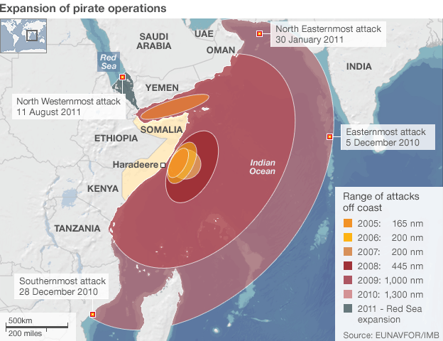
Somali pirate operations. (EUNAVFOR/IMB)

Illegal, unreported, and unregulated (IUU) fishing is another important issue. IUU fishing can also add economic power to actors that also perpetuate maritime terrorism, human trafficking, and illegal migration at sea. Countries like Sri Lanka, Indonesia, Bangladesh, and Myanmar are highly notable victim countries for human smuggling. Sri Lanka is considered a major source country on this issue. Suitable Maritime Domain Awareness mechanisms would be the possible solution to mitigate these threats in the IO. Diplomatic and multilateral solutions are the most viable action on this issue and again counties have to use conference diplomacy to peacefully engage in these types of challenges.

Conclusion

The IO is the third largest ocean in the world and for the balance of power extra-regional actors always wish to display their presence in this region. Therefore, geo-strategic and geo-political competitions in this region are inevitable. Regional and extra regional countries are much more concerned with China’s maritime expansionism in particular. China is especially interested in becoming a modern maritime civilization. This is evidenced by its constructions of harbors in Sri Lanka, Bangladesh, Pakistan, and Myanmar. This has generated vulnerability to their balance of power and traditional regional relationships. Due to the economic advantages they littoral are reluctant to create any rivalries. However, their own game of survival is inevitable.

Security is an important factor for a nation state. To be survivable in the international arena nation states have to concern themselves with energy and trade security. Therefore, the nation state has to give much more concern for their maritime security in a world whose globalization is being fed by the world’s oceans. IO strategic waterways have taken special attention in maritime trade. Oil trade is flowing from the Middle East to Asia and elsewhere via these IO chokepoints and sea routes. Their protection is the responsibility of all.

Lieutenant Commander Roshan Kulatunga is presently performing duties in the Sri Lanka Navy. He is a specialist in Gunnery, from INS Droanacharya, India. He earned a Diploma in Diplomacy and World Affairs at Bandaranaike International Diplomatic Training Institute, Sri Lanka. He also holds a degree in BNS (Bachelor in Naval Studies) University of Kalaniya Sri Lanka, MSc in Security & Strategic Studies, MSc in Defence and Strategic Studies in Kotelawala Defence University (KDU), Sri Lanka. His research interest includes, Maritime Domain Awareness in the Indian Ocean Region

Bibliography

Colombage, A. J., 2017. Maritime Security in the Indian Ocean: Contest for power by major maritime users and non-traditional security threats. Defence and Security Journal, 1(1), p. 103.

Department of the USA Navy, 2009. Maritime Domain Awareness in the Department of the Navy. Washington: Secretary of the Navy.

Ghosh, C. P. K., 2004. American-Pacific Sealanes Security Institute conference on Maritime Security in Asia. Maritime Security Challenges in South Asia and the Indian Ocean: Response Strategies.

Gunawardena, C., 2015. Sri Lanka Navy Outlines Importance of Maritime Hub in Seminar Sessions.

Jayawardena, A., 2009. Terrorism at Sea. Maritime Security Challenges in South Asia.

Kaplan, R., 2011. Monsoon. New York: Random House Trade Paperbacks.

Kaplan, R., 2013. The Revenge of Geography. New York: Random House Trad Paperbacks.

Mihalka, M., 2005. Cooperative Security. Cooperative Security in the 21st Century, Volume 3, p. 113.

Morgenthau, H. J., 2005. Politics Among Nations: The Struggle for Power and Peace. New York: McGraw-Hill/Irwin.

NMDAP, 2013. National Maritime Domain Awareness Plan. New York: Presidential Policy Directives.

Rabasa, A. & Chalk, P., 2012. Non-Traditional Threats and Maritime Domain Awareness in the Tri-Border Area of South East Asia. p. 21.

Sheehan, M., 2006. International Security, An Analytical Survey. New Delhi: Lynne Rienner Publishers, Inc.

The Indian Ocean and the future of American Power. 2010. [Film] s.l.: s.n.

Thean, P. T., 2012. Institute for Security Studies Paper. Maritime security in the Indian Ocean: strategic setting and features, Issue No – 236, p. p.4.

Thiele, R. D., 2012. Building Maritime Security Situational Awareness, Issue No – 182.

Till, G., 2013. Sea Power, A Guide for the Twenty First Century. New York: Routledge.

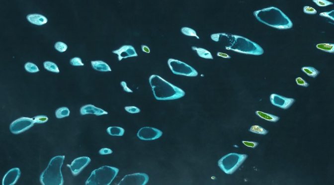
Featured Image: North and South Malosmadulu Atolls in the Maldives. Image taken by the Advanced Spaceborne Thermal Emission and Reflection Radiometer (ASTER) onboard NASA’s Terra satellite. Source: ASTER gallery. Courtesy of NASA Goddard Space Flight Center/Japanese Ministry of Economy, Trade and Industry/Japan Space Systems and the U.S./Japan ASTER Science Team.
India-U.S. Strategic Convergence in the Indo-Pacific Region

By Jyotirmoy Banerjee

As early as 2010 Secretary of State Hillary Clinton spoke of the need for U.S. naval cooperation with the Indian Navy, given the importance of the Indo-Pacific basin for world trade. Although the Pacific was already an American lake since the end of World War II,1 in 2011 President Obama launched the new strategy of “rebalancing “Asia-Pacific as a “pivot.” This, notes a Philippine study,2 was an indication of the growing alarm that the U.S.—and many Indo-Pacific littorals—continued to feel about the dramatic rise of China’s economic and military power. Further, as a U.S. commentary noted, “China scared everybody into our arms”3 The U.S. Defense Department’s strategic guidance released around this time singled out India to observe that the U.S. “is also investing in a long term strategic partnership with India to support its ability to serve as a regional economic anchor and provider of security in the broader Indian Ocean region.”4

To be sure, the U.S. has a large number of military bases in the Asia-Pacific region, and deploys some 80,000 troops in Japan and South Korea. U.S. naval and air power can be credibly projected into every part of this region stretching from Bollywood to Hollywood and from the polar bear to the penguin. Under President Obama, however, the U.S. strategic priority, or “rebalancing,” was meant to shift from the Middle East to the Asia-Pacific, and expand U.S. presence within the region by forging closer military, trade, and other ties. President Trump’s Defense Secretary Jim Mattis took the shift further and termed India as a “Major Defense Partner” while urging U.S. agencies to expedite drone sales to India.5 On 30 May 2018 he renamed the U.S. Pacific Command as INDOPACOM, or Indo-Pacific Command, in Honolulu as America’s “priority theater.” Shortly thereafter, at the Shangri-La Dialogue in Singapore Mattis stressed the concern of not only the U.S. but several other littorals of Asia’s eastern periphery at China’s allegedly overbearing behavior, e.g. placing war potential on the features it occupies in the Spratly and Paracel Islands, including “the deployment of anti-ship missiles, surface-to-air missiles, electronic jammers, and more recently, the landing of bomber aircraft at Woody Island.”6

India’s Prime Minister Modi, however, refrained from censuring China, presumably to avoid being openly ensnared in a U.S.-led “counter-China” strategy. But Mattis called for underpinning a free and open Indo-Pacific with his country standing “shoulder to shoulder with India, ASEAN and our treaty allies and other partners.” He identified the “Indo-Pacific” region as “critical” for America. He did not hesitate to transparently arraign India against China: “The U.S. values the role India can play in regional and global security, and we view the U.S.-India relationship as a natural partnership between the world’s two largest democracies, based on a convergence of strategic interests, shared values, and respect for a rule-based international order.”7 Indeed, Hillary Clinton had openly come out against China’s long-standing claim of practically all of the South China Sea—with its so-called “9-dash Line”—during her Hanoi visit in 2010. This was welcomed by the affected states of Vietnam, the Philippines, Malaysia and Brunei.8 Nevertheless, China continued to pursue its “active defense strategy” and “anti-access /aerial denial (A2/AD)” to counter any intervention in waters under its control, presumably by the U.S.

In November 2013 Beijing had gone ahead with establishing an Air Defense Identification Zone (ADIZ) over portions of the East China Sea. It was a matter of concern that China might establish a similar zone in the South China Sea conflicting with territorial claims by others. In August 2018 the PLA Navy (PLAN) sent two frigates and a supply ship to the Gulf of Aden and the waters off Somalia. And a Chinese commentary proudly proclaims, “As China’s ship-building industry has been making rapid progress in recent years, the number of warship types has also increased, including combat support ships that are essential among the ocean-going fleets…The Type-901 comprehensive supply ship Hulunhu (Hull 965) is known as the “nanny of aircraft carriers.’” 9

There were other reports of PLAN exercises too. “Naval vessels from three theater commands of the People’s Liberation Army (PLA) have conducted air defense and anti-missile live-fire exercises in the East China Sea,” declared the PLA Daily in August 2018. The exercises would beef up the PLAN’s defense capability “in response to potential threats from anti-ship missiles from Japan, the U.S., and other countries near China.”10 The PLAN hosted that same month “Seaborne Assault,” a five-nation military exercise.11 China deployed several hundred surface-to-air missiles as well as the anti-ballistic missile interceptor HQ-26 on the South China Sea islands. Chinese military expert Yin Zhuo justified such deployment in light of the powerful naval force of the U.S. in the region. Yin alleged that the U.S. was the one which truly threatened regional stability, though Western media had been spreading the theory of the “so-called China threat.”12

The reasons for China’s apparent high-handedness around the sea lines of communication (SLOCs) in the East and South China Seas through the Indian Ocean all the way up to eastern Africa are not far to seek. Beijing’s energy-hungry, export-driven economy that heavily depends on raw material and fuel imports seeks to buttress its supposed lordship over regional SLOCs which, however, are also critical to the survival of other Asia-Pacific states. China transports $1.5 trillion worth of goods, including petroleum through the IOR.13 In 2015, in an unprecedented move that worried New Delhi, a Chinese nuclear submarine deployed to the IOR. Stretching Beijing’s overseas influence, a PLA military contingent also appeared that year in South Sudan on a UN peace-keeping mission while a hospital ship offered free medical services to Fijian islanders.14 In July 2017 reports circulated that the PLA was setting up China’s first permanent overseas deployment in Djibouti – right next to the U.S. Navy’s Camp Lemonnier base there – since its withdrawal from North Korea in 1958.15 In August 2017 the Chinese aircraft carrier Liaoning started its exercises in the East China Sea but then quickly shifted its force to South China Sea and flew its combat aircraft – the J-15 “Flying Shark” – for the first time over that sea. The U.S. has sent a number of aircraft carrier strike groups to cruise in the South China Sea and, alleged China Military, frequently harassed Chinese soldiers stationed on the islands. The presence of the Liaoning was to stake out China’s claims in the region. Moreover, the South China Sea is an important advance base for China’s strategic nuclear submarines and Liaoning can be there to provide air cover for them.16

Regarding China’s ambitious Belt and Road Initiative (BRI), there are fears that engaging China in these large infrastructure projects could put participating countries at debt risk. The port of Hambantota in Sri Lanka is an example. And many in Pakistan anticipate a similar debt-ridden fate over the Chinese-aided Gwadar port in their country. It is feared that this debt will then be used by China as leverage to gain access to resources and pursue its strategic interests.17

The issue of military or economic dominance in the Indo-Pacific is just a part of the greater challenge: finding a balance of power between the U.S. and China that is acceptable to both nations. Ever since the 1997 Bill Clinton-Jiang Zemin talks and despite a number of other high-level meetings, U.S.-China relations remain characterized by the classic “Thucydidean trap,” where the status quo power (U.S.) is concerned at the rise of another power (China). The resulting strategic tension bodes ill for both as well as the region.

In such a changing strategic naval scenario, where the U.S. has been taking a fresh look at its naval deployments and diplomacy in the Indo-Pacific, India with its vast coastline and geographic position can play a significant role. Over 80 percent of world oil exports, 50 percent of the global container traffic and 33 percent of global cargo trade move through the IOR and its strategic chokepoints like the Straits of Hormuz and Malacca. The renaming of the Asia-Pacific to Indo-Pacific clearly signaled the role the US expected India to play in countering China.

In its turn India had already stressed in its January 2015 statement on “U.S.-India Joint Strategic Vision for the Asia-Pacific and Indian Ocean Region” the importance of safeguarding maritime security and ensuring freedom of navigation and over-flight throughout the region, especially in the South China Sea. In a transparent reference to China it had added, “We call on all parties to avoid the threat or use of force and pursue resolution of territorial and maritime disputes through all peaceful means…”18

India also provided some muscle to that statement. In May 2016 a strong Indian naval force deployed to the South China Sea,  took part in the Malabar-16 exercise with the  U,S, and Japanese navies,  and also called at the  ports of several littorals stretching all the way to the East China Sea right up to Vladivostok. The Indian Navy declared the region as being of “vital strategic importance to India.”19 In 2017 a U.S. naval study observed that “India’s maritime engagement and activities with Southeast and East Asian countries are increasing…indicating greater space for USN-Indian Navy cooperation” and that “U.S.-India naval ties under the Modi administration are thriving.”20

Following the new U.S. conventional arms transfer policy and the drone export policy of April 2018, State Department official Ambassador Tina Kaidanow declared that the U.S. was “raising the bar in the [arms transfer] relationship with India.”21 India, however, has been more circumspect on that relationship. Even though the Doklam border conflict with China was just a few months old,22 Premier Modi did not raise the issue of China’s assertiveness at the Shangri-La Dialogue, as already noted. However, he highlighted India’s naval activities and cooperation with regional navies, including the U.S. Nor did India quickly fall in line with Japan urging an early meeting of the Quadrilateral Security Dialogue, or the quad, revived in 2017, with U.S., India and Australia. The dialogue was held in June 2018 only after India completed its diplomatic engagements with China and Russia. New Delhi was also careful to not mix up the Malabar Exercises with the U.S. navy with the Quad, which India believed would be a red flag to China.23

At the same time, India was delighted that in April 2018 the Trump administration decided to release armed Guardian drones to India,24 no doubt partly upon Mattis’ urging, and thus taking a step further to cement bilateral strategic ties. It would be the first time U.S. sells a large armed drone to a country outside the NATO. For the past few years only unarmed drones had been permitted to India. India’s importance for the U.S. lies in the fact that its navy, with its two dozen destroyers and frigates, an aircraft carrier, and assorted submarines, including a nuclear-powered one, as well as other vessels, is the largest among Indian Ocean Region (IOR) littorals.

In July 2018 the Indian Navy adopted a “new mission-based deployment” plan. It involves deploying mission-ready ships and aircraft along critical sea lanes of communications.25 This was in response to the uneasiness created by China’s “string of pearls” strategy, a U.S. coinage, which China calls the “21st Century Maritime Silk Road.”26 It refers to Beijing’s ever-expanding overseas commercial and concomitant military ties, naval movements and base and facility acquisitions in the IOR (Hambantota and Colombo port  in Sri Lanka, Cocoa Island and Kyaukphyu in Myanmar, Gwadar and Karachi in Pakistan, and Djibouti in the Horn of Africa),  construction of seaports, railroads and highways in littoral states,  island-building in the distant waters of the South China Sea and a massive submarine-building program, with the country now boasting more submarines than the U.S.27 What’s more, a Pentagon report on 16 August 2018 raised the spectre of PLA bombers training to strike the U.S. and its allies.28

In early September this year, an Indo-US ‘2+2′ dialogue was held for the first time at the Foreign at the Foreign and Defence ministers’ level in New Delhi. The significant results included the signing of The Communications, Compatibility and Security Agreement (COMCASA). This was a landmark agreement in  Indo-US defence and security relations. The ensuing joint statement described the two countries as “strategic partners, major and independent stakeholders in world affairs.”29

Beijing’s ambitious moves look very much like an attempt to turn China into the hub of a new order in Asia and the Indian Ocean region. It is also to counter the U.S. “pivot” to Asia. China’s $40 billion Silk Road Fund and its Asian Infrastructure Investment Bank are further indicators of its policy. It plans to develop a 3,000-kilometer, $46 billion China-Pakistan Economic Corridor (CPEC) connecting its restive Xinjiang province to the Baluch port city of Gwadar on the Arabian Sea. India has responded with a comparatively feeble “Look East Act East” policy, but India will need the U.S. as much as the U.S. needs India to shore up countervailing power to China’s seaward thrust in the IOR.

Dr. Jyotirmoy Banerjee, former Professor of International Relations (Strategic Studies), Jadavpur University, Kolkata has over four decades of academic experience, including frequent research and teaching stints in Germany, Poland and the USA. Besides winning Fulbright, Alexander von Humboldt and Goethe Institute Fellowships, each several times, he has been recipient of other post-doctoral grants of the Rockefeller, Erasmus Mundus, InterNationes and UGC research programs. His academic peregrinations have stretched from India’s academia to California-Berkeley, Pennsylvania, Hawaii (Manoa), Massachusetts, St.Francis College, Indiana, Berlin (FU), German Society for Foreign Affairs in Bonn and Berlin, German Foreign Ministry (AA), the Toenissteiner Kreis in Cologne as well as Wroclaw University in Poland. He has presented at the State Department, U.S. National Security Council, and the Library of Congress in Washington DC.

References

[1] Cumings B. (2016) The Obama “Pivot” to Asia in a Historical Context of American Hegemony. In: Huang D. (eds) Asia Pacific Countries and the US Rebalancing Strategy. Palgrave Macmillan, New York, pp 11-30.

[2] Uriel N. Galace, “In Retrospect: Assessing Obama’s Asia Rebalancing Strategy”, http://www.fsi.gov.ph/in-retrospect-assessing-obamas-asia-rebalancing-strategy/, CIRSS Commentaries, VOL. III, NO. 16, December 2016, electronically accessed 8/9/2018, 10.34 P.M. IST (All times are in Indian Standard Time unless otherwise mentioned).

[3]  MICHAEL J. GREEN, “The Legacy of Obama’s “Pivot” to Asia”, https://foreignpolicy.com/2016/09/03/the-legacy-of-obamas-pivot-to-asia/. | SEPTEMBER 3, 2016Electronically accessed 8/10/2018, 06.20 A.M.

[4] Quoted in S. Amer Latif,”India and the New U.S. Defense Strategy”,https://www.csis.org/analysis/india-and-new-us-defense-strategy,February 23, 2012.Electronically accessed on 8/19/2018,6:50 AM.

[5] “’Once-in-a-generation’ opportunity for US to find more common ground with India: Jim Mattis”, Apr 27, 2018, https://economictimes.indiatimes.com/news/defense/once-in-a-generation-opportunity-for-us-to-find-more-common-ground-with-india-jim-mattis/articleshow/63936701.cms. Electronically accessed on 8/26/2018, 4.00 AM.

[6] Euan Graham, “Mattis Lays Out U.S. Indo-Pacific Strategy at Shangri-La,” https://www.realcleardefense.com/articles/2018/06/04/mattis_lays_out_us_indo-pacific_strategy_at_shangri-la_113504.html, June 04, 2018. Electronically accessed on 8/14/2018, 04.50 A.M.

[7] Remarks by Secretary Mattis at Plenary Session of the 2018 Shangri-La Dialogue, Secretary of Defense James N. Mattis; John Chipman, Director-General and Chief Executive, IISS, June 2,2018.Transcript. https://www.defense.gov/News/Transcripts/Transcript-View/Article/1538599/remarks-by-secretary-mattis-at-plenary-session-of-the-2018-shangri-la-dialogue/ Electronically accessed on 9/13/2018, 04.46 A.M.

[8] Jeffrey A. Bader, “The US-China Nine-Dash Line: Ending the Ambiguity”, https://www.brookings.edu/opinions/the-u-s-and-chinas-nine-dash-line-ending-the-ambiguity/, Feb.6, 2014. Electronically accessed on 14 August 2018, 6.12 A.M.

[9] Bei Guo Fang Wu,” PLA Navy ends era of “supply-ship troika” in its escort mission”, http://english.chinamil.com.cn/view/2018-08/09/content_9247256.htm, Electronically accessed on 8/13/2018, 4:36 AM. Emphases added.

[10] Li Jiayao (Global Times Editor), “PLA naval exercises in East China Sea test missile interceptions”, http://english.chinamil.com.cn/view/2018-08/13/content_9249528.htm, Electronically accessed on 8/13/2018, 4:38 AM.

[11] Li Jiayao, “”Seaborne Assault” concluded in China”, http://english.chinamil.com.cn/view/2018-08/11/content_9249169.htm. Electronically accessed on 8/13/2018 4:41 AM.

[12] “China’s missile deployment in South China Sea completely reasonable: expert”, http://eng.mod.gov.cn/Opinion/2017-01/04/content_4769263.htm. Electronically accessed on 8/13/2018 5:17 AM.

[13] Sarosh Bana, “Rebalancing with India”, https://idsa.in/idsacomments/rebalancing-with-india_sbana_310516. Electronically accessed on 8/25/2018, 3.34 AM.

[14] http://english.chinamil.com.cn/view/2018-08/09/content_9246542.htm. Electronically accessed on 8/13/2018 4:43 AM; http://search.chinamil.com.cn/search/milsearch/stouch_eng.jsp. Electronically accessed on 8/13/2018 4:56 AM. 12 Charles Clover,Sherry Fei, “Chinese military base takes shape in Djibouti” https://www.ft.com/content/bcba2820-66e1-11e7-8526-7b38dcaef614, JULY 12, 2017.Electronically accessed on 9/9/2018, 4.55 A.M.

[16] “Expert: China’s home advantage in South China Sea cannot be overlooked”, http://eng.mod.gov.cn/Opinion/2017-01/04/content_4769264.htm. Electronically accessed on 8/13/2018 5:27 AM. The expert Li Jie, however, believes that aircraft carrier Liaoning is developed based on the Russian-made aircraft carrier Varyag and therefore it will inevitably be affected by the original design. But more critically, the number of ship-borne fighter jets of Liaoning is only half of that of US super aircraft carriers. In this way, it is hard for ship-borne fighter jets of Liaoning to bear air defense, anti-submarine and long-range strike at the same time.

[17]  Darlene V. Estrada, “China’s Belt and Road Initiative: Implications for the Philippines,” VOL. V, NO.3,March 2018, http://www.fsi.gov.ph/chinas-belt-and-road-initiative-implications-for-the-philippines/ Electronically accessed on IST 8/10/2018 6:36 AM.

[18] US-India Joint Strategic Vision for the Asia-Pacific and Indian Ocean Region”, January 25, 2015, http://www.mea.gov.in/bilateraldocuments.htm?dtl/24728/USIndia_Joint_Strategic_Vision_for_the_AsiaPacific_and_Indian_Ocean_Region. Electronically accessed on 8/25/2018, 5.11 AM.

[19]  Sarosh Bana, op.cit.

[20] Nilanthi Samaranayake, Michael Connell,Satu Limaye,”The Future of U.S.-India Naval Relations”,February 2017,Center for Naval Analyses, http://www.dtic.mil/dtic/tr/fulltext/u2/1029962.pdf. Electronically accessed on  8/25/2018,5:58 AM.

[21] U.S. Arms Transfer Policy: Shaping the Way Ahead,August 8, 2018 (transcript), https://www.csis.org/analysis/us-arms-transfer-policy-shaping-way-ahead. Electronically accessed on 9/9/2018, 7 AM.

[22] The dispute was over Chinese construction of a road in Doklam near a trijunction of India-China-Bhutan border area.

[23]  Indrani Bagchi, “ India, Australia, US, Japan to hold meet in Singapore”, Jun 6, 2018. Electronically accessed on 8/19/2018, 6 A.M.

[24] Ajay Banerjee, “India could be gainer as US changes policy on supply of armed drones”, https://www.tribuneindia.com/news/nation/india-could-be-gainer-as-us-changes-policy-on-supply-of-armed-drones/576937.html, 8/19/2018, 6:16 AM.; “US offers India armed version of Guardian drone: Sources”,  “https://timesofindia.indiatimes.com/india/us-offers-india-armed-version-of-guardian-drone-sources/articleshow/65043647.cms, Jul 18, 2018. Electronically accessed on 9/9/2018, 6/20 AM.

[25] “Navy to implement new plan for warships in Indian Ocean region”, https://economictimes.indiatimes.com/news/defense/to-counter-china-navy-to-implement-new-plan-for-warships-in-indian-ocean-region/printarticle/61231821.cms. Elecronically accessed 8/21/2018, 1.20 AM. 

[26] “China reinvents ‘string of pearls’ as Maritime Silk Road”, https://asia.nikkei.com/Politics/China-reinvents-string-of pearls-as-Maritime-Silk-Road, April 29, 2015. Electronically accessed 8/21/2018. 2.21 AM.

[27] Ibid.

[28] “Chinese bombers ‘likely training for US strikes’ says Pentagon”, https://asia.nikkei.com/Politics/International-Relations/Chinese-bombers-likely-training-for-US-strikes-says-Pentagon, August 17, 2018. Electronically accessed 7/21/2018, 8.01 PM.

[29] Indrani Bagchi, “2+2 talks set strategic direction for Indo-US ties”, Sep 9, 2018, https://timesofindia.indiatimes.com/india/22-talks-set-strategic-direction-for-indo-us-ties/articleshow/65737608.cms, Electronically accessed 16 Sept.2018, 6.16 PM.

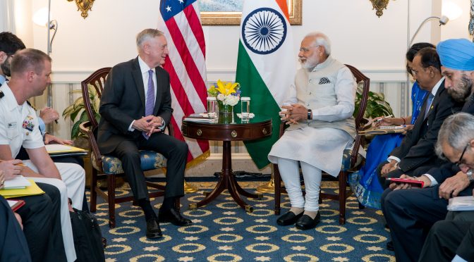
Featured Image: Secretary of Defense Jim Mattis meets with India’s Prime Minister Narendra Modi in Washington, D.C., June 26, 2017. (DOD photo by U.S. Air Force Staff Sgt. Jette Carr)

British Amphibious Operations in Egypt, 1801: A JP 3-02 Perspective, Pt. 1

By Jason Lancaster

Introduction

“Amphibious Warfare requires the closest practicable cooperation by all the combatant services both in planning and execution, and a command organization which definitely assigns responsibility for major decisions throughout all stages of the operation.”– Admiral Henry K. Hewitt, USN1

By late 1800, the French Revolution was going poorly for the British. Britain’s economy was in distress, her allies had been driven from the war, Russia was shifting to support France, and neutral Baltic nations were arming to enforce their maritime rights and neutrality. Yet despite all this Britain fought on alone against France.

British armed forces were a tale of two branches. The Royal Navy had cleared the seas of French warships, blockaded the coasts of France, and was well respected. By way of contrast, the British Army had performed poorly ashore in northern Europe, had suffered catastrophic casualties while campaigning in the West Indies, and was universally derided by other European armies.2 Britain needed a military victory to solidify the government’s political position at home and abroad as well as to demonstrate the capability of the newly reformed British Army. The British amphibious operation in Egypt was what the nation needed.

Since July 1798, French forces had occupied Egypt. In August 1798, Nelson’s fleet obliterated the French fleet, cutting the French army off from France. After a year of campaigning in Egypt and Syria, Napoleon returned to France. Yet, the French army remained in Egypt, a permanent threat to British India. Britain needed a victory on land to secure room for negotiations at the expected peace conference.

The British joint campaign in Egypt has languished in relative obscurity, overshadowed by Admiral Nelson’s epic naval battle in 1798. When viewed through U.S. Joint Publication 3-02 Amphibious Operations, this campaign provides several lessons on the successful conduct of an amphibious operation.  

Despite the successful execution of the landing and British victory in the campaign, mistakes made by the national command authority, in intelligence, logistics, planning, and the relationship between the commanding general and admiral caused problems throughout the operation. Even though U.S. amphibious doctrine was developed and refined in the Second World War era and Joint Publication 3-02 is the evolution of those experiences, this essay argues that the principles of a successful amphibious campaign as defined by JP 3-02 are applicable regardless of time period and this historic case study can be analyzed through this doctrine.

Planning

“The planning phase normally denotes the period extending from the issuance of an initiating directive that triggers planning for a specific operation and ends with the embarkation of landing forces. However, planning is continuous throughout the operation.” – JP 3-02 3

British politicians agreed that they needed a victory, but where Britain should strike was a matter of debate. The Prime Minister and cabinet debated whether to support another royalist uprising in France, another landing in Holland, Egypt, or somewhere else.4 Surprisingly, despite Britain’s recent support of failed French royalist uprisings and landings in Holland both options were initially more popular than Egypt.

Secretary of State for War Sir Henry Dundas spent years improving Britain’s position in India, and did not want French interference to threaten his work. Secretary Dundas and Napoleon agreed Egypt was the key to India. The French Consul in Egypt stated 10,000 French troops could proceed down the Red Sea to India and take Bengal from the British in one campaign. In London, intelligence on French force levels in Egypt were scarce, but estimates were 13,000 French troops demoralized and crippled by the plague. Intelligence Reports stated the garrison of Alexandria numbered 3,000, and scattered through Upper Egypt and Syria were 10,000 more French troops. 5 In reality, the French army in Egypt was closer to 25,000 soldiers, and despite sacrifices and hardship, their morale was high.6 Britain planned to send an army of 15,000 to Egypt.7 Britain also planned to send an additional 3,000 troops from India, but there was little likelihood of coordination between the two forces, and a failed landing would have enabled the French to defeat both forces piecemeal. This faulty intelligence could have proved disastrous to the landing force. British diplomats in Constantinople also believed they had coordinated Ottoman logistical support for horses and gunboats.  

Secretary Dundas, turned to his fellow Scot, General Sir Ralph Abercromby, to lead the expedition and turn the tide of the war. General Abercromby was an experienced general who had successfully conducted several amphibious operations in the West Indies earlier in the war. At 65, he was an innovative soldier despite his age who mixed the best of the American light infantry and Prussian close order drill schools of British military thought. His protégé, another Scot, General Sir John Moore, pioneered British light infantry tactics, and had served with General Abercromby throughout the West Indian campaigns seizing sugar islands from the French. He served as a division commander throughout this campaign and represented the army’s interests in planning the ship-to-shore movements of the campaign.8

The naval leadership was no less capable and distinguished. Admiral George Elphinstone, 1st Viscount Keith, successfully negotiated with the mutineers at the Nore in 1798. He served as deputy Commander-in-Chief, Mediterranean under Admiral Lord St Vincent before himself assuming the command in November 1799. Lord Keith experienced amphibious operations during the siege of Charleston in the American Revolution and in 1795, an expedition that captured the Dutch Cape Colony. Lord Keith’s deputy for planning the ship to shore movement was Captain Alexander Cochrane, uncle of Admiral Lord Thomas Cochrane and a distinguished future admiral in his own right. He had served on the American station during the Revolutionary War and was commanding officer of HMS Ajax, a 74-gun ship of the line.

“The focus of the planning process is to link the employment of the amphibious force to the attainment of operational and strategic objectives.”9  Initially clear direction for operational and strategic objectives was not given. Campaigns in the Netherlands, France, and Egypt were proposed. Finally, Secretary Dundas tasked General Abercromby and Lord Keith to conduct a landing in Egypt. Secretary Dundas gave the commanders four objectives: eject French forces, restore Ottoman rule in Egypt, protect British interests in India, and secure a better negotiating position for a future peace conference. Secretary Dundas directed the joint force to attempt to seize the Spanish Fleet at anchor in Cadiz before proceeding to Marmorice Bay to receive promised logistical support from the Ottoman Empire and then to defeat the French forces in Egypt accomplish British objectives.

Operational planning for the expedition began when General Abercromby arrived in Gibraltar. According to JP 3-02, top down planning, unity of effort, and integrated planning are the key components of the planning phase. General Abercromby’s presence in the planning was keenly felt, however Lord Keith displayed little interest in the planning. General Abercromby spoke with naval officers who had served on the Egyptian coast. These conversations helped shape the campaign and narrow the landing sites to the Aboukir Peninsula or Rosetta. Aboukir would enable the British fleet to provide logistical support and the army’s flanks would be protected by water during the advance on Alexandria. A landing at Rosetta would enable the British army to link up with the Ottoman army and advance together toward the French.10  

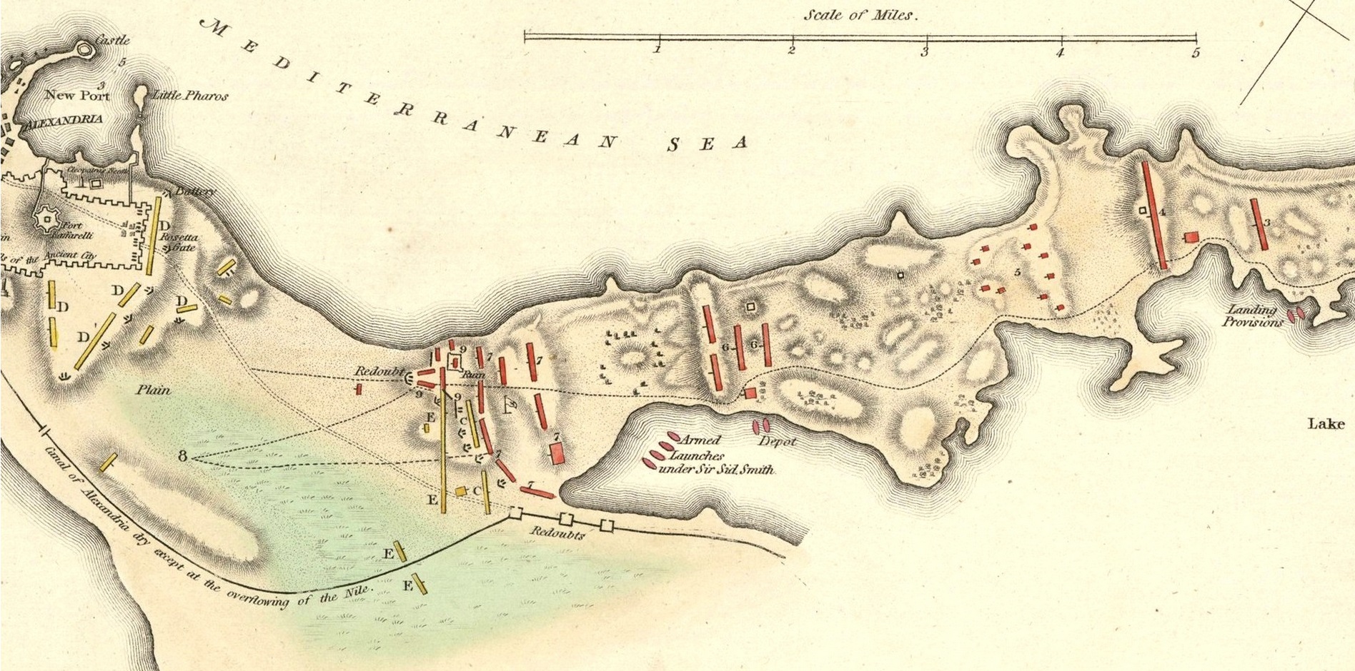
Initial reports led General Abercromby to believe that his army would find potable water on the Aboukir Peninsula. Eventually, General Abercromby learned through captured letters that all water would have to come from the amphibious shipping. During a council of war aboard HMS Foudroyant naval officers familiar with the coast explained, “when anchored in Aboukir Bay, [the fleet] would be able to land a sufficient quantity of water and provisions for the army.” As the army advanced, “it would always be within a mile of [the coast], boats with water and provisions might attend.”11 If the fleet was destroyed in battle or forced off station by gales, “the army would die of thirst.” While the force was anchored in Marmorice Bay, General Moore was sent to Syria to speak with Captain Sir Sydney Smith RN, serving with the Ottoman forces fighting the French. General Moore assessed the Ottoman forces as disorganized, poorly trained, and disease-ridden. General Abercromby selected Aboukir for the landing site. The condition of the Ottoman army played a major role in that decision. Despite the water supply risk, Aboukir Peninsula was closer to Alexandria, and the waters of the bay and lake protected the army’s flanks from French cavalry.12

Embarkation

“The embarkation phase is the period during which the landing force with its equipment and supplies embark in assigned shipping.” – JP 3-02

Despite almost a decade of war, in 1801, the British army remained small. To create an expedition of 15,000 troops involved redeploying  from British deployments around Great Britain, Ireland, and Europe. Not all regiments in the British Army were designated for service outside Europe. Some regiments, particularly militia regiments, were able to volunteer for active service, but only in Europe. High casualty rates in the West Indies meant that few militia regiments volunteered to serve outside Europe. British troops embarked from Ireland and Britain, including units who would not participate in the campaign, but would relieve units in Gibraltar and Minorca that would participate in the campaign.13 The complex embarkation plan shuffled soldiers across Europe, resulted in some soldiers spending months cramped inside troopships waiting to get ashore.     

The expeditionary force also lacked cavalry mounts. British forces often deployed without horses and purchased them locally since horses take up a large amount of space aboard ships and there was a great difficulty keeping horses healthy for long voyages. The Ottoman Empire promised the British army an ample supply of horses. In reality, British diplomats and supply officers were unable to procure a sufficient number of quality mounts for the cavalry, artillery, and wagon train. The horses provided proved to be subpar, and the strongest horses were given to the artillery to pull cannons. The poor quality mounts meant that the French cavalry would outclass the British cavalry in Egypt.14

Rehearsal

“The rehearsal phase is the period during which the prospective operation is rehearsed to: test the adequacy of plans, timing of detailed operations, and combat readiness of participating forces; provide time for all echelons to become familiar with plans; and test all communications and information systems.” – JP 3-02

The British attempt to land a force to seize the Spanish Fleet at Cadiz was a fiasco. A large portion of that was because there had been no time for a rehearsal. Boats went to the wrong transport, it took hours for soldiers to embark the boats, and then they did not form up properly. The landing was called off and the following day a storm scattered the fleet, and the invasion of Cadiz was over. When the fleet arrived in Marmorice, they planned to spend just a few days to rendezvous with Ottoman naval forces and supplies before proceeding to Egypt. Instead, the expected logistical support from the Ottomans never materialized and the expedition spent almost two months waiting.15 General Abercromby used this time to good effect drilling his troops. This time enabled the force to learn and rehearse their ship-to-shore movement to great effect. For seven weeks, the troops practiced ship-to-shore movements, boats going to the right transport, soldiers embarking the boats, boats forming waves, and soldiers forming line of battle from the boats.

A detail of a plan of the Operations of the British Forces in Egypt from the landing in Aboukir Bay on th 8th of March to the Battle of Alexandria March 21st inclusive. (William Fadden, Geographer to His Majesty & to His Royal Highness the Prince of Wales/Wikimedia Commons)

The boats were organized into three waves. The first wave comprised 58 flatboats. Each flatboat carried 50 soldiers. The second wave encompassed 81 cutters and the third wave comprised 37 launches. Artillery in boats followed in the fourth wave, the cannons would be disembarked and crewed by sailors.16  The troops practiced disembarking from ships into the landing craft and forming into line of battle on the beach. The soldiers were instructed to enter the flatboats as expeditiously as possible, sit down, and keep their muskets unloaded until formed into line on the beach. Officers’ servants were instructed to bear arms in the ranks and to carry no more than their own equipage.17 The boat crews practiced maintaining the assault boat spacing of 50 feet and the movement from ship-to-shore.18

Movement

“The movement phase is the period during which various elements of the amphibious force move from the points of embarkation or from a forward deployed position to the operational area.” – JP 3-02

The expedition’s movement phase consisted of three phases. Phase 1 consisted of the movement from Great Britain and Ireland to Gibraltar and Minorca where the forces were gathering. This phase included the failed attempt to seize the Spanish fleet at Cadiz.

Phase 2 consisted of the movement from Gibraltar and Minorca to Marmorice Bay. Following the Cadiz debacle, the expedition watered and victualed in Africa, and proceeded to Marmorice Bay, Turkey. During this phase a terrible storm scattered the fleet and several days were spent bringing the transports back to the fleet.19 After several weeks, the fleet arrived in Marmorice Bay, whose deep waters and high cliffs proved an excellent anchorage.

Phase 3 was the movement from Marmorice Bay to Egypt. The expedition encountered a storm that frightened the Turkish gunboats, which left the expedition. On 1 March, the expedition arrived off Alexandria – sailing in so close that the masts of the French ships in harbor were visible – and proceeded down the coast to Aboukir; however, weather conditions prevented the landings until the 8th of March.20 This alerted the French, gave General Menou eight days to concentrate troops and entrench them on Aboukir Peninsula. While French troops were rushed to the scene, including 2,000 soldiers to Aboukir Peninsula, there was confusion in the French army as Captain Moiret described, “various movements so numerous as to be impossible – as well as pointless.”21

Now that the expedition was off the coast, the Royal Engineers conducted a beach reconnaissance. Unfortunately, the good works of Majors Fletcher and Mackerras was to no avail. Major Fletcher was captured and Major Mackerras was killed by artillery during their reconnaissance. When the fleet arrived, General Abercromby undertook the reconnaissance himself.22 

LT Jason Lancaster is a U.S. Navy Surface Warfare Officer. He is currently the Weapons Officer aboard USS STOUT (DDG 55). He holds a Masters degree in History from the University of Tulsa. His views are his alone and do not represent the stance of any U.S. government department or agency.

References    

[1] Joint Publication 3-02: Amphibious Operations, 18 July 2014, pg II-1

[2] Michael Glover, Peninsular Preparations, (Cambridge, 1963),pg  3.

[3] Joint Publication 3-02 Amphibious Operations, (2014), I-7

[4] (Mackesy 2010, 5)

[5] John Fortescue, A History of the British Army Vol. IV, (MacMillan, 1915), pg 800.

[6] Joseph –Marie Moiret, Memoirs of Napoleon’s Egyptian Expedition, 1798-1801, (Green Hill, 2001), pg 160.

[7] Piers Mackesy British Victory in Egypt, (TPP 2010), pg 13.

[8] Piers Mackesy British Victory in Egypt, (TPP 2010), pg 14.

[9] JP 3-02, pg III-2.

[10] John Moore, The Diary of Sir John Moore, (Arnold, 1904), pp 397-398.

[11] Moore, 397.

[12] Fortescue, pg 809.

[13] Fortescue pg 804.

[14] Mackesy, pg 100.

[15] James Lowry, Fiddlers and Whores, (Chatham, 2006), pg 59.

[16] John Creswell, Generals and Admirals, (Longman’s, 1952), pg 101

[17] Aeneas Anderson, Journal Of the Forces, ( Debrett, 1802), pg 201.

[18] Moore, pg 399.

[19] Lowry, pg 59.

[20] Lowry, pp 70-71.

[21] Moiret, pg 161.

[22] Anderson, pp 213-215.

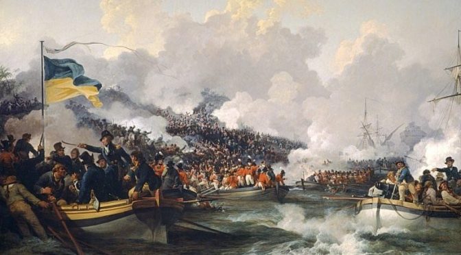
Featured Image: British Troops Landing at Aboukir by Philip James de Loutherbourg (Wikimedia Commons)

Adjusting to New Conditions for Command of the Seas

Sea Control Topic Week

By Theodore Bazinis

In a historical turn, the 2018 National Security Strategy (NSS) of the United States asserts that the world is returning to an era of great power competition. The 2018 NSS explicitly states that “after being dismissed as a phenomenon of an earlier century, great power competition has returned.”  World history is a landscape of consecutive great power competition for hegemony and as the great navalist Alfred Thayer Mahan showed in his book The Influence of Sea Power Upon History, the one who commands the seas is the one who imposes the rules of the sea (most of the time at least). Even though the Mahanian term “Command of the Seas” is rather an ideal condition, in the real world we could substitute it with the term “sea control’’ which describes a temporary1 condition existing in a particular maritime area where one has freedom of action to fulfill goals and purposes.2 Sea control is a condition and a necessary operational function to achieve strategic goals.

Whatever character naval warfare takes on in the future sea control will always be the key to success. Being so essential one should understand its principles in order to gain sea control, but history abounds with cases where nations succeeded or failed. Some of those who initially failed were able to readjust their doctrines in time (and consequently their capabilities) to gain sea control and win.

The First World War revealed the insufficiency of the Mahanian doctrine (and thus the capabilities of the U.S. Navy), to fulfill U.S. strategic objectives. A doctrine designed to win a decisive battle in the Caribbean had resulted in building a fleet of heavy battlecruisers quite improper to gain sea control in the Atlantic Ocean dominated by German submarines. This resulted in an inability to protect sea lanes through which supplies were transported to European allies. The improvidence of Mahanian doctrine to anticipate the nature of the future war at sea (attrition instead of decisive battle) and mainly the inability to foresee the vital role that a new technological asset had (the submarine instead of big-gun warships), were the causes of the gap between ends and means. However, the U.S. realized this in time and procured lighter combatant crafts such as destroyers which were  more suitable units to assert protection of sea lanes, escort supply transport vessels, destroy enemy submarines, and finally to acquire sea control in a new context.

Just concluding that sea control is a dependent variable of proper capability is not new. But what does proper capability mean? Capability can be defined as the means that enable a Navy to fulfill strategic objectives, adjust to the particular demands of the operational environment, and encounter all possible expected threats.

The case of WWI highlights the dramatic influence that new technologies have in the ability to gain sea control. The introduction of submarines, aircraft carriers, and naval air forces expanded the physical dimensions of war at sea to include air and undersea domains. This in turn changed the number and the quality of threats a navy could encounter. A robust reform of existing doctrines was introduced and subsequently new capabilities for the fleet were required. The successful use of sea power has now come to be regarded as the best method of distributing capabilities and tactics across domains. A major consideration for gaining sea control during war was the quick adjustability of capabilities and tactics to operational conditions. However, changing tactics and tools in the midst of war will be difficult in the modern threat environment. That means that the planning of the fleet during peacetime is very critical.

Littorals (green/brown waters) rather than high seas (blue waters) are expected to be more essential in future maritime conflicts. They may feature anti-access strategies using mines,3 land-based precision guided munitions (of extended range or/and ballistic), diesel submarines,4 Special Forces, electronic warfare, space systems and cyber operations. As advanced capability proliferates, traditionally less powerful states in the littoral will be able to pursue sea control and sea denial in ways they have not been able to before.

In order to balance asymmetries in military power, states that feel weaker are also expected to use terrorist networks, criminal groups and/or state-incited paramilitary groups equipped with low cost but of high effectiveness light arms. They will also attempt hybrid tactics, exploiting high technological means (smart mines, cyber-attacks) and simple tactics (suicidal bomb attacks, old fashioned guided weapons) which base their success in the inability of the defender to deter attacks. The same effect is caused in complex geographic environments like littorals, island clusters, and archipelagic waters.

Non-Military Dimensions of Sea Control

Considering all abovementioned threats and characteristics of the international environment we need to procure fleets with proper capabilities to enable their successful response. Even though the ability to respond to advanced threats emerging in tactical level is essential however these capabilities should include the consideration that sea control operations are not just a summation of hard power but they should simultaneously shape a conducive strategic environment in which military acts will follow in a more favorable context. At the strategic level, executing information operations of an honest nature to further a narrative that legitimizes military acts to internal or international audiences, especially with respect to preserving international law.

Great powers could be questioning world order in the context of command of the seas. At sea this strategy is manifested by arbitrary interpretations of international law which (in many cases) attempt to negate freedom of navigation, by planning anti-access policies and/or provoking small scale crises to achieve political ends. International law is expected to exert vast influence (more than any other time in history) on rules of engagement and wartime conduct, especially in areas replete with commercial shipping and civilian crews. As a result this will limit freedom of action to operational commanders. Military actions should always take into consideration international law so as to assert the legitimacy of their actions.

In the operational level, executing legal warfare will be important to secure the legitimacy of military actions during war or crisis. Certain situations could limit or affect commanders’ decision-making procedure, for example when trying to clarify if existing assets are paramilitary groups such as maritime militia or genuine non-combatants. Legal confusion with respect to using force may result in civilian casualties which would then create undesirable legal and diplomatic consequences.

Conclusion

To conclude, sea control is the ultimate criterion that should be fulfilled in order to achieve strategic aims in and through the maritime environment. Although sea control is a military concern, it would be wrong to regard it as a bare result of military power and neglecting the realm of law or public opinion. New threats, new conditions, and new courses of action by opponents require fresh responses and capabilities. Rapid adjustability to the conditions, to the specific threats, and to the environment of operations should blossom as an organizing principle of naval planning.

Theodore Bazinis has an MA in International Relations. He is a researcher at the Institute of International Relations in Athens and a of member of the Maritime & Seapower Analysis Group. He also cooperates with Hellenic Institute of Strategic Studies and Center of International Strategic Analysis (KEDISA).

Endnotes

[1] For a predetermined time.

[2] The highest level of Sea Control is to deny (the opponent) access in a particular area.

[3] As a retardant factor to time intensive operations / tasks.

[4] Advanced diesel electric submarines present the most challenging proposition due to their numbers and propensity to operate near or in littorals.

Featured Image:  The Vanguard-class submarine HMS Vigilant, one of four Royal Navy submarines armed with Trident missiles, is seen at Naval Base Clyde, also known as Faslane, in Scotland in January. (AP)