Category Archives: History

Naval and maritime history section.

Lessons from History: An Ottoman Navy by Any Other Name

This was written as part of our Non-Navies Series AND Matthew Merighi’s “Lessons from History” series.

By Matthew Merighi

In 1538, Christendom assembled one of the largest allied fleets in its history. Called the Holy League to honor its Papal sponsors, it numbered 157 ships and was drawn from many of the strongest maritime powers of the age, including Spain, the Papal States, Venice, and the Maltese Knights of St. John. This motley alliance had one goal: to defeat the fearsome fleet of the Ottoman Empire under the legendary pirate Hayreddin Barbarossa.

Picture - Early Expansion - Wikimedia Commons

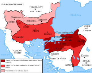
The early borders and expansion of the Ottoman Empire. Although a navy would have been useful, it was not necessary as maintaining land-power dominance to control outlying vassal states. As a result, their navy never developed until later years (image from Wikimedia Commons).

The Ottoman Empire was not always a maritime powerhouse. Until the mid 15th century, the Ottomans were best known for their dominant land forces which they used to counter that landpowers in their neighborhood. This all changed under the Sultan Mehmet II, who intentionally increased the size of the navy to fuel his wars of conquest and, specifically, to go after the greatest city in the medieval world.

Picture - Constantinople - Wikimedia Commons

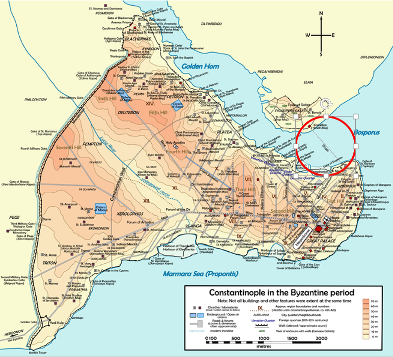
A map of Constantinople and the infamous anti-access, area-denial (A2AD) chain across the Golden Horn. Mehmet II ordered his army to drag ships across the northern landmass to complete the city’s encirclement and take advantage of the lower walls on the city’s northern expanse (image from Wikimedia Commons).

In 1453, Mehmet II conducted his famous final siege of Constantinople. In order to fully surround the city, he needed to move naval forces into the Golden Horn. Unfortunately for him, the Byzantines used a traditional medieval anti-access/area-denial (A2AD) technology to keep out enemy navies; a massive chain lay across the entire expanse (see map above). To achieve his encirclement, Mehmet ordered his army to physically drag his ships out of the Bosphorus to the east of the city and, using logs as rollers, drag them across the northern landmass and deposit them in the western part of the Horn away from Byzantine forces. The move, though daring, was essential but not sufficient for the defeat of the city. Constantinople fell on 29 May 1453 only after the army breached the supposedly impregnable land walls to the west.[i] Even when it played a crucial role in operations, the Ottoman navy played second fiddle to the army.

Picture - Galley of Barbarossa - Wikimedia Commons

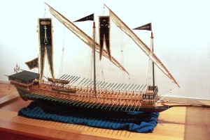
An Ottoman galley. Using sails and oars, the galley could keep moving regardless of weather. The banners with the downward crossed swords at the bow and stern are the colors of Barbarossa while the one depicting three crescent moons is the Ottomans’ imperial flag (image from Wikimedia Commons and the Istanbul Naval Museum).

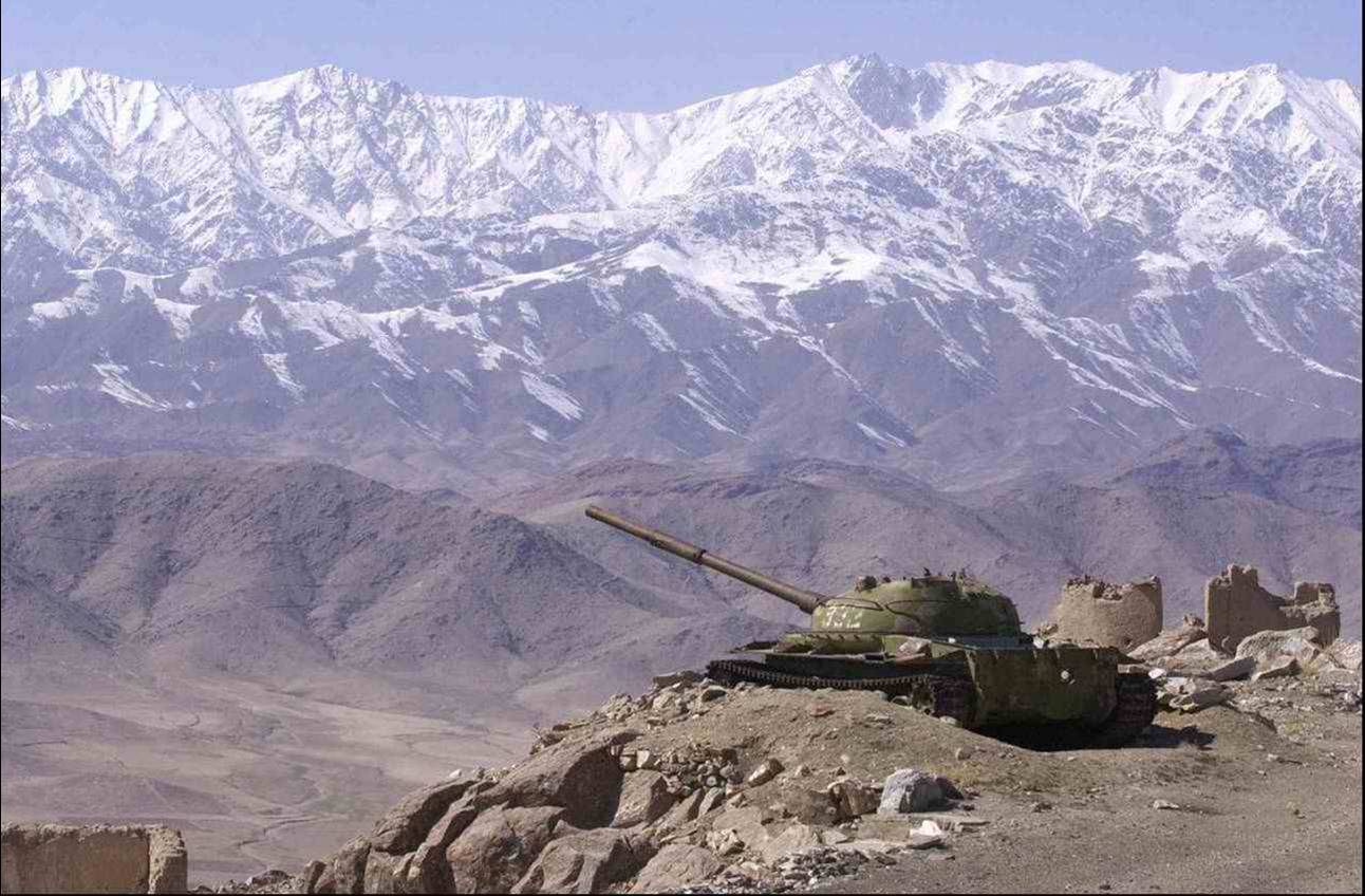
The mainline in the Ottoman navy for most of its history was the galley. For those unfamiliar, the galley was a warship first devised in the Classical era and first made famous in Greece, particularly in its roles in the Persian and Peloponessian Wars in the 300’s B.C. It had two methods of propulsion: sail-power and oar-power. Sails provided the fastest and most efficient speed but, in times of bad weather or no wind, or when rapid movements were needed in close combat, oars provided a useful alternative. Oar-power, while useful, did have a significant drawback: it required a lot of manpower. The Ottomans, however, possessed the bureaucratic acumen to recruit these rowers through a sophisticated administrative and judicial apparatus that levied paid conscripts from provinces around the empire. They divided up recruitment between coastal and inland provinces, leveraging experienced mariners from the coastal levies for work in rigging and the non-maritime minded levies from the inland provinces as rowers.[ii]

Although the 15th and 16th century century saw the rise of the high-sided, sail-powered galleass as a weapon of war, the galley remained a viable military technology throughout this entire period. The galley’s capabilities were not useful on the Atlantic and other harsh ocean waters but, inside the confines of the Mediterranean, their utility was still as manifest in the 1500’s as it was two thousand years earlier; weather was still unpredictable and the Mediterranean, although dangerous, was still not as violent as the deep ocean. Galleys had similar gunpowder armaments as their galleass competitors during this period, so they retained their lethality as well.

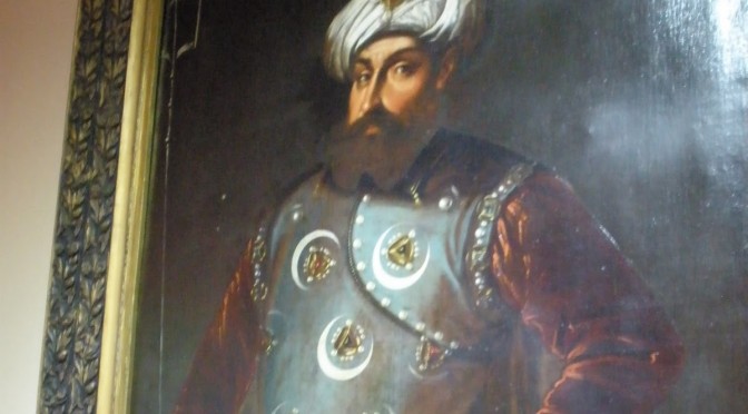
While the Ottomans were causing general mayhem for Christendom in the Eastern Mediterranean through the early sixteen century, including the conquest of Venetian islands and the expulsion of the Knights of St. John from Rhodes, another Islamic force caused similar problems on the Western shores. Piracy was rife across the entire Mediterranean but those in the west were of a particular brutal and effective breed. Chief among these brigands were the forces of the pirate brothers Uruj and Hayreddin.

While these two men were the scourges of the western Mediterranean, they were not natives to the region. The brothers lived and conducted piracy in the Aegean with the tacit backing of the brother of the man who would become Selim I, the ruling Sultan. Selim fought a brutal succession war against his brother but emerged victorious and had his brother executed in 1513. Sensing their mortal peril, the young brothers fled to safer waters in the west[iii]. They made a reputation for themselves there as ruthless raiders but also as folk heroes to the Islamic community when they used their fleets to smuggle Muslim refugees fleeing persecution in Spain. Their efforts were so successful that they amassed enough resources, both money and manpower, to conquer the city of Algiers in 1516, establishing themselves as the Sultans of North Africa and converting one the largest cities in the region into their own private pirate base. It is at this time that Hayreddin acquired his nickname Barbarossa (Red Beard) from European commentators.

Picture - Charles V and Map of Holdings

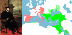
Charles V of the Habsburg Empire. One of the greatest monarchs in European history, he laid the foundations for the world’s first global empire. A map of his European possessions in 1538 is shown on the right in red with Ottoman holdings in green. His personal motto, “Plus Ultra” (onwards and upwards) still graces the Spanish flag to this day (image of Charles from Wikipedia; map from Griffith University in Australia).

Unfortunately for the brothers, 1516 also marked the accession of a new king in Spain: Charles V. Charles was a young, dynamic leader who wanted nothing more than to establish himself as the universal king of Christendom.[iv] He was expansionist minded and could not tolerate the existence of Barbarossa’s raiding fleets in the south. He organized a counter offensive which, with himself at the head, wrested control of Algiers and other cities from the brothers. Uruj himself died in 1518 while fighting the Spanish, leaving Barbarossa to salvage what he could. Salvation came from an unlikely source: Selim I.

Selim I and Barbarossa both needed each other. Barbarossa was desperate for assistance from whatever source he could find to keep his pirate business turned political empire alive. Selim I, meanwhile, was fighting against the Habsburgs in central Europe and needed to maintain as much pressure on Charles V as he could. Selim I also needed a stronger navy to secure lines of supply and communication between the Ottoman capital and the newly-conquered province of Egypt.[v]

Selim I’s assistance to Barbarossa came with strings attached. Barbarossa lost his political independence but retained control of his territory. While Barbarossa retained OPCON over his forces, they were placed under Ottoman jurisdiction, essentially the medieval equivalent of ADCON.[vi] Imperial inspectors would personally inspect each ship, determine their capabilities, and issue a formal letter authorizing them to operate in certain sectors and solely against targets of states at war with the Empire. [vii] Thus was the transition from pirate to a state-sponsored corsair. For those familiar with navy history at this time, these corsairs were exactly the same as European privateers during this period.

Picture - Raids

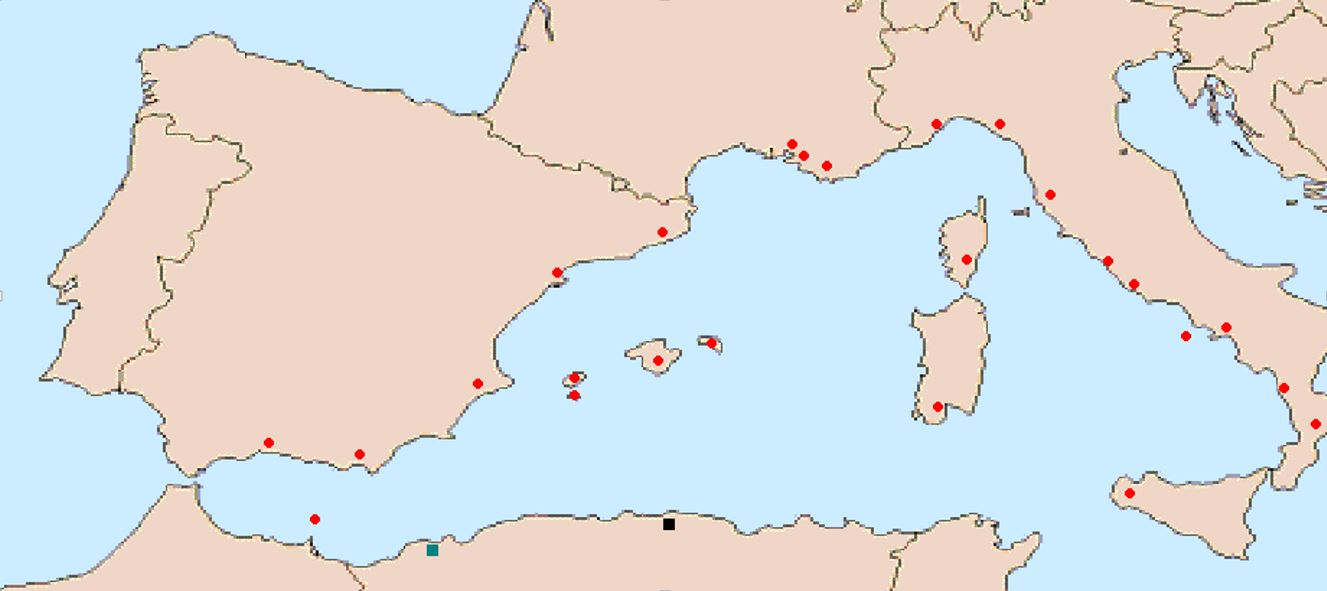
A map depicting the locations of major pirate bases (in black and green) and areas that the Ottomans raided once Barbarossa’s forces were incorporated into the Empire (in red). No one was safe.

The benefits of the partnership paid off quickly. With his newfound resources and top-cover, Barbarossa’s forces were able to push back against the Habsburgs. In the East, Selim I died in 1522 and was replaced with his son Suleyman. Later known as “the Magnificent” and “the Lawgiver,” Suleyman proved a valuable partner and patron for Barbarossa. Suleyman’s forces in the East displaced the troublesome Knights of St. John from Rhodes in 1522,[viii] making them homeless for eight years until Charles V gave them the island of Malta in 1530. Recognizing Barbarossa’s talents and feeling the pressure of Charles V and the other naval superpower, Venice, Suleyman elevated Barbarossa to Admiral of the Ottoman Navy in 1533.[ix] In that same year, the Ottomans concluded a formal alliance with the Habsburg’s perennial European opponent, France.

Charles V was in a tough spot in 1537. Ottoman armies were invading through Hungaryhis North Africa campaign was stalling, and he was embroiled in a brutal war against the Ottoman-allied French in Italy. The Reformation was in full swing, undermining his position as the champion of a Christendom united under Catholicism. His Venetian allies were entirely expelled from the Aegean thanks to Barbarossa’s command of the Ottoman fleets in the Eastern Mediterranean. Charles was on the back foot and needed to find a way to put up organized resistance at sea. Using his position as the strongest Catholic monarch and the Holy Roman Emperor, Charles leveraged the Papal States to create a Holy League of naval powers to finally defeat the Ottomans once and for all. This League, founded in February 1538, was placed under the command of the Genoese pirate-turned-admiral Andrea Doria. Doria’s forces trapped Barbarossa and his 122 ships in the narrow strip of water between the north and south halves of Greece, near the city of Preveza.  Victory seemed assured.

Picture - Preveza Map - Personal

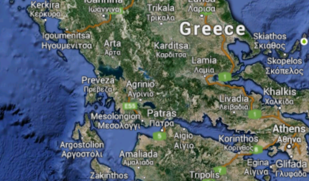
The straits  of Preveza to the left which were the defining strategic moment in the Mediterranean for three and a half decades .

The Battle of Preveza was a disaster for the Holy League. At the outset of the battle, unfavorable winds kept the League’s fleet divided while the Ottoman galleys were still able to maneuver using oar power. Barbarossa, too, outfoxed Doria and seized the initiative despite the Ottomans’ smaller numbers. In total, the League lost 49 ships while the Ottomans did not lose any. The defeat was so lopsided that the Venetians had to pursue a separate peace with the Ottomans in 1540 in which they had to surrender a number of their islands and pay large war reparations. Barbarossa became a rock-star in the medieval naval community. Suleyman made him a permanent member of the Ottomans’ governing council and received fan mail from across Europe, including from the great English privateer Sir Francis Drake.[x] The Eastern Mediterranean was transformed into the so-called Ottoman Lake which freed up additional resources to fight the Habsburgs in the West. The Ottomans, despite their humble beginnings, truly evolved from dragging ships across the land to become the strongest naval power in the Mediterranean.

Lessons Learned

1)     Be a realist and do not take things personally.

It would have been very easy for Selim I to get hung up on Barbarossa’s connection to Selim’s executed brother and ignore Barbarossa’s plight in 1518; worse yet, Selim might have welcomed Charles’ efforts against Barbarossa. Instead, Selim recognized a win-win opportunity and incorporated them into the Ottoman fold.

The same thinking goes for Suleyman’s cooperation with Christian France. Without the French causing trouble for Charles V, Barbarossa might have faced even more ships at Preveza and failed to triumph. Realism wins the day.

2)   Meritocracy is the best way to select commanders

Just as Selim I could have easily overlooked Barbarossa’s difficult position in 1518, Suleyman could have easily overlooked the corsair for the position of Admiral of the Navy in 1533. The historical precedent was for the governor of the Dardanelles province, with the largest armory and naval base in the Empire, to be the Admiral[xi] but Suleyman took a chance and elevated the former pirate instead. This meant that the brilliant commander was in place for the Battle of Preveza whereas other commander might have failed to deliver a victory.

3)    Technology is not enough to win. Also, old technology does not mean bad technology.

The victory at Preveza was only possible because the Ottomans used galleys rather than galleasses. Even though the initial design was pioneered millennia earlier, galley technology still had utility in the strategic game that the Ottomans played. Also, as Barbarossa’s actions against Andrea Doria at Preveza demonstrated, a good commander plays a greater role in a battle’s outcome than numbers or technology.

Matthew Merighi is a civilian employee with the United States Air Force’s Office of International Affairs (SAF/IA) currently transitioning to pursue a Masters’ Degree at the Fletcher School. His views do not reflect those of the United States Government, Department of Defense, or Air Force but is pretty sure the Navy is glad it does not have to fight Barbarossa in his prime.

References

[i] Imber, Colin. The Ottoman Empire, 1300-1650: The Structure of Power. United Kingdom: Palgrave Macmillan, 2009, p. 28-29.

[ii] Imber 2009, p. 306.

[iii] Imber 2009, 47.

[iv] Fodor, Pal, Geza David, and Gabor Agoston. Ottomans, Hungarians, and Habsburgs in Central Europe: The Military Confines in the Era of Ottoman Conquest. Netherlands: Brill, 2000, p. 154.

[v] Gürkan, Emreh S. ‘The Centre and the Frontier: Ottoman Cooperation with North African Corsairs in the Sixteenth Century’. Turkish Historical Review, 2010, p.132

[vi] For those unaware of the modern military terms, OPCON stands for “operational control” while ADCON stands for “administrative control.” OPCON is given to a person who ADCON denotes who is responsible for ensuring the administrative functions that support forces at sea. Basically, those with OPCON give people orders and those with ADCON tell people when their paperwork is out of order.

[vii] “Corsairs and the Ottoman Mediterranean,” Emrah Safa Gürkan and Chris Gratien,Ottoman History Podcast, No. 76 (October 26, 2012) http://www.ottomanhistorypodcast.com/2011/04/ottoman-mediterranean-corsairs-with.html

[viii] Imber 2009, 49.

[ix] Imber 2009, 51.

[x] “Corsairs and the Ottoman Mediterranean,” Emrah Safa Gürkan and Chris Gratien,Ottoman History Podcast.

[xi] Imber 2009, 297.

The Mumbai Attack: Terrorism from the Sea

This is an article in our first “Non Navies” Series.

Nearly six years ago, Pakistani terrorists from Lashkar-e-Taiba (LeT, meaning Army of the Righteous) launched a sophisticated raid on the Indian port of Mumbai. Ten LeT operatives held the city captive from 26-29 November 2008, killing 164 people and injuring more than 300 others. Fascinating in its counterterrorism aspects, the Mumbai attack is particularly noteworthy for those of us in maritime professions because of how they got there: by sea. LeT highlighted in detail how an irregular organization can circumvent landward control measures by turning to the maritime environment.

A pre-26/11 U.S. Department of State fact sheet on Lashkar-e-Taiba.

Violent extremist organizations (VEOs) such as LeT succeed in irregular warfare by going where government authority is absent or insufficient. The Indo-Pak coast is no exception. The expansive region has supported the livelihood of fishermen and merchants for centuries, making it a permeable environment where minimal government presence was (and remains) tolerant of transient craft. Such an environment offers myriad advantages compared to overland routes where government checkpoints and patrols are far more rigorous. VEOs continue to pursue these overland routes for infiltration or smuggling, but LeT minimized the chance of their high-stakes attack being interdicted by Indian authorities when they chose to come by sea.

The raid itself wasn’t the first iteration of LeT’s maritime infiltration. For example, in late-2006/ early-2007 eight operatives rendezvoused at sea with Indian LeT members aboard an unidentified fishing vessel and returned with them to reconnoiter Mumbai. This gave them ample opportunity to assess the coastal pattern of life, including security presence and traffic density, as well as to gather imagery of everything from landing sites to target location from the perspective of the raiding party. Once ashore they split into two-man teams, just as the raiding party would do, observing the area by travelling from safehouse to safehouse. They were not discovered during the seaborne infiltration nor during the reconnaissance of Mumbai. However, two of the eight were arrested in March 2007 by the Jammu & Kashmir police (Jammu & Kashmir being a state in northern India). During interrogation the two suspects gave specific information about their infiltration of Mumbai as well as LeT’s desire to use the sea as a routine ingress. Neither this shot-across-the-bow nor corroborating intelligence provided by U.S. and Indian agencies proved sufficient to energize India’s maritime security agencies.

After more than a year of training on the Mangla Dam reservoir in Kashmir, the raiding party departed Karachi on 21 November 2008 aboard motor vessel HUSSEINI. They spotted the Indian fishing vessel KUBER two days later in Pakistani waters. Though their plan had been to hijack a Mumbai-based craft in Indian waters, KUBER’s Indian registry enticed them to seize it as an early opportunity. They were able to come alongside, possibly by feigning distress, and quickly commandeeredthe fishing boat. The raiding party embarked KUBER and transferred all of her crew except the master to HUSSEINI. The raiders started towards Mumbai after the equipment was moved aboard and HUSSEINI returned to Karachi. The four fishermen taken from KUBER were executed, their bodies left adrift on the sea.

The transit to Mumbai was filled with map reconnaissance, table-top rehearsals, equipment prep, as well as probable comms checks and intel updates from LeT’s ad hoc operations center in Pakistan. KUBER arrived off the coast of Mumbai unscathed and unaddressed by maritime authorities on the evening of 26 November. The master was bound and his throat slit. The raiding party assembled their inflatable Gemini boats (counts vary from one to three), transferred their equipment and began the 4 NM insert under cover of darkness. KUBER was left adrift with a GPS, satellite phone, and other materials that would prove instrumental in developing the backstory during the subsequent investigation.

It’s unknown where the inflatable craft parted company (assuming there was more than one), but multiple beach landing sites were used. In the truest sense of camouflage, the boat(s) were not colored black and green to blend into the night, but bright yellow to blend

One of the boats used by LeT to insert into Mumbai.

into the menagerie of local craft- undoubtedly a result of the early reconnaissance. At one site the operatives cheerfully claimed to be college students. At the other site they responded gruffly to locals, telling them to mind their own business, possibly even displaying their weapons. They continued unhindered in both cases, abandoned their craft on the beach, and shortly thereafter waltzed into history as executioners in a horrific raid.

To recap: LeT reconnoitered by sea, trained on Pakistan’s inland waterways, departed a major sea port (Karachi), hijacked a fishing vessel illegally operating in Pakistani waters/EEZ, transited unmolested across 500 NM of Indo-Pak littorals, amphibiously inserted into the Mumbai metropolis unchallenged, and came ashore unnoticed save for a handful of local fishermen accustomed to illicit maritime activity.

LeT violated the Indo-Pak littorals with impunity and conducted a raid heralded as a wake up call for maritime terrorism. This raid indeed required a great deal of competence, but VEOs embracing riverine or littoral waters as a maneuver space should not have come as any surprise. Then and now, the Niger River Delta and the Gulf of Guinea were abused by criminal organizations on a daily basis; Philippine waters were plagued by Abu Sayyaf; Colombian Riverines routinely battled the FARC and AUF; and in the U.S.’s backyard were organizations trafficking drugs, money, and violence through the Caribbean, Western Pacific, and Rio Grande. Oceans and waterways are indeed the vital connective tissue of the world, but they are open for both legitimate and illegitimate business alike.

So how do nations prevent VEOs from gaining an advantage in the maritime domain? First, by viewing the fight against irregular enemies as more than a footnote to the Mahanian themes used to define influential maritime powers. Thirteen years of war in Iraq and Afghanistan have taught our landward compatriots a valuable lesson: maneuver warfare is on the back-burner and irregular adversaries are in. The world’s maritime agencies must adapt that lesson themselves or risk learning its reality firsthand in the aftermath of attacks like Mumbai, the USS COLE, or SUPERFERRY 14.

One way of adapting that lesson would be borrowing two key themes from counterinsurgency: presence and engagement. Simply put, government authority must be present to win. That’s easier said than done when talking about enormous littoral and riverine areas. The key must then be cooperation. Within a country, that means developing a culture of partnership amongst government agencies (e.g. Customs, Coast Guard, local law enforcement) to supplement each other’s presence and intelligence efforts. No one agency can be everywhere, but a network of agencies can cover waterspace far more effectively. That cooperation and partnership must also be extended across national borders since, as we have seen, VEOs are not bound by such borders. Here we can find a blend of Mahanian themes and irregular fights- countries who can project seapower beyond their local shores can train and enable

U.S. Navy Riverines discuss tactics with their Colombian counterparts using a hasty terrain model.

the local seapower partner nations, thereby strengthening both. But they must have the right tools (i.e., riverine and littoral units) with the mindset for the job, neither of which can be best employed until irregular warfare moves beyond its footnote status.

Next, local maritime communities must be engaged. The fishing and merchant culture which was mentioned earlier as giving rise to the permeable maritime environment may be the best asset for monitoring it. These tradesmen have numerous networks, both formal and informal, that if partnered with or sourced by human intelligence professionals may reveal nefarious activity (e.g., combat training on Mangla reservoir or strangers who are out of place in Mumbai). Additionally, reliable engagement builds trust, which in turn builds security by aligning the interests of local communities and lawful government for mutual benefit. If the government is the trusted partner of the community, then this is precisely anathema to the VEOs which wish to destablize the community or exploit the disconnect from government to conceal their operations.

VEOs and irregular warfare in the maritime domain are not up-and-coming prospects, they have been here for some time. High-visibility attacks such as the Mumbai raid bring them to the foreground every so often, but after the 24-hour news cycle returns to mundane matters these VEOs continue to skillfully exploit the world’s waterways. There is, frankly, nothing new about what has been said here. But for the time being, these suggestions bear reiterating so we can fuel the discussion and move the ball forward.

Alan Cummings is a 2007 graduate of Jacksonville University. He served previously as a surface warfare officer aboard a destroyer, embedded with a USMC infantry battalion, and as a Riverine Detachment OIC. The views expressed here are his own and in no way reflect the official position of the U.S. Navy. 

The Geographic Limits of National Power

It is surprising that in the fine group of “personal theory of power” essays CIMSEC ran jointly with The Bridge May-June, no author selected strategic geography as a subject source. Despite advances from steam power to cyber communications that have reduced the relative size of the world, large geographic obstacles like the Hindu Kush mountain range in Afghanistan and vast empty space of the Indian Ocean continue to cause trouble for even the most powerful states.

Geopolitical theorists from Sir Halford Mackinder to journalist Robert Kaplan have warned  of the pitfalls of ignoring geography in strategic calculations and estimates of national power. Successful great powers always included strategic geography in their deliberations up through and including the period of the Second World War.   The advent of a muscular and well resourced Cold War, buttressed by an arsenal of advanced nuclear and conventional weapons convinced many U.S. decision-makers  that strategic geography was a concept of the 19th rather than the 20th century. The Kennedy administration completed this break with the past in its implementation of the doctrine of “Flexible Response” as the cornerstone of U.S. strategic thought. As stated in Kennedy’s inaugural speech, the United States would employ its vast technological and financial resources to “support any friend” and “oppose any foe” regardless of geographic relationship to U.S. strategic interests. Despite the debacle of the Vietnam War, the U.S. was largely able to continue this policy until the very recent past.

Afghanistan_18Now, a combination of decreasing military budgets, a smaller armed force,  and public disinterest in supporting causes not directly tied to U.S. interests demands that the U.S. return to a rigorous practice of geopolitical calculation. It must exercise discipline in determining how, where and when to commit military forces in defense of national interest. The examples of Afghanistan and the Indian Ocean demonstrate the fundamental limits geography can impose on national power. They also illustrate an important law in geostrategic analysis. A nation may overcome geographic barriers like the Hindu Kush or the Indian Ocean, but such an achievement requires technological and financial commitment. If such effort is not sustained, geographic limitations will again impose their effects.

The cases of conflicts in Afghanistan and control of the Indian Ocean over history illustrate the limits geography exposes on national power. Isolated by a series of geographic barriers including the Hindu Kush mountain range, Afghanistan remains a remote location. Its unique series of mountain passes in key locations has drawn Eurasian conquerers from the dawn of history. These men and their armies came not so much to capture Afghanistan, but rather to control these mountain passes that form a virtual “roundabout” for transiting in and around Central Asia. Control of Afghanistan throughout history has meant easy access to Iran, the Indian subcontinent and northern Central Asia.

Afghanistan’s false reputation as a “graveyard of empire” comes not so much from it’s inhabitants who seem to habitually resist any attempts at outside control, but rather the problem of maintaining a large force in such a remote region. Western armies from Alexander the Great to the present U.S. and NATO force in the country have had to create a long, tortuous, and expensive supply line into or though Afghanistan in order to sustain their military operations there  or in adjacent lands. Alexander, British imperial forces in three wars, and now American and NATO forces have always crushed Afghan resistance and have been able to maintain a reasonable amount of control within the region. They have departed only when deprived of the economic support that provides the technological edge to their warfighting and logistics capabilities. A nation can maintain an army of many thousands in Afghanistan, provided that power or group of powers is willing to fly in supplies or negotiate their delivery through unfriendly states over long and difficult overland routes. Now that financial support for the technological effort necessary to sustain a large Western force in Afghanistan is failing, the limits of geography are again re-imposing themselves on the remote Central Asian region.

The Indian Ocean has equally proved itself a vast and relatively remote space from the early 1400’s when Chinese Admiral Zheng He sailed its waters seeking trade and building Chinese influence to recent, frustrating efforts to located missing Malaysian Air Flight 370. When the Chinese Ming dynasty decided to forgo further Zheng He voyages in 1424, either for economic reasons, an intensified Mongol threat, or just superstition (the accounts vary), geographic limits returned with later, deadly results for the Chinese empire. Nascent European powers like Portugal, the Netherlands, and the British were able to penetrate and control the Indian Ocean and its key chokepoint connections to the Pacific. In just 200 years, the once omnipotent Chinese Empire found its coastline controlled by powerful European naval forces.  The Chinese failure to appreciate the geographic limits of seapower caused the near-dismemberment and wreck of the Chinese state.

The British Empire also lost control of the Indian Ocean when it failed to either fully fund its naval presence there or fully implement a technological solution to mitigate funding shortfalls. A series of Royal Air Force (RAF) facilities, originally conceived to support air policing of imperial holdings became a crucial element of British efforts to control the Indian Ocean in spite of reduced naval expenditures. This network of RAF installations became even more important after the Second World War as the strength of the Royal Navy (RN) plummeted and newer, longer-ranged aircraft could patrol wider areas of ocean, especially when equipped with radar. The British finally abandoned this network of installations in the 1970’s as their naval presence in Singapore came to an end. When this happened, the limits of geography were re-imposed and the Indian Ocean again became a relatively un-patrolled open space. This vacuum of power allowed the Soviet Navy to enter the Indian Ocean with nuclear cruise missile submarines and threaten U.S. forces in transit, as well as Australian interests.

The United States would do well to respect these examples of geographic limits, as significant financial restraints limit future U.S. military efforts. Extreme geographic disadvantage can be overcome by a combination of financial and technological solutions.  In the absence of such effort however, geographic limitations again impose effects and limit the exercise of national power. With a shift in U.S. attention to the large Indo-Pacific region, geographic obstacles to the exercise of U.S. power will require innovative, well funded technological solutions. The U.S. must fund these efforts, such as improved unmanned platforms, better offensive and defensive capabilities for naval units and improved space-based surveillance of the region. Neglecting such actions will create significant geographic barriers to the exercise of U.S. national power in the Indo-Pacific region.

Steve Wills is a retired surface warfare officer and a PhD student in military history at Ohio University. His focus areas are modern U.S. naval and military reorganization efforts and British naval strategy and policy from 1889-1941. He posts here at CIMSEC, sailorbob.com and at informationdissemination.org under the pen name of “Lazarus”.

Expanding the Naval Canon: Fernando de Oliveira and the 1st Treatise on Maritime Strategy

Every community has a canon that best encapsulates the genealogy of personalities, ideas, and events that shape the way the community sees itself and is perceived by others. The naval community is no exception. This article suggests that an important monograph has been overlooked in that canon: Fernando de Oliveira’s “The Art of War at Sea” published in 1555. It is the oldest treatise on maritime strategy.

The naval lore and the mainstream canon
Maritime strategy and war at sea have long occupied the minds of sailors and statesmen. The scholarly study of maritime strategy, however, is a relatively recent endeavour. Its roots in the modern western tradition are found in the United Kingdom during the latter half of the 1800s.

Authors such as the Colomb brothers, Sir John Laughton, and, more famously, Sir Julian Corbett were among the first to muster a robust understanding of strategy in discussions of naval problems. The United States soon followed suit as Alfred Mahan, William Sims, and Willis Abbot, among others, penned numerous other works to an increasingly sophisticated naval lore.

Not surprisingly, the standard account of the disciplinary evolution of maritime strategy and naval affairs reflects this Anglo-Saxon outlook. This account is taught in naval academies and some civilian universities around the world, further reinforcing the existing canon. Other influences surely contribute to the debate, including Jomini and Beaufre, and even ancient Greeks, such as Thucydides and Themistocles, but by and large the naval lore is founded on works dealing with the British and American experiences at sea.

Fernando de Oliveira’s “The Art of War at Sea” (1555)

In its rise to become the first global maritime empire, Portugal had to develop an understanding of maritime strategy that enabled the achievement of its political aims. Like Britain’s Corbett and America’s Mahan, Portugal’s greatest maritime strategist was Fernando de Oliveira. Writing at the peak of Portuguese power, Oliveira put in writing the foundations of that global empire.

Fernando de Oliveira’s “The Art of War at Sea” (Arte da Guerra do Mar), published in Coimbra in 1555, stands as the oldest treatise on maritime strategy. Oliveira himself acknowledges that very little had been written on the subject; he only refers to Vegetius (4th century AD) for his important but sparse insights into naval warfare. In historical context, Oliveira wrote this treatise three centuries before Corbett, Mahan, and others acquired the habit of thinking strategically about naval warfare. So what can we find in Oliveira’s “The Art of War at Sea”?

Frontispiece of the original "Arte da Guerra do Mar" (1555), by Fernando de Oliveira.
Frontispiece of the original “Arte da Guerra do Mar” (1555), by Fernando de Oliveira.

The book is divided into two parts, the first dealing with the principles of war at sea whereas the second explores its conduct. Each part has fifteen chapters. The genius of Oliveira’s work is found not merely in his (dated) analysis of Portugal’s 16th century navy, but, more importantly, in his comprehensive grasp of the (perennial) foundations of maritime power. The chapters focus on topics such as just war theory, strategic theory, leadership, shipbuilding, logistics, personnel recruitment and retention, and military readiness. And this is just in the first half. The second part goes on to tackle force structure, situational awareness, oceanography, and intelligence, among other topics.

These are obviously modern terms to describe very old phenomena. However, the challenges of 16th century naval power are not dissimilar to those of today’s navies whose countries depend on the sea for wealth and prestige. Oliveira, like Corbett and Mahan, was aware of this and expressed it in the opening pages of the treatise. Discussing naval matters, the author argues, “is a useful and necessary matter, particularly for the people of this land [Portugal] who now fare more at sea than others, whereby they gain many profits and honour, and also run the risk of losing it all, if they do not preserve it […].” This verdict ought to resonate contemporary strategists from nations such as the United States, Britain, and Japan, but also those strategists whose countries have maritime ambitions, such as China and India.

Fernando de Oliveira (or Fernão de Oliveira) was an interesting man living in interesting times. A true polymath educated in a Catholic seminary, it soon became evident that God had other plans for him. Oliveira dwelled in the maritime community of Lisbon, then as now a capital with an umbilical connection to the sea, learning key skills that made him a valuable asset for any navy. These skills included: navigation (he became a pilot aboard a French warship in expeditions against British commerce); shipbuilding (two English kings coveted his counsel whilst a prisoner of war in London); negotiation (he led a prisoner exchange when a Portuguese military expedition to north Africa failed; and possibly espionage (some sources mention his spying for the Portuguese Crown in negotiations with the Vatican).

In between his adventures, Oliveira wrote invaluable works that rival “The Art of War at Sea” in scope and insight. These include the world’s first encyclopaedic treatise on navigation and shipbuilding entitled Ars Nautica (ca. 1570), which he later expanded into the first treatise on naval architecture, Livro da Fabrica das Naos (ca. 1580), the first book on Portuguese grammar, Grammatica da Lingoagem Portuguesa (1536), and one of the first books on Portuguese history, Historea de Portugal (ca. 1581). These works attest to Oliveira’s genius. Unlike Corbett, who entertained a career as a novelist at first, Oliveira made a lasting literary contribution to fields beyond maritime strategy.

Conclusions
There is every reason for Fernando de Oliveira’s “The Art of War at Sea” to become compulsory reading for sailors, mariners, strategists, historians, and laymen with an interest in the complexity of conflict at sea. I will highlight only four of them.
First, the book is a distant yet direct ancestor to the current mainstream canon of maritime strategy. Incorporating this source into the canon and submitting it to academic scrutiny will help illuminate the origins of Western maritime strategic thought.
Second, there is an inherent value in studying Oliveira’s work in the context of naval warfare in the age of sail, particularly Portugal’s path toward a global maritime empire.
Third, the book retains great relevance for current debates on maritime strategy. Oliveira’s thoughts on the building, maintenance, and deployment of navies in the pursuit of policy can inform decision-makers, analysts, and the larger policy community on the often misunderstood nature and character of naval warfare.
Fourth, “The Art of War at Sea” can foster a debate on broader issues of strategy and power in light of existing scholarship on just war theory, military leadership, defence economics, and so forth.

In conclusion, it is high time for the naval community to retrieve Fernando de Oliveira’s “The Art of War at Sea” from the dustbin of history. My current efforts to translate the treatise to English will hopefully set this process in motion.


Tiago Mauricio is a WSD-Handa non-resident fellow at Pacific Forum CSIS. He holds an MA in War Studies from King’s College London and is continuing his studies at Waseda University, after spending two years as a researcher at Kyoto University, Japan. He is currently translating Fernando de Oliveira’s Arte da Guerra do Mar (1555) to English.