All posts by Guest Author

The Nanxun Jiao Crisis and the Dawn of Autonomous Undersea Conflict

Fiction Topic Week

The following story is the next installment of a series on micronaval warfare. Read Part One of Admiral Lacy’s oral history on the emergence of micronaval warfare, “The Battle of Locust Point.”

By David R. Strachan


TOP SECRET/NOFORN

The following classified interview is being conducted per the joint NHHC/USNI Oral History Project on Autonomous Warfare.

Admiral Jeremy B. Lacy, USN (Ret.)

November 19, 2033

Annapolis, Maryland

Interviewer: Lt. Cmdr. Hailey J. Dowd, USN 


Good morning.

We are joined again today by Admiral Jeremy B. Lacy, widely considered the father of autonomous undersea conflict, or what has come to be known as micronaval warfare. Admiral Lacy spearheaded the Atom-class microsubmarine program, eventually going on to establish Strikepod Group 1 (COMPODGRU 1), and serving as Commander, Strikepod Forces, Atlantic (COMPODLANT). He is currently the Corbin A. McNeill Endowed Chair in Naval Engineering at the U.S. Naval Academy.

This is the second installment of a planned eight-part classified oral history focusing on Admiral Lacy’s distinguished naval career, and his profound impact on modern naval warfare. In Part I, we learned about the genesis of the Atom-class microsubmarine and its operational construct, the Strikepod, and the series of events leading up to the first combat engagement of the micronaval era, the Battle of Locust Point, where a Strikepod of prototype Atoms tracked and engaged several Russian Istina-class microsubmarines prowling the upper Chesapeake Bay during Baltimore Fleet Week, 2016. Today our discussion will focus on the aftermath of Locust Point, the continued development of the Atom-class microsubmarine, as well as the early days of autonomous undersea conflict, including the first major confrontation of the micronaval era, the Nanxun Jiao Crisis.

The period following Locust Point was a time of high tension and uncertainty. With the United States now facing an unprecedented undersea threat to both the homeland and forces abroad, the president, through a series of classified executive orders, mobilized a full range of U.S. defensive capabilities. This included authorizing a broad expansion of the Atom-class microsubmarine program via the Joint Undersea Initiatives Group (known colloquially as FathomWorks), a consortium of leading defense contractors and specialized units of the United States Navy, Coast Guard, and Marine Corps charged with, among other things, developing a coastal undersea network to defend against foreign micronaval threats.

We joined Admiral Lacy again at his home in Annapolis, Maryland.

Let’s begin today with FathomWorks. Paint the picture, if you will, of those early weeks in the wake of Locust Point.

It was all about testing, evaluation, and improvement. The Atom had performed admirably, but for all intents and purposes, it was still a prototype, and there were serious gaps in coms and navigation that needed addressing, as well as kinks with Falken [the Atom’s artificial intelligence]. Our vision for the Atom-class was achievable, but in order to get there we had to enhance Falken dramatically. Strikepods would be operating – and fighting – in a complex, communication-denied environment for extended periods. This demanded a highly advanced form of artificial intelligence, as well as a more evolved approach to human-machine teaming.

We emerged from Locust Point feeling pretty validated, and confident that Strikepods could be more than just another club in the bag, that they promised much more than minehunting or intel gathering. We knew that this was a capable platform in and of itself that could be integrated into the fleet at the operational level.

But there was no time to dream and tinker. Our mandate was clear, and the sense of urgency was unmistakable. The Russians were on the move, and the threat they posed to our security was greater than at any time since the Cold War. Our analysts had taken one on the chin with Locust Point, but they’d been warning for months that Moscow was working on something highly advanced and very closely guarded, but there was no indication that anything was operational, much less poised to invade our inland waters. A lot of folks at the Pentagon laughed it off. But they weren’t laughing now, especially when we took a closer look at Poseidon.

So Locust Point influenced the Navy’s perception of the Poseidon program?

When we first heard of it, it seemed more implausible than Istina. That the Russians had the know-how or the resources to develop an autonomous microsubmarine was difficult enough to believe, but when we started receiving information on a nuclear-tipped autonomous torpedo, we were honestly beginning to wonder if we were the target of a wildly excessive disinformation campaign. Even when we received intelligence that it had been test fired from the Sarov, we just didn’t see it as a viable platform. But the Istina changed all that.

In what way? 

If the Russians were capable of the miniaturization and AI integration – and audacity – we’d experienced with the Istinas, then we had to assume that Poseidon would eventually threaten our shores as well. We needed a viable micronaval defense.

And so the Atlantic Undersea Network was born? 

Yes. The Atom was incredibly flexible by design, and could be configured to fulfill a multitude of roles. We’d been tossing around concepts for mine warfare, including a variant optimized for the seabed, something akin to a mobile, local area SOSUS, with the capability to detect and engage both surface and subsurface targets. The idea, conceptually, was to have Strikepods fanned out across the seabed near certain approaches to the eastern seaboard – Bangor, Boston, New York, the Chesapeake, Norfolk, Kings Bay. These would serve as the ears for either roving hunter-killer Strikepods, or Atoms housed in undersea microsubmarine batteries. In this way, AUDEN would essentially be an integrated minefield.

The signature feature of the seabed-optimized Atom was the Advanced Seabed Warfare module which, in addition to providing a suite of highly advanced communication and sensor technologies, also housed the SEASTAR [Seabed Static Array] – a passive microsonar array that would deploy from the module and extend about 150 feet upward into the water column. With their SEASTARs deployed, the networked seabed Atoms could act as a large array, identifying and classifying targets and passing that information along to the Strikepods – either roving, or turret-based.

AUDEN was clearly prompted by the immediacy of the Russian micronaval threat, but were you also troubled by other adversary programs, such as the Chinese Shāyú-class microsubmarine? 

We were keenly aware of adversary developments, particularly with the PLAN. The intelligence we’d been receiving on the Shāyú was spotty, but given China’s public successes with Haiyi gliders and deep diving vehicles like the Hailong III, as well as their commitment to an Undersea Great Wall, we were fairly confident that not only did the program exist, but that it was in all likelihood operational. And it wasn’t long before our suspicions proved correct.

In the South China Sea? 

About six months after Locust Point, late in the spring of 2017, I got a call from Seventh Fleet inquiring about our progress on the improved Atom, and whether we’d be up for an overseas deployment. At that point we’d pretty much improved the coms issues, and Falken’s training and testing was nearly complete. After checking with the engineers, we thought we were up for the challenge, and on April 1, 2017, half a dozen 5-ship Strikepods were deployed to the Spratlys in what was called Operation Eminent Shadow. Each pod’s initial configuration was one rogue, two remoras, and two relays, and their mission was to carry out general ISR and ASW operations, focusing primarily on the waters off of Subi, Mischief, and Fiery Cross, and to escort both surface ships and submarines performing FONOPS throughout the central Spratlys.

So there was harassment under the sea as well? 

Oh, absolutely. Of course, none of these encounters ever made headlines. It simply wasn’t in anyone’s interest to publicize them, and anyway there was more than enough high-profile harassment happening on the surface to keep the public and media buzzing.

The concerning thing was that Chinese subs were showing up unexpectedly, at times and places that suggested they knew where we were. Their Y-8s were dropping buoys practically right on top of our boats, and destroyers and frigates would show up suddenly to shoo us away. It was reminiscent of what we were experiencing with our boomers right before the Istinas showed up at our front door. Needless to say, COMPSUBPAC’s hackle was up. So the Strikepods were there to help figure out what the hell was going on.

Were they under the control of COMSUBPAC?

Actually, they were under the control of COMPODGRU 1, out of Norfolk, Virginia. There’d been a great deal of debate over this – whether Strikepods were a platform or payload, whether there should be a centralized Strikepod command versus a more decentralized payload approach. But we pointed at the Air Force piloting Reapers and Predators out of the southwest, and said look, there’s no reason why Strikepods can’t be run out of Norfolk, particularly when we’re talking about providing a persistent forward presence like any high-value asset.

So we’d airlift the Atoms to Guam, load them onto waiting Virginias, who’d then deploy them – from the torpedo tubes, initially, until we were able to fully integrate a launch and recovery system with the Virginia Payload Module.  And then we’d get to work, reporting contacts, keeping tabs on the PLAN. We were even able to test the Remora Module in a live environment, tracking a Yuan-class submarine for ten straight days all over the Central Spratlys. It was all going pretty smoothly, with high fives all around. But the Chinese were still showing up unannounced.

What was it like when you finally encountered the Shāyú? 

It was another day of Eminent Shadow, nothing particularly unusual. It’s Caitlyn’s thirteenth birthday, and I’ve got chaperone duty at 1400 for ice-skating and a fondue dinner, so I skip out early, but then at around 1545 I get an “urgent” from the watch: Something’s happened.

When I get back, the place is going bananas, and a watch officer briefs me. One of our Strikepods – Delta – on patrol off Subi had detected three small contacts closing at about fifteen knots. Initially they were classified as biologicals, given their signatures and behavior, and sensing a collision, the rogue ordered evasive action, accelerating and diving, while ordering a relay to break off and come shallow, probably to ensure communications. A second later, one of the contacts breaks formation and heads toward the relay.

So now Falken is faced with something it’s only experienced in the lab. We’d been developing some rudimentary combat tactics and introducing them into the training regimen, running scenarios where Falken would encounter something hostile. But in almost every case it chose to flee rather than fight. There were just too many variables, too much ambiguity for it to go lethal without a human on the loop giving the order.

The first contact reaches the relay and their signals promptly disappear. With the two remaining contacts closing on Delta, Falken orders Flee, and the Atoms scatter. The contacts split up and lock on to the two remoras, and thirty seconds later they also disappear. The rogue scans for additional threats, and finding none, orders relay-2 to head to the surface to phone it in.

Fortunately Falken had ordered all ships to fire their onboard imaging systems, so from the moment Delta went evasive there was running video. Of course 99 percent of it was just black water and bubbles, but there were five screen grabs that were very compelling.

You had a visual? 

It was another one of those moments – like Cape Charles when we first laid eyes on an Istina. I was honestly half expecting to see an eye, some flukes, or a long jaw and teeth. But there it was – a short hull, a propulsor. We knew it then – we’d just encountered the Shāyú-class microsubmarine.

Was there continued harassment by the Shāyús during Eminent Shadow? 

Almost daily, and as such there was a real sense of urgency at FathomWorks to get Falken in a place to adequately defend itself. We were losing Atoms at a rate of nearly five per week. They needed to fight back.

Were there no attempts at communication? No back channel diplomatic overtures by either side? 

It’s important to understand – this was the dawn of autonomous undersea conflict, a time when there were very few environments left for sovereign governments to carry out covert operations without risk of exposure. The Chinese tactics were risky, to be sure, but they believed – correctly – that we had a shared interest in keeping this sort of thing quiet. The undersea community, regardless of nationality, has always been characterized by a cult-like devotion to secrecy, and in the unmanned era, it would be no different. In fact, in some ways there would be an intensification of that silence, if you will, given the willingness to take greater risks with systems that were hidden from public scrutiny, and posed no risk to human life.

But the risk, of course, was that this new type of conflict could spill over into the manned, visible world and precipitate a more serious, potentially bloody crisis. I’m referring, of course, to the Decatur, and the Nanxun Jiao Crisis. 

Yes, of course. Just because the conflict is unseen and unmanned doesn’t insulate it from the overarching strategic reality. It’s woven into that reality, and its effects can indeed break the surface and escalate, as it did at Nanxun Jiao.

Can you tell us about the Decatur incident, and the events leading up to the strike on the Nanxun Jiao installation? 

So, after Subi we could confirm the Shāyú’s existence, and that the Chinese were serious about it as an ASW platform. It was an eye-opener for sure, but beyond that we knew very little – its capabilities, performance characteristics, or Chinese microsubmarine tactics, or doctrine. But then we had a HUMINT breakthrough.

CYAN? 

In early 2018, we get a call from the CIA station chief in Manila. Apparently the embassy received something in the mail that might be of great interest to us – a letter with a simple handwritten sketch of what looks like a missile turret, but on closer inspection the missiles are actually small submarines. Below that sketch are a series of random dots that are actually a fairly accurate representation of the Spratlys. One of the dots has a circle drawn around it – the northern reef of the Gaven Reefs, what the Chinese call Nanxun Jiao.

Needless to say, we were intrigued, but what was particularly intriguing was how the sketch bore a striking resemblance to our working concept for AUDEN.  So the CI folks immediately open a file, and we’re left pondering the possibility that the Chinese have deployed a battery of microsubmarines, and that it could be based on a design stolen from a highly classified U.S. Navy program.

What was the response? 

Well, we were alert to the possibility of disinformation, but to what end? To draw us in to Nanxun Jiao? A lesser-militarized island, one that appeared to be used primarily for logistics and resupply?

We weighed the options carefully, and ultimately decided we needed to take a look. Rather than divert resources from Eminent Shadow, we shipped a new 5-ship Strikepod via SH-60 to the nearest destroyer, USS Decatur, and about six hours after delivery, the FONOP is underway, with the Strikepod sweeping the reef. At first it’s pretty routine, nothing unusual, but then at the five minute mark, we get a flash: seabed contact. Falken positions the Strikepod for a closer look, and thirty seconds later, another flash. Shāyús in the water. Six of them. So we order an immediate withdrawal to Decatur, and the Shāyús give chase.

By now the PLAN destroyer Lanzhou has made her appearance, and has closed to around three miles. The Strikepod, with the Shāyús in pursuit, is at flank, but won’t reach Decatur before it can be safely recovered. So we have a decision to make. Since the encounter at Subi, the engineers at FathomWorks had been working nearly nonstop on combat scenarios, and even worked with DARPA to develop a special wargame for Falken to help it anticipate conflict and learn how to fight. But we were still uncomfortable with it making the call. So we dipped a SUMO [Shipboard Undersea Modem] and hoped it would get the message.

What followed was seven minutes of sheer chaos. The Strikepod goes hot, and now it’s a furball. All that training seems to have paid off, and we were looking at a much different outcome than Subi. But what we quickly realize is that the Strikepod isn’t the Shāyús’ objective. Three of them disengage and resume course toward Decatur, and by the time the captain orders the ATT [Anti-Torpedo Torpedo System] to engage, it’s too late, and they slam into Decatur’s hull just aft of the sonar dome. Meanwhile, the remaining Shāyús and the Strikepod fight it out until the end. About a minute later the Lanzhou makes its aggressive pass across Decatur’s bow.

Was there any damage to the Decatur? 

Nothing of any consequence. Some scratched paint. The Shāyús were inert. It was a warning, and a damn stern one at that.

What was the reaction in Norfolk? 

Shock, on a host of levels. We’d just experienced the most aggressive harassment yet. Chinese employment of microsubmarines was unsettling enough, but they were based on the seabed near disputed areas, and were tasked with threatening our manned warships and kinetically engaging our unmanned systems.

But more unsettling still was what the imagery revealed. As CYAN’s letter suggested, the Chinese system was nearly identical to AUDEN. The turret, the network of sensors on the seafloor, complete with SEASTAR-like tentacles.

They’d gotten there first?

AUDEN was still in testing, so it certainly appeared so. Maybe they’d already made a lot of headway, and the stolen design helped push them over the edge. We knew the Chinese were making huge strides in AI and seabed warfare, but this was too much too soon. The signs were clearly there. They’d either hacked us, or they’d had help.

We knew this was coming, though. We knew that microsubmarines were the future of offensive mining operations, and we were well on our way with Strikepods. But we weren’t expecting our adversaries to be quite so far along.

What was the reaction in Washington? 

We’d been patched into the Situation Room from the very beginning, so all the principals were well aware of what we’d found. Needless to say, they shared our concerns, but were also particularly concerned with the strategic implications – that China had moved beyond island building to leveraging the seabed for weapons emplacements. And of course, if it was happening at Nanxun Jiao, surely it was happening at Subi, Mischief, Fiery Cross, and others.

It was a complex situation to say the least, and there were some fairly heated discussions on how to proceed. Many believed we should strike immediately, to send a message that this type of illegal installation would not be tolerated, particularly as it has been used to destroy sovereign U.S. property and threaten a U.S. warship. Others called for expanding Eminent Shadow to include all of the waters off disputed outposts in order to build a diplomatic case and compel the Chinese to dismantle the sites.

And where did you fall on the matter? 

I felt the crisis called for a blended approach, that neither one alone would have done the trick. Even though a show of force risked emboldening the Chinese, we needed to send a strong signal. Diplomacy could come later, but behind closed doors. A Cuban Missile Crisis-style U.N. confrontation would have made for riveting diplomatic theater, but what if the Chinese didn’t blink? We were talking about what they believed was their territorial sea. So they don’t blink – they refuse to dismantle their microsubmarine batteries. What then? U.S. credibility would be on the line, and we would have no choice but to take action – what would be, at that point, very public action. And suddenly we’re at war in the South China Sea.

And ultimately your approach won the day? 

Yes, it did. The president ordered an immediate expansion of Eminent Shadow. We were deploying Atoms by the dozen to the South China Sea, and all told, spent about eight weeks gathering evidence. 

As you might imagine, we encountered quite a bit of resistance. The Chinese were onto us now, and were expecting us to go sniffing around. The PLAN was on high alert, stepping up air and surface activities, and Shāyús were everywhere.

The Atom’s LENR [Low Energy Nuclear Reactor] afforded excellent standoff capability, so we were able to launch all of the sorties from well offshore. The Strikepods would arrive on station, form up, and wait for the go order. They’d fight their way in, and, with any luck, a few Atoms would penetrate far enough to capture some imagery, beam it to the others, and then race to the surface to relay the data. The plan worked about 75 percent of the time, gathering more than enough evidence to satisfy the policymakers. We lost nearly 120 Atoms out of the 150 participating in the expanded Eminent Shadow. Expensive, yes, but they weren’t human casualties. This new form of conflict was evolving right before our eyes.

And what did you find? 

Ultimately we found operational systems off of Subi, Mischief, and Fiery Cross, with partial construction off Hughes, Johnson, and a few others.

So you have the evidence you need to make a compelling case. Now you move on Nanxun Jiao?

Yes, the planning for the Nanxun Jiao strike – or what was now being called Operation Roundhouse – was complete.

Tell us about Operation Roundhouse. 

During the expanded Eminent Shadow, we were also keeping a close eye on Gaven Reefs, with particular focus on any human comings and goings at the Nanxun Jiao undersea installation. The last thing we wanted was casualties, and from what we could tell, the schedule was routine. Every Wednesday at 10am local, a dive tender would head out over the spot and they’d deploy, and we’d listen as they performed routine maintenance, and after about two hours or so they’d surface and head in.

After several weeks of recon, the date was set – a Saturday at 0300 to avoid any possibility of human activity or unwanted attention from satellites or passing aircraft. (The turret was at a depth of fifty meters, so there would surely be a disturbance on the surface.)

The package was sixty Atoms strong, organized into three waves of Strikepods that would make a staggered approach. The Shāyús had a tendency to be all in at the first sign of trouble with almost no reserve, so we hoped the first wave would draw them out, exposing the turret’s flanks and allowing waves two and three to penetrate and carry out the mission.

The package launched at 0215 for the cruise to staging, approximately 10 miles west of Nanxun Jiao. The go order went out at 0245, and then we waited, watching a real-time feed via a surfaced relay trailing approximately 500 yards behind.

At three miles out we hear the Shāyús pinging away, and at two miles they engage the first wave. Resistance is light, which, in hindsight, should have been cause for concern. We only lose about fifteen Atoms during the first wave, and waves two and three meet with almost no resistance at all. Falken had been trained to race toward the target and detonate at the last possible moment, but with such little resistance we were able to perform a static demolition to ensure more thorough destruction.

So we pull back, and we’re watching the split screen with feeds from various perspectives, including the kill vehicles as they continue to close, and as the turret comes into view…

[Admiral Lacy pauses here.]

That’s when you saw them?

I called immediately for confirmation. The pilots switched frantically between feeds, and, yes – quite distinctly. Dive suits. Four of them.

The room erupted, and we immediately fired off a flash to abort. The relay confirmed, but it was already too late, and half a second later the screens went blank. BDA later confirmed that the mission was a success. The turret was completely destroyed, and many of the surrounding network sensors appeared badly damaged or disabled. We searched in vain for three hours, but there was no trace of any divers.

The next day we received the news.

From Chinese state television?

The lead story was an explosion at a CNOOC facility that claimed the lives of four offshore divers. Of course, it wasn’t uncommon for Beijing to cover up accidents of any kind, particularly when they were security related or politically sensitive. But then we received word from CIA, who’d been running CYAN from the beginning. They’d been trying to track him down, to recruit him for more, and in the course of their research they’d determined that the letter had likely come from a member of the Nanxun Jiao dive team, and that one of the four divers reportedly killed in the CNOOC accident – a Mr. Xin Li – was in fact CYAN.

The Chinese had been onto him?

 Perhaps CIA had been careless while poking around and attracted the attention of Chinese counterintelligence, or…

Or they’d been tipped?

 A very real possibility as well.

And they’d known you were coming?

The fact that Mr. Li had been exposed, and that this had likely led to his death – his execution – along with those of three others, was of course problematic enough. But the fact that there were divers down as Roundhouse was underway, and that one of those divers was most likely the individual who led us there in the first place – the implications were unimaginably grave.

Some questioned whether they’d been killed elsewhere, and were never down there at all. But I’m fairly certain they died there that night. The Chinese wanted to send a message to would-be traitors, and especially to us. It was textbook psychological warfare. They wanted us to know we’d pulled the trigger.

What I can tell you is that there were people in the room that day who were never the same again.

I know I wasn’t.

And the aftermath?

Nanxun Jiao was spun as a stalemate, but it was really a Chinese victory. Four casualties and the perils of autonomous undersea conflict were too much for the politicians to stomach, and so, much as Chinese island building had gone unchecked for years, so too would their undersea buildup continue. 

In just three years we were an order of magnitude beyond Locust Point, and the brave new world of autonomous undersea conflict was coming into focus. The underwater realm was more secretive, more complex, and more dangerous than ever before, but one thing in particular was becoming inescapably clear:

Nothing less than total undersea dominance was at stake.

[End Part II]

David R. Strachan is a naval analyst and writer living in Silver Spring, MD. His website, Strikepod Systems, explores the emergence of unmanned undersea warfare via real-time speculative fiction. Contact him at strikepod.systems@gmail.com.

Featured Image: Project 885 Yasen Class Submarine by Isra Tan.
The Strategic Dimensions of the Sea of Azov

By Ridvan Bari Urcosta

Introduction

The Sea of Azov is a tiny and small sea that historically has not often earned much strategic attention from the countries that possessed it. However, history reveals that the strategic importance of the sea periodically rises when at least two countries possess the shores of this sea. The sea lends itself to regional geopolitical rivalry, and as a result of tensions both sides often create Azov flotillas. Such a contest existed during the Civil War in Russia and the Second World War when both the Soviet Union and Nazi Germany had to establish special naval units in the Sea of Azov. In general, Russia’s historical expansion to the South had three main directions – the Northern Caucasus, the Sea of Azov, and Crimea. All of these three geographical directions are fully interrelated. First, the Russian Azov Flotilla appeared in 1768 in order to fight the Crimean Tatars and Ottoman Empire. Now the geopolitical situation again necessitates that both Kiev and Moscow urgently create Azovian geographical units drawn from their naval forces.

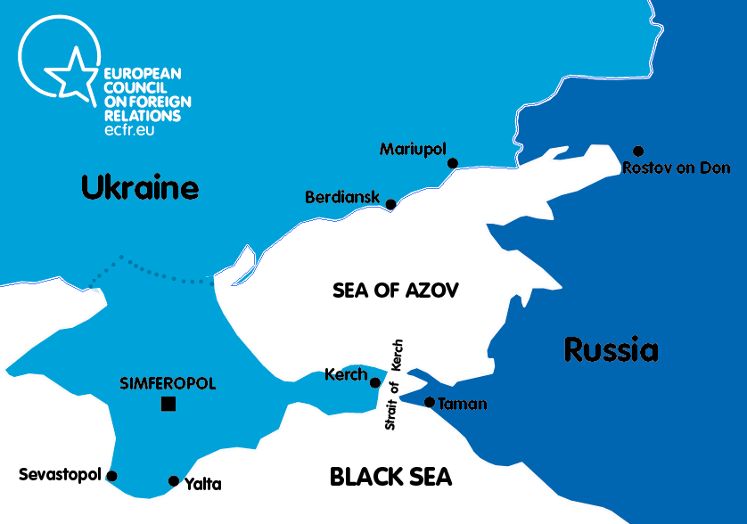
Since the annexation of Crimea in 2014, the Russian Federation became a full-fledged hegemon in the Azov Sea because of how the annexation of Crimea greatly expanded Russian coastal possessions. The Kerch Straits made Russia the keeper of a strategic chokepoint where the Kerch Strait acts as a gate to free waters and to Ukrainian and Russian Azovian ports. Interestingly, Russian river waterways facilitate a connection between the Black Sea with Russian cities that are almost located in Siberia and even deliver goods directly to Moscow or to the Baltics. In these regards, the possession of the Kerch Strait and access to the Sea of Azov has strategic meaning to Russia. As tensions have been building in recent months in the Sea of Azov Russia and Ukraine find themselves poised for further escalation.

Russian Naval and Maritime Strategy in the Sea of Azov

It is crucial to view Russia’s general vision regarding naval strategy and its place in the Sea of Azov since 1991 in order to understand the current state in broader context. Before Vladimir Putin, Russia’s leadership did not pay much attention to the country’s naval forces. But in 2000, the same year Putin came to power, the situation changed. Russia introduced the “Naval Strategy of Russia” in which there was pointed attention from the Kremlin in the Sea of Azov and the Black Sea. Putin personally participated in the drafting of the document. In the document it was clear that these seas, together with the Baltic and Caspian Seas, have serious importance to Russian national interests. With respect to the Sea of Azov Russia had proposed it be labeled as internal waters as the most suitable approach to national interests. Moreover, along with Moscow’s return to the old Soviet Union approach in trying to turn southern seas into “internal seas,” Russia wanted to establish a favored regime that would block every non-Azovian state warship from the entrance into the seas.

Next year in 2001, Russia introduced the “The Russian Maritime Doctrine” where again the Kremlin asserted that the Sea of Azov is a part of national interests. According to the document, the longstanding interests of Russia in the Black and Azov Seas were the restoration of the naval and merchant fleets along with the inland navigation system (Don-Volga canal system), ports, and other infrastructure. It emphasized the necessity of addressing with the Ukrainian government the legal status of the Black Sea Fleet and to ensure that Sevastopol remains the main base of the Fleet. And finally, it discussed the creation of conditions for basing and using the components of maritime potential that would protect the sovereignty as well as international rights of the Russian Federation in the Black and Azov Seas.

A map of the Sea of Azov and Crimea region. (European Council on Foreign Relations)

Next, the “Naval Strategy of Russia 2020” was issued in 2012 and neither of the seas were mentioned. However, it was clear that some aspects of the document were related to the Sea of Azov and that Russia was facing restrictions to full access to the global maritime domain, and faced disputed maritime claims from neighboring countries. After the alteration of the international environment and due to the annexation of Crimea, Moscow released the “Maritime Doctrine 2020” in 2015, and again paid full attention to the region and categorizes the Black and Azov Sea as a part of the “Atlantic Regional Priority Area.” It highlights the region as crucial for national interests partly because it is proximate to NATO.

Thus, according to the document, the following measures were provided:

  • To set more favorable (on the basis of the international law) international regimes for Russia in the Azov and Black Seas
  • Systems of using natural resources of these seas
  • Free use of the oil and gas fields and construction and operating pipelines
  • To set international and legal regulation regimes in the Kerch Strait
  • To enhance and to improve the structure and naval bases of the Black Sea Fleet and the development of its infrastructure in Crimea and Krasnodar Kray
  • Building the related vessels and ships, especially river-sea type, and development of port infrastructure in these seas
  • Creation of three huge regional economic and maritime zones (centers): Crimean, Black Sea-Kuban, and Azovian-Don zones
  • Further development in regional gas and oil pipeline systems. (For instance, according to the Ministry of Energy, in the production structure of the Russian Federation the share of offshore fields in the Azov Sea is 9.4 percent of Russian oil and 14.7 percent of gas.)
  • To provide a direct logistical connection between the Crimean peninsula and Krasnodar Kray. (Here at the moment of adoption of the document, it still was a theoretical scenario for a direct land connection through the territory of Ukraine, but now the recently completed Kerch Bridge has become the sole option.)
  • Exploration of minerals in the seas

On July 20, 2017 Putin signed “The fundamentals of the state policy of the Russian Federation in the field of naval policy for the period up to 2030.” Again, previously mentioned threats were indicated, but the language of the document changed gravely in that it became more antagonistic and aggressive. The Azov Sea was mentioned regarding the necessity of maintaining favorable legal regimes around the state border of the Russian Federation, the border area, in the exclusive economic zone, on the continental shelf, as well as in the waters of the Caspian and Azov Seas. Without the Crimean peninsula it is impossible to fully appreciate the security implications for Russia’s policy in the Azov Sea. In Crimea, according to the document, it was recommended that Russia pursue an increase of the operational and combat capabilities of the Black Sea Fleet by developing an interspecific grouping of forces on the territory of the Crimean peninsula.

A historic moment that sheds light on Russia’s strategic vision in the Sea of Azov is the Yeysk meeting in 2003. The Tuzla Island conflict started on September 29, 2003 when Russia initiated the construction of an artificial dam on the tiny island within the Kerch Strait, and the Yeysk meeting was conducted under Vladimir Putin’s supervision on September 17, 2003. On the same day before Yeysk, he had met with Ukrainian President Leonid Kuchma where he clearly stressed that “the Sea of Azov must be the internal sea of Russia and Ukraine.” Already in Yeysk (an important Russian city on the Azov shores with heavy military presence), Putin held a historical meeting for Russian geopolitical ambitions in its southern region. All the most important ministers responsible for the state military, naval, and security policy were present.

During the meeting, Putin made strong commitments regarding the Black and Azov Seas. At the onset of the meeting he said:

“I would like to talk about the Azov-Black Sea basin as a whole. On military and environmental issues it is a zone that is very important for Russia. This is the zone of our strategic interests. The Black Sea region has a special geopolitical significance. The Black Sea provides Russia’s direct access to the most important global transport routes, including energy.”

In this phrase he outlined the key interests of Russia in this region without which Russian national interests could not be fulfilled. In order to impart this vision in the formal framework, Putin signed the document “Plan of cooperation of ministries and agencies to address the diplomatic and military missions in the Azov-Black Sea region.” The text of the plan was closed from publicity but its general aim was to provide a complex strategy of Russia to this Black-Azov Seas region and the modernization of port and naval facilities. The next point which was raised is the Azov Sea question; according to Putin, it is undergoing a difficult process of negotiations and painstaking efforts to resolve existing problems of the legal status of the borders, regimes of straits, and legal aspects of the use of the water area and resources of the Black and Azov Seas. Moreover, within the meeting he signed a decree “On the establishment of the Black Sea Fleet’s base in Novorossiysk.” Many western and Ukrainian experts and politicians regarded it as a retreat of Russia in the means of her ambitions in the region, but Putin directly stressed that it is not a sign of retreat and that Sevastopol will remain a main base of the Russian Black Sea Fleet. Furthermore, during the meeting Putin emphasized the crucial reason why the Kremlin did not pay attention to the Azov Sea because “For a long time, a large number of ministries and departments were focused on the Caspian Sea. I think that now it is time to come to grips with the problems of the Azov-Black Sea basin.”

A Longstanding Dispute

Negotiations regarding the status of the Sea of Azov and the Kerch Strait began in 1995, and Russia steadily avoided finalizing them on Ukrainian terms. Only after the Tuzla Island crisis in September 2003 did Ukraine and Russia finally sign the agreement in December of the same year. At the same time, the biggest political disaster that Russia faced as a result of Tuzla crisis was the consolidation and hardening of the Ukrainian nation toward Russia. The Tuzla events were partly preconditions for the Orange Revolution in 2004. For the first time in many years it posed the possibility of a direct confrontation between the two nations.

After the Orange Revolution in 2004 new political leadership in Kiev called for a revision of this agreement and considered it a deal that had been imposed on Ukraine by the use of political and diplomatic pressure. Since then, negotiations were conducted many times but Ukranian President Viktor Yushchenko could not manage to settle the issue on Ukrainian terms. It should be taken into account that even the 2003 agreement did not satisfy Moscow, but it was definitely a victory for Moscow after years of contention. Ukraine was holding the largest and richest share of fish zones in the Sea of Azov and had total control of the Kerch-Enikale Canal. But for Russia, it secured the Sea of Azov from any possibility of foreign warships entering the sea, and Russia earned the ability to use the Kerch-Enikale Canal freely. Before, Russian vessels had to pay Ukraine for passage in and out of the Kerch Strait. Finally, the signed treaty that ended the dispute had a positive impact on Russia because Ukraine was forced to recognize the Sea of Azov as an internal sea. Thus the sea was sealed from third-party countries.

Unfortunately, Ukraine in 2003 did not effectively use international law and the influence of the West in order to settle the issue with Russia. NATO behaved in a very tempered manner and avoided taking sides. Ukrainian President Kuchma publicly asked the General Secretary of the NATO Lord George Robertson for an intervention into the confrontation before his departing to Moscow. Moreover, the head of the foreign office of the EU presented almost the same position of NATO and EU when he said the conflict “will be resolved and defused among themselves.” In 2010 when the regime of Yanukovich came to power, Russia made the status of Sevastopol a priority (the Kharkov Agreement), but negotiations about the Kerch Strait and the Sea of Azov never stopped because Russia wanted further expansion. Particularly in terms of favorable regimes, in the Kerch Strait they proposed the creation of a joint venture that would operate in the Strait. In 2013, Putin officially returned to the Sea of Azov question but he never returned to this topic very publicly. Even since the annexation of Crimea, he delegated the issue while he was silent about it himself. After the Maidan Revolution, the new Ukrainian political elite confronted the agreement but did not manage to revise it.

According to the 2003 agreement, Ukraine has legal control over 62 percent of Sea of Azov’s area and Russia only 38 percent, but since the annexation of Crimea, Russia possesses de facto three-quarters of the territory of the sea. It tries to impose this fact in relations with Ukraine. Plus, Russian proxies are possessing additional territories in the East of Ukraine that plays on Russian advances. The whole coastline of the breakaway Donetsk People’s Republic is approximately 45 km. In their territories, there are plans to erect a naval base in the Obryw village. It is more likely that Russia will be denying its involvement in the creation of the base. Therefore, in the Sea of Azov there are three major established naval centers in the zones of control under Ukraine, Russia, and the separatist republic of DPR.

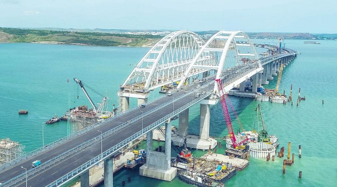
Additionally, a great hindrance to the free navigation of international and Ukrainian ships was incurred with the opening of the Kerch Bridge in May. The bridge has an air draught of 33 meters and a water draught of eight meters which restricts the entrance of larger ships into the Sea of Azov. Notwithstanding the fact that Ukraine is reportedly eager to denounce the 2003 Agreement, Russia could go even further unilaterally – eventually sealing the free passage in the Kerch Strait to the Ukrainian merchant fleet. In this scenario Ukraine could have to pay for passage as Russia did before 2003.

The Sea of Azov after 2014 was more or less a tranquil place compared to the Donbas and Crimea, but the completion of the first phase of the Kerch Bridge required more decisive measures from Russia. Additionally, an incident with a boat arrested by Ukraine further escalated the situation. The Russian Federation still demands that Kiev return the boat and the captain as a main condition for returning to the status quo. Russia continues to use the following measures against Ukraine:

  • Increasing the time for permit issues for the passing to and from the Azov Sea
  • Undertaking additional controls of the vessels in the Azov Sea water going to Ukrainian ports and “luckily” facing one more control when they return after shipment
  • Russia is challenging Ukrainian naval forces when controls are happening very close to Ukrainian shores
  • Pushing Ukrainian fisheries to avoid going to sea
  • Since June until October, Russia inspected 171 vessels and it took on average three days
  • Ukrainian and Georgian vessels undergo more detailed inspections
  • Usually 10 Russian warships are patrolling the Sea of Azov and Moscow sometimes closes parts of the sea under the pretext of naval drills

The Ukrainian economic losses to date are obvious. For instance, only from January to July Ukraine lost 50 percent of fishing, 30 percent of the profit of ports, and most importantly, the share of the ports in metallurgical export deteriorated to 50 percent. This trend will only be broadening and it is even possible to say that in the long-term Russia may attempt to eventually halt commercial activities. This could lead to social and political protests against the current political elite in Kiev if the situation does not change. Furthermore, Russia has plans to extract and use Ukrainian and Crimean Tatar natural resources from Crimea and the Sea of Azov such as the Azov-Berezansky and Indolo-Kubnasky oil and gas fields. Estimated oil and gas deposits in the Sea of Azov are 413 million tons. As a result of the Ukrainian water blockade of Crimea, Moscow may also be desperately seeking the fresh water in the Sea of Azov.

Russia caught Kiev in three main geopolitical traps. First, if Ukraine is going to confront Russia and demonstrate principality in the Azov sea, she should take into account that economic and social deterioration will become a direct consequence of this confrontation. Even though Ukraine goes to a stiff political stance in confronting Russia, international maritime companies will be avoiding this region and will try to find alternative routes. It should be noted that a quite popular idea with Russia is that of mining the Ukrainian coastline. Definitely these kinds of measures do not attract foreign investments. Second, Ukrainian naval forces are incomparable with Russian forces. Moscow is the absolute naval hegemon in this sea. Third, it is a “denunciation” trap. In Ukraine, denunciation is quite popular but some voices are against the argument that Ukraine will be deprived of a free passage through the Kerch Strait for the Ukrainian merchant fleet.

Western Responses and Countermeasures

The Ukrainian answer is offered by several measures. First, is a “law binding” policy. In 2016 Ukraine filed a lawsuit against the Russian Federation to the Permanent Court of Arbitrations – “Dispute Concerning Coastal State Rights in the Black Sea, Sea of Azov and Kerch Strait (Ukraine vs. the Russian Federation).” Interestingly, Russia is actively engaging in the process. Second, it is the establishment of sufficient naval forces (an “Azov flotilla”) by using external and internal sources for naval enforcement – for instance, building additional gunboats “Gurza-M” (Project 58155). For instance, Capitan Andriy Ryzenko presented a strategy of a “Mosquitoes Fleet” as the best option to counter Russia expansion in the sea. Currently, NATO and Ukrainian specialists are engaged in preparation of the “Naval Strategy 2035” that will take into consideration the recent developments in the Sea of Azov. Ukraine is considering the possibility of convoying Ukrainian and European vessels into the Sea of Azov. Additionally some Ukrainian politicians are voicing the necessity of sanctioning Russian ports in the Black and Azov seas for Russia’s unlawful activities and to develop the coastal missile defense systems that could deter Russia from direct invasion of Mariupol and Berdyansk.

Western reaction to the developments in the Sea of Azov have not been prompt since the recent confrontation began in March 2018. On August 30, the U.S State Department issued a press statement “Russia’s Harassment of the International Shipping Transiting the Kerch Strait and Sea of Azov.” The State Department called on Russia to cease its harassment of international shipping. On October 24, the General Secretary of NATO Jens Stoltenberg stressed during a press conference NATO’s concern regarding the situation in the Sea of Azov and about importance of the freedom of navigation both for Ukrainian and NATO ships in this sea. Interestingly, on October 31 there was a regular official meeting of the NATO-Russia Council in Brussels where according to the press release both sides discussed the situation in Ukraine and the escalation in the Sea of Azov but without any public details.       

In Brussels, already in the middle of summer there were some discussions regarding the situation in the Sea of Azov.  For example, on October 9, the European Policy Center conducted the event “Occupied Crimea: The impact on human rights and security in the Black and Azov Seas” that has been dedicated particularly to the recent escalation in the region. Representatives of the European Parliament, Ukrainian Ministers, experts and former NATO officials took part in the event. In the European Parliament of Subcommittee on the Security and Defense (SEDE) a very effective hearing was held with a fruitful discussion and provided analytical grounds for the European Parliament’s Resolution. Additionally, the Chair of the SEDE, Anna Fotyga, together with the other MPs, visited the east of Ukraine on 16-20 September where they observed the security situation in the contact-line in Donbas and in the city of Mariupol. In the SEDE hearings on October 11, “On the Security Situation in the Azov Sea” in the EP there were officials from the European External Action Service responsible for the Eastern dimension of the EU foreign policy, including Ambassador Konstiantyn Yelisieiev who is now the Deputy Head of Presidential Administration to the President of Ukraine and NATO’s officials.

Ms. Fotyga stressed that the Russian approach toward the seas has some similarities and they are to be found even in the Baltic region, where Russia is using its geographical advantage over Poland in the Vistula Lagoon and Strait of Baltiysk. Russia, as she stressed, is seeking ways to establish internal lakes (with limited access) in those seas. The representative of the EEAS stated that in July the EU imposed individual sanctions against persons involved in the Kerch Bridge construction and condemned the deterioration of the situation in the Black and Azov Seas. Mr. Yelisieiev presented a comprehensive and full picture of aggressive Russian behavior not only in the Sea of Azov but also in Crimea and the Black Sea. According to him, Russia pursues the following aims:

  • A land corridor to Crimea
  • Militarization of the Sea of Azov thereby to outflank Ukrainian military positions in the East of Ukraine
  • Social and economic destabilization of the region
  • Total control over the Black and Azov Seas in order to have secure flanks for further expansion

At the same time Yelisieiev outlined the necessity of the technical and economic assistance to Mariupol and Berdyansk. Moreover, on behalf of Ukrainian government, he was asking for the extension of sanctions against southern ports of Russia. As he noted “lack of the common response instigates the aggressor’s appetite.” He reiterated that the best option to deter Russia is to be braver in Ukraine and to finalize the membership action plan.  

NATO representative Radoslava Stefanova, Head of the Russia and Ukraine Section, Political Affairs and Security Policy Division, stated that the case of the Sea of Azov is a much broader problem that is happening in the southern flank of the NATO. Three littoral states have access to the Black Sea together with strategic partners (Ukraine and Georgia) and since the Warsaw Summit NATO is trying to establish stronger presence in this region. During the last year and a half, NATO is actively involved in the assistance of the reconstruction of Ukrainian naval and maritime capability and the associated training. NATO, according to Ms. Stefanova, has reinforced the staff in Kiev and especially to those fields that are related to security and defense, and even sent to Kiev more experts to prepare a Ukrainian naval strategy.

Another event of interest is the Plenary Session in Strasbourg on October 23 “On the Situation in the Sea of Azov” together with the Vice-President of the Commission Federica Mogherini. In her speech, she outlined that the EU is concerned about the situation in the sea and its militarization and reiterated the EU’s support to Ukraine. She emphasized that militarization of the sea is threatening to undermine the wider Black Sea region and this is in no one’s interests. What is also of note is that she said that the Black Sea is a European sea – an idea that is not welcomed in Russia and is considered aggressive. In general, the discussion during the plenary session demonstrated full commitment and almost absolute majority to support Ukrainian sovereignty and asked for further development of sanctions against the Russian Federation.

The resolution adopted on October 24 appears to demonstrate that the European Parliament is firmly committed to reacting to emerging threats in this neighborhood. The resolution goes through crucial details of the confrontation and touches on the problem of the militarization of the Crimean peninsula and Sea of Azov as intertwined cases. Among its contents it also:

  • Condemns Russian violation of the freedom of navigation and construction of the Kerch Bridge
  • Highlights Russia’s plans to extract natural resources (oil and gas resources) from the legal Ukrainian territories
  • Goes through the unacceptability of such a policy not only in the Sea of Azov but in the Vistula Lagoon (Poland)
  • Calls for a more comprehensive EU foreign policy in this region and to appoint an EU Special Envoy to Donbas, Crimea, and the Sea of Azov
  • Underlines the necessity to send mission experts to Mariupol that will be assessing the damage to the region and look at alternative ways of maintaining regional, social, and economic sustainability.

Regarding the recent escalation in the Black Sea zone of the Kerch Strait the western reaction was again quite restrained. The U.S State Department issued a statement indicating that they are concerned with the dangerous escalation in the Kerch Strait and that it “condemns this aggressive Russian action.” Washington again called for both parties to “exercise restraint and abide by their international obligations and commitments. We urge Presidents Poroshenko and Putin to engage directly to resolve this situation.” It is possible to assume that such a vague statement holds little water with Ukraine. Something similar happened with the European Union’s reaction where it defined the situation as dangerous and called on both sides to exercise “utmost restraint” and called for de-escalation. The Turkish Republic also called for the peaceful resolution of the confrontation, and the Turkish Foreign Affairs Ministry stated that it is concerned that Ukrainian vessels were fired upon but it does not make any reference to Russia. Even so, Ukraine together with its allies, managed to conduct an emergency meeting at the UN Security Council but it did not had desired effect. The most lackluster reaction was the aftermath of the private meeting of the Political and Security Committee in Brussels that refrained to go tougher against the Russian Federation.

Thus we could see that the consequences of the incident remain unclear. The international reaction demonstrates to Kiev that it is not ready to escalate the situation. At the same time, it is more likely that both the European Union and the United States are going to provide more measures to deter Russian hegemony in the Sea of Azov and Black Sea.     

Conclusion

History rarely pays attention to the Sea of Azov, but it is always related to the strategic importance of Crimea. When the Russian Federation annexed the Crimean peninsula and further consolidated its military facilities, it became clear that the Sea of Azov will again be playing an important strategic role in East-West relations. After more than 20 years of strategic patience Russia resolved many of its longstanding problems about the Azov and Black Sea regions by annexing Crimea. It is not a mere coincidence when the Foreign Minister of Russia, Sergey Lavrov, on March 21, 2014 straightforwardly pointed out that since the annexation, the Kerch Strait “could not be the subject of negotiations anymore.”

Almost five years after the annexation of the Crimean peninsula it appears that Russia is again trying to impose a long-term strategy to deal a crucial blow in Ukraine via the Sea of Azov. In Moscow they count on strategic patience, and as Putin said “in long-run strategy we must win.” Western answers and reactions have to be strong and preventative. The case of the adopted EU resolution is direct evidence of how interested Western commitments are. But if the recommendations in the resolution remain on paper it means that aggressive Russian behavior is poised to deal another blow to Ukraine and the West.  

Ridvan Bari Urcosta is a research fellow at the Center of Strategic Studies, University of Warsaw.

Featured Image: Kerch bridge. (Wikimedia Commons)

Maritime Partnerships and the Future of U.S. Seapower in the Indo-Pacific

By LCDR Arlo Abrahamson

Introduction

“Relationships don’t stay the same, they either get better or they get worse.” These were the words of U.S. Defense Secretary James Mattis at the 2018 Shangri-La Dialogue in Singapore. Mattis was speaking about the importance of avoiding the status quo in America’s defense relationships by exercising “strategic reliability” through enduring military presence and meaningful security cooperation.1

Mattis’ concept of strategic reliability is an appropriate frame to examine the future of U.S. seapower in the Indo-Pacific. America’s rise as a naval power was predicated on the ability to form alliances and partnerships with nations that believe cooperative maritime security benefits common interests and enhances regional and global stability. The backbone of these alliances and partnerships derives from a fundamental belief in freedom of the seas, a central tenant of the international rules-based order, to which the former Commander of the Indo-Pacific Command Admiral Harry Harris said “ensures all nations, big or small, have equal access to the shared  domains.”2 Since the fall of the Soviet Union, in what the late Charles Krauthammer described as “America’s unipolar moment,” U.S. seapower, along with the alliances and partnerships that bolster its preeminence in the Indo-Pacific, has largely gone unchallenged.3 However, with a rising China and its focus on building its own world-class, blue water navy, the future of U.S.-led, cooperative maritime security in the Indo-Pacific cannot be taken for granted.

The underlying question is can U.S. seapower with its existing framework of maritime alliances and partnerships remain the leading guarantor of Indo-Pacific  maritime security, or will China take on that role? The collective wisdom is that the U.S. Navy will continue to lead and foster cooperative maritime security efforts in the Indo-Pacific, but only with a careful reexamination of how the U.S. projects its seapower and postures itself in a new era of great power competition with China.

Alliances and Partnerships, the Foundations of U.S. Seapower  

With the presence of the U.S. Asiatic squadrons in the 19th century, the U.S. Navy made its debut in the Indo-Pacific region. Like most global navies, the U.S. Navy emerged in the region to protect and promote America’s growing interests in commercial trade and diplomatic relations. From the U.S. Navy’s debut in the region, alliances and partnerships helped bolster and sustain U.S. seapower in the Indo-Pacific. Those alliances and partnerships were cemented with the spoils of victory in World War II, with the establishment of U.S. naval bases and forward operating locations throughout the region.

Today, the U.S. Navy enjoys unprecedented access to the Indo-Pacific region, with naval forces forward or rotationally deployed in Guam, Japan, Korea, Okinawa, and Singapore, and visiting force agreements in the Philippines and Australia. This access enables the U.S. Navy’s power projection in the region and yields opportunities for the U.S. to play a constructive role in strengthening cooperative maritime security networks by, with, and through the assistance of allies and partners.

In February 2018 while underway in the South China Sea, Rear Admiral John Fuller, commander of the USS Carl Vinson Strike Group, told a group of academics and reporters that “nations in the Pacific are maritime nations. They value stability…That’s exactly what we are here for. This is a very visible and tangible presence. The United States is here again. U.S presence matters.”4

The prosperity and upward economic trajectories of Indo-Pacific nations are a byproduct of the relatively stable period that emerged after World War II. This prolonged period of regional stability was underwritten for the last 75-plus years in part due to unfettered U.S. naval presence. Sustained by a strong network of alliances and partnerships, the U.S. Navy has focused its forward presence on deterring conflict, ensuring access to the global commons, protecting U.S. commerce, while promoting U.S.-led security cooperation.

The U.S. Cooperative Strategy for 21st Century Seapower underscores the value of maritime security cooperation directly tied to U.S. interests, particularly in the economic and security spheres:

“By expanding our network of allies and partners and improving our ability to operate alongside them, naval forces foster the secure environment essential to an open economic system based on the free flow of goods, protect U.S. natural resources, promote stability, deter conflict, and respond to aggression.”6

The Indo-Pacific region features a complex stratosphere of global and economic interests with growing importance for the U.S., China, and the international community at large. The United Nations estimates more than 80 percent of global trade by volume travels by sea; with 60 percent of seaborne trade volume traveling through the Indo-Pacific region.7 Moreover, $5.3 trillion in seaborne trade passes through the South China Sea each year, nearly a third of all global trade. This includes $1.2 trillion in trade destined for U.S. ports and 80 percent of China’s hydrocarbons that pass through the strategic chokepoints of the Straits of Malacca and Singapore and onward to the South China Sea.

In such a dynamic maritime environment, the existing framework of rules, standards, norms and laws that assures free access to the global commons and open sealanes remains essential for regional stability. James Manicom notes that  “free access to the seas fosters not only economic growth within individual East Asian states, but also the creation of robust economic interdependence between East Asian states that creates a powerful disincentive for war.”9 A strong belief in free and open sealanes has not lost its relevance among Indo-Pacific nations, even with the threat of a rising and revisionist power in China that seeks to adjust the international order to benefit its own interests. Accordingly, great power competition with China presents both challenges and opportunities for the U.S. Navy in the Indo-Pacific. While Indo-Pacific nations make room for China’s rise as a maritime power, U.S. seapower should remain focused on preserving the rules-based order while enhancing stability that binds its existing network of allies and partners.10

Forward Presence and Cooperation in the Midst of a Rising Maritime Power

A rising Chinese maritime power harkens to the realities of geo-strategic position. The U.S. Navy serves as a mostly non-resident, yet established maritime power in the Indo-Pacific while China is embracing its role as the resident, emerging maritime power.

Against the backdrop of the routine presence of the U.S. Navy across the Indo-Pacific, nations are increasingly hosting the People’s Liberation Army-Navy (PLAN) in their waters and ports. The PLAN is growing rapidly as a regional maritime powerhouse and blue water navy, and nations in the Indo-Pacific know they must cooperate and work with their Chinese neighbors at sea to maintain cordial and friendly relationships with the fledgling superpower.

In August 2018 China conducted its inaugural multilateral exercise with Association of Southeast Asian Nations (ASEAN) noting the maritime drills aimed “to expand China and ASEAN’s military communications and security cooperation.”11 Singapore, currently at the helm of the rotational leadership of ASEAN, lauded the exercise as a notable first step in enhancing interoperability with the PLAN. “At the end of the exercise, we have strengthened our ability to work together,” said Colonel Lim Yu Chuan, commanding officer of the Singapore Navy’s 185 Squadron.12

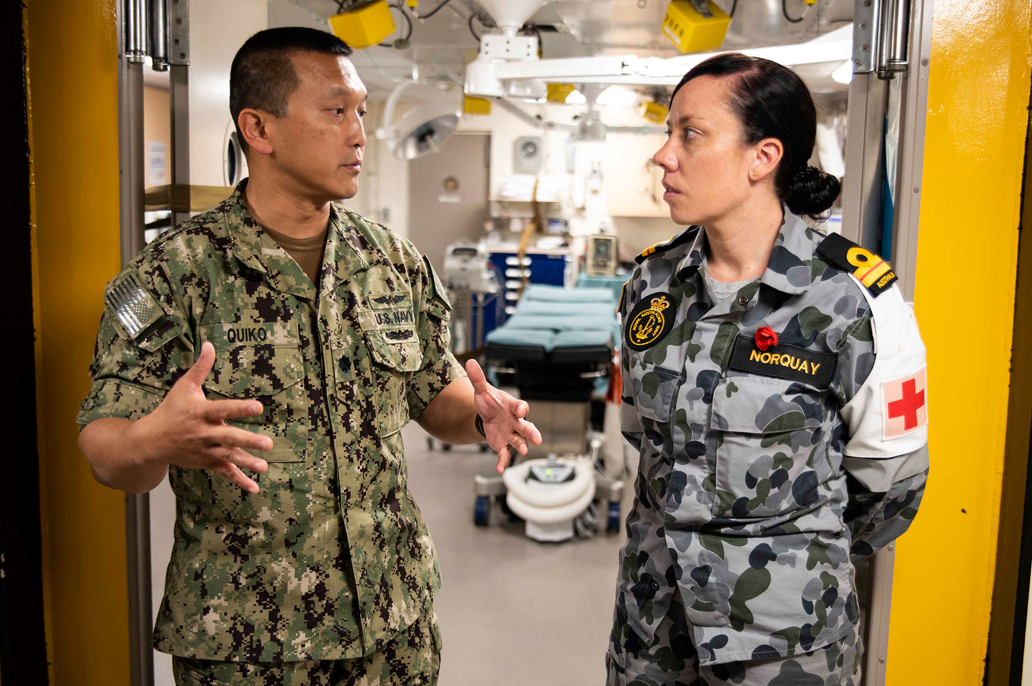
PORT MORESBY, Papua New Guinea (Nov. 16, 2018) Cmdr. Albin Quiko, assigned to the Expeditionary Resuscitative Surgical System (ERSS) team, discusses medical capabilities with Lt. Miranda Norquay, the medical officer aboard the Royal Australian Navy landing helicopter dock ship HMAS Adelaide (L01), in the surgical room of the amphibious transport dock ship USS Green Bay (LPD 20) during a tour. (U.S. Navy photo by Mass Communication Specialist 2nd Class Anaid Banuelos Rodriguez/Released)

Despite the emergence of China as a rising maritime power, the U.S. still embodies its role as the principal leader of cooperative maritime security in the Indo-Pacific region. The U.S. Navy facilitates multilateral, cooperative security engagements such as Rim of the Pacific (RIMPAC), Malabar alongside the Japanese and Indian navies, and Southeast Asia Cooperation and Training (SEACAT) that enables the U.S. to operate with ASEAN and South Asian partners such as Sri Lanka and Bangladesh. When manmade and natural disasters afflict the region, nations in the Indo-Pacific frequently request the assistance of the U.S. Navy in relief operations such as in the Philippines after Typhoon Haiyan in 2013, the search and rescue of Air Asia Flight 8501 that crashed into the Java Sea in 201, and more recently to assist in flood relief efforts in Sri Lanka in 2017.

Collin Koh, maritime studies researcher at the Rajaratnam School of International Studies (RSIS), notes that nations in the Indo-Pacific generally regard U.S. naval presence as constructive in promoting collaborative partnerships, capabilities, and stability:

“The U.S. naval presence is still seen as a stabilizing element in a geopolitically uncertain time in the region. Operationally, regional militaries see their engagements with the U.S. as a vehicle for extracting knowhow, expertise, and best practices for their own capacity building processes.”13

The U.S. Navy should use its credibility in the Indo-Pacific to advance the National Defense Strategy that advocates for strengthening the U.S. network of alliances and partnerships through “mutually beneficial collective security,” “reinforcing regional coalitions and security cooperation,” and “deepening interoperability.”14 Indo-Pacific nations have no choice but to cooperate with China as the emerging, resident maritime power, but that doesn’t diminish the U.S. Navy’s role in the region. In fact, fears of how China is using its rising maritime power may even strengthen it.

Focusing on Relationships as a Means to Balance China’s Influence

Edward Luttwak postulates that seapower during peacetime equates to “passive suasion” that can reassure allies and/or influence the behavior of nation states.15 In an increasingly competitive and contested maritime environment in the South China Sea and

Northeast Asia, the U.S. Navy’s mere presence in the region is increasingly viewed by nations within the context of strategic hedging of great power capabilities. In Richard Fontaine’s view, this hedging is “creating regional security challenges that incentivize cooperation and counterbalancing.”16

While some Indo-Pacific nations are careful to temper their public sentiment regarding U.S. naval presence, countries of the region clearly support U.S. seapower and continue to enable it. James Manicom argues that by virtue of Chinese maritime assertiveness in contested waters, “there is clearly still an appetite for U.S. seapower among East Asian states, which reinforces the legitimacy of American power.”17

In recent years the Philippines, Australia, and Singapore have upgraded their enhanced defense cooperation agreements with the U.S. that allows rotational deployments of ships and aircraft. Moreover, the U.S. has significantly enhanced maritime security cooperation, information sharing, and logistical support agreements with Vietnam, Sri Lanka, and India.18

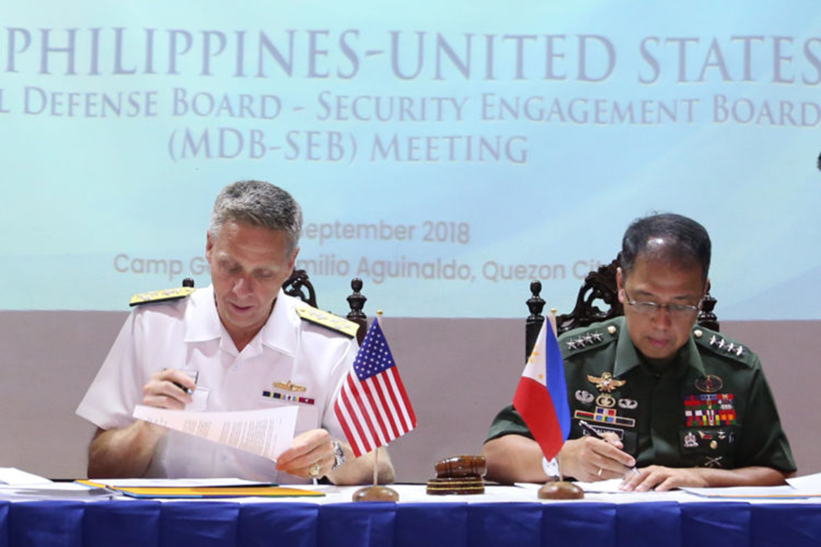
MANILA, Philippines (Sept. 27, 2018) – Adm. Philip Davidson, Commander of the U.S. Indo-Pacific Command, and Gen. Carlito Galvez, Chief of Staff of the Armed Forces of the Philippines, sign agreements on security cooperation activities for 2019 at this year’s Mutual Defense Board and Security Engagement Board Meeting at Tejeros Hall, AFP Commissioned Officers Club, Camp Aguinaldo, Quezon City. (Photo by SN1 Donald Viluan PN/PAOAFP)

Despite its strong regional security networks and amicable relations with allies and partners, the U.S. Navy cannot take its status quo for granted. An easy assumption may be that maritime alliances and partnerships can endure through periods of non-engagement when priorities for naval platforms and people are needed for other pressing operations. This would be a strategic mistake for the U.S. in an environment where China is eager to fill even the smallest void left by the U.S. Navy’s competing priorities. Consequently, U.S. strategic choices in projecting routine naval presence and its investment in long-term military relationships correlate directly with Mattis’ concept of strategic reliability. On the operational and tactical levels, this translates to meaningful and routine maritime security cooperation where relationships form the foundation of trust for the alliance or partnership.

Dzirhan Mahadzir, former researcher at Malaysia’s Maritime Institute, notes that while fostering relationships through routine engagement is paramount, these relationships and persistent naval presence also “dissuades or prevents countries like China from diminishing the U.S. role in leading cooperative security.”19

Every time the U.S. Navy conducts a security engagement or exercise with its allies and partners, it sends a strategic message that aligns with America’s stated commitments to the Indo-Pacific. Moreover, in the age of tweets and 24-hour news cycles where organizational memories are short, the Navy’s engagement with allies and partners must be routinely executed to demonstrate U.S. resolve and commitment. Rest assured, U.S. friends and allies will take note of how it postures its seapower and forward presence to match words with deeds.

What could marginalize U.S. Seapower in the Indo-Pacific?

The task of fulfilling global commitments remains a challenge for the U.S. Navy with competing priorities both globally and domestically. Critics can point to the findings of the Navy’s reviews of surface force incidents that the U.S. 7th Fleet is overstretched in both commitments and platforms, a challenge complicated by the sheer geography of plying the waters of a vast Indo-Pacific operating area.20

After at-sea collisions by USS Fitzgerald near Japan and USS John S. McCain in the Singapore Strait, China took full advantage of the disarray and characterized the U.S. Navy in its state-run press as dangerous and undependable for Indo-Pacific nations.21 The U.S. Navy cannot be everywhere, and it certainly is not immune to accidents, but the solution to restoring any lack of faith in U.S. seapower in the Indo-Pacific is to remain engaged and double down on the U.S. commitment to free and open seas and regional stability by way of its alliances and partnerships.

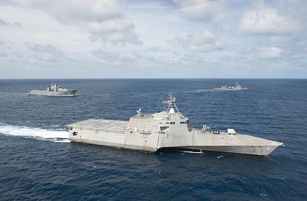
GULF OF THAILAND (June 3, 2017) The littoral combat ship USS Coronado (LCS 4) is underway in formation with ships from the Royal Thai Navy as part of a division tactics exercise during Cooperation Afloat Readiness and Training (CARAT) Thailand. (U.S. Navy photo by Mass Communication Specialist 3rd Class Deven Leigh Ellis/Released)

William Choong, Senior Fellow for Asia-Pacific security at the International Institute for Strategic Studies (IISS), posits that “Southeast Asian countries usually prioritize economic development over U.S. military presence in the region” as means for advancing their upward economic mobility.22 This trend in the region will continue and China is equipped to assert its economic leverage through ambitious programs such as the One-Belt, One Road initiative, which could be a potent undercurrent in nations’ decisions to engage with the U.S. in the maritime security sphere.

However, even with growing economic ties between Indo-Pacific nations and China, Collin Koh notes China’s economic influences have not discouraged most allies and partners from working closely with the U.S. in security cooperation engagements:

“Even as Indo-Pacific countries move toward China in economic ties, we don’t see a let down in enhancing and building security relations with the U.S. This can only mean these governments are intent on keeping these military ties with the U.S. in the midst of their wariness towards a growing Chinese shadow.”23

The U.S. Navy possesses adequate technology, diverse naval platforms, and perhaps most important, the creativity and ingenuity in its people, to remain relevant and engaged with allies and partners across the Indo-Pacific and retain its principal leadership role. Yet with the realities of great power competition, skepticism will not cease completely, and tepid or inconsistent engagement will cast doubts of U.S. resolve. In essence, any marginalization of U.S. seapower in the Indo-Pacific will be a strategic choice, not a preordained destiny.

Practical Considerations for Sustaining U.S. Seapower

The National Defense Strategy contends the U.S. military must “outthink, out maneuver, out-partner, and out-innovate” America’s adversaries and competitors.24 In this vein, practical considerations for cooperative maritime security engagement should be considered carefully. The U.S. Navy must continue to demonstrate credible, lethal, and distributed seapower.25 This must be accomplished using the full breadth of naval power and associated platforms that can operate adeptly in the littorals, global commons and in contested grey zone spaces.

The 3rd Fleet forward initiative is a prudent step to deploy additional naval assets to the Indo-Pacific to enhance presence operations and maritime security cooperation engagements and exercises. Moreover, the U.S. Navy should continue to harness the employment of Military Sealift Command (MSC) ships in security cooperation engagements ranging from logistics interoperability to operating with partner navies at sea. Progress has already been made with the inclusion of expeditionary fast transport ships (EPF) and expeditionary transfer docks (ESD) in a number of exercises and engagements throughout the region.26 The value of security cooperation with small, expeditionary units should not be underestimated. Diving and salvage subject matter expert exchanges, explosive ordnance disposal team engagements, civil engineering exchanges with Seabees, and small boat operations are in high demand for many of the U.S. Navy’s partners in the region, particularly in South and Southeast Asia.27

Lastly, the U.S. Navy should seek more opportunities to work jointly with other U.S. military services during cooperative security engagements. Partnering with other U.S. services, including the U.S. Coast Guard, increases opportunities, scope, and the quality of engagements with allies and partners while prudently managing finite resources in manpower and available platforms.

In practical terms, maritime security cooperation is military diplomacy. As with all forms of national diplomacy, the task is never quite finished.28 The byproduct of a broad cooperative maritime security strategy is cumulative when measuring the value of all engagements and activities. The late Admiral J.C. Wylie posits that cumulative operations, much like effective diplomacy, can advance national interests systematically:

 “…the entire pattern is made up of a collection of lesser actions, but these lesser or individual actions are not sequentially interdependent. Each individual one is no more than a single statistic, an isolated plus or minus, in arriving at the final result.” 29

Wylie’s view of cumulative operations provides a suitable template to assess the value of cooperative maritime security engagements across the Indo-Pacific. Engagements large and small all matter when assessed holistically and contribute toward the greater goal of advancing U.S. interests and strengthening seapower.

More importantly, the cumulative effect of sustained U.S. naval presence and engagement sends an important message to allies, partners, and adversaries alike that America is an Indo-Pacific maritime power that remains committed to its role as the principle guarantor of regional stability.  

Conclusion

The future of U.S. seapower in the Indo-Pacific is filled with challenges yet ripe with opportunity. As the National Defense Strategy notes, “the willingness of rivals to abandon aggression will depend on their perception of U.S. strength and the vitality of our alliances and partnerships.” 30

China’s rising maritime power should not threaten U.S. maritime superiority. U.S. seapower will only be marginalized by inaction induced by lack of will or by strategic choice. While both the U.S. and China have an important role to play in preserving peace in the Indo-Pacific, the U.S. Navy is uniquely positioned to remain a regional leader of cooperative maritime security due to the values it promotes and the stability it underwrites through sustained naval presence.

Competing operational priorities and finite resources are a reality for a forward-deployed maritime power. Yet these challenges should not deter routine security cooperation with allies nor should it equate to neglect of smaller, less strategic maritime partners. China’s growing economic influence, sometimes coercive in nature, also raises doubts about the sustainability of U.S. alliances and partnerships.

The future of U.S. seapower in the Indo-Pacific remains viable so long as it remains embedded in the alliances and partnerships that sustain it. This requires routine naval presence, reassurance when necessary, meaningful military relationships, and as Secretary Mattis suggested, these actions culminate in strategic reliability. In this frame, U.S. seapower in the Indo-Pacific remains as relevant today as it ever was.

Lt. Commander Arlo Abrahamson is a career public affairs officer with the U.S. Navy and current graduate student at the U.S. Naval War College in Newport, Rhode Island. He has served operational and staff tours in Japan, Korea, and Singapore with the U.S. 7th Fleet operating as a spokesperson for the U.S. Navy while supporting major exercises and security cooperation engagements across the Indo-Pacific. Abrahamson holds a Masters Degree in Mass Communication from San Diego State University.

References

1. James Mattis, Remarks at Plenary Session of Shangri-La Dialogue, 2 June 2018, accssed 25 Sept, 2018,  https://dod.defense.gov/News/Transcripts/Transcript-View/Article/1538599/remarks-by-secretary-mattis-at-plenary-session-of-the-2018-shangri-la-dialogue/

2. Harry B. Harris,  Keynote Remarks at the Galle Dialogue, 28 Nov 2016, accessed 11 Sept 2018, http://www.pacom.mil/Media/Speeches-Testimony/Article/1013623/sri-lanka-galle-dialogue/

3. Charles Krauthammer, The Unipolar Moment, 20 July 1990, accessed 22 Sept 2018, https://www.washingtonpost.com/archive/opinions/1990/07/20/the-unipolar-moment/62867add-2fe9-493f-a0c9-4bfba1ec23bd/?utm_term=.d50667a20b8a

4. Agence France Press (AFP), U.S. Admiral: U.S. Presence Matters, 15 Feb 2018,  accessed 15 Sept 2018, https://www.scmp.com/news/asia/south-asia/article/2133506/us-presence-matters-admiral-aboard-uss-carl-vinson-says-carrier

5. U.S. Navy. A Cooperative Strategy for 21st Century Seapower, 9 March 2015. Accessed 10 September 2018, http://www.navy.mil/local/maritime/150227-CS21R-Final.pdf

6. U.S. Navy. A Cooperative Strategy for 21st Century Seapower. 9, March 2015. Accessed 10 September 2018, http://www.navy.mil/local/maritime/150227-CS21R-Final.pdf

7. CSIS Chinapower, How Much Trade Transits the South China Sea, 2018,  accessed 14 Sept 2018, https://chinapower.csis.org/much-trade-transits-south-china-sea/

8. New York Times, “The South China Sea, explaining the dispute,” 15 July 2016,  accessed 20 Sept 2018, https://www.nytimes.com/2016/07/15/world/asia/south-china-sea-dispute-arbitration-explained.html

9. James Manicom, “Chinese and American Seapower in East Asia, Is Accomodation Possible?,” Journal of Strategic Studies, 37, No. 3 (2014): 345-371. DOI: 10.1080/01402390.2014.900753

10. Tan Weizhen, “China’s military and economic power cannot be denied and the U.S. has to make room,” 17 Sept 2018, accessed Sept 25, https://www.cnbc.com/2018/09/18/china-military-is-growing-us-must-make-room-eurasia-groups-kaplan.html

11. Fathin Ungku (Reuters News), “China, Southeast Asia Kick Off Inguaral Mariime Drills”,  Reuters.com, 3 Aug 2018, accessed 11 Sept 2018, https://www.reuters.com/article/us-asean-singapore-navy/china-southeast-asia-kick-off-inaugural-maritime-drills-idUSKBN1KO0S7

12. IBID.

13. Dr. Collin Koh (Rajaratnam School of International Studies RSIS), email correspondence to author, Sept 21, 2018.

14. U.S. Department of Defense,  U.S. National Defense Strategy, Washington, D.C.: Secreatary of Defense, 19 Jan 2018.

15. Edward Luttwak, “Political Uses of Seapower,” Studies in International Affairs (The Johns Hopkins University Press), 23 (1974).

16. Richard Fontaine, “Networking Security in Asia,” The Washington Quarterly, Vol. 40, No. 3 (2017), 45-62.

17. James Manicom, “Chinese and American Seapower in East Asia, Is Accomodation Possible?,” Jounal of Strategic Studies 37, no. 3 (2014), 345-371. DOI: 10.1080/01402390.2014.900753

18. Congressional Research Service, “U.S. Strategic and Defense Relationships in the Asia-Pacific Region,” Foreign Affairs, Defense, and Trade Division, January 2007, accessed Oct 1 2018. https://fas.org/sgp/crs/row/RL33821.pdf

19. Dzirhan Mahadzir (Maritime Institute of Malaysia), email correspondence to author, 22 Sept, 2018.

20. U.S. Navy, Comprehensive Review of Recent Surface Force Incidents, March 2018,  accessed 19 Sept 2018, https://www.public.navy.mil/usff/Pages/usff-comprehensive-review.aspx.

21. Hueling Tan, “USS John McCain collision met with applause in China, state run media reports”, CNBC.com, 21 Aug 2017, accessed 26 Sept 2018, https://www.cnbc.com/2017/08/21/uss-john-s-mccain-accident-created-applause-chinese-state-media.html.

22. Dr William Choong, email correspondence to author, Oct 20, 2018.

23. Dr. Collin Koh (RSIS), email correspondence to author, Sept 21, 2018.

24. U.S. Department of Defense,  U.S. National Defense Strategy, Washington, D.C.: Secretary of Defense, 19 Jan 2018.

25. Thomas Rowden, VADM,  Peter Gumataotao, RDML,  Peter, Fanta, RDML,  “Distributed Lethality”,  U.S. Naval Institute,  January 2015, accessed Sept 24, 2018. https://www.usni.org/magazines/proceedings/2015-01/distributed-lethality

26. Mahadzir, Dzirhan,  “U.S. Plans to Expand Naval Engagements in Southeast Asia using LCS and EPFs”, USNI News, 21 Nov 2017, accessed 24 Sept, 2018, https://news.usni.org/2017/11/21/u-s-plans-expand-naval-engagements-southeast-asia-using-littoral-combat-ships-epfs

27. Doornbos, Caitlin,  “Navy and Marine Corps begins this Year’s  CARAT Drills in Thailand”,  Stars and Stripes,  14 June 2018,  accessed 27 Sept, 2018. https://www.stripes.com/news/pacific/navy-marine-corps-begin-this-year-s-carat-drills-in-thailand-1.532680

28. Adams, Gordon, Murray, Shoon, Mission Creep, The Militarization of Foreign Policy? (Washington, D.C.: Georgetown University Press, 2014).

29. J.C. Wylie, Military Strategy: A General Theory of Power Control (Annapolis: Naval Institute Press 1989), 22.

30. U.S. Department of Defense,  U.S. National Defense Strategy, Washington, D.C.: Secretary of Defense, 19 Jan 2018.

Featured Image: YOKOSUKA, Japan (June 14, 2018) Hospital Corpsman 2nd Class Joey Legaspi (left) verifies a Japanese Maritime Self Defense Force (JMSDF) patient during a mass patient disembarkation bilateral training exercise between the United States and JMSDF. (U.S. Navy photo by Mass Communication Specialist 2nd Class Kelsey L. Adams/Released)

Sea Control Through The Eyes of the Person Who Does It, Pt. 2

The following article originally appeared in The Naval War College Review and is republished with permission. Read it in its original form here. It will be republished in three parts, read Part One here

By Christofer Waldenström 

The Field of Sensors

To determine whether the field of safe travel is receding toward the minimum safety zone, the commander must be able to observe the objects present in the naval battlefield. Today, the naval battlefield comprises more than just the surface of the sea. Threats of all sorts can come from either beneath the surface or above it. The driver of a car determines from the pertinent visual field whether the field of safe travel is receding toward the minimum stopping zone.22 For a commander, however, it is not possible to perceive directly the elements of the operations area—the naval battlefields are far too vast. Instead, as noted above, the objects present have to be inferred, on the basis of sensor data.23

Thus, there exists a “field of sensors” that the commander uses to establish whether the field of safe travel approaches the edge of the minimum safety zone. The field of sensors is an objective spatial field the boundaries of which are determined by the union of the coverage of all sensors that provide data to the commander. The importance of the sensor field is also emphasized in one theory of perception-based tactics that has been advanced (though without discussion of its spatial dimensions).24 As the sensors that build up the field have different capabilities to detect and classify objects, the field of sensors will consequently consist of regions in which objects can be, variously, detected and classified with varying reliability. (These regions could be seen as fields in their own right, but for now we will leave them as is.) Nevertheless, to establish the boundary of the field of safe travel and determine whether it is receding toward the minimum safety zone, the commander must organize the field of sensors in such way that it is possible both to detect contacts and to classify them as nonhostile before they get inside the minimum safety zone.

Factors Limiting Detection

Several factors limit the detection of enemy units. First, terrain features can provide cover. Units that hide close to islands are difficult to detect with radar. In a similar way, a submarine that lies quietly on the bottom is difficult to distinguish from a rock formation with sonar. The weather is another factor: high waves make small targets difficult to detect; fog and rain reduce visibility for several sensors, such as visual, infrared, and radar; and temperature differences between layers in the atmosphere and in the water column influence how far sensors can see or hear. Yet another factor is stealth, or camouflage, whereby units are purposely designed to be difficult to detect with sensors. Sharp edges on a ship’s hull reflect radar waves in such ways that they do not return to the transmitting radar in detectable strength. Units are painted to blend into the background, propulsion systems are made silent, ships’ magnetic fields are neutralized, and exhaust gases are cooled—all to reduce the risk of detection. Being aware of these factors makes it possible for commanders to use them to advantage. Units might be positioned close to islands while protecting the field of safe travel, or the high-value units might select a route that will force the enemy units to move out at sea, thus making themselves possible to detect.

Factors Limiting Classification

To avoid being classified, the basic rule is to not emit signals that allow the enemy to distinguish a unit from other contacts around it. Often naval operations are conducted in areas where neutral or civilian vessels are present, and this makes it difficult to tell which contacts are hostile. To complicate matters, the enemy can take advantage of this. For example, an enemy unit can move in radar silence in normal shipping lanes and mimic the behavior of merchants, so as to be difficult to detect using radar and electronic support measures. Suppressing emissions, however, only works until the unit comes inside the range where the force commander would expect electronic support measures to classify its radar—no merchant ever travels radar silent. To detect potential threats the commander establishes a “picture” of the normal activities in the operations area. Behavior that deviates from the normal picture is suspect and will be monitored more closely. Thus, contacts that behave as other contacts do will be more difficult to classify.

The Field of Weapons

As mentioned above, the commander has three choices for handling a detected threat: move the high-value units away from the threat, take action to eliminate the threat, or receive the attack and defend. In the two latter cases the threat can be eliminated either by disabling it or by forcing it to retreat. Either way, the commander must have a weapon that can reach the target with the capability to harm it sufficiently. It is immaterial what type of weapon it is or from where it is launched, as long as it reaches the target and harms it sufficiently. Thus, the weapons carried by the commander’s subordinate units, or any other unit from which the commander can request fire support, create a “field of weapons” in which targets can be engaged. Like the field of sensors, the field of weapons is a spatial field, bounded by the union of the maximum weapon ranges carried by all units at the commander’s disposal. The field of weapons is further built up by the variety of weapons, which means that the field consists of different regions capable of handling different targets. For example, there will be regions capable of engaging large surface ships, regions capable of destroying antiship missiles, and other regions capable of handling submarines. Nevertheless, to prevent the high-value units from being sunk, the field of weapons must be organized in such way that it is possible to take action against hostile units and missiles before they get inside their corresponding minimum safety zones. For example, the threat posed by air-to-surface missiles can be dealt with by protecting two minimum safety zones. The commander can take out the enemy aircraft before they get a chance to launch the missile—that is, shoot down the aircraft before they enter the minimum safety zone created by the range of the missile they carry. If this fails the commander can take down the missiles before they hit the high-value units—that is, shoot down the missiles before they get inside the minimum safety zone created by the distance at which the missile can do damage to the high-value units.

It is now possible to specify how the fields of sensors and weapons work together: the field of sensors and the field of weapons must be organized in such a way that for each field of safe travel hostile units can be detected, classified, and neutralized before they enter the corresponding minimum safety zone. One scholar of naval tactics and scouting touches on what can serve as an illustration. Closest to the ships that should be protected is a zone of control where all enemies must be destroyed; outside the zone of control is a zone of influence or competition, something like a no-man’s-land.25 Outside the zone of influence is a zone of interest where one must be prepared against a detected enemy. Scouting in the first region seeks to target; in the second, to track; and in the third, to detect. Important to notice is that the field of sensors and the field of weapons are carried by, tied to, the commander’s units, which simultaneously bring the fields to bear with respect to all pairs of fields of safe travel and minimum safety zones. This complicates matters for the commander. As the fields of safe travel and minimum safety zones are stacked, actions taken to tackle a threat to one minimum safety zone may create problems for another. The competition of units between the pairs of minimum safety zones and fields of safe travel may lead to a situation where a managed air-warfare problem creates a subsurface problem. This bedevilment is not unknown to the naval warfare community: “The tactical commander is not playing three games of simultaneous chess; he is playing one game on three boards with pieces that may jump from one board to another.”26

To illustrate the problem, suppose that the situations in figure 3 occur simultaneously; there is both a surface and a subsurface threat to the high-value unit. In this case the field of sensors has to be organized so that contacts can be detected and classified in a circular field with a radius of a hundred kilometers (for the antiship missile, figure 3a) and also within a smaller and elliptical field (figure 3b, in the torpedo case). For example, radars and electronic support measures have to be deployed to detect and identify surface contacts, while sonar and magneticanomaly detection have to be used to secure the subsurface field. Accordingly, the field of weapons has to be organized so that contacts can be engaged before entering the respective minimum safety zones—antisubmarine weapons for subsurface threats and antiship weapons for surface threats.

Not only weapons can be used to shape the field of safe travel; another means to influence it is deception. Deception takes advantage of the inertia inherent in naval warfare. First, there is the physical inertia whereby a successful deception draws enemy forces away from an area, giving an opportunity to act in that area before the enemy can move back. Second, there is the cognitive inertia of the enemy commander. It takes some time before the deception is detected, which gives further time. Deception can, thus, be seen as a deliberate action within the enemy’s field of sensors to shape the field of safe travel to one’s own advantage. For successful deception it is necessary that commanders understand how their own actions will be picked up by the enemy’s field of sensors and that they be aware of both the enemy’s cognitive and physical inertia. The commander has to “play up” a plausible scenario in the enemy’s field of sensors and then give the enemy commander time to decide that action is needed to counter that scenario (cognitive inertia) and then further time to allow the enemy units to move in the wrong direction (physical inertia). The central role of inertia will be further discussed later.

Having defined the fundamental fields it is now possible to formulate what is required from commanders to establish sea control. The skill of securing control at sea consists largely in organizing a requisite set of pairs of correctly bounded minimum safety zones and corresponding fields of safe travel shaped to counter actual and potential threats, and in organizing the field of sensors and field of weapons in such way that that for each field of safe travel, hostile contacts can be detected, classified, and neutralized before they enter the corresponding minimum safety zone.

Factors Limiting the Field of Safe Travel

So far it has been said that it is the enemy that limits and shapes the field of safe travel. This is, however, not the whole truth. The field of safe travel is also shaped by other physical and psychological factors.

Terrain Features That Reduce Capability to Detect and Engage Targets

To be able to sink the high-value unit the enemy must detect, classify, and fire a weapon against it. All this must happen in rapid succession, or the high-value unit may slip out of the weapon’s kill zone. This means that to fire a weapon against the high-value unit the enemy must organize its field of sensors and its field of weapons so that they overlap the high-value unit at the time of weapon release. In this way the field of safe travel is built up by all the paths that take the high-value unit outside the intersection of the enemy’s field of sensors and the enemy’s field of weapons. This further means that the boundaries of the field of safe travel are determined in part by terrain regions where high-value units can go but enemy weapons cannot engage them—for example, an archipelago that provides protection against radar-guided missiles. The boundaries are also determined by the enemy’s capability to detect the high-value units, and thus terrain features can also delimit the field of safe travel in that they protect the high-value units from detection. For example, the archipelago mentioned above also provides protection against detection by helicopter-borne radar, as long as the ships move slowly. (If they start to move quickly, however, they will stand out from the clutter of islands.) It is also important to notice that a minimum safety zone is resized in the same way as the corresponding field of safe travel—if the enemy cannot see the high-value unit or has no weapon that can engage it, the enemy unit can be allowed closer in.

Terrain Regions Where Enemy Units Can Hide

Like enemy units, potential threats also throw out lines of clearance. One such potential threat is a terrain feature where the enemy might have concealed units and from which attacks can be launched (see figure 4a). Such regions—for example, islands where enemy units can hide close to land—contain potential threats. There may or may not be actual threats there, the objective field of safe travel may or may not be clear, but since commanders can only react to their subjective fields, the latter are properly shaped and limited by these barriers.

Terrain features that serve as good attack points for the enemy also radiate lines of clearance, and they shape the field of safe travel (a); enemy units may or may not be present. In (b) the field of safe travel is impinged by the potential location of enemy units. When an enemy unit slips out of the field of sensors, it creates an area of potential threat that grows as time passes. These potential threat areas also determine the boundaries of the commander’s subjective field, although here the enemy never encroached on the objective field and is now well clear of it.

Enemy Units That Are Spotted and Then Lost

Another potential threat that will radiate clearance lines arises from the movement of enemy units. It is possible for a contact that has been detected and classified to slip out of the field of sensors —for instance, by turning off its radar after being tracked by electronic support measures. The potential movement of such a unit shapes the field of safe travel. Suppose an enemy unit was detected at position p at time t (see figure 4b). As the enemy is outside the field of safe travel, it does not pose a threat to the commander at this time. Now, the contact slips out of the field of sensors, and contact with it is lost. As time passes and the commander fails to reestablish contact, the region where the unit can be is a circle that grows proportionally to the maximum speed of the enemy unit. Eventually the region grows to such a size that it is not possible for the force to pass without the minimum safety zone intersecting with it. In figure 4b the subjective field of safe travel is correctly shaped by the potential threat, but the objective field of safe travel is clear—the enemy unit has turned around and is heading away.

Legal Obstacles and Taboos

 The field of safe travel is also limited by international law. One such legal obstacle is the sea territory of neutral states. A neutral state has declared itself outside the conflict the commander is involved in, and this prohibits the parties of the conflict from using its sea territory for purposes of warfare. Such regions delimit the fields of safe travel and thus restrict where the commander’s units can move. On the other hand, they do not pose a threat to the high-value units and can safely be allowed to encroach on the minimum safety zone.

Neutral Units in the Operations Area

Today, as noted, naval operations take place in areas where neutral shipping is present. Like the sea territory of neutral states, neutral shipping is protected by international law. A consequence of this is that neutral shipping in the area also influences the shape of the field of safe travel. The commander is of course prohibited from attacking neutral merchants. This is not a problem in itself—if a certain contact is classified as neutral, we cannot engage it. Nevertheless, it has implications for where high-value units are allowed to move. As neutral shipping cannot be engaged, we are forbidden to use it for cover—for instance, to move so close to a merchant vessel as to make it difficult for the opponent to engage without risk of sinking the merchant. This means that neutral shipping creates “holes” in the field, where combatants are not allowed to move. If the commander does not track the merchant vessels continuously, these holes grow proportionally to the merchants’ maximum speed, as they do for enemy units spotted and then lost.

Mines

Mines shape the field in the same way that ships do. They can be seen as stationary ships with limited weapon ranges; the minimum safety zone for a mine would be the range at which a ship could pass it without being damaged if the mine detonated. Laying mines shapes the commander’s field, and the commander must react, either by taking another route or by actively reshaping the field—that is, by clearing the mines. Clearing mines has the same effect as taking out enemy ships; the field of safe travel expands into the area that has been cleared. Of course, the enemy can use this for purposes of deception, pretending to lay mines, sending a unit zigzagging through a strait, and making sure that the commander’s field of sensors picks this up. If the deception is successful, the commander’s subjective field is shaped incorrectly.

Dr. Waldenström works at the Institution of War Studies at the Swedish National Defence College. He is an officer in the Swedish Navy and holds an MSc in computer science and a PhD in computer and systems sciences. His dissertation focused on human factors in command and control and investigated a support system for naval warfare tasks. Currently he is working as lead scientist at the school’s war-gaming section, and his research focuses on learning aspects of war games.

References

22. Gibson and Crooks, “Theoretical FieldAnalysis of Automobile-Driving,” p. 457.

23. Intelligence reports from higher command are also included when constructing this operational view of the battlefield. This operational view of the battlefield is compiled by exchanging and merging sensor data, a partly manual and partly automatic process well known in all navies. The result is usually displayed as a map of the operations area overlaid with symbols representing the objects present in varying stages of classification— detected, classified, or identified.

24. T. Taylor, “A Basis for Tactical Thought,” U.S. Naval Institute Proceedings (June 1982).

25. Hughes, Fleet Tactics and Coastal Combat.

26. Ibid., p. 196.

Featured Image: MEDITERRANEAN SEA (July 25, 2012) A plane captain signals to the pilot of an F/A-18C Hornet assigned to the Blue Blasters of Strike Fighter Squadron (VFA) 34 on the flight deck of the Nimitz-class aircraft carrier USS Abraham Lincoln (CVN 72). (U.S. Navy photo by Mass Communication Specialist Seaman Joshua E. Walters/Released)