The South China Sea has turned into a hotspot for potential regional conflicts in recent years. Nonetheless, parties concerned have already tried their best efforts to establish certain mechanisms to prevent crisis and reduce tension together. The first significant initiative was the “Declaration on the Conduct of Parties in the South China Sea”, known as the DOC, signed by all the members of the ASEAN and the People’s Republic of China on November 4, 2002.
Although the Article Ten of the DOC explicitly noted with “The Parties concerned reaffirm that the adoption of a code of conduct in the South China Sea would further promote peace and stability in the region and agree to work, on the basis of consensus, towards the eventual attainment of this objective.”, yet no substantial progress has been achieved since then. On July 20, 2011, another joint statement signed by the ASEAN members states and the PRC known as the “Guidelines for the Implementation of the DOC” was noted as another milestone for “embodying their collective commitment to promoting peace, stability and mutual trust and to ensuring the peaceful resolution of disputes in the South China Sea.” Nonetheless, the Code of Conduct was never mentioned by the later established guidelines. It may also imply the actual pessimistic situation for formulating the South China Sea Code of Conduct.
According to the present structure for negotiating the South China Sea Code of Conduct, there are several arrangements that can be challenged since they may eventually undermine the legitimacy of the COC as an effective mechanism to affect behaviors of every party involved in theSouth China Sea.
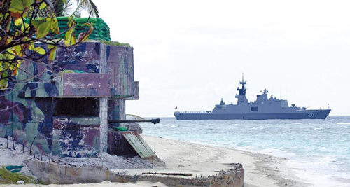
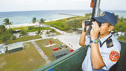
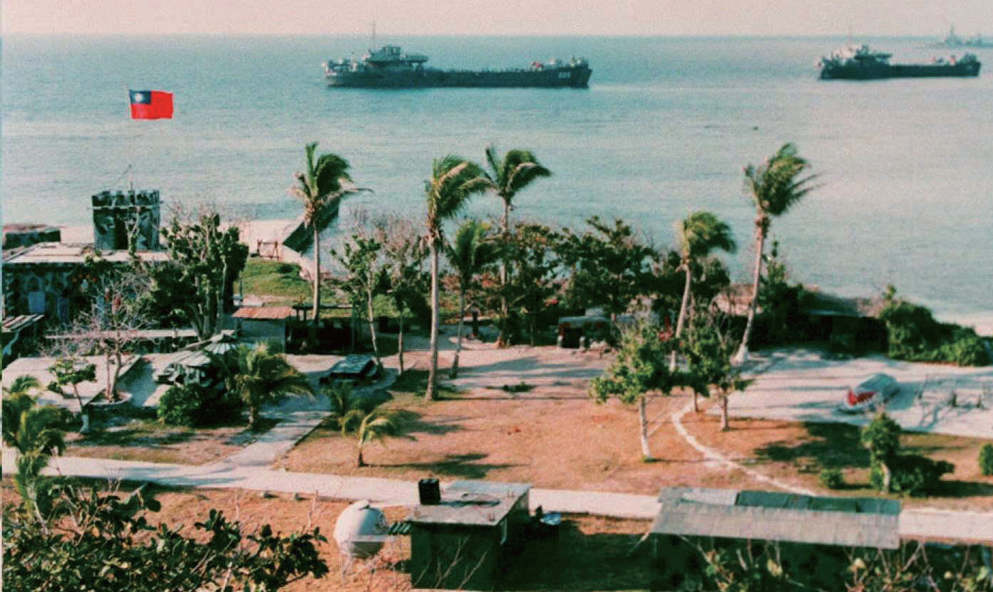
First, the Republic of China now in Taiwan was never invited to join the COC negotiation process. It is obviously opposed by Beijing for negating the ROC presence in the international community. And all ASEAN members follow the “one China” policy as the prior condition when they established the diplomatic relationship with the PRC. It is not surprised to see that the ROC is excluded from the collective effort so far. Nonetheless, the ROC is not only a claimant of the territories and waters of the South China Se,. Taipei is a substantial occupant of a major island, Tai-Ping Island, in the South China Sea. Further, Taiwan also actively conducts various maritime activities in the South China Sea. Without Taipei’s involvement and consent, how can the South China Sea Code of Conduct be a meaningful mechanism to assure the stability and peace in the South China Sea?
The ROC Coast Guard stationed in the South China Sea.
Compared to Myanmar, Thailand, Cambodia, Singapore and Laos, the Republic of China should have more reasons to be involved in the negotiation process since all these ASEAN states noted above are not adjacent to the South China Sea at all. Taipei should also have the better reason than Jakarta to sit together with other claimants of the territories in the South China Sea since Indonesia is not even a claimant but only concerned of its Economic Exclusive Zone. Although Beijing frequently implies that all Taipei’s privileges and interests in the South China Sea will be guaranteed by the People’s Republic of China, the proposal has never been accepted by Taipei. Any assurance like this will not be recognized by ASEAN member states.
Second, nations’ individual interests in the South China Sea have not been totally covered by the negotiation process. As addressed by the Article Nine of the DOC, “The Parties encourage other countries to respect the principles contained in this Declaration;” how can we expect that states never involved in the negotiation process of the future South China Sea COC can be constrained by a mechanism that they never explicitly accept. Many states use the South China Sea as major sea lanes of communication to serve their maritime interests and supporting their national economic welfare. If we expect the South China Sea COC to be a meaningful document to assure the peace and stability in the South China Sea, it should allow more states to be involved in the codification process and even subsequently signing and ratifying the international decree.
Tai-ping Island in the South China Sea is substantially stationed by the ROC garrison forces after World War II.
Based on the flaws already mentioned, the author would like to propose a “Multi-chaptered South China Sea Code of Conduct” in order to make this document can be more sensible and functional also. The South China Sea Code of Conduct should be categorized into several chapters according to participants’ conditions. In another word, it should be modularized by function and status accordingly.
Those who are concerned with the situations in the South China Sea are encouraged to read the contents of the “Declaration on the Conduct of Parties in the South China Sea” and the “Guidelines for the Implementation of the DOC.” It is obvious that many terms are totally irrelevant to some ASEAN member states since they have no position to engage with those activities. To some extent, these ASEAN member states are so innocent to be kidnapped into a process that may not serve their true interests simply because of the plot to use ASEAN to balance the PRC in the South China Sea. On the other hand, for many states actually involved into activities in the South China Sea, the negotiation process does not consider preparing a document for them to participate so that establishing constraints on their behaviors or activities in the South China Sea is unlikely.
A multi-chaptered South China Sea Code of Conduct may allow states using the South China Sea for whatever reason to choose those chapters they would like to sign and promise to follow the code accordingly. Several chapters like environmental protection, fishery regulation, search and rescue, scientific research, climate report, oceanographic survey, anti-piracy and smuggling, nature preservation, sewage and waste process, navigation aid and regulation can be easily established with no controversy. For those codes that intentionally restrict behaviors enhancing future territory claim position, we should consider to replace the term of “claimants” into “occupants” so reducing the de jure proclamation by more objectively expressing the de facto statement.
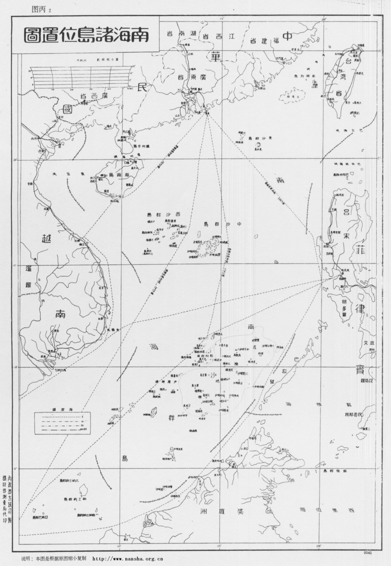
Eleven dash line map the territory and waters in the South China Sea published by the Republic of China in 1946.
This may be the only way to accommodate the Republic of China in Taipei and have it join this mechanism but not provoking Beijing. Beijing is very sensitive to anyone who violates the one China principle by accepting any term that may imply “Two Chinas” or “One China, One Taiwan.” Taipei has no intention to use the South China Sea Code of Conduct as a stage to irritate Beijing. Adopting the term of occupants to replace claimants may allow the specific chapter to be a description of realities in the South China Sea but not a statement of expressing political aspirations. The author would like to remind all the readers that without the Republic of China, the South China Sea Code of Conduct is only a self-deceived paper. Without all other states actually involved in the maritime activities in the South China Sea to promise following the terms noted in the chapters they choose to sign, the South China Sea Code of Conduct cannot be meaningful.
Chang Ching is a Research Fellow with the Society for Strategic Studies, Republic of China. The views expressed in this article are his own.
This article by Dr. James Kraska was originally published at The Diplomat. It is republished here with the author’s permission.
Since 2009, when China asked the secretary-general of the United Nations to circulate its nine-dashed line claim to the community of nations, the world has stood in bewilderment at Beijing’s actions in the South China Sea. Vietnam, Malaysia, and the Philippines have the most to lose over China’s gambit, and the disparity in power between them and China leaves them confounded and stunned – and privately, apoplectic. China’s policies have created a dangerous messin the South China Sea. The irony is palpably bitter on nine distinct levels. Vietnam, Malaysia, and the Philippines hold the key to the best chance to fix the mess.
The first irony is that during negotiations for the UN Convention on the Law of the Sea (UNCLOS), the developing states reluctantly ceded freedom of navigation through straits and in the exclusive economic zone (EEZ) for exclusive offshore resource rights. Malaysia and Indonesia, in particular, were averse to free transit through the litany of straits that cut through their nations, such as the Strait of Malacca and Sunda Strait. They relented, however, because the benefits of the package deal, foremost of which included a 200 nm EEZ, overcame their hesitancy on free navigation. If you want to get something in maritime diplomacy – exclusive control over an area of ocean – you have to give something in return if the rest of the world is going to cede its rights.
China’s seizure of its neighbors’ EEZs shatters that bargain. The Third UN Conference on the Law of the Sea that produced UNCLOS was convened after Ambassador Avid Pardo issued a clarion call in the UN General Assembly in 1967 to designate the riches of the seabed as the common heritage of all mankind as a source of
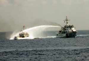
A Chinese Coast Guard Ship fires water cannons at a Vietnamese Vessel in 2014.
development for the world’s poorest nations. Similarly, since 90 percent of the world’s fisheries lie within 200 nm of shore, the EEZ was created to ensure food security for developing states. Today the maritime states of Southeast Asia, more reliant on the sea than most, face the real prospect of losing their rightful bounty, even as they accepted they navigational provisions.
Second, China was a leader among the developing states pushing for increased andsecure offshore fishing and mineral rights for coastal states. Now a first order power, China takes it all back. It is as though the United States, Japan and Russia, who successfully bargained for liberal rules to protect freedom of navigation in exchange for recognizing the EEZ, agreed to give up the right to distant water fishing. Then decades after signing the treaty, the maritime powers began again sending industrial factory fishing vessels to scour the EEZs of the developing world.
The United States, which initially opposed creation of the EEZ and is not a party to UNCLOS, promotes and respects other countries’ EEZ rights; China, which championed the EEZ, is a party to UNCLOS and yet does not respect the EEZ rights of its neighbors.
Strategic Hegemony
Third, at its core, the dispute between China and its neighbors is not about China’s voracious appetite for resources, but rather about fortifying Beijing’s power and strategic hegemony in East Asia. The irony is that there are few resources to be had in the South China Sea. Only CNOOC, the Chinese state-controlled offshore oil company, suggests there are large reservoirs of oil and gas in the South China Sea. The U.S. Energy Information Administration, in contrast, believes that although the South China Sea contains perhaps 11 billion barrels of oil and 190 trillion cubic feet of natural gas, those resources mostly reside in undisputed areas along the coastline outside of China’s nine-dashed line claim. Likewise, while the fisheries of the South China Sea once were rich, in recent years they have been grossly depleted. China operates the largest fishing fleet in the world, and is principally to blame. While the hydrocarbons and fishing resources are not enough to move the dial on the Chinese economy, they are critically important for the smaller populations and economies of Vietnam, Malaysia, the Philippines, Indonesia, and Brunei. The resource angle is a Chinese canard to mask a bold and strategic move.
Fourth, China serially insists on heartfelt and unique “interpretations” of international law to justify its South China Sea policy that lack any support outside China. We are told to abandon ethnocentric notions of international law and accommodate China’s outcome-based, albeit relatively recent way of thinking. Yet Beijing has demonstrated a sophisticated and patient adherence to the international law of land boundary disputes and signed fair and balanced treaties with 13 of 14 of its neighbors. It is as though there are two sets of Chinese Foreign Ministry lawyers – one informed by principles of international law and accepted norms, and another that appears incredulous to the most basic rules of the history, norms, and practices in the law of the sea. Chinese officials and scholars have been subject to an onslaught of tutorials and protests on maritime law by foreign lawyers and policy makers at countless official and Track II conferences and dialogues. The predictive pattern: The rest of the world argues until it is blue in the face, and Chinese representatives appear not to get it.
The only impediment to this theory, however, is that ironically China appears to actually understand the law of the sea when it is in its interest to do so. China has quietly reached amicable and even-handed agreements with both Vietnam and South Korea in the Gulf of Tonkin and Yellow Sea, respectively, to responsibly and equally divide fisheries and conduct joint enforcement patrols that reduce tension. Cooperation in these areas is strong and enduring, yet it attracts no media attention and elicits no question why China understands law of the sea norms in these areas, but utterly fails to grasp them in the South China Sea.
The fifth irony is that China has pocketed the rights it gained in UNCLOS, but had dodged its responsibilities. As a leader in offshore enclosure, China was a leader among a group of states from Asia, Africa, and Latin America, to expand the territorial sea from 3 nm to 12 nm and create the 200 nm EEZ. As a package deal, China and other state parties have a legal obligation to accept the obligations of the treaty along with the newly created rights. China has failed to observe its obligations to other states operating in its own territorial seas and EEZ. For example, China attaches conditions to the right of innocent passage in the territorial sea and freedom of navigation in the EEZ that not only are nowhere in UNCLOS, but were specifically rejected by the world community during the negotiations. Just as China fails to accept its obligations toward foreign ships and aircraft in its own EEZ, it has enjoyed the rights and freedoms of UNCLOS in other countries’ EEZs.
Dubious Claim
Sixth, even a sweepingly generous and sympathetic application of international law in favor of China’s claims fails to give Beijing anything more than a handful of tiny maritime zones in the region. Although China has declined to clarify the meaning of its nine-dash line
A depiction of China’s “nine dashed line” claim
and islands of the South China Sea. The numerous reefs, low-tide elevations, and skerries, however, are not subject to legal title and belong to the state on whose continental shelf they are located. While China has asserted a claim to the rocks and islands based on historic discovery, it has not put forth even a prima facie case to support such an audacious claim.
A prima facie case is one that asserts material facts and relevant law that would allow a judge to decide the case in favor of the proponent. In this case, however, even if one accepts as true that everything that China has said about its history in the region – a dubious proposition to be sure – China fails to assert a lawful claim. While China claims that its ancient records show that Chinese seafarers visited and named some of the rocks in the Spratly and Paracel Islands, it is not clear that the voyages were made as an official function of state or simple happenstance recorded by anonymous fishermen. As a matter of law, even if agents of the emperor visited the rocks and claimed them on his behalf, the visits are legally immaterial in the same way that the U.S. visits to the moon do not confer upon the United States legal title to that celestial body.
Mere discovery by itself is not a lawful basis for acquisition of territory, as the U.S. learned when it lost the seminal Island of Palmas arbitration in 1928. The island of Palmas lies between Indonesia and the Philippines, and the governments of the Netherlands and the United States, as colonial powers, submitted the dispute to arbitration. Although the United States asserted a claim of historic discovery on behalf of the Philippines from Spanish explorers, the arbitration panel awarded the island to the Netherlands because simple discovery without effective governance extending over a long period of time was immaterial as a matter of law. Island of Palmas is the most important case to uphold the legal principal that mere historic discovery is immaterial; other precedents include the Clipperton Island arbitration (France v. Mexico, 1933). In that case, Mexico, like the United States in the Palmas case, traced its claim of sovereignty from Spanish discovery. The arbitration, however, awarded the small feature to France based upon French occupation and usage.
Similarly, in the 1953 case at the International Court of Justice over the Minquiers and Écréhous groups in the Channel Islands, the court rejected a French claim based on historic presence and fishing rights that is remarkably similar to Chinese historic claims in the South China Sea. Instead, the court awarded the features to England based on subsequent exercise of jurisdiction over them by the Manorial court of the fief of Noirmont in Jersey. Furthermore, even assuming beyond the evidence that China actually had lawful title to the rocks and islands, it lost them long ago. This has nothing to do with Western imperialism, but rather China’s closure to the rest of the world. Inactivity and lack of official presence in a feature constitutes abandonment of title over time.
Maritime Zones
Seventh, while China has not made a prima facie case, let’s assume that it magically acquired legal title to every one of the rocks and islands in the South China Sea. In this case, under the law, China could be awarded only tiny maritime zones around them. States seek to augment or buttress their claims to tiny features in the vain hope that they can secure large maritime zones of sovereignty, sovereign rights, and jurisdiction over the adjacent waters. The mindset that a nation can strike a bonanza of offshore territory and wealth from a tiny dot of coral is one of those “too good to be true” stories that never seem to die. Apparently, the potential jackpot for making such claims is too great to resist. A mid-ocean low-tide elevation, which is below water at high tide, but above water at low tide, is not entitled to any territorial sea. Zero.
A tiny rock jutting above water at high tide generates a territorial sea of only 452 nm2. In contrast, a bona fide island capable of sustaining human habitation or an economic life of its own generates an EEZ of 125,664 nm2, an area more than 275 times larger. Of course, if any of these zones overlap with another country’s zones, they have to be adjusted, and in the South China Sea, there’s the rub. International courts have uniformly rejected the idea that small features of any sort are entitled to large maritime zones, but the judgments in cases of overlapping zones are especially harsh. In the 2012 case between Nicaragua and Colombia at the ICJ, for example, the Court awarded legal title to Colombia to two tiny rocks, and then confined them within 12 nm territorial sea enclaves set within Nicaragua’s EEZ. The court did so by comparing the vast disparity of shoreline facing the area of ocean subject to dispute, and noted that while Columbia had minimal shoreline from its rock possessions, Nicaragua’s shoreline generated by its lengthy mainland coast was eight times longer. This principle of shoreline disparity examines only that coast from islands or mainland that actually face toward the opposing disputant, and it is particularly salient for the ASEAN states vis-à-vis China in the South China Sea. Take Vietnam, for example. Vietnam has a 2,200 km coastline facing the South China Sea, which is hundreds of times greater than the combined coastline of every rock and island in the region that faces Vietnam. Under the ICJ formula, Vietnam is accorded a vast, normal EEZ from its long coast, and whichever country has title to the islands within Vietnam’s EEZ would be afforded a very minimal zone. The precedent suggests that rather than winning the jackpot, the state with title to tiny, insignificant features that lie within another country’s EEZ are awarded rather tiny and insignificant rights over the nearby water.
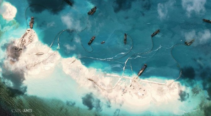
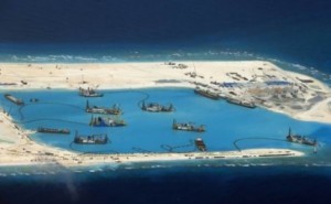
Eighth, China’s herculean effort to construct and occupy new artificial islands in the South China Sea is also legally nugatory. China has constructed enormous artificial islands from seven reefs: Mischief Reef, Gaven Reef, Hughes Reef, Subi Reef, Fiery Cross Reef, Johnson Reef, and Cuarton Reef. Analysis at Middlebury College identifies each of these reefs appears to be a low-tide elevation; the Philippines has suggested in its arbitration filing against China that the latter three are rocks.
No matter how large an artificial island is constructed, it cannot acquire additional or new legal rights over what it is entitled to in its natural state. While China has expended enormous political capital and scared its neighbors into unprecedented embrace of the United States, India, and Japan, it has actually weakened, rather than strengthened its legal position in the South China
Construction activities on the Spratleys, seen July of this year.
Sea. Why? Because the burden of proof of whether a feature is in its natural state a rock entitled to a 12 nm territorial sea and not a low-tide elevation entitled to nothing lies with the claimant. But now that China has so irreparably tampered with the evidence, it is virtually impossible to divine the natural state of its artificial islands. Some sources have recorded all of the features as mere low-tide elevations, whereas others say that at least some may be rocks. We may never know for sure now that China has hideously transformed them.
Appreciating Irony
The ninth and final irony in the South China Sea is that the principal coastal states that stand to benefit from the rule of law do not fully appreciate the ironies and so far have been unable to form a coherent approach to preserve their rights, yet the key is solely within their grasp. Brunei and Indonesia do not claim any feature in the South China Sea. Their EEZs are encroached upon by China, but because they claim no rocks, they are secondary to the disputes. Vietnam, Malaysia, and the Philippines all assert far-reaching claims over various reefs, rocks and islands in the region. These three frontline states have the most to gain from cooperation, and the most to lose from Chinese maritime hegemony. These states must recognize now that they face an imminent threat of losing their EEZ to China, but how can they secure their moral and legal inheritance from UNCLOS?
First, Vietnam, Malaysia, and the Philippines should renounce their claim to any feature that is within the natural EEZ generated by a neighboring mainland or large island coastlines, such as Borneo, Mindanao, and Palawan. The same greed and historic hogwash that drives China’s audacious claims also sometimes attracts the frontline states, ruining any chance that they can work together. Only by renouncing legally specious claims against tiny features that generate tiny maritime zones can these states ensure that they preserve the EEZ. For developing states, the EEZ was the crown jewel of rights and jurisdiction in UNCLOS, and insistence upon unrealistic claims against their neighbors only ensures that they will lose it all. Unless these states work together, they will slowly but surely lose their EEZs, the principal inheritance that the law of the sea conferred on developing states.
If Vietnam, Malaysia, and the Philippines can foreswear a claim of title to any feature within the EEZs of its neighbors, they can present a united front against China. Unity among the three nations is the best bet for galvanizing support within ASEAN, and by the member states of the European Union and NATO, and perhaps even Russia. By further diplomatically isolating China, Vietnam, the Philippines, and Malaysia drastically raise the costs for Beijing, while lowering the costs for states outside the region to support them. American support for such a plan, for example, levels the playing field, while nominally avoiding “taking sides” with a particular claimant. By giving up legally unsupportable claims that encroach on their neighbors EEZs, the frontline states assure they enjoy their rightful legacy of UNCLOS.
James Kraska is professor in the Stockton Center for the Study of International Law at the U.S. Naval War College and senior associate with the China Maritime Studies Institute, also at the Naval War College.
Featured Image: CSIS Asia Maritime Transparency Strategy Initiative via Reuters.
CIMSEC content is and always will be free; consider a voluntary monthly donation to offset our operational costs. As always, it is your support and patronage that have allowed us to build this community – and we are incredibly grateful.
The following post by Dr. James Kraska was originally published at the Asia Maritime Transparency Initiative. It is re-posted here with the author’s permission.
While China conducts innocent passage around real U.S. islands of Alaska, the U.S. is apparently unable to do so around China’s fake islands in the South China Sea. The transit by Chinese warships in innocent passage through the territorial sea of Attu Island in the Aleutian chain has added an additional wrinkle to U.S. policy in the South China Sea.
On May 12, the Wall Street Journal reportedthat Secretary of Defense Ash Carter had asked his staff to “look at options” for exercising the rights and freedom of navigation and overflight in the EEZ, to include flying maritime patrol aircraft over China’s new artificial islands in the region, and sending U.S. warships to within 12 nautical miles of them. Later that month, a P-8
The U.S. Navy’s P-8 Poseidon Maritime Patrol and Reconnaissance Aircraft (MPRA)
surveillance aircraft with a CNN crew on board, was repeatedly warned to “go away quickly” from Fiery Cross Reef, even as it flew beyond 12 nm from the feature. Fiery Cross Reef is a Chinese-occupied outcropping that has been fortified by a massive 2.7 million square meter land reclamation into an artificial island with a 3,110-meter airstrip and harbor works capable of servicing large warships.
Warships and commercial vessels of all nations are entitled to conduct transit in innocent passage in the territorial sea of a rock or island of a coastal state, although aircraft do not enjoy such a right. Ironically, the website POLITICO reported on July 31 that the White House blocked plans by Admiral Harry Harris, Commander, U.S. Pacific Command, to send warships within 12 nm of China’s artificial islands – features that may not even qualify for a territorial sea. By blocking such transits, military officials apparently suggest that the White House tacitly accepts China’s unlawful claim to control shipping around its occupied features in the South China Sea. Senator John McCain complained that the United States was making a “dangerous mistake” by granting de facto recognition of China’s man-made “sovereignty” claims.
It is unclear whether features like Fiery Cross Reef are rocks or merely low-tide elevations that are submerged at high tide, and after China has so radically transformed them, it may now be impossible to determine their
PRC operations at Fiery Cross Reef
natural state. Under the terms of the law of the sea, states with ownership over naturally formed rocks are entitled to claim a 12 nm territorial sea. On the other hand, low-tide elevations in the mid-ocean do not qualify for any maritime zone whatsoever. Likewise, artificial islands and installations also generate no maritime zones of sovereignty or sovereign rights in international law, although the owner of features may maintain a 500-meter vessel traffic management zone to ensure navigational safety.
Regardless of the natural geography of China’s occupied features in the South China Sea, China does not have clear legal title to them. Every feature occupied by China is challenged by another claimant state, often with clearer line of title from Spanish, British or French colonial rule. The nation, not the land, is sovereign, which is why there is no territorial sea around Antarctica – it is not under the sovereignty of any state, despite being a continent. As the United States has not recognized Chinese title to the features, it is not obligated to observe requirements of a theoretical territorial sea. Since the territorial sea is function of state sovereignty of each rock or island, and not a function of simple geography, if the United States does not recognize any state having title to the feature, then it is not obligated to observe a theoretical territorial sea and may treat the feature as terra nullius. Not only do U.S. warships have a right to transit within 12 nm of Chinese features, they are free to do so as an exercise of highs seas freedom under article 87 of the Law of the Sea Convention, rather than the more limited regime of innocent passage. Furthermore, whereas innocent passage does not permit overflight, high seas freedoms do, and U.S. naval aircraft lawfully may overfly such features.
In response, it might be suggested that while the United States may not recognize Chinese ownership of the rocks, it must realize that some country, perhaps one of the coastal states actually located in the vicinity of the feature, has lawful title, and therefore the U.S. Navy is bound to observe a putative territorial sea.
It is possible, however, that there is no state that has lawful title, and indeed the swirling debate and paucity of evidence rendered by claimants suggests this may be the case. Before World War II, few if any of the features were effectively governed by anyone, except Japan, which illegally occupied them during war. Tokyo gave up its claim after World War II. Similarly, actions taken by states after 1945 to seize maritime features using armed aggression are prima facie unlawful under article 2(4) of the Charter of the United Nations. Furthermore, actions taken by a state to fortify its claim after there is a dispute are similarly void of legal effect. In any event, the strongest claims appear to flow from the doctrine of uti possidetis, which stipulates that lawful possession is assumed by colonies after they become independent states. Prior to 1945, conquest was a lawful means of acquiring title to territory, so the European colonial powers certainly enjoyed legal title to the features they controlled. The Philippines, Malaysia and Brunei, Indonesia, and Vietnam derive their title to features from Spain, Great Britain, the Netherlands, and France.
More importantly, even assuming that one or another state may have lawful title to a feature, other states are not obligated to confer upon that nation the right to unilaterally adopt and enforce measures that interfere with navigation, until lawful title is resolved. Indeed, observing any nation’s rules pertaining to features under dispute legitimizes that country’s claim and takes sides. This point is particularly critical for commercial overflight since states already manage international air traffic through the International Civil Aviation Organization and the worldwide air traffic control regions. Finally, there is a policy reason that supports this approach. Given the proliferation of claims over the hundreds of rocks, reefs, skerries and cays in the South China Sea, if the international community recognizes the maximum theoretical rights generated by each of them, the oceans and airspace will come to look like Swiss cheese and be practically closed off to free navigation and overflight.
Distinguished American historian Samuel Flagg Bemis called the doctrine of freedom of the seas the “ancient birthright” of the American Republic.[1] This birthright faces its gravest risk since unrestricted submarine warfare. Woodrow Wilson brought the United States into World War I to vindicate a Fourteen Point program for peace. Point number 2 was for “freedom of navigation … in peace and in war.” Similarly, Franklin D. Roosevelt and Winston Churchill signed the Atlantic Charter in 1941 that set forth principles for a new world order – a united nations. Principle Seven committed them to freedom of the seas. Maritime freedoms and the law of the sea are at an inflection point. The United States and the international community must take action now to operate with regularity on, under, and above the surface of the South China Sea, persistently and routinely in the vicinity of China’s artificial islands. Only a normalized presence today will ensure predictability and stability tomorrow.
[1]Samuel Flagg Bemis, A Diplomatic History of the United States, 4th ed. (New York: Henry Holt, 1955): 875.
Dr. James Kraska is Professor in the Stockton Center for the Study of International Law, where he previously served as Howard S. Levie Chair in International Law from 2008-13. During 2013-14, he was a Mary Derrickson McCurdy Visiting Scholar at Duke University, where he taught international law of the sea. He is also a Senior Fellow at the Center for Oceans Law and Policy at the University of Virginia School of Law, Guest Investigator at the Marine Policy Center, Woods Hole Oceanographic Institution, Senior Fellow at the Foreign Policy Research Institute, and a Senior Associate at the Naval War College’s Center on Irregular Warfare and Armed Groups.
CIMSEC content is and always will be free; consider a voluntary monthly donation to offset our operational costs. As always, it is your support and patronage that have allowed us to build this community – and we are incredibly grateful.
This post originally appeared on Navy Grade 36 Bureaucrat. It can be found in its original form here.
At first glance, the recently released Asia-Pacific Maritime Security Strategy looks like a rehash of a lot of old points about the US’ position on Pacific matters. But upon closer examination, there is a key shift in language that those of us who watch the region will take note of. Here are ten things you might have missed:
1. It calls out the Senate directly on UNCLOS, but doesn’t address ISA.
Normally DoD publications don’t delve too much into policy matters with Congress. But it’s hard to say that about this statement:
“This is why the United States operates consistent with – even though the U.S. Senate has yet to provide its advice and consent – the United Nations Convention on the Law of the Sea”
UNCLOS was originally opposed due to the International Seabed Authority (ISA), which does such un-American things like taxing sea bed mining for distribution to other countries and mandating technology transfer. The military normally focuses on the navigation portion of UNCLOS, which it has abided by since the Regan era. The problem comes when the US is encouraging nations to use UNCLOS while not actually having ratified the treaty. There isn’t an easy solution, short of removing the ISA from UNCLOS, but expect to see UNCLOS ratification cries in the near future.
2. It calls out everyone on the South China Sea.
It’s not just China. Every claimant in the South China Seas has issues. This document clearly spells that out, taking away a talking point from the PRC that the US is overlooking the other countries to focus on China. But it pulls no punches on China, going after the “so-called Nine-Dash Line” as an excessive claim.
3. It spells out why the Senkakus became a problem.
Most people view the Senkakus as a bunch of rocks that China and Japan hold in dispute. Very few know that the Japanese government bought them in order to prevent the Governor of Tokyo from buying them. This was actually an attempt to prevent a clash with China, since the Governor was rightwing and would likely have stoked the issue. This narrative has been lost to China’s narrative about how Japan “changed the status quo,” so it’s good to see it spelled out here.
4. It puts India as a model for dispute resolution.
Comparing the India/Bangladesh maritime dispute resolution to what is occurring in the South China Sea is no accident. This document clearly spells out US support to India, likely in an attempt to spur continued Indian investment in their “Look East” strategy.
5. It denies territorial sea around reclaimed islands.
This is big.
“At least some of these features were not naturally formed areas of land that were above water at high tide and, thus, under international law as reflected in the Law of the Sea Convention, cannot generate any maritime zones (e.g., territorial seas or exclusive economic zones). Artificial islands built on such features could, at most, generate 500-meter safety zones, which must be established in conformity with requirements specified in the Law of the Sea Convention.”
This is a clear US denial of any Chinese territorial claim of these features. This has been implied before, but not ever strongly stated. On that same note…
6. Freedom of Navigation (FON) is coming to you.
One paragraph in particular tells us to expect more FON operations:
“Over the past two years, the Department has undertaken an effort to reinvigorate our Freedom of Navigation program, in concert with the Department of State, to ensure that we regularly and consistently challenge excessive maritime claims.”
Coming on the heels of stating that PRC reclaimed land is an excessive claim, this is a really good sign, although realize that future FON operations will likely include challenges to all claimants (and make diplomatic efforts interesting).
7. It accuses China of changing the status quo.
If you sit on a beach, you’ll watch the waves crash against rocks. The seawater slowly erodes the rocks until they split open at seams you couldn’t have seen before. This is analogous to China’s strategy in the East and South China Seas. They have slowly worn away at seams around every other claimant, always claiming to “maintain the status quo” when in reality they are waiting for the other claimant to make the first move, then instantly cry that they are the victim. Scarborough Reef is a classic example, yet the media has essentially ignored the issue. Luckily, this document calls it out, stating “China is unilaterally altering the physical status quo in the region.”
8. It calls out A2/AD and how we would stop any short war.
It gives vague language to DoD efforts to combat A2/AD, but it does say that it’s happening, with “robotics, autonomous systems, miniaturization, big data, and additive manufacturing.” It also later mentions that we’ll be dispersing around the Pacific, into more Japanese bases and places like Australia. This complicates PRC targeting. Will the PRC risk war with the US if we have units spread out everywhere? They don’t have enough missiles to hit everything, and striking into a country like Australia means that any sort of “short, sharp war” on their part quickly expands…something that will cause a lot of angst on their end.
9. It calls out information sharing with allies.
“This is why DoD is working closely with partners in the Asia-Pacific region to encourage greater information sharing and the establishment of a regional maritime domain awareness network that could provide a common operating picture and real-time dissemination of data.”
I’ve long argued that sharing data with allies is too hard. At the CJOS-COE we worked hard to make Carrier Strike Groups use networks that supported integrating ships from non-“Five Eyes” countries, like Germany and Norway. We proved that successfully, and in the Pacific we’ve integrated South Korean and Japanese ships before. But what about Malaysia? Indonesia? Brunei? We get some play at RIMPAC, but not enough. The disaster that was ABDA in World War 2 wasn’t that long ago. We need to get friendly nation integration right before any shooting starts.
10. It’s got great graphics.
From the scale model of Fiery Cross Reef reclamation to a very nice and detailed map of South China Sea features, this is one of the few documents that uses more than just pretty pictures of military equipment. Well done to the authors who picked quality illustrations to help drive their points home…almost as good as my choice of memes 🙂
Ryan Haag is the Hawaii CIMSEC President and an Information Warfare Officer navigating the uncharted waters of the Information Dominance Corps. He can be reached through his blog at The Navy’s Grade 36 Bureaucrat.