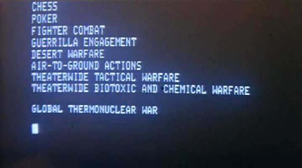

Checkers, Risk, Command & Conquer, and Fencing…since childhood, humans are exposed to games in various forms. From basic to advanced and from purely fun to cut-throat poker matches – we are continuously given opportunities to challenge ourselves and compete against fellow man in the arena (or on the screen).
The United States military has numerous, robust and mature wargaming departments that have been developing complex scenarios for more than 75 years. It is not just recreating history merely for recreational purposes, but instead it captures the vast capabilities of Naval Fleets of today, placed at the hands of military professionals to face wicked problems and thinking enemies. This week CIMSEC will explore how wargaming specifically has been used by military and security professionals for gaming’s intrinsic conflict qualities and also why Wargaming is still relevant. This week we will ask readers to consider the strengths and weaknesses of current wargaming endeavors and to propose games that we are not playing, but are inherently part of maritime security.
As we look to the future, how shall we best capture the gaming process and synchronize the structure with technology? During peacetime, gaming is one effective tool for testing the commander for the friction of combat (See Sumida on Clausewitz). This week we ask what else can and should be considered in future wargames to fully challenge the commander-of-tomorrow and to prepare the forces for the demands of confrontation in the maritime domain. What can future technology bring to further enhance our cognitive ability and challenge the profession of arms?
We look forward to your comments, critiques, and discourse.
 LCS has been taking a beating, from the cut in production numbers to the recent HASC request to slow their rate of product. With the new Request For Information out on possible replacement hulls, there’s clearly some thinking to be done. Zack Howitt joins us to discuss his Proceedings article, “
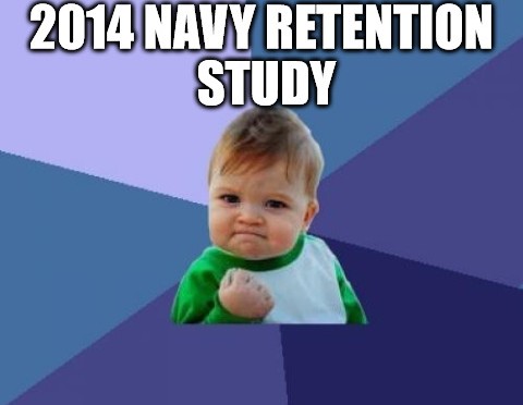
 A business can hire-in at every level, shifting employment for new projects and products. The milieu can be fun and exciting! Too bad! The military HR machine is driven by a more concrete, inflexible requirement: to-fill seats of operators and planners necessary to man the defenses. The military cannot hire-in at every level, it needs to develop people from start to finish, designing in flexibility for future changes but without so much as to demotivate personnel floating in endless holding patterns. The needs of the force are precariously balanced with the space to hone the warfighter and the warfighter’s own envisioned personal path. In this naturally messy and un-artful system, retention becomes a critical issue.
 To coincide with this retention push,
 Wargaming is an opportunity to ponder the implications of security and war plans amongst the unfolding of assumed and unexpected events. An important step in most planning processes, wargaming provides the leaders, planners, and gamers with various products and considerations, to include: the ability to evaluate strengths and weakness of ways and means; a validation of plans against a thinking adversary; potential illumination to the organizational leadership on the unique aspects, advantages and disadvantages of options, and key decisions; and an opportunity to further synchronize and refine various warfighting and interagency functions.