Dr. Jeremy Stöhs and Dr. Henrik Breitenbauch join the program to discuss European naval power in the wake of the Cold War and what the future holds, to include Techflation, personnel problems, missile gaps, and more!
When attempting to answer the question of what the U.S. military should be ready for, the responses are usually positive ones, statements of actions it should be prepared to undertake. But another possible answer is a negative one, a statement of what the U.S. should reject doing, and should choose to not be ready for. When the U.S. makes an effort to be ready for one eventuality, it is reducing its readiness to respond to others. Policymakers should consider both sides of this coin, and more consciously accept risk.
A new policy to not deploy forces to a particular location need not be formally proclaimed or written down. Nevertheless, if observers around the world could infer from American action and inaction that the U.S. has determined that a region is a lower priority for its forces, they would pick up the message that even the U.S. military is unwilling to burden itself with presence in particular corners of the world, at least not in an era of great power competition. In the maritime realm, both the Navy and the Marine Corps can benefit from excluding certain regions from sustained deployments; it would allow them to more effectively concentrate on great powers.
The Navy could cease deploying ships to the Persian Gulf, or at least reduce deployments far below the significant levels it has maintained for the past two decades. While ensuring the stability of oil supplies is not the only rationale for the U.S. Navy’s presence there – deterring Iran is another major reason, as are concerns about terrorism – the U.S. nevertheless spends $5 billion per year securing Gulf oil, according to a 2019 estimateby the Watson Institute at Brown University.1 This is part of the estimated $81 billion it spends on protecting global oil supplies.2 A reduction in this expense is worth pursuing at a time when defense spending is likely to fall, and when naval readiness has suffered major maintenance issues as a consequence of attempting to meet this CENTCOM demand signal.
An objection that might be raised to this policy is that, even if the stability of oil supplies and prices is not the primary reason for a U.S. presence in the Gulf, the removal of U.S. warships would nonetheless have a destabilizing effect. If Iran felt emboldened to attack the Arab monarchies of the Gulf, the likelihood of a full-fledged regional conflict would increase, and one consequence of which would be a rise in oil prices. However, while for a time it was a standing requirement for the U.S. to have at least one carrier in the Gulf at any given time, gaps in carrier presence have become more frequent in recent years, and Iran did not launch any attacks during month-long gaps in 2015 and 2017.3 Fears of Iranian aggression might well be misplaced.4
Meanwhile, an oil price increase resulting from greater instability (assuming it does not stem from acute conflicts or violence) is not necessarily something for the U.S. to actively avoid. On the contrary, it is something the U.S. can use to its advantage, a spur to reduce its reliance on oil more generally, regardless of where it comes from. The Biden administration’s desire to greatly increase American use of non-fossil energy provides the military with an opportunity to engage with the energy side of readiness.5 If an embrace of high oil prices resulting from withdrawal from the Gulf were combined with an energy policy that included greater investment in clean technology – building on DOD’s longstanding investmentsin alternativesto fossil fuels – readiness would receive a boost.6,7,8As Peter W. Singer and Jerry Warner put it in a 2009 primer for the Brookings Institution:
“The path to continued readiness requires reducing the overall amount of energy that the Department of Defense (DoD) uses and increasingly turning to alternative energy sources to meet fuel needs.”9
There is also the human cost of dependence on oil. In 2009, the Army Environmental Policy Institute analyzed casualties in fuel and water convoys in Afghanistan and Iraq from 2003 to 2007. They found that one in every 24 convoys in Afghanistan in that period, and one in every 38 in Iraq, resulted in at least one casualty.10 As Iraq war veteran Adam Tiffen wrote in War on the Rocks in 2014, “going green on the battlefield saves lives.”11 Going green can also help keep U.S. Navy warships out of the Gulf and in the Indo-Pacific.
There are further potential benefits to readiness for scaling down regional commitments. It would leave more ships available to deploy to other regions, including the Indo-Pacific. In recent years, China has increased its naval presence in the Middle East, and a reduction in U.S. vessels in the region could be an invitation for Beijing to increase it further, and thereby dilute its presence in the Western Pacific.12 While it is not guaranteed that China would move into the Gulf if the U.S. moved out, it is significant that China imports approximately 35 percent more oil from Saudi Arabia than the U.S. does.13 Most likely, any increase in oil prices resulting from instability would have a stronger effect on China than the United States. Any action that can tie China’s hands vis-à-vis energy security short of direct confrontation is something for the U.S. to consider.
The Gulf’s proximity to India can also make the People’s Liberation Army Navy’s challenges more difficult should it devote more resources to the region. China’s rival in South Asia would surely be worried about an increased Chinese naval presence in the Persian Gulf and the Arabian Sea. It would amplify India’s longstanding worries about the long-term partnership between its two continental rivals, China and Pakistan.14 Resulting pushback from India could make it more difficult for China to secure its oil supplies, further distracting it from the Pacific, and forcing it to devote more attention toward guarding against a rival navy.
A decision to make parts of the world off limits for sustained U.S. presence could benefit the Marine Corps especially. The deployment of Marines in Afghanistan and Iraq in the past two decades has drawn the Corps away from what ought to be its primary focus, maritime operations. Continuing to send members of what is ostensibly a maritime service into land-based theaters is not an effective way to prepare them for great power competition in the Pacific.15
The United States could decide that, unless extreme circumstances transpire, it would not deploy Marines to Central Asia. If it saw the need to send troops there, it could prioritize sending Army units, and if those were insufficient to accomplish the mission, the U.S. could consider alternatives. It might help local forces stand up, incentivize allies to send in their troops, or simply turn away and consciously accept risk. While not as expedient as simply sending in more troops, these alternatives work to preserve readiness on a strategic level.
In any case, America would most likely not exhaust its Marines in that particular part of the world in the foreseeable feature. Even if another major terrorist attack was launched on the American homeland from Afghanistan, the U.S. would likely limit its response to air and missile strikes, a modest number of boots temporarily on the ground, and support for local partners, and little else. If combatant commanders requested a substantial presence of troops deep in the interior of Asia to help complete the mission, the President, Secretary of Defense, and Chairman of the Joint Chiefs would likely say no, and rightfully so. The war weariness of the American public and the associated political constraints it places on operational endeavors could be harnessed to reap readiness gains. This would be somewhat similar to the military’s recovery in the post-Vietnam era, which was greatly facilitated by the Reagan administration making the restoration of readiness a deliberate policy priority.
Conclusion
Does the U.S. need to be ready to intervene in every region of the world? Does the military’s reach and presence need to be truly global? Or would it make sense to say of certain parts of the world, “we can’t afford to be here”? A policy of saying “no” by default to some demand signals is a perfectly sensible choice, especially in a resource-constrained environment marked by great power competition. In the case of Central Asia especially, the U.S. has the option, if it chooses, of effectively sending the message to the major actors within the region – China, India, Pakistan, and Russia – “this is your burden to shoulder, not ours.” U.S. military readiness would benefit from such a message.
In an era when the military is going to spend years attempting to dig out of the readiness hole driven by decades of high operational tempo, it makes sense to intentionally rule out certain scenarios and regions in order to ensure readiness for others. With the Indo-Pacific being the Navy and Marine Corps’ primary focus for the foreseeable future, a conscious if undeclared policy of keeping assets out of the Gulf and Marines out of Central Asia can improve the sea services’ readiness to confront China. If the U.S. is to remain the preeminent world power, it might have to give up the ability to be global in its military reach.
Michael D. Purzycki is an analyst, writer, and editor based in Arlington, Virginia. He has worked as a communications and media analyst for the United States Marine Corps and a technical writer for the Department of the Navy. He has been published in Charged Affairs (the journal of Young Professionals in Foreign Policy), Divergent Options, Merion West, Braver Angels, the Washington Monthly, France 24, the Truman National Security Project, and Arc Digital. He was awarded First Place in Divergent Options’ 2020 writing contest, “Below Threshold Competition: China,” for his essay, “Options for Altering Global Energy Developments to America’s Advantage and China’s Disadvantage.” He can be found on Twitter at @MDPurzycki and on Medium at https://mdpurzycki.medium.com/. The views expressed here are his own.
Endnotes
1. Crawford, Neta C. “Pentagon Fuel Use, Climate Change, and the Costs of War.” Watson Institute for International and Public Affairs, Brown University, June 12, 2019. https://watson.brown.edu/costsofwar/files/cow/imce/papers/2019/Pentagon%20Fuel%20Use,%20Climate%20Change%20and%20the%20Costs%20of%20War%20Final.pdf
2. Securing America’s Future Energy. “The Military Cost of Defending the Global Oil Supply.” September 21, 2018. http://secureenergy.org/wp-content/uploads/2020/03/Military-Cost-of-Defending-the-Global-Oil-Supply.-Sep.-18.-2018.pdf
3. Larter, David B. “What if the US stopped sending aircraft carriers to the Arabian Gulf?” Defense News, May 2, 2018. https://www.defensenews.com/naval/2018/05/02/what-if-the-us-stopped-sending-aircraft-carriers-to-the-arabian-gulf/
4. Larter, David B. “With Iran tensions high, a US military command pushes a dubious carrier strategy.” Defense News, March 24, 2020. https://www.defensenews.com/naval/2020/03/24/with-iran-tensions-high-centcom-pushes-a-dubious-carrier-strategy/
5. The White House. “FACT SHEET: President Biden Sets 2030 Greenhouse Gas Pollution Reduction Target Aimed at Creating Good-Paying Union Jobs and Securing U.S. Leadership on Clean Energy Technologies.” April 22, 2021. https://www.whitehouse.gov/briefing-room/statements-releases/2021/04/22/fact-sheet-president-biden-sets-2030-greenhouse-gas-pollution-reduction-target-aimed-at-creating-good-paying-union-jobs-and-securing-u-s-leadership-on-clean-energy-technologies/
6. Energy.gov. “Departments of the Navy, Energy and Agriculture Invest in Construction of Three Biorefineries to Produce Drop-In Biofuel for Military.” September 19, 2014. https://www.energy.gov/articles/departments-navy-energy-and-agriculture-invest-construction-three-biorefineries-produce
7. Alexander, David. “’Great Green Fleet’ using biofuels deployed by U.S. Navy.” Reuters, January 20, 2016. https://www.reuters.com/article/us-usa-defense-greenfleet/great-green-fleet-using-biofuels-deployed-by-u-s-navy-idUSKCN0UY2U4
8. Gardner, Timothy. “U.S. military marches forward on green energy, despite Trump.” Reuters, March 1, 2017. https://www.reuters.com/article/us-usa-military-green-energy-insight/u-s-military-marches-forward-on-green-energy-despite-trump-idUSKBN1683BL
9. Singer, Peter W. and Jerry Warner. “Fueling the ‘Balance’: A Defense Energy Strategy Primer.” Brookings Institution, August 25, 2009. https://www.brookings.edu/research/fueling-the-balance-a-defense-energy-strategy-primer/
10. Army Environmental Policy Institute. “Sustain the Mission Project: Casualty Factors for Fuel and Water Resupply Convoys.” September 2009. https://apps.dtic.mil/dtic/tr/fulltext/u2/b356341.pdf
11. Tiffen, Adam. “Going Green on the Battlefield Saves Lives.” War on the Rocks, May 22, 2015. https://warontherocks.com/2014/05/going-green-on-the-battlefield-saves-lives/
12. Eckstein, Megan. “5th Fleet CO: China Laying Groundwork in Middle East to Pose Future Threats; International Coalitions Pushing Back Against Iran.” USNI News, July 23, 2020. https://news.usni.org/2020/07/23/5th-fleet-co-china-laying-groundwork-in-middle-east-to-pose-future-threats-international-coalitions-pushing-back-against-iran
13. Stevens, Harry, Lauren Tierney, Adrian Blanco and Laris Karklis. “Who buys Saudi Arabia’s oil?” Washington Post, September 16, 2019. https://www.washingtonpost.com/world/2019/09/16/who-buys-saudi-arabias-oil
14. Blank, Jonah. “Pakistan and China’s Almost Alliance.” RAND Corporation, October 16, 2015. https://www.rand.org/blog/2015/10/pakistan-and-chinas-almost-alliance.html
15. Associated Press. “For Marines, it’s back to the future after Iraq, Afghanistan.” Washington Post, December 4, 2011. https://www.washingtonpost.com/politics/for-marines-its-back-to-the-future-after-iraq-afghanistan/2011/12/04/gIQAADA6TO_story.html
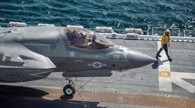
Featured Image: PACIFIC OCEAN (March 24, 2021) – A U.S. Marine Corps F-35B Lightning II with Marine Fighter Attack Squadron (VMFA) 211, Marine Aircraft Group 13, 3rd Marine Aircraft Wing, sits on the flight deck of Wasp-class amphibious assault ship USS Essex (LHD 2) during routine flight operations. (U.S. Marine Corps photo by Cpl. Israel Chincio)
As I write this in late April, America’s National Football League (NFL) Draft season is in full swing. Around the country, hundreds of athletes showcase their athletic prowess in tests and combines, thousands of journalists, scouts, and coaches observe every metric they can find, and millions of football fans greedily consume every rumor, analysis, and mock draft they can find in the “content desert” that is the football offseason. And every year, a certain class of player emerges. These athletes are genetic freaks, even among their impressive peer group. They run faster, leap higher, and throw farther than everyone else. They emerge from the NFL combines and pro days to mass media acclaim, with the eye-popping numbers to back it up. Among these standouts, a given NFL team will find a “favorite” and the team’s ownership, coaches, or staff will invariably fall in love with their favorite’s potential and draft them in an early round, signing them to a multi-million dollar, multi-year contract. Just as invariably, year after year, many teams’ favorites on draft day will be disappointments when the NFL season kicks off.
That is not a foregone conclusion, and a number of hyped early-round choices go on to successful NFL careers. But many more of them flame out; their athletic gifts do not provide them the same advantage in their professional careers as they had at the college level. It turns out there is more to being a star linebacker or running back than simply running fast and jumping far. Of course, no NFL scout can resist claiming they predicted such an outcome. “Yeah, his numbers were good,” they say knowingly, “but it didn’t show up on the game tape.”
Now, imagine these athletes never had the chance to play in a live game. There is no game tape to provide context to their incredible testing numbers. Imagine a world in which players were only ever tested, clocked, ranked, and drafted but never actually took the field to play against another team for a trophy. Each team has no schedule, but must be ready to play a game at any time. Could they truly project their ability to win by listing how strong and fast each player is?
The set for the 2010 NFL Draft at Radio City Music Hall in New York City. Photo By Marianne O’Leary – originally posted to Flickr as “NFL Draft 2010 Set at Radio City Music Hall”, CC BY 2.0, via Wikimedia commons. NFL, NFL Draft, NFL teams, and other logos are registered trademarks of the National Football League and the respective teams.
The U.S. Department of Defense is like an NFL franchise that, for lack of any game tape, relies solely on the athletic testing numbers to determine how ready their players are for the next game. Internal metrics of success, as the only numbers available, take on an outsized importance in predicting battlefield success. But anyone with even a small amount of military (or athletic) experience understands that there is more to winning than simply being the most proficient person on the field. A military, like a football team, has to be effective, as well.
In common usage, “proficient” and “effective” are nearly synonymous, but the distinction between them is critical to understanding how evaluating military forces must change. “Proficiency” is being competent or skilled at a task, whereas “effectiveness” is something that successfully produces a desired or intended result. The reason they are so easily conflated is that in many cases, they are the same: when a young private finds his weapon is jammed, his proficiency at clearing his rifle should yield the effective result of getting back into the fight.
To continue the athlete analogy, proficiency is testing well at the combine; effectiveness is catching touchdowns and making tackles in a game. There is a connection between the two, but a loose one, depending on the position and individual player.
Warfighting is not a task where proficiency necessarily correlates directly to effectiveness. Furthermore, there is no established metric for measuring battlefield proficiency. The U.S. has not fought an industrialized peer competitor since 1945, and even if it had, such proficiency would be only tangentially relevant in the hyper-connected information competition space of 2021 and beyond.
The U.S. military’s current fixation on “readiness” as a term is more focused on proficiency than effectiveness. Readiness has its roots in Congressional hearings: the Pentagon, ever vigilant of Congressional budgetary oversight, justifies budget requests and expenditures with metrics such as the number of exercises performed, deployments made, and man-hours spent on maintaining and operating systems.
Moving down the chain, tactical units report similar metrics to the Combatant Commands, who are always hungry for data. Each echelon reports their own measures of performance because the appetite for budgetary justification is omnipresent and unforgiving. These are not selfish or incompetent actions on anyone’s part—it is simply the way that incentives have been structured.
What is not being asked are the more important, but difficult to measure, questions: Are the actions being taken actually effective? Is the force actually capable of successfully producing the desired outcome, which is victory in a full scale armed conflict? For that matter, is the goal of a modern military solely to win a declared conflict, or is it to compete effectively with global and regional adversaries before overt hostilities? Time will ultimately tell if “Readiness” actually reflected the ability to succeed, but there is also plenty more that could be done now to determine that answer before relying on hindsight.
Generals Brown and Berger explained this same problem in their recent War on the Rocks op-ed “Redefine Readiness or Lose.” These veterans of high-level DoD decision-making charged that “readiness” could not just be synonymous with “availability”, as it stymied the incentives for long-term transformational actions in favor of maintaining current systems and strategies to maintain a fictional sense of omnipresent readiness. Put slightly more irreverently, the driving incentive for too much of the DoD is presenting green (i.e., “ready”) metrics on PowerPoint slides to their boss, who can report green metrics to their boss, so on and so forth, all the way to Congressional Armed Services Committees. It is important to reiterate: these are not the results of incompetent or cowardly individuals, they are simply the result of the systemic incentives as they exist today.
This critique is not new, nor is it particularly challenged by most military leaders today. What remains, though, is a deafening vacuum for what the solution must be. The fact that change is needed is widely accepted; what that change should be is undetermined. The challenge, as always, is capturing a subjective measurement in appropriately objective metrics for data collection. How can one tell what a “ready” unit is? Up until now, the U.S. has relied far too much on measurements of proficiency. Units report their training activity continuously, and the most “ready” unit is the one that most recently completed a standard list of operations and tasks. The U.S. military is an athlete that runs an incredible 40-yard sprint, jumps through the gym’s roof, and throws the ball a mile and a half, but has never analyzed the game film to see how effective it really is.
The concept of U.S military “game film” is problematic for two reasons: first, all clear-thinking Americans should hope and pray never to actually play the “game” for which the military trains. Military leaders should leverage “practice film,” to keep the analogy intact: how well does the military play in a setting as close to the game as possible?
Second is that the challenges faced by the U.S. in its most recent “scrimmage” film from Vietnam, Iraq, and Afghanistan paints an ugly picture about its readiness to handle asymmetric challenges. The U.S. showed up to the game with almost every imaginable advantage—the most athletic (read: proficient) players, high-tech uniforms, a full roster, coolers full of Gatorade, air support, and scores of expert coaches to lead them. The opponents arrived with fewer players, some outdated but simple equipment, and home field advantage. And to be frank, they won, because both teams had prepared to play “football” and the U.S. team had not expected to find itself in a soccer match. The U.S. military, in the process of measuring their proficiency and determining themselves “ready” for conflict, had diminished their ability to adapt once they understood the reality of the game. That those failures were both military and political in nature prove that sometimes the front office drafts a player who just is not a good fit for the game, regardless of the numbers on draft day.
There have been positive recent developments towards getting more practice film, including a significant push for more wargaming across the naval services, and numerous large scale force-on-force exercises at Marine Corps Air-Ground Combat Center, Twentynine Palms. These efforts are laudable and should be reinforced, but they are not solutions in and of themselves. Wargames and exercises are laboratories, where experiments can be run with unproven pieces of gear and newly-developed tactics. What they must become is an actual testing ground, wherein a force proves its readiness in a subjective manner. “Ready for what?” is the obvious rebuttal, and one of the questions posed in the aforementioned generals’ op-ed. The answer should be “problem solving.”
This is the precise point where the concept of effectiveness must be most divorced from the concept of proficiency. The problems faced by deployed military forces around the globe today do not have a proven solution. There is no handbook or checklist that describes how a decision maker should counter malign narratives and compete with undeclared special operations forces. A modern military unit, more than any other time in history, must be able to find solutions to unexpected problems. Proficiency is an element of that—a robust patrolling effort will be doomed from the start if none of the squad leaders can navigate on a map—but planners and leaders who can recognize the effectiveness of a potential action are the truest measure of readiness. A simple example might be a staff that can account for whether patrolling through the town is useful or if it will simply feed a hostile propaganda campaign. Measuring a unit’s ability to solve unknown problems is how the force should move forward in marrying proficiency with effectiveness.
This is, of course, far easier said than done. The current model of performing a list of tasks to a certain standard prior to deployment is nearly antithetical to evaluating effectiveness (though not proficiency, which is not useless, just incomplete on its own). The DoD has honed the current readiness model through decades of conflict and painful lessons in Iraq and Afghanistan; slaughtering that sacred cow is a tall order. Instead of outright replacement, priorities must be realigned to allow for testing and evaluation of decision-making and problem-solving skills in a tactical setting. It will entail the hard decisions of identifying which areas of proficiency are irrelevant. Time is the ultimate constrained resource, so deliberate thought must be put into what proficiency metrics are absolutely essential. But if the metrics that determine readiness change, and leaders communicate that appropriately, then the demand signal for objective proficiency metrics will automatically fall. This challenge is one of risk acceptance and messaging at all levels of command, but it is the cultural shift called for by Generals Berger and Brown.
Finally is the difficult task of testing problem solving skills. One answer to the question of how to evaluate problem solving is deceptively simple. Wargaming, in certain forms, is perhaps the best form of measuring the ability to solve problems. For relatively low costs in manpower and materials, war games allow commanders and staffs to test their ability to move through the Observe-Orient-Decide-Act loop. The game might be intricately detailed to stress a staff’s ability to find and retain critical information, or it can be as simple as a verbal brief. The point is that the staff must demonstrate the ability to analyze and synthesize new information from incomplete or uncertain information environments. They must study, understand, and enhance their ability to think through new problems, rather than solve old ones more and more proficiently. It is the equivalent of quizzing a quarterback on what he would do if the defense aligned in an unexpected formation. His ability to throw accurately is rendered meaningless if he cannot understand the environment and make the right decision of who to throw to.
If anything defines the competition continuum, it is uncertainty. This applies across tactical, operational, and strategic echelons, which can be addressed by corresponding changes to the war game structure. Tactical units can maneuver forces on a map, with a dedicated red cell providing a thinking, adaptive enemy. Strategic war games could range from discussing diagrams on white boards all the way to advanced simulation software emulating the actions and opinions of entire national populations.
The question of “how” can be addressed in a number of specific ways, depending on the specific nature of the unit or headquarters being tested. The point is that for a unit to be ready in any modern and meaningful sense its problem solving ability must be tested and evaluated. This will be subjective, to a certain extent, and will require a corresponding cultural shift in risk acceptance and understanding by commanders. Moreover, the specific training and evaluation events need to be created, though many elements within the DoD have already set a firm foundation for such a campaign. But until effectiveness is valued as much as proficiency is, the U.S. military is at risk of finding itself woefully unprepared when the game kicks off.
Captain Jesse Schmitt is the Assistant Intelligence Officer for the 31st Marine Expeditionary Unit in Okinawa, Japan. He earned Bachelor’s Degrees in Political Science and Economics from the University of Florida, and is currently completing a Master’s Degree in International Relations. He firmly believes that if the U.S. ever wins both the Men’s and Women’s World Cup, the rest of the world should have to call the game “soccer” until the next tournament.
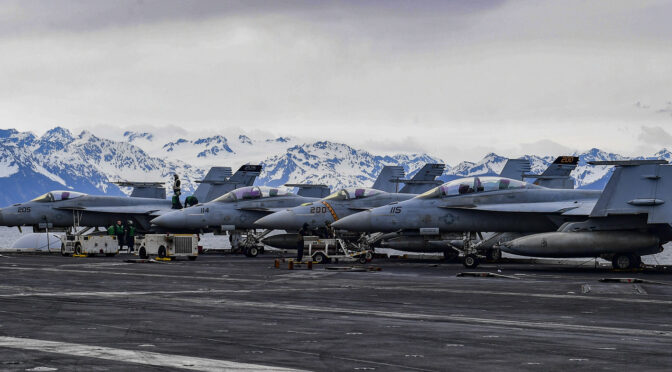
Featured image: GULF OF ALASKA (May 7, 2021) – F/A-18F Super Hornets, assigned to the “Black Knights” of Strike Fighter Squadron (VFA) 154, and the “Tomcatters” of Strike Fighter Squadron (VFA) 31 are secured to the flight deck of the aircraft carrier USS Theodore Roosevelt (CVN 71) May 7, 2021, in support of flight operations above the Joint Pacific Alaska Range Complex and Gulf of Alaska during Exercise Northern Edge 2021 (NE21). (U.S. Navy photo by Mass Communication Specialist 3rd Class Brandon Richardson)
By Connor S. McLemore, Shaun Doheney, Philip Fahringer, and Dr. Sam Savage
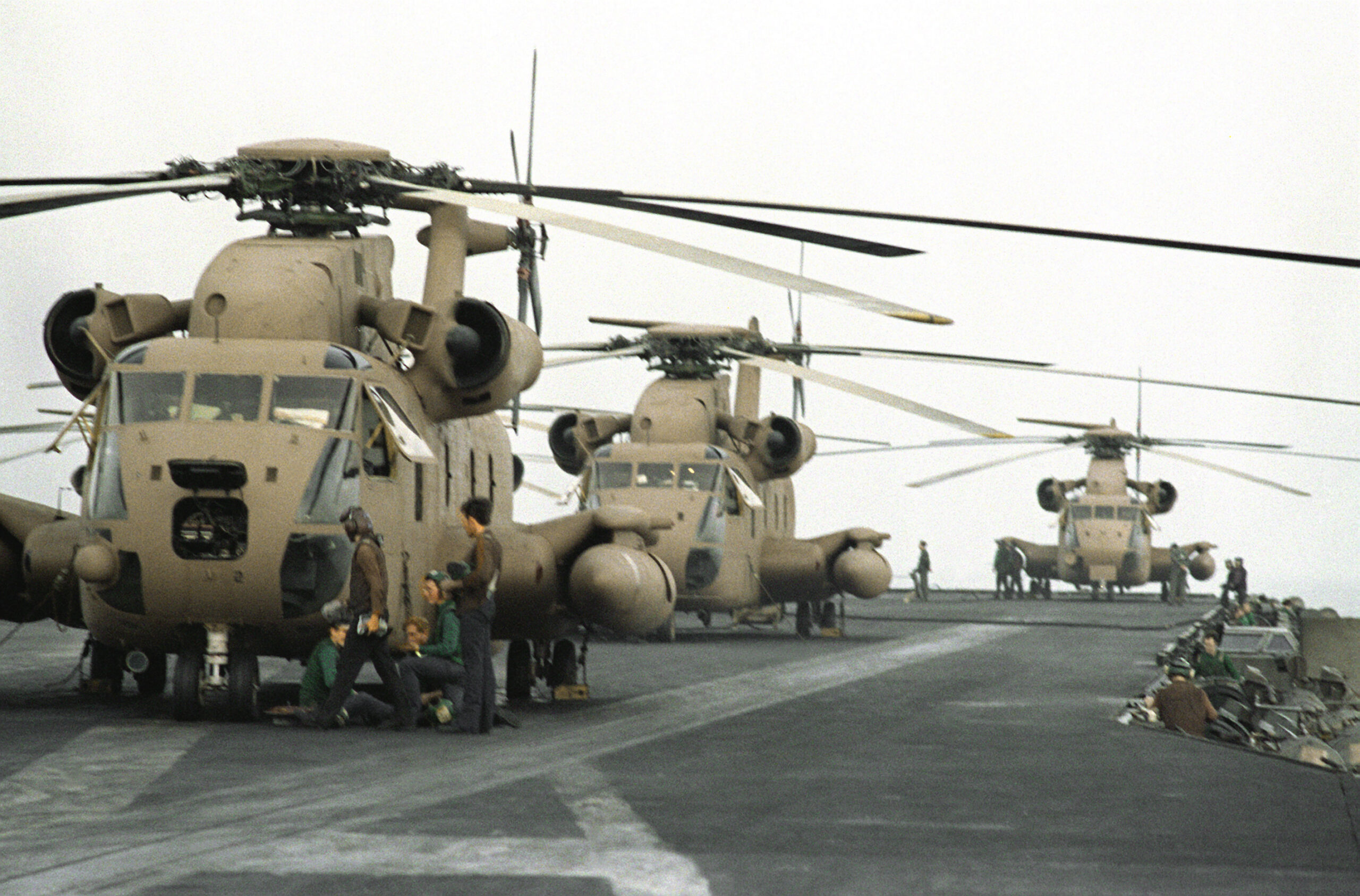
On April 24th, 1980, eight American helicopters heavily laden with special forces and their equipment launched from the aircraft carrier USS Nimitz operating in the Arabian Sea. They flew northeast into the Iranian desert to rendezvous with refueling aircraft in order to attempt a rescue of 52 hostages taken in 1979 from the American Embassy in Teheran. The operation, Eagle Claw, ended in disaster: a dust cloud kicked up by aircraft propellers and helicopter rotor blades caused one of the helicopters to collide with a refueling aircraft and explode, killing eight U.S. personnel and wounding several others. Yet the mission had already been aborted prior to the collision. During the flight to the refueling site, three helicopters suffered equipment failures, leaving just five able to continue the mission. Mission go/no-go criteria required at least six helicopters to continue, and the order from the president to abort the mission was passed. The tragic collision occurred when aircraft were attempting to transfer fuel in order to depart Iran after the mission was already cancelled.
Helicopter capability to support Eagle Claw was quantifiable based on historical helicopter failure data, and yet prior to the mission, it was not quantified. The Holloway Report, which detailed the results of the investigation into the mission’s failure, laid bare how the number of helicopters sent was a major contributing factor to the early mission abort, and recommended that more helicopters should have been sent. Using basic probability theory and known helicopter failure rates, the mission had an estimated probability of 32 percentthat there would not be six helicopters ready at the refueling site. Former President Jimmy Carter said in 2015, when asked if he wished he had done anything differently as president, “I wish I’d sent one more helicopter to get the hostages, and we would have rescued them, and I would have been re-elected.” Yet over 40 years later, the same underlying military readiness shortfalls that prioritized availability over capability for those helicopters remain largely unfixed.
April 24, 1980- Three RH-53 Sea Stallion helicopters are lined up on the flight deck of the nuclear-powered aircraft carrier USS NIMITZ (CVN-68) in preparation for Operation Eagle Claw. (Photo via Wikimedia Commons)
The urgent need for changes to the military’s existing readiness framework has been called for by General Charles Brown, the chief of staff of the Air Force, and General David Berger, the commandant of the U.S. Marine Corps. In their recent War on the Rocks article, they describe the necessity of a better analytical framework for the joint force to better assess balancing operational costs of existing forces with investment costs to modernize and replace those forces. The two service chiefs point out, “Our current readiness model strongly biases spending on legacy capabilities for yesterday’s missions, at the expense of building readiness in the arena of great-power competition and investing in modern capabilities for the missions of both today and tomorrow.” In order to address that problem, they call for “a framework for readiness” and “a more precise understanding of risk — to what, for how long, and probability.” Our team at Probability Management, a 501(c)(3) nonprofit dedicated to improving communication of uncertainty and risk, wholeheartedly agrees.
Achieving the service chiefs’ vision of a better analytical framework will require changes to both the qualitative and quantitative underpinnings of the existing readiness system. To improve the quantitative parts, we recommend the implementation of a supporting data framework that is capable of informing probability-based capabilities assessments by making the Defense Department’s readiness data more flexible, visible, sharable, and usable.
Diagnosing the Problem
The readiness system contributes to unquantified capabilities of combinations of military assets, zero-risk mindsets in combatant commanders, and requirements that are excessive. These problems must be addressed in any future readiness system. It is unreasonable to expect service chiefs to push back on requirements from combatant commanders if discussions around the capabilities of combinations of military assets are purely subjective. We make no claim as to what acceptable capability thresholds should be; however, we must point out that even if the service chiefs and combatant commanders were in complete agreement on a threshold, without a way to quantify the probability of achieving it, requirements will probably remain excessive. Requirements supported with too many or not enough forces leads to imbalanced risks and costs. Why pay to achieve a 99.9 percent chance of success when a 90 percent chance of success is adequate? Conversely, why risk a 10 percent chance of failure when a 99.9 percent chance of success is required? The existing readiness system does not support thinking in these terms.
Fixing the limitations of the existing readiness system is not purely a data challenge. However, too many problems with the existing military readiness system are a direct result of the ways in which Defense Department data is being collected, stored, and communicated. We do not advocate for the military readiness system to remove subjectivity from all readiness calculations – the readiness system should always endeavor to support the service chiefs in assessing what is meaningful, not just against what is measurable. However, subjectivity supported by systematic estimates of probability is likely to outrun subjectivity alone. The existing readiness system is simply not capable of providing military leaders with timely, fully-informed systemic probabilistic estimates of mission capabilities.
A principal problem with the existing system is that metrics associated with readiness requirements are routinely measured as “ready or not.” Once a unit meets a defined level of performance, the unit is declared “ready.” However, even when units are “ready,” it is often vague as to what they are ready for and when. Additionally, the percentages used in current readiness metrics cannot easily be aggregated by mathematically defensible means. For example, a notional requirement could be that at least 80 percent of unit systems must be ready. If a unit with 90 percent of its systems ready reports as “ready,” and pairs with a dissimilar unit at 70 percent and reporting “unready”, the combined capability of the two units to support a given mission at an uncertain future time is unclear. Fundamentally, the existing military readiness system cannot be used to quantitatively predict probabilities of mission success at uncertain future times for portfolios of dissimilar assets.
When joining readiness levels of dissimilar units, the lack of a mathematically defensible readiness framework results in important issues being distorted or lost, leaving little coherence for understanding the capabilities of the joint force at the operational or even strategic levels. Because joint force capabilities required by combatant commanders are not being credibly quantified, and because the service chiefs, who are tasked with providing ready and capable military forces to combatant commanders pay to support those requirements, the combatant commanders have little incentive to ask for fewer forces than are needed. Additionally, combatant commanders are responsible for requesting capabilities that cover their missions now, not several years in the future. Why would they risk failure by not requesting enough forces, especially considering they aren’t paying for the forces they receive? Combatant commanders are simply doing their jobs when they prioritize getting more forces in their theater now over future capabilities. Yet this is clearly a problem because marginal improvements to fulfil near-term requirements may be coming at enormous cost to important future capabilities.
DoD is not being hindered by a lack of enough data. Rather, it is hindered by an inability to see and make use of the data it collects in its many vast, opaque, stovepiped databases. Today, most military readiness data arrives in the form of historical records and subject matter expert opinions. An ideal future military readiness data framework should be able to better use that existing data while also enabling the continuous and increasingly automated collection and sharing of additional data sources that are authoritative, timely, clean, and contain useful information. Yet it is simplistic to think it will be possible to efficiently apply advanced data science techniques such as simulations, regression, machine learning, and artificial intelligence on data that is not easily visible, sharable, and usable. The lack of the appropriate data framework prevents a readiness framework from being informed by timely, visible, usable data. Fundamentally, there is no format today that allows for the efficient sharing of datasets in DoD, and much time is being wasted figuring out what data is available, if it contains useful information, and then transforming it manually so that it can be used for analysis.
A New Framework
A real gap lies in the ability of DoD to quantitatively measure what makes military units combat effective (vice combat available) and the associated costs of those capabilities. We propose the military adopts a uniform data framework that could be used within and across military services and systems to better quantify readiness predictions both now and in the future, such as providing timely estimates of the probability that helicopters will not be capable for a given mission, and to better communicate risks, such as the probability of an important mission failing because not enough helicopters are being sent. Such a data framework would allow for better sharing and employment of existing data, resulting in better quantitative metrics, leading to better cost and risk tradeoff discussions among decision-makers. This could be used to allow decision-makers to see forward in time as well with capability outcomes generated continuously through the use of large military datasets. This will allow data sources and models to evolve over time, resulting in improving probability-based capability predictions that would go a long way toward supporting the outcomes Generals Brown and Berger propose. A new approach can allow planners, commanders, and decision-makers to speak the same language to communicate, “How ready are units for what?”
Probability Management has long advocated for improvements to the quantitative underpinnings of the military readiness framework, and detailed technical explanations and example use cases for the data framework we recommend can be found in our publishedtechnicalarticles. In our work, we describe the underlying problems of the existing framework, and describe necessary steps if the joint force is to adopt a “holistic, rigorous, analytical framework to assess readiness properly,” as the service chiefs rightly demand.
In straightforward terms, the data framework is best explained as the standardized representation of the readiness of military assets in the form of columns of data with statistical dependence between columns preserved. Unlike data in the existing framework, these columns of data can then be straightforwardly rolled up to probabilistically estimate the capabilities of groups of dissimilar assets operating in uncertain environments. This data framework can be used to improve military readiness reporting systems broadly by conveying the probability of achieving specified levels of availability and capability for specified missions now and at uncertain future times. We believe the limits of the existing system do not result from the limitations of math, but rather from the limits of the data structures employed in readiness calculations. In contrast, our framework supports simple and straightforward arithmetic, while transparently carrying along probabilistic information that may be extracted when required.
The basic approach, democratized and standardized by Probability Management, does not forecast the future with a single number, for example, “on average a helicopter is operable 75 percent of the time,” but instead models many possible futures for each helicopter using cross-platform data standards. In terms of Operation Eagle Claw, consider eight columns of data with 1,000 rows each, with each column of data representing one helicopter. Every row represents a different possible future, with a one in a row if the aircraft is up and a zero if it is down. Each row will have on average 750 ones and 250 zeros. The total number of operable aircraft out of the eight is represented in a ninth column summing each of the original eight columns row by row. When the original Eagle Claw assumptions are entered into this framework, of the thousand elements in the ninth column, about 320 (32 percent) would have fewer than the six required for the mission, indicating a 32 percent chance of failure. These sorts of row-by-row calculations, known as vector operations, are trivial in virtually any software platform today, so the open standard framework could be used to enable chance-informed decisions across any other existing or future readiness software platforms.
When the readiness of an asset is represented as a column of thousands of “ready or nots,” then units can be combined in a row-by-row sum to provide a column of assets available in each of 1,000 futures. This approach, long used in stove-piped simulations, becomes a framework by simply storing simulated results in a database and making them sharable.
For example, suppose the DoD is choosing between two aircraft systems, A and B. They are both operational 75 percent of the time, but A is 5 percent cheaper than B. We might pick A to save money. But suppose that system A goes down at random 25 percent of the time, and system B is guaranteed to be operational for 7.5 flight hours and then require 2.5 hours of maintenance. Traditional readiness metrics based on averages can’t detect the difference between A and B, except on cost. But for missions requiring less than 7.5 flight hours, system B is vastly superior, because you can arrange to have 100 percent of the fleet in action. The added predictability may be well worth the 5 percent cost premium. For missions over 7.5 hours, system B is worthless, as no aircraft will be ready. With System A, however, a few planes will survive the long mission. So again, we should be asking “how ready for what,” where “how ready” may be interpreted as “what are the chances?” Chance-informed capability decisions would allow the Defense Department to quantify cost today versus the chance of adverse events tomorrow.
Conclusion
The adoption of this new data framework for military readiness would go a long way toward achieving the quantitative underpinnings necessary to support the service chiefs’ vision and it can be used to fix the fundamental problem they call out: the “gold-plating” of existing force requirements at the expense of future capability. Additionally, the framework we propose is merely a data standard, not requiring any particular software implementation, is not proprietary, is available at no cost to the government, and does not require the wholesale elimination of the existing military readiness system; it can expand upon the existing system and be implemented incrementally. It is not designed to eliminate subjectivity from a commander’s readiness calculations, nor should it. A more structured readiness approach that explicitly acknowledges uncertainty is complementary to subjective estimates. Commanders will still need to make decisions subjectively based on myriad factors, including their own risk tolerance.
Combining the predicted risks of a portfolio of dissimilar assets occurs commonly in the commercial sector. Our approach has long been widely used in applications in financial engineering, insurance, and many other industries. It has been applied to portfolios of oil exploration projects at a global energy firm and portfolios of risk mitigationsat a large utility. We are confident that our approach is both straightforward to understand and simple to use without specialized software or mathematical training. For example, using the same data framework we propose the military adopts for its readiness system, Probability Management taught modern portfolio theory, a complicated subject that involves evaluating the predicted returns of financial portfolios, to West Oakland Middle School eighth graders in 2017. The students quickly understood the framework and employed it effectively, and we are confident that military personnel will be able to easily employ it in the area of military readiness.
Our proposed data framework is already adopted by commercial organizations in sectors as diverse as healthcare, energy, and defense to quantitatively support decisions and mitigate risks. Lockheed Martin, Pacific Gas & Electric, and Kaiser Permanente are incorporating the framework to better assess the likelihood of critical outcomes in terms of probabilities of success and failure based on historical performance and future predictions.
The data framework we propose is generic and is easily tailored to new-use cases and industries, including to an improved military readiness framework. The expectation is that if our approach were applied in a military readiness context, it would support a better analytical framework for the joint force and allow better assessments. This would help better balance operational costs of existing forces with investment costs to modernize and replace those forces. Through this framework, military leaders would have a more practical understanding of the tradeoffs within military readiness and better manage the challenges of today and tomorrow.
Mr. Connor McLemore is a principal operations research analyst for CANA Advisors and the Chair of National Security Applications at ProbabilityManagement.org. He has over 12 years of experience in scoping, performing, and implementing analytic solutions. He holds Masters’ degrees from the Naval Postgraduate School in Monterey, California, and the Naval War College in Newport, Rhode Island, and is a former naval officer and graduate of the United States Navy Fighter Weapons School (TOPGUN) with numerous operational deployments during 20 years of service.
Shaun Doheney is a Senior Data and Analytics Strategy Consultant for a large global company with experience as a Chief Analytics Officer for an Inc. 5000 company. He is a retired Marine Corps Lieutenant Colonel who has conducted, participated in, or led a whole host of analyses and evaluations across major Department of Defense decision support processes. He is the Chair for the Military Operations Research Society’s Readiness Working Group and the Chair of Resources and Readiness Applications at ProbabilityManagement.org.
Mr. Philip Fahringer is a Fellow and Strategic Modeling Engineer for Lockheed Martin Aeronautics with 35 years of combined military and defense applied research in analytics and decision support. He holds a Master’s degree Operations Analysis from the Naval Postgraduate School in Monterey, California, and in Strategic Studies from the Army War College in Carlisle, Pennsylvania, and he is a former naval officer with numerous operational deployments and strategic planning assignments during 20 years of service.
Dr. Sam L. Savage is Executive Director of ProbabilityManagement.org, a 501(c)(3) nonprofit devoted to the communication and calculation of uncertainty. The organization has received funding from Chevron, Lockheed Martin, General Electric, PG&E, Wells Fargo and others, and Harry Markowitz, Nobel Laureate in Economics was a founding board member. Dr. Savage is author of The Flaw of Averages: Why We Underestimate Risk in the Face of Uncertainty (John Wiley & Sons, 2009, 2012), is an Adjunct Professor in Civil and Environmental Engineering at Stanford University and a Fellow of Cambridge University’s Judge Business School. He is the inventor of the Stochastic Information Packet (SIP), a standardized, auditable data array for conveying uncertainty. Dr. Savage received his Ph.D. in computational complexity from Yale University.
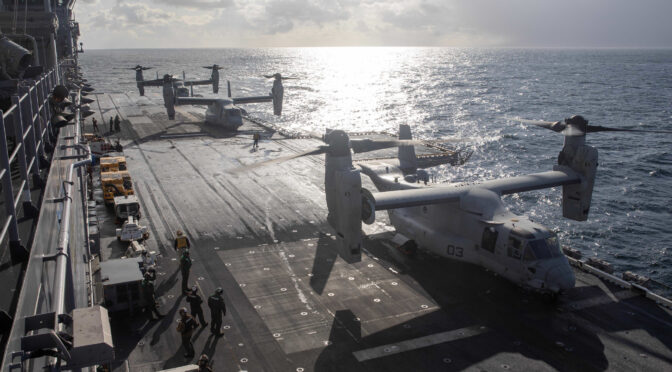
Featured Image: NORTH PACIFIC OCEAN (May 3, 2021) – U.S. Marine Corps MV-22 Ospreys, assigned to Marine Medium Tiltrotor Squadron 164 (Reinforced), 15th Marine Expeditionary Unit, prepare to take off from the amphibious assault ship USS Makin Island (LHD 8) in support of Northern Edge 2021. (U.S. Navy photo by Mass Communication Specialist 2nd Class Jeremy Laramore)