The Forgotten Chokepoint: The Mozambique Channel’s Rich Past and Bright but Insecure Future

As a Christmas gift from our friends at Risk Intelligence, we’re sharing two free articles from the publication Strategic Insights by CIMSECians. This second (also available in Pdf form), originally appeared in the November 2014 issue and provides a background and maritime risk analysis on the Mozambique Channel.

When considering maritime chokepoints worldwide the Mozambique Channel should come to mind; however, because of greater instability and vulnerability in other geographic bottlenecks it is often overlooked. Yet, for the past millennium, the Mozambique Channel has served as a key transit and trade hub linking the Indian Ocean to the world. Today is no different. This article will examine the history of the channel, its growing importance as a source for fossil fuels, the lack of adequate maritime security from regional governments, and the international efforts to mitigate security deficiency.

Pre-Suez Canal History

M_MozambiqueChannelMaritimeRegionThe Mozambique Channel is approximately 1000 nm long and 250 nm wide at its narrowest point. Madagascar, the world’s fourth largest island, forms the eastern boundary, with Mozambique to the west. The volcanic Comoros Islands and the French island of Mayotte lie in the centre of the northern mouth of the channel. The first settlers here were Austronesian seafarers from South-east Asia; next, the great Bantu migration brought Bantu peoples to the Mozambique coast and islands around 1000 CE. In the 11th and 12th centuries, Omani Arab and Persian traders sailed down the East African coast in dhows, establishing trading posts, starting a slave trade from East Africa to the Middle East, and bringing the Islamic faith to what became known as the ‘Swahili Coast.’ The Arab traders were the first, but not the last, to incorporate the Mozambique Channel into the larger Indian Ocean trading sphere.

Europeans arrived in 1498 when Portuguese explorer Vasco De Gama navigated through the Mozambique Channel on his way to India. In the following centuries the Portuguese established colonies throughout the Indian Ocean basin and East Asia, largely displacing the Arab traders, and used slave labour from Mozambique to supply plantations in Portuguese Brazil and other Indian Ocean destinations. The channel became an international thoroughfare and a critical transit hub for trade linking the Middle East, India, and East Asia with Europe and Brazil.

As the power of France and Britain ascended, ship resupply points in and safe transit through the Mozambique Channel were vital to trade routes with India and the Middle East for both countries. Predictably, pirate havens soon emerged in Madagascar and the Comoros Islands due to their strategic location and the value of passing trade, creating a need for warships to act as protection. Despite prohibition by most countries by 1820, and curtailment of slaving in West Africa, slavers shifted their operations to East Africa and in the 1850s the British Royal Navy and the US Navy regularly patrolled the channel on counter-slave trade deployments.

shipping_1750_1800

Whaling was also common. In 1851, an American whaling brig, Maria, was taken hostage in Anjouan, one of the Comoros Islands. The US Navy sloop-of-war, USS DALE, in the area conducting counter-slave trade patrol, responded by bombarding the Island’s defences to release the Maria. By the 1860s, the Mozambique Channel had for centuries played a dominant role in trade within the Indian Ocean and to East Asia and the Western world. Yet to safeguard channel trade and prevent illicit traffic required an international naval response – the same scenario one sees today.

The Most Significant Day in Mozambique Channel History

The Suez Canal, opened on 17 November 1869, drastically reduced shipping times and costs for trade between Asia, Europe, and the Americas. This ended the Mozambique Channel’s longstanding and central function as the indispensable link between Asia and the West, relegating it to a supporting role. However, because of the growing threat of terrorism and regional instability, reliance on the Suez Canal causes concern. The September 2013 rocket-propelled grenade (RPG) attack against a merchant vessel transiting the Suez highlighted this. If the Canal closed, the subsequent disruption to trade and immediate increase in shipping costs of re-routing through the Mozambique Channel would significantly increase the price of global consumer goods and oil.

Of course, before the 1869 opening of the Suez Canal, no one questioned the Mozambique Channel’s significance to global commerce – it was understood to be essential. One can see the Mozambique Channel’s role in international trade and traffic from pictured map of British trade.

Post-Suez Canal History

In the 1890s France’s territorial ambitions in the Mozambique Channel set off few alarm bells in Britain, as the French brought Comoros (including Mayotte) and Madagascar into their Empire – Britain’s primary focus had shifted to securing the route to India and the Middle East through the Mediterranean, Suez and Gulf of Aden. However, during World War II, Axis forces in the Mediterranean and North Africa threatened the British supply route to the Indian Ocean, forcing them to use the Mozambique Channel extensively. In fact, the British became so concerned that Vichy France’s Madagascar territory might be used by the Japanese Imperial Navy to harass their vital sea line of communication (SLOC), that they successfully invaded Madagascar in 1942 to ensure Allied control of the Mozambique Channel.

Post-war independence movements reached the Mozambique Channel in 1960 when Madagascar separated from France. Mozambique gained independence in 1975, after fighting a brutal, decades-long guerrilla war against Portugal. The Comoros Islands eventually broke away from France in 1978, with the notable exception of Mayotte, which remains French. After independence, instability continued to plague Mozambique as a violent civil war ensued until the 1990s. Comoros fared only marginally better, experiencing a series of 20 coups from 1978 to 2008 when the African Union intervened militarily to restore order. Madagascar only emerged from its 2009 coup in late 2013. Most of the world viewed these up heavals as internal security struggles that required little attention from the international community, since global maritime transit had shifted to the Suez Canal. Yet today the Mozambique Channel is regaining its status as an important chokepoint, and the resulting maritime security challenges demand international attention.

From Afterthought to Global Hydrocarbon Hub

In the past few years, East Africa has rapidly emerged as one of the hottest natural gas plays in the world – and the international interest and investment show no signs of letting up. The offshore region straddling north-east Mozambique and south-east Tanzania, known as the Rovuma Basin, contains, on estimation, over 100 trillion cubic feet of recoverable natural gas, making it one of the largest gas finds in the world. Multinational energy firms have rushed to take advantage of the opportunity. In particular, the US-based energy firm Anadarko and the Italian energy firm Eni hold the two largest offshore investments in north-east Mozambique. Due to the remoteness of the region, the two energy firms have agreed to convert the gas to liquefied natural gas (LNG) onshore in a joint facility for eventual transport via tanker to worldwide markets. The LNG facility is scheduled for operation by 2018 according to company press releases.

map_strategic_passages

The Indian ‘Gulf of Guinea’

The Gulf of Guinea (GoG) in West Africa provides the US and northern Europe with obvious advantages as a source for hydrocarbons: 1) several countries offering favourable terms to private investment 2) short distance to the US and northern Europe compared to Middle East oil; 3) no geographic chokepoints en route. In contrast, Middle East oil has to go through four critical maritime chokepoints (Hormuz, Bab el Mandeb, Suez, and Gibraltar) before reaching the Atlantic. Currently, most of India’s LNG comes from Qatar; thus Mozambique and East Africa could represent India’s equivalent ‘Gulf of Guinea’ – a large natural gas source close to India with no geographic chokepoints, no Middle East political calculus, and with countries open to international investment. Without a doubt, LNG imports will play an increasingly important role in India’s electrical generation mix as India’s growing population and economy demand and expect access to energy. Not surprisingly, Indian oil and gas firms bought significant stakes in Anadarko’s Mozambique holdings. According to ArcticGas.gov (27 May 2014), India’s Oil and Natural Gas Corp (ONGC), India Oil Limited (staterun), and Bharat Petroleum Corp have purchased a combined 30 per cent stake in the Anadarko’s Rovuma fields at a cost of well over $5bn USD.

Not to be outdone, the China National Petroleum Company (CNPC) bought into Eni’s Mozambique lease to the tune of $4.2bn USD for a 28 per cent stake, making the Mozambique play “China’s biggest ever investment in overseas natural gas fields” according to the Financial Times (14 March 2013). Japan and South Korea, both looking globally for alternative sources of LNG, have also invested with both Anadarko and Eni’s holdings; the Japanese energy company Mitsui now holds a 25 per cent stake in Anadarko’s concession and Korean Gas Corp (Kogas) holds a 10% stake in Eni’s concession. Additionally, European Union (EU) tensions with Russia make gas from Mozambique and Tanzania more attractive to the EU members as they attempt to diversify sources away from Putin’s Russia.

To add to the equation, western Madagascar potentially holds billions of barrels of heavy oil onshore and natural gas offshore. As reported by Reuters (07 Nov 2013), ExxonMobil, Total, BG International, and a host of international oil and gas majors have returned to Madagascar to pick up where exploration efforts (both onshore and offshore) left off before the 2009 coup. If exploration yields commercially viable oil and gas, Madagascar might become a hydrocarbon production powerhouse in its own right.

923494-120711-b-lng

Undoubtedly, critical energy maritime traffic in and around the Mozambique Channel will increase significantly as East Africa transforms itself into a hydrocarbon hub over the next decade. However, the logistics, infrastructure, port facilities, lodging, and support vessels must be created from scratch to support the development. For instance, Anadarko and Eni currently operate two large drill ships in the Mozambique Channel, but security has to be provided by private security companies using their own platform supply vessels (PSV), due to inadequate maritime security capability from area navies, especially in the remote Rovuma offshore region.

Furthermore, the local populace will have to be incorporated into the picture. Populations in the areas around the Rovuma Basin in Mozambique and Tanzania are largely marginalised Muslim communities. Protests and civil unrest in Mtwara in southern Tanzania erupted in 2013 when the country announced a multi-billion USD deal with a Chinese firm to build a gas pipeline from the south to the northern port of Dar es Salaam. As Robert Ahearne states in Think Africa Press (31 May 2013), the chronic grievances in these marginalised areas could become acute as foreign investment pours in and locals see no improvement their lot. The emergence in the mid-2000s of the infamous Movement for the Emancipation of the Niger Delta (MEND) in Nigeria, which posed a serious threat to Nigeria’s oil revenues because of MEND’s sabotage, piracy, and kidnapping of oil workers, serves as a stark warning. While the Mozambique Channel might not descend into a MEND-style armed insurgency, one cannot rule out an increase in piracy, kidnapping, and harassment as energy production related vessels, workers, and infrastructure flood into an area with a disaffected, impoverished population.

The Comoros Islands pose a similar challenge, with an impoverished Sunni Muslim population of over 700,000 inhabiting a strategic location at the northern mouth of the Mozambique Channel. A prudent course of action would be to engage with moderate Islamic groups and leaders to prevent radical voices from influencing Comorans. Appropriate levels of international and regional engagement with Comoros to enhance maritime security and co-operation should be considered.

Maritime Security

In 2010, during the height of the Somali piracy scourge, the Mozambique Channel experienced several piratical events including the hijacking of an Indian merchant vessel. Despite this, Mozambique can still only occasionally field one vessel capable of patrolling the channel. Madagascar’s navy, emerging from years of government neglect (and virtual isolation from security co-operation with international navies) after the 2009 coup, has even less capability with a few older patrol vessels of questionable value. Comoros has an advanced US-donated patrol vessel, but the high cost of operations and maintenance severely restricts its use. Additionally, these navies and coastguards do not have the fuel and operations and maintenance budgets required to conduct regular patrols of their economic exclusion zones (EEZs).

Djibouti Code of Conduct
Djibouti Code of Conduct Members

Typically the channel’s navies stay in port unless there is a distress call or search and rescue (SAR) emergency. The basic calculus is, if the vessels are not underway, then they are not burning fuel or incurring damage. This is a budget-driven decision, not a strategic assessment of the multitude of threats to maritime security and economy in the channel including illegal, unreported, and unregulated (IUU) fishing and illicit trafficking of drugs, people, etc. Last year, however, Mozambique offered a bond for a tuna fishing venture that garnered $80m USD investment due to the high returns, and a French shipyard has been contracted to deliver $300m USD-worth of patrol vessels to be run by private companies to protect this tuna fleet – whether this tuna fleet and associated security vessels materialise remains to be seen (The Economist, 23 November 2013).

Equally limited in the Mozambique Channel is maritime domain awareness (MDA). No Mozambique Channel country uses maritime patrol aircraft (MPA) to monitor the channel regularly. The region also has few automated identification system (AIS) monitoring locations and/or coastal radars. While AIS antennas and systems have recently been installed in Mozambique by the US, the ability to keep them operational (electricity, internet connectivity, maintenance, manning) remains a challenge. French Mayotte offers some MDA capabilities, but the lack of incentive and mechanisms to share the information creates impediments to developing a common, channel-wide MDA picture, leaving MDA severely limited outside of satellite AIS reporting, with patrolling capabilities of regional naval forces sporadic at best. As in the past, regional and international partners have had to step in to ensure the security of the Mozambique Channel.

The Regional Response

While the Somali piracy threat has diminished, the structures put in place during the crisis remain. One of the most important maritime security initiatives is the International Maritime Organization’s (IMO) 2009 Djibouti Code of Conduct (DCoC). The DCoC links countries from Egypt to South Africa in an attempt to build regional support structures to improve maritime security through training, information sharing, formalised collaboration, and MDA initiatives (material, exercises, and operations). Despite DCoC’s efforts to build capability, the reality is that the member states’ capabilities to meet its goals remains questionable, especially in the Mozambique Channel, as discussed above.

In 2012, South Africa stepped into the maritime security void with Operation Copper. It signed an agreement with Mozambique and Tanzania for the South African Navy to conduct permanent counter-piracy patrols in the Mozambique Channel and in Tanzanian waters. South Africa also stationed MPA in northern Mozambique to assist with airborne reconnaissance and targeting for the SA Navy frigates and offshore patrol vessels (OPV). In 2013 Tanzania withdrew from the agreement, but the SA Navy deployments continue on a bilateral basis with Mozambique (DefenceWeb, 20 March 2014). Without question, the SA Navy is the most capable force in southern Africa, and its presence in the Mozambique Channel offers a modicum of stability and security. However, South African politicians and observers have begun to question the necessity of continuing Operation Copper in the absence of a clear Somali piracy threat, because of the cost and the need for Mozambique to contribute a legitimate force of their own, (DefenceWeb, 05 March 2014). Should the SA Navy decide to stop Operation Copper, the Mozambique Channel would face serious maritime security and MDA issues – just as the region looks likely to become an offshore energy production and exporting hub.

International Maritime Security Efforts

SA-Extends-Anti-Piracy-Patrols-in-Mozambique-ChannelUS and European navies have played a minor role compared with South Africa. The US sponsors the Africa Partnership Station (APS) programme that features ship visits, training, and annual exercises for Mozambique in particular. APS increased US engagement with the region, and the US has used its foreign military financing budget to buy limited equipment (patrol boats, AIS, etc) and training for regional navies. European Union navies also pass through the channel to conduct training, ship visits, and exercises. Most notably, considering Italy’s energy company Eni’s investments in Mozambique, Italy deployed an entire aircraft carrier naval group to Mozambique for two months in early 2014, and signed an agreement with Mozambique to train and operate with the small Mozambique Navy (DefenceWeb 10 February 2014). These arrangements may well continue as Eni’s offshore natural gas field and LNG export facilities come online over the next five years. Meanwhile, through its Indian Ocean Commission (IOC) efforts, France is looking to strengthen co-operation with Comoros, Madagascar, Seychelles, Mayotte, Reunion, and Mauritius on maritime issues included illegal fishing, environmental degradation, etc. Finally, the EU has also recently agreed to restart engagement with Madagascar following the successful election.

However, one must not forget that the future of the Mozambique Channel will be influenced by Asian countries’ need for resources. The Indian Navy signed a maritime security co-operation agreement with Mozambique in 2012 and opened a ‘listening post’ in Madagascar in 2007 (Asia Times Online, 02 August 2007. See also David Brewster in The Interpreter, 12 July 2012 for India’s broader strategic interests). The Chinese People’s Liberation Army – Navy (PLA-N) has conducted a few port calls in Mozambique, but one can expect greater involvement of the PLA-N in years to come as CNPC’s investments in Mozambique and resources deals with Madagascar move forward. Whether Indian and Chinese security and economic interests can co-exist here will be an interesting ongoing measure of their relative power and influence in the Indian Ocean.

International security co-operation in the Mozambique Channel should also focus on humanitarian assistance/ disaster response (HA/DR). The channel receives regular tropical cyclones, inflicting massive damage and flooding. These pose several maritime issues: 1) environmental response (especially when, as the offshore oil and gas industries increase, so too does the channel’s exposure to damage and spills caused by weather or man-made disasters); 2) SAR – without capabilities to conduct SAR channel-wide, ships in distress will have to hope for merchant vessel or foreign navy aid in extremis; 3) disaster response – should a disaster occur, international navies might be called upon to bring relief.

The historical precedent for international involvement in the Mozambique Channel is clear, and the issues that first confounded the Portuguese, British, and French still largely remain. A proactive international approach to building regional capacity seems warranted in light of the channel’s growth in offshore energy trade, traffic, and infrastructure in the coming years.

Final Thoughts

As long as the Suez Canal remains open and operational, the Mozambique Channel will remain a relative afterthought in global maritime security conversations. Yet the channel looks certain to regain some of its historical significance as a key trade link as the hydrocarbon boom increases maritime traffic volume and value in the channel. Indian, East Asian, and European countries will all come to depend on a steady flow of LNG from and through this chokepoint. Issues ranging from piracy, HA/DR, and illegal fishing will challenge maritime security in the channel for the foreseeable future. Security will have to be underwritten by regional and international partners until the governments in Mozambique, Madagascar, and Comoros make funding viable and operational navies and coastguards a budgetary priority. In the meantime, a better understanding of the maritime history of the region, its importance to future energy markets, and its current security challenges merits focused attention from the international maritime community. Attention, and a few prayers that the Suez stays open.

Louis P. Bergeron serves in the U.S. Navy Reserve and works in his civilian career as a strategy consultant in the national security sector.  He obtained a M.A. in Security Studies from Georgetown University in 2011.

Navigating the Black Ditch: Risks in the Taiwan Strait

As a Christmas gift from our friends at Risk Intelligence, we’re sharing two free articles from the publication Strategic Insights by CIMSECians. This first (also available in Pdf form), by myself, originally appeared in the September 2014 issue and provides a background and maritime risk analysis on the Taiwan Strait.

The author’s sole experience transiting the Taiwan Strait was not a pleasant one. Like many on his ship, a US Navy destroyer, he had earlier in the week gone to sleep expecting to awake anchored in Hong Kong harbour for a few days of liberty to celebrate the American holiday of Thanksgiving. Instead, the Chinese government rescinded permission for the U.S.S. Kitty Hawk Strike Group to enter port, causing the aircraft carrier and its escorting vessels to chart a course back to Japan and leave behind many loved ones who had flown to town to rendezvous. Typhoon-spawned weather heightened the crew’s enjoyment as they headed for the Taiwan Strait to undertake a ‘freedom of navigation’ transit. Seven years later, the relationship between China and the United States has not much improved. But that between China and Taiwan has softened markedly, even as 1,600 Chinese missiles remain arrayed against targets in Taiwan. In fact, this change has resulted in a shift in the geopolitical dangers facing those who ply the strait’s waters. This article will examine the outlook of these threats.

Geography of the Taiwan Strait

Until 10,000 years ago, a land bridge connected the Neolithic people of Taiwan with those of mainland China, until rising sea levels from melting glaciers at the start of the Holocene epoch created the strait. As described by the late Harvard professor Kuangh-chih Chang, over the subsequent ten millennia the strait’s width expanded and contracted in a series of six ‘sea invasions’ and six ‘withdrawals’ as the waters rose and fell. Today the strait runs 330 km north-east to south-west, and ranges in width from 220 km at its widest to 130 km at its narrowest, with an average width of 180 km. It is bounded in the north by the East China Sea and in the south by the South China Sea, circulating waters between the two bodies with an average depth of 60 m. At its deepest in the Penghu Channel the strait reaches 177 m and is a mere 25 m deep at its shallowest near the centre of the strait’s southern mouth – the ‘Taiwan Shoal’ or ‘Taiwan Banks’.

Taiwan_Strait

Seasonal environmental variation has a large impact on the navigability of the strait. The China Coastal Current flows southward in the western part of the strait from a maximum strength in winter months, backed by the northeast monsoon, to its weakest point in the summer. On the eastern side of the strait the northward flowing Kuroshio Branch Current is turned back by the north-east monsoon in the winter after exiting the Penghu Channel, but continues the rest of the year, while reaching its maximum strength in the summer. Each year from July to September, an average of six larger (and, thus, named) tropical storms and typhoons impact the strait. Year-round, the strait is known for strong winds, wave swells, and fog (156.3 days a year of level 6 or higher on the Beaufort Scale), but these effects are amplified during the winter months. Fang Xu and Pingping Chen, writing in Securing the Safety of Navigation in East Asia by Keyuan Zhou and Shicun Wu, note that these conditions impact “not only challenges to safety at sea but also obstacles for efficient search and rescue.”

The largest group of islands in the Taiwan Strait – and the group most impactful to navigation – is the Penghu Islands, consisting of 64 islets of volcanic origin, also known as the Pescadores for the fishing communities the Portuguese encountered in the 17th century. Situated 120 km from the Chinese mainland and separated by the 45 km-wide Penghu Channel from the south-west Taiwan coast, the Penghu Islands total 127 km2, with the namesake island accounting for roughly half that total area and 70 per cent of the total population of 100,400 inhabitants.

PRC forces on Yiangshan

Another archipelago of note – the Kinmen Islands – lies just 2 km from the south-eastern coast of Fujian Province in mainland China, yet is also controlled by the government in Taipei. Consisting of 13 islets of 151 km2 and 120,713 people, the Kinmen, or ‘Quemoy’, are low and flat except for hilly Kinmen proper. These islands, along with the 36 Matsu islets at the north end of the strait, were the scene of fierce artillery duels between forces of the People’s Republic of China (PRC) and those of the Republic of China (ROC) in the 1950s during the First and Second Taiwan Strait Crises. Unlike another pair of island groups in the Taiwan Strait that the ROC controlled at the start of these crises, the Tachen and Yijiangshan islands, the Kinmen and Matsu islands remain under Taiwanese administration.

A unique, informal feature of the Taiwan Strait helps keep the peace between ROC and PRC air and naval forces and prevent misunderstanding by encouraging them to remain on ‘their’ side of the strait. Referred to variously as the Taiwan Strait ‘middle line’, ‘centerline’, or ‘Davis Line’, the 1950s origins – and exact boundary – of this division are murky, but most sources point to its first appearance in 1955 as an incidental by-product of designated American patrol areas. Since the 1958 Second Taiwan Strait Crisis, both sides have in practice mostly followed what remains a tacit understanding between China and Taiwan to prevent their warships and military aircraft from crossing to the other’s side of a line roughly bisecting the strait.

Following remarks by then-Defense Minister Lee Jye in 2004 threatening to shoot down Chinese aircraft crossing the middle line, the Taiwanese Defense Ministry released co-ordinates for their conception of the line. Today, the midline also functions as the jurisdictional boundary for a range of other regimes including the division of responsibility for search and rescue services, although increased cross-strait co-ordination and collaboration is blurring its importance.

Geopolitical Background

While most now know it as the Taiwan Strait, or Strait of Taiwan, the waterway’s aliases are a reflection of its history. The first, ‘The Formosa Strait’, comes from the former Portuguese name for Taiwan, the ilha formosa or ‘beautiful isle’. The origins of this name are shrouded in fascinating tales of doubtful veracity, as depicted in Jonathan Manthorpe’s Forbidden Nation: A History of Taiwan, but the popularisation – of both the name and the discovery of the island – by Dutch spy Jan Huygen van Linschoten in the 1596 book Iteneratio marked a transition. Whereas the 16th century was filled with Portuguese, Japanese, Chinese, and pirate expeditions and warfare in the strait, the exposure of Portugal’s secret trade routes brought Dutch and Spanish traders into that mix in the 17th century, as well as their attempts at colonisation.

Siege of Zeelandia
Siege of Zeelandia

The European colonisers were soon followed by Chinese forces. Robert Kaplan notes in Asia’s Cauldron: The South China Sea and the End of a Stable Pacific that although several Chinese dynasties launched earlier expeditions, it wasn’t until the Ming dynasty in the 17th century that an “organic connection” between Taiwan and the mainland was forged. This was achieved first with Cheng Chih-lung’s resettlement of thousands from mainland China’s Fujian province and later with his son Cheng-Kung’s 400-ship, 25,000-troop force to drive out the Dutch, culminating in the 1662 successful siege of Zeelandia.

The second alias for the Taiwan Strait, ‘The Black Ditch’ or ‘Black-water Ditch’, came into use by cross-strait traders by at least the late 17th century. This period, stretching through the 18th century, was a time of increasing integration and trade with mainland China, and the name derived (along with red, white, and green-water ditches) from the colour of the currents crossed during these voyages. In fact, there appear to have been several regional stretches of water called the black ditch, including on either side of the Penghus. One of these is the Penghu Channel, which an 1807 text calls “the most dangerous place in all the ocean. Its depth is unfathomed, and the water is as black as ink,” – but the term has since been applied to the whole of the strait. (For an exploration of the origin of the term ‘The Black Ditch’ and its physical basis see Michael Turton’s online article The Black Water Ditch and the Chinese Claim to the Senkakus from which this quote was taken.)

In the late 1800s, a punitive Japanese military campaign on Taiwan and later French blockade of its ports presaged China’s cession of the island and the Penghus to Japan in 1895 at the end of the Sino-Japanese War. Japan’s administration of the island ran until the end of World War II, when Taiwan was returned to Chinese rule under ROC control and has served as the ROC’s seat of government since its 1949 evacuation from mainland China.

The Third Taiwan Strait Crisis occurred 40 years after the first two, raising the spectre of armed conflict in the strait as PRC military exercises and missile launches were countered by American naval movements over the course of 1995-1996. Following a rocky relationship under Taiwanese President Chen Shui-bian of the Democratic People’s Party (DPP, 2000-2008) and fears that he would precipitate a crisis through an unilateral declaration of independence, cross-strait ties have notably warmed with the election in 2008 (and 2012 re-election) of Ma Ying-jeou of the Kuomintang party (KMT).

In December of 2008, direct cross-strait flights and postal services restarted for the first time in 59 years. More importantly for this paper, the ‘third link’ – direct shipping – also resumed and, according to the US Library of Congress’ Global Legal Monitor, now connects 72 mainland ports with 13 in Taiwan. In 2010, China and Taiwan negotiated and signed the Economic Cooperation Framework Agreement (ECFA) – covering specific tariff reductions and a general understanding that the two sides will work to further lower trade tariffs and investment barriers across a broad swath of the economy. In the most recent sign of friendlier ties between Beijing and Taipei, the director of China’s Taiwan Affairs Office, Zhang Zhijun, met for the first time with Taiwan’s Mainland Affairs Minister Wang Yu-Chi in June.

Activity in the Strait

The Taiwan Strait is sometimes touted as a vital shipping route, connecting Asia with the energy supplies of the Middle East. Yet its importance should neither be overstated nor viewed in isolation. Except for cross-strait transits and vessels calling at a port in the immediate vicinity of the strait, the closure of the strait would result in only minor disruptions to Asian and global trade as most international traffic could be re-routed through the Luzon Strait to the west.

maplngbig

What determines the severity of disruption is whether the Taiwan Strait is closed alone or in conjunction with the Luzon Strait. A paper by Henry Kenny for the US government-sponsored think tank CNA (formerly Center for Naval Analyses) describes what a blockade of Taiwan might look like, with “exclusion zones for normal commercial shipping, as well as harassment of ships that approach the exclusion zone. Mines are another possibility, as is strafing of ships that intentionally or inadvertently approach the island.” It too notes that “disruption might be minimized if shipping to and from Northeast Asia steered clear of Taiwan on a wide berth … of the island, entering/exiting the South China Sea off northern Luzon.”

Other analysts focus not on a conflict in the strait but its potential resolution, arguing that a PRC-controlled Taiwan would enable China to extract concessions from Japan by threatening to close the Taiwan Strait and neighbouring Luzon Strait and thereby cripple its economy. Writing in Asia’s Cauldron, Robert Kaplan says Taiwan’s “de facto independence is key to the integrity of the Taiwan Strait that guarantees Japan’s trade routes.” While both the likelihood of these contingencies and their effects are debatable, a PRC in possession of Taiwan and in conflict with Japan would indeed cause serious disruption of Japan’s trade routes. Former Japanese diplomat Hisahiko Okazaki stated in 2003: “In case of emergency, the only safe [shipping route] for Japan in Asia will be the passage through the Lombok Strait in Indonesia through the east coast of the Philippines.” Kaplan is wrong that the Taiwan Strait guarantees Japan’s trade routes, but Taiwan’s de facto independence does keep them affordable.

This is not to say traffic in the strait is negligible. By 2008 the Taiwanese government counted 400 ships transiting the strait every day, along with 5.4 million barrels of crude oil and 0.6 trillion cubic feet of liquid natural gas (LNG) as of 2011 in an analysis by the US Energy Information Administration (EIA). In comparison, the EIA showed another 5.6 million barrels of oil and 4.8 trillion cubic feet of LNG headed to South Korea and Japan through the Luzon Strait.

Traffic patterns in the strait have changed since the 2008 resumption of direct shipping. Much of today’s cross-strait traffic used to flow through the strait to enter China indirectly via Hong Kong. Now, not only has crossstrait traffic increased by 10% every year since 2008 as annual bilateral trade between the mainland and Taiwan has risen to nearly $200 billion, the overall traffic density has also reportedly increased, swelling the risks of collision. To handle this increase, the Chinese Ministry of Transport is exploring options for managing vessel traffic in the strait, including traffic separation schemes that may be implemented in the next few years.

Scope for Increased Activity

As busy as the strait is today, there are several possible scenarios that would increase congestion further. The South China Morning Post reports China may attempt physically to bridge the strait, having approved in 2013 two such highway projects, although whether the connections would involve bridges or tunnels in unclear. It is also unlikely that this project will come to fruition until much later stages of political and/or economic integration – according to independent intelligence firm Stratfor, the nearterm prospects for the link remain “largely illusory”. But if at some date it does proceed, the project could have an appreciable impact on strait traffic; on the other hand, once completed it would also divert some of the of crossstrait shipping traffic.

Far sooner than any such infrastructure, two follow-ons to the ECFA are likely to increase cross-strait traffic. The first, the Cross-Strait Services Agreement (CSSA), was signed last year and awaits ratification by Taiwan’s legislature. According to The New York Times, the CSSA opens 80 industries to investment in China and 64 in Taiwan. Although these are primarily service-sector openings, the CSSA does include the potential to boost the cross-strait travel industry. The second ECFA follow-on is the Cross-Strait Goods Agreement (CSGA), a tradein-goods pact still under negotiation that would have an even greater impact on vessel traffic.

Lastly, the EIA reports that Taiwan is working with China’s state-owned China National Offshore Oil Corporation (CNOOC) to explore for oil and natural gas in the strait. While these efforts have yet to make any substantial discoveries, and have failed in earlier attempts, any such finds would complicate the strait’s already crowded transit conditions.

Geopolitical Risk Assessment

ROC Marines
ROC Marines

The current state of reduced tensions between China and Taiwan is likely to continue until at least the next presidential administration in 2016, and cross-strait economic integration is unlikely to abate in the foreseeable future. Nonetheless the risks of a future military conflict in the strait remain real. Scott Kastner of the University of Maryland notes that while even a return to power of the DPP would not dampen the current spirit of co-operation, “the cross-strait relationship has not been fundamentally transformed.” Although economic incentives are increasing for both sides to continue the peaceful status quo, especially given Taiwan’s pragmatic acceptance of ambiguous sovereignty, this does not forestall the potential of a determined policy shift to resolve by force or decree what remains a matter of uncompromising principle – nor of a domestic contingency resulting in an attempt to use the flashpoint issue for political advantage.

PRC Marines
PRC Marines

For Taiwan, the growth of economic interdependence and the strength of China’s military have driven the cost of an attempt to alter the status quo to a rationally unacceptable level if it would knowingly invite an armed response from China (see Scott Kastner’s draft paper A Relationship Transformed? Rethinking the Prospects for Conflict and Peace in the Taiwan Strait for an excellent analysis of rational calculations and redlines, from which his prior quote was taken). A declaration of independence is highly unlikely in the next decade, yet a future Taiwanese leader may nonetheless face, or believe he/she faces, what Thomas Christensen writing in the journal International Security terms as a “closing window of opportunity” to maximise Taiwan’s position in respect to its freedom of action and international status. Analysts have given a range of dates when China will be able to defeat Taiwan alone or in conjunction with American assistance, with Taiwan itself (and self-interestedly) predicting a lost edge by 2020. All such assessments are a moving target and based on assumptions about military investments that may not hold true, but they might reinforce a perception that the time for Taiwan to act – even modestly – is sooner rather than later.

RisksFor China’s part, this shift in the balance of power in its favour recommends patience. But such patience has its limits. Given the recent perceived violations of promises regarding Hong Kong’s governance and electoral future it is unlikely for a Taiwanese ruler to agree to an accord along Hong Kong’s model of ‘One China, Two Systems’. Further, as the same balance of power increases in China’s favour it places downward pressure on the cost for China of settling the matter by force. Kastner remarks that if this pressure outweighs the countervailing upward pressure from economic integration it could have the destabilizing effect of tempting future decision-makers to act. This is especially so if coupled with beliefs that work towards a peaceful settlement will be an effort in vain. But, as Zachery Keck of The Diplomat points out, if China is acting rationally it also must include in its calculations the likelihood and cost of armed resistance and pacification after the defeat of Taiwan’s armed forces. On balance then, short of internal domestic upheaval in either polity, the strait will remain the premier demonstration of John Mearsheimer’s “stopping power of water” and locus of anti-access, area-denial capabilities – with China’s arrayed to deter the US Navy from entering the strait and Taiwan’s arrayed to prevent China from crossing it – and this arrangement will remain peaceful.

Conclusion

In its current incarnation, the Taiwan Strait is simultaneously a trade super-highway and a moat. As such, its value is undeniably greatest for Taiwan, but its criticality can be overstated for international trade beyond the ports and economies in the immediate strait region, due to the readily available Luzon Strait route as an alternate.

Scott Cheney-Peters is a surface warfare officer in the U.S. Navy Reserve and the former editor of Surface Warfare magazine. He is the founder and president of the Center for International Maritime Security (CIMSEC), a graduate of Georgetown University and the U.S. Naval War College, and a member of the Truman National Security Project’s Defense Council.

It’s the Economy: Exploring Indonesia’s Piracy Problem

International efforts to solve piracy often focus on displays of force. Whether it is the United States-led Task Force 151 in the Gulf of Aden or international operations in the Strait of Malacca, states most often revert to military or law enforcement to end piracy.

Force is not the ultimate answer. While states should certainly keep up efforts to apprehend pirates, security threats from piracy are just a symptom. The cause is inherently an economic problem.

The current peak of piracy and maritime armed robbery off Indonesia (the former outside territorial waters, the latter within) is a prime example of the economic problems at hand. Between January and September of 2014, Indonesia experienced 72 attempted and actual incidents of piracy and armed robbery, according to the International Chamber of Commerce’s International Maritime Bureau. [1] This figure is, far and away, the highest in the world, accounting for 40% of such incidents.

Indonesia sits at a maritime crossroads of the world, affording it considerable resources of which to take advantage. Indonesia is situated along the Strait of Malacca, a critical maritime trade route also bordered by Singapore and Malaysia. 30 percent of global maritime trade passes through the Strait, heading west into the Indian Ocean and east into the South China Sea. The Strait is critical due to the speed it provides to shippers, cutting two to three days off the next fastest route. [2]

Despite these advantages, Indonesia remains firmly among the world’s developing countries. Indonesia’s total GDP of $1.285 trillion ranks 16th in the world, but due to its population size of 254 million, that per capita purchasing power is significantly reduced at $5,200, placing it at 158th among all nations.

No matter where it takes place, piracy and armed robbery is most often undertaken by those who have not reached a post-material existence, instead taking action, regardless of legality, to obtain basic needs. For the 60 percent of Indonesians who live along the coastline, that makes piracy an attractive option in the face of limited economic opportunities.

The poor state of coastal communities leaves few major industries in which Indonesians can partake, the most prevalent being fishing. Indonesian fisheries represent a USD $4.4 billion dollar industry. However, due to weak government enforcement, the industry loses USD $8 million each year to illegal fishing. Such crimes are perpetrated both by Indonesians as a means of subsistence in a poor economic environment, as well as international fishers taking advantage of Indonesia’s poorly protected resources. The additional lost revenue for legitimate fishers adds economic distress. In tandem with poor or corrupt law enforcement, piracy and armed robbery quickly becomes an attractive option for those seeking a lifeboat.

Further, Indonesian maritime development lags, in part, due to its strategic positioning. Littoral states along well-trafficked sea lanes incur high costs for maintaining and protecting these sea lanes often without receiving reciprocal economic benefits. High costs and low benefits are especially prevalent in Indonesia, which has not been able to develop effective port infrastructure to aid its coastal development. Terminals at Indonesia’s main port in Jakarta, for instance, can only move approximately 30 containers an hour at the high cost of USD $130, putting it well below most every other major Asian port in terms of its productivity/cost-efficiency ratio. Low efficiency makes Indonesia an unattractive place for shippers to do business and hinders Indonesians from getting imports at low prices.

Accentuating the geographic predisposition towards piracy and maritime armed robbery is state weakness. Indonesia is a state defined by ethnic and linguistic divisions which, until the turn of the century, was held together by the ruthlessly autocratic rule of Suharto. In recent years, however, the state has seen a definitive move towards democracy from authoritarianism with the help of military intervention. [3] The military has also proven effective in quelling separatist movements, like the Free Aceh movement.

However, while the military has been able to accomplish much towards state stability, it has not been able to effectively patrol its own waters for piracy. Indonesia covers an area of 93,000 square kilometers of water and has a coastline of 54,176 kilometers. Despite having the largest navy of its Strait neighbors (in addition to a coast guard and a marine police) and the new administration’s promises of increased defense spending, the military simply does not have the capability to patrol the entirety of its sovereign borders. The state currently spends less than 1 percent of its GDP on security, which is insufficient for developing the rule of law and a monopoly of violence within Indonesian territory, leaving it susceptible to crime like piracy. Additionally, naval spending might be poorly directed. Many of Indonesia’s current platforms are inappropriate for successfully navigating the geographic hazards of the country’s small islands and networks of mangroves.

Indonesia’s many islands both create hot spots for piracy and make it difficult for the Indonesian military to patrol.

Economic and security weaknesses lead to a unique brand of Indonesian maritime terrorism, dissimilar to other more notorious forms across the globe. Indonesian ‘pirates’ tend to commit relatively low-grade thefts in port at night, taking personal belongings or siphoning liquid gas cargo off tankers. The latter is especially rife as 50 percent of the world’s oil supplies flow through the Strait of Malacca. Regardless of the relative petty nature of these attacks, ship owners still incur high “war-risk” insurance premiums akin to those found in true conflict zones. High costs incurred on avoidable security risks sap economic resources that could otherwise be funneled to Indonesian economic development, but instead go to international insurers like Lloyds of London.

Indonesia has seen fluctuations in the levels of piracy it has experienced over the last decade. In the late ‘00s, Indonesia saw a 75 percent drop-off in piracy from earlier in the decade. However, that rate began rising again, jumping from 15 incidents in 2009 to 106 in 2013. [5] The reasoning behind the drop-off was largely due to an increased show of force in the Strait, brought about by increased international presence and cooperation. Indonesia has warmed to regional cooperation while continuing to reject western involvement in security matters, even more so recently under newly elected president, Joko Widodo. Widodo has welcomed the assistance of, among others, China, which has been eager to work with Indonesia as a way of strengthening the Maritime Silk Road, a part of China’s larger “string of pearls” maritime strategy. Such conversations with foreign powers indicate an increasing openness to foreign assistance.

Openness is critical for Indonesia, as they continue to lack the resources to effectively quell security issues within their sovereign borders. Instead, the state relies on other nations who also have stakes in the free passage of the Strait. Japan, China, and Singapore especially have much at stake due to the economic importance of the Strait as a trade route, and have financially backed the better part of Indonesia’s anti-piracy efforts. In addition to international patrols through the Strait, one of the most effective joint efforts is Regional Cooperation Agreement on Combating Piracy and Armed Robbery against Ships in Asia (creating the somewhat tortured acronym ReCAAP), an international effort that shares maritime surveillance data collected by interested nations with the Strait states (Indonesia and Malaysia are notably absent from ReCAAP but receive the data).

However, ending Indonesian piracy and armed robbery still requires Indonesian capability and effort. Such action is difficult when the major impetuses of piracy in Indonesia only continue to increase. The Strait of Malacca saw a 32 percent increase in vessel traffic between the years 2000 and 2010. [6] On the heels of a continued global recession, increasing ease of access to targets for piracy will only encourage those seeking an illicit economic option in Indonesia.

While piracy itself is a harm to Indonesia, its effects are wide-reaching to all areas of society. The capital foreign powers feel the need to invest in Indonesian security could otherwise be invested in infrastructure or other forms of economic development were it not for piracy. Thus, piracy’s economic impact is not just the direct influence of stolen goods, but also the opportunity cost for other projects. Further, private businesses are less likely to invest in Indonesia due to the capital that they must spend to secure their interests. The high costs, in terms of human and financial risk, deter businesses from investing further in Indonesia, hindering its further economic development. Additionally, piracy makes the navigation of a strategic chokepoint dangerous, hindering the physical transportation of aid in a number of forms, including humanitarian, on its way to Indonesia.

However, one form of aid which the United States and other powers with an interest in utilizing the Strait should eagerly offer Indonesia is aid in their transportation and storage sector. Indonesia’s large population means that there are markets in that country worth exploring for major corporations, but they are hindered by the country’s poor port infrastructure. In 2012, the United States sent USD $202.8 million to Indonesia in foreign aid. Only $109,000 of that was concerned with transportation infrastructure. That number should increase significantly in order to assist the Indonesians in creating long-term economic development and maritime security in the Strait. As Indonesian ports improve, shipping companies will be more likely to take the risk to do business in Indonesia, improving Indonesia’s economy on a sustainable basis. As the economy improves, Indonesia will have more resources to direct towards its security problem, finally quashing its problems with piracy and armed robbery.

Indonesia, thanks largely to prior autocratic rule, has yet to develop a strong free economy. However, with the recent democratic regime, the opportunity to develop economically is present. Further, Indonesia has a trump card: its geographic position. Some of the world’s most powerful trade states have a high interest in using an Indonesian resource.

However, the solution to an Indonesian problem must come from Indonesia itself. For any investment in its maritime sector to be a truly effective method of stopping piracy, Indonesia will need to create an effective bureaucracy capable of good governance on both land and sea. President Widodo has continuously emphasized his interest in seeing Indonesia become the “maritime axis” of the world. In order to do, Indonesia’s public and private sectors will need to reign in corruption, allocate resources smartly, and work to find the best economic solutions for all citizens. Only then will piracy finally be extinct in the Strait of Malacca.

Christopher Papas is an undergraduate student at The College of William and Mary, the Division Leader of the United States Coast Guard Auxiliary University Programs, and Acting Director of Publications at CIMSEC. His views are his own. This article was adapted from a paper for Professor Rani Mullen’s Politics in the Developing World class. Follow Christopher on Twitter: @CPapGo.


[1] “Piracy and Armed Robbery Against Ships: Report for the Period 1 January-30 September 2014” (ICC International Maritime Bureau, 2014), 5.

[2] Takashi Ichioka, “Cooperation in the Straits of Malacca and Singapore,” in Navigating Straits: Challenges for International Law, ed. David D. Caron and Nilufer Oral (Leiden: Koninklijke Brill, 2014), 343.

[3] Edward Aspinall, “Indonesia: Redistributing Power,” in Politics in the Developing World, ed. Peter Burnell, Lise Rakner, Vicky Randall (Oxford: Oxford University Press, 2014), 320.

[4] Mary George, “Security, Piracy and Terrorism in the Straits of Malacca and Singapore,” in Navigating Straits: Challenges for International Law, ed. David D. Caron and Nilufer Oral (Leiden: Koninklijke Brill, 2014), 316.

[5] “Piracy and Armed Robbery Against Ships: Report for the Period 1 January-31 December 2013” (ICC International Maritime Bureau, 2014), 5.

[6] Ichioka, “Cooperation,” 343.

Taiwan Builds a Very Different Cutter X

It’s always nice to see what others are doing.

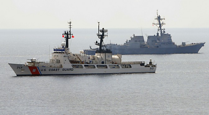
We have talked about a cutter X before, that is, a cutter larger than the U.S. Webber class, but smaller than the Offshore Patrol Cutter, that would allow more days cruising at a distance from their home ports than is possible for the Webber class.

Focus Taiwan is reporting (it is their video above) that Taiwan is building ships in this class but in a very different form, for a very different purpose. It measures 60.4 meters in length and 14 meters in width, with a crew of 41. It is fast at 38 knots and has a range of 2,000 nautical miles (this is actually less than the range of the Webber class, but if this is quoted for a higher cruise speed, the range could actually be greater than that of the Webber class at the same lower speed). The great beam is the giveaway, the hull is something unusual.

Janes.com has pictures of the hull out of the water. A separate Janes report lists the armament as eight Hsiung Feng II (HF-2) and eight ramjet-powered Hsiung Feng III (HF-3) anti-ship missiles, an “Otobreda 76 mm gun, four 12.7 mm machine guns for close-range ship defence and a Mk 15 Phalanx close-in weapon system (CIWS) to defeat incoming projectiles and hostile aircraft.”

We have seen a similar hull form before.

This article originally appeared at Chuck Hill’s CG Blog and was cross-posted by permission. Chuck retired from the Coast Guard after 22 years service. Assignments included four ships, Rescue Coordination Center New Orleans, CG HQ, Fleet Training Group San Diego, Naval War College, and Maritime Defense Zone Pacific/Pacific Area Ops/Readiness/Plans. Along the way he became the first Coast Guard officer to complete the Tactical Action Officer (TAO) course and also completed the Naval Control of Shipping course. He has had a life-long interest in naval ships and history.

Fostering the Discussion on Securing the Seas.