Category Archives: Territorial and Law of the Sea Disputes

United Nations Convention on the Law of the Sea, International Maritime Organization, and international maritime law.

Yours, Mine, and Moscow’s: Breaking Down Russia’s Latest Arctic Claims

This article originally featured on CIMSEC on August 25, 2015, and has been updated for inclusion into the Russia Resurgent Topic Week. 

By Sally DeBoer

On August 4th, the Russian Federation’s Foreign Ministry reported that it had resubmitted its claim to a vast swath (more than 1.2 million square kilometers, including the North Pole) of the rapidly changing and potentially lucrative Arctic to the United Nations. In 2002, Russia put forth a similar claim, but it was rejected based on lack of sufficient support. This latest petition, however, is supported by “ample scientific data collected in years of arctic research,” according to Moscow. Russia’s latest submission for the United Nation’s Commission on the Limits of the Continental Shelf’s (CLCS) consideration coincides with increased Russian activity in the High North, both of a military and economic nature. Recent years have seen Russia re-open a Soviet-era military base in the remote Novosibirsk Islands (2013), with intentions to restore a collocated airfield as well as emergency services and scientific facilities.  According to a 2015 statement by Russian Deputy PM Dmitry Rogozin, the curiously named Academic Lomonsov,  a floating nuclear power plant
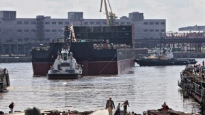
Academic Lomonsov under construction. Please click on the image for its source.

built to provide sustained operating power to Arctic drilling platforms and refineries, will be operational by 2016. Though surely the most prolific in terms of drilling and military activity, Russia is far from the only Arctic actor staking their claim beyond traditional EEZs in the High North. Given the increased activity, overlapping claims, and dynamic nature of Arctic environment as a whole, Russia’s latest claim has tremendous implications, whether or not the United Nations CLCS provides a recommendation in favor of Moscow’s assertions.

The Claim:

Russia’s August 2015 claim encompasses an area of more than 463,000 square miles of Arctic sea shelf extending more than 350 nautical miles from the shore. If recognized, the claim would afford Russia control over and exclusive rights to the economic resources of part of the Arctic Ocean’s so-called “Donut Hole.” As the New
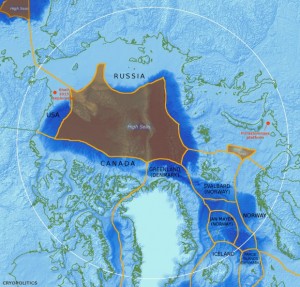
A depiction of the "Donut Hole."
A depiction of the “Donut Hole.”

York Times’ Andrew Kramer explains, “the Donut Hole is a Texas sized area of international waters encircled by the existing economic-zone boundaries of shoreline countries.” As such, the donut hole is presently considered part of the global commons. Moscow’s claim is also inclusive of the North Pole and the potentially lucrative Northern Sea Route (or Northeast Passage), which provides an increasingly viable shipping artery between Europe and East Asia. With an estimated thirteen percent of the world’s undiscovered oil and thirty percent of its undiscovered natural gas, the Arctic’s value to Russia goes well beyond strategic advantage and shipping lanes. Recognition by the CLCS of Russia’s claim (or any claim, for that matter) would  shift the tone of activity in the Arctic from generally cooperative to increasingly competitive, as well as impinge on the larger idea of a free and indisputable global common.

The Law:

As most readers likely already know, the United Nations’ Convention on the Law of the Sea (UNCLOS) allows claimants 12nm of territorial seas measured from baselines that normally coincide with low-water coastlines and an exclusive economic zone (EEZ)
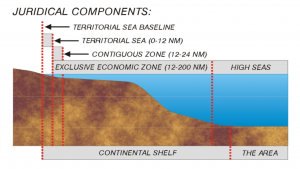
A depiction of universal claims afforded by UNCLOS

extending to 200 nautical miles (inclusive of the territorial sea). Exploitation of the seabed and resources beyond 200nm requires the party to appeal to the International Seabed Authority unless that state can prove that such resources lie within its continental shelf. Marc Sontag and Felix Luth of The Global Journal explain that “under the law, the continental shelf is a maritime area consisting of the seabed and its subsoil attributable to an individual coastal state as a natural prolongation of its land and territory which can, exceptionally, extend a states right to exploitation beyond the 200 nautical miles of its EEZ.”  Such exception requires an appeal to the Commission on the Limits of the Continental Shelf (CLCS), a panel of experts and scientists that consider claims and supporting data.  Essentially, the burden is on Russia to provide sufficient scientific evidence that its continental shelf (and thus its EEZ) extends underneath the Arctic. In any case, as per UNCLOS Article 76(5), such a continental shelf cannot exceed 350 nm from the established baseline. Russia’s latest claim is well beyond this limit; the Federation has stated that the 350 nm limit does not apply to this case because the seabed and its resources are a “natural components of the continent,” no matter their distance from the shore.

The CLCS will present its findings in the form of recommendations, which are not legally binding to the country seeking the appeal. Though Russia has stated it expects a result by the fall, the commission is not scheduled to convene until Feburary or March of 2016 and, as such, there will be a significant waiting period before any recommendation will be made.

Rival Claimants:

Russia is far from the only Arctic actor making claims beyond the 200 nautical mile EEZ. Denmark, for instance, jointly submitted a claim with the government of Greenland expressing ownership over nearly 900,000 square kilometers of the Arctic (including the North Pole) based on the connection between Greenland’s continental shelf and the Lomonosov Ridge, which spans kontinsokkel_uknearly the entire diameter of the donut hole. This claim clearly overlaps Russia’s latest submission, which is also based on the claim that the ridge represents an extension of Russia’s continental shelf. Though there is no dispute on the ownership of the ridge, both Russia and Denmark claim the North Pole.  Both nations have recently expressed a desire to work cooperatively on a resolution, though a Russian Foreign ministry statement did estimate a solution could take up to 10-15 years. Also of note: this has note always been Russia’s tune on the matter (See here and here).
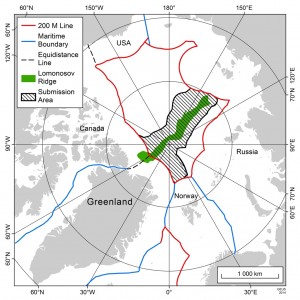
Similarly, Canada is expected to make a bid to extend its Arctic territory. Notably, Canada claims sovereignty over the Northwest Passage, a shipping route connecting the Davis Strait and Baffin Bay based on historical precedent and its orientation to baselines drawn around the Arctic Archipelago. The U.S. maintains that the Northwest Passage should be an international strait. Though they have yet to submit a formal claim to the UN’s CLCS, one has reportedly been in preparation since 2013. According to reports, Canada delayed a last-minute claim at the behest of PM Stephen Harper, who insisted the claim include the North Pole. If this holds true, Canada’s claim will likely overlap both Russia and Denmark’s submissions to the CLCS.  If the CLCS were to recognize the legitimacy of two or more states’ overlapping claims, the actors have the option to bilaterally or multilaterally resolve the issue to their satisfaction; developing such a resolution is beyond the scope of the commission.

Implications:

Likely, Russia’s submission to the United Nations is part of a larger campaign by Moscow to reassert and re-establish its influence in the international order by virtue of its status Arctic influence. Regardless of approval or rejection by the UN, Russia’s expansive claim highlights Moscow’s very serious intention to control and exploit the Arctic. As the Christian Science Monitor’s Denise Ajiri explains, “a win would mean access to sought after resources, but the petition itself underscores Russia’s broader interest in solidifying its footing on the world stage.” With much of Western Europe reliant on Russian oil and natural gas, the Arctic and its resources represent an opportunity for the Kremlin to boost their position in the international order and develop a source of sustained and significant income. Russia may be acting within the letter of the law on the issue of their claim at this time, but it’s hard to separate that compliance from the Federation’s significant investment in the militarization of the Arctic, frequent patrols along the coastline of Arctic neighbors, and expenditure on the economic exploitation of the High North. For now, the donut hole remains part of the global commons and therefore free from direct exploitation or claim of sovereignty.  The burden of proof on any one state to claim an extension of their continental shelf is truly enormous, but as experts and lawyers at the CLCS pore over these claims, receding Arctic ice combined with economic and strategic interests of the claimants will likely increase the claimants’ sense of urgency.

Sally DeBoer is a 2009 graduate of the United States Naval Academy and a recent graduate of Norwich University’s Master of Arts in Diplomacy program.  She can be reached at Sally.L.DeBoer@gmail(dot)com or on twitter @SallyDeBoer.

CIMSEC content is and always will be free; consider a voluntary monthly donation to offset our operational costs. As always, it is your support and patronage that have allowed us to build this community – and we are incredibly grateful.
Select a Donation Option (USD)

Enter Donation Amount (USD)

An Embarrassing Fact: The Legal Basis of the PRC East China Sea ADIZ

By Chang Ching

Two years ago on this day, the Ministry of National Defense of the People’s Republic of China issued a statement on establishing the East China Sea Air Defense Identification Zone. According to “the Statement by the Government of the People’s Republic of China on Establishing the East China Sea Air Defense Identification Zone,” three PRC domestic laws and administrative rules were addressed as the basis of the East China Sea ADIZ within the following text:

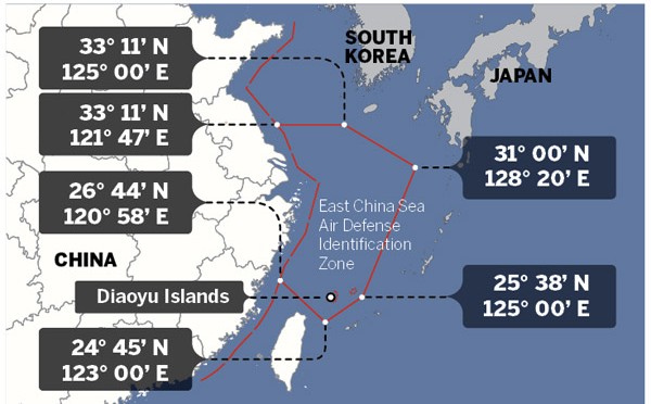
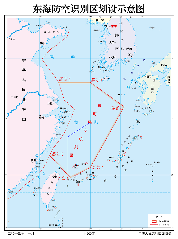
The government of the People’s Republic of China announces the establishment of the East China Sea Air Defense Identification Zone in accordance with the Law of the People’s Republic of China on National Defense (March 14, 1997), the Law of the People’s Republic of China on Civil Aviation (October 30, 1995) and the Basic Rules on Flight of the People’s Republic of China (July 27, 2001). The zone includes the airspace within the area enclosed by China’s outer limit of the territorial sea and the following six points: 33º11’N (North Latitude) and 121º47’E (East Longitude), 33º11’N and 125º00’E, 31º00’N and 128º20’E, 25º38’N and 125º00’E, 24º45’N and 123º00’E, 26º44’N and 120º58’E.

IMG_5846
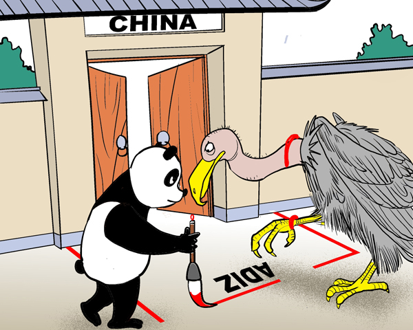
It is highly unlikely that the East China Sea ADIZ may effectively terminate all the foreign air reconnaissance maneuvers.

Further, based on this government statement, China’s Ministry of National Defense issued an announcement of the aircraft identification rules for the East China Sea Air Defense Identification Zone of the People’s Republic of China as the following text:

The Ministry of National Defense of the People’s Republic of China, in accordance with the Statement by the Government of the People’s Republic of China on Establishing the East China Sea Air Defense Identification Zone, now announces the Aircraft Identification Rules for the East China Sea Air Defense Identification Zone as follows:

First, aircraft flying in the East China Sea Air Defense Identification Zone must abide by these rules.

Second, aircraft flying in the East China Sea Air Defense Identification Zone must provide the following means of identification:

  1. Flight plan identification. Aircraft flying in the East China Sea Air Defense Identification Zone should report the flight plans to the Ministry of Foreign Affairs of the People’s Republic of China or the Civil Aviation Administration of China.
  2. Radio identification. Aircraft flying in the East China Sea Air Defense Identification Zone must maintain the two-way radio communications, and respond in a timely and accurate manner to the identification inquiries from the administrative organ of the East China Sea Air Defense Identification Zone or the unit authorized by the organ.
  3. Transponder identification. Aircraft flying in the East China Sea Air Defense Identification Zone, if equipped with the secondary radar transponder, should keep the transponder working throughout the entire course.
  4. Logo identification. Aircraft flying in the East China Sea Air Defense Identification Zone must clearly mark their nationalities and the logo of their registration identification in accordance with related international treaties.

Third, aircraft flying in the East China Sea Air Defense Identification Zone should follow the instructions of the administrative organ of the East China Sea Air Defense Identification Zone or the unit authorized by the organ. China’s armed forces will adopt defensive emergency measures to respond to aircraft that do not cooperate in the identification or refuse to follow the instructions.

Fourth, the Ministry of National Defense of the People’s Republic of China is the administrative organ of the East China Sea Air Defense Identification Zone.

Fifth, the Ministry of National Defense of the People’s Republic of China is responsible for the explanation of these rules.

Sixth, these rules will come into force at 10 a.m. November 23, 2013.

For the most part, military observers and political commentators have analyzed the matter from the political dimension. What is lacking is an examination of the validity of these three PRC domestic laws and rules as well as their association with the PRC government statement and the subsequent aircraft identification rules. 

After reviewing the three laws and rules, i.e. the Law of the People’s Republic of China on National Defense, the Law of the People’s Republic of China on Civil Aviation and the Basic Rules on Flight of the People’s Republic of China, noted by the PRC East China Sea ADIZ statement (hereafter, the statement) and the associated aircraft identification rules, we may conclude the following flaws:

First, the effective dates of these three laws and rules noted by the statement are indeed questionable.

For the Law of the People’s Republic of China on National Defense, it was initially put into force on March 14, 1997, as noted by the statement. Likewise, the Law of the People’s Republic of China on Civil Aviation was originally put into effect on October 30, 1995, also noted by the statement. Nevertheless, according to the “Decision of the Standing Committee of the National People’s Congress on Amending Some Laws” issued by the Standing Committee of the National People’s Congress on August 27, 2009 and subsequently put into effect by the “Order No.18 of the President of the People’s Republic of China”, the Article 48 of the Law of the People’s Republic of China on National Defense was revised. Similarly, contents or wordings of the Article 191, 192, 193, 194, 195, 196, 197, 198, 199 and 200 of the Law of the People’s Republic of China on Civil Aviation were also revised by the same amending process and government document. Hence, the effective dates of these two laws noted by the statement were definitely incorrect after the law amendment process.

IMG_5850
The original map attached to the PRC East China Sea ADIZ government statement.

Moreover, the Basic Rules on Flight of the People’s Republic of China was not initially put into force as noted by the statement. It was first jointly issued by the PRC State Council and the PRC Central Military Commission on July 24, 2000, by the “Decree No. 288 of the State Council of the People’s Republic of China and the Central Military Commission of the People’s Republic of China” after a large scale revision from its progenitor with the identical title established by the same two institutions on April 21, 1977.

Based on two separate documents but with the same titles known as the “Decision of the State Council and the Central Military Commission on Amending the General Flight Rules of the People’s Republic of China”, it was subsequently twice amended on July 27, 2001 and October 18, 2007. Also, the revised rules were put into force by the “Decree No. 312 of the State Council of the People’s Republic of China and the Central Military Commission of the People’s Republic of China” and “Decree No. 509 of the State Council of the People’s Republic of China and the Central Military Commission of the People’s Republic of China” on August 1, 2001 and November 22, 2007, accordingly. We therefore may notice that the effective date of the Basic Rules on Flight of the People’s Republic of China noted by the statement was neither the initial effective date of the rule nor the latest effective date of the rule.

Based on the survey results already mentioned , we may conclude that the validity and legality of the judiciary documents cited by the statement is undeniably questionable. The quality of this government statement is poor.

Second, the jurisdiction associated with the contents noted by these three laws and rules as compared with the airspace defined by the PRC East China Sea ADIZ can also be problematic. The jurisdiction defined by the Law of the People’s Republic of China on National Defense is basically illusive. It does note with the territorial airspace in its text. Yet, the substantial content of this law has never specifically mentioned its jurisdiction may extend to any air defense identification zone. Likewise, the Article 2 of the Law of the People’s Republic of China on Civil Aviation does declare the PRC’s exclusive sovereign rights over its territorial airspace. Many other articles of this law also repeatedly address its jurisdiction over the PRC territorial airspace. By the principle of ratione loci, we may clearly identify the jurisdiction defined by this law never was intended to extend to the airspace over the East China Sea.

A screenshot from a video posted on the website of China's Ministry of National Defense shows a Japanese fighter jet following Chinese fighter jet. (Handout)
The PRC East China Sea ADIZ is not a hollow statement. The Substantial interception maneuvers toward the JMSDF MPA by the PLAAF fighters.

On the other hand, according to the Chapter 13 and the Article 173 of the People’s Republic of China on Civil Aviation, its jurisdiction does cover those foreign aircrafts or other flying objects within its territorial airspace. Also, by the terms noted in its Article 182, its jurisdiction may extend to certain search and rescue areas out of its territory. Nonetheless, such search and rescue areas are governed by the international treaties and totally irrelevant with any air defense identification zone.

Basically, the Basic Rules on Flight of the People’s Republic of China is the administrative rule originated from the People’s Republic of China on Civil Aviation. This is exactly the reason why the Article 1 of this rule specifically noted its jurisdiction only covering those aviation activities within the PRC’s territory. However, the Article 2 of the same rule also extends its jurisdiction over those units and persons with the ownership of the aircrafts as well as the personnel relevant to the aviation activities and the activities themselves. There are numerous articles of this rule repeatedly addressing its jurisdiction and objectives involved in the activities within this airspace as well as the aviation activities themselves.

The only exception regarding the jurisdiction out of its territorial airspace ever appeared in this rule is the Article 121 of Chapter XII titled with Supplementary Provisions: “In regard to the aircraft of the People’s Republic of China operating over the contiguous zones, exclusive economic zones or high seas beyond the territorial waters of the People’s Republic of China, where the provisions of an international treaty concluded or acceded to by the People’s Republic of China are different from the provisions of these Rules, the provisions of that international treaty shall apply, except the provisions for which reservation has been declared by the People’s Republic of China.” According to the content noted above, its jurisdiction may only cover the aircraft with the PRC nationality registration. It does not authorize any jurisdiction over foreign aircraft out of its territorial airspace.

After reviewing the content of these three laws and rules, we may very confidently believe that there is no basis of jurisdiction over the East China Sea ADIZ ever granted by them. This is another solid evidence of staff work negligence.

Third, terms or any substantial contents noted by these three laws and rules are never associated with the airspace defined by the statement or the aircraft identification rules requested by the PRC Defense Ministry announcement. The term of the ADIZ itself was never specifically defined by these three legal documents since it never ever appeared in any text of them. Further, for those means of identification demanded by the PRC Defense Ministry announcement, no corresponding regulation has ever been noted in these three laws and rules. Of course, Article 167 and 168 of the Law of the People’s Republic of China on Civil Aviation as well as Article 39 and 90 of the Basic Rules on Flight of the People’s Republic of China are noted with the term of flight plan, yet, the substantial content is totally irrelevant with the flight plan identification within the PRC East China Sea ADIZ.

As for the radio identification, the term does appear in the text of the Article 10, 88 and 90 of the Law of the People’s Republic of China on Civil Aviation for eight times and in the Article 48, 57, 60, 87, 95, 101 and 105 of the Basic Rules on Flight of the People’s Republic of China for a total of thirteen times. Again, the context of these applications is not relevant to the East China Sea ADIZ identification procedures. The term of secondary radar transponder noted by the transponder identification section of the PRC Defense Ministry announcement of identification rules is never noted in these three legal documents. Last but not least, for the logo identification, the term “logo” itself is mentioned by the Article 8, 58, 61 and 85 of the Law of the People’s Republic of China on Civil Aviation five times but the contexts are not substantially associated with the East China Sea ADIZ identification procedures.

Likewise, it was also noted by Article 24, 41 and 47 of the Basic Rules on Flight of the People’s Republic of China for six times. The content of the Article 24 and 47 is totally unrelated to the logo of any aircraft. Only the Article 41, “Aircraft operating within the territory of the People’s Republic of China shall bear distinct identification marks. Aircraft without identification marks are forbidden such flight. Aircraft without identification marks shall, when in need of such flight due to special circumstances, be subject to approval by the Air Force of the People’s Liberation Army. The identification marks of aircraft shall be subject to approval in accordance with the relevant provisions of the State,” the content is seemingly in accordance with the East China Sea ADIZ identification rule. Nonetheless, the jurisdiction of the Article 41 is only within the PRC territory, which is not the airspace defined by the East China Sea ADIZ.

It is noteworthy that there are various airspaces defined by these three laws and rules. Apart from the search and rescue areas mentioned above, the only other airspace that has the coverage out of the PRC territorial airspace is the “Flight Information Region” noted in the Article 30 and the Article 85 to Article 88 of the Basic Rules on Flight of the People’s Republic of China. The significance of the Flight Information Region is clearly defined by the International Civil Aviation Organization. It is totally different from ADIZ declared by any nation in the world. No confusion can happen between these two terms.

The PRC government statements on establishing the East China Sea Air Defense Identification Zone and the Defense Ministry announcement of the aircraft identification rules within this ADIZ are fundamentally reckless. The PRC East China Sea ADIZ has already existed for almost two years. Can we ask the following questions?

Does the PRC adopt this ADIZ to expand its sovereign claim as many political accusations ever predicted? Does this ADIZ successfully expand the PRC sphere of influence as many commentators ever actively speculated? Does this ADIZ pave the solid foundation for the PLA to exercise its airpower above the East China Sea as many military experts assessed? Do expanding PRC military air activities associate with the mechanism of this ADIZ? How much national pride is substantially acquired after establishing this ADIZ? Whether this ADIZ actually serves the functions as the PRC government originally claimed? And finally, do we fairly and comprehensively judge this issue by excluding our prejudice first?

All readers may have their own answer to these questions. We should never forget that the biased vision may only cause distortion of the fact and creating confusions that hindering us to see the reality. Whether we may fairly observe and assess the regime in Beijing does matter to our future strategic options and welfare.

Chang Ching is a Research Fellow with the Society for Strategic Studies, Republic of China. The views expressed in this article are his own.

Maritime Security: Fact or Fallacy? The View from Gibraltar

By Michael Sanchez

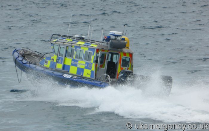
The recent global maritime security scenario has been deeply affected by several factors that have by necessity, changed the way of approaching and dealing with individual problems at sea. Piracy, drugs smuggling, weapon trafficking and the repugnant trade in human lives have reemerged with particular virulence but of paramount concern and indeed priority is the ominous threat of seaborne terrorism. Most of us witnessed to our horror the murder of innocent tourists in a beach at Tunisia. The execution of this attack came from what appears to be a well coordinated plan that took everyone by surprise. The proliferation of fast RHIBs (Rigid Hull Inflatable Boats) and jet ski type vessels have given terrorists flexibility of speed and the ability of evasion that gives them a distinct advantage as they are able to mix and mingle with other craft and raise less suspicion when choosing their targets Not only are these fast vessels in the inventory of terrorists but they are the preferred method of transport by drug smuggling gangs

In the case of Gibraltar it can be said with  concern that by the nature of our geographical position we are exposed to the threats of terrorism. It’s no use hiding behind the fact that North Africa lies 14 miles across the Strait of Gibraltar (STROG) and pretending it will not affect us sooner or later, directly or indirectly. Morocco has been subjected to attacks within its territory but has been successful in thwarting seaborne assaults against shipping in the strait including warships but they cannot do it all on their own. The Spanish enclave of Ceuta has been the recruiting ground for potential jihadist recruits that consequently find their way to Syria and/or Iraq. The North African coastline opposite Gibraltar can be considered a launch pad for vessels that trade in drugs, humans and other illicit activities. All stakeholders in the vicinity, Gibraltar, Morocco, and Spain have a duty to ensure that the malignant barbarity of present day terrorism does not cross the Strait of Gibraltar into Europe via this vulnerable route. To repulse any sort of seaborne attacks everyone must be prepared and not fall into one of mankind’s many weakness Complacency

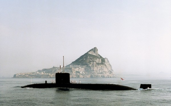
As far as Gibraltar is concerned the responsibility for the maritime security of Gibraltar Territorial Waters falls under very awkward operational procedures and tasking. The MOD through the Royal Navy Gibraltar Squadron is tasked with, according to its mission statement “To contribute to the maritime defence and security of Gibraltar and when necessary, the prosecution of offensive maritime operations in order to allow BFG to support military ops as directed by HMG.” Quite a mouthful and perhaps ambiguous but it’s not the intention to assess the political ramifications of such a broad statement. Bearing all this in mind, the security of HM Naval Base Gibraltar falls into question. Every time a naval vessel is berthed alongside South Mole or “The Tower” a boom is placed across the harbour from South Mole to the old Gun wharf site. It consists of small orange buoys held in position by floaters and strung across with rope. This is to prevent unauthorised craft from entering the security cordon. The security boom is totally inadequate and useless. Any determine driver of a jet ski or RHIB can “jump” this boom and instantly find itself within a restricted area.

The MOD should invest in purpose built security booms that protect warships, particularly submarines in naval bases around the world. It has not gone unnoticed that since 2013 there has been an increase of RN nuclear power submarines visiting the naval base. Various operational tasks have been carried out including transfer of weaponry that demand the highest levels of security. This cannot be guaranteed with a weak protective boom that can be easily penetrated. On the fifth of July a drug smuggling jet ski entered the harbour through the southern entrance whilst HMS Ambush was alongside South Mole. Luckily, the intruder turned left and not right. The inadequacy of this security boom is a glaring capability gap that can be exploited by the enemy. Within this boom the task of protecting these warships is carried out efficiently by the GDP (Gibraltar Defence Police). Despite being equipped with 2 slow and aging ex Range Safety craft that are not fit for purpose they stick to their duty of affording port force protection but their response time to a fast intruder is minimal. GDP were to be equipped with modern patrol craft some time ago but it was decided otherwise to renege on it, another UK base benefitting from these new craft. For years there has been a succession of UK politicians and high ranking military officers trumpeting and touting the importance of Gibraltar as a base for UK ops. It’s time they put their money where their mouths are and transmit their thoughts into deeds.

Leaving aside the MOD estates we come to the protection of the civilian population which is by and large entrusted to the marine section of the Royal Gibraltar Police. This service boasts the most modern and fast craft to carry out their duties. There is a certain overlapping of responsibilities with the RN that due to constitutional obligations muddies the waters as to who is responsible for what when and how. This is rather unhelpful when it comes to tackling a potential terrorist threat. We are led to believe that there is coordination when it comes to security matters at sea but to a plain simple observer it does not appear to be so. A more robust communication environment should be encouraged to interchange ideas thoughts and indeed intelligence on a regular basis, not on ad hoc terms. To use a well worn phase everyone should be “singing from the same hymn sheet” instead of tearing out pages so that the other sings out of tune.

Gibraltar-body

Gibraltar’s important maritime security infrastructure requires overhauling and redesigning. Our hugely important cruise liner industry can sometimes walk a tight rope when it comes to passenger and owner satisfaction. Cruise liners are vulnerable and a tempting target. On very few occasions are cruise ships escorted to and from the liner terminal by law enforcement craft and there is no seaward protection whilst alongside North Mole. This would prevent any unwanted or inquisitive boats from getting too close for comfort. We must bear in mind that although Cruise liners companies might be satisfied with ashore security arrangements any incident no matter how small or insignificant at sea could cause them to leave and this would destroy an important pillar of our economy. Why not go the extra mile and provide seaside security to such an important gem in our crown? It will enhance our reputation amongst cruise line companies as a serious port of call in which to do business with.

What cannot be allowed to happen again is a situation similar to that of the theft of one our reef blocks from under our noses. This was a highly embarrassing event that exposed a certain lack of supervision of Gibraltar Territorial Waters. It highlighted the absence of coordination in patrolling our waters. Each to their own without knowing who was doing what and where. Naturally there were local law enforcement craft swarming over the area next day but the horse had bolted and the stable was empty

These are but a few of the more noticeable flaws in the protection of our little country. I accept the fact that security cannot be 100% guaranteed but it can be made extremely difficult for anyone attempting to threaten our peace and stability. It serves no purpose to find faults and criticize without offering suggestions and ideas in which to improve the protection of our waters from dynamic situations that confront our day to day lives. With the expansion of yachting facilities at Ocean Village and the proposed reclamation at the Eastside there will be an increase in the load factor for law enforcement agencies in maintaining a safe maritime picture. A maritime surveillance system similar to the Spanish SIVE (Systema Integrado de Vigilancia Exterior) should be considered as an aid to combating illegal activities close to our shores This system comprises of radars, infrared cameras and other surveillance equipment placed at strategic sites and controlled by an operations room. Any information gathered by this system can be transmitted to civilian law enforcement vessels (RGP HM Customs Port Authority) in real time via video link. It will make the task of intercepting suspect vessels easier and with ample time. The introduction of a joint maritime control centre is  of vital importance. It is of huge value that all incidents be controlled “under one roof” thereby improving response times and rapid interventions. Everyone working together instead of pulling away from each should be encouraged. Pooling of resource can be an effective method of dealing with certain events/actions whilst each law enforcement agency maintaining their independence and freedom of movement in their particular field of responsibilities. Joint training exercises whether live or in tabletop format can be useful in honing particular skills and at the same time exchanging operational experiences. Of course the major stumbling block is finance as all these suggestions do not come cheaply, but in the long term it is an investment that will pay dividends by ensuring the adequate protection of life and property.

I am by no means advocating a “Fortress Gibraltar” bristling with guns missiles and military hardware. Life must go on as normal. In the present climate of economic prosperity and physical expansion it has to be top priority that to accommodate a thriving yacht industry, the protection of bunkering facilities, the secure operations of cruise liners and importantly the safety of local seafarers fishermen and pleasure boat owners the necessary infrastructure to enable Gibraltar to maintain its reputation as a competitive serious and reliable player in the maritime industry must be in place so that we hopefully never become an easy target for our foes whoever they may be

Michael Sanchez is a naval observer and commentator for Gibraltar & STROG. He is the founder of OpWest and the promoter of Gibraltar Coast Watchers, and explained the former’s operation in an interview with CIMSEC. Born in the Rock, he served as a police officer for 33 years before retiring. He tweets at @key2med

He Who Defends Everything Defends Nothing

He who defends everything defends nothing: The Philippines, Scarborough Shoal, the South China Sea, and Sabah and the Sultanate of Sulu

By Alex Calvo

Introduction. The Philippines’ South China Sea strategy brings together rearmament, rapprochement with the US, tighter security and defense links with Japan, and an international arbitration case under UNCLOS, whose fate is still pending, with oral hearings on jurisdiction having taken place over the summer. Manila’s narrative and legal arguments concerning Bajo de Masinloc (Scarborough Shoal) are grounded on post-World War II developments. On 18 April 2012 the Philippines’ Department of Foreign Affairs stated that “The Philippines considers Bajo de Masinloc an integral part of Philippine territory on the basis of continuous, peaceful and exclusive exercise of effective occupation and effective jurisdiction over the shoal”, stressing this was not based on UNCLOS but “anchored on other principles of public international law”, and also underlining that it “is not premised on the cession by Spain of the Philippine archipelago to the United States under the Treaty of Paris”. While, alternatively, the Philippines may seek to resort to historical arguments from earlier eras, this may play into China’s hands, as noted by some observers. The offer to Malaysia to downgrade Filipino claims on Sabah in exchange for moves reinforcing Manila’s position in the international arbitration case under UNCLOS seems to confirm that the Philippines have indeed decided to focus on post-WWII arguments.

Alternatively, Manila may have sought to follow one of three routes to prove the past exercise of sovereign powers as the foundation for her territorial claims in the South China Sea. The first possible line of argument would involve proving that the Spratly were part of the Spanish Philippines, and were transferred to the US after the 1898 war. The second would be to claim that they were incorporated into the Philippines following their transfer to American sovereignty. Finally, a third approach would be to argue that they were part of the Sultanate of Sulu, thus linking the two claims.

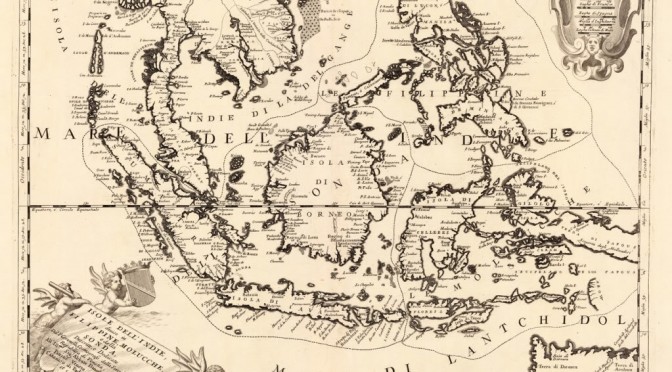
The Spanish colonial era. Three international conventions regulate the geographical extent of the territorial transfer following the 1898 war: the Treaties of Paris and Washington between the US and Spain, and that concluded between the United States and Great Britain on 2 January 1930. A range of potential problems would loom large if Manila tried to resort to the geographical extent of this territory. First of all, the mentioned treaties do not provide a fully detailed picture of the resulting borders. Second, the actual reach of the colonial administration was not always clear, with widespread resistance to Spanish rule and insurgency in a number of areas. In line with many other colonies, actual control was often a measure of distance from the capital, and went from long-standing exercise of sovereign powers, resulting in widespread cultural, linguistic, legal, economic, and social, influence, to little more than nominal sovereignty (or suzerainty when indirect rule was favored) on paper. Third, geographical knowledge was not always accurate, with some territories imperfectly mapped or chartered, and confusion sometimes arising out of conflicting accounts. Having said that, some maps, like the one below, do explicitly include features currently under dispute, such as Bajo de Masinloc (Scarborough Shoal).

Spanish colonial era map of the Philippines, including Bajo de Masinloc / Scarborough Shoal. Kindly provided by Dr David Manzano Cosano, Escuela de Estudios Hispano-Americanos (CSIC; Spanish National Research Council)
“This map, from present-day Italy, included the Spratly in the Philippines’ territory”

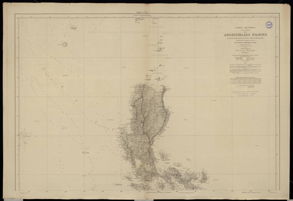
Furthermore, some expeditions and other activities took place featuring Bajo de Masinloc (Scarborough Shoal). After a long history of uncertainty over its existence and location, the grounding of HMS Scarborough, chartered by the East India Company to transport tea, on 12 September 1748 led not only to its modern English-language name, but to its precise chartering. Navigation charts published after the incident reflected it, but uncertainty still meant some debate on exactly where the ship had run aground, and some decades would pass until this was dispelled. It was the Malaspina Expedition which in May 1792 finally ascertained the exact location of Scarborough Shoal, and confirmed that some reefs appearing on maps actually referred to this feature. This was followed, in 1800, by the first detailed Spanish survey, conducted by the frigate Santa Lucia, part of the Cavite-based naval squadron. Commanded by Captain Francisco Riquelme, she was one of the first steam-powered warships deployed in the Philippine Islands to take part in the campaigns against the Sultan of Sulu and the Moro slave-raiding pirate bands. Thus, this ship illustrates two aspects of Spanish colonial rule which to some extent are contradictory, supporting and weakening potential historical arguments in line with Philippine claims. On the one hand, it illustrates the connection between the Philippines and Scarborough Shoal, with activities from Luzon-based ships. On the other, it reflects how conflict with insurgents and pirates were a constant of the period, with sovereignty on paper extending further than on the ground (and the waters).

Frigate Santa Lucia, which commanded by Captain Francisco Riquelme conducted the first Spanish survey of Scarborough Shoal (Bajo de Masinloc) in 1800

This low-lying reef, per Riquelme, extends more than 8 2/3 miles from North to South, and 9 1/2 miles from East to West from one end to the middle part, but from there narrowing until it ends in a tip. It is surrounded by horrible dangers that may appear without warning or other markings to serve notice of their proximity. Some rocks can be seen slightly above water only by close observation on a clear day, and only by having careful look-outs can one see the reef at a distance of 7 miles”Capitan Riquelme’s findings were incorporated into the “Dorroteo del Archipielago Filipino”, the Spanish pilot’s guide. An 1879 edition reads:

Spanish colonial authorities did not only incorporate details of Scarborough Shoal into their charts, but also began to exercise search and rescue jurisdiction over the shoal, sending ships from Manila to assist vessels in distress. Since this is one of the activities traditionally considered to fall under the umbrella of exercise of sovereign powers, it is worth noting.

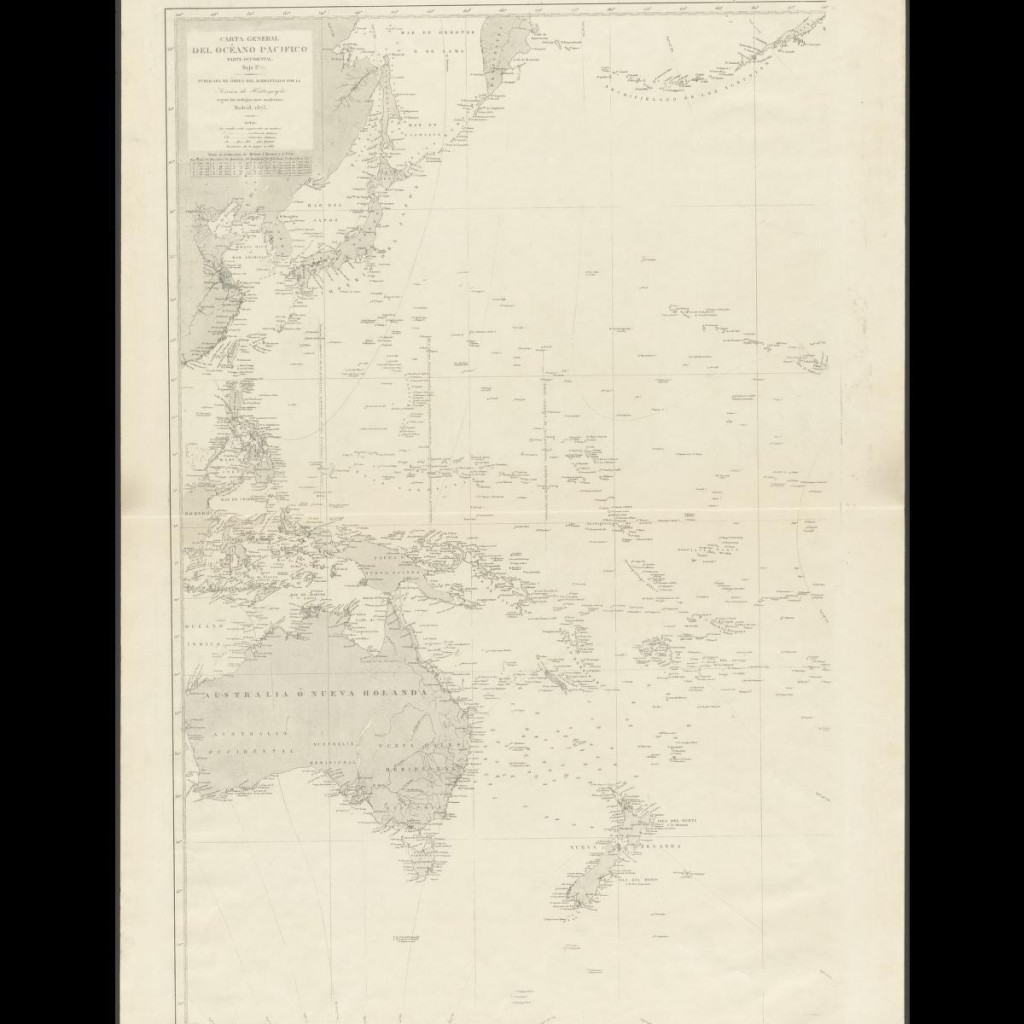
Eastern half of the General Chart of the Pacific Ocean, published in 1897 by the Hydrography Section of the Spanish Navy.
Spanish colonial era map of the Philippines, including Bajo de Masinloc / Scarborough Shoal. Kindly provided by Dr David Manzano Cosano, Escuela de Estudios Hispano-Americanos (CSIC; Spanish National Research Council)

The Philippines under American sovereignty. A second possibility would be to argue that once under American sovereignty, currently disputed features clearly came to be officially considered part of Filipino territory. A significant obstacle to any such assertion is Washington’s long-held position that it takes no position on territorial disputes in the South China Sea, restricting its policy to how disputes are solved (insistence on peaceful solutions in accordance with international law) and the extent of any resulting settlement, with particular emphasis on freedom of navigation and overflight, and compliance with US views on the extent of coastal states powers in their EEZs. In December 2014 The Department of State published No 143 in its “Limits in the Seas” series, titled “China: Maritime Claims in the South China Sea”, which again emphasized that “The United States has repeatedly reaffirmed that it takes no position as to which country has sovereignty over the land features of the South China Sea”.

However, this view does not reflect the fact that the activities described earlier under Spanish colonial rule continued to take place after 1898. The most famous, and a well-documented, incident took place in 1913. A typhoon hit the S.S. Nippon, a Swedish steamer carrying copra, and she was wrecked on Scarborough shoal. This prompted Philippine authorities to intervene, together with private ships, in the rescue of the crew, investigate the accident, and carry out a scientific study on the effects of the sea on her cargo. In addition, the ship came under the salvage laws of the Philippines, and the resulting legal case was appealed all the way up to the Supreme Court of the Philippines, leaving behind an extensive paper trail documenting the exercise of a wide range of powers by the Philippine authorities in connection with Bajo de Masinloc (Scarborough Shoal).

The SS Nippon, owned by the Swedish East Asiatic Co., which shipwreck on Scarborough Shoal in 1913 led to a civil case that ended up before the Supreme Court of the Philippines

In the 1930s, the Commonwealth Government sought an explicit assertion of sovereignty over Scarborough Shoal, going beyond the exercise of administrative powers, including search and rescue. On December 6, 1937, Mr. Wayne Coy (Office of the US High Commissioner for the Philippines) asked Captain Thomas Maher (head of the US Coast and Geodetic Survey) whether any country had claimed Scarborough Shoal. The reply, dated 10 December 1937, was that no information was available on whether any nation had. Concerning the Santa Lucia 1800 survey, Captain Maher said “If this survey would confer title on Spain or be a recognition of sovereignty, or claim for same without protest, the reef would apparently be considered as part of Spanish territory the transfer of which would be governed by the treaty of November 7, 1900”. He also suggested that a new survey take place, and a navigational light be installed.

The next year saw Mr. Jorge B. Vargas (secretary to the president) write to Mr. Coy, asking about the status of Scarborough Shoal and saying that “The Commonwealth Government may desire to claim title thereto should there be no objection on the part of the United States Government to such action”. This prompted Mr Coy to forward this correspondence to the US War Department, which in turn sent them to the State Department, resulting in an interesting exchange. For example in a letter dated 27 July 1938 Secretary of State Cordell Hull told Secretary of War Harry Woodring that his department “has no information in regard to the ownership of the shoal”, which “appears outside the limits of the Philippine archipelago as described in Article III of the American-Spanish Treaty of Paris of December 10, 1898”. However, Hull wrote, “in the absence of a valid claim by any other government, the shoal should be regarded as included among the islands ceded to the United States by the American-Spanish treaty of November 7, 1900” and therefore the State Department would not object to the Commonwealth Government’s proposal to study the possible setting up of air and ocean navigation aids, as long as “the Navy Department and the Department of Commerce, which are interested in air and ocean navigation in the Far East, are informed and have expressed no objection”. The reply from Acting Secretary of the Navy W.R. Furlong to Acting Secretary of War Louis Johnson was positive, both concerning navigation aids and “the possibility of later claiming title”. The secretary of commerce also said his department had no objections.

We can observe a measure of ambiguity, though, with the US Government having no objections to the Commonwealth Government claiming Scarborough, and even considering it to be included in the second treaty with Spain following the 1898 War, but not actually claiming the features itself. Manila also expressed an interest in the Spratly, but despite this prompting Washington chose to keep a “low profile” concerning the archipelago, with non-recognition of claims by others and a close eye on Japanese interests and activities going hand in hand with a failure to officially claim the islands. The same applied could be said about Scarborough Shoal. In the words of François-Xavier Bonnet (IRASEC; Research Institute on Contemporary Southeast Asia), “the geographical proximity spoke in favor of the Philippines (rescue operations). In a way, Bajo de Masinloc could be seen as integrated in the sphere of influence of the Philippines, but outside the main archipelago. Political and symbolic acts, like naming the shoal, surveying, mapmaking, and organizing rescue operations, were the only appropriate activities that the Spanish and American authorities could do on an isolated shoal, which was, for the most part, underwater during high tide”.

The Sultanate of Sulu. A third possibility for Manila would be to claim sovereignty over Bajo de Masinloc as having historically been under the Sultanate of Sulu, that is merging the claim with that over Sabah. However the Philippines seem to be leaning towards focusing on Scarborough, going as far as offering Malysia to downgrade her claim to Sabah in exchange for support on the former conflict. This was clear in one of the Filipino moves this year connected to the international arbitration case, namely the offer to Malaysia, in a Note Verbale, to review its protest against the 6 May 2009 joint Vietnamese-Malaysian submission to the UN Commission on the Limits of the Continental Shelf (CLCS), containing a claim by Kuala Lampur of an extended continental shelf (350 nautical miles from the baselines) projected from Sabah. In exchange for this, Manila is requesting two actions that she believes would reinforce her case against China: First, to “confirm” that the Malay claim of an extended continental shelf is “entirely from the mainland coast of Malaysia, and not from any of the maritime features in the Spratly islands”. Second, to confirm that Malaysia “does not claim entitlement to maritime areas beyond 12 nautical miles from any of the maritime features in the Spratly islands it claims”.

The impact on Manila’s Sabah claims has not been lost on observers, with former Philippine permanent representative to the United Nations Lauro Baja Jr., if Malaysia explaining that if the deal is accepted the Philippines’ claim to Sabah will be “prejudiced”, adding that “We are in effect withdrawing our objection to Malaysia’s claim of ownership to Sabah”. Some voices argue that the Philippines need to stop claiming Sabah, since otherwise they are favoring Chinese claims to South China Sea features. William M. Esposo has criticized the “charlatans and overnight Sabah claim experts” who “thought they were patriots fighting for Philippine national interest” but “didn’t even realize that the arguments they were mouthing were supporting China’s very claims to our territory in the South China Sea”. Esposo cites Renato de Castro (De La Salle University International Studies Department), to stress that “historic claims, such as the one we have with Sabah, are the weakest cases when international courts decide territorial dispute”.

Conclusions. The Philippines are basing their South China Sea narrative on post-Second World War developments, and going as far as appearing ready to sacrifice their claim to Sabah in order to reinforce the arguments put forward in their international arbitration case against Beijing. This fits with Washington’s agnostic view of territorial claims, even when they involve areas formerly under US sovereignty. However, it is still interesting from a historical perspective to examine other possible arguments of this nature that could support Filipino claims on Bajo de Masinloc (Scarborough Shoal).

Alex Calvo is a guest professor at Nagoya University (Japan) focusing on security and defence policy, international law, and military history in the Indian-Pacific Ocean. Region. A member of the Center for International Maritime Security (CIMSEC) and Taiwan’s South China Sea Think-Tank, he is currently writing a book about Asia’s role and contribution to the Allied victory in the Great War. He tweets @Alex__Calvo and his work can be found here.