Category Archives: Asia-Pacific

Analysis relating to USPACOM.

US Department of State Seeks to Clarify Meaning of China’s 9-Dash Line Part 1

By Alex Calvo

Introduction

Despite repeatedly stating that it will not take sides in territorial disputes in East Asia, Washington remains keenly interested in the ultimate fate of the South China Sea. In addition to perennial calls to settle disputes peacefully, regular reminders of the importance of freedom of navigation, military aid to regional actors like the Philippines, and support for a more active policy by non-littoral maritime democracies like India and Japan, the US Department of State (DOS) took a further step late last year by issuing a document, part of its “Limits in the Seas” series. The text seeks to explain the different ways in which one may interpret Chinese maritime claims in the South China Sea (“that the dashes are (1) lines within which China claims sovereignty over the islands, along with the maritime zones those islands would generate under the LOS Convention; (2) national boundary lines; or (3) the limits of so-called historic maritime claims of varying types”). It concludes that the “dashed-line claim does not accord with the international law of the sea” unless “China clarifies that” it “reflects only a claim to islands within that line and any maritime zones.” The text includes supporting Chinese official views, without attributing “to China the views of analysis of non-government sources, such as legal or other Chinese academics.” Concerning this latter restriction, although it is of course official sources which may be considered to be most authoritative when it comes to interpreting a government’s position, we should not forget that administrations in different countries will often resort to “two-track diplomacy” or employ semi or non-official back channels to test the waters and lay the groundwork for future formal negotiations.

[otw_shortcode_button href=”https://cimsec.org/buying-cimsec-war-bonds/18115″ size=”medium” icon_position=”right” shape=”round” color_class=”otw-blue”]Donate to CIMSEC![/otw_shortcode_button]

The object of this five-part series is to summarize the DOS document, while commenting on some of its most relevant features, and where appropriate going beyond the text and examining related aspects of the South China Sea conflict.

Tyranny of History: Can Washington claim not to take sides on Filipino territorial claims?

Before summarizing the “Limits in the Seas” document, we should note that the American policy of not taking sides concerning the ultimate issue of sovereignty could be challenged given Washington’s past sovereignty over the Philippine Archipelago. While this has not been publicly stressed by Manila to date, it could enter the debate as a means of putting more pressure on Washington to adopt a more robust posture.

Chinese Claims and Possible Interpretations According to International Law

In line with long-standing US demands that Beijing clarify the ultimate nature of her South China Sea claims, the DOS document analyzes those figures within UNCLOS and customary international law which may provide cover to Beijing’s claims. Issued on 5 December 2014, the Department of State paper begins by stressing that “China has not clarified through legislation, proclamation, or other official statements the legal basis or nature of its claim associated with the dashed-line map”, explains the “origins and evolution” of the dashed-line maps, provides a summary of the different maritime zones recognized and regulated by UNCLOS, and then proceeds to explain and discuss three possible interpretations of that claim “and the extent to which those interpretations are consistent with the international law of the sea.” The document contains a number of maps, including (Map 1) that referred to in China’s two May 2009 notes verbales to the UN Secretary General, which stated that “China has indisputable sovereignty over the islands in the South China Sea and the adjacent waters, and enjoys sovereign rights and jurisdiction over the relevant waters as well as the seabed and subsoil thereof. The above position is consistently held by the Chinese government, and is widely known by the international community.”

1
Nine-dash map attached to China’s two 2009 Notes Verbales.

A Look at Chinese Map Quality and Accuracy

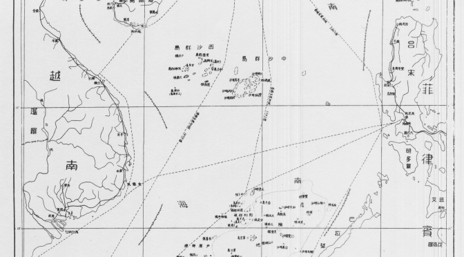
The text first outlines the history of China’s maps of the South China Sea containing dashed lines, starting with a 1947 map published by the Nationalist government, noting that later PRC maps “appear to follow the old maps” (see L. Jinming and L. Dexia, “The Dotted Line on the Chinese Map of the South China Sea: A Note”, Ocean Dev’t & Int’l L., Volume 34, 2003, pp. 287-95, p. 289-290) with two significant changes: the removal of two dashes inside the Gulf of Tonkin (in an area partly delimited by Vietnam and the PRC in 2000) and the addition of a tenth dash to the East of Taiwan. These two changes can be interpreted in different ways, to some degree contradictory. On the one hand, the partial delimitation agreement with Vietnam could be seen as evidence of Chinese pragmatism and flexibility, and proof that it is possible for countries in the region to at least partly settle their disputes by diplomacy. On the other, explicitly encompassing Taiwan with an extra dash may be seen as a reinforcement of Chinese claims on the island not necessarily based on the will of her population. Alternatively, it could simply be a way to more comprehensively encompass the waters and features that Beijing (either directly or via Taipei) wishes to master.

The paper then examines successive Chinese maps from a cartographic perspective, stressing that “China has not published geographic coordinates specifying the location of the dashes. Therefore, all calculations in this study relating to the dashed line are approximate.” A similar criticism has sometimes been made of the San Francisco Treaty. The text also notes that “China does not assign numbers to the dashes,” and therefore those in the study are for “descriptive purposes only.” They “are not uniformly distributed,” being “separated from one another by between 106 (dashes 7 and 8) and 274 (dashes 3 and 4) nautical miles (nm).” This section of the paper stresses that “Nothing in this study is intended to take a definitive position regarding which features in the South China Sea are ‘islands’ under Article 121 of the LOS Convention or whether any such islands are ‘rocks’ under Article 121(3).” This is in line with Washington’s refusal to take sides concerning the ultimate sovereignty disputes in the region. The text notes that the “dashes are located in relatively close proximity to the mainland coasts and coastal islands of the littoral States surrounding the South China Sea,” and explains that, for example, Dash 4 is 24 nm from Borneo’s coast, part of Malaysia. Generally speaking, “the dashes are generally closer to the surrounding coasts of neighboring States than they are to the closest islands within the South China Sea,” and as explained later this is significant when it comes to interpreting the possible meaning of China’s dashed line, since one of the principles of the Law of the Sea is that land dominates the sea, and thus maritime boundaries tend as a general rule to be equidistant. That is, maritime boundaries tend to be roughly half way between two shores belonging to different states.

To hammer home this point, the study includes a set of six maps illustrating this. The report criticizes the technical quality of the PRC maps, saying that they are inconsistent, thus making it “complicated” to describe the dashed line, whose dashes are depicted in different maps “in varying sizes and locations.” Again, this is important in light of possible interpretations of Chinese claims, since this lack of consistency and quality not only obfuscates Chinese claims, introducing an additional measure of ambiguity, but also makes it more difficult to ascertain whether historical claims are being made and whether they are acceptable in light of international law.

The dashes change from map to map, with those “from the 2009 map” being “generally shorter and closer to the coasts of neighboring States” than those in the 1947 map. The dashed lines in these two maps are illustrated and compared in Map 5 of the document. The section concludes noting that the 2009 map, which Beijing distributed to the international community “is also cartographically inconsistent with other published Chinese maps.”

Read the next installment here

Alex Calvo is a guest professor at Nagoya University (Japan) focusing on security and defence policy, international law, and military history in the Indian-Pacific Ocean. Region. A member of the Center for International Maritime Security (CIMSEC) and Taiwan’s South China Sea Think-Tank, he is currently writing a book about Asia’s role and contribution to the Allied victory in the Great War. He tweets @Alex__Calvo and his work can be found here.

[otw_shortcode_button href=”https://cimsec.org/buying-cimsec-war-bonds/18115″ size=”medium” icon_position=”right” shape=”round” color_class=”otw-blue”]Donate to CIMSEC![/otw_shortcode_button]

History and the Sea: Interview with Sarah Ward, Marine Archaeologist

Interview performed by Alex Calvo

The sea is a vital venue for trade and national security, and also holds the key to understanding much of our past. From the dispute over the South China Sea, to the protection of sea graves such as HMS Prince of Wales and HMS Repulse, maritime archaeology matters. Sarah Ward, a maritime archaeologist, diver, and outreach specialist, who works for ArchaeoMar Australasia (a cultural heritage practice based in Sydney Australia) and has her own blog, has kindly agreed to tell CIMSEC a bit more about her work.

[otw_shortcode_button href=”https://cimsec.org/buying-cimsec-war-bonds/18115″ size=”medium” icon_position=”right” shape=”round” color_class=”otw-blue”]Donate to CIMSEC![/otw_shortcode_button]
CIMSEC: When did you decide to become a maritime archaeologist and why?

Ward: As a child I had a fascination with the sea. I grew up on my parent’s boat, diving and exploring the shipwrecks of Tangalooma Island (near Brisbane, Australia). I was obsessed with Jacques Cousteau and when not splashing about in the water, would spend hours poring over his books and films. Then having worked in finance for a number of years, and with an MBA under my belt, I decided that life was too short and it was time that I did what I loved. A water baby with a passion for the past, I eventually abandoned my desk job, took the plunge and proved that it is possible to turn your passion into a challenging and rewarding career.

CIMSEC: What kind of training is needed for this job? What are the main skills required?

Ward: To become a maritime archaeologist, you would generally need to complete an undergraduate degree in archaeology, followed by a masters degree in maritime archaeology. You might also like to complete studies in the time period or geographic region you are interested in e.g. Roman History or Asian studies, and, if you wish to teach at tertiary level, a relevant PhD. If you wish to work underwater (which not all maritime archaeologists do), this will need to be topped off with commercial diving certification (e.g. from the HSE in the UK or ADAS in Australia).

With regard to the core skills of a maritime archaeologist, these fall into three main areas: intellectual, practical, and administrative.

  1. Intellectual skills include (but aren’t limited to):
    • an understanding of the history, languages, and culture of the period and area/site in which you work;
    • an understanding of the theory and concepts of archaeological practice, such as sequence, relation, association, chronology, observation, synthesis, interrogation, and interpretation;
    • a sound understanding of the ethical considerations and applications and an ability to understand and respond to the context in which archaeological work is conducted.
  2. Practical or technical skills include:
    • diving (for those working under water);
    • diving supervision (for those leading work under water);
    • an understanding of geophysical and other prospection methods;
    • data collection and retrieval, such as survey, recording, excavation, and pre-excavation and post-excavation data analysis;
    • historical, archival, and topic-based research;
    • first aid for finds and a basic understanding of preliminary conservation;
    • an understanding of a broader scientific methods.
  3. Administrative/managerial skills are standard across any business or project management, including:
    • remote area logistics (field & diving);
    • financial and information management.

If you would like more details on the skills required, I led a study on benchmarking competency in maritime archaeology for the NAS a number of years ago; the study is online here.

CIMSEC: How does maritime archaeology differ from the more traditional, land-based variety?

Ward: The intellectual requirements are the same, however there are two key differences: the theme of study (human relationship with the sea); and the environment in which we work (intertidal zone or underwater). The environment brings its own challenges as the the tools, techniques, equipment and training required when working underwater, for example, can vary substantially to that employed on land.

CIMSEC: Which project are you currently working on? Could you tell us a bit about it?

Ward: My current research work is focused on the maritime archaeology of China, the maritime silk route and the early Ming Navy, notably the voyages of Zheng He and the resulting connections with Africa. I’m currently investigating evidence suggesting that one of the Zheng He fleet wrecked on the East African coast. This is significant as it could be the first vessel relating to the voyages that has been found. If so, it would give us an incredible insight into the expansionist Ming maritime policy and today’s parallels.

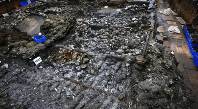
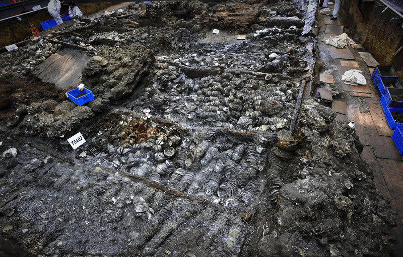
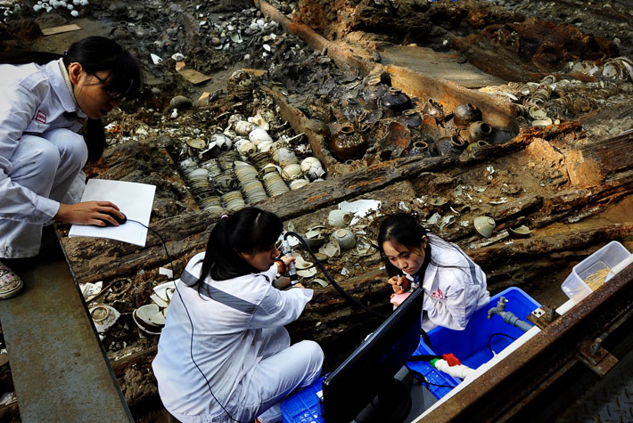
Nanhai1 excavation.
Nanhai1 excavation. Maritime Silk Road Museum of Guangdong and the Peoples Republic of China.

CIMSEC: What is your favorite past project and why?

Ward: Asking me to chose a favourite project would be like asking a mother to chose her favourite child! That said I have been fortunate enough to work on some incredible projects, with some incredible people. Present research excluded, here are a few of my favourites:

  • Excavation of the a settlement on Gask Ridge, Scotland’s Roman Frontier, with Drs Brigitta Hoffman and David Woolliscroft of the Roman Gask Project – the information gained from the dig changed our understanding of the history of Roman Scotland;
  • Excavation of King Henry VIII’s Tudor flagship the Mary Rose, when the sternpost and anchor was lifted;
  • remote sensing survey of the Late Bronze Age, early Iron Age settlement at High Past Cave, on the Isle of Skye;
  • Excavation of Kizilburun Roman Column Wreck on the Aegean Coast of Turkey with the Institute of Nautical Archaeology; and
  • Excavation of the Scottish settlement of the Isthmus of Panama, the failure of which lead to the Union of the Crown in 1707.

CIMSEC: The dispute over the South China Sea has seen some claimants use archaeological evidence to support their claims. Is there a danger of the discipline being politicized? Could this result in restrictions on archaeological work?

Ward: The South China Sea dispute is an interesting situation. China claims sovereignty over almost 90% of the South China Sea, and has done since ancient times. To an extent, this claim is made on the basis that way back in China’s first dynasty, the Xia (c. 2070 – c. 1600 BC), China was apparently the first state to discover, name, explore, and exploit the contested Spratly (Nansha) and Paracel (Xisha) Islands. This claim is based more on historical, rather than legal grounds, and China is looking to the past to create a future – to the Han ceramics found on Taiping Island, Nanhai 1 off Hainan 20 nm off Dongping, the 200 submerged prehistoric sites identified between the Spratly and Paracel Islands, and to early maps and documents which support historic Chinese ownership.

Coins from Nanhai 1.
Coins from Nanhai 1. Maritime Silk Road Museum of Guangdong and the Peoples Republic of China.

For China, this is a nation-building exercise. It’s also not the first time archaeology has been put to overt political use. In 1914, Leonard Woolley and Thomas (TE) Lawrence provided archaeological camouflage for a British military survey of the Turkish-controlled Sinai Peninsula. During World War I, Sylvanus Morley used his investigations of Mayan sites in the Yucatán as a cover to negotiate with rebel Mayan leaders for their support of U.S. interests.

Archaeology often reveals a contested space, a battleground for struggles over economic gain, heritage, and identity, and its practice often carries with it profound political implication. In China’s case, it can and has resulted in restrictions on archaeological work, such as when a French team working on a Chinese shipwreck off the Philippine coast was turned back by the Chinese on the basis of their sovereign claims.

CIMSEC: On the other hand, could international cooperation in maritime archaeology be part of confidence-building measures in disputed sea areas?

Ward: Absolutely. Confidence is the result of a dynamic process, based on past experiences, present perceptions, and future expectations, and affected by a multitude of elements. As confidence is especially sensitive to the behaviour of States, cooperation in maritime archaeology, which is a tenant of the UNESCO 2001 Convention, would be an excellent confidence-building measure.

China, Vietnam, Taiwan, Philippines, and Malaysia have a mutual, shared maritime heritage and our appreciation of the past determines how we shape our future. A shared heritage not only reminds us of our collective identity and cultural diversity, it also nurtures social belonging, promotes economies amongst local communities, and it deepens mutual understanding of each other’s values, histories, and traditions.

CIMSEC: Do you use unmanned submarines in your work? Do they offer the potential to radically transform our understanding of the maritime past?

Ward: Yes, quite often. In the past, for example, I’ve worked with the Australian Centre for Field Robotics at the University of Sydney to carry out a high-resolution shipwreck survey in deep water using Sirius, an autonomous underwater vehicle (AUV). The submersible is equipped with a full suite of oceanographic instruments, including a high-resolution stereo camera pair and strobes, a multibeam sonar, depth and conductivity/temperature sensors, Doppler Velocity Log (DVL) including a compass with integrated roll and pitch sensors, Ultra Short Baseline Acoustic Positioning System (USBL), and forward looking obstacle avoidance sonar. The result is effectively a 3D map of the shipwreck site to millimetric accuracy.

Nanhai-Shipwreck.
Nanhai-Shipwreck. Maritime Silk Road Museum of Guangdong and the Peoples Republic of China.

This technology allows us to locate, identify and survey submerged sites with greater accuracy than ever before, in smaller timeframes, in deep water and other environments not previously accessible to divers. The result is high quality, often real time data that can be used for interpretation, education, dissemination, and site monitoring in new and exciting ways.

CIMSEC: What is the best approach to protect sea graves? How to combine our thirst for knowledge about our past with the necessary respect for those who fell at sea?

Ward.- War graves at sea is a very sensitive issue, and one on which an international consensus has not been reached – in spite of the Geneva Conventions, their additional protocols, and international humanitarian law. The treatment of human remains in maritime museums was discussed at the ICMM in Hong Kong recently and there were as many opinions on what is appropriate, as there were people in the room.

The same diversity of opinion applies to war graves at sea. In the UK for example, the Protection of Military Remains Act 1986 protects human remains associated with the remains of military aircraft and vessels that have crashed, sunk or been stranded, from unauthorised interference. Australia on the other hand, has no such legislation.

Personally, I believe that the best approach is protection via the UNESCO Convention on the Protection of Underwater Cultural Heritage 2001. Underwater cultural heritage means all traces of human existence (including human remains) having a cultural, historical or archaeological character, which have been partially or totally under water, periodically or continuously, for at least 100 years.

The Convention sets out basic principles for the protection of underwater cultural heritage:

  • an obligation to preserve underwater cultural heritage;
  • in situ preservation as first option (note first, not best option; this allows for recovery in certain situations);
  • no commercial exploitation;
  • training and information sharing.

It also provides a detailed State cooperation system; widely recognized practical rules for the treatment and research of underwater cultural heritage; and for public access to sites up to the point where it becomes detrimental to the site.

With regard to war graves, first and foremost, the personal dignity of the deceased must be safeguarded, as must the relatives’ right to know the fate of their next of kin. Mechanisms must also be established for relatives to access the burial place and for their interest in recovering the dead to be registered.

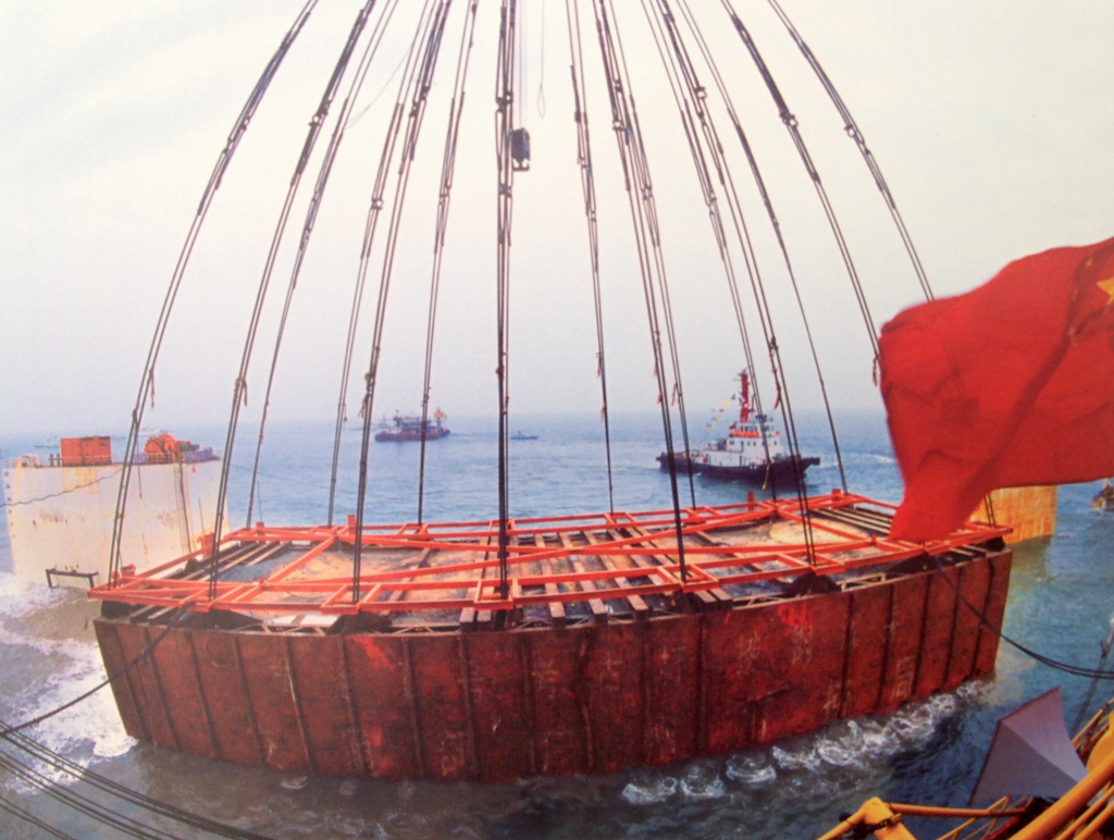
Lifting items from Nanhai 1.
Lifting items from Nanhai 1. Maritime Silk Road Museum of Guangdong and the Peoples Republic of China.

CIMSEC: You have recently attended the International Congress of Maritime Museums (ICMM) in Hong Kong, could you tell us about the work of this organization? What were the highlights of the congress?

Ward.- ICMM was an absolutely fantastic event an one which I thoroughly enjoyed.

To give you some background, ICMM is a biennial congress attended by maritime archaeologists, maritime museum directors, and related maritime professionals from around the world. The aim of the congress is for delegates to network, share expertise and resources, and to learn about the international best practices in the capacity of maritime museum operations and management, and it certainly achieved that.

This was both the first ICMM in Asia and quite possibly the best conference I have ever attended. Our friends at the Hong Kong Maritime Museum really know how to put on a good show!

The two keynotes − Lincoln Paine, author of the acclaimed Sea and Civilization, and Fred Kenny, Director External and Legal Affairs at the IMO − were excellent. As were the presentations by my old friends and mentors, Fred Hocker, Director of Research at the Vasa Museum, and Christopher Dobbs, Head of Maritime Archaeology and Interpretation at the Mary Rose Museum. The excursions to The Peak, Tai O, Jao Tsung-I Academy, Hong Kong Museum of History, and Macau Maritime Museum were all enlightening, but for me the real treat was meeting new friends from China, and to hear about the incredible work being undertaken at both the China Maritime Museum and visiting the Nanhai 1 Song Dynasty shipwreck at the Maritime Silk Road Museum of Guandgong. Fascinating!

Sarah Ward is a maritime archaeologist, diver, and outreach specialist. She works for ArchaeoMar Australasia (a cultural heritage practice based in Sydney Australia) and is a regular blogger and tweeter.

Alex Calvo is a guest professor at Nagoya University (Japan) focusing on security and defence policy, international law, and military history in the Indian-Pacific Ocean. Region. A member of the Center for International Maritime Security (CIMSEC) and Taiwan’s South China Sea Think-Tank, he is currently writing a book about Asia’s role and contribution to the Allied victory in the Great War. He tweets @Alex__Calvo and his work can be found here..

[otw_shortcode_button href=”https://cimsec.org/buying-cimsec-war-bonds/18115″ size=”medium” icon_position=”right” shape=”round” color_class=”otw-blue”]Donate to CIMSEC![/otw_shortcode_button]
South China Sea arbitration: Beijing puts forward her own views: The Finale

By Alex Calvo

This is the final installment in a four-part series devoted to China’s 7 December 2014 document, putting forward her views on the Philippines’ international arbitration case on the South China Sea. Although Beijing is refusing to take part in the proceedings, as confirmed following the Court’s 29 October 2015 ruling on jurisdiction, by issuing this document, and communicating in other ways with the Court, the PRC has failed to completely stay aloof from the case. It is thus interesting to analyze China’s narrative as laid down in that document. Read Part OnePart Two, Part Three

[otw_shortcode_button href=”https://cimsec.org/buying-cimsec-war-bonds/18115″ size=”medium” icon_position=”right” shape=”round” color_class=”otw-blue”]Donate to CIMSEC![/otw_shortcode_button]

The South China Sea and the Arctic: contradictions in China’s posture? Beijing’s insistence on excluding non-littoral estates from the dispute furthermore clashes with Chinese policy in the Arctic, where the country seeks a voice, arguing that despite just being a (self-labeled) “quasi-Arctic state” it has a right to at the very least make its voice heard given that the region has an impact on its interests. Countries like India, Japan, and the United States, may well put forward similar views concerning the South China Sea, considering themselves to be “quasi-littoral” states given among others their dependence on Sea Lanes of Communication (SLOCs) going through it.

Incentives to delay negotiations. A number of contradictory arguments may be put forward concerning this. Those wishing to blame China may accuse Beijing of seeking to change facts on the ground first (by, for example, occupation of some features and the artificial expansion of others), before engaging in meaningful negotiations. They may also argue Beijing is waiting for the balance of naval power in the region to shift further in her favor, or for developments elsewhere in the world to weaken the resolve of non-regional actors to intervene. On the other hand, those seeking to blame the Philippines may put forward similar accusations, arguing that Manila wishes to rearm (with US and Japanese assistance) first before engaging in serious negotiations with China. These voices may also put forward the view that Manila first wishes to take the moral high ground (among other means by the international arbitration bid), secure stronger support by the United States, or draw in other interested parties like Japan. We can thus see how both sides have potential reasons not to seek a speedy start of bilateral negotiations.

China defends cooperation prior to delimitation, but it is Taiwan and Japan which have implemented the principle. Section IV is perhaps not so original, basically reiterating arguments already expounded in Section III. It still contains some paragraphs worthy of comment, though. In Paragraph 61 the text refers to the “Agreement for Joint Marine Seismic Undertaking in Certain Areas in the South China Sea” between China National Offshore Oil Corporation and Philippine National Oil Company, expanded in 2005 to “a tripartite agreement, with the participation of Vietnam Oil and Gas Corporation.” The text praises it as “a good example of the constructive efforts made by the States concerned to enhance cooperation and create conditions for a negotiated settlement of the disputes in the South China Sea,” stressing that the “maritime area covered by that agreement is within that covered in the present arbitration initiated by the Philippines.” Few would disagree that agreements like this do indeed offer an interesting path, allowing states party to a dispute to build trust while concentrating on the joint development and management of natural resources, leaving for later tricky questions of sovereignty. When we move from the realm of theory to that of practice, however, we find that such efforts involving China have not been successful. In the South China Sea, possible cooperation seems to have given way to violent competition, with oil rigs becoming “weapons” rather than symbols of cooperation. In the East China Sea, where a similar agreement was concluded with Japan, it later unraveled and has not been implemented. It is Taiwan, not China, that has actively pushed for joint management that could proceed while leaving sovereignty for later. This has resulted not only in President Ma’s East China Sea Peace Initiative, but in a fisheries agreement with Japan along these lines. Whatever the reasons, no similar agreement has been concluded and effectively implemented by the PRC.

 8,- “Chinese Embassy to the Netherlands. While refusing to take part in the arbitration proceedings, China has regularly communicated with the Court, often through this Embassy.

Chinese Embassy to the Netherlands. While refusing to take part in the arbitration proceedings, China has regularly communicated with the Court, often through this Embassy.

Partial versus comprehensive solutions in territorial conflicts. It is interesting to note the position paper’s critique of Manila’s arbitration bid in Paragraph 68, which argues that “The issues presented by the Philippines for arbitration constitute an integral part of maritime delimitation between China and the Philippines” and that “The Philippines’ approach of splitting its maritime delimitation dispute with China and selecting some of the issues for arbitration, if permitted, will inevitably destroy the integrity and indivisibility of maritime delimitation and contravene the principle that maritime delimitation must be based on international law as referred to in Article 38 of the ICJ Statute and that ‘all relevant factors must be taken into account.’ This will adversely affect the future equitable solution of the dispute of maritime delimitation between China and the Philippines.” While the first sentence is just a reiteration, the second one touches upon a legitimate concern, given that any partial ruling runs the risk not only of being difficult to implement due to its non-comprehensive nature, but also of not being equitable for lack of consideration of certain factors concerning areas or aspects not included in the arbitration proceedings. This could be a reason to reject this approach. On the other hand, it could be said that history shows how countries often reach limited agreements, either because they are unable to successfully reach a comprehensive settlement, or because they prefer to start dealing with those issues where they either expect it to be easier to reach an understanding or which are more pressing. China is no stranger to this posture. The reference to equity though is important since an equitable settlement is often one involving tradeoffs, and such tradeoffs will often only be acceptable when covering a case’s full spectrum of issues.

The long shadow of history in China’s narrative against compulsory arbitration. In Section V the text demands full respect for China’s “right to freely choose the means of dispute settlement”, while defending the position that the “rejection of and non-participation in the present arbitration is solidly grounded in international law.” The stress on “consent” (76), while not amounting to any Chinese singularity, may also reflect the country’s experience with the so-called “unequal treaties.” Also important is the reference (76) to the “package deal” nature of UNCLOS, which is indeed the case, and as the text notes involved “extended and arduous negotiations” with regard to Part XV dealing with dispute settlement. The position paper insists (78) that the resulting “balance” in that Part was “a critical factor” prompting many countries to sign the convention, and again cites the Southern Bluefin Tuna Case, this time to reinforce the notion that compulsory arbitration should be restricted to cases where all parties agreed to it. The problem with this is that if all parties agree to arbitration, then there is no need for the procedure to be compulsory, and if compulsory proceedings are provided for, it is with a view to at least some cases where one or more countries may indeed oppose them. If “compulsory” arbitration could only move forward with the post-ratification consent of all parties involved, one could argue that there would be no need for UNCLOS to lay down areas where arbitration could be mandatory.

Abuse of right. Another legal principle that the text delves into (84) is that of “abuse of right”, in tandem with the above-mentioned “good faith.” These are general principles of law found, in some form or another, in most legal systems. The text cites Article 300 of UNCLOS, which lays down that “States Parties shall fulfill in good faith the obligations assumed under this Convention and shall exercise the rights, jurisdiction and freedoms recognized in this Convention in a manner which would not constitute an abuse of right,” adding that Manila has not done so by seeking to bypass Beijing’s refusal to engage in arbitration and existing agreements to settle the dispute by negotiations.

Conclusions. Beijing’s document, despite stressing that it is not a formal reply, systematically rejects all of Manila’s arguments, while summarizing China’s position. While China emphasizes the Philippines’ alleged promise to deal with the issue bilaterally, the text refers to treaties between other countries, mentions ASEAN, and touches upon the sensitive issue of Taiwan, in a reminder of how difficult it is to keep things bilateral in this corner of the world. Reading in between lines we can also see how history casts a long shadow over Beijing’s position, a position which is not always free from contradictions, for example when it defends the delay in opening up negotiations with Manila by stressing the complexities involved due to among others the large number of parties, while at the same time emphasizing her traditional stance that the dispute should be approached bilaterally. At the end of the day, it will be might (in a broad sense of the word, not necessarily limited to naval power, and in particular traditional lethal naval power), rather than right which will determine the fate of the South China Sea, but this does not mean that international law will not play a role, and hence the need to carefully follow developments in the international arbitration case initiated by the Philippines, together with rearmament and greater coordination among maritime democracies.

Alex Calvo is a guest professor at Nagoya University (Japan) focusing on security and defence policy, international law, and military history in the Indian-Pacific Ocean Region. A member of the Center for International Maritime Security (CIMSEC) and Taiwan’s South China Sea Think-Tank, he is currently writing a book about Asia’s role and contribution to the Allied victory in the Great War. He tweets @Alex__Calvo and his work can be found here.

[otw_shortcode_button href=”https://cimsec.org/buying-cimsec-war-bonds/18115″ size=”medium” icon_position=”right” shape=”round” color_class=”otw-blue”]Donate to CIMSEC![/otw_shortcode_button]
Common Public Good at Sea: Evolving Architecture in the Indo-Pacific Region

The following piece by guest author Captain Gurpreet S. Khurana, PhD, was originally posted by The National Maritime Foundation, and was republished with permission.  You can read it in its original form here

The concept of ‘Common Public Good(s) at Sea’ has lately gained much traction in the context of maritime safety and security in the Afro-Asian swath of the Indo-Pacific region.[i] As the centre-of-gravity of world’s economic power shifts eastwards, the salience of this predominantly maritime-configured region is increasing, and the attendant emphasis on security and stability in its maritime domain.

[otw_shortcode_button href=”https://cimsec.org/buying-cimsec-war-bonds/18115″ size=”medium” icon_position=”right” shape=”round” color_class=”otw-blue”]Donate to CIMSEC![/otw_shortcode_button]
One does not recall coming across a precise definition of the phrase ‘Common Public Good(s) at Sea’ (CPGS). The closest one gets is to define it is through exemplification of a navy’s ‘constabulary’ and ‘benign’ tasks at sea, ranging from counter-piracy and counter-terrorism to search and rescue (SAR), and humanitarian assistance and disaster-relief (HADR). This essay attempts to understand CPGS as a concept, examine the regional trends, and extrapolate the emerging CGPS architecture in the Indo-Pacific region.

The Concept

Most of us are familiar to the term ‘public good(s)’ used in the economic context. It draws its genesis from the renowned economist Paul Samuelson, who defined it in his 1954 paper as:

“[goods] which all enjoy in common in the sense that each individual’s consumption of such a good leads to no subtractions from any other individual’s consumption of that good.”[ii]

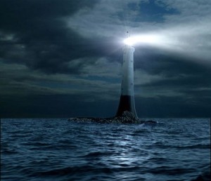
A ‘public good’ is, therefore, something that is a collective good sans exclusions. Furthelighthouser, it is not amount to a ‘zero-sum’ reckoning; in a sense that its consumption by one entity does not reduce its availability to other entities. In the maritime domain, a public good are best represented by ‘lighthouses’ that beacon weather-beaten seafarers to ports and safe waters.

Much of the world’s ocean realm wherein humans undertake multifarious maritime activities is ‘international medium’ not subject to the laws of any single country. The delivery of safety and security in such space of global commons thus becomes a logical extension of ‘public good’. Further, such ‘good’ could be extrapolated to the littoral. The watery medium provides transnational access to maritime security forces to undertake humanitarian missions during adverse contingencies on and off foreign shores. It is pertinent to note that while undertaking such benign tasks – whether at high seas or in the foreign littoral – the maritime forces perform a valuable function for their respective governments as ‘instruments of foreign policy.’ Given the above, in the contemporary context, CPGS may be defined as: ‘measures taken by the maritime security forces to meet their respective States’ international commitments towards facilitating good and lawful order in the maritime global commons, while also meeting their respective foreign policy objectives.’

It is necessary to note, however, that the maritime domain – represented by the seas and oceans of the world – constitutes the most unregulated and treacherous realm on Earth. To develop situational awareness in this domain, deliver safety and regulate activities therein presents a formidable challenge for maritime forces, including those belonging to major naval powers.

The Regional Context

In geographical terms, the Indo-Pacific region has a predominant maritime configuration. While geography has been a ‘constant’ in history, the so-called ‘rise of Asia’ and the attendant maritime-economic activity in the region has made the CPGS concept highly relevant to the regional countries and the extra-regional stakeholders. Traditionally – or at least in more recent times since the beginning of the post Cold War era – CPGS across the globe, and particularly in the Indo-Pacific region, has been provided by the maritime forces of the United States (US); at times, assisted by the forces of what the US calls, its “allies and partners.”

The regional countries, beset by the lack of adequate capacity – besides limited national objectives in terms of geographical scope – have been largely content with the arrangement, and have adopted a ‘free-rider’ approach to security. However, clearly, such a measure is not sustainable, neither for the regional countries, not for the global stakeholders. It is not easy – even for a superpower like the US – to deliver CPGS incessantly in the nearly ‘endless’ stretch of the world’s maritime realm. The military/ naval resources of the US have been increasingly stretched since the end of Cold War due to its increasing military-strategic commitments overseas. The geopolitical challenges added to the US resource ‘overstretch,’ best exemplified by the Proliferation Security Initiative (PSI) and the Regional Maritime Security Initiative (RMSI). This led the US Navy Chief of Naval Operations (CNO) to propound the concept of ‘Thousand-Ship Navy’ (TSN) in 2005.

Seeking support of allies and partners to partake the responsibility of CPGS, the TSN concept continued well into later years, though ‘TSN’ concept was later rephrased as the ‘Global Maritime Partnership’ (GMP) initiative, and the same was highlighted in the US Maritime Strategy document of 2007.

In the long run, the reliance of the Indo-Pacific region on a single power (or even on a group of ‘monolithic’ western powers) for providing CPGS may not be in the interest of the regional countries and global stakeholders alike, including the US. There are nascent indicators of a change, which augurs well for both categories of nations.

Emerging CPGS Architecture

Tier One

For the US, since the beginning of the current decade, delivery of CPGS in the Indo-Pacific has assumed greater salience than ever before in consonance with its national-strategic concept of ‘Re-balance to Asia.’   Strategy-2015 furthers the appeal for the partnership, with the ‘Global Maritime Partnership’ (GMP) – of the 2007 Maritime Strategy document – now rephrased as a “global network of navies” in the 2015 Maritime Strategy. The 2015 document effectively communicates to the potential partners the rationale for such “plug and play” cooperation with the US forces sans “commitment.”

While the US has been a ‘constant’ in terms of delivery of CPGS in the region, and it may continue to be the ‘lead actor’ for some time, it is unlikely to be the ‘only’ provider of ‘net security’[viii] in the longer run. The Indo-Pacific is witness to the emergence of new major and middle powers with increasing geopolitical, economic and military stakes in the entire Indo-Pacific region. For geopolitical and military-strategic reasons, China is likely to contest the primacy of the US in delivery of CPGS. Notably, however, the Chinese refer to CPGS differently, as ‘Military Operations Other than War’ (MOOTW), as indicated in China’s Defence White Papers since the 2012 document titledThe Diversified Employment of China’s Armed Forces.’

Tier Two

While the US-China dialectic may soon emerge as the first tier of the regional CPGS arrangement, other medium powers are likely supplement it and form the second tier. These include Australia, India and Japan: middle powers, all of whom have gained considerably from their alliance/ partnership with the US, but would like to form a concert to hedge against being entangled in the US-China tussle. Towards this end, analysts are increasingly promoting the idea of “middle power coalitions” to offset big-power rivalry in the Indo-Pacific.

Australia’s strategic focus has traditionally been on its eastern seaboard facing the Pacific. Lately, however, Canberra is increasingly looking westwards, akin to a “pivot to the Indian Ocean,” and reminiscent of events of the 1970s leading to Australia’s

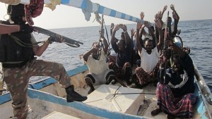
Counter Piracy Operations

‘Two-Ocean Navy’ policy enunciated in 1986.[xii] Sam Bateman writes, “Australia’s approach to the Indian Ocean in recent decades might appear to have waxed and waned (but) it never withered away…I don’t see any prospect of the current ‘pivot’ withering away!”[xiii]

The second tier is likely to be reinforced by the European Union (EU). Through the EU Naval Force (EUNAVFOR) Operation Atalanta, the EU has already proved itself to be a reckonable actor in the Indian Ocean, and the EU Maritime Security Strategy (EUMSS) promulgated in June 2014 is likely synergise the role of EU navies to provide CPGS – and least in the IOR, if not further eastwards – through its “integrated approach to global maritime security.” The Strategy would support the role of France – the only major power besides the US that has maintained a continuous naval presence in the Indian Ocean – and would draw support from the re-establishment of the Royal Navy’s permanent presence east of the Suez after a hiatus of nearly 45 years.

 Tier Three

In due course, some other medium powers and other relevant countries are likely to share the stage by taking on the gauntlet of CPGS in the Indo-Pacific, forming the third tier of the regional CPGS architecture. The potential medium powers include Indonesia and Iran. Indonesia has enunciated for itself the sobriquet of “Porus Maritim Dunia” (global maritime axis) that envisions developing of the maritime power of the archipelagic nation to its full potential. Further, in consonance with its geo-strategic centrality, it seeks to shape events in the maritime space of the Indo-Pacific region. Although Jakarta has accorded priority to internal consolidation, it is likely to play a significant CPGS role in the region.

Iran could be an effective counter to the global threat posed by the Islamic State in Iraq and Syria (ISIS) and bears a high potential of contributing to stability in West Asia and maritime security in the western Indian Ocean. The international community needs to realize the potential of ISIS to disrupt the West Asian international shipping lanes (ISL) by targeting oil and gas tankers, particularly in the maritime choke-points. The Iranian Navy may be a bulwark against the ISIS in securing the global energy trade sourced from the Persian/ Arabian Gulf. The positive trends in P+1 negotiations with Iran over its nuclear programme represents an opportunity for the stakeholders to engage with Iran.

The other relevant powers that could potentially contribute to CPGS in the region are South Africa, Pakistan and a cohesive group of the Gulf Cooperation Council (GCC) countries. Their highly capable and professional maritime forces could contribute significantly to regional CPGS effort. However, the political leaderships in Islamabad and the GCC capitals need to realize the emerging imperative to look beyond their respective sub-regional rivalries.

Concluding Remarks

The postulated CPGS architecture for the Indo-Pacific region conforms to the so-called “inclusive approach to maritime security,” which has been the ‘mantra’ of all the multilateral security institutions of the region: the ASEAN Regional Forum (ARF), the ASEAN Defence Ministers Meeting – Plus (ADMM+), the Western Pacific Naval Symposium (WPNS), the Indian Ocean Rim Association (IORA) and the Indian Ocean Naval Symposium (IONS). However, in the longer term, a formulation of regional security and stability architecture on a select group of regional countries and non-resident powers does not auger well for regional and global security.

The CPGS effort would need to be pan-Indo Pacific and collective, and enmesh the IOR and Western Pacific spheres of multilateralism. While it may be too ambitious and unrealistic to expect ‘all’ regional countries to acquire ‘surplus’ capacity for CPGS, even if the smaller countries develop adequate capacity to police their respective maritime zones and areas of SAR responsibility, they could contribute significantly to the collective regional CPGS effort. The efforts of multilateral institutions, and major and middle powers would need to be directed towards such ‘capacity-building.’

Captain Gurpreet S Khurana, PhD is Executive Director, National Maritime Foundation (NMF), New Delhi. The views expressed are his own and do not reflect the official policy or position of the NMF, the Indian Navy, or the Government of India. He can be reached at gurpreet.bulbul@gmail.com

[otw_shortcode_button href=”https://cimsec.org/buying-cimsec-war-bonds/18115″ size=”medium” icon_position=”right” shape=”round” color_class=”otw-blue”]Donate to CIMSEC![/otw_shortcode_button]

Notes:

[i] The term ‘Indo-Pacific Region’ was first used in 2007 by the author. See ‘Security of Sea Lines: Prospects for India-Japan Cooperation’, Strategic Analysis, Vol 31(1), January 2007, pp.139-153.

[ii] Paul A. Samuelson , ‘The Pure Theory of Public Expenditure’, The Review of Economics and Statistics, Vol. 36, No. 4 (Nov., 1954), pp. 387-389

[iii] The Proliferation Security Initiative: Can Interdiction Stop Proliferation?’ Arms Control Association, June 2004, at https://www.armscontrol.org/act/2004_06/Joseph. Also see, Gurpreet S Khurana, ‘Proliferation Security Initiative: An Assessment’, Strategic Analysis, Vol. 28, No. 2, Apr-Jun 2004, p.237

[iv] Joshua Ho, ‘Operationalising the Regional Maritime Security Initiative’, IDSS Commentary (18/2004), 27 May 2004 at https://www.rsis.edu.sg/wp-content/uploads/2014/07/CO04018.pdf

[v] Address by the US Navy CNO Admiral Mike Mullen to the students and Faculty of the Naval War College, 31 August 2005 at the Naval War College Newport, R.I. See US Navy website at http://www.navy.mil/navydata/leadership/quotes.asp?q=11&c=2

[vi] ‘A Cooperative Strategy for 21st Century Seapower’, October 2007, at https://www.ise.gov/sites/default/files/Maritime_Strategy.pdf

[vii] ‘A Cooperative Strategy for 21st Century Seapower’, US Maritime Strategy, 2015. Also see, Gurpreet S Khurana, ‘Indo-Asia Pacific’ Explained: An Assessment of US Maritime Strategy 2015’, Web-publication of National Maritime Foundation (NMF), New Delhi, 21 August 2015, at http://www.maritimeindia.org/View%20Profile/635756366838030982.pdf

[viii] The concept of ‘net security’ is defined as “…the state of actual security available in an area, upon balancing prevailing threats, inherent risks and rising challenges in the maritime environment, against the ability to monitor, contain and counter all of these”. ‘Ensuring Secure Seas: Indian Maritime Security Strategy’, Integrated Headquarters, Ministry of Defence (Navy), 2015, New Delhi.

[ix] ‘The Diversified Employment of China’s Armed Forces’, Information Office of the State Council, The People’s Republic of China, April 2013, Beijing, at http://news.xinhuanet.com/english/china/2013-04/16/c_132312681.htm

[x] Rory Medcalf and C Raja Mohan, ‘Responding to Indo-Pacific rivalry: Australia, India and middle power coalitions’, Lowy Institute for International Policy, August 2014, at http://www.lowyinstitute.org/files/responding_to_indo-pacific_rivalry_0.pdf

[xi] Gurpreet S Khurana, ‘ AUSINDEX-2015: Australia ‘Pivots’ to the Indian Ocean’, Web-publication of National Maritime Foundation (NMF), New Delhi, 12 October 15, at http://www.maritimeindia.org/View%20Profile/635802023056774316.pdf

[xii] In the 1970s, Australia was wary of Soviet naval activity in the Indian Ocean, which led to the establishment of its lone naval base in west (HMAS Sterling)in 1978 and enunciation of ‘Two Ocean Policy’ in 1986, through which Canberra intended to relocate half of the Navy’s fleet to the Indian Ocean seaboard.

[xiii] E-mail communication with Commodore Sam Bateman (Retd.), Royal Australian Navy (RAN), 24 October 2015.

[xiv] ‘Mr. Modi’s Ocean View’, The Hindu, 17 March 2015, at http://www.thehindu.com/opinion/editorial/mr-modis-ocean-view/article7000182.ece

[xv] ‘Ensuring Secure Seas: Indian Maritime Security Strategy’, Integrated Headquarters, Ministry of Defence (Navy), 2015, New Delhi. For an analysis of the Strategy, see Gurpreet S Khurana, ‘Net Security Provider’ Defined: An Analysis of India’s New Maritime Strategy-2015’, Web-publication of National Maritime Foundation (NMF), New Delhi, 23 November, at http://www.maritimeindia.org/View%20Profile/635838396645834619.pdf

[xvi] ‘Japan to reinforce SDF anti-piracy base in Djibouti for broader Middle East responses’, Asahi Shimbun, 19 January 2015, at http://ajw.asahi.com/article/behind_news/politics/AJ201501190036

[xvii] ‘European Union Maritime Security Strategy’, Council of the European Union, Brussels, 24 June 2014, at http://register.consilium.europa.eu/doc/srv?l=EN&f=ST%2011205%202014%20INIT

[xviii] European Commission Press Release data base, Brussels, 6 March 2014, at http://europa.eu/rapid/press-release_IP-14-224_en.htm

[xix] In December 2015, Britain began construction of is new military base at Bahrain. ‘Work starts on new UK military base in Bahrain’, The Gulf News, 18 December 2015, at http://gulfnews.com/news/gulf/bahrain/work-starts-on-new-uk-military-base-in-bahrain-1.1610885

[xx] ‘Jokowi’s Inaugural Speech as Nation’s Seventh President’, The Jakarta Globe, 20 October 2014, at http://jakartaglobe.beritasatu.com/news/jokowis-inaugural-speech-nations-seventh-president/ Also see, Gurpreet S Khurana, ‘The Maritime ‘Rise’ of Indonesia: Indicators, Intentions and Inferences’, Web-publication of National Maritime Foundation (NMF), New Delhi, 16 Jan 2015, at http://www.maritimeindia.org/CommentryView.aspx?NMFCID=5381