By Bruce B. Stubbs
The Problem
Every year the Chief of Naval Operations (CNO) submits a posture statement to Congress. It is the Navy’s principal annual self-assessment, the one document in which the service’s senior uniformed officer reports, over a personal signature, on readiness, force structure, and strategic requirements. For the congressional committees charged with raising and maintaining a Navy, it is among the most important pieces of evidence they receive, because it is the Navy’s official account of its own condition.
It is also almost entirely unconstrained. No statute dictates what a posture statement must contain, what form it must take, or what baseline should be used to evaluate it. What the document emphasizes or omits, and how it frames what remains is shaped, as we will see, not by the Navy alone but by several powerful players with competing agendas, none of whom holds the pen entirely. The result is not a standardized assessment but an annual narrative, its register set less by the requirements of oversight than by the incentives of advocacy and different agendas.
This is a peculiar gap, and it has nothing to do with the character of any individual CNO. Even if every CNO communicated in perfect good faith, an unconstrained annual narrative would still be a poor instrument of oversight, because oversight depends on structure, continuity, and comparability that no single year’s narrative can supply. Congress has long understood this everywhere else in its dealings with the Navy, and has imposed that structure by law on shipbuilding, acquisition, and fleet-requirement reporting. The posture statement is the conspicuous exception. This essay argues that Congress should impose the same reporting discipline upon the posture statement that it already applies to other required Navy reporting, by legislating its format.
The Evidence: Thirty-Five Years of Warning Without Consequence
A review of Navy posture statements from 1991 through 2026 reveals a consistent and durable pattern. In almost every year the statement paired a warning, whether shrinking force structure, deferred maintenance, an aging fleet, industrial-base erosion, manpower shortfalls, or rising operational risk, with a reassurance that the Navy remained ready and capable of meeting its commitments. The warning was usually present. Rarely, however, was it allowed to stand alone long enough to alarm.
Read one at a time, each statement seemed reasonable. Read in sequence, the pattern becomes unmistakable, and it runs in three movements. First the warning, naming a real and worsening condition. Then the reassurance, set in the same passage, affirming present readiness. Then, year after year, normalization set in, as a deficiency acknowledged every cycle without consequence stopped reading as a deficiency at all and became a feature of the landscape. Repetition without consequence is the mechanism. A problem reported annually, and annually absorbed, ceases to look like a problem.
The pairing is visible in the CNOs’ own words. In 2006, CNO Michael Mullen told Congress that the fleet “stands at 281 ships—not enough in my view,” then assured the committee in the same breath that the Navy’s plan “centered on 11 aircraft carriers with a fleet of about 313 ships, affordably meets these needs.”1 In 2014, CNO Jonathan Greenert warned that under Budget Control Act caps the Navy “would be unable to execute at least 4 of the 10 primary missions,” even as he testified that the budget “delivers sufficient readiness to meet our GFMAP [Global Force Management Allocation Plan] presence commitments and provide sufficient ‘surge’ capacity for contingency response.”2 Each warning was real, but neither was allowed to stand without the reassurance that blunted it.
A recurring weakness in many posture statements was the tendency to describe conditions rather than consequences. The statements might warn that: fleet size was insufficient; maintenance was deferred; readiness was declining; or industrial capacity was strained. While these were important warnings, they often stopped short of explaining what would happen if the deficiencies remained unaddressed. The language of “risk” was frequently used, yet the specific operational, strategic, fiscal, or human consequences of that risk were not always clearly articulated. A reader of three decades of these documents is left to ask the question every congressional staffer eventually asks of a vague brief. So what? Unsustainable when? Which mission fails? Which ship does not deploy? The statements seldom were answered. A warning that never states its consequence cannot compel action, because it never tells anyone what they stand to lose by waiting. The problem was not that Congress lacked warnings. It was that the warnings rarely matured into explicit statements of what the nation would lose if they were ignored. As a result, Congress was often informed of problems without receiving a corresponding assessment of the consequences of inaction.
This was not for lack of information. Over the same decades a separate body of evidence stated the problems and consequences plainly. The 2010 Balisle Fleet Review Panel concluded that cumulative decisions made over the preceding decade had produced a measurable decline in material readiness across the surface force, and traced the fall to 2000.3 The Center for Naval Analyses (CNA) was blunter still, concluding in its 2010 Tipping Point study that “when you are no longer present in one or two areas of vital national interest with dominant maritime forces, you are at the ‘tipping point.'”4 CNA’s warning extended beyond the immediate moment. It concluded that absent corrective action the Navy would “continue to leak capabilities and capacity throughout the next two decades.” The Navy’s Board of Inspection and Survey (INSURV) recorded falling material-condition scores year after year.5 The Government Accountability Office (GAO) counted the cost in hard numbers, including 10,363 days of attack-submarine idle time and maintenance delay between 2008 and 2018.6 The contrast between posture statement warnings and these reviews is the point, because each of these reviews named a consequence and attributed it to a cause. The same conditions that presented as alarms in an audit read as manageable challenges in the posture statement.
That cost came due in the summer of 2017, when the separate collisions of USS Fitzgerald (DDG-62) and USS John S. McCain (DDG-56) in the western Pacific killed seventeen sailors. Much of official Washington reacted as though the Navy’s readiness problems had appeared out of nowhere, but the Washington policy world had got it wrong. The problems had been documented for years, in some cases for decades, as two internal authoritative post-collision Navy reviews underscored. The Strategic Readiness Review concluded that the accidents reflected broad institutional and readiness failures that had accumulated over years, not isolated mistakes.7 The Comprehensive Review reached a similar conclusion. It found that “the risks that were taken in the Western Pacific accumulated over time, and did so insidiously,” and that the operating environment had become normalized to the point that sailors and headquarters staffs could no longer recognize that the processes used to identify, communicate, and assess readiness were failing.8
These external and internal reviews generally stated consequences more directly and concretely than the Navy’s annual posture statements. They described readiness systems breaking down, training standards atrophying, maintenance being deferred, risk accumulating, and capacity becoming unsustainable. It was the Navy’s own senior leaders, in the end, that documented those consequences more explicitly and forcefully than its annual posture statements had. The issue was not the absence of warning which were common and occasionally stark. The problem was that their implications were often underdeveloped and that they were frequently paired with reassurances that the Navy remained ready and capable of meeting its commitments.
The interesting question, then, is not whether warning existed. It is why warning, and by extension risk, became normalized. The harder questions are why the Navy’s own signed account of its condition so rarely stated the consequences that would have made the warning impossible to defer, and why the oversight system built to catch such a decline did not. Part of the answer lies in what the posture statement was asked to do, and in the process it was meant to serve.
Why It Happened: A Document Serving Many Masters
Over time, posture statements evolved from relatively straightforward professional assessments into hybrid documents that simultaneously served oversight, budgetary, political, institutional, and strategic-communication purposes. Warnings were embedded within a narrative that simultaneously described the Navy’s current condition, the future force readiness, and assurances of continued mission execution. The narrative tended to blur the distinction between the Navy’s current posture, the future force envisioned under the forthcoming President’s Budget, and the consequences of continued fiscal constraint. The result was not an absence of warning. It was a warning embedded within a narrative that simultaneously assessed current readiness, advocated for future resources, projected future capability, and reassured Congress that mission execution remained possible. This pattern persisted across the post–Cold War era under successive administrations and CNOs, which is the first clue that its source is structural rather than personal. A document produced by that many different people, under that many different Presidents, in that consistent a form, is not expressing anyone’s individual choice. It is expressing the incentives of the system that produces it.
Those incentives pull in different directions, because the posture statement is expected to serve several masters at once. The Secretary of the Navy, (SECNAV), through the Secretary of Defense, answers to the President, and no administration wants its officials telling Congress that the President’s budget is inadequate or the service is heading toward trouble. That induces an incentive toward reassurance. Congress is not one audience but many, with the majority often inclined to support the administration and the minority more inclined to expose its shortfalls. And the Navy itself wants resources without inviting the detailed direction that every admission of weakness can provoke. This concern is evidenced by the steady growth of the National Defense Authorization Act from roughly 20 pages in the early 1960s to “more than 3,000 pages” for FY2026, becoming an ever more prescriptive document.9 Nor are members of Congress immune from incentives of their own, often attending more closely to the shipyards, bases, programs, and jobs in their districts than to the aggregate condition of the fleet, which makes a clear, standardized account of that aggregate condition all the more necessary.
Combine all those pressures and the posture statement emerges as a negotiated document, not negotiated line by line, but in a way that accommodates various institutional preferences. The administration wants reassurance, the two parties in Congress want material that serves their differing aims, and the Navy wants resources without micromanagement. The warning satisfies the Navy’s need to signal requirements; the reassurance satisfies the administration’s need to demonstrate competence; the ambiguity holds detailed intervention at bay. The warning-and-reassurance pattern is the natural product of those crosscurrents. It is, in the end, a compromise document, and a compromise document makes a poor instrument of oversight, because the very ambiguity that lets it satisfy everyone is what drains it of the consequence, continuity, and comparability that oversight requires. Indeed, these annual documents are so compromised that retired Army Lieutenant General Thomas Spoehr observed that posture hearings have “largely devolved into ‘information-free’ events.”10
Congress Already Knows How to Fix This
If this problem were unique to posture statements, reform might be difficult. In fact, Congress has confronted similar reporting failures repeatedly and has developed a consistent solution. The reform this essay proposes is not novel. It advocates that the rule Congress already follows in all other dealings with the Navy be applied at last to the one document that has escaped it. Again and again, when Congress found executive-branch self-reporting too optimistic, too inconsistent, or too vague to support oversight, it has responded the same way, not by asking the service to do better, but by legislating what the report must contain.
The pattern began with acquisition. Dissatisfied with rosy program reporting, Congress created the Selected Acquisition Reports11 and, through the Nunn-McCurdy provisions, required formal notification and justification whenever a program breached defined cost thresholds.12 The intent was not to manage programs from Capitol Hill but to force a standardized, comparable account that optimism could not soften.
Congress extended the same logic to force planning, though with an instructive limit. Under 10 U.S.C. § 231, the Secretary of the Navy must submit with the budget an annual 30-Year Shipbuilding Plan, carrying the views of the CNO and the Marine Corps Commandant, along with a certification that the budget actually funds it. The plan does useful work.13 It lays out a procurement timeline that lets the shipbuilding industry plan, budget, and prepare, and it lets Congress see the Navy operating with intent toward a stated force-level goal. But its purpose is narrow. It is, in effect, a funded-or-not construction schedule, valuable for industrial coordination and budget markup, and largely silent on readiness, maintenance, risk, and consequence. It can show how many ships the Navy wants, and by when, but it was never built to justify a larger fleet, to explain the failure to reach one, or to connect the fleet’s condition to the stakes of inaction. The record bears out that narrowness. The plan has been submitted faithfully every year since 2003, yet in March 2025 the GAO reported that the Navy has no more ships today than when it issued that first plan, despite a near-doubling of its shipbuilding budget over the same two decades.14 The plan recorded the intent and the timeline; it neither caused that stagnation nor was equipped to arrest it. That is the lesson for posture-statement reform. A report is only as useful as the substance Congress requires it to contain, and a timeline of intentions is not the same as an instrument of oversight.
Congress has shown it can do exactly that. There are three prime examples of statutory reports mandated by Congress primarily because Congress could not get the information it required for effective oversight of the Navy and the other armed services. These reports are the Battle Force Ship Assessment and Requirement (BFSAR), the Annual Long-Range Plan for Construction of Naval Vessels, and the Annual Aviation Inventory and Funding Plan.15 In each report Congress did three things it has never done for the annual posture statement. It named the official who signs and submits the report, it set a deadline or triggering event, and it prescribed the specific content the report must contain. No comparable statute governs the posture statement. The precedent to mandate its originator, format, and contents is well established. (See Table 1.)
Table 1: Statutory Precedents for a Congressionally Mandated Navy Report
|
Report
|
Statute |
Originator (signs and submits) |
Purpose |
Major Data and Information Elements Required
|
| Annual Aviation Inventory and Funding Plan
Current form: Annual Aircraft Procurement Plan and Aircraft Inventory Report |
10 U.S.C. § 231a16
Annual plan and certification, submitted not later than 30 days after the President’s budget. |
Secretary of Defense
Submits the plan and signs the certification. |
Show whether the budget funds the aircraft needed to sustain the aviation force structure the national military strategy requires, and disclose the risk if it does not. |
• A 15-year procurement program for fighter, attack, bomber, lift, and ISR aircraft
• The aviation force structure required by the national military strategy
• Estimated annual investment funding for each program
• Estimated annual life-cycle operating and support funding
• An annual aircraft inventory by type, model, and series
• A certification that the budget funds the plan, with a shortfall and risk assessment if it does not |
| Battle Force Ship Assessment and Requirement (BFSAR) |
10 U.S.C. § 869517
Submitted not later than 180 days after a covered event (a change in strategic guidance, laydown, operating concepts, or missions). |
Chief of Naval Operations
Submits to the congressional defense committees. |
Establish and update the battle force ship requirement, the force-level goal and mix the fleet must reach to meet strategy and combatant-commander demand. |
• A review of the federal, DoD, and Navy strategic guidance the force must follow
• The steady-state demand for maritime security and security force assistance
• The force options that meet combatant-commander theater campaign plan demands
• A force optimization analysis of the day-to-day global posture required
• Amphibious warfare and Marine-lift requirements set by the Commandant of the Marine Corps |
| Annual Long-Range Plan for Construction of Naval Vessels
The 30-Year Shipbuilding Plan |
10 U.S.C. § 23118
Annual plan and certification, submitted with the President’s budget. |
Secretary of the Navy
Submits and signs plan, which carries the unaltered assessment of Chief of Naval Operations and Commandant of the Marine Corps. Secretary of Defense certifies funding adequacy. |
Present the 30-year plan to build, maintain, and modernize the battle force, and certify whether the budget funds it. |
• A 30-year construction program by fiscal year, ship type, and quantity
• The battle force inventory the plan would produce
• The estimated annual construction cost and the basis for it
• The estimated funding to operate, maintain, and modernize the force
• The unaltered assessment of the Chief of Naval Operations and the Commandant of the Marine Corps
• A certification that the budget funds the plan, with risk if it does not |
For illustrative purposes, the Battle Force Ship Assessment and Requirement (BFSAR) report, codified at 10 U.S.C. § 8695, does not solicit input from the Secretary or the administration. It directs the CNO, by name, to submit to the congressional defense committees an assessment of the fleet the Navy requires. And Congress did not merely ask for a number. It specified the contents, a review of strategic guidance, an analysis of steady-state demand, modeling of the Navy’s ability to fight and win approved scenarios, and based on all of that, the required number and posture of each class of ship, projected across five, ten, fifteen, twenty, twenty-five, and thirty years. The detail was the point, because Congress had learned that left to define the report’s contents itself, the Navy would not reliably say how many ships it needed, or why. The reports bear this out. The first, in 2022, set the requirement at 373 ships;19 the second, in 2023, at 381.20 The number moved, but for the first time Congress could see, in a specified form, the reasoning behind it.
The BFSAR also exposes the limit of what format reform can promise, and the objection deserves a direct answer. That assessment did everything this essay advocates. It was mandated in detail, signed by the CNO, and specific to the ship. It set the requirement at 381. And it changed almost nothing: no administration funded it, and the battle force still sits below 300. A skeptic may fairly ask why mandating the posture statement’s format would fare any better. The answer is that legislating format compels accounting, not appropriations, and such distinction is the point rather than a concession. A mandated format cannot force Congress to buy ships. What it can do is strip the Navy of the ability to let a warning quietly disappear, to state a requirement one year and fall silent the next, to name a problem and never report what became of it. That is the specific failure this essay diagnoses, and it is the failure a disciplined format would cure. Accountability is not the same as appropriation, but it is the precondition for it.
Alongside these mandated self-reports, Congress built a second layer of defense, independent analysis. The Congressional Budget Office (CBO) scores the Navy’s shipbuilding plans against its own cost models. The GAO audits acquisition and maintenance. The Congressional Research Service (CRS) supplies standing expert analysis to the committees. Congress created these institutions precisely because it understood that agencies are poor judges of their own performance. The purpose was not to eliminate agency expertise but to ensure that congressional oversight did not depend exclusively upon it. The Navy is a documented case in point, and the most telling testimony comes not from a critic but from Congress’s own analyst. CRS naval analyst Ronald O’Rourke has observed that the incentive toward optimistic Navy cost estimates is so strong that it has become, in his words, “almost standard operating procedure.”21 That is not an accusation of dishonesty. It is a description of exactly the institutional optimism this essay has traced in the posture statements, identified independently, in another reporting stream, by the very office Congress created to check it.
The conclusion writes itself. Across acquisition, shipbuilding, fleet requirements, and budget analysis, Congress has already decided that it cannot rely on unstructured Navy self-assessment, and it has imposed structure by law in every one of them. The posture statement is the lone holdout, the one major annual account of the Navy’s condition that Congress still receives as whatever narrative the Navy chooses to write. There is no principled reason for the exception.
The question is no longer academic. The Navy faces a fleet below the size its own strategy demands and which is still shrinking, submarine-maintenance delays measured in years, a strained shipbuilding and repair base, munitions shortfalls, aging infrastructure, and an adversary in China that numerically “has the largest navy in the world.”22 In the coming decade Congress will be asked to make consequential decisions about force structure and resources, very likely involving the largest naval buildup since the 1980s. Those decisions require a reporting instrument capable of connecting conditions to consequences and preserving institutional memory across administrations. The posture statement, as currently written, is not that instrument.
Caudle’s 2026 posture statement demonstrates that candid discussion of readiness consequences is possible. However, the historical record reviewed here shows substantial variation in how CNOs have presented risk, readiness, and implications. Effective oversight should not depend upon the communication style or priorities of a particular CNO. The purpose of reform is to ensure that Congress receives consistent, comparable, and decision-relevant information regardless of who occupies the office.
A Navy Posture Statement Reform Act
The remedy follows directly from the diagnosis. If the posture statement fails as an oversight instrument because it is an unconstrained narrative, the fix is to constrain it, not by dictating the Navy’s conclusions but by mandating the categories it may not omit, soften, or quietly drop. The aim is to convert an annual advocacy document into an oversight instrument with continuity from one year to the next. The lesson of the 30-Year Shipbuilding Plan must be heeded. The mandate must drive the contents, not merely the calendar. This degree of specificity is neither unusual nor unprecedented. Congress already prescribes detailed content requirements for numerous defense reports, including those governing acquisition, shipbuilding, and force-structure assessments.
A reformed posture statement would fall into three parts as presented in Tables 2, 3, and 4. The current-year assessment in Part I would preserve what the Navy already does well and discipline it. It would provide: (1) a short assessment of the current security environment; (2) a ranked list of the service’s ten most serious problems. By design, this is a list of problems, not challenges, with each problem carrying its status, trend, severity, corrective action, and the consequence of leaving it unresolved. By providing this list, the Navy lives its management motto to “Embrace the Red” which, according to ADM Stephen Koehler, U.S. Pacific Fleet Commander, is “Navy speak for embracing problems and adjusting quickly and holistically to fix them” and is a major plank in its “Get Real, Get Better” command philosophy.23 In addition, Part I would address: (3) an assessment of the changing character of war caused by developments in the threat capability, geo-political actions, technology, and warfare concepts, etc.; (4) CNO’s risk assessments; (5) CNO’s personal assessment of the Navy’s current readiness; (6) CNO’s evaluation of the implications and consequences of the navy’s top ten problems and current readiness; (7) the top ten accomplishments of the past year (“Embrace the Green”); and (8) formal acknowledgment and praise of Congressional support. Part I would also include an Annex A to address the status of major programs of record and procurements. In regard to risk, as previously explained, Navy posture statements frequently used that term without specifying the type of risk and not always clearly articulating the consequences of that risk. Congress, consequently, while informed of problems was not exposed to the consequences.
Many posture statements exhibited inconsistent treatment of consequences. Some CNOs articulated them clearly while others described only conditions or generalized risk. Even when consequences were identified, they were often accompanied by reassurances that the Navy would continue meeting its commitments. As a result, Congress was frequently presented with warnings without a standardized assessment of what inaction would mean. Section 6 would address this deficiency by requiring the CNOs to state explicitly the consequences of failing to correct major deficiencies.
Table 2: Major Elements of a Congressionally Mandated Posture Statement—Part I Current Fiscal Year Assessment
|
The Current Year Assessment Topic
|
What It Requires
|
| 1. Assessment of Current Security Environment |
Professional judgment through a naval lens. |
| 2. Assessment of the Top Ten Problems (Embrace the Red) |
Status, trend, severity, corrective action, and consequence of individual problems. |
| 3. Assessment of the Changing Character of War |
What is changing, and what is not. |
| 4. Risk Assessments |
Specific current “risk.” to mission, force, strategy, the industrial base, and the nation. |
| 5. Current Readiness |
Greatest readiness concerns, vulnerabilities, opportunities, and assumptions most likely to prove wrong. |
| 6. Evaluation of Navy’s Top Problems and Current Readiness |
Strategic implications and national-security consequences for current environment. |
| 7. Top Ten Accomplishments of the Past Year (Embrace the Green) |
Year’s principal achievements, briefly. |
| 8. Acknowledgment of Congressional Support |
Enacted authorities and appropriations recognized. |
| Annex A: Overview of Programs and Procurement (Description and Status) |
Detailed reference material on major programs. |
Part II would focus on and assess the Navy’s future readiness, performance, and environment based on the assumption that Congress will approve the President’s Budget submitted for the next fiscal year. This component of a reformed posture statement would provide: (1) an assessment of the future security environment; (2) strategic planning assumptions; (3) the CNO’s personal assessment of the Navy’s future readiness, given passage of the President’s Budget for the next fiscal year; (4) the CNO’s future risk assessments; (5) on-going and potential future problems; and (6) consequences and implications of these on-going and future problems. As in Part I, Section 6 of Part II requires the CNO to identify, in concrete terms, what will occur if major deficiencies remain unresolved.
Table 3: Major Elements of a Congressionally Mandated Posture Statement—Part II Next (i.e., Future) Fiscal Year Assessment
|
The Future Year Assessment Topic
|
What it Requires
|
| 1. Assessment of Future Security Environment |
Professional judgment through a naval lens. |
| 2. Strategic Planning Assumptions |
Premises on: budget, recruiting, retention, shipbuilding and maintenance capacity, industrial base, operational demand, and threat. |
| 3. Assessment of Navy’s Future Readiness Based on Submitted President’s Budget for next FY |
Greatest readiness concerns, vulnerabilities, opportunities, and assumptions most likely to prove wrong. |
| 4. Risk Assessments |
Specific future risk to mission, force, strategy, industrial base, and nation. |
| 5. On-going and Future Key Problems and Future Readiness |
Problem description, status, trend, severity, and corrective action. Every major external review status (for example, 2010 Balisle Report, GAO Reports, Annual INSURV Reports, the 2017 Strategic and Comprehensive Readiness Reviews, etc.) kept visible until formally closed. For each major problem, what happens if Congress does nothing, stated concretely. Each problem named in any prior year carried forward with status, trend, and resolution or abandonment, so none can quietly drop off the list. |
Part III, would focus on longitudinal assessment, building the institutional memory that posture statements have always lacked. This third component of the reformed posture statement tracks the Navy across time rather than freezing it in a single budget cycle. Section 1 in Part III requires the CNO to track from 1991, at the end of the Cold War, to the present, the condition of the fleet using standardized categories such as force structure, readiness, maintenance, munitions, infrastructure, industrial capacity, and personnel. But describing conditions alone is insufficient. Section 3 requires the CNO to explain the consequences of inaction by identifying the operational, strategic, and fiscal risks that will result if these longitudinal deficiencies are not addressed. In addition, Section 3 requires those warnings and risks to be tracked from year to year until resolved, preventing them from disappearing into successive posture statements. This reporting requirement transforms warnings from isolated observations into potentially enduring Congressional oversight items. It compels the articulation of consequences and thus provides continuity and accountability to eliminate a central weakness identified in this posture statement review. Furthermore, by using 1991 as the benchmark year, trends cannot be passed off as snapshots.
Part III should reveal where the Navy is headed and whether longstanding warnings are being addressed. Requiring the longitudinal assessment distinguishes this proposal from a routine reporting requirement, because it is a proposal for institutional memory. No existing statutory report provides a longitudinal assessment of readiness trends, unresolved deficiencies, corrective actions, and the consequences of inaction.
Table 4: Major Elements of a Congressionally Mandated Posture Statement—Part III Longitudinal Assessment
|
Part III — Longitudinal Oversight
|
What it requires
|
| 1. Historical Readiness Assessment with Cumulative Data on Key Indices |
Multi-year trends in personnel, maintenance, aviation, surface, submarine, and logistics readiness, reported as trends, not snapshots. From 1991 (end of the Cold War) to the present. |
| 2. Longitudinal Assessment: Deficiencies, Corrective Actions, and Consequences |
Consequences of inaction by identifying the operational, strategic, and fiscal risks that will result if these longitudinal deficiencies are not addressed. |
Conclusion
Congress already requires long-range reporting for ships and aircraft because force structure cannot be understood in a single fiscal year. Readiness and risk evolve over similarly long periods. Yet no comparable statutory mechanism exists to track the condition of the fleet, the persistence of readiness deficiencies, or the consequences of failing to address them.
Furthermore, the experience of the Royal Navy offers a cautionary lesson. For nearly two decades, official reports, parliamentary inquiries, retired officers, journalists, and independent analysts warned of declining Royal Navy capacity, readiness shortfalls, maintenance backlogs, personnel shortages, and the growing gap between commitments and resources. Yet because the Royal Navy continued to deploy and meet immediate operational demands, the cumulative consequences of those trends remained difficult for policymakers and the public to see clearly. The result was not a sudden collapse, but a gradual erosion of capability that became unmistakable only after critical mass had been lost. The implicit lesson is that Britain had shipbuilding plans, budgets, reviews, and testimony. What it lacked was a single, enduring, publicly accessible mechanism that continuously connected warning, consequence, trend, and accountability over decades.24 The proposed reform is designed to provide exactly that function for the U.S. Navy.
The reforms proposed here would not guarantee against a similar outcome for the U.S. Navy. No reporting system can substitute for sound strategy, adequate resources, or effective leadership. They would, however, create a longitudinal public record of U.S. Navy readiness, force structure, operational risk, and the consequences of inaction. By providing Congress and the American people with a consistent, comparable assessment over time, the U.S. Navy’s posture statement would become more than an annual budget justification. It would serve as an enduring institutional record, making long-term trends visible before they become crises and helping ensure that future warnings are neither overlooked nor forgotten.
The intent of this proposal is for the Navy to account, in a form Congress and its analysts can read against the prior year and the years before that. Congress has imposed exactly this kind of discipline on acquisition reporting, on the shipbuilding plan, and on the fleet-requirement assessment. Extending it to the posture statement asks nothing new of the institution, only that the Navy’s most important annual account of itself finally meet the standard Congress already requires of the rest. The Navy’s problem was never an absence of warning. It was the absence of a reporting system capable of preserving those warnings, tracking their resolution, and explaining their consequences in frank terms. Congress solved that problem in acquisition reporting. It solved it in shipbuilding. It solved it in fleet-requirement assessment. The posture statement is the remaining exception. It should not remain so.
Bruce Stubbs had assignments on the staffs of the secretary of the Navy and the chief of naval operations from 2009 to 2022 as a member of the U.S. Senior Executive Service. He was a former director of Strategy and Strategic Concepts in the N3N5 and N7 directorates. As a career U.S. Coast Guard officer, he served as the assistant commandant for capability at Headquarters, served on the staff of the National Security Council, taught at the Naval War College, commanded a major cutter, and served a combat tour with the U.S. Navy in Vietnam during the 1972 Easter Offensive.
References
1. Michael G. Mullen, Admiral, U.S. Navy, Chief of Naval Operations, Opening Statement, Before Subcommittee of the Committee on Appropriations, U.S. Senate, Department of Defense Appropriations for Fiscal Year 2007, 15 March 2006. Mullen stated: “Our long-range ship building plan submitted with this budget, likewise, strikes a balance between near- and long-term requirements. The fleet today stands at 281 ships—not enough in my view to deliver the joint warfighting capabilities the combatant commanders will need over the course of this long war. Our plan, centered on 11 aircraft carriers with a fleet of about 313 ships, affordably meets these needs for the good of the Navy, for the good of the Nation and for the good of our allies and partners.”
2. Jonathan Greenert, Admiral, U.S. Navy, Chief of Naval Operations, Opening Statement, Before Subcommittee of the Committee on Appropriations, U.S. Senate, Hearing on the Department of Defense Appropriations for Fiscal Year 2015, 26 March 2014. The full quote: “We would be unable to execute at least 4 of the 10 primary missions articulated in the Defense Strategic Guidance in the Quadrennial Defense Review. And his prepared statement which declared, “Despite the reduction in funding below levels planned in PB–14, PB–15 strikes this balance and the result is a program that delivers sufficient readiness to meet our GFMAP presence commitments and provide sufficient ‘surge’’ capacity for contingency response.”
3. Vice Admiral Phillip M. Balisle, U.S. Navy, Ret, Letter to Commander, U.S. Fleet Forces Command and Commander, U.S. Pacific Fleet, Enclosure (1) Final Report, Subject: Fleet Review Panel of Surface Force Readiness, 26 February 2010.
4. Daniel Whiteneck, Michael Price. Neil Jenkins, and Peter Swartz, “The Navy at a Tipping Point: Maritime Dominance at Stake?”, Center for Naval Analyses, CAB D0022262.A3/1REV, March 2010, p. 43.
5. Geoff Ziezulewicz, “Fleet’s Material Condition Keeps Getting Worse, New INSURV Report Says,” Navy Times, 2 June 2023. “The Navy fleet’s overall material condition declined slightly in fiscal 2022, ‘resuming a slight but steady negative trend’ that has occurred since fiscal 2017, according to the Navy’s annual Board of Inspection and Survey, or INSURV, report released by the Navy on Friday.”
6. United States Government Accountability Office, Report to the Subcommittee on Readiness, Committee on Armed Services, House of Representatives, Navy Readiness Actions Needed to Address Costly Maintenance Delays Facing the Attack Submarine Fleet, GAO-19-229, November 2018.
7. The Honorable Michael Bayer and Admiral Gary Roughead, U.S. Navy (Retired), Strategic Readiness Review, 3 December 2017. Released by Secretary of the Navy Richard V. Spencer.
8. Admiral P. S. Davidson, U.S. Navy, Commander, U.S. Fleet Forces Command, Memorandum for Vice Chief of Naval Operations, Subject: Comprehensive Review of Recent Surface Force Incidents, Enclosure (1): Comprehensive Review of Recent Surface Force Incidents, 26 October 2017. The report also noted: “Evidence of skill proficiency (on ships) and readiness problems (at headquarters) were missed, and over time, even normalized to the point that more time could be spent on operational missions.”
9. Michael Wilson, “FY 2026 National Defense Authorization Act: A Comprehensive Holland & Knight Analysis,” Holland & Knight Alert, 22 December 2025.
10. Thomas Spoehr, ‘What Congress Gets Wrong About Defending the Homeland,” The National Interest, 23 January 2024.
11. U.S. Department of Defense, “Department of Defense Selected Acquisition Reports (SARs),” Press Release, 22 September 2023.
12. Congressional Research Service, “The Nunn-McCurdy Act: Background, Analysis, and Issues for Congress,” R41293, 12 May 12, 2016.
13. This Navy document is formally titled Report to Congress on the Annual Long-Range Plan for Construction of Naval Vessels for Fiscal Year XXXX and is drafted by OPNAV N9 for signature by the Navy secretary. The Navy has a statutory requirement (10 U.S.C. §231) to submit annually to Congress this plan that provides “supporting information for assessing and marking up the Navy’s proposed shipbuilding program.” It provides a 30-year shipbuilding procurement profile along with broad guidance about the Navy’s intentions to meet its force structure demands. According to Ron O’Rourke, Congressional Research Service analyst, the plan enables Congress to assess whether (1) the Navy intends to procure enough ships to achieve and maintain its stated ship force-level goals; (2) there is a fundamental imbalance between program goals and projected resources; (3) ship procurement plans are likely to be affordable within future defense budgets; (4) ship procurement planning is reasonable in terms of assumed service lives for existing ships and estimated procurement costs for new ships; and (5) there are potential industrial-base implications. Ronald O’Rourke, Statement before the Committee on Armed Services Subcommittee on Seapower and Projection Forces, U.S. House of Representatives, Hearing on “Future Force Structure Requirements for the United States Navy,” 4 June 2020, p. 1. In addition, according to Dr. Eric Labs of the Congressional Budget Office, the plan benefits congressional oversight and decisions by potentially revealing: (1) cumulative long-term effects of annual appropriation decisions that may not be apparent from a shorter perspective; (2) imbalances between long-term objectives for inventories and projected budgetary resources; and (3) information on assumptions about the service lives of major weapons systems and how those assumptions may affect its inventory goals. Eric J. Labs, Senior Analyst for Naval Forces and Weapons, “The Value of 30-Year Defense Procurement Plans for Congressional Oversight and Decision-making,” Congressional Budget Office, Statement before the Subcommittee on Oversight and Investigations Committee on Armed Services U.S. House of Representatives, 1 June 2011.
14. Shelby S. Oakley, Director, Contracting and National Security Acquisition, United States Government Accountability Office, Testimony Before the Subcommittee on Seapower and Projection Forces, Committee on Armed Services, House of Representatives, “Navy Shipbuilding: A Generational Imperative for Systemic Change,” GAO-25-108136, 11 March 2025.
15. The Navy develops this shipbuilding plan; the Secretary of the Navy certifies it and includes it in the defense budget materials; the Secretary of Defense submits those budget materials to Congress; and the unaltered assessment of the Chief of Naval Operations and the Commandant accompanies the shipbuilding plan.
16. 10 U.S.C. § 231a, “Budgeting for life-cycle costs of aircraft for the Army, Navy, and Air Force: annual plan and certification.” The earlier 30-year aviation procurement plan under former § 231a (Pub. L. 110-417, § 141 (2008)) was repealed by the John S. McCain National Defense Authorization Act for Fiscal Year 2019.
17. 10 U.S.C. § 8695, “Navy battle force ship assessment and requirement reporting” (added by Pub. L. 117-81, § 1017(a), Dec. 27, 2021).
18. 10 U.S.C. § 231, “Budgeting for construction, maintenance, and modernization of naval vessels: annual plans and certifications.”
19. Sam Lagrone, “New Navy Fleet Study Calls for 373 Ship Battle Force, Details are Classified,” USNI News, 19 July 2022.
20. Ronald O’Rourke, Navy Force Structure and Shipbuilding Plans: Background and Issues for Congress, Report RL32665 (Washington, DC: Congressional Research Service, 31 March 2025), Table I-1: Total Number of Ships in Navy Since FY1948 and p. 3. “In March 2024, as part of its FY2025 30-year (FY2025-FY2054) shipbuilding plan, the Navy released the details of this new goal, which calls for achieving and maintaining a fleet of 381 manned ships of certain types and numbers, plus 134 large, unmanned surface and underwater vehicles.” U.S. Naval Institute Staff, “Fleet and Marine Tracker,” USNI News, 4 August 2025.
21. Ronald O’Rourke, Congressional Research Service, Testimony Before the Armed Services Committee, Seapower and Projection Forces Subcommittee, U.S. House of Representatives, Hearing on “The State of U.S. Shipbuilding,” 11 March 2025.
22. Office of the Secretary of Defense, Military and Security Developments Involving the People’s Republic of China 2024, Annual Report to Congress, Executive Summary, December 2024, p. vii.
23. Nuray Taylor, “U.S. Pacific Fleet Commander Calls to ‘Embrace the Red’”, Signal Magazine, 28 January 2025. ADM Koehler’s full quote: “”Let’s take a holistic, innovative approach that brings transformative, strategic gain to our force. That includes considering things we’re not doing that we should be doing. It includes embracing the red, which is Navy speak for embracing problems and adjusting quickly and holistically to fix them.”
24. “Is the Royal Navy in Crisis?” Navy Lookout, 8 January 2024.
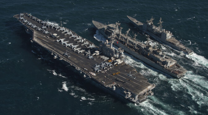
Featured image: The Nimitz-class aircraft carrier USS Carl Vinson and the Ticonderoga-class guided missile cruiser USS Bunker Hill conduct a replenishment at sea with the Military Sealift Command fast combat support ship USNS Bridge. (U.S. Navy photo by Petty Officer 2nd Class James Evans)