Tag Archives: featured

The Mumbai Attack: Terrorism from the Sea

This is an article in our first “Non Navies” Series.

Nearly six years ago, Pakistani terrorists from Lashkar-e-Taiba (LeT, meaning Army of the Righteous) launched a sophisticated raid on the Indian port of Mumbai. Ten LeT operatives held the city captive from 26-29 November 2008, killing 164 people and injuring more than 300 others. Fascinating in its counterterrorism aspects, the Mumbai attack is particularly noteworthy for those of us in maritime professions because of how they got there: by sea. LeT highlighted in detail how an irregular organization can circumvent landward control measures by turning to the maritime environment.
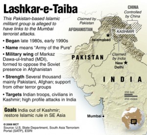
A pre-26/11 U.S. Department of State fact sheet on Lashkar-e-Taiba.

Violent extremist organizations (VEOs) such as LeT succeed in irregular warfare by going where government authority is absent or insufficient. The Indo-Pak coast is no exception. The expansive region has supported the livelihood of fishermen and merchants for centuries, making it a permeable environment where minimal government presence was (and remains) tolerant of transient craft. Such an environment offers myriad advantages compared to overland routes where government checkpoints and patrols are far more rigorous. VEOs continue to pursue these overland routes for infiltration or smuggling, but LeT minimized the chance of their high-stakes attack being interdicted by Indian authorities when they chose to come by sea.

The raid itself wasn’t the first iteration of LeT’s maritime infiltration. For example, in late-2006/ early-2007 eight operatives rendezvoused at sea with Indian LeT members aboard an unidentified fishing vessel and returned with them to reconnoiter Mumbai. This gave them ample opportunity to assess the coastal pattern of life, including security presence and traffic density, as well as to gather imagery of everything from landing sites to target location from the perspective of the raiding party. Once ashore they split into two-man teams, just as the raiding party would do, observing the area by travelling from safehouse to safehouse. They were not discovered during the seaborne infiltration nor during the reconnaissance of Mumbai. However, two of the eight were arrested in March 2007 by the Jammu & Kashmir police (Jammu & Kashmir being a state in northern India). During interrogation the two suspects gave specific information about their infiltration of Mumbai as well as LeT’s desire to use the sea as a routine ingress. Neither this shot-across-the-bow nor corroborating intelligence provided by U.S. and Indian agencies proved sufficient to energize India’s maritime security agencies.

After more than a year of training on the Mangla Dam reservoir in Kashmir, the raiding party departed Karachi on 21 November 2008 aboard motor vessel HUSSEINI. They spotted the Indian fishing vessel KUBER two days later in Pakistani waters. Though their plan had been to hijack a Mumbai-based craft in Indian waters, KUBER’s Indian registry enticed them to seize it as an early opportunity. They were able to come alongside, possibly by feigning distress, and quickly commandeeredthe fishing boat. The raiding party embarked KUBER and transferred all of her crew except the master to HUSSEINI. The raiders started towards Mumbai after the equipment was moved aboard and HUSSEINI returned to Karachi. The four fishermen taken from KUBER were executed, their bodies left adrift on the sea.

The transit to Mumbai was filled with map reconnaissance, table-top rehearsals, equipment prep, as well as probable comms checks and intel updates from LeT’s ad hoc operations center in Pakistan. KUBER arrived off the coast of Mumbai unscathed and unaddressed by maritime authorities on the evening of 26 November. The master was bound and his throat slit. The raiding party assembled their inflatable Gemini boats (counts vary from one to three), transferred their equipment and began the 4 NM insert under cover of darkness. KUBER was left adrift with a GPS, satellite phone, and other materials that would prove instrumental in developing the backstory during the subsequent investigation.

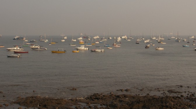
It’s unknown where the inflatable craft parted company (assuming there was more than one), but multiple beach landing sites were used. In the truest sense of camouflage, the boat(s) were not colored black and green to blend into the night, but bright yellow to blend

One of the boats used by LeT to insert into Mumbai.

into the menagerie of local craft- undoubtedly a result of the early reconnaissance. At one site the operatives cheerfully claimed to be college students. At the other site they responded gruffly to locals, telling them to mind their own business, possibly even displaying their weapons. They continued unhindered in both cases, abandoned their craft on the beach, and shortly thereafter waltzed into history as executioners in a horrific raid.

To recap: LeT reconnoitered by sea, trained on Pakistan’s inland waterways, departed a major sea port (Karachi), hijacked a fishing vessel illegally operating in Pakistani waters/EEZ, transited unmolested across 500 NM of Indo-Pak littorals, amphibiously inserted into the Mumbai metropolis unchallenged, and came ashore unnoticed save for a handful of local fishermen accustomed to illicit maritime activity.

LeT violated the Indo-Pak littorals with impunity and conducted a raid heralded as a wake up call for maritime terrorism. This raid indeed required a great deal of competence, but VEOs embracing riverine or littoral waters as a maneuver space should not have come as any surprise. Then and now, the Niger River Delta and the Gulf of Guinea were abused by criminal organizations on a daily basis; Philippine waters were plagued by Abu Sayyaf; Colombian Riverines routinely battled the FARC and AUF; and in the U.S.’s backyard were organizations trafficking drugs, money, and violence through the Caribbean, Western Pacific, and Rio Grande. Oceans and waterways are indeed the vital connective tissue of the world, but they are open for both legitimate and illegitimate business alike.

So how do nations prevent VEOs from gaining an advantage in the maritime domain? First, by viewing the fight against irregular enemies as more than a footnote to the Mahanian themes used to define influential maritime powers. Thirteen years of war in Iraq and Afghanistan have taught our landward compatriots a valuable lesson: maneuver warfare is on the back-burner and irregular adversaries are in. The world’s maritime agencies must adapt that lesson themselves or risk learning its reality firsthand in the aftermath of attacks like Mumbai, the USS COLE, or SUPERFERRY 14.

One way of adapting that lesson would be borrowing two key themes from counterinsurgency: presence and engagement. Simply put, government authority must be present to win. That’s easier said than done when talking about enormous littoral and riverine areas. The key must then be cooperation. Within a country, that means developing a culture of partnership amongst government agencies (e.g. Customs, Coast Guard, local law enforcement) to supplement each other’s presence and intelligence efforts. No one agency can be everywhere, but a network of agencies can cover waterspace far more effectively. That cooperation and partnership must also be extended across national borders since, as we have seen, VEOs are not bound by such borders. Here we can find a blend of Mahanian themes and irregular fights- countries who can project seapower beyond their local shores can train and enable
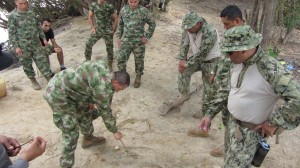
U.S. Navy Riverines discuss tactics with their Colombian counterparts using a hasty terrain model.

the local seapower partner nations, thereby strengthening both. But they must have the right tools (i.e., riverine and littoral units) with the mindset for the job, neither of which can be best employed until irregular warfare moves beyond its footnote status.

Next, local maritime communities must be engaged. The fishing and merchant culture which was mentioned earlier as giving rise to the permeable maritime environment may be the best asset for monitoring it. These tradesmen have numerous networks, both formal and informal, that if partnered with or sourced by human intelligence professionals may reveal nefarious activity (e.g., combat training on Mangla reservoir or strangers who are out of place in Mumbai). Additionally, reliable engagement builds trust, which in turn builds security by aligning the interests of local communities and lawful government for mutual benefit. If the government is the trusted partner of the community, then this is precisely anathema to the VEOs which wish to destablize the community or exploit the disconnect from government to conceal their operations.

VEOs and irregular warfare in the maritime domain are not up-and-coming prospects, they have been here for some time. High-visibility attacks such as the Mumbai raid bring them to the foreground every so often, but after the 24-hour news cycle returns to mundane matters these VEOs continue to skillfully exploit the world’s waterways. There is, frankly, nothing new about what has been said here. But for the time being, these suggestions bear reiterating so we can fuel the discussion and move the ball forward.

Alan Cummings is a 2007 graduate of Jacksonville University. He served previously as a surface warfare officer aboard a destroyer, embedded with a USMC infantry battalion, and as a Riverine Detachment OIC. The views expressed here are his own and in no way reflect the official position of the U.S. Navy. 

Sea Control 45 – West Africa Naval Development

seacontrol2This week, we discuss naval development in West Africa with Dirk Steffen of Risk Intelligence and Paul Pryce of the NATO Council of Canada, We cover the challenges of developing state maritime security apparatus, particularly procurement, capabilities & training, as well as the rising challenges of private demand for security vs. public supply that can cause corruption, confusion, as well as innovation.
DOWNLOAD Sea Control 45:
West African Naval Development

We are available on Itunes, Stitcher Stream Radio, etc… Remeber to subscribe, leave a comment and a 5-star rating.

The Geographic Limits of National Power

It is surprising that in the fine group of “personal theory of power” essays CIMSEC ran jointly with The Bridge May-June, no author selected strategic geography as a subject source. Despite advances from steam power to cyber communications that have reduced the relative size of the world, large geographic obstacles like the Hindu Kush mountain range in Afghanistan and vast empty space of the Indian Ocean continue to cause trouble for even the most powerful states.

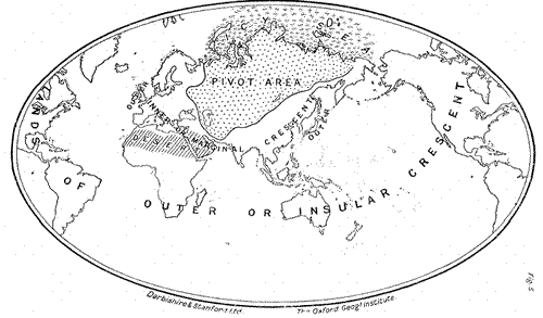
Geopolitical theorists from Sir Halford Mackinder to journalist Robert Kaplan have warned  of the pitfalls of ignoring geography in strategic calculations and estimates of national power. Successful great powers always included strategic geography in their deliberations up through and including the period of the Second World War.   The advent of a muscular and well resourced Cold War, buttressed by an arsenal of advanced nuclear and conventional weapons convinced many U.S. decision-makers  that strategic geography was a concept of the 19th rather than the 20th century. The Kennedy administration completed this break with the past in its implementation of the doctrine of “Flexible Response” as the cornerstone of U.S. strategic thought. As stated in Kennedy’s inaugural speech, the United States would employ its vast technological and financial resources to “support any friend” and “oppose any foe” regardless of geographic relationship to U.S. strategic interests. Despite the debacle of the Vietnam War, the U.S. was largely able to continue this policy until the very recent past.

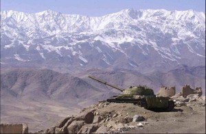
Afghanistan_18Now, a combination of decreasing military budgets, a smaller armed force,  and public disinterest in supporting causes not directly tied to U.S. interests demands that the U.S. return to a rigorous practice of geopolitical calculation. It must exercise discipline in determining how, where and when to commit military forces in defense of national interest. The examples of Afghanistan and the Indian Ocean demonstrate the fundamental limits geography can impose on national power. They also illustrate an important law in geostrategic analysis. A nation may overcome geographic barriers like the Hindu Kush or the Indian Ocean, but such an achievement requires technological and financial commitment. If such effort is not sustained, geographic limitations will again impose their effects.

The cases of conflicts in Afghanistan and control of the Indian Ocean over history illustrate the limits geography exposes on national power. Isolated by a series of geographic barriers including the Hindu Kush mountain range, Afghanistan remains a remote location. Its unique series of mountain passes in key locations has drawn Eurasian conquerers from the dawn of history. These men and their armies came not so much to capture Afghanistan, but rather to control these mountain passes that form a virtual “roundabout” for transiting in and around Central Asia. Control of Afghanistan throughout history has meant easy access to Iran, the Indian subcontinent and northern Central Asia.

Afghanistan’s false reputation as a “graveyard of empire” comes not so much from it’s inhabitants who seem to habitually resist any attempts at outside control, but rather the problem of maintaining a large force in such a remote region. Western armies from Alexander the Great to the present U.S. and NATO force in the country have had to create a long, tortuous, and expensive supply line into or though Afghanistan in order to sustain their military operations there  or in adjacent lands. Alexander, British imperial forces in three wars, and now American and NATO forces have always crushed Afghan resistance and have been able to maintain a reasonable amount of control within the region. They have departed only when deprived of the economic support that provides the technological edge to their warfighting and logistics capabilities. A nation can maintain an army of many thousands in Afghanistan, provided that power or group of powers is willing to fly in supplies or negotiate their delivery through unfriendly states over long and difficult overland routes. Now that financial support for the technological effort necessary to sustain a large Western force in Afghanistan is failing, the limits of geography are again re-imposing themselves on the remote Central Asian region.

The Indian Ocean has equally proved itself a vast and relatively remote space from the early 1400’s when Chinese Admiral Zheng He sailed its waters seeking trade and building Chinese influence to recent, frustrating efforts to located missing Malaysian Air Flight 370. When the Chinese Ming dynasty decided to forgo further Zheng He voyages in 1424, either for economic reasons, an intensified Mongol threat, or just superstition (the accounts vary), geographic limits returned with later, deadly results for the Chinese empire. Nascent European powers like Portugal, the Netherlands, and the British were able to penetrate and control the Indian Ocean and its key chokepoint connections to the Pacific. In just 200 years, the once omnipotent Chinese Empire found its coastline controlled by powerful European naval forces.  The Chinese failure to appreciate the geographic limits of seapower caused the near-dismemberment and wreck of the Chinese state.

The British Empire also lost control of the Indian Ocean when it failed to either fully fund its naval presence there or fully implement a technological solution to mitigate funding shortfalls. A series of Royal Air Force (RAF) facilities, originally conceived to support air policing of imperial holdings became a crucial element of British efforts to control the Indian Ocean in spite of reduced naval expenditures. This network of RAF installations became even more important after the Second World War as the strength of the Royal Navy (RN) plummeted and newer, longer-ranged aircraft could patrol wider areas of ocean, especially when equipped with radar. The British finally abandoned this network of installations in the 1970’s as their naval presence in Singapore came to an end. When this happened, the limits of geography were re-imposed and the Indian Ocean again became a relatively un-patrolled open space. This vacuum of power allowed the Soviet Navy to enter the Indian Ocean with nuclear cruise missile submarines and threaten U.S. forces in transit, as well as Australian interests.

The United States would do well to respect these examples of geographic limits, as significant financial restraints limit future U.S. military efforts. Extreme geographic disadvantage can be overcome by a combination of financial and technological solutions.  In the absence of such effort however, geographic limitations again impose effects and limit the exercise of national power. With a shift in U.S. attention to the large Indo-Pacific region, geographic obstacles to the exercise of U.S. power will require innovative, well funded technological solutions. The U.S. must fund these efforts, such as improved unmanned platforms, better offensive and defensive capabilities for naval units and improved space-based surveillance of the region. Neglecting such actions will create significant geographic barriers to the exercise of U.S. national power in the Indo-Pacific region.

Steve Wills is a retired surface warfare officer and a PhD student in military history at Ohio University. His focus areas are modern U.S. naval and military reorganization efforts and British naval strategy and policy from 1889-1941. He posts here at CIMSEC, sailorbob.com and at informationdissemination.org under the pen name of “Lazarus”.

Deciphering the Japanese Ship Guarding Act

Written by Simon O. Williams with research support credited to Michitsuna Watanabe

First released by The Maritime Executive, July 1st, 2014

Over six months since the Japanese government issued a landmark national law permitting privately contracted armed security personnel (PCASP) aboard Japanese flagged vessels, there remains confusion and uncertainty as to its scope and practical application. The legislation is entitled the “Special Measures Act for Security of Japanese Vessels in Pirate Infested Waters” of 20th November 2013, Law No.75 (Japanese Ship Guarding Act.) This Act, along with its supporting Orders and Ordinances, sets the policies, procedures, and applications for the employment of armed guards aboard Japanese flagged oil tankers. It is written exclusively in Japanese and requires not only translation, but also analysis by those seeking to provide or procure compliant maritime security services for the Japanese market.

THE ACT

Despite the Act being rolled out more than half a year ago, Japanese ship-owners and operators struggle to find foreign PCASP and private maritime security companies ready to provide their services aboard Japanese vessels.

According to Mr. Henri Vlahovic, founding director of Amniscor Ltd., which offers market entry support to companies in this sector, “while our team has developed the right compliance solutions for the constantly evolving procedures in Japan, significant challenges remain for foreign private maritime security companies to enter this new-born market. There are several reasons, including a lack of comprehensive information on policies and laws, which themselves are still not completely defined and remain emerging. This is compounded by protracted application procedures that hinder, rather than foster, advancement of this crucial new industry segment in Japan. The Japanese Ministry Of Land, Infrastructure, Transportation and Tourism (MLIT) is still missing sufficient mechanisms to attract foreign service providers, while Japanese ship-owners’ demand for high standard PCASP is steadily increasing.”

So as the demand grows, supply of services remains lacking due to the complexity of navigating the Japanese legal system, especially the hurdle of deciphering the Japanese Ship Guarding Act, which can be seen as scaring off foreign security providers.

While the world now observes a trend in piracy and maritime-armed robbery, priority areas shifting to West Africa and Malacca, the Act came into existence against the backdrop of increased PCASP deployment aboard vessels transiting the High Risk Area– the Horn of Africa and the Indian Ocean. The Japanese government accepted the correlation of increased use of PCASP with decreased successful pirate boarding in this region. Coupling this with Japan’s energy dependence being exclusively sea-borne from source countries mostly in the Middle East, authorities sought strategies to protect their vulnerable maritime assets and energy flow. However, unlike some other nations which could place PCASP on-board their ships at-will, Japanese flagged vessels were prevented from doing so as firearms possession is prohibited by the Japanese Swords and Firearms Control Law of 1958.

The recently adopted Japanese Ship Guarding Act provides an exception to this Law. The Japanese legal system is composed of three unique components: Laws, Orders, and Ordinances.

The Act itself is actually a Law, meaning that it was passed by a vote in the Diet, Japan’s parliament. However, it also includes Orders and Ordinances, which can be modified without Diet debate by the cabinet or the relevant ministry, in this case—MLIT. This allows the cabinet and MLIT the necessary legal latitude to independently adapt or expand the scope of the legislation without Diet approval, a crucial aspect to respond to the fluid nature of maritime operations and maritime threats.

THE ORDERS

According to the relevant Orders, to obtain MLIT permission for embarking armed guards on Japanese flagged vessels, the candidate vessel must be a Japanese flagged tanker carrying crude oil and meeting certain fundamental static requirements as set down in the Ordinances described below.

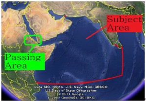
The Orders prescribe the use of PCASP only within a designated High Seas area in the Gulf of Aden and Indian Ocean along with a ‘passing area’ at Bab-el-Mandeb, the entrance to the Red Sea.

Japanese Ship Guarding Act Subject Area

According to Mr. Takashi Watanabe, the Deputy Director of MLIT’s International Shipping Division, the operational area remains the High Seas, beyond twelve nautical miles from shore, as prescribed by the UNCLOS framework, while the territorial sea spaces of these oceans are considered transit areas. This means that armed guards may be onboard within twelve nautical miles, designed specifically to facilitate embark and disembark procedures in a coastal state’s territorial sea, but in such locations they are forbidden from using weapons.

As these requirements are prescribed specifically in the Order and not the Act itself, the Japanese government maintains the jurisdiction to modify such specific geographic requirements as needed to adapt to fluid operational and threat conditions.

Should security operations be needed to protect the Japanese fleet in West Africa or Malacca, for example, the government maintains the power to grant these permissions in the form of a new or modified Order which can expand the subject area for a security response.

Likewise, should the need for increased protection be deemed necessary aboard vessels other than crude oil tankers, such as LNG carriers, fishing vessels, or even perhaps the Japanese whaling fleet, cabinet can similarly expand the scope of the Order to include these parameters.

THE ORDINANCES

Related Ordinances specify that in order to qualify for armed security permission, Japanese oil tankers must have a maximum speed no faster than eighteen knots fully loaded, and have a freeboard less than sixteen meters (distance between the water line and the deck or other places where humans can enter the ship.) Ships must also have a secure citadel where crew members can seek refuge and continue external communication in the event of an attack, along with primary preventative measures including a water discharging system and razor wire along exposed areas of the deck.

Application forms are included with the Ordinances as appendices available in Japanese only, which ship-owners must submit to MLIT for obtaining permission to employ PCASP aboard their Japanese flagged vessel. However, a summary of required information has been created and is presented below.

This includes applications to authorize a Ship Security Plan, modify all or part of the Ship Security Plan, confirm security personnel and their weapons, change of security personnel, submit the guarding implementation plan, and notify MLIT about lost or stolen firearms.

Ship-owners must submit a designated guarding plan for each candidate vessel to MLIT along with personal details of the PCASP and their embarked weapons. These applications are free of any charges and commissions and have validity periods of two months, after which a new application must be submitted.

DESIGNATED GUARDING PLAN

An application must be submitted to MLIT detailing the Designated Guarding Plan. This plan includes information on the ship-owner, including copies of their personal identification documents and criminal record check. It also must include details of the candidate vessel, certification of its Japanese flag possession, architectural schemes, pictures, and drawings. This evidence shall detail the equipment required under the Regulation to prevent and reduce damage by piracy, including that of the citadel, razor-wire, water discharge system, and appropriate storage facilities for firearms. Moreover, a written pledge by the Ship’s Master (Captain) must be enclosed stating that he/she is over twenty years old, and does not have any psychological or physical conditions which may impact his performance, is not a previous criminal offender, and is capable of overseeing and monitoring the possession and use of firearms onboard for special security activities.

The ship-owner or their liaison must also submit relevant documents about the PCASP to be embarked on the vessel and the company they hail from. Along with copies of relevant PCASP team leader or company director’s personal identification documents, such as residency card, a medical certification by a doctor or public body indicating this individual does not suffer from any psychological issues, addictions, or other health problems that can impact this line of work must be included. They must also submit results of a clean criminal background check indicating they have not been imprisoned in the past five years or have been a violent criminal within the last ten years. A copy of the guards or guarding company’s insurance or alternative form of liability protection demonstrating that the PCASP to be employed are insured for the scope and duration of their operations must be included.

The ship-owner or their designated liaison must submit documents indicating details of the intended voyage, cargo, number of rifles, bullets, and activities to take place on the candidate vessel during the special security period. Photographs of weapon profiles and serial numbers must be attached for the specific firearms slotted to be brought on-board.

VERIFICATION OF DESIGNATED GUARDING BUSINESS (DGB) PERSONNEL

MLIT also requires an application to verify what they call the Designated Guarding Business (DGB) Personnel, or PCASP, to be engaged in special security activities aboard the candidate vessel. This is the middle stage after ship-owner’s Designated Guarding Plan has been approved, but before they receive the final greenlight to undertake the specific maritime security operations requested in their Guarding Implementation Plan, described in the subsequent section.

The verification of Designated Guarding Business Personnel by MLIT takes approximately two months to process, so it is imperative for ship-owners to begin this process early. It requires them to provide evidence attesting to the quality and competence of the individual guards scheduled to embark upon their vessel. It requires evidence of their training and education which must be submitted in a document indicating that the individuals were trained by the relevant maritime security company along with a video demonstrating their proficiency for MLIT review and record-keeping. These videos must demonstrate (1) rifle handling and the other basic skills, (2) inspection of firearms, (3) loading / unloading various types of ammunition, (4) shooting form and weapons handling, (5) marksmanship and external variables. In some circumstances MLIT may issue a paper test to be completed by PCASP in order to verify their qualifications and education.

As is standard throughout this industry, medical certification by a doctor or public body must be produced that indicates the mental and physical health of the candidate. A document indicating the employment relationship between the maritime security company and the individual guard must be provided along with copies of the individual’s passport, residence permit, as well as a clean criminal background check indicating they have not been imprisoned in the past five years or have been a violent criminal within the last ten years. Evidence of insurance coverage for damages that can occur from their activities should also be included.

GUARDING IMPLEMENTATION PLAN

After guards are approved by MLIT, the ship-owner must submit the Guarding Implementation Plan at least five days prior to the commencement of the special security arrangements. Like the other documents, there is no fee for MLIT processing this request.

To this they must attach a copy of the contract between the ship-owner and PCASP or their hiring company along with details of the special security activities planned. This shall include navigational charts for the assigned vessel’s voyage indicating the location where weapons will be loaded/unloaded and if relevant, where PCASP will embark/disembark.

NOTIFICATION FOR LOST OR STOLEN FIREARMS

When guns are lost or stolen, the Master of the approved vessel must submit a pre-form document which is included with the Act to report the location, nature, and reason for the loss along with indication and identification of the missing items. Masters are requested to contact MLIT for updates to the document and to submit the details as soon as possible after their disappearance.

RULES FOR THE USE OF FORCE (RUF)

Mr. Takashi Watanabe of MLIT highlights that the use of firearms to deter pirates attacking a Japanese vessel remains a last resort. The preliminary steps taken beyond deterrence with razor wire are discharging water and escaping the crew into a reinforced citadel, or protected area.

To use rifles, additional steps are required. First, PCASP must warn the suspected pirates using all other means, both audio and visual, without using firearms. Second stage is warning by rifle use, safely firing warning shots into the sky or sea to deter attack.

Only in cases which the first two measures are undertaken, but the pirates do not halt their attack, are PCASP aboard Japanese flagged vessels permitted to shoot at the pirate ship for the purpose of protecting the lives of crew members.

The Japanese government’s move to permit PCASP onboard their vessels is certainly a step welcomed by the international maritime community. Its redundant safety and approval protocols will keep their seafarers safe and energy supply uninterrupted, while ensuring that PCASP operations remain monitored for compliance. Although challenging to decipher, the Japanese legal system caters specifically to this complex Act, placing its components within the numerous levels of Law, Order, and Ordinance that permit the Japanese cabinet and MLIT the flexibility to expand the Act’s scope and geographic-area as new threats against the Japanese fleet emerge and security responses evolve.


Written by Simon O. Williams with research support from Michitsuna Watanabe, under the auspices of Tactique Ltd. Their team remains available for contact at info@tactique.org should there be queries regarding this subject or related compliance matters.

This article is for information only and does not constitute legal consultation services.