By Bem Ibrahim Garba
Introduction
The world’s oceans occupy over 70 percent of the earth’s surface, playing a significant role in the support of the socio-economic growth and development of nations. These oceans provide a source of livelihood for many people through fishing, shipping and logistics, exploration of hydrocarbons and petroleum resources, exploitation of mineral resources, as well as leisure.
For some time now, these repositories of valuable natural resources have endured great degradation due to man’s activities. In order to continuously utilize and benefit from them now and in the future, the oceans need to be efficiently managed and sustained with guidelines and policies for effective governance.
This implies that ocean governance is not only obligatory but also compulsory on nations that are contiguous to the oceans and other major water bodies around the world.
Ocean Governance
Ocean governance refers to actionable policies, strategies and activities embarked upon by governments and non-governmental agencies for influencing and managing the affairs of the world’s oceans. The world’s ocean systems are complex, as such matters concerning ocean governance are multi-pronged and multi-faceted. The challenges associated with climate change, green-house pollution, biodiversity loss, offshore extraction, and overfishing also continue to be a burden, posing various kinds of threat to marine life and humankind as well.
These challenges are too complex to be tackled by a single group, region, or nation-state, hence keeping the world’s oceans healthy and safe requires a broad coalition of actors coming together under international guidelines and protocols. This becomes even more imperative as the global population is estimated to hit 10 billion by 2050 and 11 billion by the year 2100.
Governance in general involves interactions between formal institutions, civil society groups and organizations within areas of interest (sometimes geographic) aimed at exercising authority and influence, which leads to the enactment of policies and decisions, in the management of the economic and social resources of an area.
Ocean governance involves making sure that those who operate and trade on the oceans do so with safe and reasonable caution. They need to be guided by the requisite laws and order. As an example, in line with its Global Strategy and specific regional policies for the Gulf of Guinea, the European Union plays a key role as a global maritime security provider. It has mobilized resources to protect the region against maritime threats like piracy and human trafficking, reduced maritime accidents, and prevented environmental disasters. Satellite data from its Copernicus programme have been used by the European Maritime Safety Agency for international search-and-rescue operations at the request of the UN.
Since the inception of seaborne trade, ocean coastlines have been valuable gateways for global trade, however today, with ongoing pollution, human degradation, piracy, armed banditry, kidnapping of seafarers and illegal bunkering on the seas on the rise, there is a noteworthy decline in the economic value derived from seaborne trade within areas that border oceans notorious for criminality at sea.
Some of the threats to life and assets at sea include terrorism, vandalization, robberies, piracy, gun running, bunkering, and other acts of economic sabotage, stealing, pollution (from oil spillage), war and civil unrest, etc. These acts of criminality are especially common on the African coastline known as the Gulf of Guinea.
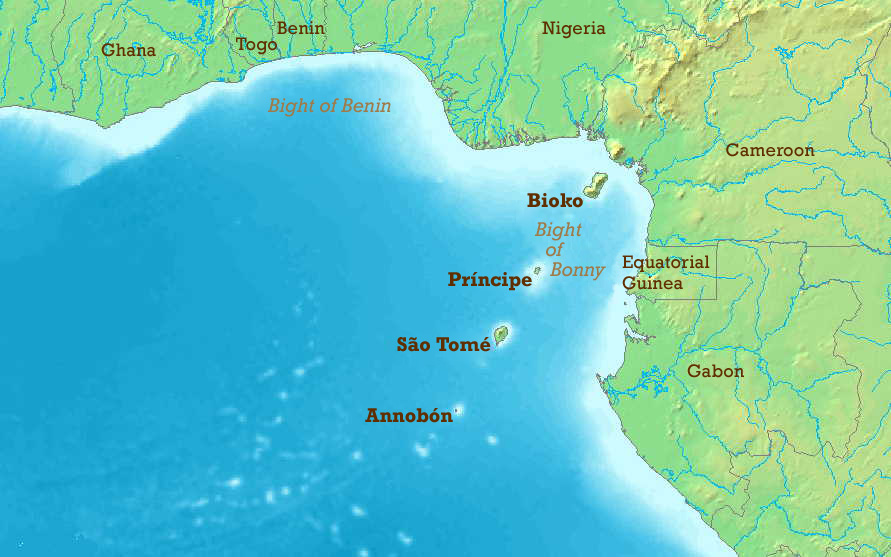
The Gulf of Guinea (GOG)
The Gulf of Guinea (GOG) represents the continental coastline that borders the Atlantic Ocean and is more than 6,000 kilometers in length. This coastline spans the border of Africa from Central and West Africa, and borders more than a dozen countries.
The Gulf of Guinea (GOG) provides an economic theater to both coastal and landlocked African countries and is of strategic importance to the global business community and international shipping. The safe passage of goods and services to ports in this region, plus the required security within its waters is a critical factor to global energy production and transportation. This is more so as Nigeria and Angola, two countries within this zone, are amongst the world’s top ten crude oil exporters.
The Gulf of Guinea is also important to West Africa’s fishing industry, as it provides employment and a means of sustenance for a large percentage of the indigenous population. It offers vast mineral resources and commercially valuable marine life, as well as providing strategic maritime transport routes for international shipping. Its natural resources are integral to global trade networks. This justifies the need for maritime security and safety at all times.
The socio-economic and political environment within this area has changed over the years. Insecurity in the Gulf of Guinea has taken a different dimension. Piracy and other criminal activities have been on the rise, and constitutes a serious threat to life and commercial activity within the area.
Within Nigeria’s Niger Delta, there has been a spike in maritime piracy, armed robbery, and youth militancy. In 2007, over 100 attacks against shipping vessels were recorded. A study by Friedrich Ebert Stiftung in 2013 identified the threats in the Gulf as acts of violence at sea, organized transnational crime, trafficking in drugs and illegal substances, illegal and unrecorded fishing, and other ecological risks. The report of the International Maritime Bureau (IMB) records the Gulf of Guinea as the most dangerous sea in 2016.
The IMB also reported that in 2017 the Gulf of Guinea had the highest number of reported incidents of piracy and armed robbery at sea in the world. It was noted in the same report that 102 crew members were kidnapped in 2018, compared to 63 kidnap incidents in 2017.
However, it is worthy to note that piracy is not the only cause of maritime instability and insecurity in the Gulf of Guinea. Other challenges related to weak governance include organized crime such as illegal fishing, drug smuggling, human trafficking, money laundering, and corruption. The region is known as a major transit corridor for drug trafficking from South America to Europe and other parts of the world.
Close analysis suggests that weak ocean governance is the major factor enabling insecurity in the Gulf of Guinea. Other factors would include poverty within coastal communities, corruption of government officials, growing unemployment, youth militancy, terrorism, and the lure of quick money provided by criminal enterprise.
Healthy global trade demands a concerted global effort to combat criminal activities and the racketeering that have become synonymous with this region. To create a safer more secure economic region, there must be adequate information, human capacity development, the development and transfer of technical knowledge, sound and practical institutional policies and technological resources to manage the adverse human impact and natural hazards inherent within this marine environment and its ecosystem. This is impossible without integrated governance and a trans-regional ocean policy that will balance the use of this coastline with the sustainable development of its abundant resources.
Rising up to this challenge, many maritime organizations, especially the International Maritime Organization (IMO), have followed the security issues in the Gulf of Guinea for many years with a strong commitment to understanding and resolving the underlying challenges. This started after an appeal was made to the United Nations by the then-President of Benin Republic Thomas Boni Yayi for assistance in combating crimes in the region. In response to this, amongst many other pleas from other stakeholders, the UN Security Council in February 2012 came up with Resolution 2039 which urged states within the region to develop counter-piracy policies at regional and national levels.
Bodies such as the Economic Community of West African States (ECOWAS), the Economic Community of Central African States (ECCAS), and the Gulf of Guinea Commission (GGC) also convened joint meetings and strategic sessions to draft regional strategies. Documents drafted at the above meetings were endorsed at a summit of heads of states and governments of Central and West Africa in Yaoundé, Cameroon, in June 2013.
2015 saw the creation of the Inter-regional Coordination Center (ICC) under the auspices of the Gulf of Guinea Commission (GGC). Many other bodies have also been created to deal with the issue of insecurity and facilitate development in the area. These bodies include CRESMAO in 2014 and CRESMAC in 2015, under ECOWAS.
On the global scene, the UN Security Council Resolution 2039 invited international partners to provide support for regional efforts and bilateral relations and partnerships in the Gulf of Guinea. Developed countries such as the United States, the United Kingdom, Canada, France, and Spain are to be part of the bilateral partnerships. The EU has also released its strategy for the Gulf of Guinea, and INTERPOL and the UN Office on Drugs and Crime (UNODC) have included Gulf of Guinea piracy in their analyses and reports concerning organized crime in West and Central Africa.
This international attention acknowledges that maritime insecurity in West Africa, like Somali piracy, exists as a component of transnational crime and can have an impact far beyond the immediate region.
The IMO Council, in its Resolution 1069 of 2003, resolved to monitor the situation in relation to acts and attempted acts of piracy and armed robbery against ships, illicit maritime activity, and threats to ships sailing in the Gulf of Guinea. The council resolved to initiate any actions which it may deem necessary, including coordinating the work of competent committees of the organization to ensure the protection of seafarers and ships sailing in those waters and to ensure appropriate cooperation with other organizations and entities tasked with relevant activities.
Notwithstanding the efforts listed above, piracy and armed banditry still remain a critical challenge in the Gulf of Guinea, and this challenge continues to rise. Many factors have been adduced for the inability of these regional bodies to eliminate the incessant insecurity in the Gulf of Guinea. One of the key factors listed include the structure of the regional bodies responsible for this work. Most of them have duplicated functions and are poorly coordinated.
Another factor is the competition for scarce resources (mostly financial) by regional heads, organizations, committees, and donor bodies. This implies that most of these organizations are unable to operate efficiently, making them ineffective in tackling and combating criminal activity within the region.
There is no verifiable record of any criminal prosecutions for crimes committed within this region, hence the absence of any legal deterrents. This has, in turn, further led to an international outcry among the littoral states and maritime operators for increased surveillance, better restructuring, and greater funding for the management of the Gulf of Guinea.
To develop a workable blueprint for the sustainable development of renewable and non-renewable resources within the region, the conservation and protection of this marine domain, and to address the interrelated problems of the ocean space as a whole, there are key questions and challenges that are likely to confront the policymakers responsible for ocean governance.
When viewed holistically, there are four major areas or perspectives that ocean governance needs to be addressed from. They include environmental problems and population pressures; institutional responses to these problems and pressures; modern technology; and the adoption of the principles of responsible governance. A combination of these environmental, institutional, technological, and societal perspectives will have a significant bearing on ocean governance and, by extension, on the security and development of the Gulf of Guinea.
Major Environmental Problems
Perhaps the most significant pressures on the marine environment over the coming decades will be exerted by the ever-increasing human population. This is currently at around 7.5 billion and is estimated to reach 11 billion by 2100.
Significant reforms and adjustments are needed if humanity will be guided away from the present yet obsolete socio-economic systems, while entering into a future blue economy that is directed and guided by sustainable ecological principles.
As millions of people live in and around coastal cities and islands, the ability to recognize the threats and benefits of the ocean in relation to economic and public health issues will become a major imperative for marine environmental protection. In order to achieve this, studies in nautical sciences, oceanography, ocean technology, navigation, and fishery technology (all interrelated), will be needed for the effective practice of ocean governance of the Gulf of Guinea and its coastal communities.
Institutional Arrangements and Principles
In order to achieve the far-reaching security for people and cargo within the Gulf of Guinea and along its coasts, the governments of stakeholder states need to develop and adopt a grand security architecture in their approach to ocean governance. This will require inter-sectoral cooperation amongst the governing bodies.
Modern management principles and an integrated governance framework will be needed to improve enforcement and compliance in this ecological belt. Responsible ocean governance goes beyond legal and institutional arrangements and policies, even though these remain fundamental and key determinants. Other key factors worthy of consideration would include ethics and shared values; the use of the best scientific knowledge, shared information from indigenous knowledge systems; human capacity development; enhanced public awareness systems; technological advancements and innovation. All these are essential to enhancing cooperation amongst the stakeholders in order to strengthen institutional arrangements for ocean governance and to broaden participation amongst governing institutions at all levels in the Gulf region.
Technological Challenges and Opportunities
The use of science and technology is increasing within many maritime domains. Some of the areas that have seen these developments include improved internet connectivity, marine information forecasts, transport efficiency, navigation, ocean floor profiling, and marine resource exploitation capabilities.
These developments in technology offer great opportunities for capacity development and wealth creation in the sector. In the future, access to cost-effective, timely data will be critical to enhancing ocean governance within the Gulf of Guinea. Information gathering and sharing via geospatial data systems and infrastructures will be essential for maritime domain awareness, observation, reporting, and more detailed exploration of the ocean’s floor. This will ensure the safety and security of marine operators while at the same time improving the management of commercial fishing practices.
Institutional Framework for Ocean Governance and Maritime Safety in the Gulf of Guinea
To achieve the above, institutional frameworks built on a multi-layered approach are required.
African nations within the littoral and landlocked zones of the Gulf of Guinea need to be more committed to formulating strategic maritime policies that engage with key ocean players to build bilateral partnerships. There is a need for an integrated fisheries management policy at the regional level through Regional Conventions and Fisheries Management Boards (RFMBs). This will improve regional ocean fishery regulation.
Finally, there is a need to build the capacity of partner states and organizations to monitor the oceans, conserve marine biodiversity and eliminate illegal, underreported and unregulated (IUU) fishing in the Gulf of Guinea.
National governments can, through determined political will, take up the mantle of leadership needed to formulate national policies and regulations for their respective states. The regional bodies, on their part, can integrate the policies developed by individual states and fashion them into actionable goals to be achieved within specific time periods. At the global level, international agreements and protocols can be strengthened and implemented with support and advocacy from the diverse coastal communities.
All the above, if well-coordinated, will draw support from the coastal communities. Through social networking, capacity-building, and effective communication, coastal communities will lead the effort and support participatory governance. This will promote shared values and enhance the rule of law.
The Future of the Gulf of Guinea
Looking into the future, the European Commission, in 2019, established the International Ocean Governance Stakeholders Forum which brought together maritime experts, civil society representatives, academics, and policymakers dedicated to ocean and maritime issues worldwide.
Their terms of reference were to establish new protocols, discuss current challenges that hinder international ocean governance, and recommend future actions to resolve them. African nations dotting the Gulf of Guinea need to borrow from this effort. They need to become more proactive, transcending from being ordinary policy formulators, to implementors of agreed-upon goals for the development of oceans and coastlines in Africa.
Addressing the Gulf of Guinea’s challenges is a significant task, while ocean governance is a daunting issue which demands an interdisciplinary approach and innovative solutions. It remains a known fact that this maritime domain has a community of likeminded peoples with the passion and commitment to tackle these challenges. Their reasons are very simple. The economic and historic importance of the area is beyond reproach.
Much can be achieved through the collective efforts of these coastal communities when they come together as progressive stakeholders for the governance of the Gulf of Guinea. Effective ocean governance within the Gulf of Guinea will require their collective identification of common goals and the implementation of collectively agreed upon effective strategies for managing the region. These must all be built on enduring institutional structures.
It is by doing this, and by carrying out the shared recommendations, that the laudable objective of ocean governance and maritime security in the Gulf of Guinea will be achieved.
Bem is the Chief Executive Officer of GOG Marine Limited, a shipowner and management company established to provide high quality product shipping services to end users doing business within the West African sub-region. From 2011 to 2017, Bem through his company BNTI Limited, was actively involved in defense equipment manufacturing projects (through strategic relationships) in India, South America, Europe and the U.S. For many years, he provided technical support and services to Nigerian law enforcement and military end users, supplying them with various hardware requirements. Bem is currently a Certified Management Consultant (CMC), and a Fellow of the Institute of Management Consultants (FIMC).
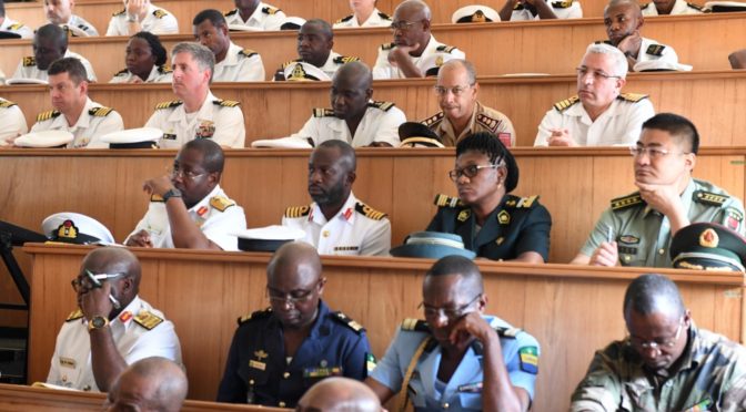
Featured Image: LIBREVILLE, Gabon (March 21, 2018) Participating African forces and international partners attend the exercise Obangame Express 2018 opening ceremony in Libreville, Gabon, March 21, 2018. (U.S. Navy photo by Mass Communication Specialist 1st Class Justin Stumberg)