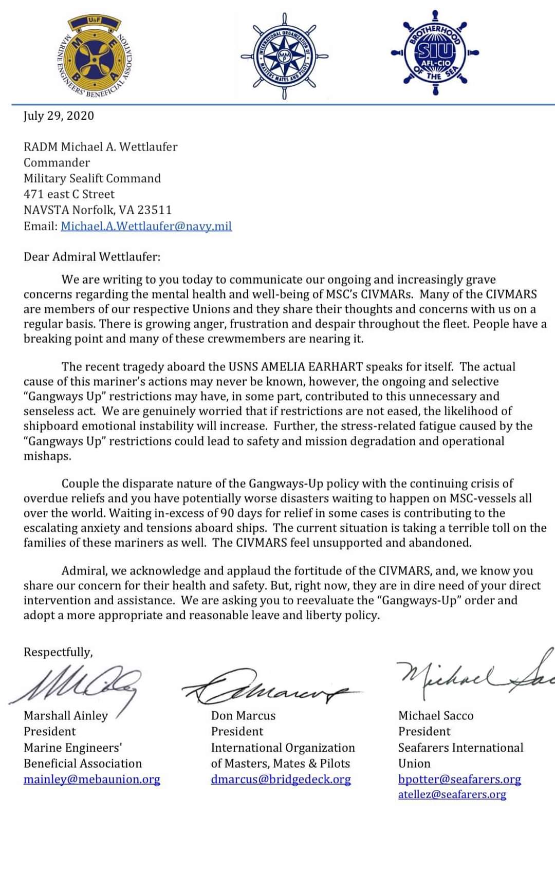
The following article appeared in the March-April 2020 edition of Military Review and is republished with permission. It will be republished in two parts. Read it in its original form here.
By Lt. Col. Brian P. Schoellhorn, U.S. Army
The commander stepped outside the stuffy command post tent and breathed in the night air as he tried to contain his growing frustration. His staff had just finished an update, painting a grim and incomplete picture of the brigade combat team’s (BCT) current state. The commander struggled to understand what had gone so wrong. The fight had started successfully with air insertions of deep observation posts, seizure of key terrain, and the successful prosecution of enemy targets with indirect fire, attack aviation, and fixed-wing aircraft. In short, the BCT had seized the initiative from the enemy.
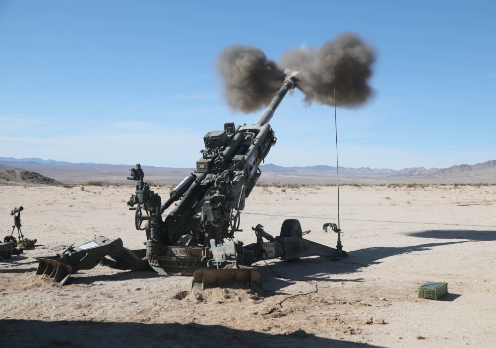
That was over thirty-six hours ago. Since then, reporting had ceased, communications had collapsed, and units had repeatedly failed to attain their designated objectives. The cavalry squadron had not yet achieved its planned reconnaissance and security objectives, resulting in repeated surprise attacks and costly penetrations of the BCT’s zone. It had gained only two to three kilometers since its initial deployment. The field artillery battalion, which had started so well, had since fired only a few ineffective missions after the initial targets planned for the operation’s opening phase. Close air support (CAS) and attack aviation had ceased inflicting the devastating effects of the first day. Combined arms battalions had either stumbled into contact with significant losses for no appreciable gain or had been repeatedly surprised by the enemy in their attack positions. To make matters worse, the brigade support battalion commander had complained to him earlier in the day that every unit was clamoring for “emergency resupply” of all commodities. He had no idea how many casualties the BCT had taken in the recent contacts. Finally, the brigade engineer battalion operated in a constant state of crisis as insurgents and special purpose forces wreaked havoc across the BCT rear area with asymmetrical attacks and deadly accurate indirect fire that seemed to materialize out of nowhere and everywhere.
The BCT tactical operations center (TOC) was faring no better. Although everyone was working frenetically trying to resolve the friction that had ground the BCT to a halt, these efforts had resulted in no greater understanding of the BCT’s situation nor had they provided any realistic means to get it moving again. Some staff officers had started pointing to failures at the subordinate level, while others had exceeded their ability to process the multiple simultaneous issues that bombarded the BCT on an hourly basis. Few had slept more than a few fitful hours slumped over at their stations or in their vehicles. This included the BCT commander himself.
The attempted “two-minute” update had taken forty-five minutes but made clear that staff running estimates remained wildly inaccurate and incomplete. To make matters worse, the BCT executive officer (XO) had just completed a scratchy and decidedly one-way telephone call with the division operations officer, who demanded that the BCT regain the offensive as soon as possible. The commander was supposed to receive a staff planning update for the operation to seize the provincial capital, but he thought it would merely waste time given the TOC’s current state. The commander was unsure how to restore order and resume offensive action akin to that of the first day. It was frustrating and bewildering. What to do?
Introduction
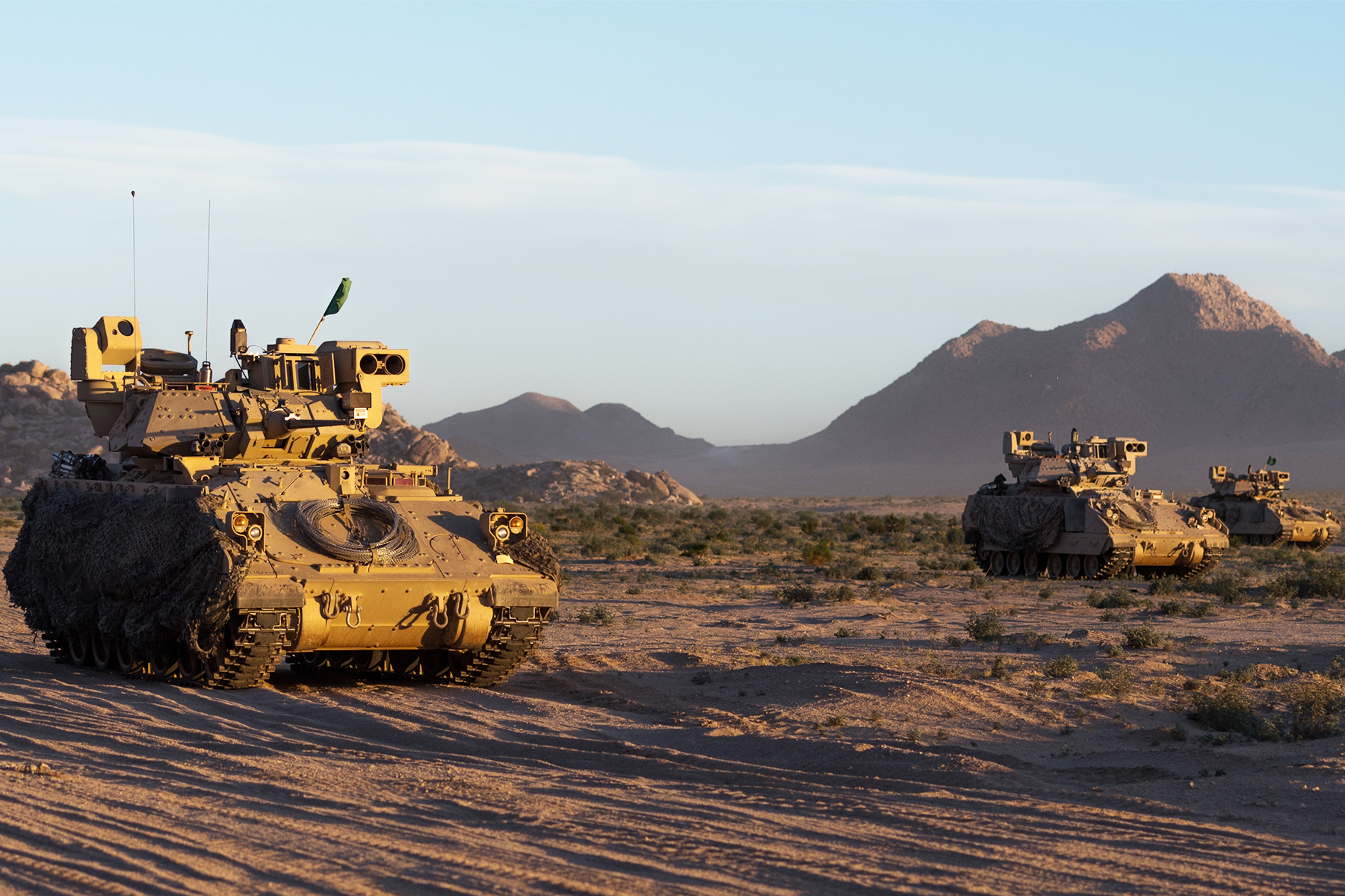
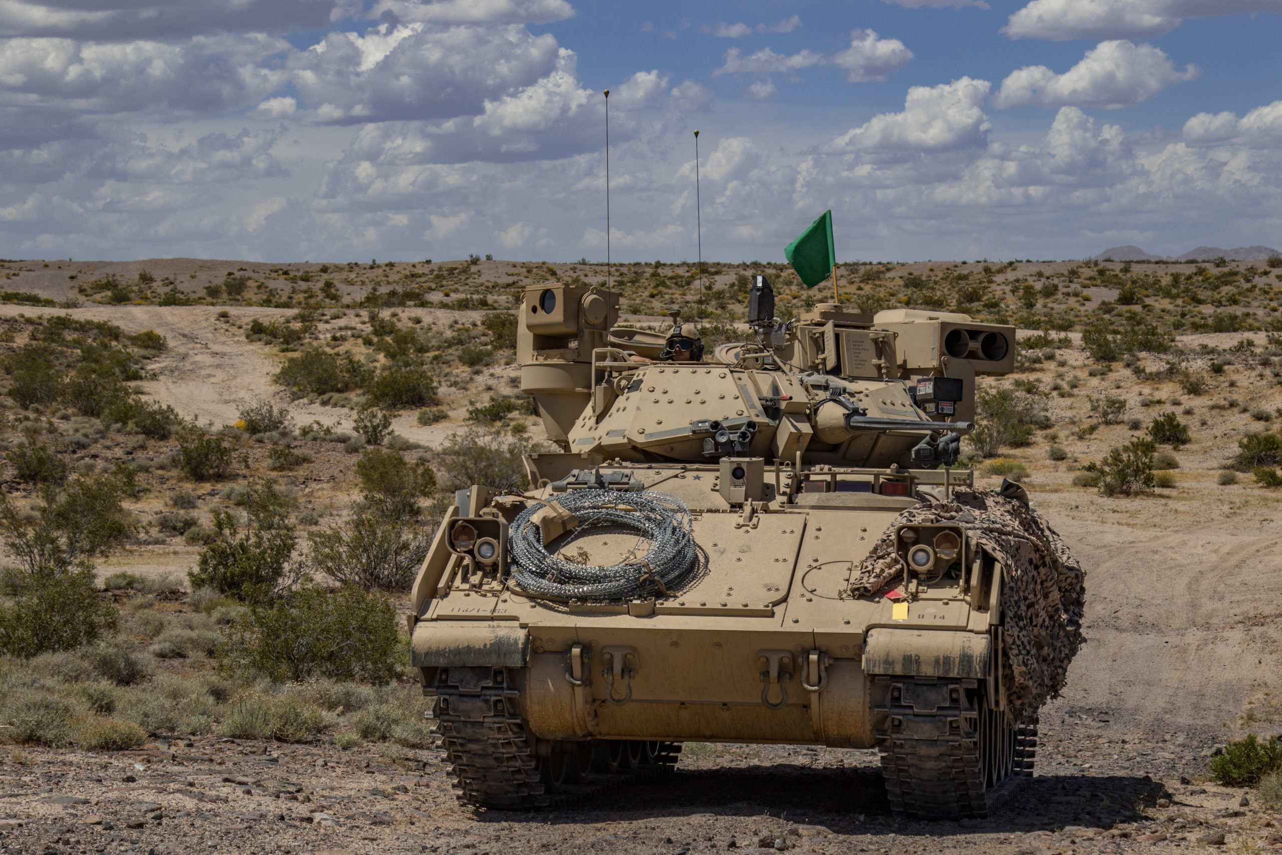
The situation described above happens nearly every month at the National Training Center (NTC). Most BCTs come to the NTC with a solid baseline of training and preparedness for the first day of the fight. They routinely attack the contested reception, staging, onward movement, and integration (RSOI) process with alacrity. Many BCT leaders think that their unit is ready to go on the offense as soon as the fourth day of RSOI. No matter how far geographically or fast physically the BCT gets on the first day, however, the initial mission invariably devolves into twenty-four to forty-eight hours of what can be described as a BCT-wide collapse of offensive action.1 The BCT’s subunits and staff make contact with the enemy and are hampered by the terrain, which in turn produces a deleterious effect on time available to continue planning. These inputs compound, producing a level of friction that most units have not experienced in training. Units and staffs enter survival mode, trying desperately to work through the pressing problems in front of them to the detriment of the larger mission. In this situation, reporting, sustainment, communication, and planning break down, leaving battalion and BCT staffs in the dark as to the state of units and their adherence to orders. Any enemy contact reverberates throughout the BCT, causing further confusion. The net result of friction at every level causes a collapse in tempo and offensive action, resulting in paralysis across command posts and attack positions. Why does this happen?
As a reasonable approximation of combat, the NTC induces a level of friction not re-created anywhere else. Home-station training cannot replicate the space, terrain, time, enemy, and stress that the NTC produces at the tactical level. The first forty-eight hours probably represent the first simultaneous deployment of every BCT element at doctrinal distances under combat conditions against an enemy capable of dominating all forms of contact.2 In this light, the general collapse of tempo and offensive action is understandable and part of the training process. The first few days also expose the BCT’s systems to friction in a way that no other training event short of combat can. In many ways, the most powerful drivers of friction are BCT- and battalion-level staff organization, processes, and procedures. Most staffs are not adequately organized according to plans, current operations (CUOPs), and mobile command group sections. Even if they are, staff functions rarely remain clearly defined as the BCT makes contact, and everyone tries to understand the current problem to resolve the immediate threat. The BCT often outruns the plan; the staff does not continue planning, and consequently fails to prepare to transition the BCT from one operation to another. In this situation, battalions and companies stumble into unplanned contact with the enemy, unsupported by BCT-level enablers. These independent and desynchronized actions rarely result in BCT-wide offensive action and increased tempo.
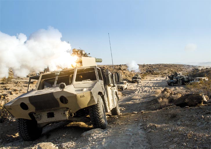
Communications difficulties due to range, terrain, load, training deficiencies, and mistakes cause difficulties even understanding what is happening, much less directing actions of subordinate units.3 To resolve this, BCT commanders often resort to understanding and directing the BCT by talking directly to battalion commanders on tactical radios. Although this can prompt action, it often results in plans developed in isolation from staffs and lacking BCT-level enablers. These radio conversations can also generate additional friction as battalion commanders often “talk their way out of” directed tasks because they lack assets, need more time, or their situation (combat power, casualties, sustainment, and communication) prevents continued offensive action.
How to shorten this inevitable loss in tempo is a topic of much discussion at the NTC, and its answer is existential in nature given the enemies and situations we are likely to face throughout the world. The following discussion is meant to spark thought, but it is not a prescriptive guide to resolving the friction inherent in combat.
Know the Collapse Is Coming
One of the main causes of the collapse is physiological. Units, leaders, and soldiers spend RSOI in a heightened state of alert and activity that cuts into sleep and interrupts the normal rhythms of garrison. RSOI at the NTC is designed to help a unit “see itself” in a way not possible in garrison. While enormously beneficial, this process can stress a unit and its leaders as unforeseen problems emerge and must be dealt with quickly, often at the expense of planning, eating, and rest. The planning and preparation for combat, as well as the unit’s exposure to the NTC, Operations Group, and its observer, coach, trainers (OC/Ts), only add to task and time demands, causing further stress. RSOI also introduces the unit to NTC’s contested environment, wherein it faces insurgent attacks, rocket strikes, and drone swarms, to name only a few forms of contact with which leaders must contend while building combat power. Finally, nervousness, anxiety, adrenaline, and a desire to prove oneself are intermingled to the point that the first twelve to twenty-four hours of action are a release from RSOI and the logistics support area. These emotional and physical conditions closely replicate those of precombat, and if harnessed effectively, can be a positive impetus for aggressive action.4 The costs of this heightened state, however, often remain hidden until manifesting themselves across the force in the subsequent twenty-four to forty-eight hours after the first operation.
BCT-level planning for the first attack is regularly the most complete and detailed of the rotation despite some initial unfamiliarity with the environment. OC/T coaching is also the least impactful at this stage since OC/T suggestions are largely theoretical for the unit until after it makes contact. As a result, plans are frequently overly ambitious in their geographical objectives and rarely take the enemy, terrain, and time into full account. Units also invariably fail to consider the amount of friction that their own systems and processes will encounter after first contact. Units deploy, have some success, and gain some ground but inevitably encounter the enemy at a time or place in an unplanned manner. The friction and shock of this first surprise encounter rapidly ripples up from the lowest unit and across the BCT, causing confusion, and routinely, the end of offensive action. Unit leaders look inward to solve their immediate problems, reporting breaks down, and the BCT ceases to act in concert as reacting to contact consumes its constituent parts. The hyperactivity of the preceding days rapidly turns into fatigue as the stress of initial contact combines with a lack of rest. Sustainment problems swiftly develop in these conditions due to deficiencies in reporting and planning. Additionally, training, equipment, and maintenance deficiencies accumulate to cause BCT-wide failures in communications, control, and sustainment.
Countless historical descriptions of first contact, from the phalanx to conflicts today, point to the commonality of this situation in combat.5 The adrenaline of preparation, the frenetic activity prior to the mission, followed by the shock of first contact create an unprecedented level of what Carl von Clausewitz described as friction, or the fabled “fog of war” experienced by every commander in conflict and training throughout military history.6 The fog of war is often thought of as a lack of information that leads to inaction. However, it is also the multiplication of inputs to the BCT after contact leading to a state of confusion that often results in paralysis and inaction. The NTC can inflict a BCT with every form of contact, stressor, and inducer of friction simultaneously, which compounds the fog of war in the first days. In fact, this is part of its mandate: to replicate the stress of combat in a way that causes the BCT and its soldiers “to have their hardest day in the desert so that they do not go untrained into combat.”7
While the fog and friction of the first days of combat cannot be completely eliminated, their time and effect can be reduced. Knowing they are coming and preparing the BCT’s leaders for the physical, mental, and emotional rigors of the first hours and days of the fight is the first step. Physical fitness that results in combat endurance is critical. Training the mind through historical examples in a leader professional development/self-development program will give leaders some context as they think about the trials likely facing them in the first fight. Tactical decision games that focus on actions after the breakdown of the plan and absence of further orders will train junior leaders to think through the fog of war.8 Leaders must develop and enforce rest plans throughout RSOI and especially during the first few days of contact, as the body and mind acclimate to the shock and rigors of combat, simulated or otherwise. Finally, leaders must share this understanding with their soldiers, from the most junior to senior levels, through discussion, and more importantly, training.
Lethality is a Necessary but Insufficient Condition for Success
It is a truism that lethal squads, crews, platoons, and companies form the building blocks of victory at NTC and in combat. Although this is undoubtedly the case, lethality at the small-unit level is necessary but not sufficient to fight through the fog of war. Too often, even the most lethal formations are surprised by the enemy, make contact at an unexpected place and time, and are forced to fight on the enemy’s terms to shore up the situation. Win, lose, or draw, these small-unit actions inescapably result in combat losses that slow the tempo of the company, the battalion, and the BCT, if not immediately followed by a combined arms fight that reinforces success. Observations at NTC also indicate that deficiencies in the science and art of terrain and enemy analysis, and the inability to execute actions on contact at the platoon level contribute to combat losses, even with favorable system-to-system kill ratios.
The enemy inevitably exploits these opportunities and weaknesses. Consequently, a spoiling attack can surprise a unit in a key location, penetrate its position, and wreak havoc throughout the BCT. Platoons and companies do not report in enough detail, eventually leaving the BCT ignorant as to the enemy and friendly situation. Orders are then given without regard or knowledge of the true situation, causing further confusion and disorder. A lack of discipline in field maintenance and during logistic package resupply also causes BCT-wide effects, as units utilize limited assets for “emergency” resupply and maintenance.10 The wear and tear on sustainment units, systems, and soldiers ultimately contribute to a collapse of tempo.
Preventing the accumulation of small-unit deficiencies that result in BCT-wide problems requires the discipline born of repetitive training. Leaders at the BCT level should never have to order a platoon or company to report, secure, and sustain themselves. The current live-fire-centric model of unit training requires a great deal of crew, squad, and platoon gunnery proficiency.11 This has yielded positive results for units at NTC. Live fire alone, however, will not ingrain the skills of automatic reporting, security, and sustainment without ruthless enforcement during training. Leaders should not assume that their small-unit leaders know how to perform these tasks to standard. They may need to start with a white board or a Micro-Armor (miniature model) explanation followed by a walk-through.
A review of standard operating procedures (SOPs) and reports may also prove necessary to ensure standardization across the BCT. Finally, training that requires small units to establish security, report, and sustain themselves for long durations under combat conditions—repeatedly—best builds the muscle memory required to perform these tasks in combat or at NTC. Each repetition should be executed and evaluated under increasingly more difficult conditions (day, night, chemical attack, degraded communication, drone observation, etc.) and for longer duration. Units must be evaluated on these tasks using training and evaluation outlines, be given an after action review, and be required to do it again. This kind of training can be done at a gunnery or at low cost in local training areas.12
Mission Command Requires Discipline and Accountability
Leaders routinely misunderstand the concept of mission command regarding planning and execution of operations at NTC. There is often a sense that orders, timing, requirements, reports, and battle-rhythm events are in some ways negotiable if they interfere with or do not conform to lower-unit actions or expectations. Missed suspenses and tardy reporting, unperformed requirements, and a lack of communication add to the general collapse as the BCT tries to understand why subordinate units have not accomplished their assigned missions. A reluctance persists to enforce these requirements either through direct or general admonishment. This disinclination to require compliance is frequently coupled with planning mistakenly deliberate in its lack of details, which the staff hopes will enable commanders to exercise initiative. These conceptual plans usually lack adequate graphic control measures, timing, tasks, and triggers, subsequently hindering the BCT’s ability to control the fight or combine arms effectively. These two factors—a lack of adherence to the plan and conceptual planning—often lead to problems of land management, coordination, synchronization, sustainment, and combining arms, as each unit fights its own war according to its perceived needs. Doing so does not result in a BCT fight that restores offensive action. Instead, it often leads to defeat in detail and fratricide.
Decisive action requires a revitalization of command and control as the foundational pillars of mission command.13 Units and leaders must understand that fighting necessitates adherence to the plan, tasks, timing, and reporting. Many problems start with a lack of communication that extends for hours and even days without resolution. Leaders must realize that the subordinate units must gain and maintain communication with their higher headquarters. They then must report according to the battle rhythm; primary, alternate, contingency, and emergency (PACE) communications plan; and SOP accurately and on time. There can be no exceptions or excuses for not doing so. Leaders must also understand that every subordinate action happens in time and space in conjunction and coordination with other units, assets, and activities. This makes actions such as making a designated start point and a line of departure times, as well as the requirements to establish support by fire (SBF) positions, target prosecution, and logistics release points nonnegotiable.
We are no longer in a situation in which subordinate leaders can decide that “the conditions are not set” or that it really does not matter if units operate independently from one another, as in a counterinsurgency fight where units were battlespace owners. This starts with BCTs adhering to division requirements and ends with soldiers executing their given tasks on time and on target. Noncompliance under a misconceived notion of mission command risks mission failure.
Controlling the BCT fight also necessitates detailed planning of actions, triggers, and timing. This staff work constitutes the science of combat and cannot be neglected if the BCT expects to combine arms effectively.14 NTC requires BCTs to conduct the meticulous work necessary to use indirect fire, attack aviation, CAS, special munitions, and other assets in the way they would have to in combat. Applying assets for a BCT fight requires detailed graphic control measures and synchronization of actions in time and space. Therefore, leaders must adhere to the plan if the conditions that the BCT sets remain in effect in order to accomplish their given tasks as part of the overall fight. If an internal condition prevents battalion adherence to the plan, it is a subordinate commander’s responsibility to report and have a discussion early enough for the BCT and the staff to mitigate risks and modify the plan.
Although control limits a leader’s scope of action in a theoretical sense, it actually provides the framework for exercise of initiative because it tells a commander what to do where and when, not how to do it.15 Ample room remains for a commander to exercise initiative and creativity in task organization, sequence, application of internal assets, etc. Good graphic control measures and the applied science of control also lend clarity to the situation, delineate boundaries, and allow for the effective use of combined arms. Control does not negate the art of command.16 Adhering to the plan, understanding the intent, and being accountable to the BCT reflect the tenants of mission command. It is the discipline in disciplined initiative.17
The commander’s intent is also a powerful guide for action, especially when the plan breaks down due to the friction inherent in any fight. The key tasks in the intent statement not only have to be accomplished but also have to be done in time and space to be effective. Units will have to fight through the enemy and friction to accomplish these tasks that set the conditions for victory. None of these considerations preclude a commander or subordinate leader from assessing the situation, applying the commander’s intent, and then acting to exploit an opportunity that not only achieves the intent but also places the unit in a position of advantage vis-à-vis the enemy. For example, a battalion or company tasked to establish an SBF position could surprise the enemy and continue to maneuver around or behind a position to achieve a more decisive effect than a straightforward SBF. Doing so achieves the required result while also exploiting an opportunity inherent in mission-type orders. Conversely, the commander and staff retain responsibility to communicate intent clearly and to design straightforward, yet flexible plans, which allow for command, control, the exercise of initiative, and the assumption of risk.
The concepts of command, control, discipline, and accountability as they relate to mission command need to be explained and trained at home station in order to prevent misunderstanding and confusion for leaders throughout the formation. Taking the time to discuss the requirements of decisive action as they relate to mission command through conversation and reading can go a long way to building a shared approach to command and control prior to the rotation. Additionally, trainers should design scenarios that require leaders to exercise initiative and assume risk to meet their stated objectives in time and space according to the plan and the commander’s intent. This can be done through tactical decision games, training exercises without troops, and simulations.
Training leaders to think and adapt is the commander’s responsibility and will achieve the shared understanding and mutual trust required of mission command. Discipline and accountability, however, must be ruthlessly enforced in garrison, training, at NTC, and in combat. Leaders should attempt to find ways to match battle-rhythm events and reporting formats and requirements in garrison to those that they will use in combat. There can be no excuses for late or inaccurate reports. A climate of accountability will help to dissipate the fog of war quickly and allow the BCT to act in concert to achieve its mission.
Lt. Col. Brian Schoellhorn, U.S. Army, is the operations officer for 3rd Infantry Division at Fort Stewart, Georgia. He previously served as the brigade combat team senior trainer at the National Training Center. A career armor officer, he has served in command and staff positions in Germany, Kosovo, Korea, Iraq, Afghanistan, Alaska, and Fort Carson, Colorado. He commanded 1st Battalion, 24th Infantry Regiment, Fort Wainwright, Alaska.
Notes
1. Merriam-Webster’s Collegiate Dictionary, 11th ed. (2003), s.v. “collapse.” The term collapse is used throughout this article to describe the unexpected and widespread results of the friction the brigade combat team (BCT) experiences after first contact. According to Merriam-Webster, to collapse is “to suddenly lose force, significance, and effectiveness,” which best describes what happens to a BCT. The use of the term is not meant to imply that this takes place because of neglect or poor planning but to suggest that the consequences of friction are so sudden and its scope so unexpected that responding to it effectively is extremely difficult.
2. Army Techniques Publication (ATP) 3-90.1, Armor and Mechanized Infantry Company Team (Washington, DC: U.S. Government Publishing Office [GPO], January 2016), 2-13. The eight forms of contact are direct; indirect; nonhostile; obstacles; chemical, biological, radiological, nuclear; aerial; visual; and electronic warfare.
3. Communications difficulties typically include issues with retransmission system positioning and functionality, establishment of Army Battle Command Systems using upper tactical internet, and the consistent ability to communicate using Blue Force Tracker or the Joint Capabilities Release systems. Many other issues are the result of incomplete precombat checks and inspections, a lack of critical equipment or not-mission-capable systems that are unreported, or a lack of proper training and supervision. The accumulation of these soldier-level tasks lead to BCT-wide friction.
4. Robert L. Maginnis, “Battle Stress: Are We Prepared?,” Armor 93, no. 6 (November-December 1984): 35–40; Dave Grossman and Loren Christensen, On Combat: The Psychology and Physiology of Deadly Conflict in War (Millstadt, IL: Warrior Science Publications, 2008).
5. There are countless historical examples and references that can inform personal professional reading and leader development in helping understand the conditions, toll, and consequences of preparation for combat and the first fight. Some examples include Victor Davis Hanson, The Western Way of War: Infantry Battle in Classical Greece (Berkeley, CA: University of California Press, 1989); John Keegan, The Face of Battle (London: Penguin Books, 1979); S. L. A. Marshall, Men Against Fire: The Problem of Battle Command (Norman, OK: University of Oklahoma Press, 1947); T. R. Ferhrenbach, This Kind of War: A Study in Unpreparedness (New York: Macmillan, 1963).
For engaging descriptions of training at the National Training Center (NTC), see Daniel P. Bolger, Dragons at War: 2-34th Infantry in the Mojave (Novoto, CA: Presidio Press, 1986); James R. McDonough, The Defense of Hill 781: An Allegory of Modern Mechanized Combat (New York: Ballantine Books, 1988); Anne W. Chapman, The Origins and Developments of the National Training Center, 1976-1984 (Fort Monroe, VA: U.S. Army Training and Doctrine Command [TRADOC], 1992), 85–90, 106–9; Anne W. Chapman, The National Training Center Matures, 1985-1993 (Fort Monroe, VA: TRADOC, 1997), 107–36, 281–305.
For fictional accounts of mechanized combat, see Harold Coyle, Team Yankee: A Novel of World War III (Philadelphia: Casemate, 2016); Ralph Peter, Red Army: A Novel of Tomorrow’s War (New York: Pocket Books, 1989).
6. Carl von Clausewitz, “Friction in War,” in On War, ed. and trans. Michael Howard and Peter Paret (New York: Oxford University Press, 2007), 65–68, 88. Clausewitz’s explanation of friction is undoubtedly amongst his greatest contribution to the theory of war since, in his words, “friction is the only concept that more or less corresponds to the factors that distinguish real war from war on paper.” His equally famous dictum that “everything in war is very simple, but the simplest thing is difficult” elucidates the straightforward, but profound, truth that governs and limits every action in combat. As he further explains, “We should bear in mind that none of its [the unit’s] components is of one piece: each part is composed of individuals, every one of whom retains his potential friction.” The entire chapter seven is required reading and gives context to the friction, difficulties, and state of collapse that units struggle with at the NTC; Clausewitz, “Third Property: Uncertainty of All Information,” in Howard and Paret, On War, 88–89. Although Clausewitz does not specifically use the term “fog of war,” his description of the components of friction: physical exertion, intelligence (or lack thereof), and danger combined with the complex nature of moving, maneuvering, and leading a military organization filled with individuals suggest that all actions in war take place under a fog or haze of uncertainty. For a contrary interpretation of Clausewitz’s notion of “fog and friction,” see Eugenia C. Kiesling, “On War: Without the Fog,” Military Review 81, no. 5 (September-October 2001): 85–87.
7. Brig. Gen. Christopher R. Norrie, then commander, Operations Group, author’s personal notes from Senior Trainer In-Brief, July 2018.
8. For resources for using and developing tactical decision games (TDGs), see John F. Schmidt, Mastering Tactics: A Tactical Decision Game Workbook (Quantico, VA: Marine Corps Association, 1994); see also “Tactical Decision Games: Your Index for TGDs,” The Company Leader, accessed 12 September 2019, http://companyleader.themilitaryleader.com/tdg. TDGs are an easy and cost-effective way for battalion and brigade combat team commanders to not only train subordinate leaders but also to see how they think about tactical problems. Giving an officer or a noncommissioned officer a TDG to solve during staff duty or professional development sessions is a relatively simple way to build tactical competence, provide repetitions, and convey intent through feedback.
9. ATP 3-20.15, Tank Platoon (Washington, DC: U.S. Government Printing Office, January 2012), 6-1–6-5, 6-12–6-15.
10. Ibid., 9-1–9-14.
11. See Leader’s Guide to Objective Assessment of Training Proficiency (Washington, DC: U.S. GPO, 29 September 2017), accessed 12 September 2019, https://atn.army.mil/unit-training-management-(utm)/standards-for-training-proficiency-(stp) (CAC required).
12. For discussions of small-unit training, see Arthur Collins, Common Sense Training: A Working Philosophy for Leaders (Novoto, CA: Presidio Press, 1978); Dandridge A. Malone, Small Unit Leadership: A Common Sense Approach (Novoto, CA: Presidio Press, 1983); Training Circular 25-10, A Leader’s Guide to Lane Training (Washington, DC: U.S. Government Printing Office, 1996) [obsolete]; James B. Hickey, Closing with the Enemy: Company Team Maneuver (Fort Leavenworth, KS: Center for Army Lessons Learned, March 1998); Field Manual 7-0, Train to Win in a Complex World (Washington, DC: U.S. GPO, 2016).
For insights from Operations Group on preparing for an NTC rotation, see Alan R. Cocks, “Objective NTC: Some Ideas for Leaders on How to Get There From Here,” Armor 95, no. 4 (July-August 1986): 11–19; Larry E. Word, Observations from Three Years at the NTC (Monterey, CA: U.S. Army Research Institute for the Behavioral and Social Sciences, 1987), accessed 13 September 2019, https://apps.dtic.mil/dtic/tr/fulltext/u2/a179386.pdf; Christopher R. Norrie, Thomas E. Lamb, and Michael J. Culler, “Ready Now-Our Number One Priority,” Military Review 98, no. 5 (September-October 2018): 61–69.
13. Army Doctrine Reference Publication (ADRP) 6-0, Mission Command (Washington, DC: U.S. Government Printing Office, 2012 [obsolete]), 2-17, superseded by Army Doctrine Publication (ADP) 6-0, Mission Command: Command and Control of Army Forces, July 2019.
14. Ibid., 2-12–2-17.
15. ADRP 5-0, The Operations Process (Washington, DC: U.S. Government Printing Office, 2012 [obsolete]), 4-1–4-2, superseded by ADP 5-0, The Operations Process, July 2019.
16. ADRP 6-0, Mission Command, 2-5–2-17.
17. Ibid., 1-1–1-4.
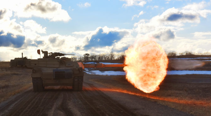
Featured Image: U.S. Army tank crews engage targets downrange during gunnery training at Camp Ripley, Minn., April 3, 2019. (Photo by Army Sgt. Mason Cutrer)