Regional Strategies Topic Week
By Captain Gregory W. Snyder, USMC
The ongoing territorial disputes playing out in the South and East China Seas offer useful case studies for determining what nations in the western Pacific can do differently to counter malign Chinese actions. Additionally, the United States has a variety of options to employ all of its sea services to help support its allies and partners in the region.
An analysis of the collaborative measures against piracy in and around the Gulf of Aden indicates that multinational efforts can yield tangible results. NATO’s Operation Ocean Shield, the European Union’s Operation Atalanta, and the United States’ Combined Task Force 151 (CTF-151) are all models that steadily drove down piracy in and around the Horn of Africa over the last decade. A sustained presence by vessels and aircraft from various nations did much to deter piracy in those waters. Where there were attempts of piracy, those coalition forces were in a position to take measures to protect commercial shipping, ensuring the safety of those merchant crews and preventing the disruption of global commerce.
A major problem that presents itself currently in the South China Sea is that China has failed to observe the 2016 ruling by the Permanent Court of Arbitration. This ruling stated that China has no right to the territory as depicted by the “nine-dash line.” Unsurprisingly since then, China has continued to harass vessels in international waters and violate the Exclusive Economic Zones (EEZ) of its Southeast Asian neighbors, including in the conduct of commercial fishing and energy resource exploration. Further inflaming regional tensions, China has built artificial islands hosting military outposts, seemingly demonstrating China’s ambition to claim this territory as its own. Compounding the issues are the predatory economic and political means in which China is enticing other nations into enabling its Belt and Road Initiative. Offering overinflated credit to less developed countries in order to fund infrastructure projects, China bets on the debtor country to default on the loan. Then based upon the negotiated terms, China is entitled to additional compensation or rights to specific infrastructure such as a port or railway. Many of the countries China is investing in include Association of Southeast Asian Nations (ASEAN) member states.
A way to combat this grey zone competition is to engage ASEAN member nations with a few additional countries, including more powerful partners. ASEAN plus 6 features the ASEAN member nations with the addition of China, Japan, the Republic of Korea, India, Australia, and New Zealand. As China continues to ostracize other nations, the United States should focus on an ASEAN plus 5 model for developing a coalition enabling training and operations within the Western Pacific. In a recent Proceedings article, retired Rear Admiral Sudarshan Shrikhande of the Indian Navy calls for a similar approach in which containing China should be focused on growing the Quadrilateral Security Dialogue, or the “Quad.” With this, he goes on to emphasize the need for the participating members of Australia, Japan, India, and the United States to coordinate more with one another as well as with other Asian democracies in order to counter China in the region.
In order to counter Chinese influence, smaller powers like Vietnam, Brunei, Malaysia, and the Philippines should expect security assistance and assured backing from the medium powers as well as the United States. The U.S. and medium powers must support the smaller powers in addressing violations of international treaties and laws on the high seas both with forces present, ashore, and afloat, in the region as well as with leveraging intergovernmental organizations, such as the United Nations. In doing so, the U.S. and medium powers gain access and clout in the region that mutually benefits them and the smaller countries. Coalition efforts may deter Chinese actions better than unilateral efforts and will provide strategic forward deployment, advanced warning, and increased intelligence in the case of conflict. In fact, just recently the western Pacific nation of Palau is requesting that the U.S. Department of Defense build installations on its territory to counter Chinese influence in the region. The smaller powers currently face aggressive and coercive actions by the Chinese Communist Party (CCP) and the People’s Liberation Army (PLA) and require support to effectively counter such actions. These nations cannot compete with or deter a rapidly modernizing and expanding Chinese military.
As the People’s Liberation Army Navy (PLAN) currently conducts generally unconstrained operations in the South China Sea, local forces are qualitatively and quantitatively inferior, leaving few options for retaliation or countermeasures. Submitting grievances to international bodies has shown to have no effect on Chinese actions, especially after China dismissed the Permanent Court of Arbitration findings in 2016. In addition, smaller powers involved in the Belt and Road Initiative may find it harder to raise such grievances due to China’s economic influence and direct holdings. For example, although the Philippines has contested the legality of China’s claims over the Scarborough Shoal, any action to assert their sovereignty must consider the fact that Chinese firms own a significant portion of the power grid that supports the Philippine capital city of Manila. This is an excellent opportunity for those member nations of ASEAN plus 5 to support one another. The defensive forces of the region can work together to help the smaller nations maintain their sovereign borders while the medium powers and the U.S. can step in economically to offer non-predatory infrastructure agreements.
The U.S. must apply the same coalition model that successfully eliminated piracy in the Gulf of Aden to the current challenge in the South China Sea. A coalition of the ASEAN plus 5 nations could employ all manners of naval forces and coast guard assets to perform myriad of tasks across the spectrum of operations. One example of a potential symbiotic relationship between a small and large power could be Malaysia and the United States. Consider that U.S. naval power, at large, encompasses all of the sea services (Navy, Marine Corps, and Coast Guard). In the conduct of ongoing grey zone operations, this is a perfect environment where the U.S. Coast Guard (USCG) can add true value. The benefit to the USCG operating in the area is directly tied to their missions, specifically, maritime law enforcement (to include international law and treaties as well as fisheries law enforcement), maritime safety, and search and rescue.
A program could be developed to partner USCG detachments or units with local Malaysian Navy, Coast Guard, or maritime police units. This construct would be similar to the terms Advise and Assist (A2) or Advise, Assist, and Accompany (A3) used in the special operations community, or the short-lived Naval Civil Affairs units. From a messaging perspective, the use of law enforcement units would likely be less inflammatory than engagement by traditional military units. While these maritime A2 and A3 operations are ongoing, Malaysia would receive training to improve maritime domain awareness, secure their Exclusive Economic Zone, as well as have additional resources and support to aid in counter smuggling and search and rescue operations. Additionally, the USCG can help provide assessments of port infrastructure and recommend improvements.
Should the CCP and the PLA actions continue to persist and escalate, the next step involves the other two sea services and beginning to ramp up actions in the region. In this scenario, the U.S. Navy could deploy vessels with embarked USCG Law Enforcement Detachments to bolster the USCG partnering efforts in the region and perform some of the same duties already being executed. This would blunt harassment by the Chinese Coast Guard and paramilitary militia against ASEAN country-flagged vessels operating within their own EEZ or international waters. Additionally, the U.S. Marine Corps could begin recurring training evolutions on the northern portion of Borneo. International military exchanges and exercises bringing ASEAN countries together to interoperate along with the regional powers and the U.S. would signal to China that it is facing a united front against aggression in the region. This also would enable the Department of State and Department of Defense to further foreign military sales of equipment and materiel to potentially underdeveloped units from the smaller powers. Additionally, training exercises in this region are excellent opportunities for the U.S. to test, experiment, and further develop new and emerging concepts, capabilities, and technologies. This would be the best opportunity for field testing shy of actual warfare that forces, combat developers, and experimenters can achieve.
This strategy will also benefit the U.S. if current competition with China escalates into conflict. By that point, forces have come to understand each other’s capabilities and shortfalls. Liaisons have hypothetically been established, but most importantly strong relationships and likeminded attitudes have been formed and a coalition has some idea of how it should operate together after conducting multiple joint and international exercises. Additionally, the U.S. and regional powers have forward forces, bases, and proven access to various locations within the borders of those smaller powers bordering and within the contested space. Those experiences, current intelligence of the geography of those littoral environments, and established relationships are invaluable at the beginning stages of conflict. As this plays into the current U.S. Navy and U.S. Marine Corps concepts of Distributed Maritime Operations and Expeditionary Advanced Base Operations, this advanced familiarization of the physical and human geography of the area may better aid operational planners in determining where to implement sea denial or expeditionary advanced base operations. Plus, the prospect of the USCG falling under the Navy during wartime means that if kinetic operations begin, some part of the Coast Guard is already on site and awaiting tasking. It becomes less of a large-scale mobilization effort and more of a paper drill. This forward presence buys additional time for commanders in theater to make decisions because they are not waiting for additional forces and capabilities to come from CONUS to support.
The other benefit of coalition organizations and interoperability is that it makes things easier in terms of being able to exploit the strengths, ties, and relationships each individual country has with one another. The U.S. may find that it is easier to have New Zealand or Australia partner with Malaysia or Brunei due to the fact that they are both Commonwealth countries and thus already share that additional diplomatic bond. Additionally, this strategy can also occur across the ASEAN member nations simultaneously. While the U.S. is conducting training, A2 and A3 operations and foreign military sales with Malaysia, India could be doing the same with Vietnam and Japan could be engaging the Philippines. The sheer number of countries requiring engagement and partner capacity-building means that the U.S. simply cannot do it alone, nor should it.
Conclusion
The coalition model in the Gulf of Aden helped offset the investment the U.S. had to make in terms of military capability and national treasure. As global commerce routes travel through the Gulf of Aden, it rightfully took a globally-sourced solution to solve the situation. Now as the rules-based system is being challenged in the region of Southeast Asia, it should take a Southeast Asian solution, with outside partners offering help. Only with partners and allies can nations begin to push back the tide of revisionist China and uphold the international rule of law.
Captain Gregory Snyder is a Logistics Officer currently serving at the Capabilities Development Directorate, Combat Development & Integration, Headquarters Marine Corps. The opinions expressed here are the author’s alone and do not necessarily represent the United States Marine Corps or Department of Defense.
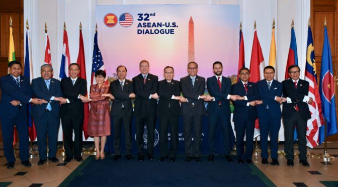
Featured Image: Delegates meet for the 32nd U.S.-ASEAN Dialogue in Washington, D.C., in March 2019. (Photo via U.S. Mission to ASEAN)