Tag Archives: Chokepoints

There Are No Strategic Chokepoints

Chokepoints and Littorals Topic Week

By Captain Jamie McGrath, USN (ret.)

Keys to the World

Naval theorist Milan Vego opens a chapter on chokepoint control with a quote from British Admiral Sir John Fisher, who stated that there are “five keys to the world. The Strait of Dover, the Straits of Gibraltar, the Suez Canal, the Straits of Malacca, and the Cape of Good Hope. And every one one of these keys we hold.”1 Fisher spoke from an Anglo-centric view, but his point is evident that control of key chokepoints equated to control of national strategic interests. But a century later, with the technological advances in weapons and sensors, and the interconnectedness of the global economy, can such a claim be made today?

There are over 100 straits where international interest in the free flow of trade transcends the interests of the nearby littoral states. Not all of these maritime chokepoints are of equal importance. Military strategists often speak as Fisher did of strategic chokepoints, believing them to have significant geopolitical value and act as epicenters for maritime strategy, where the control of which is considered vital for success in maritime conflict. But are these chokepoints truly strategic? Does the success of a nation’s maritime strategy actually hinge on the control or loss of control of these narrow seas?

Perhaps the strategic value of any given chokepoint is overstated because the ability to truly “control” these chokepoints is significantly degraded in the current maritime threat environment. The focus should instead be placed on strategic seas, and not the connectors between them.

Strategic Versus Operational Significance

Before scuttling the idea of strategic straits, there should be a common understanding of the difference between the strategic and operational importance of maritime geography. Maritime strategy is the science and art of using all naval and non-naval sources of power at sea in support of the national military strategy, with military strategy being “the art and science of using or threatening to use military power to accomplish the political interests of a nation…”2 The 2018 National Defense Strategy calls for:

“A more lethal, resilient, and rapidly innovating Joint Force, combined with a robust constellation of allies and partners, will sustain American influence and ensure favorable balances of power that safeguard the free and open international order. Collectively, our force posture, alliance, and partnership architecture, and Department modernization will provide the capabilities and agility required to prevail in conflict and preserve peace through strength.”3

The focus on lethality, resilience, and lethality within an alliance and partnership architecture, combined with “lethal, agile, and resilient force posture and employment,”4 and “a global strategic environment [which] demands increased strategic flexibility and freedom of action,”5 indicate that fixed geographic positions like chokepoints have reduced strategic relevance in U.S. strategy.

Naval operations are defined as the “theory and practice of planning, preparing, and executing major naval operations aimed at accomplishing operational objectives.”6 While operational objectives are chosen to achieve strategic ends, there often are multiple operational options to a support strategy. The operational value of a chokepoint tends to be temporal and depends on the other operational factors of time, space, and force of the particular operation. A chokepoint with high operational value may have limited or no strategic value if other options exist to achieve the national political objectives.

Traditional Methods of Sea Control

The control of chokepoints has long been a primary way to control access to a given body of water. Revisiting Fisher’s assertion that there were five keys to the world, control of key straits meant control of the flow of global maritime traffic and, therefore, the strategic interest of most maritime nations. Warships and merchantmen during the age of sail depended on the prevailing winds for reliable propulsion and shore bases for routine resupply. These trade winds and shore bases funneled ships through specific shipping lanes, many of which transited the key chokepoints Fisher identified. Since transit of these chokepoints was essential, controlling them guaranteed control of merchant shipping and warship movement.

The emergence of steam propulsion removed reliance on the trade winds, but increased dependence on the shore bases that had been established in the age of sail, which were starting to serve as coaling stations. Thus, in Admiral Fisher’s time, his assertion was correct. But since World War II, dependence on shore basing for resupply has diminished. The U.S. Navy perfected at-sea replenishment during World War II, and merchantmen have significantly increased their unrefueled range, both of which reduced the reliance on shore stations and subsequent dependence on specific shipping lanes.

Chokepoints simplify several operational and tactical aspects of naval warfare by concentrating forces. This, in turn, limits the challenges of scouting and screening, because less sea space must be scouted and screened. The avenues of approach to the chokepoint are limited, so the party that controls the chokepoint can concentrate forces or make better use of limited forces available.

Admiral Tōgō Heihachirō’s defeat of Russia’s Second Pacific Squadron at the Tsushima Strait demonstrates how chokepoints simplify scouting. Togo did not know when the Russian fleet would arrive, nor did he wish to search for it in the open ocean. But he did know that the Russian fleet had to pass through the Tsushima Strait to reach its base at Vladivostok. This allowed Togo to concentrate his scouting force of cruisers in the strait and consolidate his battle line inside the Sea of Japan. But what if the Russians had entered the Sea of Japan through the La Pérouse Strait, Tsugaru Strait, or Strait of Tartary? In the 1890s, the limitations of coal-fired steam plants meant that traveling the extra 1000 or more miles without a coaling station made the Tsushima Strait the only choice. Today, however, at-sea logistics provide naval forces greater flexibility in entering strategic seas.

Changing Military Value of Chokepoints

Historically, chokepoints held strategic military value partly because they forced ships to transit within range of the weapons and sensors posted there, and made movements more predictable. Into the second decade of the twentieth century, optical sensors and coastal guns limited that range to or just beyond the horizon. Technological advances over the intervening century expanded that range immensely. First, aircraft extended scouting range, then, as aircraft improved, expanded the striking range of weapons well beyond the chokepoint’s horizon. The introduction of radar further enhanced scouting and early-warning capabilities, and space-based surveillance now allows for the searching of vast ocean areas independent of geographic chokepoints. The missile age added over-the-horizon, ship-killing weapons, with anti-ship ballistic missiles (ASBM) marking the ultimate long-range strike capability.

Holding a chokepoint serves two fundamental purposes, one rooted in sea control and the other in sea denial. The sea denial case, often a strategy of the weaker navy, holds that by controlling the chokepoint, an adversary cannot access the seas on its opposite side. As Vego points out, this is often part of a larger, major defensive joint/combined operation and maybe one of several elements of a national defensive strategy to either bottle up an opponent’s naval force in its own narrow seas, or prevent an opponent’s naval force from entering a narrow sea where it could threaten the defending nation’s territory.7 In the sea control case, control of the chokepoint theoretically allows one to use their naval forces at the time and manner of their choosing within the chokepoint and in the seas controlled by the strait. That is to say, if a nation controls a chokepoint, naval forces and maritime trade can pass through that chokepoint freely at the discretion of the nation that controls it.8

In the current maritime threat environment, controlling the land and water in the vicinity of the chokepoint no longer represents the exclusive manner to control it. The focus on strategic chokepoints may have held when the range of weapons was barely over the horizon, but today an adversary no longer has to control the geographic entrance to strategically important seas to deny their use. Space-based sensors and long-range missile firepower allow an adversary to effectively close, or at least threaten closure of, geographic chokepoints without the traditional need to hold the immediate surrounding land or seas. “Holding” a geographic chokepoint no longer guarantees the use of the seas on either side, nor does it ensure safe passage through the chokepoint itself. Therefore, the U.S. Navy would be better served to focus more broadly on its ability to control or deny strategic seas than the strategic chokepoints of ages past.

Changing Economic Value of Chokepoints

Another element that gives a chokepoint strategic value is the volume of trade transiting the strait. Traditionally, blockades and maritime trade warfare have used control of chokepoints to great strategic effect. Britain’s control of the Dover Straits, combined with the North Sea Mine Barrage, closed all maritime trade to Germany during World War I and contributed to the fall of the Kaiser’s government in 1918. During World War II, the failure of the Axis powers to seize the Suez allowed Great Britain to continue using the canal for resupply of its empire. Would such action have the same strategic effects today?
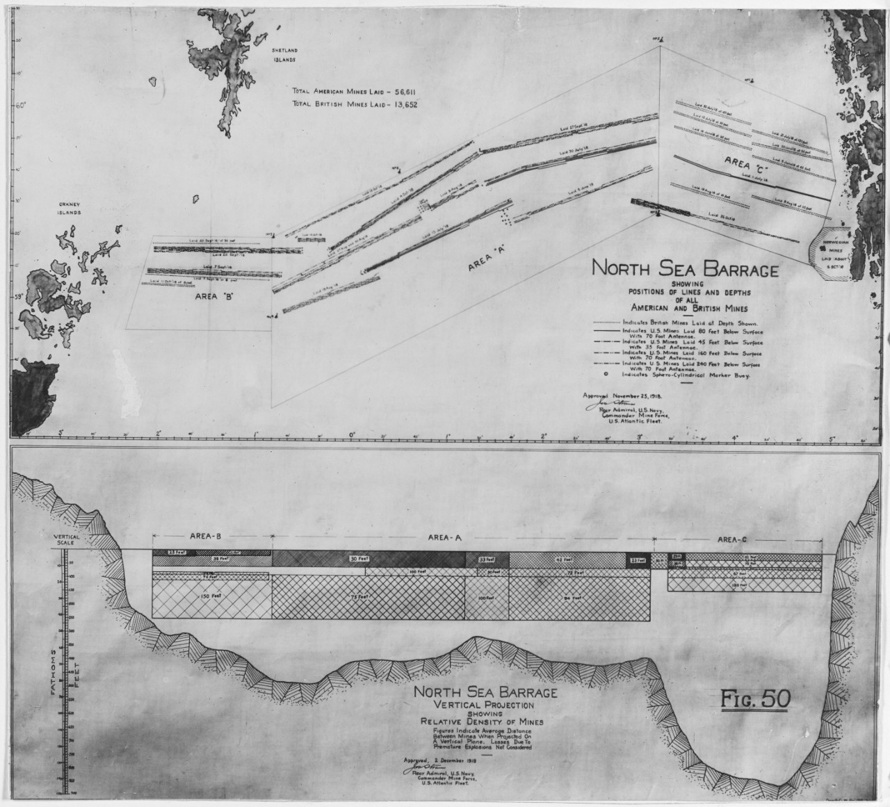
Vertical and horizontal charts showing locations and densities of mine fields of the North Sea Mine barrage, issued in November and December 1918, after the fields were completed. (Naval History and Heritage Command)

Today, high trade volume certainly gives a strait economic value because these chokepoints often represent the shortest route from manufacturer to market and thus the cheapest transportation cost. But is controlling trade through a strait a viable strategic goal? Chris McMahon argues that maritime trade warfare is ineffective in today’s global economy. Among the many reasons he presents, he notes that the closing of chokepoints has no real impact on global trade.9 One of the most-often mentioned strategic chokepoints is the Strait of Malacca because it handles so much of the world’s maritime traffic. But how would closing the Strait of Malacca affect global trade? It would impact Singapore’s role in the global shipping market, certainly. But would the global shipping network be severely burdened by having to transit the Sunda Strait or the Lombok Strait? Would there be a cost increase, yes, but once the market adjusts for the increased cost, shipping will find a way to make it work. 

Consider the wave of piracy off the Horn of Africa in the early 2000s, an area often discussed as a strategic chokepoint because of the volume of trade passing through the Arabian Sea. Shipping companies dealt with the insecurity of that maritime region in one of three ways – accept the risk and charge accordingly, arm themselves against pirates, or re-route ships around the Cape of Good Hope at increased cost and charge accordingly. In each case, maritime trade continued. Lord Fisher mentioned the Suez Canal as one of the keys to the world, but it has been closed on five occasions since it opened in 1869, including for eight years between 1967 and 1975. During that most recent closure, the cost of shipping around the Cape of Good Hope was markedly higher than the Suez route but presented no serious economic hardship to global consumers. Rerouting Pacific trade for a closed Strait of Malacca would have a similar minimal effect on the cost of global trade.10

Chokepoints Can Be Superseded

The demise of the strategic value of chokepoints is revealed by looking at some traditional strategic chokepoints of the past. One of Fisher’s keys to the world, British control of the Straits of Dover, seemingly kept Hilter’s Kriegsmarine bottled-up in the North Sea, much as it had the Kaiserliche Marine three decades before. But Germany negated the British advantage by conquering France and establishing bases in Brittany, unfettered by the Straits of Dover. To be sure, the straits still impeded access to merchant shipping and warship transit to the German homeland, but control of the strategic strait did not mean control of the German U-boats. Chokepoints can be bypassed.

During the Cold War, the water between Greenland, Iceland, and the United Kingdom – the so-called GIUK Gap – was a strategic chokepoint because Soviet ballistic-missile submarines had to pass through that gap to threaten the United States. The later development of longer-range submarine-launched ballistic missiles meant the submarines could remain in the Arctic to launch these weapons, thus limiting the strategic value of the GIUK Gap as a chokepoint. Chokepoints can be outranged.
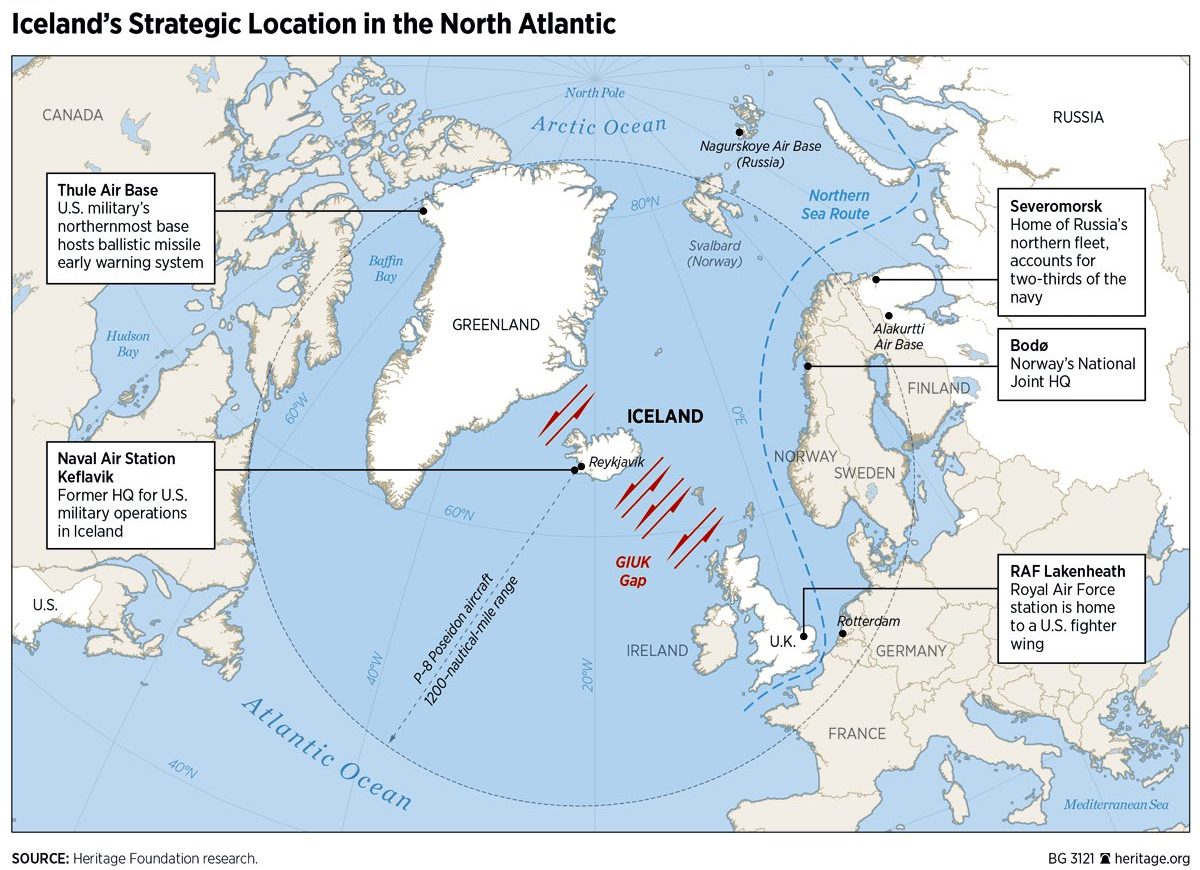
The GIUK gap and major regional military bases. (Heritage Foundation)

Today, a resurgent China lays claim to the South China Sea (SCS) as its own internal waters. As discussed above, the Strait of Malacca has traditionally been a key to control of the SCS and, therefore, strategically important for trade between Europe and Asia. But the Strait of Malacca is not the only access route to the SCS, which can also be accessed through the much larger Luzon Strait and numerous passages through the Indonesian and Philippine archipelagos. The PRC recognizes this and has adopted control mechanisms that do not depend on control of the chokepoints, but instead focuses on long-range anti-access, area-denial (A2/AD) weapons and redundant fortified islands within the SCS.11

China’s A2/AD strategy in the SCS is important for two reasons. First, the assumption that physical control of a chokepoint guarantees use of the chokepoint is invalid in the face of PRC A2/AD weapons and sensors. Although the United States and its partner states may possess the land on either side of the Strait of Malacca, and have sufficient naval forces to patrol the strait, the PRC could nonetheless prevent free transit of the Strait of Malacca using ASBM and long-range anti-ship cruise missiles (ASCM). Furthermore, these long-range weapons based on the Chinese mainland or in the central SCS can contest the other straits leading into the SCS. Conversely, the reduced reliance of predictable trade routes for maritime traffic – both merchant and military – means they can easily bypass the Strait of Malacca if it were to be “controlled” by an opposing power.12 Chokepoints can be replaced.

Conclusion

The question then should not be “what are today’s strategic chokepoints?” but instead, “what are today’s strategic seas?” Control of chokepoints is only one of the ways to control a sea. Vego writes that there are two primary arenas of naval conflict: open ocean and narrow seas. While many characteristics differentiate the open ocean from the narrow sea, the predominant one is proximity to land.13 In narrow seas, the land influences many aspects of naval warfare, from the ability of naval vessels to maneuver to the threat from land-based weapons. As one moves further out to sea, maneuver space opens up and land-based threats dissipate, or so it would stand to reason.

The ability of naval forces to operate freely on the open ocean outside the threat of land-based weapons, whether missiles or aircraft, is greatly diminishing in the current threat environment. This, in turn, means an expansion of the areas previously considered narrow seas – even if not in all aspects. If the narrow seas have now broadened to cover a much higher portion of the world’s oceans, then the restrictive chokepoints once seen as strategic lose much of their relevance. 

There may be operationally compelling reasons to control a chokepoint, but their strategic value is greatly diminished in an era of space-based sensors and proliferating long-range missiles. Control of a chokepoint no longer means the “keys to the world” as it did in Admiral Fisher’s day. Expending the time and force to control a chokepoint will likely not result in the strategic advantage sought, and worse, could fix forces to a geographic location when mobility is operationally necessary. The U.S. would be better served exercising more agile and dynamic mechanisms of strategic sea control and sea denial rather than focusing on the obsolete idea of strategic chokepoints.

Captain Jamie McGrath (ret.), retired from the U.S. Navy after 29 years as a nuclear-trained surface warfare officer. He now serves as a Deputy Commandant of Cadets at Virginia Tech and as an adjunct professor in the U.S. Naval War College’s College of Distance Education. Passionate about using history to inform today, his area of focus is U.S. naval history, 1919 to 1945, with emphasis on the interwar period. He holds a Bachelor’s in History from Virginia Tech, a Master’s in National Security and Strategic Studies from the U.S. Naval War College, and a Master’s in Military History from Norwich University.

References

1. Quoted in Milan Vego, Maritime Strategy and Sea Control: Theory and Practice (Rutledge: London, 2016), 188.

2. Milan Vego, Maritime Strategy and Sea Control: Theory and Practice (Rutledge: London, 2016), 2.

3. James Mattis, Summary of the 2018 National Military Strategy of the United States of America (US Department of Defense: Washington, DC, 2018), 1.

4. Ibid., 7.

5. Ibid.

6. Milan Vego, Operational Warfare at Sea: Theory and Practice (Rutledge: London, 2017), 1.

7. Vego, Sea Denial, 301.

8. Vego, Sea Control, 188-9.

9. Christopher J. McMahon, “Maritime Trade Warfare,” Naval War College Review: Vol. 70: No. 3 (Summer 2017), 29-34.

10. Ibid., 29-30.

11. Naval War College Professor James Holmes argues that considering PRC sea power, their entire military must be considered and not just the PLAN, see James Holmes, “Visualize Chinese Sea Power,” United States Naval Institute Proceedings (June 2018). https://www.usni.org/magazines/proceedings/2018/june/visualize-chinese-sea-power

12. McMahon, “Maritime Trade Warfare,” 29-30.

13. Vego, Sea Control, 18-20.

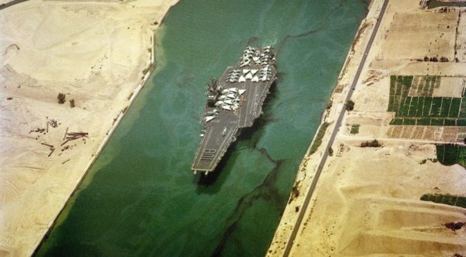
Featured Image: August 6, 1988, Egypt: An aerial port bow view of the aircraft carrier USS FORRESTAL (CV 59) transiting the Suez canal. A formation of crewmen spells out”108″on the bow to signify that the ship has been at sea for 108 consecutive days. (Photo by PH2 Buckner, USN/U.S. National Archives)

Let Me Get this Strait: The Turkish Straits Question Revisited

Chokepoints and Littorals Topic Week

By Paul Pryce

The Bosporus and Dardanelles Straits, together with the adjoining Marmara Sea, are known collectively as the Turkish Straits and provide the only access between the Black Sea and the Aegean Sea. More than 40,000 vessels passed through these waters in 2019, transporting almost 650 million tons of cargo, and reaffirming the Turkish Straits as one of the most important maritime trade corridors in the world. Additionally, the shores of the Straits – which narrow at some points to as little as 700 meters apart – are home to more than 22 million people, including the historic city of Istanbul.

Since 1936, the Montreux Convention Regarding the Regime of the Straits, hereinafter referred to as the Montreux Convention, has allowed for the peaceful flow of commerce through the Turkish Straits. However, recent calls from Turkish and Russian policy circles for revisions to the Montreux Convention should be cause for concern, as these proposals threaten to either spur a naval arms race in the Black Sea region or look to exploit the Straits as a geostrategic chokepoint.

The Montreux Convention

The Montreux Convention sought to address questions regarding the status of the Turkish Straits that, by the time of the Convention’s writing, had persisted for well over a century, occasionally culminating in violence or near-violence, as in Britain’s effort to wrest control of the Dardanelles in 1922. Among its terms, the Convention stipulates that only littoral states to the Black Sea may transit capital ships (which, if we follow the 1923 Washington Naval Treaty’s definition, refers to “…a vessel of war… whose displacement exceeds 10,000 tons… or which carries a gun with a caliber exceeding 8 inches…”) through the Straits, escorted by no more than two destroyers.

The Bosporus Straits, straddled by Istanbul, are the gateway to and from the Black Sea. (Image: Marine Vessel Traffic)

It also prohibits any country from deploying to the Black Sea more than nine naval vessels displacing a total aggregate of 45,000 tons; it requires that no group of non-littoral states deploy to the Black Sea any naval vessel weighing more than 10,000 tons; and it limits the stay of any vessels from non-littoral states to just 21 days. Littoral states are further obliged under the Convention to inform the relevant Turkish authorities of an intended transit of the Straits by a military vessel at least eight days prior and non-littoral states are obliged to provide 15 days’ notice. Turkey is further empowered to close the Straits to all military traffic in wartime or when under threat of aggression while also denying passage to merchant vessels belonging to countries at war with Turkey.

It is worth noting that Annex II of the Convention specifically excludes aircraft carriers from the definition of a capital ship. This does not extend to any other ship transporting aircraft since, at the time of the Convention’s writing, it was not uncommon for battleships and other military vessels to carry observation aircraft. This may explain the Soviet Union’s unusual designation of its aircraft carriers as ‘aircraft-carrying cruisers’ – for example, the Kiev and Kuznetsov classes. These vessels could fulfill the same strategic function as carriers while still being free to transit the Turkish Straits, even as the Convention denied access to the Black Sea for NATO aircraft carriers due to their explicit designation as aircraft carriers in both name and function.

Though the Montreux Convention has constrained the capacity of NATO support to Ukraine in its struggle against Russian aggression, such as by limiting the number of vessels permitted in the Black Sea as part of Standing NATO Maritime Group 2 (SNMG2), the continued implementation of the agreement is in the national interest of the United States and other non-littoral nations. The United States has long supported the “principle of freedom of transit and navigation” referred to in Article 1 of the Convention and, although it has never ratified the United Nations Convention on the Law of the Sea (UNCLOS), the United States already abides by UNCLOS as a matter of customary international law.

On the one hand, this seems to suggest that challenging the legitimacy of the Montreux Convention would advance American interests – after all, the International Court of Justice (ICJ) ruled in 1949 that, for vessels transiting the Straits or Corfu, which runs along the coasts of Albania and Greece and which serves as a passage between the Adriatic and Ionian Seas, the concept of innocent passage should prevail over any claims of state control over such strategic waterways. With the Corfu precedent and the customary nature of UNCLOS, one might assume that a legal challenge of the Montreux Convention by a non-littoral state would easily succeed.

But the unique geography of the Turkish Straits makes this legal question far from simple. The Marmara Sea is an internal sea, all the coasts of which belong to Turkey. In the event of a dissolution of the Convention, the ICJ would need to consider whether the Turkish Straits constitute a single strait connecting two open seas, in which case innocent passage prevails, or if they are two separate straits connecting an open sea and an internal sea, in which case Turkey would be able to exert even greater control over the flow of maritime traffic through the Straits. Referring to the Turkish Straits in common parlance – rather than referring separately to the Dardanelles, the Bosporus, and the Marmara Sea – implies a single unit, and the bulk of the maritime traffic has flowed over the past decade between the Aegean Sea and the Black Sea. It would seem likely then that the ICJ would favor the conception of the Turkish Straits as a single strait connecting two open seas, but this outcome is not guaranteed.

The Turkish Straits are comprised of: (A) The Dardanelles, (B) The Marmara Sea, and (C) The Bosporus. (Image: Maritime Studies South Africa)

It is also difficult to discern to what extent the United States would be able to practically alter the administration of the Turkish Straits. Turkey is a significant maritime power in its own right and much of its naval forces are stationed at Gölcük Naval Base, located on the east coast of the Marmara Sea. Any freedom of navigation operation (FONOP) would encounter immediate resistance and would add to the existing tensions between the Turkish and U.S. governments, especially as Turkey refuses to recognize UNCLOS.

The economic and social importance of the Straits to Turkey cannot be overstated. Beyond the millions of Turkish citizens who live on its banks and the commerce the Straits facilitate, it also offers a physical representation of Turkey’s duality as a European and Asian state, while the administration of the Straits has afforded Turkey a self-image as the guardian of the Black Sea.

Given all of this, it would possibly require the wholesale destruction of Turkish naval forces to impose a major change in the administration of the Turkish Straits and, even then, barriers could be erected intentionally or accidentally that would interfere with the future use of the waterway. In short, the legal and practical status quo offers the best guarantee for the continued flow of trade through the Straits.

Calls for Reform

However, there has been much discussion in Russian and Turkish policy circles around possible revisions to the Montreux Convention. These revisions would be detrimental to U.S. national interests, which include the maximum possible freedom of transit and navigation through the Turkish Straits. In particular, since the annexation of Crimea, some Russian defense planners have called for the Convention to be revised so that the length of stay in the Black Sea for vessels from non-littoral states would be shorter than the current allowance of 21 days. Furthermore, Russian policymakers have creatively interpreted the Convention since annexing Crimea in 2014.

In May 2016, Turkish President Recep Erdogan decried the Black Sea as a “Russian Lake.” In response, the Chair of the State Duma Committee on Defense, Admiral Vladimir Komoyedov, claimed that the Russian Federation need only inform Turkey of the transit of its military vessels through the Turkish Straits and that restrictions on the number and kind of vessels transiting applied only to non-littoral states. Meanwhile, in response to Russia’s unilateral restrictions on the flow of maritime traffic through the Kerch Strait between the Black Sea and the Sea of Azov, Ukraine called in November 2018 for tighter restrictions on the number and kind of vessels from all states transiting the Turkish Straits, in hopes that this might interfere with the strategic maneuvers of the Russian Navy.

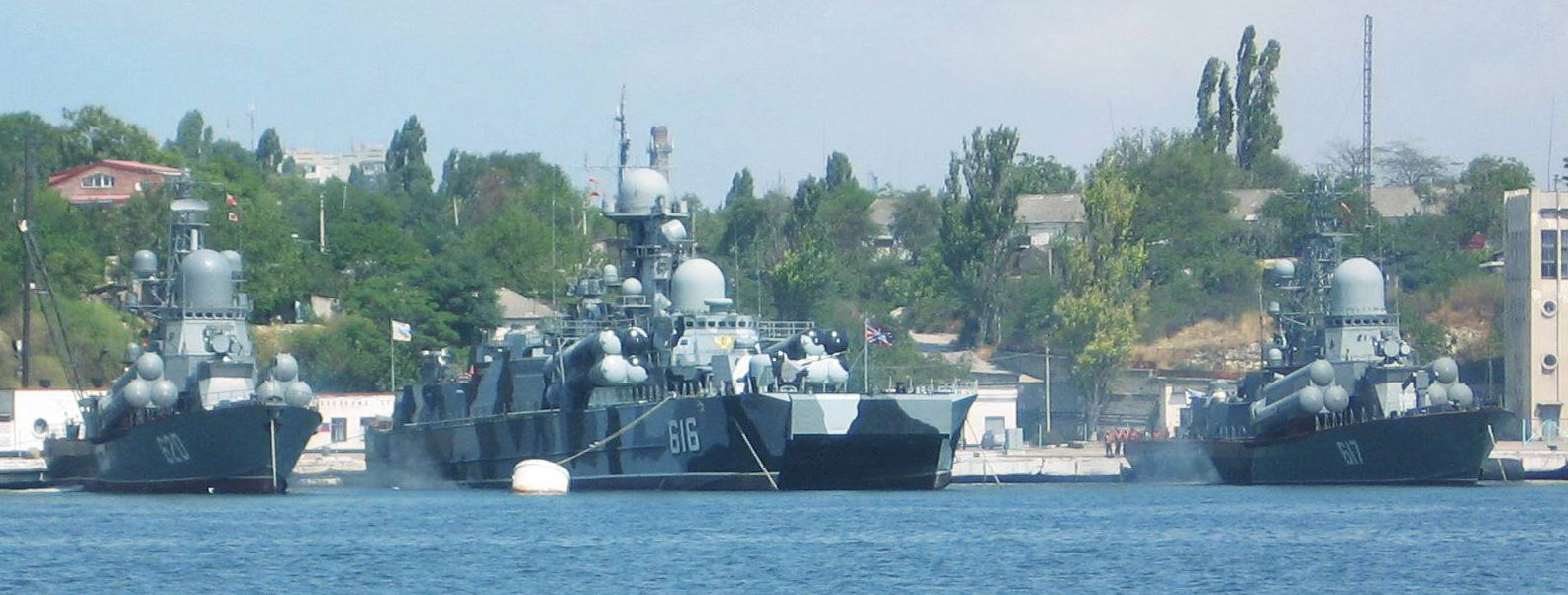
Russian Navy warships based in the Black Sea (Wikimedia Commons)

There have been rumblings from the Turkish government as to how Istanbul is “…threatened by the ever growing number of oil tankers and other dangerous cargo vessels” that transit the Straits. While Turkey has been mostly satisfied by regulations adopted through the International Maritime Organization (IMO) and other multilateral bodies, some Turkish commentators have proposed further action. In particular, some suggest promoting a regional ownership model for the Straits under the auspices of the Black Sea Economic Cooperation (BSEC), a multilateral forum comprised of Turkey and the Russian Federation but also Albania, Armenia, Azerbaijan, Bulgaria, Georgia, Greece, Moldova, Romania, Serbia, and Ukraine.

Such a model could facilitate the re-interpretation of the Montreux Convention, loosening the restrictions on vessels from Black Sea littoral states, but maintaining or even tightening the restrictions on vessels from non-littoral states. This could, in turn, be circumvented by the United States and other non-littoral states by re-flagging vessels. In the wake of the Crimean annexation, some American commentators suggested an enhanced NATO presence in the Black Sea by having U.S. Navy ships fly Bulgarian or Romanian flags. But this, too, would likely only add to tensions between the United States and Turkey as well as further undermine the rules-based order.

The Istanbul Canal

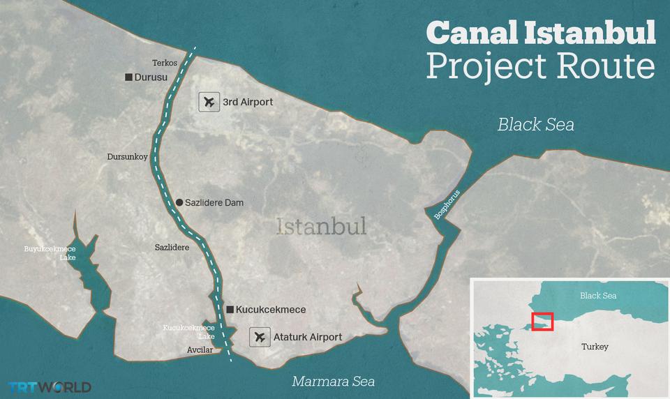
A $25-billion infrastructure project announced in 2011 by Turkey’s then-Prime Minister Recep Erdogan, known as the Istanbul Canal, presents the greatest challenge to the legal and practical status quo in the Turkish Straits. The canal would consist of a 45-kilometer waterway bisecting the European side of Istanbul, allowing 160 vessels daily to bypass the Bosporus as they transit between the Marmara and Black Seas. Officially, the Istanbul Canal was proposed to alleviate congestion on the Bosporus and divert tanker traffic toward less sensitive areas of Istanbul. However, Turkish freighter captains have cast doubt on this, noting that the canal as currently envisioned would be too shallow to accommodate many of the tankers Erdogan claims would be diverted from the Bosporus. Indeed, the canal plan calls for a maximum draft of 17 meters.

In reality, the Istanbul Canal may have been introduced to circumvent the Montreux Convention. In January 2018, Turkey’s then-Prime Minister Binali Yıldırım asserted that, as an artificial waterway, the Convention would not apply to the Istanbul Canal and so the Turkish authorities would be able to unilaterally restrict or regulate traffic through it. This again depends on whether the Turkish Straits are understood to be a single unit or as three distinct waterways – the Dardanelles, Marmara, and Bosporus. In the former interpretation, the Convention could still apply to the canal, given that it connects part of the Straits to the open waters of the Black Sea. In the latter interpretation, however, the canal would be an entirely new and distinct feature to which the Convention would indeed not apply.

Project route of the Istanbul Canal. (Image: TRTWorld)

In any case, the canal presents a serious threat to the spirit of the Convention. On the one hand, Turkey has consistently advanced the narrative that continued use of the Bosporus is unsafe to the natural environment, the millions who live on its banks, and the hundreds of vessels that transit each day, and so unilateral restrictions on maritime traffic through the Bosporus could be justified on the basis that vessels ought to transit the safer canal route. On the other hand, Turkey could upset the balance of power in the Black Sea region by allowing vessels to transit the canal that would have otherwise been denied passage through the Turkish Straits under the Convention. Either scenario would clash with the U.S. policy of seeking the maximum possible freedom of transit and navigation, while also making NATO’s capacity to support members and partners in the Black Sea region contingent on Turkish whims.

Similar concerns regarding Erdogan’s strategic intentions have been expressed in Russia, with some commentators warning that completion of the canal could soon be followed by a Turkish denouncement of the Montreux Convention. Under the Convention’s provisions, a denunciation by any of the signatories would prompt a conference to be held for the purposes of drafting amendments to the existing Convention or an entirely new agreement on the use of the Turkish Straits. For such a conference to be valid, the Convention calls for participation from three-quarters of the “High Contracting Parties” that are littoral states – in other words, five out of six of what is now Ukraine, Romania, Bulgaria, Georgia, Russia, and Turkey.

It is conceivable, then, that a denunciation by Turkey of the Montreux Convention could be followed by a conference to draft a new agreement, held validly without Turkish participation. But it is unlikely Turkey would readily abide by any new agreement that was drafted without its participation, especially when, from the perspective of the Turkish authorities, the Istanbul Canal and the denunciation of the Montreux Convention would afford Turkey full control over access between the Aegean and the Black Seas.

Open Channels

Fortunately, there are diplomatic options available that could preserve the status quo in the Turkish Straits. For example, through the auspices of the Organization for Security and Cooperation in Europe (OSCE) – of which the United States and all the Black Sea littoral states are members – a series of confidence- and security-building mechanisms (CSBMs) could be developed regarding access between the Aegean and the Black Sea. As exemplified by the Vienna Document, an integral document to the work of the OSCE, CSBMs can include annual exchanges of information on the disposition of military forces, base inspections, and the mutual invitation of observers to military exercises, all of which are intended to demonstrate to neighbors that there is no hostile intent behind various military activities in border areas.

The development of a similar document or agreement pertaining to the Turkish Straits could include a commitment from all parties not to interfere in any way with access between the Aegean and the Black Sea, aside from those powers already afforded Turkey under the Montreux Convention, effectively backstopping the Convention but also de facto extending its remit to any artificial waterways that might be established connecting the Aegean and Black Seas.

There is nothing here that would stop Turkey from refusing to abide by these terms at some later date – after all, Russia suspended its participation in the Conventional Forces in Europe (CFE) Treaty, another OSCE-related CSBM, a little over one year before it mounted its 2008 attack on Georgia. But a suspension of Turkish participation in CSBMs related to the Straits would afford an early warning to the U.S., Russia, and other interested parties that a denunciation of the Montreux Convention may be forthcoming.

Even with a Turkish denunciation of the Convention, CSBMs would help to avoid a regional arms race. The continued exchange of information between the other Black Sea littoral states would provide assurance that no one state intends to take advantage of the change in the practical and legal status of the Turkish Straits, such as by securing a side agreement with Turkey that would allow for an increased buildup of naval forces in the Black Sea. The inclusion of some clear punitive measures for state non-compliance in the CSBM could also deter Turkey from unilaterally altering the practical or legal status of the Straits – for example, the imposition of sanctions by all other parties – but this could also make the conclusion of any agreement on the CSBM unlikely. In any case, it would serve Turkey’s national interests to participate in such an arrangement as CSBMs would provide a safety net for all of the concerned parties, helping to avoid any change in the legal or practical status of the Turkish Straits from escalating into armed conflict.

Beyond multilateral agreements and fora, Erdogan must also contend with public opinion at home. The newly elected Mayor of Istanbul, Ekrem İmamoğlu, has expressed strong opposition to the Istanbul Canal project and handily defeated former Prime Minister Binali Yıldırım, a canal proponent and Erdogan ally, despite alleged efforts by the Turkish authorities to skew the election results in Yıldırım’s favor. Calls for a referendum on the canal also bode ill for Erdogan, with polling in December 2019 showing that more than 72 percent of Istanbul residents are opposed to the project. The canal could be sacrificed in hopes of avoiding a showdown with İmamoğlu for the presidency in Turkey’s anticipated 2023 general election.

Conclusion

Given the strategic importance of the Turkish Straits – and the rumblings for reform from Ankara, Moscow, and even Kyiv – the most prudent course for U.S. policymakers would be to ensure open diplomatic channels, both by pursuing commitments from littoral states in multilateral fora like the OSCE, and by maintaining an open dialogue with all Turkish stakeholders on this issue. Neglecting these diplomatic tools would mean surrendering the initiative to the Turkish authorities, who have thus far demonstrated a willingness to erode the legal order that has governed the Turkish Straits for nearly a century whenever it is deemed to serve narrowly defined national interests.

Paul Pryce is the Principal Advisor to the Consul General of Japan in Calgary, and a long-time contributor to the Center for International Maritime Security (CIMSEC). He has previously written as the Senior Research Fellow for the Atlantic Council of Canada’s Maritime Nation Program and earlier served as a Research Fellow with the Organization for Security and Cooperation in Europe (OSCE) Parliamentary Assembly.

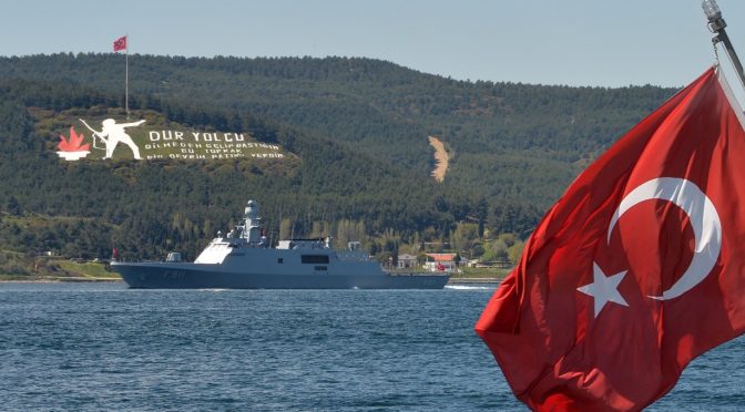
Featured Image: Turkish Navy MILGEM corvette transits by the Dur Yolcu Memorial on its way to the Dardanelles (Turkish Ministry of Defense photo)

‘This Presence Will Continue Forever’: An Assessment of Iranian Naval Capabilities in the Red Sea

By James Fargher

International attention has focused on the possibilities of an Iranian closure of the Straits of Hormuz, and the catastrophic effect a blockade would likely have on global energy supplies. Even a temporary closure or military disruption in the waterway would cause energy prices to soar and could politically destabilize the Persian Gulf region. Far less attention has been paid to Iranian activity in the Red Sea, however, despite the crucial importance of the Bab-el-Mandeb Strait to world oil shipments. In 2013, an estimated combined total of 8.3 million barrels of oil passed through Bab-el-Mandeb and the Suez Canal at either ends of the Red Sea, making it the world’s third-busiest maritime oil transit chokepoint.1 A limited military conflict in the Sea or the presence of naval mines would cause major disruption to European energy supplies and would force oil tankers to take the much longer southern route around the Cape of Good Hope. In this event, oil prices would likely rise dramatically and remain high until security in the Bab-el-Mandeb Strait was restored.

Iran has regularly deployed naval forces to the Red Sea since 2011. Although Iranian naval doctrine has typically concentrated on closing the Straits of Hormuz using asymmetric forces, more recent efforts by Iran’s naval leadership to project naval power beyond the Persian Gulf have resulted in a frequent Iranian naval presence in the Red Sea and the Gulf of Aden. The Red Sea remains an important route for Iranian weapons smuggling to militants in Gaza and Syria,2 and senior Iranian naval officers have announced plans to maintain a permanent maritime presence in the region.3  At present, Iran does not possess the same level of naval capability in the Red Sea and the Gulf as it does in its coastal waters in the Strait of Hormuz. Nevertheless, given the importance of the Bab-el-Mandeb Strait to global oil shipments, it would appear that more research is needed to assess Iran’s ability to disrupt shipping from the Indian Ocean to the Mediterranean.

This article aims to outline Iran’s military capabilities in the Red Sea and the southern approach to the Bab-el-Mandeb Strait. It relies principally on open-source information published on the Islamic Republic’s naval forces, and attempts to make realistic projections about Iran’s ability to intercept the Suez shipping line, which remains limited at present. Even in the case of the much more heavily-guarded Strait of Hormuz, it is generally acknowledged that Iranian forces could only hope to close the waterway for a matter of days or, at best, a few weeks, given its crucial importance for Western oil supplies.4 Attacks on oil shipments to Western Europe and North America in the Red Sea would risk triggering a devastating Western response, and it is not clear whether the Iranians would be prepared to do so. Moreover, in the event of a conflict with Iran, clashes would almost certainly be primarily focused on the Persian Gulf and the Red Sea would likely be a secondary theatre. This analysis therefore attempts to understand what forces Iran would be able to deploy to the area in the event of conflict, and how effective they might be in closing the strait.

This essay begins with a review of recent Iranian involvement in the Red Sea beginning in 2011, as well as its current naval policy towards the region. It will then give a brief overview of Iran’s current naval forces at Iran’s disposal, and will discuss the types of vessels and weapons Iran is capable of deploying to the Red Sea. In so doing, this article will attempt to give a broad summary of Iran’s likely present military capabilities in the Bab-el-Mandeb Strait and the kinds of threats which ships in the Red Sea could expect to face in the event of a conflict.

Iranian Involvement in the Sea

Between 1979 and 2011, there was no confirmed Iranian naval activity in the Red Sea. Iran was suspected to have supported a terrorist group which in 1984 claimed it had laid nearly 200 naval mines in the sea, but Tehran denied any involvement.5 In February 2011, however, a small flotilla of Iranian warships was dispatched on a mission to Syria, marking the first time that Iranian vessels had entered the Red Sea and transited the Suez Canal since the 1979 Revolution.6 Several months later, in July the Iranian government announced its intention to deploy one of its submarines on a patrol of the Red Sea. After completing its cruise, Rear Admiral Habibollah Sayyari, commander of the Iranian navy, declared that the Kilo-class submarine “could finish its 68-day mission in international waters with full preparation despite all sanctions and through the effort of domestic specialists.”7 Subsequently, at the end of 2011, Iran held naval exercises in the Arabian Sea, with units deployed in the Gulf of Aden as far as the Bab-el-Mandeb Strait. The purpose of this exercise, declared Tehran, was to show “Iran’s military prowess and defense capabilities in the international waters, convey a message of peace and friendship to regional countries, and to test the newest military equipment.”8

After a year-long hiatus, Iran once again deployed units to the Red Sea in January 2013. The Iranian government reported that it would be sending its 24th Fleet on a three-month patrol of the Gulf of Aden and the Red Sea before transiting the Suez Canal for the Mediterranean.9 Citing the need to protect its vessels from pirate attacks, Iran established its own small anti-piracy task force in the Gulf, and in March 2014 purportedly defended an Iranian tanker from an attack in the Bab-el-Mandeb Strait.10 In 2015, Iranian-backed Houthi fighters captured the strategic island of Perim in the Strait, and Sayyari announced that “The Islamic Republic of Iran’s Navy has deployed in the North of the Indian Ocean and the Gulf of Aden and this presence will continue forever.”11

These moves came as part of a wider Iranian drive to expand its regional influence by developing its blue-water capabilities. Iranian warships entered the Pacific Ocean for the first time in the Navy’s history in 2013, and dispatched a vessel to South Africa in 2014.12 The Iranian naval leadership has placed particular effort on projecting naval power onto sea lanes in the Arabian Sea,13 and as a report produced by the American intelligence firm Stratfor concluded, “Iran’s navy cannot project enough power to control key shipping lanes, but Tehran has emphasized its presence around Bab-el-Mandeb as a possible means of disrupting global trade in the event of an attack on Iran and a key point for negotiations in the future.”14

Stratfor’s report also highlighted Iran’s use of the Red Sea as an important shipment route to provide arms to its proxies and allied militant organizations in Gaza and Syria. Rockets bound for Hamas fighters, for example, were discovered in a ship on course for Port Sudan, where they were due to be unloaded and shipped across the Egyptian border to Gaza.15 Israeli aircraft have attacked alleged weapons convoys travelling from Sudan to Gaza, and the Red Sea forms a crucial link in this illicit supply line.16 Iran’s overt involvement in the ongoing Yemeni civil war has further increased the importance of the Red Sea and the Gulf of Aden to Tehran’s strategic aims.17

ARABIAN SEA (March 31, 2016) A cache of weapons is assembled on the deck of the guided-missile destroyer USS Gravely (DDG 107). The weapons were seized from a stateless dhow which was intercepted by the Coastal Patrol ship USS Sirocco (PC 6) on March 28. The illicit cargo included 1,500 AK-47s, 200 RPG launchers, and 21 .50 caliber machine guns bound for Yemen. (U.S. Navy Photo/Released)

In addition to using Sudan to supply weapons to its proxies, Iran has been cultivating good relations with Eritrea, which controls the remaining two large ports in the Red Sea.18 Iranian ships frequently dock in Massawa and Assab, and Iran is believed to be concentrating on building its regional influence with key East African states.19 Indeed, as early as 2008, rumors surfaced that Iran had secretly established a naval base in Assab. Whilst there is some satellite evidence suggesting that Iran has established a permanent naval facility in the port, these rumors cannot be confirmed.20

Iran’s Naval Forces

The Iranian fleet is divided between the regular Islamic Republic of Iran Navy (IRIN), and the Iranian Revolutionary Guard Corps Naval Forces (IRGCNF). 18,000 sailors are enlisted in the regular navy, whilst the IRGCNF is comprised of 20,000 sailors and 5,000 marines.21 Iran has seven frigates and 32 fast-attack missile craft designed for green-water service which form the core of its surface fleet, all armed with the C-802 Noor long-range anti-ship missile.22 Iran has also invested in a large flotilla of small craft, ranging from offshore patrol boats to armed motorboats and dhows, intended for coastal service and for mounting swarm attacks in the Strait of Hormuz. Iran has a squadron of five minelayers, as well as several mine countermeasures vessels, which can be supplemented by its small craft in laying naval mines in the Strait.23 The Iranian submarine service is made up of a total of 29 submarines, divided between the IRIN and IRGCNF.24 Five of these submarines are capable of operating in blue water, and the rest appear to be designed for service in the Persian Gulf. A number of ships and submarines are currently under construction, although information about these vessels remains limited.

The IRGCNF is tasked primarily with defending the Iranian coast and for interdicting shipping in the Strait of Hormuz. IRGCNF controls Iran’s asymmetric capability force, including its small attack craft, suicide vessels, and batteries of relatively short-ranged anti-ship missiles. IRGCNF bases are located in the Persian Gulf, and as its focus is limited to Iran’s littoral zone, its vessels are constrained by a smaller operating radius than the regular surface fleet. The IRGCNF also commands over 17 Qadir­-class and Nahangclass midget submarines, the majority of Iran’s submarine force, which are designed for service exclusively in the Persian Gulf.

By contrast, the IRIN controls Iran’s blue-water capabilities. Although both the IRIN and IRGCNF share responsibility for protecting the Iranian coast in the Persian Gulf and the Caspian Sea, since 2011 the IRIN has begun to focus on expanding Iran’s regional maritime reach. In the event of a conflict with the United States or with Iran’s Gulf Cooperation Council (GCC) rivals, the main Iranian effort would likely be focused on closing the Strait of Hormuz and on attacking shipping in the Persian Gulf. Most of these operations would fall under the responsibility of the IRGCNF, which has the capability to interdict shipping through the Strait with its small vessels and missile batteries. The Bab-el-Mandeb Strait, however, falls out of the operating range of most of the IRGCNF’s vessels, and so any operations in the Red Sea or the upper Gulf of Aden would be undertaken by the IRIN.

Surface Ships

According to IISS’ Military Balance, the core of the IRIN’s main surface fleet consists of two Jamaran-class light frigates, three Alvand-class frigates, and two Bayandor-class patrol frigates. Five of these ships date from the 1960s; the Alvand ships were bought as refitted Vosper Mark 5 frigates from the Royal Navy in 1971,25 and the Bayandor ships were purchased from the U.S. between 1964 and 1969.26 The Jamaran frigates are based on the basic Vosper Mk 5 design, although unlike the Alvand and Bayandor ships, they are armed with anti-air defenses. The Jamaran-class is thought only to be armed with two single SAM launchers, firing the SM-1 anti-air missile which was originally developed for the U.S. Navy in 1967.27 The lack of anti-aircraft capabilities indicates that Iran’s core surface vessels are dangerously exposed to air attack, critically limiting their ability to be deployed outside the umbrella of Iran’s coastal defense anti-air batteries.

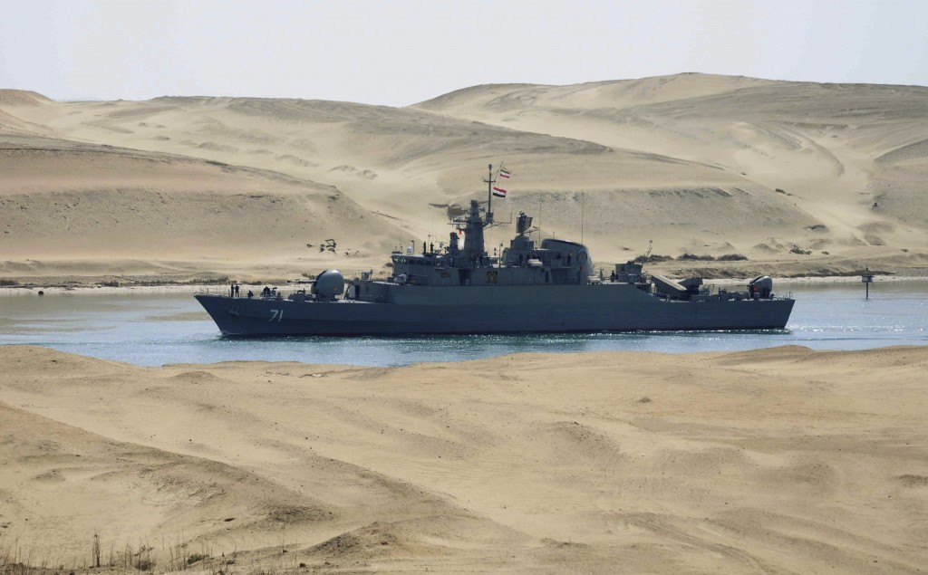
Iranian navy frigate IS Alvand passing through Egypt’s Suez Canal in February 2011 (AP)

All three classes are armed with the C-802 (CSS-N-8 Saccade) long-range anti-ship missile.28 The C-802 was developed by China to upgrade its own naval surface-to-surface missile (SSM) capabilities, and it is believed to be extremely accurate.29 The missile is powered by a turbojet with a range of at least 120km and carries a 165kg warhead.30 The C-802 is sea-skimming, and a successful Hezbollah attack on an Israeli missile ship in 2006 using the C-802 seriously damaged the Israeli vessel.31

Fourteen of Iran’s smaller missile boats also carry the C-802, although the remainder are armed with the C-704 Nasr short-range SSM.32 The Nasr is a domestically-manufactured missile with a range of 35km and a 150 kg warhead, capable of sinking medium-sized vessels.33 Three of Iran’s frigates received upgraded fire controls to better utilize the Nasr, but the Iranian missile stockpile is thought to be quite limited and mostly concentrated in coastal batteries.34

In theory, Iran could use its surface ships to mount a blockade of the Bab-el-Mandeb Strait by attacking ships attempting to pass through the Red Sea. The main Iranian surface fleet clearly has the operating radius to project power into the Red Sea from the Gulf of Aden, and its ships are armed with sufficiently long-ranged missiles to engage tankers in the narrow confines of the southern Red Sea. However, the extreme vulnerability of these ships to air attack with their lack of air defense cover suggests it is highly unlikely that these vessels would be capable of maintaining a blockade for long, or would even be risked attempting to do so. The disastrous losses inflicted on the Iranian fleet during the 1988 tanker war by U.S. aircraft highlighted this weaknesses, and prompted Iranian strategists to focus on asymmetric forces as an alternative.35 With both an American F-15 squadron based in Camp Lemonnier36 and ships from EUNAVFOR Atalanta stationed in Djibouti,37 it is doubtful whether any hostile Iranian surface ships would be able to successfully interdict Red Sea shipping.

Submarines and Mines

Since 1988, the main effort by the Iranian naval leadership has concentrated on building up Iran’s asymmetric capabilities, including acquiring a strong submarine force.38 Although most of Iran’s submarines are small or midget craft designed for operations in the shallow waters of Persian Gulf, Iran does possess at least four blue-water submarines.39

Three of these are diesel-electric Kilo­-class submarines, purchased from Russia in the 1990s.40 The Kilo-class was designed as a quiet attack submarine, but because they were intended for colder climates, Iran’s three Kilos do not operate well in the warm waters of the Persian Gulf. For this reason, whilst they are currently based in the main Iranian naval station at Bandar Abbas in the Strait of Hormuz, a new submarine base for them is reportedly under construction at Chah Bahar on the Gulf of Oman.41 Not much is yet known about the fourth submarine, the lead boat of the domestically-produced Fateh-class, but it is designed for service in blue water.42

The three Kilo submarines represent Iran’s main operating capability in the Red Sea. Whilst its surface ships are hampered by their vulnerability to air attack and small operating range, the Kilo-class submarine is designed for extended operations in open waters.43 Each Kilo is thought to be armed with wake-homing torpedoes, and they can carry a total payload of 24 mines, deployable through the torpedo tubes.44 A batch of 1,000 mines was included in the original purchase from Russia.45

Since then, Iran is estimated to have built up a stockpile of at least 2,000 mines, including the M-08 contact mine, the MDM-6 pressure mine, and the EM-52 smart mine.46 The Red Sea and the Bab-el-Mandeb Strait are too deep for the M-08 contact mine, which operates at depths of up to 110 meters, but potentially within the range for both the MDM-6 and EM-52.47 The EM-52 is a particularly lethal threat, as it is laid on the sea floor and is a guided, rocket-propelled warhead. It is also powerful enough to penetrate a carrier hull.48

Seafloor mines are especially challenging to detect; it took a Royal Navy minesweeper six days to detect a single Iranian smart mine in the Red Sea in the 1980s.49 Caitlin Talmadge, in her analysis of Iranian capabilities in the Strait of Hormuz, calculated that a task force of 12 NATO ships managed to clear an Iraqi minefield at a rate of 1.18 mines per day, a rate that was unusually fast and done under ideal conditions.50 Given the rugged geography of the Red Sea’s floor and the proliferation of smart mines, it is not clear whether another task force would be able to clear an Iranian minefield at the same rate.

However, the Kilo class is aging, and these vessels are vulnerable to U.S. and British hunter-killer groups. The proximity of Western forces to the Bab-el-Mandeb Strait and the strategic importance of the Red Sea to Western interests suggests that the Kilo submarines would probably only get one voyage to the Red Sea before being neutralized in the case of hostilities. If Iran deployed all three of its blue-water submarines, which is unlikely, they could sow 72 mines at most. If a naval task force was to achieve the same rate of minesweeping as in Talmadge’s analysis, it would take 61 days to clear this minefield completely. Nevertheless, it is improbable that the Iranian leadership would risk all three of its largest submarines on such a risky, possibly one-way mission, and similarly it is unlikely that minesweepers would be able to operate with the same speed in the Red Sea as in the Persian Gulf. Therefore, a rough estimate of Iran’s submarine capabilities and mine stock would indicate that a single Kilo submarine with a well-trained crew could close the Bab-el-Mandeb Strait for at least a week in an attempt to divert attention away from combat in the Persian Gulf.

Ballistic Missiles

Iran does not at present have any fixed-wing aircraft with sufficient range to operate from Iranian bases to the Red Sea. Besides its naval capabilities, it can only reach the Red Sea with ballistic missiles. Iran currently has nine types of missile able to reach the Red Sea; the Shahab-3, -4, -5, and -6, the Ghadr-101 and 110, the IRIS, SAJIL, and the new Emad rocket.51 All of these classes have the range to strike targets in the Red Sea, and all can reach the waterway within ten minutes of being launched.52

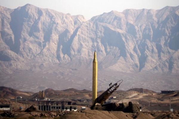
A variant of the Emad missile, the long range Shahab-3. (UPI/Ali Shaygan/Fars News Agency)

As a general rule, Iran’s long-range missiles are extremely inaccurate and are designed to hit strategic targets, not individual ships transiting the Red Sea.53 The sole exception is the latest Iranian missile, the Emad, which was designed as Iran’s first precision strike system. The Emad is equipped with an advanced guidance system in the nose cone, and has a reported accuracy radius of 500 meters.54 It also carries a 750 kg warhead with enough explosive power to cripple or sink even a heavy oil tanker.55

Whilst the Emad represents an improvement in Iran’s ballistic missile capability, it is not clear how effective it would be as an area-denial weapon in the Red Sea. It does not appear to be accurate enough to target individual ships, and it will take several years to perfect the guidance technology.56 Furthermore, in order to reach the Red Sea, a costly Emad missile would need to transit across the Arabian Peninsula through Saudi Arabia’s air defenses. The possibility of using ballistic missiles to attack Red Sea shipping is therefore remote.

Conclusion

Iran’s ability to interdict shipping in the Red Sea is limited by its aging surface fleet and by the small number of submarines and missiles it can deploy to the waterway. Despite Iran’s growing interest in expanding its influence into the Bab-el-Mandeb Strait and the southern Red Sea as a means of securing its regional power, its current naval forces are tasked primarily with shutting the Strait of Hormuz.

Nevertheless, in spite of these limitations, the Iranians do have a narrow range of capabilities in the Bab-el-Mandeb Strait. Although its surface fleet is unlikely to risk its assets by deploying surface vessels so close to U.S. and Saudi airbases during wartime, Iran has demonstrated that it can send submarines on extended cruises of the Red Sea. Its aging Kilo-class submarines are equipped with sophisticated mines in quantities which would take weeks to clear, and could be used to apply pressure on both the U.S. and Western Europe as well as the oil-exporting countries of the Persian Gulf. Iran is already suspected to have laid mines in the Red Sea in the 1980s, and it is capable of doing so again – either as a means of leveraging its position in the Greater Middle East, or as a way to disrupt oil shipping and to open a new theater of operations in the event of a war with its regional rivals.

James A. Fargher works as an intelligence analyst at a political risk firm in the UK, and is currently enrolled as a PhD candidate at the Department of War Studies, King’s College London. James holds a BA from Drew University and an MA in modern history from King’s. He specializes in Imperial history and naval theory, with a particular focus on the Red Sea region. 
 

Endnotes

1. Alexander Metelitsa & Megan Mercer, ‘World Oil Transit Chokepoins Critical to Global Energy Security,’ Today in Energy, US Energy Information Administration, 1 December 2014.

2. Stratfor, ‘Eastern Africa: A Battleground for Israel and Iran,’ Report, 29 October 2012.

3. ‘Iran Making Naval Moves into Red Sea,’ The Tower, 20 January 2015.

4. Caitlin Talmadge, ‘Closing Time: Assessing the Iranian Threat to the Strait of Hormuz,’ International Security, 33:1 (Summer 2008), 84.

5. Gerald F. Seib and Robert S. Greenberger, ‘Iran’s Signals Mixed on Mines in the Red Sea,’ The Wall Street Journal, 8 August 1984.

6. ‘Israel anger at Ian Suez Canal warship move,’ BBC News, 16 February 2011.

7. ‘Iran to send submarines to international waters – Press TV,’ BBC News, 30 July 2011.

8. ‘Iran Navy to Hold War Games Near Crucial Sea Lanes,’ The New York Times, 23 December 2011.

9. ‘Iran navy to deploy 24th fleet to Mediterranean Sea – commander,’ BBC News, 16 January 2013.

10. ‘Iran Navy counters pirate attack against oil tanker in Red Sea,’ BBC News, 4 Mach 2014.

11. ‘Iran Making Naval Moves into Red Sea,’ The Tower, 20 January 2015.

12. ‘Islamic Republic of Iran Navy IRIN / Iranian Revolutionary Guard Corps (IRGC) Navy,’ Global Security, accessed 23 June 2016, http://www.globalsecurity.org/military/world/iran/navy.htm.

13. Tarek Fahmi, quoted in ‘Iran Making Naval Moves into Red Sea,’ The Tower, 20 January 2015.

14. Stratfor, ‘Eastern Africa: A Battleground for Israel and Iran,’ Report, 29 October 2012.

15. Ibid.

16. Ibid.

17. ‘Iran steps up support for Houthis in Yemen’s war – sources’, Reuters, 22 March 2017.

18. Ibid.

19. Ibid.

20. Ibid.

21. International Institute for Strategic Studies (IISS), ‘The Middle East and North Africa,’ The Military Balance, 2016 (London: IISS, 2016), 328.

22. Ibid.

23. Ibid.

24. Ibid.

25. ‘Alvand Class,’ Global Security, accessed 30 June 2016, http://www.globalsecurity.org/military/world/iran/alvand.htm.

26. ‘Bayandor Class,’ Global Security, accessed 30 June 2016, http://www.globalsecurity.org/military/world/iran/bayandor.htm

27. International Institute for Strategic Studies (IISS), ‘The Middle East and North Africa,’ The Military Balance, 2016 (London: IISS, 2016), 329.

28. Ibid.

29. ‘C-802 / YJ-2 / Ying Ji-802 / CSS-C-8 / SACCADE C-8xx / YJ-22 / YJ-82,’ Global Security, accessed 1 July 2016, http://www.globalsecurity.org/military/world/china/c-802.htm.

30. Ibid.

31. Ibid.

32. International Institute for Strategic Studies (IISS), ‘The Middle East and North Africa,’ The Military Balance, 2016 (London: IISS, 2016), 329.

33. ‘Kosar / Nasr,’ Global Security, accessed 1 July 2016, http://www.globalsecurity.org/military/world/iran/kosar.htm.

34. Talmadge, ‘Closing Time,’ 104.

35. Nuclear Threat Initiative (NTI), ‘Iran Submarine Capabilities,’ 21 August 2015, accessed on 22 June 2016, http://www.nti.org/analysis/articles/iran-submarine-capabilities/.

36. Craig Whitlock, ‘Remote U.S. base at core of secret operations,’ The Washington Post, 25 October 2012.

37. David Styan, ‘Djibouti: Changing Influence in the Horn’s Strategic Hub,’ Briefing Paper (London: Chatham House, 2013), 4.

38. NTI, ‘Iran Submarine Capabilities’.

39. International Institute for Strategic Studies, ‘The Middle East and North Africa,’ 329.

40. ‘Kilo Class Submarine,’ Global Security, accessed 23 June 2016, http://www.globalsecurity.org/military/world/iran/kilo.htm.

41. Nuclear Threat Initiative (NTI), ‘Iran Submarine Capabilities’.

42. ‘Fateh (Conqueror / Victor) “semi-heavy” submarine,’ Global Security, accessed 23 June 2016, http://www.globalsecurity.org/military/world/iran/fateh.htm.

43. ‘Iran to send submarines to international waters – Press TV,’ BBC News, 30 July 2011.

44. International Institute for Strategic Studies, ‘The Middle East and North Africa,’ 329.

45. ‘Kilo Class Submarine,’ Global Security.

46. Talmadge, ‘Closing Time,’ 92.

47. Anthony H. Cordesman with Aaron Lin, The Iranian Sea-Air-Missile Threat to Gulf Shipping (Washington: Centre for Strategic & International Studies, 2015), 21.

48. Ibid., 108.

49. Ibid.

50. Talmadge, ‘Closing Time,’ 95.

51. Abdullah Toukan and Anthony Cordesman, ‘GCC-Iran: Operational Analysis of Air, SAM and TBM Forces,’ Centre for Strategic & International Studies (Washington: CSIS, 2009), 37.

52. Ibid., 127.

53. Sam Wilkin, ‘Iran Tests New Precision-Guided Ballistic Missile,’ Reuters, 11 October 2015.

54. Ibid.

55. Ibid.

56. Ibid.

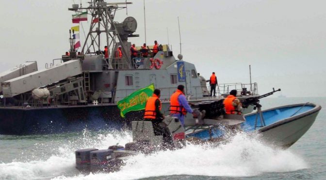
Featured Image:Iran’s elite Revolutionary Guard ride in their boat alongside an Iranian naval vessel (AFP: IRNA)

“Strategic Insights” – Call for Articles

And now, for something completely different… of sorts. If you want to expand audience for your ideas, look no further than Strategic Insights, the global maritime security analysis journal of Risk Intelligence from Denmark. Strategic Insights often goes by the short-hand SI, but it should not to be confused with the sports magazine of the same acronym, for it focuses on up-to-date and in-depth studies of contemporary maritime risks rather than on professional athletics or even swimsuit-clad beauties. So if you look like I do in a bikini, it will be much easier to publish in this version of SI! Each one of the six issues per year features an external contributor, and the SI editorial board is soliciting contributions for the 2014-2015 cycle for its new series on maritime chokepoints.

The other SI that is (sometimes) concerned with maritime security.
The other SI that is (sometimes) concerned with maritime security issues.

Anyone with an interest in writing a piece on a major maritime bottleneck of their choice (The Bosporus and Strait of Taiwan have already been taken, sorry) should send a short note Sebastian Bruns, member of the SI editorial board and fellow CIMSECian, at [email protected]. Please include a short bullet-point list of your take on the maritime security situation and threats to shipping at the chokepoint of your choice (ex: Strait of Gibraltar, Strait of Hormuz, Suez Canal, Panama Canal, or others you may come up with), and 2-3 sentences on your professional background. If your article is accepted for publication – and there is little doubt that the cumulative intellect of CIMSEC members and readers of the NextWar blog will be willing and able to cover all major global choke points – remuneration is 300.00 € (or 400.00 USD) per article and will be paid via bank transfer on the first of the month after publication of the respective issue.

Strategic Insights draws on the focus and geographical coverage of Risk Intelligence’s MaRisk maritime security monitor, but takes a wider look at the nature of maritime risk in different threat locations around the world. Each issue goes beyond facts and figures to consider the drivers of maritime security challenges and how these challenges will evolve in the future.

The focus of Strategic Insights is on security threats and political-military developments with a maritime dimension, particularly non-traditional security issues such as piracy, maritime terrorism, insurgency, smuggling, and port security. The journal is read by players in the maritime industry, law enforcement agencies, think tanks and institutions, and inter-governmental regional security bodies. A particular emphasis is placed on articles that offer policy-relevant and operational analysis relevant to the maritime community. The style is a mix of journalism and academic, length about 2,500-3,000 words. Visit the website for more info and to download your complimentary free issue.

Sebastian Bruns is a doctoral candidate at the University of Kiel, Institute for Political Science/ Institute for Security Policy (Germany). His dissertation analyses U.S. Navy strategy. On the side, he is supporting Risk Intelligence and hoping to one day become a member of the Sports Illustrated editorial board.