Tag Archives: Littoral

Sweden and the Blue Society: New Challenges for a Small Navy

Regional Strategies Topic Week

By Lars Wedin

The Royal Swedish Academy of War Science is presently undertaking a study of strategic and operational requirements for the Swedish Armed Forces in the 2030 timeframe. Its naval section has recently published its findings in a book, Vår marin för ett tryggt Sverige och ett starkt Europa. Marin strategi 2030 (Our Navy for a Secure Sweden and a Strong Europe. Naval Strategy 2030).1 This article discusses some of our findings.

Classic naval strategists – Mahan, Corbett, and Castex – basically saw naval strategy as consisting of three major alternative offensive strategies: attack on land from the sea, blockade, and commerce raiding, as well as the corresponding defensive strategies. Sea control (command of the sea is an older term) and its opposite, sea denial are key. French Admiral Raoul Castex summed it up nicely: “Depending on whether one has command of the sea or not, one may or may not:

  • be in an offensive mode, intercept the communications at sea of the enemy and attack his territory from the sea;
  • be in a defensive mode, guarantee one’s own communications and prevent the enemy from attacking one’s territory from the sea.”2

Today, the spectrum of maritime warfare is much broader and fluid. Some parts of this spectrum, such as nuclear deterrence, are only relevant to the navies of larger powers, but many are highly relevant also to coastal navies.

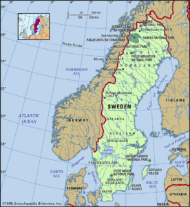
Geographically, Sweden is a maritime country dependent on sea lines of communications (SLOCs) for its international trade but also, increasingly, for domestic transportation. Its biggest port is Gothenburg, but there are important ports along all its 2,700 kilometers of coastline. The sea around Sweden is divided into three operational areas by the straits of Öresund and the Åland archipelago. Strategically, Sweden borders the Arctic in the north, Russia in the east, the EU in the south and the Atlantic Ocean in the west. The country is not a member of NATO but enjoys a close partnership with the alliance. It is a member of the EU, and has close military relationships with other Nordic countries, especially Finland. The Swedish navy is modern and capable, but much too small for the tasks expected of it.

Map of Sweden (via Britannica.com)

The Blue Society

The future of humankind lies at sea, which is demonstrated by the 70-80-90-99 rule: the sea covers 70 percent of the surface of the globe, 80 percent of its population lives near the sea, 90 percent of goods are transported on ships, and 99 percent of world’s digital information is carried by submarine cables.3 Two thirds of the world’s wealth is also produced at, or in, the sea. One could talk about a littorialization of the world’s population and thus of its economy.4 In sum these trends form what one could call a blue society – a society turned toward and dependent on the sea, its possibilities, and challenges.

Several important factors drive this development. It is well-known that the globe’s major reserves of oil and gas lie beneath the sea; there are tens of thousands of platforms of different kinds and more than 100,000 people serve on them. Climate change drives the construction of an ever-increasing number of wind farms and other forms of at-sea power generation. Climate change also drives moving traffic of goods from roads to ships (and railways). Mineral resources at sea are increasingly important as well as resources for the biochemical and pharmacological industry. Fishing – catch of wild fish as well as fish farms – is of vital importance for a large part of the world’s population. Shipping and related activities are vital for the economy. Just in the EU, some 574,000 people work in ports, a sector worth a collective €89 billion.5, 6

To conclude, the old adage of Corbett that “Command of the sea, therefore, means nothing but the control of maritime communications, whether for commercial or military purposes” is no longer sufficient. The sea itself is now intrinsically important. He is still correct, however, when he stated that naval warfare is not about “the conquest of territory.”7

Littoralization in Scandinavia

Two extreme cases of littoralization are the interlinked mega-regions known as Western Scandinavia and Greater Copenhagen. The former includes southwestern Sweden and southern Norway while the latter covers the Danish and Swedish parts of the Öresund. 30 percent of Norway’s and 33 percent of Sweden’s populations live in Western Scandinavia which is responsible for the major part of Norway’s and half of Sweden’s GDP.8 A driving factor is the area’s largest ports, Gothenburg and Helsingborg, which link the region with the global market. Greater Copenhagen is, from an economic point of view, an integrated area on each side of one of the world’s most busy waterways, where around five million people live.

Even minor disturbances may create great economic danger to the countries in the region. Hybrid warfare could be a very effective mode of attack due to the dependence on vital infrastructure. For instance, just a suspicion of mines in the waterways would cause disruption; such a suspicion is relatively easy to spread through a disinformation campaign. Their actual use would cause great harm. Due to the archipelago covering the port of Gothenburg, preventive mine-hunting would require significant resources.

The defense of such a littoral area with its thousands of islands, broad countryside, as well as modern cities, as well as extensive transport networks would be very complex. One might add the great sensitiveness of modern ports as well as infrastructure in general to attacks in cyberspace.

Infrastructure – Changing the Geography of the Littoral 

Trends in building new infrastructure on the sea – the construction of wind farms and diverse platforms for oil and gas including the deployment of Floating Liquefied Natural Gas (FLNG) and Floating (production) Storage and Offload (F(P)SO) – change the operational seascape.9 These facilities are a sort of hybrid infrastructure, where they retain the permanence of land-based facilities but are located out at sea. In the Swedish context, only wind farms are relevant.

Windfarms may cover large areas and they produce noise that may conceal the presence of submarines. It is believed that a wind turbine has a radar cross section of around 10,000 meters squared. The movements of the blades affect a doppler radar, which is in current use in modern aircraft. Wind farms, covering large areas, constitute a new tactical environment. Submarines, especially midget submarines, and fast attack craft (FAC) may conceal themselves in such areas and would be very difficult to detect. In fact, during the Iran-Iraq war in the 1980s, Iran used its oil platforms as bases for their fast attack craft – the famous Boghammar.10 Sweden also has a goal of 100 percent renewable energy by 2040. Wind farms at sea are bound to play an important part in this program.11 Consequently, such wind farms become strategically important and, hence, a target for warfare.

Another aspect of infrastructure is constituted of cables. Cables may be damaged accidentally or intentionally, but their information could also be intercepted by specialized submarines. It is believed that the Russians are very capable in this area. Stopping information through cable-cutting is a measure already used  since the Spanish–American War of 1898. Electrical power is also transmitted through cables on the seabed. The strategically important Swedish island of Gotland is highly dependent on electricity from the mainland. Sweden is also connected to the EU internal energy market through a network of such cables.13, 14

A final type of growing infrastructure is the bridges that connect Sweden, Denmark, and Germany. They are of clear strategic importance but vulnerable. They also constitute physical obstacles – modern aircraft carriers may not enter the Baltic Sea because the bridges are too low. The Great Belt and the Öresund have, historically, had great strategic importance. They still have as they link, or separate, the Baltic Sea from the Atlantic area.

In sum, infrastructure at sea is strategically important, but vulnerable. A complete command of the sea would constitute an efficient defense but such a command is likely impossible. Consequently, this is an area in need of tactical development.

Technology – A Force Multiplier

Naval officers tend to equate military capacity with the number of keels or missile tubes available. These metrics are important of course, but technology creates new possibilities. A primary observation is that distances, expressed as range, depend on technology: “The physical arena is as big as before when considered in linear dimensions, in kilometers. However, when expressed in passage time, it is much reduced.”15 Until now, range has been dependent on a ship’s organic sensors and weapons. Now, the use of drones changes this.

Drones will have an increasing role to play in surveillance, as decoys, and as weapon platforms over, on, and under the surface. Drones for undersea, surface and air use will be networked together. The future naval force will probably have a number of such drones for communications, targeting purposes, and as weapon delivery platforms. With the development of standard interfaces, drones will be able to communicate among themselves. This also means that one ship may use another’s drone. Artificial Intelligence (AI) will make it possible for drones to cooperate actively and independently to a great extent.

For the Swedish Navy, there are a number of possible tactical uses. A critical one is the surveillance of the undersea domain in ports and important parts of archipelagos in search of mines and minisubs. Another is increasing the sensor range for ships on surveillance missions. Sweden could perceive cargo ships loaded with military units that “suddenly” steer toward Swedish ports as an important threat.16 AI will help in detecting such moves early on.

Swedish corvettes will (finally) be equipped with medium-range anti-air missiles. This will give these ships quite a new role as part of the Swedish air defense, which has mainly depended on the Air Force. Sweden has bought the Patriot system, but the number of systems and missiles is not known and probably small. The contribution of the Navy, with its staying power at sea, could be significant. New ships may be constructed with built-in sensors in the hull, in engines, and weapon systems. This may make planned maintenance less important as the sensors will be able to report continuously on the condition of the material. The aspect of cybersecurity will, obviously, be very important in this context. These are just some examples of what new technology may have to offer a small navy.

Naval Diplomacy

Aircraft carriers are sometimes called “100,000 tons of diplomacy.” But even smaller navies and ships can be applied toward naval diplomacy. The general objective is to shape the strategic environment to one’s advantage, to reassure friends, and earn the respect of potential enemies. Naval presence is the basic action in the context of naval diplomacy; without presence, there is no diplomatic effect. Naval diplomacy and presence can cover a range of actions that are not clearly defined from one another, and may be engaged in simultaneously. Naval presence may produce a number of strategic effects (interdiction, coercion, creation of friendship and confidence) depending on the actions of the deployed naval force. But the result also depends on posture and credibility. This can be illustrated by the following formula: Diplomatic result = (action plus posture) times credibility. Naval diplomacy and presence can cover a range of actions that are not clearly defined from one another. Naval diplomacy also influences one’s own perceptions of others, and can help mitigate the assumptions that come with mirror imaging.

Even a small navy like the Swedish Navy can engage in a range of naval diplomatic activities. To be present at sea with capable naval ships with well-trained crews is a priority in peacetime. It is also necessary in order to keep track of developments in the busy seas surrounding Sweden. Exercises with friends (the U.S., NATO, Finland, and others) create the necessary interoperability and mutual trust needed in crisis and war. It also has a deterring effect showing that they are able to fight together even though Sweden is not a formal member of NATO. Naval visits are a classic and effective way of creating mutual friendships.

More controversial would be efforts to approach the Russian Navy. Russian presence in the Baltic and adjacent seas is a fact and perfectly legal according to the UNCLOS.18 All states in the area share an interest in the keeping of good order and safety at sea. The problem with Russia is, of course, its rather aggressive posture and its actions against Ukraine. However, simple exercises at sea could be a way of creating some degree of mutual trust. As the sea is free, such endeavors would be less controversial than activities on land.

Conclusion

A small navy like the Swedish Navy does not seek to be able to project power on a global scale – not even on a regional one. It cannot protect SLOCs in contested areas far away. But it can, and must, promote and defend its interests at sea in its own area of interest. It can also be a small but important player in larger contexts as shown, for instance, by the Swedish participation in Operation Atalanta off the coast of Somalia.19

In fact, even small navies will see enlarged requirements as a result of the increased importance of the sea in the context of the blue society – a society dependent on the sea and its use. This will include traditional missions like defense of territory against amphibious operations and protection of shipping. But it will also include new missions in the context of the increased importance of infrastructure at sea. Technology will create new possibilities also relevant for small navies, such as through drones, AI, and new missiles.

Representatives of major navies often tend to see smaller navies – without the whole panoply of naval might – as less relevant. But a small navy may be as relevant as a large one in the context of its own strategic environment, and where larger allies may depend on their success.

Lars Wedin is a retired Captain R Sw N. He is the editor of Tidskrift i Sjöväsendet which, since 1835, is the journal of the Royal Society of Naval Sciences founded in 1771. He is also a member of the Royal Academy of War Sciences.

References

  1. Odd Werin, Lars Wedin: Vår marin för ett tryggt Sverige och ett starkt Europa. Marin strategi 2030, Kungl. Krigsvetenskapsakademien, Stockholm, 2020.
  2. Raoul Castex: Théories stratégiques, Institut de Stratégie Comparée et Economica, Paris 1997, vol V, p. 87.
  3. Slightly adapted from Remarks by the Honorable Ray Mabus Secretary of the Navy 27th Annual Emerging Issues Forum: Investing in Generation Z Raleigh, NC Tuesday, 7 February 2012. https://www.navy.mil/navydata/people/secnav/Mabus/Speech/emergingissuesfinal.pdf
  4. République Française : Stratégie nationale de sûreté des espaces maritimes, Paris, 2015. p. 5.
  5. Before Brexit and the Coronavirus Pandemic
  6. The EU blue economy report 2019, Publications Office of the European Union, Luxembourg 2019.
  7. Julian S Corbett: Some Principles of Maritime Strategy, Conway Maritime Press, London 1972 [1911], p. 90
  8. OECD: OECD Territorial Reviews: The Megaregion of Western Scandinavia, OECD Publishing, Paris 2018, https://read.oecd-ilibrary.org/urban-rural-and-regional-development/oecd-territorial-reviews-the-megaregion-of-western-scandinavia_9789264290679-en#page15. www.greatercph.com/about
  9. See Lars Wedin: Maritime Strategies for the 21st Century. The Contribution of Admiral Castex, Paris, Nuvis, 2016, p. 164 – 165.
  10. http://www.navalhistory.org/2013/04/18/operation-praying-mantis-18-april-1988. Accessed March 10, 2014.
  11. https://www.regeringen.se/debattartiklar/2017/12/vi-vill-gynna-vindkraften-till-havs/
  12. See https://www.submarinecablemap.com/
  13. Lars Wedin: “L’île De Gotland. Clé De La Mer Baltique, Stratégique 2019/1-2 (N° 121-122), p. 103-115.
  14. Hållbar och säker elförsörjning, Svenska kraftnät, 2020, https://www.svk.se/sakerhet-och-hallbarhet/hallbarhet/hallbar-och-saker-elforsorjning.
  15. Castex: Théories stratégiques, vol III, p. 153.
  16. The realism of this perception is open to some doubt but it is regarded as a fact in Swedish defense policy circles.
  17. Martin Motte: “Splendor Rei Navalis”, Stratégique, no. 118, 2018, p. 81
  18. UN Convention on the Law of the Sea
  19. See Robert McCabe, Deborah Sanders and Ian Speller (eds): Europe, Small Navies and Maritime Security. Balancing Traditional Roles and Emergent Threats in the 21st Century, Routledge, 2019.

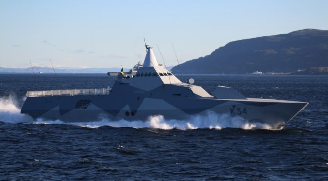
Featured Image:  TRONDHEIM FJORD, Norway (Oct. 30, 2018) The Swedish navy corvette HSwMS Nyköping (K34) transits Trondheim Fjord in Norway, Oct. 30, 2018, as part of NATO exercise Trident Juncture 2018. (U.S. Navy photo by Lt. Cmdr. Pedro Miguel Ribeiro Pinhei/Released)

The Case for Maritime Security in an Era of Great Power Competition

By Joshua Tallis

“Maritime security.” The phrase, and the nebulous set of missions that loosely fall underneath it, came into expanded use in the decades after September 11, including in U.S. strategic documents. Even during the height of interest in maritime security, however—say, around 2007 and the publication of A Cooperative Strategy for 21st Century Seapower—it was not clear how those missions could or should be prioritized with respect to other strategic challenges. As the Department of Defense, and the Navy with it, reorients to great power competition, it will only become easier for those questions to slide into the background. And yet, as we will see below, historical trends and emerging patterns will conspire to keep the littorals at the forefront of policymaker’s minds. Alongside the renewed focus on traditional adversaries, therefore, operations in green and brown waters driven by unconventional threats will likely play an enduring role in U.S. foreign policy.

In his book Out of the Mountains, counterinsurgency strategist David Kilcullen sets out a compelling argument for taking the littorals seriously. Kilcullen’s argument is focused on events ashore, but his articulation of the global drivers shaping the littorals can be made equally valuable for the seaward end of the domain. The premise underlying these drivers is based on one simple principle: conflict happens where people are.1 So, where are the people?

In response, Kilcullen identifies four “megatrends” of demography and economic geography that suggest where we will find most of the world’s population in the coming decades. “Rapid population growth, accelerating urbanization, littoralization (the tendency for things to cluster on the coastlines), and increasing connectedness” all suggest that populations are concentrating in networked, urban, dense, littoral communities.2 UN estimates project that by 2050 at least two-thirds of the global population (which is projected to reach 9.8 billion) will likely live in cities, a great many of whom will end up in slums (where about a billion people already call home). Moreover, much of this urban expansion—most of which will be coastal—will take place across the global South, often where governments are least prepared to receive it. The populations of the Caribbean and Latin America could grow by more than 130 million people; Africa may see its population expand by more than a billion; and Asia will see a growth of at least 800 million according to mean estimates from the United Nations.

To give an indication of scale, consider the following. In one generation, the world’s poorest cities will absorb most of a population increase equal to all the population growth ever recorded in human history through the year 1960.3 That is sure to produce astounding institutional strains, ones that will inevitably stress already fragile municipal governments. And we need not wait for 2050 to see these statistics in action. Today, half of the world’s population lives within about thirty miles of a coast, and three-quarters of large cities are on the water. To those and other cities, nearly 1.5 million people migrate to every week, which explains why urban areas are soon expected to absorb almost all new population growth.4

But how is demography dangerous? The answer comes from how urban communities respond to the pressures of these trends. Research suggests that when a city doubles in size, it produces, on average, “fifteen percent higher wages, fifteen percent more fancy restaurants, but also fifteen percent more [HIV/AIDS] cases, and fifteen percent more violent crime. Everything scales up by fifteen percent when you double the size.”5 In cities already straining their respective systems, cities like Lagos or Mumbai or San Pedro Sula, the consequences of a 15 percent spike in crime or HIV/AIDS rates act on preexisting stressors like poverty, climate change, and political violence, which can precipitate disorder. In the most extreme cases, the impact of these magnified stressors might even cause a metropolis to turn “feral.” In the Naval War College Review, Richard Norton defines a feral city as “a metropolis with a population of more than a million people in a state the government of which has lost the ability to maintain the rule of law within the city’s boundaries yet remains a functioning actor in the greater international system.”6 John Sullivan and Adam Elkus describe the feral city as a place without any meaningful presence of legitimate authority, where “the architecture consists entirely of slums, and power is a complex process negotiated through violence by differing factions.”7 Norton noted at the time that only Mogadishu truly exemplified his criteria of a feral city. Yet, several cities then contained feral pockets characteristic of Norton’s theory. In such pockets, segments of an urban sprawl may exist outside the reach of the government. A Proceedings article by Matthew Frick as well as a New York Times piece both cite São Paulo, Mexico City, and Johannesburg (the Times also adds Karachi) as examples of modern cities with components that could be described as feral.Frick even explicitly links these feral cities to maritime security by arguing that they are echoes of the pirate havens of the 18th century, when raiders similarly leverage ungoverned spaces as bases of operation. In feral cities or pockets, the legitimate governing fabric of the urban area erodes as the stress of an oversized population pushes it past the ability to cope with the pressures of crime, poverty, and health. Such violence perpetuates the cycle of urban exclusion that created it, precipitating yet more political, social, economic, and infrastructure neglect.9

The collapse or erosion of local governance creates a power and services vacuum. That power vacuum creates disorder from which people naturally crave a reprieve. In turn, the local actor that can produce a sense of order and stability is frequently adopted as a surrogate government. Inevitably, these surrogates are not peaceful neighborhood watch groups. Kilcullen’s concept of “competitive control” posits that the surrogates most likely to survive in these environments are those that can act across a spectrum of power ranging from soft to coercive.10 Without soft power, the allure of an institutionalized set of normative community rules, the population is denied the sense of order it demands. Under such a rules-based system, a neighborhood is likely to tolerate a measure of violence because it can be predicted and avoided. Without violence, a competitor will find it easy to supplant the surrogate. What we are left with is a void filled by organized gangs, terrorists, militias, or criminal networks that manipulate a feral city’s disorder to establish fortifications within neighborhoods that often come to depend on them. In Kingston, Jamaica, garrison neighborhoods offer one such example where these districts are made loyal to gang leaders because of their dominant role in the local informal justice system and economy.11 We are left facing an amorphous hybrid threat, what John Sullivan calls “criminal insurgents,” or the melding of criminal syndicates with the direct political control of territory.12 When such groups offer residents enough of a sense of fair and predictable order, many are willing to tolerate their presence.

So far, however, violent nonstate groups and feral cities would appear a danger largely within their own neighborhoods, far from concerning the United States, and certainly not U.S. maritime services. What brings these groups and populations into the international maritime orbit is Kilcullen’s final megatrend—connectedness. Crowded, poor, coastal zones may turn feral, but feral regions do not implode. Instead, they remain connected with the world around them through the Internet, ports, airports, diaspora communities, and other connective tissues. Thus, with all the implications of such connectedness, even a feral region remains a dynamic, strategic, and significant actor in the international arena. This connectedness allows the feral elements of a community to interact with licit and illicit trade and information flows, offering local actors the capacity to directly impact events across the country and, potentially, the globe.13 The same pathways that facilitate normal trade and migration likewise enable illicit transfers such as the smuggling of narcotics, people, and weapons; human trafficking; terrorism; and piracy. This connectedness is what gives rise to the potential for actions a world away, events like protests or acts of political violence, to have a rapid and meaningful consequence across domains, from cyberspace to the sea. September 11 was a dramatic example of the extreme consequences of this networked, globalized connectivity of local violence to the international system. What we have increasingly seen in the intervening two decades, thanks in part to the explosive growth in technologies that connect all of us, is that this ladder between local and international is only strengthening. As a result, in the sphere of nonstate threats, “the distinction between war and crime, between domestic and international affairs” almost disappears.14

As the line blurs between war and crime, the capacity for the return to great power competition to focus minds on a singular, important challenge may simultaneously make it more attractive for strategists to circumvent planning for these opaque, nontraditional challenges. History, however, suggests that would be a mistake. What is remarkable about the pattern of unconventional conflict is its irreverence for the preferences of policymakers.15 Lyndon Johnson was eventually subsumed by a troop escalation in Vietnam despite his clear domestic policy agenda. Bill Clinton, after reluctance to act in the Balkans and Rwanda, ultimately sent troops to Bosnia, Kosovo, Macedonia, Haiti, and Liberia. While candidate George W. Bush dismissed interest in stability operations, President Bush launched two prolonged, large-scale counterinsurgency campaigns and led NATO into its largest stabilization mission ever.16 As President Obama initiated his pivot to Asia, he was still negotiating the drawdown of two land wars while conflicts simmered (and flared), inter alia, in Syria, Yemen, Somalia, Iraq, Mali, Nigeria, and the Congo. Now President Trump, despite obvious isolationist impulses, has struggled to extricate U.S. forces from Afghanistan and Syria in practice. “American policy makers clearly don’t like irregular operations, and the U.S. military isn’t much interested in them, either,” but as the demographic and economic geographic trends discussed above suggest, they will likely continue to present policymakers with difficult choices.17

Any attempt to predict the exact nature of a future threat or conflict is a fool’s errand. To borrow a metaphor from Kilcullen, much like how climate modeling cannot say whether it will rain or snow next week, the projections above say little about the near-term conflict forecast. Yet, just as with climate models, such forecasts “do suggest a range of conditions—a set of system parameters, or a ‘conflict climate’—within which [future] wars will arise.”18

These projections illustrate trends. And while those trends do not say much about what happens tomorrow or the day after, they speak volumes about the forces steadily reshaping our world. These forecasts are unequivocally telling us that dense, networked, and littoral communities are an emerging global force. How maritime forces meet (or fail to meet) the challenges associated with that rise will be dictated by their attentiveness to the unique constraints of securing muddy waters.

Joshua Tallis is the author of The War for Muddy Waters: Pirates, Terrorists, Traffickers, and Maritime Insecurity, from which the above passage is adapted. He is a research scientist at the Center for Naval Analyses and holds a PhD in international relations from the University of St Andrews.

References

[1] David Kilcullen, Out of the Mountains: The Coming Age of the Urban Guerrilla (London: Hurst, 2013), 239.

[2] Ibid., 25.

[3] Ibid., 29.

[4] Ibid., 29.

[5] Ibid., 247.

[6] Richard Norton, “Feral Cities,” Naval War College Review 56, no. 4 (2003): 98.

[7] John Sullivan and Adam Elkus, “Postcard from Mumbai: Modern Urban Siege,” Small Wars Journal, February 16, 2009, 8.

[9] Kilcullen, Out of the Mountains, 40.

[10] Ibid., 114.

[11] Ibid., 89, 93.

[12] Sullivan and Elkus, “Postcard from Mumbai.”

[13] Kilcullen, 45.

[14] Ibid., 99.

[15] Ibid., 24.

[16] Ibid., 24.

[17] Ibid., 24.

[18] Ibid., 27.

Featured Image: A Republic of Singapore Navy Littoral Mission Vessel (background, far left), and the Police Coast Guard’s patrol interdiction boat (at right) intercepting a mock terrorists’ speedboat in Singapore waters off Changi Coast Road during a demonstration for Exercise Highcrest. (PHOTO: LIANHE ZAOBAO)

Sea Control Through The Eyes of the Person Who Does It, Pt. 2

The following article originally appeared in The Naval War College Review and is republished with permission. Read it in its original form here. It will be republished in three parts, read Part One here

By Christofer Waldenström 

The Field of Sensors

To determine whether the field of safe travel is receding toward the minimum safety zone, the commander must be able to observe the objects present in the naval battlefield. Today, the naval battlefield comprises more than just the surface of the sea. Threats of all sorts can come from either beneath the surface or above it. The driver of a car determines from the pertinent visual field whether the field of safe travel is receding toward the minimum stopping zone.22 For a commander, however, it is not possible to perceive directly the elements of the operations area—the naval battlefields are far too vast. Instead, as noted above, the objects present have to be inferred, on the basis of sensor data.23

Thus, there exists a “field of sensors” that the commander uses to establish whether the field of safe travel approaches the edge of the minimum safety zone. The field of sensors is an objective spatial field the boundaries of which are determined by the union of the coverage of all sensors that provide data to the commander. The importance of the sensor field is also emphasized in one theory of perception-based tactics that has been advanced (though without discussion of its spatial dimensions).24 As the sensors that build up the field have different capabilities to detect and classify objects, the field of sensors will consequently consist of regions in which objects can be, variously, detected and classified with varying reliability. (These regions could be seen as fields in their own right, but for now we will leave them as is.) Nevertheless, to establish the boundary of the field of safe travel and determine whether it is receding toward the minimum safety zone, the commander must organize the field of sensors in such way that it is possible both to detect contacts and to classify them as nonhostile before they get inside the minimum safety zone.

Factors Limiting Detection

Several factors limit the detection of enemy units. First, terrain features can provide cover. Units that hide close to islands are difficult to detect with radar. In a similar way, a submarine that lies quietly on the bottom is difficult to distinguish from a rock formation with sonar. The weather is another factor: high waves make small targets difficult to detect; fog and rain reduce visibility for several sensors, such as visual, infrared, and radar; and temperature differences between layers in the atmosphere and in the water column influence how far sensors can see or hear. Yet another factor is stealth, or camouflage, whereby units are purposely designed to be difficult to detect with sensors. Sharp edges on a ship’s hull reflect radar waves in such ways that they do not return to the transmitting radar in detectable strength. Units are painted to blend into the background, propulsion systems are made silent, ships’ magnetic fields are neutralized, and exhaust gases are cooled—all to reduce the risk of detection. Being aware of these factors makes it possible for commanders to use them to advantage. Units might be positioned close to islands while protecting the field of safe travel, or the high-value units might select a route that will force the enemy units to move out at sea, thus making themselves possible to detect.

Factors Limiting Classification

To avoid being classified, the basic rule is to not emit signals that allow the enemy to distinguish a unit from other contacts around it. Often naval operations are conducted in areas where neutral or civilian vessels are present, and this makes it difficult to tell which contacts are hostile. To complicate matters, the enemy can take advantage of this. For example, an enemy unit can move in radar silence in normal shipping lanes and mimic the behavior of merchants, so as to be difficult to detect using radar and electronic support measures. Suppressing emissions, however, only works until the unit comes inside the range where the force commander would expect electronic support measures to classify its radar—no merchant ever travels radar silent. To detect potential threats the commander establishes a “picture” of the normal activities in the operations area. Behavior that deviates from the normal picture is suspect and will be monitored more closely. Thus, contacts that behave as other contacts do will be more difficult to classify.

The Field of Weapons

As mentioned above, the commander has three choices for handling a detected threat: move the high-value units away from the threat, take action to eliminate the threat, or receive the attack and defend. In the two latter cases the threat can be eliminated either by disabling it or by forcing it to retreat. Either way, the commander must have a weapon that can reach the target with the capability to harm it sufficiently. It is immaterial what type of weapon it is or from where it is launched, as long as it reaches the target and harms it sufficiently. Thus, the weapons carried by the commander’s subordinate units, or any other unit from which the commander can request fire support, create a “field of weapons” in which targets can be engaged. Like the field of sensors, the field of weapons is a spatial field, bounded by the union of the maximum weapon ranges carried by all units at the commander’s disposal. The field of weapons is further built up by the variety of weapons, which means that the field consists of different regions capable of handling different targets. For example, there will be regions capable of engaging large surface ships, regions capable of destroying antiship missiles, and other regions capable of handling submarines. Nevertheless, to prevent the high-value units from being sunk, the field of weapons must be organized in such way that it is possible to take action against hostile units and missiles before they get inside their corresponding minimum safety zones. For example, the threat posed by air-to-surface missiles can be dealt with by protecting two minimum safety zones. The commander can take out the enemy aircraft before they get a chance to launch the missile—that is, shoot down the aircraft before they enter the minimum safety zone created by the range of the missile they carry. If this fails the commander can take down the missiles before they hit the high-value units—that is, shoot down the missiles before they get inside the minimum safety zone created by the distance at which the missile can do damage to the high-value units.

It is now possible to specify how the fields of sensors and weapons work together: the field of sensors and the field of weapons must be organized in such a way that for each field of safe travel hostile units can be detected, classified, and neutralized before they enter the corresponding minimum safety zone. One scholar of naval tactics and scouting touches on what can serve as an illustration. Closest to the ships that should be protected is a zone of control where all enemies must be destroyed; outside the zone of control is a zone of influence or competition, something like a no-man’s-land.25 Outside the zone of influence is a zone of interest where one must be prepared against a detected enemy. Scouting in the first region seeks to target; in the second, to track; and in the third, to detect. Important to notice is that the field of sensors and the field of weapons are carried by, tied to, the commander’s units, which simultaneously bring the fields to bear with respect to all pairs of fields of safe travel and minimum safety zones. This complicates matters for the commander. As the fields of safe travel and minimum safety zones are stacked, actions taken to tackle a threat to one minimum safety zone may create problems for another. The competition of units between the pairs of minimum safety zones and fields of safe travel may lead to a situation where a managed air-warfare problem creates a subsurface problem. This bedevilment is not unknown to the naval warfare community: “The tactical commander is not playing three games of simultaneous chess; he is playing one game on three boards with pieces that may jump from one board to another.”26

To illustrate the problem, suppose that the situations in figure 3 occur simultaneously; there is both a surface and a subsurface threat to the high-value unit. In this case the field of sensors has to be organized so that contacts can be detected and classified in a circular field with a radius of a hundred kilometers (for the antiship missile, figure 3a) and also within a smaller and elliptical field (figure 3b, in the torpedo case). For example, radars and electronic support measures have to be deployed to detect and identify surface contacts, while sonar and magneticanomaly detection have to be used to secure the subsurface field. Accordingly, the field of weapons has to be organized so that contacts can be engaged before entering the respective minimum safety zones—antisubmarine weapons for subsurface threats and antiship weapons for surface threats.

Not only weapons can be used to shape the field of safe travel; another means to influence it is deception. Deception takes advantage of the inertia inherent in naval warfare. First, there is the physical inertia whereby a successful deception draws enemy forces away from an area, giving an opportunity to act in that area before the enemy can move back. Second, there is the cognitive inertia of the enemy commander. It takes some time before the deception is detected, which gives further time. Deception can, thus, be seen as a deliberate action within the enemy’s field of sensors to shape the field of safe travel to one’s own advantage. For successful deception it is necessary that commanders understand how their own actions will be picked up by the enemy’s field of sensors and that they be aware of both the enemy’s cognitive and physical inertia. The commander has to “play up” a plausible scenario in the enemy’s field of sensors and then give the enemy commander time to decide that action is needed to counter that scenario (cognitive inertia) and then further time to allow the enemy units to move in the wrong direction (physical inertia). The central role of inertia will be further discussed later.

Having defined the fundamental fields it is now possible to formulate what is required from commanders to establish sea control. The skill of securing control at sea consists largely in organizing a requisite set of pairs of correctly bounded minimum safety zones and corresponding fields of safe travel shaped to counter actual and potential threats, and in organizing the field of sensors and field of weapons in such way that that for each field of safe travel, hostile contacts can be detected, classified, and neutralized before they enter the corresponding minimum safety zone.

Factors Limiting the Field of Safe Travel

So far it has been said that it is the enemy that limits and shapes the field of safe travel. This is, however, not the whole truth. The field of safe travel is also shaped by other physical and psychological factors.

Terrain Features That Reduce Capability to Detect and Engage Targets

To be able to sink the high-value unit the enemy must detect, classify, and fire a weapon against it. All this must happen in rapid succession, or the high-value unit may slip out of the weapon’s kill zone. This means that to fire a weapon against the high-value unit the enemy must organize its field of sensors and its field of weapons so that they overlap the high-value unit at the time of weapon release. In this way the field of safe travel is built up by all the paths that take the high-value unit outside the intersection of the enemy’s field of sensors and the enemy’s field of weapons. This further means that the boundaries of the field of safe travel are determined in part by terrain regions where high-value units can go but enemy weapons cannot engage them—for example, an archipelago that provides protection against radar-guided missiles. The boundaries are also determined by the enemy’s capability to detect the high-value units, and thus terrain features can also delimit the field of safe travel in that they protect the high-value units from detection. For example, the archipelago mentioned above also provides protection against detection by helicopter-borne radar, as long as the ships move slowly. (If they start to move quickly, however, they will stand out from the clutter of islands.) It is also important to notice that a minimum safety zone is resized in the same way as the corresponding field of safe travel—if the enemy cannot see the high-value unit or has no weapon that can engage it, the enemy unit can be allowed closer in.

Terrain Regions Where Enemy Units Can Hide

Like enemy units, potential threats also throw out lines of clearance. One such potential threat is a terrain feature where the enemy might have concealed units and from which attacks can be launched (see figure 4a). Such regions—for example, islands where enemy units can hide close to land—contain potential threats. There may or may not be actual threats there, the objective field of safe travel may or may not be clear, but since commanders can only react to their subjective fields, the latter are properly shaped and limited by these barriers.

Terrain features that serve as good attack points for the enemy also radiate lines of clearance, and they shape the field of safe travel (a); enemy units may or may not be present. In (b) the field of safe travel is impinged by the potential location of enemy units. When an enemy unit slips out of the field of sensors, it creates an area of potential threat that grows as time passes. These potential threat areas also determine the boundaries of the commander’s subjective field, although here the enemy never encroached on the objective field and is now well clear of it.

Enemy Units That Are Spotted and Then Lost

Another potential threat that will radiate clearance lines arises from the movement of enemy units. It is possible for a contact that has been detected and classified to slip out of the field of sensors —for instance, by turning off its radar after being tracked by electronic support measures. The potential movement of such a unit shapes the field of safe travel. Suppose an enemy unit was detected at position p at time t (see figure 4b). As the enemy is outside the field of safe travel, it does not pose a threat to the commander at this time. Now, the contact slips out of the field of sensors, and contact with it is lost. As time passes and the commander fails to reestablish contact, the region where the unit can be is a circle that grows proportionally to the maximum speed of the enemy unit. Eventually the region grows to such a size that it is not possible for the force to pass without the minimum safety zone intersecting with it. In figure 4b the subjective field of safe travel is correctly shaped by the potential threat, but the objective field of safe travel is clear—the enemy unit has turned around and is heading away.

Legal Obstacles and Taboos

 The field of safe travel is also limited by international law. One such legal obstacle is the sea territory of neutral states. A neutral state has declared itself outside the conflict the commander is involved in, and this prohibits the parties of the conflict from using its sea territory for purposes of warfare. Such regions delimit the fields of safe travel and thus restrict where the commander’s units can move. On the other hand, they do not pose a threat to the high-value units and can safely be allowed to encroach on the minimum safety zone.

Neutral Units in the Operations Area

Today, as noted, naval operations take place in areas where neutral shipping is present. Like the sea territory of neutral states, neutral shipping is protected by international law. A consequence of this is that neutral shipping in the area also influences the shape of the field of safe travel. The commander is of course prohibited from attacking neutral merchants. This is not a problem in itself—if a certain contact is classified as neutral, we cannot engage it. Nevertheless, it has implications for where high-value units are allowed to move. As neutral shipping cannot be engaged, we are forbidden to use it for cover—for instance, to move so close to a merchant vessel as to make it difficult for the opponent to engage without risk of sinking the merchant. This means that neutral shipping creates “holes” in the field, where combatants are not allowed to move. If the commander does not track the merchant vessels continuously, these holes grow proportionally to the merchants’ maximum speed, as they do for enemy units spotted and then lost.

Mines

Mines shape the field in the same way that ships do. They can be seen as stationary ships with limited weapon ranges; the minimum safety zone for a mine would be the range at which a ship could pass it without being damaged if the mine detonated. Laying mines shapes the commander’s field, and the commander must react, either by taking another route or by actively reshaping the field—that is, by clearing the mines. Clearing mines has the same effect as taking out enemy ships; the field of safe travel expands into the area that has been cleared. Of course, the enemy can use this for purposes of deception, pretending to lay mines, sending a unit zigzagging through a strait, and making sure that the commander’s field of sensors picks this up. If the deception is successful, the commander’s subjective field is shaped incorrectly.

Dr. Waldenström works at the Institution of War Studies at the Swedish National Defence College. He is an officer in the Swedish Navy and holds an MSc in computer science and a PhD in computer and systems sciences. His dissertation focused on human factors in command and control and investigated a support system for naval warfare tasks. Currently he is working as lead scientist at the school’s war-gaming section, and his research focuses on learning aspects of war games.

References

22. Gibson and Crooks, “Theoretical FieldAnalysis of Automobile-Driving,” p. 457.

23. Intelligence reports from higher command are also included when constructing this operational view of the battlefield. This operational view of the battlefield is compiled by exchanging and merging sensor data, a partly manual and partly automatic process well known in all navies. The result is usually displayed as a map of the operations area overlaid with symbols representing the objects present in varying stages of classification— detected, classified, or identified.

24. T. Taylor, “A Basis for Tactical Thought,” U.S. Naval Institute Proceedings (June 1982).

25. Hughes, Fleet Tactics and Coastal Combat.

26. Ibid., p. 196.

Featured Image: MEDITERRANEAN SEA (July 25, 2012) A plane captain signals to the pilot of an F/A-18C Hornet assigned to the Blue Blasters of Strike Fighter Squadron (VFA) 34 on the flight deck of the Nimitz-class aircraft carrier USS Abraham Lincoln (CVN 72). (U.S. Navy photo by Mass Communication Specialist Seaman Joshua E. Walters/Released)

Don’t Neglect the Human Factor in Littoral Combat

The following article originally appeared by The National Interest and is republished with the author’s permission. It may be read in its original form here

By James Holmes

A new article from Wayne Hughes is a treat for anyone in naval geekdom. Captain Hughes literally wrote the book on U.S. Navy fleet tactics and coastal combat; I still schlep around my dog-eared copy of Fleet Tactics from my midshipman days in the 1980s. It keeps good company with tracts from Clausewitz, Corbett and the boys.

But last month over at USNI Blog, Hughes and a brace of Naval Postgraduate School colleagues proposed the concept of “mesh networks.” It refers to a dispersed yet networked ships, planes, weapons, and sensors that are able to seize the initiative from regional adversaries, maneuver in both physical and cyberspace, and prevail in near-shore combat. The whole thing is worth a read.

It’s a compelling read in many respects. Hughes and his coauthors accentuate how complex and menacing offshore waters and skies can be. For instance, we tend to evaluate weapons in large part by their firing range. Outrange a foe and you acquire a significant tactical edge. Similar to boxing, in sea fights, the pugilist with greatest range can wallop his opponent before he has the chance to strike back. The perpetrator inflicts damage without absorbing any himself.

But range is mainly an asset for open-ocean battle. The open sea resembles a vast, featureless plain; weapons can reach their full potential there. Ships and planes can pound away from their maximum firing ranges. Littoral combat, by contrast, compacts the distances at which battle takes place. You have to get close to shore to strike inland, land troops, or blockade enemy harbors.

To continue the boxing analogy, it is similar to forcing boxers to fight in the clinch rather than dancing around the ring. The fight transpires within weapons range of an enemy who’s fighting on his own ground, with all of his manpower and armaments close to hand. Compressing the theater, then, attenuates any range advantage U.S. forces may enjoy, or nullifies it altogether.

And if that’s not bad enough, inshore combat constricts the time available to defend against incoming rounds. Dexterity is essential when forced to cope with myriad challenges. Scattering and moving sensors and “shooters” around the theater constitutes one way to confound foes—provided U.S. forces can still mass firepower at the decisive place on the map at the decisive time. Hence the concept of nimble, “networked” forces. Despite the concept’s virtues, it feels incomplete and abstract, possibly even otherworldly.

That’s because it slights the human dimension of sea combat—a hazardous thing to do when contemplating how to wage war, an intensely human enterprise. My advice is to look not to a U.S. Navy admiral but to a U.S. Air Force colonel for insight into how to prosecute littoral combat. Let’s keep the human in human competition—enriching mesh-network tactics.

The coauthors make the late Vice Admiral Arthur Cebrowski’s model of decision-making their own, using it to explore the potential of offshore networks. Cebrowski describes tactics as a three-phase cycle. Sensing represents the first phase. Combatants gather and exchange data about their surroundings. They next decide what arms and tactics to deploy within those surroundings. And then they act on the decision, with the aim of getting off the first effective shot. Sense, decide, act. It makes sense on the surface, but the trouble is that this approach is too mechanical. It makes little allowance for the messiness that is human interaction in a competitive environment.

Cebrowski implies that in combat you can plug data into an algorithm, churn out an answer, and do what the algorithm says. Colonel John Boyd, a fighter pilot and self-made strategist, interjects a fourth element into the decision cycle. The tactical surroundings, says Boyd, are constantly in flux. It’s not enough to collect information about the setting. It’s about orienting oneself to the setting before making a decision and acting.

For Boyd, then, the cycle goes observe, orient, decide, act—OODA. Fail to orient to the surroundings and you are disoriented, estranged from the reality around you. Losing touch with reality represents a dangerous situation at the best of times—but especially in combat. The victor, oftentimes, is the combatant best in tune with the situation. So orienting is important.

How do you do it? It’s a process of assimilating and analyzing new information that comes in from sensors and other sources. Sounds like Cebrowski’s decide function. But Boyd also maintains that past experience shapes how combatants adapt to their surroundings. So do cultural traditions. So does “genetic heritage.” Boyd even factors in the biological basis of human cognition.

The fighter pilot thus incorporates not-strictly-rational components of human decision-making into his paradigm for tactics and strategy, adding texture to the model. Thinkers from Machiavelli to Taleb warn that people are hardwired to think in linear terms, projecting the past into the future in a straight line. Past trends constitute the best guide to future events.

Yet straight-line thinking impedes efforts to cope with the opponent—a living, determined contestant with every incentive to deflect competition onto nonlinear, unpredictable pathways. Culture likewise channels efforts to process new data in certain directions. Bewilderment greets unfamiliar information all too often—further slowing down adaptation.

Nor is orientation some incidental or throwaway element of the decision cycle. Boyd portrays it as the one element to rule them all: “The second O, orientation—as the repository of our genetic heritage, cultural tradition, and previous experiences—is the most important part of the O-O-D-A loop since it shapes the way we observe, the way we decide, the way we act.”

There’s a corollary to Boyd’s decision-making taxonomy. Pit two antagonists against each other, both of which are struggling to observe, orient, decide, and act effectively. Orienting swiftly and accurately is a defensive endeavor. But if there’s an orient function whereby each antagonist tries to stay abreast of change, there must also be an offensive, disorient function to the OODA cycle.

And indeed, Boyd beseeches savvy contestants to spring “fast transients” on their adversaries, seizing control of the environment. Sudden, swift, radical maneuvers befuddle the adversary. Repeated maneuvers cut him off from the tactical or strategic environment altogether, making him easy pickings. Boyd famously defeated every mock adversary he encountered during air-combat training within forty seconds. He ascribed his unbeaten record to fast—unforeseeable—transients.

All models simplify; that’s true in all fields of inquiry. We assume perfect competition in economics, exaggerating economic actors’ rationality for the sake of simplicity. We assume laminar flow in fluid dynamics, disregarding turbulence within the fluid and between the fluid and the pipe wall. And we assume frictionless machinery to illustrate physics and engineering principles.

And this is all to the good—provided economists and physicists disregard only secondary factors for the sake of explaining fundamental concepts, and provided they take account of these factors when they devise economic policies, piping systems, and engines for real-world use. Disregarding a primary factor could invalidate the model altogether. Cebrowski takes the orient function—the most important function—out of the decision cycle. Doing so abstracts any model founded on his theory from reality.

As a legendary pugilist once said, any scheme for human competition and conflict that neglects interaction has dim prospects for success. I urge the Naval Postgraduate School team to reject Cebrowski’s paradigm, and eliminate that fallacy from their worthwhile project. Wargames premised on Boyd’s more realistic decision cycle will yield more meaningful insight into how coastal combat may unfold, and that will bolster U.S. Navy performance.

Naval warfare is an intensely human enterprise, rife with dark passions, chance, and uncertainty. It’s disorderly and erratic, operating by its own topsy-turvy logic. Not for nothing does John Boyd insist that people, ideas, and hardware—in that order—constitute the crucial determinants of victory and defeat. Prioritizing people represents the starting point for wisdom.

James Holmes is Professor of Strategy at the Naval War College and coauthor of Red Star over the Pacific. The views voiced here are his alone.

Featured Image: USS Fort Worth (LCS-3) enters Apra Harbor for a port visit on U.S. Naval Base Guam on Dec. 11, 2014. (U.S. Navy photo by Leah Eclavea)