Sea Control 142 – The Blue Economy and Ocean Clusters with Kate Walsh

By Matthew Merighi 

Join us for the latest episode of Sea Control for a conversation with Professor Kate Walsh of the U.S. Naval War College about the Blue Economy, ocean clusters, and their relevance for maritime security. It’s a conversation about innovation, organization, and competition between the U.S. and China.

Download Sea Control 142 – Blue Economy and Ocean Clusters with Kate Walsh

For additional information on this topic, take a look at the following links:

The Ocean Economy in 2030 (OECD)

Center for the Blue Economy (Middlebury Institute of Monterey)

CMSI Workshop on U.S. and Chinese Perspectives on the Blue Economy (U.S. Naval War College)

Vision for Maritime Cooperation under the Belt and Road Initiative

A transcript of the interview between Professor Walsh (KW) and Matthew Merighi (MM) is below. The transcript has been edited for clarity. The views in this interview do not reflect those of the U.S. Naval War College, Navy, Department of Defense, or Federal Government.

MM: As is Sea Control tradition, please introduce yourself.

KW: I teach at the U.S. Naval War College as an Associate Professor of National Security Affairs. I teach officers and others policy analysis, which is basically policy decision-making in the U.S. and how it works or doesn’t work in some cases. I am also an affiliate with the China Maritime Studies Institute (CMSI) where I do research on China.

I came to the Naval War College as a former think tanker and consultant in Washington, DC. In 1997, I was offered a project in the Commerce Department to look at China and issues of technology transfer. That’s where I started on a different area of research focusing on science, technology, and innovation in China. I’ve stuck with it since then. In 2013 or thereabouts, I started to find references to the Blue Economy in that research. I started asking around what the was and didn’t get any good answers. I found since then that this idea is one which China and others are developing.

MM: Let’s dive into the idea of the Blue Economy. I’ve noticed that there’s a general lack of awareness on what the Blue Economy is. Tell us more about what it is, what industries are involved, and how is it relevant to your maritime work.

KW: One of the challenges is the different terminology whether you call it the Blue Economy, Ocean Economy, or Marine Economy. The definitions are not set yet so it’s hard for the U.S. and China to know what the other is talking about.

It’s organized around clusters where industries, such as fishing and shipbuilding, ones which deal with marine issues, are clustered together in a coastal area. It follows on earlier research done in the 1990s on innovation clusters in Silicon Valley. The ocean clusters build on that original research because it’s not just about innovation but also conservation. There’s the industry, innovation, and conservation aspects in ocean clusters. Some of the industries involved include oil and gas, shipbuilding, fishing, fisheries, conservation NGOs, government departments including navies and coast guards, and anyone having to do with anything wet or ocean or coastal or water. But the terminology differs in different areas.

MM: You mentioned different time periods. From your research, how long has this ocean cluster concept been around? Is it new or is it new branding for an existing trend?

KW: I’m still investigating this as I know you and others are as well. My best understanding is that they build on earlier research but focusing on an area which doesn’t get a lot of attention. My sense is that the cluster concept only goes back to about the late 2000s or 2010. Iv’e been focusing mostly on China’s Blue Economy concept which dates to a policy from Hu Jintao in 2010. China’s concept was built on earlier work in Europe and the U.S., so dating it is difficult. It’s definitely still new, which is what makes the terminology so difficult. That terminology is a real world problem. Just recently I was at an event and these definitional issues were raised because it hasn’t really been decided what they mean even in the U.S. It’s a new field in early days, which is exciting.

MM: Have you discovered why the Blue Economy is going unnoticed? A lot of our listeners are likely already literate in ocean issues but why is the broader academic enterprise ignoring this area?

KW: I don’t have the definitive answer but my sense is that a lot of the actors and interest is there but that the cluster idea is new. What I’m seeing regionally in Rhode Island is people saying they already have the parts that go into clusters: the academics, industries, and entrepreneurs. What they don’t have is an approach to network and connect these different players in a way that is beneficial to all of them.

There’s a natural resistance with some of these actors, such as ocean researchers and fishermen who are in competition with each other over use of water resources nearby. It takes work to overcome these differences; they don’t happen organically most of the time. I think there’s an interest, as globalization is progressing, to connect people together in ways which promotes cooperation, new ideas, and new opportunities. When I look at China, it’s first Special Economic Zone (SEZ), which in itself was a cluster, dates back to 1979. The focus on the ocean and adding of blue conservation in a way that serves everyone’s interest in the long term is the new part. The ocean is already under threat due to climate change and overfishing which I think has increased the focus on the ocean as an area of study.

MM: You mentioned geopolitical entities of various sizes ranging from China to Rhode Island. Clearly the cluster concept is happening in a lot of different places. Which areas, whether its counties, cities, or regions, have the most dynamic ocean cluster systems?

KW: I started my research with China and I would put them high on the list because they’ve been thinking about this for almost a decade now. Other countries are looking to China for their expertise, including countries in Africa. China is a big player there not only because of their size but because of their interest in this issue for such a long period of time. Under Xi Jinping, it’s been enhanced. Also of course the U.S.

We have a very different approach from China but the idea is not new here; in San Diego, L.A., and Monterey, they’ve been studying this idea for a while. San Diego is particularly strong. They have a virtual network of companies called The Maritime Alliance to foster and collaborate on opportunities. They’re providing a lot of advice to other countries now in Europe and elsewhere. Europe is the birthplace of the Blue Economy concept, so a number of countries there are pursuing this in their own way. Iceland comes up quite a lot and is prominent, along with other Scandinavian countries. Ireland has a Blue Economy effort underway. There are other countries in Asia beyond China, particularly in Small Island Developing States. It’s a global enterprise and the attraction is universal. I think this will be a growing area of study. In the U.S., there’s a number of different pockets: Maine, parts of Massachusetts, Rhode Island, and Alaska, among others.

MM: You mentioned different approaches in these different clusters. You said the U.S. and China models have the largest different. What is the biggest difference between them?

KW: I alluded to China’s system, which is top-down like most of their innovation programs. The plan comes from Beijing and trickles down to the province and local level. It’s the same with the Blue Economy. In the U.S. it tends to be more organic, more locally driven. Many of them start because something was already happening and there was a clear opportunity for more. It comes from an opportunity to be entrepreneurial and seeing that the actors are there. All that’s missing is the coordination and collaboration. It just takes one person to start that.

For example, in San Diego, The Maritime Alliance started when its founder, Michael Jones, started talking to people and trying to get people connected. In Rhode Island, there’s an effort to develop a cluster with an international linkage between a local city with a sister city relationship in China. At the end the day, it’s all about global networking.

MM: What is the most pressing or relevant aspect of the cluster model for maritime security and national security?

KW: Building on the idea of global networking, this is a cooperative opportunity, but also a competition in terms of who does this better. Because global population is increasing and food and energy are depleting, the ocean is being looked at as more of a resource but one which is very unexplored. There’s competition to be the one who exploits the resources more effectively. I use the term exploit very carefully here to mean “understand what opportunities the ocean provides.”

One of the differences between the U.S. and China I’ve found is how they look at the ocean. Americans see the ocean as tourism, as recreation, and beach-going as well as industry. In China, it’s very different because they had a land-based mentality for a long time. They look at the ocean as an extension of the land. Conservation is the last priority. It is a part of their model but it’s not a priority; the priority is industry and innovation. There’s opportunity for cooperation but there’s going to be competition. And whoever competes better is going to have an economic advantage.

On the science and technology side, this is part of the consideration when evaluating the South China Sea or Arctic or Antarctica. What comes back is about Exclusive Economic Zones (EEZs), mineral rights, and economic rights with these zones. Part of the Blue Economy efforts have to do with planning who will be able to use which parts of the ocean and who can’t. Of course, in the Asia-Pacific much of this is under dispute. There’s a lot of uncertainty in that relationship and that has to do with the nature of the ocean itself. The ocean connects us whether we like it or not. And if countries start to fight over ocean spaces, this could become more a conflict driver than cooperation driver. On the positive side, we’re involved with a number of Track 2 discussions with our Chinese colleagues. I think we have similar goals but different approaches to developing the the Blue Economy, especially for disputed EEZs.

MM: For those who are interested in ocean clusters, what are the short and long term trends to see how this concept develops?

KW: I’m going to be a bit parochial with my interest in China. One of the things I’ve seen that is important to the U.S. government and U.S. Navy is China’s plans for the Maritime Silk Road. Xi Jinping announced in 2013 a new One Belt, One Road plan; a very ambitious plan to connect China to parts of the old Silk Road on both land and sea. The maritime part of that plan includes the Blue Economy and ocean clusters along the way. If you look at the map, there are dots along the route where China hopes to develop the maritime road. There’s an action plan that came out March 2015 that has considerable detail. These includes developing ocean clusters, SEZs, and Blue Economy zones along this route. It takes China’s model and develops them overseas.

There’s a question as to whether or not the U.S. and its allies, partners, and friends will be able to be a part of this effort as collaborators and investors. China just recently announced a new maritime vision which is even more ambitious than the original plan. That’s important because it puts Xi Jinping’s stamp on what was originally Hu Jintao’s concept. This new maritime vision has a number of different initiatives which have the word blue attached to them: Blue partnerships, Blue carbon efforts, and Blue conservation efforts. The Blue Economy idea will be a carrot to other countries along the Maritime Silk Road. I don’t see anything in competition with this coming from the U.S., so it’s something to keep an eye on.

It seems to me that these zones and cluster are to be driven by Chinese investment, developed by Chinese infrastructure, using Chinese telecommunications, possibly with Chinese labor, all along the Chinese cluster model. This is not necessarily bad but it opens questions on how much the U.S. and its allies could be able to be involved. This is going to be somewhat of a race to see who can exploit these opportunities in a way that doesn’t undermine conservation. The ocean is a lot of ungoverned space with a lot of unknowns. We’ll have to work hard to make sure that, if it is a competition, that it’s a benign economic and industrial competition.

MM: What things would you recommend to learn more about the Blue Economy and ocean clusters? Beyond that, are there any other interesting things you’re reading now?

KW: There’s a great study by the OECD from 2016 which looks at the Blue Economy through 2030. It’s quite long but it is a good introduction and those with a strategic mind will find its future orientation useful. Those interested in the economic aspect, the Center for Blue Economy at the Middlebury Institute in Monterey, has a journal which is worth looking at. They’re trying to come up with economic metrics to measure what the Blue Economy is and how much it contributes to GDP.

Those interested in the China question, CMSI held a workshop in late 2014 addressing U.S. and Chinese perspectives on the Blue Economy to understand the similarities and differences. The Center for American Progress, a think tank in DC, has done a number of studies on the Blue Economy and U.S.-Chinese issues. They’ll be coming out with a report soon from a June dialogue which focused on the Blue Economy, fisheries, and the Arctic.

Those interested in the Maritime Silk Road should read the maritime vision white paper which China put out on 20 June to get a sense of how they promoting new blue partnerships not just domestically but in the entire region. In terms of other things, because I teach policy analysis, I picked up John Farrell’s new Nixon biography. I’m also just starting The Beautiful Country by John Pomfret.

Kathleen (Kate) Walsh is an Associate Professor of National Security Affairs in the National Security Affairs Department at the US Naval War College (NWC), where she teaches Policy Analysis. She is an affiliate of the China Maritime Studies Institute  and participates in NWC’s Asia Pacific Studies Group

Matthew Merighi is the Senior Producer of Sea Control and Assistant Director of Fletcher’s Maritime Studies Program.

Narco Submarines: A Problem That Will Not Sink

The Southern Tide

Written by W. Alejandro Sanchez, The Southern Tide addresses maritime security issues throughout Latin America and the Caribbean. It discusses the challenges regional navies face including limited defense budgets, inter-state tensions, and transnational crimes. It also examines how these challenges influence current and future defense strategies, platform acquisitions, and relations with global powers.

“The security environment in Latin America and the Caribbean is characterized by complex, diverse, and non-traditional challenges to U.S. interests.” Admiral Kurt W. Tidd, Commander, U.S. Southern Command, before the 114th Congress Senate Armed Services Committee, 10 March 2016.

By W. Alejandro Sanchez

In the past year a number of narco submarines have been seized in several Latin American states. Narco submarines continue to be a problem as hemispheric security forces combat drug trafficking. Unfortunately for every narco sub that is seized, another is under construction. While recent successful operations should be applauded, combating narco subs needs a regional strategy of its own.

This commentary is a continuation of previous articles published by CIMSEC on this issue: “An Update on Narco Submarines and Maritime Law Enforcement Agencies’ Efforts to Thwart their Operational Effectiveness,” “Narco submarines: Drug Cartels’ Innovative Technology,” as well as the author’s “U.S. Southcom vs Caribbean Narco Pirates.” The incidents mentioned in this commentary will focus on events that have occurred over the past year. (The colloquial term “narco sub” will be utilized for these platforms, though we will later do a more thorough analysis of their characteristics.)

Recent Narco Sub Incidents

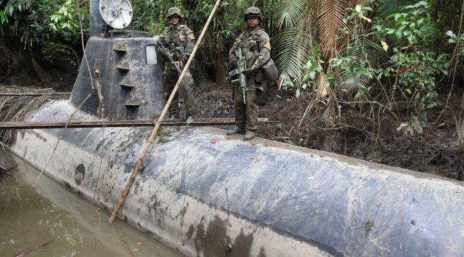
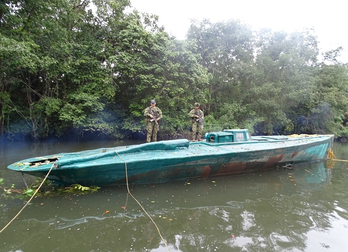
In recent months, several narco submarines have been seized in various Latin American states. For example, on 5 August, Ecuadoran marines located one in the Las Delicias area, close to the border with Colombia. For Colombia, a narco sub was seized in an operation by army and naval personnel in the San Juan and Baudó Rivers in the Choco department in late July. The platform, which was carrying approximately four tons of cocaine, was apparently manufactured by ELN rebels. The Colombian Navy explained that this was the first time a narco sub was operating in a river, and that it probably took some five to six months to be constructed. Not long after, in mid-August, the Colombian Navy located yet another narco sub, this time in the Nariño department and with the capacity to transport up to four tons of drugs. This one measured 14 meters, with a diesel motor and propellers, the Navy explained in a communiqué.

On the Ecuadorian Colombian border, the Colombian National Navy located and seized a submarine that had the capacity and autonomy to transport approximately five tons of cocaine. (Colombian National Navy photo)

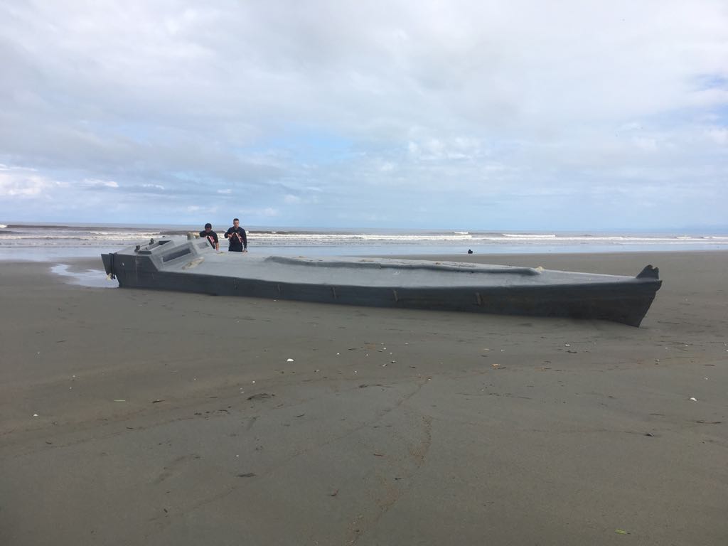
Narco subs have also been located in Central America. For example, a narco sub, reportedly 16 meters in length and capable of transporting up to five tons of drugs, was found in Guatemala in mid-April. Months later, in late July, the Costa Rican Coast Guard found a similar illegal platform on a beach. Local authorities believe that the vessel, with the capacity to transport up to four tons of drugs, had a motor problem and was discarded by the crew, until it washed ashore and got stuck in the sand.

Catching Them At Sea

The aforementioned examples highlight one fact. So far, the vast majority of narco-platforms are captured in the mainland (meaning either on dry land or “docked” in some body of water), either before they depart or upon arriving to their destination.

As far as the author has been able to find, in the past couple of years, there have only been a couple of narco subs intercepted in open waters. One was in July 2015, when during a “joint operation, the U.S. Navy, U.S. Coast Guard, and assets from the Customs and Border Protection Office of Air and Marine, intercepted a “narco submarine” off the coast of El Salvador,” Business Insider explains. The platform was carrying over 16,000 pounds of cocaine.

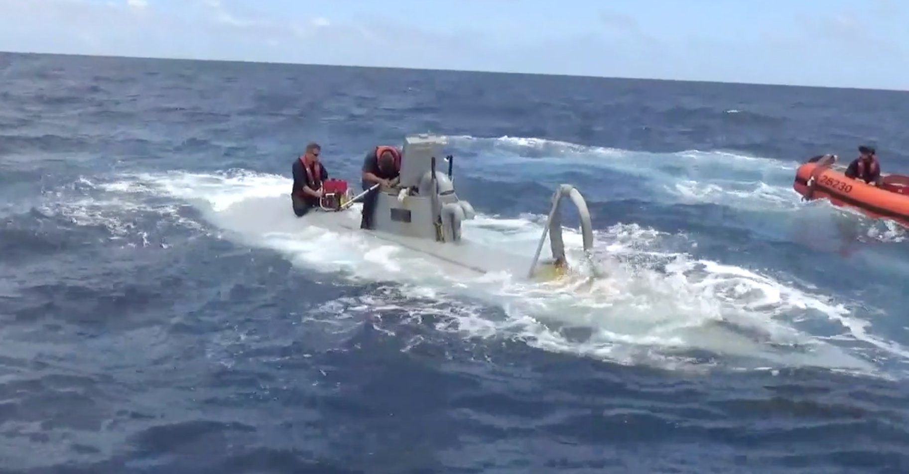
U.S. Coast Guardsmen board a narco sub as part of a drug seizure in September 2016. (U.S. Coast Guard photo)

More recently, in early September 2016, the U.S. Coast Guard Cutter Waesche intercepted a narco sub in the Pacific Ocean off the Central American coast. The Cutter reportedly launched two vessels and an armed helicopter in pursuit. U.S. personnel caught up with the sub, apprehended five suspects, and thwarted a scuttling attempt by pumping water out of the interior of the sub.” By preventing the sinking of the sub, the USCG seized more than 5,600 pounds of cocaine, with an estimated value of USD$73 million.

Who Finds The Narco Subs?

Nowadays, several Latin American and Caribbean navies and coast guards are undergoing a modernization process, which includes the acquisition of new platforms. For example, Colombia and Mexico are domestically manufacturing new fleets of patrol vessels. Christian Ehrlich, a director of intelligence for Riskop, a Mexican Strategic intelligence and risk control company explained to the author that  the Mexican Navy is in the process of adding Damen Sigma 10514 frigates to its fleet, “this will provide a decisive boost to Mexico’s Maritime Domain Awareness but unfortunately it will be some time before this system has an acceptable operational level” (construction for the first of the new frigates commenced in mid-August). Meanwhile The Bahamas is in the final stretch of its ambitious Sandy Bottom Project, via which it is obtaining a fleet of different patrol boats from Damen Group. Similarly, in late June IHS Jane’s reported that Louisiana-based shipbuilder Metal Shark and Damen will construct near coastal patrol vessels (NCPVs) for regional U.S. partners like “the Dominican Republic, El Salvador, Honduras, Costa Rica, Guatemala.” It is worth noting that Mr. Ehrlich, remarked how Mexico possesses aircraft like CASA CN—235 and Beechcraft King Air 350ER for ISR; Colombia also possesses similar assets.

Nevertheless, in spite of more modern navies and coast guards, locating narco subs at sea continues to be a problem. In an interview with the author, Gustavo Fallas, a journalist for the Costa Rican daily La Nacion, explained that “[Costa Rica] depends on the Americans to combat [narco submarines]. In 2006 we detained a submersible with three tons [of drugs] and it was thanks to an American frigate. In 2012 we chased another one in the Caribbean, and it was also after the Americans alerted us. For those reasons it is vital to have U.S. aid to locate these platforms.” Mr. Fallas added that Costa Rica must create a shield (meaning more vessels, radars, personnel) to prevent drug traffickers from using the country as a warehouse or transit path for drugs.

Unfortunately, Randy Pestana, a policy analyst at Florida International University’s Jack D. Gordon Institute for Public Policy, has a gloomy assessment about regional naval forces vis-à-vis narco subs. Mr. Pestana explained to the author how “relying on partner nations to stop, slow, or detain these shipments is difficult in itself as they do not have the necessary tools to do so unless provided by the U.S.” Of a similar opinion is Mr. Ehrlich, who stated to the author that “there isn’t a navy or coast guard in Central America with the [necessary platforms] to detect, follow and interdict [narco submarines].” 

In other words, Central American navies will continue to rely on the U.S. (be it SOUTCHOM or the Coast Guard) to monitor maritime areas in order to combat, among other threats, narco submarines. This is problematic, since, as Mr. Pestana remarked, even U.S. security agencies have limits to their abilities, particularly nowadays when the U.S. has other security operations and geopolitical concerns around the globe. Furthermore, there is the problematic and ever-present red tape, namely, “the inability of the U.S. to respond to an identified narco submarine without permission from higher leadership. This often led to the narco submarine to either get away, or move out of the U.S. areas of operation,” the FIU expert explained.

How To Find A Narco Sub

Locating a narco submarine at sea is a tricky business. In an interview with the author, Mario Pedreros, a retired Chilean Naval officer and an expert in airborne maritime patrol, provided an excellent analysis on this problem.

As previously mentioned, the term narco submarine is commonly utilized for these vessels, however they are not really submarines. As Mr. Pedreros explains, these platforms are semi-submersibles, meaning that they cannot go completely underwater, and if they can do so, it is for brief periods of time. (“Narco submarine” is still a catchier name than “narco-semi-submersible” though). However, even if these vessels cannot fully dive, they are nonetheless difficult to locate at sea. Mr. Pedreros explained how some of these platforms have electronic motors, which makes them more silent than diesel engines, making them harder to find with passive sonar. “When it comes to semi-submersibles, utilizing  sonar is not very efficient,” Mr. Pedreros concludes. Adding to the problem is that the vessel is pretty small, and “once at sea, the submersibles have 20 percent of their structure above the surface,” making them hard to pinpoint by radar.

A narco submarine found by the Costan Rican Coast Guard (MSP)

Mr. Pedreros recommended maritime patrol aircraft (MPA) as an ideal tool to combat narco submarines at sea, as these aircraft possess superior sensors and radars for intelligence, surveillance, and reconnaissance. Obviously, locating the target is only part of the solution, because then it has to be intercepted. “The aircraft must work with together with a vessel to capture the submersible. In other words, there are three components in this process: an aircraft (MPA), a vessel, and a light boat that can board the submersible and detain the crew,” the retired Chilean Naval officer explained. As previously discussed, various Latin American and Caribbean navies are acquiring OPVs with attached light boats, while Colombia and Mexico have platforms for maritime patrol, fulfilling the requirements by Mr. Pedreros; what is needed is greater multinational support, apart from additional platforms. 

The Future of the Narco Sub

It would be naïve to assume that recent successful operations by regional security forces will convince drug traffickers to stop investing in narco submarines. There is simply too much money to be made in drugs, and the subs cost only around USD$1 million to manufacture. Even if five narco subs are stopped, drug traffickers only need one or two successful deliveries to make up for their losses.

Moreover, recently seized narco subs show they are becoming more technologically advanced, including bigger in size so they can transport greater quantities of contraband. The narco sub seized in mid-July in Choco had space for a crew of four, measured 9 meters in length by 4 wide, had radars, stabilizers, ballast weights and was powered by over 100 batteries, according to the Colombian daily El Colombiano.

Indeed, the (brief) history of narco subs shows a trend towards modernization, particularly as drug lords are always looking for new methods to transport drugs, from Cessna aircraft and go-fast boats during the Pablo Escobar era to drones and narco subs nowadays (though of course, narcos continue to utilize the former as well). Mr. Pestana drives this home remarking how “top drug traffickers are relatively smart and have a good grasp on technology and history.” Moreover, the attractive wages narco-organizations can afford to pay means that they can hire “former engineers or other trade workers,” as Mr. Pestana explains, to continuously improve previous designs.

Final Thoughts

From a scholarly point of view, the appearance of the narco sub is a fascinating development as it highlights drug traffickers’ ingenuity as they continuously think of new ways of transporting their contraband. Unfortunately, this represents an ongoing problem for regional security forces, as new narco subs become more technologically advanced. Unfortunately, even though many narco subs have been stopped, it only takes one successful trip to make a large profit.

In spite of several successful operations, combating narco submarines requires both a multiagency and multinational strategy of its own. Mr. Ehlrich stresses the necessity to disrupt the construction of these platforms (which requires cooperation between police and military units). As for when narco submarines are at sea, the Greater Central American region requires united front, such as a regional anti-narco submarine task force. By combining resources, in which member states can contribute platforms to create the three-platform interception teams that Mr. Pedreros described, this unit would ideally be more successful at locating narco subs at sea, and not just in inland waterways. This will decrease the region’s dependency on the U.S., which Mr. Pestana and Mr. Fallas highlighted.

Unfortunately, narco submarines are a problem that will not sink, hence new strategies are needed in order to combat them more efficiently.

W. Alejandro Sanchez is a researcher who focuses on geopolitical, military and cyber security issues in the Western Hemisphere. Follow him on Twitter: @W_Alex_Sanchez

The author would like to thank the various experts that contributed to this commentary:

Christian J. Ehrlich, Director of Intelligence, Riskop; External Analyst, Mexican Navy

Gustavo Fallas, Journalist, La Nacion (Costa Rica)

Mario Pedreros, a retired Chilean Navy Officer, expert in aero-maritime patrol. He participated as a Tactical Coordinator Officer (TACCO) in different missions overseas onboard Chilean Navy P-3 Orion aircrafts. Missions include Anti Submarine Warfare, Anti Surface Warfare, Anti Terrorism missions and Search and Rescue operations. He is currently based in Washington, DC. doing consulting for several Defense and Security companies.

Randy Pestana, Policy Analyst, Jack D. Gordon Institute for Public Policy, Florida International University

The views presented in this essay are the sole responsibility of the author and do not necessarily reflect those of any institutions with which the author is associated.

Featured Image: Members of the Colombian Navy stand guard on a seized submarine built by drug smugglers in a makeshift shipyard in Timbiqui, Cauca department. Colombian authorities said the submersible craft was to be used to transport 8 tons of cocaine into Mexico. (REUTERS/Jaime Saldarriaga)

Chinese UAV Development and Implications for Joint Operations

By Brandon Hughes

Drone Diplomacy

On December 15, 2016, a United States Navy (USN) unmanned underwater vehicle (UUV) was seized by the Chinese People’s Liberation Army Navy (PLAN) about 80 miles from Subic Bay, Philippines (Global Times, December 17, 2016). This was met with quick negotiations and the agreed return of the $150,000 research drone following complaints to Beijing. The then President-elect, Donald Trump, condemned the action from his twitter feed and responded, “Keep it!”, further escalating the situation and casting an unknown shadow on the future of the U.S.-China relationship (Reuters, December 18, 2016). Almost immediately, the seemingly mundane deployment of UUVs and unmanned aerial vehicles (UAVs) in the South China Sea became a potential flashpoint in the ever-contentious territorial disputes.

Countering President Trump’s South China Sea endeavors is a legislative move by Beijing to require all foreign submersibles transiting in China’s claimed territorial waters to travel on the surface and or be subject to confiscation (China News Service, February 15, 2017). The proposed change to the 1984 China Maritime Traffic Safety Law compares to China’s East China Sea Air Defense Identification Zone (ADIZ), set up in 2013. Codifying domestic maritime law further adds a layer of validity in the event a UAV or UUV is captured while patrolling in a disputed area. Assuming a more severe response is unlikely from the U.S., Beijing may use the law as an excuse to reduce unmanned foreign Intelligence, Surveillance, and Reconnaissance (ISR) assets in its periphery, regardless of international opinion.

While demonizing foreign ISR activities, China continues to bolster its own ISR efforts for deployment in maritime disputes, foreign surveillance, and warfighting capacity. Advances in armed/unarmed and stealth UAVs will further integrate UAVs into the Chinese People’s Liberation Army (PLA) joint forces array. Advances such as satellite data-link systems not only extend the range of these assets, but also allow for a more seamless integration of command and control (C2). This further enhances relatively low cost and low risk surveillance mechanisms.

UAVs are already an emerging capability within the PLA, law enforcement, and civil agencies and are playing a more prominent role in operations. Real-world testing will refine the PLA doctrinal use of these systems. Control, direction of development, and interoperability in joint operations are all questions yet to be answered. Developing an understanding of how these systems are incorporated into the PLA force structure may give insight into developing doctrine and political considerations. A clear understanding of both may support a potential framework for de-escalating unmanned vehicle incidents between nations where China has interests.

Deployment

On January 20th, 2017, the Chinese North Sea Fleet (NSF) received a request for help with a distress call initiated from the rescue center in Jiangsu Province to aid in the search and rescue of 13 crew members aboard a Chinese fishing boat that sank around 6 am that morning. The PLAN NSF dispatched two navy frigates, the ‘Suzhou’ and ‘Ji’an’ to the East China Sea to search for the crew of the lost fishing vessel, named the Liaoda Zhongyu 15126. What made this search-and-rescue effort unique was the announcement that a surveillance UAV (make unknown) aided in the search.

The deployment of a UAV with two naval frigates, in coordination with a maritime rescue center, demonstrates the multi-functionality and capability of China’s UAVs. Additionally, it is likely the UAV was deployed from a non-naval platform due to the size of the helicopter deck and lack of hangar on a ‘Suzhou’ and ‘Ji’an’, both Type 056/056A corvettes (Janes, November 3, 2016; Navy Recognition, March 18, 2013). This proof of concept highlights the interoperability of air, land, and sea assets coordinating for a common purpose. What is unknown, specifically, is where the UAV was launched, who controlled it, and whether it was using a line-of-sight (LOS) or extended control system.

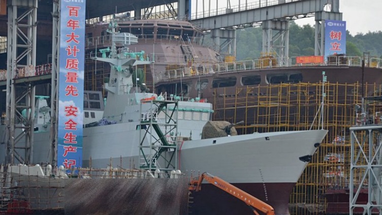
China’s 40th Jiangdao-class (Type 056/056A) corvette shortly before being launched on 28 October at the Huangpu shipyard in Guangzhou. (fyjs.cn)

Capitalizing on peacetime operations validates control and communication hand-offs and will integrate intelligence platforms, such as the PLAN’s newest electronic surveillance ship, the Kay Yangxin (开阳星 ), vastly expanding the reach of Chinese ISR. Additionally, integration of satellite-linked communication packages, utilizing the domestic constellation of GPS satellites known as the Beidou, or Compass, will continue to improve UAV navigation and targeting systems. These improved navigation and satellite aids will be integrated into existing UAV datalink systems and developed with future ISR systems in mind.

Command Guidance

The use of UAVs for military and ISR purposes can have unintended political and military consequences. The PLA command structure has always focused around centralization to retain political power over the military. It is fair to assume that the guidelines for deployment of UAVs used for strategic intelligence missions are developed at a high level. On November 26, 2015, President Xi Jinping rolled out one of the many updates to the Soviet-style military system that was part of a recent effort to make the PLA more efficient. According to Yue Gang, a retired Colonel in the PLA’s General Staff Department, placing all branches of the military under a “Joint Military Command” was the “biggest military overhaul since the 1950s.” On February 1, 2016, a few months after Yue Gang’s comments, China’s Defense Ministry Spokesman Yang Yujun stated that the PLA was consolidating seven military regions into five theater commands, a move likely to streamline C2 (China Military Online, February 2, 2016). The theater commands will be presided over by the Central Military Commission for overall military administration (See China Brief, February 4, 2016 and February 23, 2016).

Centralizing and reducing the number of commands will allow for each individual military component to focus on their own training objectives (China Military Online, February 2, 2016). This concept promotes component independence to enhance capability, but doesn’t talk to efforts to enhance integration of forces in joint military exercises. The logistical and financial burden of large-scale exercises naturally limit the frequency of exercises each region can conduct per year. What is not clear, yet important to understand for a high-end conflict, is how joint operations between military regions will be executed. Chinese Defense Ministry Spokesman Yang Yuju added that the new structure allows for the commands to have more decision-making power in responding to threats and requesting CMC support. (China Military Online, February 2, 2016).

Utilizing UAVs in regional operations to patrol disputed regions indicates that tactical control would be conducted at the highest level by a chief staff at a joint command center, but more likely relegated to a lower echelon headquarters element closer to the front lines. These lower-tiered units are likely bound by the strict left and right limits on where they patrol. Advances in simultaneous satellite data-link systems will allow for a more seamless handoff of ISR/strike assets between commands in a robust communications environment. The fielding of enhanced and interoperable satellite communications is likely to bolster the deployment of UAVs and further integrate them into PLA doctrine by supporting the “offshore waters defense” and “open seas protection” missions, as outlined in the PLA’s 2015 White Paper on Military Strategy (China Military Online, May 26, 2015).

Direct operational control of the PLA’s UAVs is generally given to the commander of the next higher echelon or to a commander on the ground. UAV technicians depicted on Chinese military websites tend to hold the ranks of junior non-commissioned officers E-5/OR-5 (Sergeant) to O- 2/OF-1 (First Lieutenant). This is similar to certain units of the United States Army, where platforms are directly controlled by enlisted and warrant officers. However, just like the U.S., guidance and direction is usually “tasked down” by a higher echelon, and UAVs with a strike package will likely be controlled or employed by officers under orders from above.

UAV units in the PLA are likely to be attached to a reconnaissance or communications company. Likewise, the PLA Air Force (PLAAF) and PLA Navy (PLAN) will likely have UAV-specific units. Advancements in communication will enable various command levels (i.e. company, battalion, brigade) to simultaneously pull UAV feeds and give guidance to the operator. Based on the size of various exercises, the training indicates UAV control is given down to the lowest level of command but under extremely strict guidance. Additionally, the authority to deploy or strike is likely to be held at the regional command level or higher. Specific rules of engagement are unknown, but those authorities will be developed through trial and error during a high-intensity conflict.

Interoperability

Communications infrastructure improvements are evident in the development of over-the-horizon satellite datalink programs and communication relays. The CH-5 “Rainbow” (Cai Hong) drone, for example, resembles a U.S. Atomic General MQ-9 “Reaper” and is made to function with data systems capable of integrating with previous CH-4 and CH-3 models (Global Times, November 3, 2016). The newest model is capable of 250 km line-of-sight datalink, with up to 2000 km communications range when linked into a secure satellite (Janes, November 7, 2016).

It is likely that improvements in interoperability will be shared among service branches. Recent developments in Ku-Band UAV data-link systems, highlighted during the 11th China International Aviation and Aerospace Exposition in November 2016, will further synchronize intelligence sharing and over-the-horizon control of armed and unarmed UAVs (Taihainet.com, November 2, 2016).

PLA Signal Units already train on implementing UAV communication relays (China Military Online, April 8, 2016). Exercises like these indicate a desire to increase the interoperability in a joint environment. UAVs with relay packages will improve functionality beyond ISR & strike platforms. Units traversing austere environments or maritime domains could utilize UAV coverage to extend the range of VHF or HF radios to direct artillery or missile strikes from greater distances. If keyed to the same encrypted channels, these transmissions could be tracked at multiple command levels.

Joined with a UAV satellite datalink, ground or air communications could be relayed from thousands of kilometers away. At the same time, a Tactical Operations Center (TOC) could directly receive transmissions before passing UAV control to a ground force commander. In a South China Sea or East China Sea contingency, UAVs could link unofficial maritime militias (dubbed “Little Blue Men”) via VHF to Chinese Coast Guard Vessels or Naval ships. These messages could also be relayed to PLA Rocket Force units in the event of an anti-access area denial (A2AD) campaign.

Capping off China’s already enormous communication infrastructure is the implementation of dedicated fiber-optic cables, most likely linking garrisoned units and alternate sites to leadership nodes. Future use technologies such as “quantum encryption” for both fiber-optic and satellite based communication platforms could lead to uninhibited communication during a military scenario (The Telegraph, November 7, 2014; Xinhua, August 16, 2016).

Functionality 

Based on the use of Chinese UAVs overseas and in recent exercises, UAVs will continue to be utilized on military deployments in the South China Sea for patrol and ISR support. In the event of a contingency operation or the implementation of an A2/AD strategy, UAVs will likely be used for targeting efforts, battle damage assessments, and small scale engagements. Against a low-tech opponent, the UAV offers an asymmetric advantage. However, the use of UAVs for something other than ISR would be greatly contested by more modern powers. UAVs are generally slow, loud, and observable by modern radar. Many larger UAVs can carry EW packages, although there is little information on how the datalink systems handle EW interference. Ventures in stealth technology, such as the “Anjian/ Dark Sword,” (暗剑) and “Lijian/ Sharp sword” (利剑) projects, would increase Beijing’s UAV survivability and first strike capability if deployed in a contingency operation (Mil.Sohu.com, November, 24, 2013). However, a large-scale deployment of stealth UAV assets is not likely in the near future due to cost and material constraints.

To reduce the risk of high-intensity engagements, China may expand its reliance on UAVs to harass U.S., Taiwanese, Japanese, Philippine, and Vietnamese vessels. Additionally, UAVs may be utilized abroad in the prosecution of transnational threats. So far, China has stuck to a no-strike policy against individuals, although it was considered as an option to prosecute a drug kingpin hiding out in Northeast Myanmar (Global Times, February 19, 2016). The “Rainbow/Cai Hong” variant and “Yilong / Pterodactyl,” made by Chengdu Aircraft Design & Research Institute (CADI), represent some of the more well-known commercial ventures used by the PLAAF (PLA Air Force) and sold on the global market. These variants are often used for ISR in counter-insurgency and counterterrorism operations (The Diplomat, October 6, 2016; Airforce-technology.com, no date).

Strike capability, aided by satellite datalink systems, is another growing capability of China’s UAV programs (Popular Science, June 8, 2016). In late 2015, the Iraqi army released images from a UAV strike against an insurgent element utilizing the Chinese-made export variant “Rainbow 4” (彩虹 4) running on a Window’s XP platform (Sohu.com, January 2, 2016; Popular Science, December 15, 2015). PLA UAVs already patrol border regions, conduct maritime patrols, and assist in geological surveys and disaster relief.

The arrival of off-the-shelf UAVs contributes to the growing integration of dual-use platforms. Technology and imagination are the only limits to the growing UAV industry. Additionally, the export of high-end military UAVs will only continue to grow as they are cheaper than U.S. models and growing in capability. The profit from these sales will certainly aid research and development efforts in creating a near-peer equivalent to the U.S. systems. For a struggling African nation held hostage by rebels (e.g. Nigeria) or an established U.S. ally in the Middle East (e.g. Jordan), the purchase of UAVs at a relatively low price will increase good will and allow for an operational environment to refine each platform’s own capability (The Diplomat, October 6, 2016; The Daily Caller, December 2, 2016).

Conclusion

UAVs for military operations are not new, however, improvements in lethal payloads, targeting, and ISR capabilities will change the role in which UAVs are utilized. Considering China’s own drone diplomacy, the deployment of UAVs is as much a political statement as it is a tactical platform. State-run media has highlighted the successes of its drone program but has not been clear on who, or at what command level, operational control of UAVs is granted. Due to Beijing’s standing policy against lethal targeting, release authority is most likely relegated to the Central Military Commission, or even President Xi himself.

The extent that doctrine has been developed in planning for a high or low-intensity conflict is still unclear. The advent of satellite data-links and communication relays means the tactical control of UAVs may be seamlessly transferred between commanders. The rapid development of UAVs will continue to be integrated into the joint forces array but must be done as part of an overall doctrine and C4ISR infrastructure. Failure to exercise their UAVs in a joint environment will affect combined arms operations and reduce the PLA’s ability to synchronize modern technology with centralized command decisions and rigid doctrine.

Brandon Hughes is the founder of FAO Global, a specialized research firm, and the Senior Regional Analyst-Asia for Planet Risk. He has previously worked with the U.S. Army, the Carnegie-Tsinghua Center for Global Policy, and Asia Society. He is a combat veteran and has conducted research on a wide variety of regional conflicts and foreign affairs. Brandon holds a Masters of Law in International Relations from Tsinghua University, Beijing and has extensive overseas experience focused on international security and U.S.-China relations. He can be reached via email at DC@FAOGLOBAL.com.

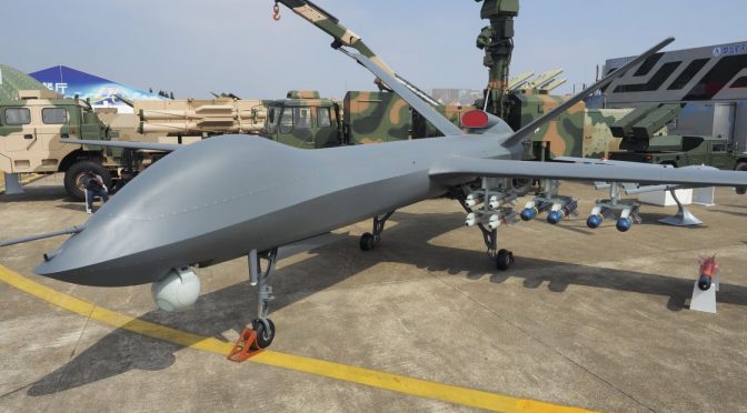
Featured Image: CASC’s CH-5 strike-capable UAV made its inaugural public appearance at Airshow China 2016 (IHS/Kelvin Wong)

Get Ready For The Spectrum Melee

By Douglas Wahl and Tim McGeehan

A New Era

In 1903, Guglielmo Marconi, the father of modern radio, was demonstrating an improved version of his device for wireless telegraphy at the Royal Institution in London. He had planned to transmit a message in Morse code from 300 miles away in Cornwall to the lecture hall in London, where it would be received and deciphered by an associate in front of the waiting audience. As the demonstration commenced the machine began receiving a signal. It repeatedly spelled the word “rats” before beginning a message that scandalously mocked Marconi: “there was a young fellow of Italy, who diddled the public quite prettily…”1 The press soon reported that someone had made a “deliberate and cowardly attempt to wreck the experiment.”2

This event was sensational because this version of Marconi’s wireless had been advertised as being specially tuned and therefore secure from outside interception or interference. The ‘scientific hooligan’ behind the interference was Nevil Maskelyne, a local magician and wireless competitor, who sought to demonstrate that the radio signals were neither as private nor as secure as Marconi had claimed.3

Although technology has progressed significantly over the last 100-plus years, this episode still has serious ramifications today, as it could be considered the first episode of communications electronic attack (EA) or spoofing. Maskelyne, who had set up his own transmitter nearby, seized control of the electromagnetic spectrum (EMS) and disrupted Marconi’s communications signal by overpowering it and injecting his own signal in its place, thereby delivering the new message to the intended receiver. Maskelyne’s 1903 stunt had also heralded a new era in warfare, where the EMS itself could and would be a contested battleground. Today, both non-state actors and adversary nations seek to use EA to deny the use of the EMS, which has become critical to both our daily lives and military operations. Fortunately, disruptive technologies are emerging to fill the urgent need to sense, characterize, and exploit the EMS, while at the same time deny it to our adversaries.

Our Reliance

As U.S. forces continue to become more technologically advanced, we continue to become more reliant on access to the EMS. Communications, sensor feeds, and command, control, and intelligence data all flow through the EMS and we have become increasingly addicted to the bandwidth available in permissive environments, with applications ranging from routine radio traffic to fire control radars. This demand will only increase.

Now, momentum is building in the drive to decouple sensors from shooters, further increasing reliance and demand on assured access to the EMS. The Naval Integrated Fire Control–Counter Air (NIFC-CA) capability distributes the AEGIS shipboard fire control data across diverse networks of remote sensors. This provides the AEGIS combat system the means to achieve independent engagement of over-the-horizon (OTH) targets with the Standard Missile (SM-6).4 In the future, engagement information will be passively provided to AEGIS from other platforms networked into NIFA-CA. Surface picket ships, aircraft like the E-2D Advanced Hawkeye, and future Unmanned Aerial Vehicles (UAV) will all be threads in the Navy’s kill web. The first generation of NIFC-CA is already here; the USS THEODORE ROOSEVELT Carrier Strike Group completed its deployment as the first NIFC-CA enabled strike group in 2015.5

Net-Enabled Weapons (NEW), like the Tactical Tomahawk that can be launched at a target and then directed inflight to a new, different target, are likewise EMS dependent.6 Future NEW weapons systems will no longer be confined to a set system of dedicated sensors, but will instead draw on the many sensors available in kill webs. These weapons will include swarms of unmanned platforms and loitering munitions that can circle overhead until being directed into a target. Similarly, our existing Tactical Data Links (Link 4A, Link 11, and Link 16) and NIFC-CA are spectrum dependent; they must be able to network, communicate, and exchange data. Our adversaries know this too and are investing in capabilities that which specifically target our access to the EMS itself as part of their Anti-Access/Area Denial (A2/AD) strategies.

In general, the A2/AD model is based on the tenants of both Clausewitz and Mahan in that it is focused on controlling the battlespace and attrition of the adversary’s forces. To counter this the surface Navy continues to develop its “distributed lethality” concept. Distributed lethality explores how dispersing forces could enhance warfighting by “countering A2/AD’s attrition model through maneuver warfare’s intent to probe for weakness” and once found, exploit it, and disable or destroy the adversary’s forces.7 Dispersion creates more room to maneuver, and “strains the anti-access mission and forces the adversary into executing area denial simultaneously.”8 However, distributed lethality will exacerbate the burden on the EMS as the distributed forces must be able to communicate and coordinate in order to mass effects when and where required.

That said, distributed lethality has a role to play in denying the EMS to our adversaries. Sun Tzu placed high value on spies and defeating adversaries before the battle. Distributed forces can test and stimulate adversary intelligence, surveillance, and reconnaissance (ISR) capabilities to determine their scope and breadth in preparation for follow-on operations. Mapping the spectral dependencies of adversary systems before conflict is key to configuring our kill web, disrupting our adversary’s Command, Control, Communications, Computers, Intelligence, Surveillance, and Reconnaissance (C4ISR) systems, and breaking their kill chains before weapons are launched.

Spectrum control is not a “future” issue; it is an urgent issue that has been long neglected and must be addressed now – as observed in Russia’s operations in Ukraine. In 2015, then-Deputy Secretary of Defense Bob Work recently summarized the situation stating “Ukrainian commanders reported to us that, within minutes of coming up on the radio net, they were targeted by concentrated artillery strikes…  They [Russian backed separatists] jam GPS signals, causing Ukrainian UAVs to drop out of the sky. And they jam proximity fuses on artillery shells, turning them into duds.”9  Likewise in the recent past, Iran claimed to have hacked into the mission-control system of a Lockheed Martin RQ-170 SENTINEL UAV flying near their Afghan border, taken control of it, and successfully landed it in Iran.10 Tehran claimed that they jammed the UAV’s communications and when it switched to autopilot they spoofed its GPS system with false coordinates, fooling it into thinking it was close to home and landing in Iran.11 Regardless of the veracity of Iran’s version of this story, it illustrates the mindset of our adversaries. We need to ensure that the multiple entry points and data links required to fully realize concepts like “distributed lethality” don’t turn them instead into “distributed vulnerability.” Ukraine is a cautionary tale of real-world vulnerability and the A2/AD investments of potential adversaries signal intent for more of the same. As part of its mandate to ensure All Domain Access, the U.S. Navy must be able to sense, characterize, and exploit a contested EMS, while at the same time deny it to our adversaries – we need to own the spectrum.12

The Technology

Real-Time Spectrum Operations (RTSO) is a new and highly automated capability theorized to provide warfighters the ability to understand and drive their forces’ use of EMS resources. RTSO predictions are based on three mainstays: physics algorithms, sensor characteristics, and numerical weather predictions (NWP). All three must work together for RTSO to transition from theory to reality:

Sense. We need sensors distributed throughout the battlespace to constantly measure the environment and accordingly adjust our weapon systems, continuously tailoring their settings to optimize performance. The “environment” includes both the ambient EM signals and the physical environment through which they propagate. As a forward deployed service, the Navy often operates in data-sparse regions, thus every platform, manned and unmanned, must be a sensor. We need environmental and ES sensors on all of our ships and aircraft from autonomous surface vehicles to UAVs and from logistics ships to strike fighters. All this data has to be collected, processed, and most importantly sent back to our modeling and fusion centers to provide information for optimizing future operations.

Massive amounts of environmental data can also be gathered “through the sensor,” in addition to the actual desired signal.13 This is analogous to the “by-catch” of commercial fishing, where additional marine species are caught in addition to the type of fish targeted by the fisherman. The bycatch is often discarded at sea, resulting in a wasted resource. The same happens during the processing of sensor data, where the extraneous signals are removed. However, this resource can be not only salvaged but used to provide a new capability. For example, Doppler radar weather data can be extracted from SPS-48 air search radars of our big-deck aviation platforms as well as from the SPY-1 radar of the AEGIS weapon system. With the multitude of sensors available there are many untapped sources of environmental data.

We also need to take advantage of commercial off the shelf (COTS) data collection systems, such as the Aircraft Meteorological Data Relay (AMDAR) program that has been adopted by over 40 commercial airlines.14 AMDAR uses existing aircraft sensors, processing systems, and communication networks to collect, process, format, and transmit meteorological data to ground stations where it is relayed to National Meteorological and Hydrological Services to be processed, quality controlled, and transmitted on the World Meteorological Organization’s Global Telecommunications System. The Navy could incorporate a similar system into its platforms to collect and transmit data on both the EMS and physical environment.

Characterize. Once we have the environmental data in hand, we can use it to characterize the environment. In the EMS this includes mapping the frequencies in use by all actors and inferring their operations and intent. For the physical environment it includes incorporating collected data into our NWPs to forecast the future physical environment itself, which can then be fed into the EMS analysis to predict how sensors and receivers will respond to new conditions. To do this effectively we must invest in supercomputing and shared processing. In the future, an advanced version of Consolidated Afloat Networks and Enterprise Services (CANES) and the Navy’s Tactical Cloud may provide the ability to have a supercomputer on each of our large deck surface platforms, enabling this capability even when reach back data-links are degraded or denied.15

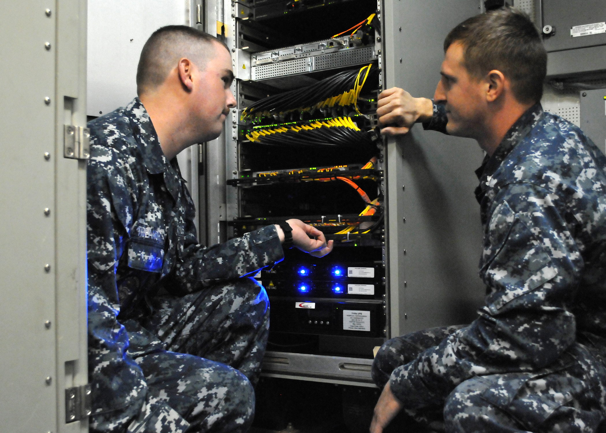
SAN DIEGO (Nov. 19, 2013) Information Systems Technician 2nd Class Anthony Pisciotto, right, familiarizes Information Systems Technician Seaman Cameron Treanor with the Consolidated Afloat Ships Network Enterprise Services (CANES) system in the Local Area Network (LAN) Equipment Room aboard the guided missile destroyer USS Milius (DDG 69).  (U.S. Navy photo by Rick Naystatt)

Exploit. Once we understand the environment, we must exploit it by adapting our tactics. We need to “seize spectral high ground” and apply maneuver warfare principles to the spectrum to assure our bandwidth. Understanding the environment better than our adversaries will allow us to evaluate trade-offs and turn Battlespace Awareness into Information Warfare. Only this will allow our forces to have the operational advantage and overmatch our adversaries by fully integrating the Navy’s information functions, capabilities, and resources to optimize decision-making and maximize warfighting effects.

Deny. Finally, we need to deny the spectrum to our adversaries by further developing systems such as the Surface Electronic Warfare Improvement Program (SEWIP) and delivering the Next Generation Jammer. We must expand the HAVE QUICK radio system with the Defense Advanced Research Projects Agency (DARPA) Analog-to-Digital Converter (ADC)16 to provide anti-jam, frequency hopping secure communications that use ultra-high frequency (UHF) and require smaller antennas.

We must also deny our spectral emissions to our adversaries. A good rule of thumb is that if your radar can range 100 nautical miles, the adversary can detect it at least to 200 nautical miles. With an eye toward preventing unwanted detection, we need to revisit how we communicate. With the widespread use of direction finding in World War II, radio silence was a normal operating procedure and information was passed between ships using semaphore. Today, Laser Communication Relay Systems exist that are both extremely secure and have high data rates. As a bonus, these systems use less energy and when paired with satellites, these line-of-sight systems have unlimited potential.

Risks, Barriers, and Integration

There are multiple risks and barriers to integrating these technologies. From the operational aspect, these technologies have to interface with currently fielded systems. Spectrum management and deconfliction are already ostensibly done through Operational Tasking Communications (OPTASK COMMS) and the Afloat Electromagnetic Spectrum Operations Program (AESOP), but we still routinely have electromagnetic interference (EMI) between our systems. The commander of the Air Force’s Space Command said that in the first 11 months of 2015 there were over 261 cases of satellite downlink jamming. When asked how many of these incidents were caused by actual adversaries, he responded “I really don’t know. My guess is zero,” and that the real cause was “almost always self-jamming.”17 In a way, this suggests that the problem might be as much cultural as it is technical. A military workforce that has grown up in the age of unlimited and uncontested bandwidth is less aware of their EMS operations, filling (and over-filling) all available bandwidth with little discipline. This nonchalance will be difficult to overcome, but the fielding of new high-end capabilities must be accompanied by a change in mindset in order to realize maximum benefit.

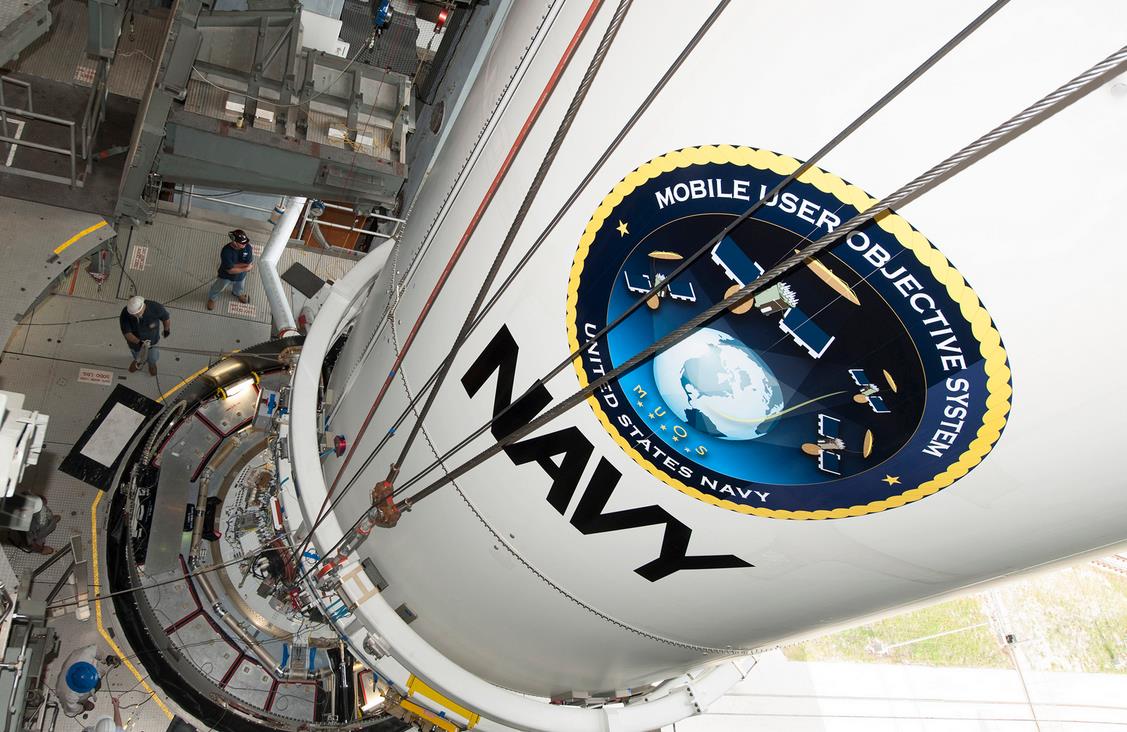
CAPE CANAVERAL, Fla. (Aug. 19, 2015) The U.S. Navy’s fourth Mobile User Objective System (MUOS) satellite, encapsulated in a 5-meter payload fairing, is mated to an Atlas V booster inside the Vertical Integration Facility at Cape Canaveral’s Space Launch Complex-41. (Photo courtesy United Launch Alliance/Released)

EMI is not confined to just our own systems. Used indiscriminately, military radar systems may be strong enough to interfere with wireless systems, air traffic control radars, and cellphone systems. In the late 1980s, a Dutch naval radar caused the Supervisory Control and Data Acquisition (SCADA) system of a natural gas pipeline near the naval port of Den Helder to open and close a valve, ultimately leading to an explosion.18 Despite a crowded spectrum at home, the U.S. government continues to sell off bandwidth and civil users continue to encroach upon what remains. The net effect is an increasing limitation on the military’s ability to effectively train stateside.

Another barrier to progress in the acquisition and integration of new systems is the U.S. military’s acquisition system itself. It is too slow and vulnerable to espionage and theft. In military acquisitions the mantra is that “we don’t fight the enemy, we fight the budget,” which is often shaped more by political considerations than by the needs of the services. In 2016, Assistant Secretary of the Navy for Research, Development, and Acquisition Sean Stackley testified that Navy needs more authority to spend on experimentation and prototyping (not necessarily programs of record), because “the pace of technology is outpacing” the services’ ability to work their way through the “long and lengthy process” of fielding weapons systems.19

In terms of security, plans to assure access to the EMS should begin before these systems are even fielded. Espionage and theft are rampant from cleared defense contractors, evidenced by the striking similarity of ‘new’ adversary platforms to our own. However, the threat even extends to university and research labs. Today’s high-tech research becomes tomorrow’s classified projects and programs; we need to ensure these capabilities are protected throughout their entire development as an early compromise of one of these technologies gives our adversaries years to either improve upon it or develop a counter.

Investment

As we wage the battle of Washington, we need to prioritize investment in the capabilities described above. Roadmaps and plans are aspirational without resources and in this constrained fiscal environment there are many promising programs that will fall “below the cut line” and not be funded. However, capabilities that will enable us to own the spectrum when and where required are just as important, if not more important, than any particular ship or handful of strike fighters. At the cost of $100-plus million dollars per unit, would one F-35 Joint Strike Fighter be missed if the Navy was to reallocate this funding towards a RTSO program? If we lose the battle for the spectrum, many platforms like these will be seriously impaired and vulnerable, if not completely blind, deaf, and dumb and thus defenseless.

Luckily, there have been recent admissions from senior Department of Defense leadership that these types of capabilities are critical as we move forward. This support may help identify funding for rapid transition or similar acquisition “fast track” opportunities to get these technologies to the Fleet quickly. However, the true level of commitment will be clear in the budget.

Conclusion

The spectrum is a battleground whose control is absolutely fundamental to warfare in the information age. The U.S. military must seize upon emerging technologies that will enable it to maintain superiority in this congested and contested environment. To paraphrase Sun Tzu, “Know the enemy, know yourself; your victory will never be endangered. Know the electromagnetic terrain, know the weather; your victory will then be total.”  The spectrum is no longer an “enabler” to military operations; it is the battlefield.

Douglas T. Wahl is the METOC Pillar Lead and a Systems Engineer at Science Applications International Corporation.

Tim McGeehan is a U.S. Navy Officer currently serving in Washington.  

The ideas presented are those of the authors alone and do not reflect the views of the Department of the Navy or Department of Defense.

References

1. Lulz, Dot-dash-diss: The gentleman hacker’s 1903, New Scientist, https://www.newscientist.com/article/mg21228440-700-dot-dash-diss-the-gentleman-hackers-1903-lulz/

2. Staff Writer, Further Developments in Wireless Telegraphy, The Evening Telegram, June 29, 1903,  https://news.google.com/newspapers?nid=35&dat=19030629&id=j6kHAAAAIBAJ&sjid=kjoDAAAAIBAJ&pg=6469,6605289&hl=en

3. Staff Writer, Interesting Marconigrams, Evening Post, August 15, 1903, http://paperspast.natlib.govt.nz/cgi-bin/paperspast?a=d&d=EP19030815.2.53

4. Jeffrey H. McConnell, (14 NOV 2013) Naval Integrated Fire Control–Counter Air Capability‐Based System of Systems Engineering, Naval Surface Warfare Center, Dahlgren Division,  http://www.acq.osd.mil/se/webinars/2013_11_14-SOSECIE-McConnell-brief.pdf

5. Sam LaGrone, (5 March 2015), “Roosevelt Carrier Strike Group to Depart for Middle East on Monday in First NIFC-CA Deployment”, http://news.usni.org/2015/03/05/roosevelt-carrier-strike-group-to-depart-for-middle-east-on-monday-in-first-nifc-ca-deployment ; Final Ship of Theodore Roosevelt Carrier Strike Group Returns Home, 14 December 2015, http://www.navy.mil/submit/display.asp?story_id=92414

6. Managing the Net-Enabled Weapons Kill Chain Testing in a Live-Virtual-Constructive Environment, Joint Command and Control for Net-Enabled Weapons (JC2NEW), Joint Test, Alexandria, VA, 22311.

7. Dmitry Filipoff, Distributed Lethality and Concepts of Future War, CIMSEC, January 4, 2016 https://cimsec.org/distributed-lethality-and-concepts-of-future-war/20831

8. Dmitry Filipoff, Distributed Lethality and Concepts of Future War, CIMSEC, January 4, 2016 https://cimsec.org/distributed-lethality-and-concepts-of-future-war/20831

9. Bob Work,  Deputy Secretary of Defense Speech at CNAS Defense Forum, December 14, 2015 http://www.defense.gov/News/Speeches/Speech-View/Article/634214/cnas-defense-forum

10. David Axe, Nah, Iran Probably Didn’t Hack the CIA;s Stealth Drone, Wired, http://www.wired.com/2012/04/iran-drone-hack/

11. Adam Rawnsley, Iran’s Alleged Drone Hack: Tough but Possible, Wired,  http://www.wired.com/2011/12/iran-drone-hack-gps/

12. A Cooperative Strategy for 21st Century Seapower:  Forward, Engaged, Ready, March 2015.

13. Tim Gallaudet, Charting the ‘Invisible Terrain’ Proceedings, July 2015.

14. https://www.wmo.int/pages/prog/www/GOS/ABO/AMDAR/AMDAR_System.html

15. The Navy Wants a Tactical Cloud, http://www.defenseone.com/technology/2014/09/navy-wants-tactical-cloud/95129/

16. Thomas Gibbons-Neff, “This new DARPA chip could give U.S. a leg up in electronic warfare”, 12 January 2016, The Washington Post.

17. Syndey Freedberg, U.S. Jammed Own Satellites 261 Times; What if Enemy Did?, Breaking Defense, December 02, 2015, http://breakingdefense.com/2015/12/us-jammed-own-satellites-261-times-in-2015-what-if-an-enemy-tried/

18. IBID Zetter

19. John Grady, Sean Stackley Asks Congress for More Department of Navy Flexibility in Acquisition, 7 January 2016, USNI News, http://news.usni.org/2016/01/07/sean-stackley-asks-congress-for-more-department-of-navy-flexibility-in-acquisition#more-16380

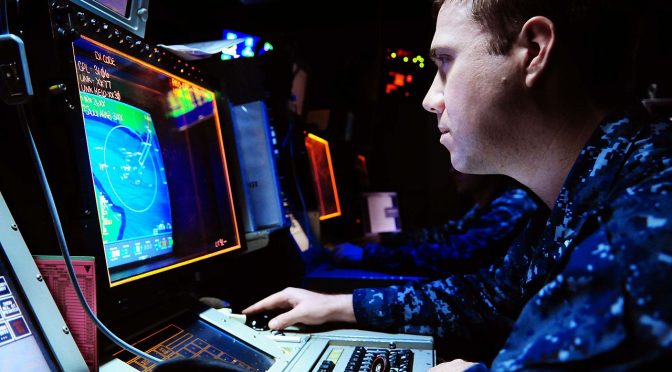
Featured Image: ARABIAN SEA (June 11, 2011) Operations Specialist 2nd Class Stephen Sittner, from Denver, identifies and tracks air contacts in the Combat Direction Center of the aircraft carrier USS Ronald Reagan (CVN 76).  (U.S. Navy photo by Mass Communication Specialist 3rd Class Alexander Tidd/Released)

Fostering the Discussion on Securing the Seas.