All posts by Guest Author

Information Warfare is Integrated Warfare

By Corey Grey

When the USS Carney (DDG-64) downed the opening salvos of Houthi land-attack cruise missiles and drones over the Red Sea in October, the Pentagon hailed the feat as a “demonstration of the integrated air and missile defense architecture.” It was much more than that. Long before Carney’s medium-range Standard Missile-2s (SM-2s) erupted from their launch cells, Information Warfare (IW) capabilities provided crucial combat support to neutralize the inbound threats, enabling these shots with critical IW equipment, intelligence, internal communications, and electronic support. In short, naval IW—with the exception of launching the SM-2s— ensured critical strategic objectives. This event, and many others like it, demonstrates the underappreciated depth of IW for the current and future fight.

As the military grapples with recruiting shortfalls, the IW community has a compelling story to counter: integrated warfighting. This narrative, epitomized by Carney and other units’ recent successes, covers efforts across a diverse range of specialties that are too often seen in isolation: meteorology/oceanography, cryptology, intelligence, communications, space, and cyber operations. As important as the success of these individual elements are for the U.S. Navy, the real impact relies on the full integration of information forces and capabilities through improved recruiting, training and career paths integration, as underscored by the recent Department of Defense Strategy for Operations in the Information Environment (SOIE).

With this in mind, the U.S. Navy should take concrete steps to further promote an integrated warfighting ethos which better incorporates all elements of the IW community, starting from initial officer training to senior level carrier strike group operations. By defining what it means to be an integrated information warfighter rather than just being an Intelligence Specialist, Cryptologist, Meteorologist, or Information Professional, the IW community will better educate, train, and most importantly, recruit the next generation of IW personnel. Equally important is the need to enhance retention. To further maintain the impressive cadre of IW personnel in service, the Navy should improve its career opportunities with better advanced training and cross-detailing availability. In the aftermath of these changes, IW will be better positioned to dominate the information environment and enable mission success.

Shared Identity

The Navy’s IW community currently boasts favorable recruiting but should do more to meet the growing demand from supported operational forces. Vice Admiral Kelly Aeschbach, Naval Information Forces commander, recently confessed that “our biggest challenge right now is facing demand. We are needed everywhere, and I cannot produce enough information warfare capacity and capability to disrupt it everywhere that we would like to have it, and so that remains a real pressing challenge for me: how we prioritize where we put our talent and ensure that we have it in the most impactful place.”

Better recruiting starts with stronger, more compelling messaging. Aviators join to fly, submariners join to drive boats, surface warfare officers to drive ships, but there is less consistency in why each IW officer volunteers for service. Future IW candidates require a holistic message that knits together the disparate range of specialties that encompass the community.

The Navy’s maritime sister service provides a clear model for messaging, encapsulated in five simple words: Every Marine is a Rifleman. This iconic phrase is based on the foundational infantry skills every Marine receives, regardless of their specialty, and the expectation that every Marine can serve in the capacity of a rifleman if called upon to do so. This narrative and ethos is so effective that last year, without any substantial increase in compensation or incentives, the Marine Corps exceeded its recruitment goals while the other services experienced shortfalls not seen in decades. Commandant of the Marine Corps, General Smith said it best: “Your bonus is that you get to call yourself a Marine.”

Sadly, the IW community lacks the clarity of the Marine Corps model. Instead, the community prescribes to an identity built around specialization. Personnel share the title of Information Warfighter, which encompasses seven officer designators and eight enlisted ratings, but the same personnel are only expected to master their own specific capability. Case in point, Congress recently compelled the Navy to produce a new maritime cyber warfare officer designator and cyber warfare technician rating due to a lack of specialization by Cryptologic Warfare Officers and Cryptologic Technicians. This change stands as criticism to the IW community as a whole as it raises questions towards their unified identity. Cyber operations cannot exist without Signals Intelligence (SIGINT) yet the Navy decided to separate the integrated IW capacity under two officer designators (1810, for SIGINT, and 1880, for Cyber Operations). Officers who joined the Navy to perform cyberspace and SIGINT functions should not have to laterally transfer to a new community to ensure they can continue to deliver and lead cyber operations. The capriciousness of this shift only leads to frustration and difficulties in recruiting and retaining talent.

Overall, the true lesson from all this is not the need to create more IW communities, but instead the need to produce a capable warfighter that can understand and provide full IW effects to the operational commander regardless of designator. Many will look to the Information Warfare Commander (IWC) position, both afloat and at maritime operation centers ashore, as the model for this vision, but how does the U.S. Navy assure future and present IW professionals that they will be properly trained to support or even become this commander?

Solutions for Integration

Although the Information Warfare Commander (IWC) for amphibious readiness groups and carrier strike groups drives the Navy towards a more integrated IW force, there is no consolidated career pipeline to properly prepare a rising officer to leverage all IW capabilities. Moreover, if that commander has done well to master his or her specialty, it comes at the opportunity cost of lesser competence in commanding an integrated force. More training is needed to ensure junior IW professionals feel competent, confident, and motivated to stay in the Navy through this milestone. Lengthening and strengthening courses that all IW officers can attend, such as the Information Warfare Officer Basic Course and Information Warfare Officer Intermediate Course, would better develop and refine how every IW specialty supports the fight while also fostering an integrated warfighting ethos, starting from the officer corps and spreading to the enlisted ratings. These trainings should highlight integrated IW operations for air, surface, sub-surface, naval special warfare, amphibious readiness group, and carrier strike group operations while leveraging evolving initiatives such as live, virtual, and constructive training. IW leaders would then be well postured to motivate and further develop the diverse cadres within the larger community.

Beyond better messaging and training is the need for increased cross-detailing, that is, assigning an officer from one IW discipline into a billet normally filled by another. The aim of this process is to ensure greater exposure and integration as IW officers broaden their experiences serving in capacities that are not traditionally aligned with their core skills. However, the IW force is not fully exposed or integrated because few leadership positions at the O-4 to O-6 levels are available for cross-detailing. These few billets are highly selective; consequently, most IW officers will never work outside their designator. The largest pool of IW officers, namely junior officers, are thus unaware of the full breadth and scope of the IW community due to a lack of experience and exposure. One especially important key to retaining talented people is to provide broader career opportunities, especially when they are most impressionable and likely to decide whether to stay in the Navy or leave for industry.

In a time when IW officers are filling senior roles once thought exclusive to unrestricted line officers, such as chief of staff, maritime operations center directors, and IWC, the question stands how they have not fully integrated within their own community. It is inconsistent to think that an Intelligence Officer can serve as the Commanding Officer of the largest Navy Information Operations Command (traditionally a Cryptologic Warfare Command) but a cryptologist cannot serve as a numbered fleet N2/N39. The same can be said for a number of other IW billets at every level. Certainly there are some positions that are best served by specific designators but this should be the exception and not the rule. The lack of cross-detailing creates identity challenges that degrade both community effectiveness and retention.

More deliberate solutions for integration, such as consolidating new accession IW officers under one broad designator and then having them select specific community tracks later in their careers, similar to the Navy’s Human Resource Officer community, should also be considered. Officer candidates would be presented with the full IW portfolio and then have the opportunity to select and support any of the various disciplines. After a set number of years being exposed to the broader community, the officer would then select a designator track from one of the IW disciplines. This could be implemented via a competency based selection process as determined from additional qualification designations (AQDs), type of assignments completed, and personal preference. The framework would enable deliberate career development, preparing officers to better succeed in more challenging IW assignments while also offering greater exposure and integration to succeed in senior level Information Warfare Commander positions.

Five Simple Words

With these solutions and more in this vein, operational commanders will be able to look to a fully pinned IW professional and receive an authoritative voice in navigating throughout the entire IW domain. This expectation should not be reserved for the select few who serve as IWC but for each individual who belongs to the IW community. IW is a compilation of many specialties in one vast domain and each sailor must be able to understand their place within it. As each member of a ship’s crew understands his or her place in maintaining a warship afloat, so must all IW professionals as they sail through the information environment.

The generalist versus specialist argument is not novel, yet these assertions go beyond that. The Navy must refit the individual IW operator’s identity towards integrated domain operations. Attracting and retaining qualified talent to meet the heavy IW demand necessitates a full commitment towards greater interconnectedness. Fourteen years have passed since the establishment of the IW community and while progress has been made, great strides still need to be achieved towards full synthesis. Without a comprehensive approach that meaningfully gets to how the IW community better integrates from messaging, to training, to detailing. It is questionable whether the Navy will indeed be capable of recruiting and retaining forces for the many and varied challenges along the horizon. More must be done and a good place to start is by putting the community’s initiatives and visions into five simple words “Information Warfare is Integrated Warfare.”

Lieutenant Corey Grey is a cryptologic warfare officer, qualified in information warfare and submarines. He holds a master’s degree from the Naval War College in defense and strategic studies with an Asia-Pacific concentration. He is assigned as the cryptologic resource coordinator on the staff of Commander, Submarine Group Seven.

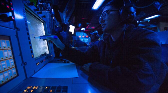
Featured Image: PACIFIC OCEAN (Aug. 25, 2023) Operations Specialist 2nd Class Itzel Ramirez identifies surface contacts in the combat information center of the Arleigh Burke-class guided-missile destroyer USS Paul Hamilton (DDG 60) in the Pacific Ocean, Aug. 25, 2023. (U.S. Navy photo by Mass Communication Specialist 2nd Class Elliot Schaudt)

The Expeditionary Sea Base as a Nucleus for Regional Maritime Security Learning and Cooperation

By Commander Daniel T. Murphy, U.S. Navy

Knowing How to Coalesce

The Office of the Director of National Intelligence Annual Threat Assessment has yet again predicted an increasingly complex global security environment and recommends that U.S. military services collaborate more with regional allies.1 In recent years, U.S. forces conducted additional and more extensive bilateral and multilateral joint training, exercises, and operations across all geographic combatant commands, especially in the maritime domain. As a result, the world’s waterways remained relatively safe. When threats did emerge or increase in specific localities (as now in the Red Sea), regional coalition navies, already regularly training and exercising together, responded with scaled-up operations, adjusted their tactics as necessary, and imposed a settling of the security situation. Sometimes, we (U.S. forces) take a leading role, and other times, we do not. Either way, the world’s maritime services seem to intuitively know how to coalesce. This is good news because the ability to coalesce can be built upon, especially in the problematic regions of the world. So, what enables that coalescence?

Expeditionary Sea Bases as an Organizational Learning Nucleus

A 2019 study explored how organizational learning within the U.S. maritime services (both Navy and Coast Guard) and with partner countries is partly the reason for that coalescence. Organizational learning is a theory, a body of frameworks and methods by which organizations or groups of larger enterprise-level organizations learn and improve over time. The study presented evidence that organizational learning in the maritime security domain evolves in stages, and the evolution can be accelerated through purposefully dedicated organizational learning elements or “nuclei.” Over time, “nuclei” inject and normalize organizational learning principles and methods into an organization’s day-to-day routines. Some examples are the Navy’s various schoolhouses dedicated to specific mission areas and jobs (rates), the Naval War College, and afloat training groups.2 The study suggests more can be accomplished by placing organizational learning centers in multiple geographic regions.

The Navy’s expeditionary sea base (ESB) is exactly the right platform to serve as an organizational learning nucleus in each regional combatant command. The 90,000-ton ESB has an overall length of 785 feet, a 164-foot beam, a 40-foot draft, a 15-knot speed, and a range of 9,500 nautical miles. According to Navy documents, the ESB serves as a sea-based platform for airborne mine countermeasures, special operations forces staging, and a “transfer vessel,” or “lily pad,” for moving equipment and cargo between ships and shore when a land base is unavailable.3

The ESB has one of the largest flight decks in the Navy, with four rotary-wing landing spots. Beneath the flight deck is a mission deck that can accommodate a multitude of special, coastal, and mine warfare vessels. The mission deck provides 25,000 square feet for containerized “plug-and-play” modules like command and control or battle management, living quarters, medical facilities, and weapons. Weapon modules could include the venerable high-mobility artillery rocket system. Other potential payloads include heavy equipment and supplies.

An ESB is crewed by civilians from Military Sealift Command and military personnel commanded by a Navy Captain. The ESB’s aft superstructure includes workspaces and berthing for 44 civilian mariners responsible for the ship’s navigation, deck operations, maintenance, and damage control. The ship’s forward superstructure houses 100 Navy officers and sailors, accommodations for 250 embarked personnel, multiple networked workspaces, a large helicopter hangar, and several sizeable armories and magazines. The Navy crew and embarked personnel are responsible for all operational command and control, air operations, weapons handling and management, mission deck operations, and force protection. Four ESBs have been delivered to the Navy thus far, with the fifth, the USS Robert E. Siamnek (ESB-7), currently under construction.4

The Expeditionary Sea Base USS Hershel “Woody” Williams (ESB 4) sails in the Atlantic Ocean, Oct. 17, 2020. (U.S. Navy photo)

The ship’s ability to carry embarked personnel and its large flight and mission deck make the ESB a potentially significant organizational learning nucleus. The following vignette will provide an example use case in the U.S. Southern Command area of operations. The ESB can accommodate more than twice the number of partner country liaison personnel that typically come together yearly to participate in regional exercises such as Panamax. With its numerous workspaces, the ESB would accommodate all joint staff and partner country liaison elements. The flight deck would serve every rotary wing aircraft type flown by partner nations. These capabilities are demonstrated. During its 2020 deployment in the Arabian Gulf and Indian Ocean, USS Lewis B. Puller (ESB-3) operated nine different types of aircraft and unmanned systems from multiple joint and coalition partners. By deployment’s end, more than 1,200 launches and recoveries were executed.5

Similarly, the ESB’s mission deck would provide a rafting and support platform for virtually every coalition partner patrol vessel in Southern Command. For example, Colombia’s new fourth-generation Patrullera de Apoyo Fluvial riverine vessel and Mexico’s Tenochtitlan and Interceptor-class coastal patrol vessels. Partner navies could potentially develop dedicated containerized mission support centers and berthing compounds to integrate with the ESB’s mission deck. Recent ESB deployments in Central Command and European Command demonstrated the ship’s ability to raft and support various patrol craft-sized vessels.

New Platform + Paradigm Shift = Force Multiplier

The ESB is uniquely qualified for the role proposed in this article; however, the author would like to emphasize that the recommendation is not only the repurposing or reorienting of a type of ship. The idea is to use the ESB as a nucleus for something new and transformational. To begin with, the vessel would become the centerpiece of most annual large-scale exercises like Panamax. Between exercises, the ESB would visit partner nations and participate in regular day-to-day operations, potentially helping those countries extend the range, endurance, and capabilities of their patrol vessels and aircraft (including unmanned systems) for enforcement activities like combatting piracy, drug smuggling, and illegal fishing. While these enforcement activities seem a low priority for U.S. naval assets, such activities enforce sovereignty, elevate the legitimacy of local governments, and provide area stabilization with increased maritime domain awareness.

From a personnel standpoint, the ESB should carry a permanently embarked multi-national organizational learning team of three to four members to provide a battle-rhythmic, regionally focused lessons-learned capability. The team would observe daily operations, facilitate assessment and reflective sessions, and develop and disseminate refined tactics, techniques, and procedures to all coalition partners. The goal is to significantly sharpen interoperability. While the team might include a combatant command’s knowledge manager or a Joint Lessons Learned Information System operator, the group would be led by a senior naval officer. This naval officer must understand the idea of the ESB mission as something big, new, and transformational. The team leader role could rotate between countries, as does leadership with other combined commands, such as Combined Task Force 153. Reservists could also play a significant role in reducing the burden on already stretched active-duty crews.

PACIFIC OCEAN (Aug. 19, 2021) Sailors assigned to expeditionary sea base USS Miguel Keith (ESB 5) stand in formation on the flight deck as the ship sails in the Pacific Ocean. (U.S. Navy photo by Mass Communication Specialist 2nd Class Hector Carrera)

Imagine a Scenario

Imagine a 2004 large-scale natural disaster, like a Tsunami, somewhere in the developing world. The disaster devastated multiple countries, with hundreds of thousands of people missing, displaced, starving, and in need of medical assistance. A prepositioned ESB becomes the disaster response’s central command and control node. Liaison elements from each affected country fly directly to the ESB using their and U.S. aircraft. Dedicated containerized command and control modules and berthing areas, some either developed by or jointly with the affected partner nations, are already on the mission deck. Because of past exercises with the ESB, fly-on partner teams are already familiar and seamlessly integrated. Liaison elements arrive from the United Nations Office for the Coordination of Humanitarian Affairs, the Red Cross, and other non-governmental organizations. The United Nations 11 Global Cluster Coordinators arrive to coordinate food security, health, nutrition, shelter, and other disaster essentials. United Nation’s coordinators, too, stand up the workspaces with which they are already familiar.

Search and rescue aircraft, surface vessels from the affected countries, and assisting countries begin arriving and departing around the clock. Coast guard, navy, and law enforcement agency vessels from multiple countries raft up nightly to the ESB for rest, stores replenishment, and refueling from the nearly half-million gallons of ESB reserve fuel storage. This allows lower-endurance coastal vessels to remain on or near the station without returning to port. The ESB’s capability as a logistics node (aka “lily pad”) is displayed as food, water, and medicine move through complex supply chains from global sources to delivery points ashore. The security detachment aboard maintains force protection of the vessel during the entire evolution, a necessary detail if in waters contested by militias or pirates.

Now, with multiple partner country liaison elements working alongside one another in the ESB’s workspaces and mission deck, imagine that Country A needs something specific from Country B. Perhaps they need to request urban search and rescue (USAR) assistance for a collapsed building. They would not need to waste time struggling to establish phone connections on land-based networks that may be overloaded or damaged by the event. Instead, Country A’s liaison officer simply walks across the mission deck to Country B’s “compound,” knocks on the container door, and says, “We need some help from your USAR guys.” This is essentially the vision for how the United Nation’s 11 Cluster System and the U.S.’s emergency response framework system are intended to work in a traditional onshore construct like the Federal Emergency Management Agency operations center. In many austere or semi-permissive environments, the challenge in responding to disaster is getting the command-and-control personnel in place quickly, housed, fed, and connected. To that end:

  • The ESB is a heliport, allowing liaison elements to quickly fly aboard using diverse military or civilian-type rotary-wing aircraft.
  • The ESB contains ready networks and information technology infrastructure, allowing liaison elements to quickly establish connectivity between embarked parties, home agencies ashore, and overseas.
  • The ESB provides substantial messing and berthing, allowing long-term sustained support for deployed personnel.
  • ESB would provide familiarity. It would be the platform on which we regularly exercise and learn together and the platform where we coalesce in times of crisis. Thus, responders would know where to go and what to do when they get there.

Often, the U.S. Navy and Coast Guard operate in concert with partners in areas of the world that possess less sophisticated platform capabilities. These platforms are optimized for their local, littoral battlespaces and possess less capable weapons and sensors. This creates integration issues due to endurance and classification. U.S. destroyers, littoral combat ships, and national security cutters are overqualified for such missions; their robust sensor suites and classified networks limit efficacy in these engagements. Considering that alliances are the true generation of power projection for the U.S. military, this is where the ESB can unburden U.S. tier-one combatants while providing more meaningful integration opportunities to less capable navies and coast guards.

Final Thought – Marketing Matters

In recent years, the world’s waterways have remained relatively safe from conflict. One of the reasons for that safety is that global maritime services seem to intuitively know how to coalesce as regional maritime security enterprises. Organizational learning is a significant enabler of that coalescence, and purposefully dedicated organizational elements (nuclei) help accelerate organizational learning. The ESB is the perfect platform to be a regional nucleus for the U.S. Navy and partner country military entities and coast guards. We just need to reposition the ESBs to the right locations, “market” them appropriately to military decision-makers, and use them in bigger and more creative ways.

Commander Daniel T. Murphy is the Senior Intelligence Officer at the U.S. Navy Fourth Fleet Reserve, an Adjunct Professor of National Security and Intelligence Studies at Northeastern University, and a scholar on how organizational learning enables maritime security.

References

1. Annual threat assessment of the U.S. intelligence community. Office of the Director of National Intelligence, 2023.

2. Daniel T. Murphy. “How Combined Navies and Coast Guards Coalesce: A Maritime Forces Learning Model,” Center for International Maritime Security (CIMSEC), April 10th, 2019. The 2019 study built on 80+ years of organizational learning by a multitude of researchers, including Dewey (1938), Lewin and Lewin (1948); Schon (1983); Argyris and Schon (1978, 1996); Argyris, Putnam, and Smith (1985); Revans (1980, 1982); Senge (1990); and Watkins and Marsick (1993, 1999). While scholars have not sufficiently studied ATG’s organizational learning role in the Navy, the Army’s Center for Army Lessons Learned (CALL) has been studied by numerous scholars, including Margaret and Wheatley (1994), Gerras (2002), Williams (2007), and DiBella (2010).

3. U.S. Navy. Expeditionary Sea Base Required Operational Capabilities and Projected Operational Environment, Office of the Chief of Naval Operations, 2015.

4. General Dynamics National Steel and Shipbuilding Company (NASSCO). ESB Program, 2021.

5. Daryle Cardone, Ben Coyle, & Daniel Murphy. “Assessing the Expeditionary Sea Base,” USNI Proceedings, January 2023. Pg. 149, 439.

Featured Image: U.S. Marines aboard rigid hull, inflatable boats prepare to deploy a team onto the expeditionary sea base USS Miguel Keith (ESB-5) during a visit board search and seizure exercise in the Philippine Sea, Aug. 17, 2022. U.S. Marine Corps photo by Lance Cpl. Christopher W. England

The Unsung Joint Operational Success at Midway

By Dale A. Jenkins, with contributions from Dr. Steve Wills

The Battle of Midway in June 1942 is best known for the brave actions of U.S. Navy carrier pilots who, despite heavy losses and uncoordinated action, were able to find and destroy four Japanese carriers, hundreds of Japanese naval aircraft, and hundreds of irreplaceable Japanese aviators and deck crews. What is not often remembered is that the defense of Midway was a joint effort with Marine Corps and Army aircraft also playing a brave role in the defense of the island against Japanese attack. Today, the U.S. military almost always fights in a joint context, and the Battle of Midway, especially in the key decision of the Japanese strike commander to rearm his reserve force for a second attack a Midway, highlight that even a small joint contribution can force an opponent to make fateful decisions. In this case, joint action contributed to a decision that cost the Imperial Japanese Navy victory and likely sealed the fate of its four-carrier task force and the lives of thousands of Japanese sailors.

A Joint but Disorganized American Team

By May 27, 1942, a week prior to the Battle of Midway, the code breakers at Pearl Harbor  were able to advise Pacific Fleet commander Admiral Chester Nimitz that the Japanese Striking Force, which included at least four aircraft carriers, would launch an air attack at first light on June 4th against the defenses on Midway Island to prepare for an amphibious landing on the island. Nimitz reinforced Midway with every plane he could mobilize to defend the island: old Buffalo fighters and a few new Wildcats, Avenger torpedo planes, B-26 and B-17 bombers, Marine Dauntless dive bombers, Vindicators, and amphibious PBY Catalina patrol aircraft. Among these aircraft were a number of Marine Corps and Army aircraft. Nimitz planned to have three Pacific Fleet aircraft carriers, Enterprise, Hornet, and Yorktown in a flanking position northeast of the projected southeast Japanese track aimed directly at Midway, and then to coordinate with the land-based aircraft to concentrate his aircraft over the Striking Force for a simultaneous attack on the Japanese forces.

Poorly Coordinated Air Battle

While Army and Marine Corps aircraft did not make up the majority of the combat aircraft, they had the vital role of supporting Navy patrol aircraft by expanding the search around Midway Island and providing more early warning. Without the Army B-17 bombers performing maritime search, fewer Navy aircraft would have been less to patrol around the carrier task force. Although Navy patrol aircraft ultimately detected the Japanese occupation and striking forces, the additional patrol space provided by Army aircraft helped ensure the detection and warning to Midway before the attack.

At 0430 on June 4, the Japanese carriers launched 108 planes, half of their total force, to attack the Pacific Fleet shore defenses on Midway Island. The remaining planes constituted a reserve force: attack planes armed with anti-ship torpedoes and armor-piercing bombs, and a large complement of Zero fighters. At 0603, a U.S. PBY patrol aircraft from Midway located the Japanese carrier fleet. Strike aircraft from Midway flew to intercept the Japanese carriers and land-based Buffalo and Wildcat fighters rose to defend the island. Marine Corps gunners on Midway fired antiaircraft guns at the attacking Japanese aircraft. The military facilities on Midway were heavily damaged in the attack with hangers and barracks destroyed. Casualties among the Midway aircraft defending Midway were equally heavy. Of the 26 Marine Corps F2F Buffalo and F3F Wildcat aircraft that opposed the Japanese strike on Midway, fifteen were lost in combat. At the end of the battle only two air defense fighters were still operational to defend the island.

The joint attackers flying against the Japanese carriers fared little better than the joint air defense fighters. Six Avenger torpedo planes and four B-26s were the first to reach the Japanese carriers just after 0700 and were opposed by thirty Japanese Zeros. Five of the six Avenger torpedo planes were shot down trying to attack a Japanese carrier. Two B-26 aircraft targeted another carrier, and one was shot down, and two escaped after their ineffective torpedo drops. The fourth B-26 was on fire, and the pilot may have attempted a suicide crash into the bridge of Japanese flagship Akagi, but he narrowly missed and ended up in the ocean. During this encounter, the carriers were forced to maneuver, and although the attacks from the Midway planes failed to score any hits, they caused alarm and confusion in the Japanese command. Aircraft from the Pacific Fleet carriers, however, failed to appear because the carriers at 0600 were over sixty miles away from their expected position, were beyond their operating range and did not launch. As a result, Admiral Nimitz’s plan for a concentrated attack failed. Joint coordination of fires is an absolute necessity in operations and the resulting failure of the Midway-based joint air attack to inflict damage is a good example of what happens when coordination is not present.

Operational and Tactical Effects of Indecision

The operational effect on the Battle of Midway from their disjointed Marine Corps and Army aircraft, and later those of U.S. carrier torpedo squadrons, however, was significant. Japanese Striking Force commander Vice Admiral Chuichi Nagumo received a message earlier from the commander of the Midway attack force recommending another attack on Midway but was slow in deciding how to respond. Because of the desperate attacks from Midway, and his personal narrow escape on the Akagi bridge, Nagumo decided the reserve force needed to launch a second attack on Midway. At 0715 he ordered a change in the ordnance of the reserve planes from torpedoes and armor-piercing bombs to the high explosive impact bombs used on land targets. At 0728, a Japanese scout plane sent a message – ten enemy ships sighted; ship types not disclosed.

Now Nagumo was presented with a dilemma, he had two different targets – the facilities on Midway Island and the now-spotted ships. He decided to let his returning Midway strike force land first and then launch his reserve force armed with torpedoes to attack American ships. This required changing the ordnance loaded on his reserve aircraft back to torpedoes and armor-piercing bombs from the weapons loaded to attack Midway a second time. This difficult and time-consuming operation would cause a substantial delay in getting the aircraft airborne.

The disruption of the Japanese air planning cycle by Marine Corps and Army aircraft yielded key tactical results as well. The Japanese planes that had attacked Midway returned as planned, beginning at 0830. They all landed by 0917, but an attack of all four refueled and rearmed air groups against the Pacific Fleet carriers would not be ready to launch until about 1045, at the earliest. Authors Jonathan Tully and Anthony Parshall noted, “the ceaseless American air attacks had destroyed any reasonable possibility of “spotting the decks” (preparing for strike aircraft recovery before Tomonaga’s (the commander of the Japanese Midway bombing attack force) return because of the constant launch and recovery of combat air patrol (CAP) fighters,” needed to intercept the attacking Army and Marine aircraft from Midway. This Japanese loss of tempo in Japanese carrier operations due to these attacks would prove fatal of the Japanese force.

Rear Admiral Raymond Spruance, in command of carriers Enterprise and Hornet, had closed the range and dispatched full air groups from both carriers at about 0710. At 1025, Dauntless dive bombers from Enterprise, running extremely low on fuel, found and destroyed two Japanese carriers. At the same time Yorktown dive bombers destroyed a third carrier. Several hours later Enterprise dive bombers destroyed the fourth carrier, but not before its attack on Yorktown led to the loss of that ship. At the end of the day, Pacific Fleet carrier pilots had scored a major victory that marked a turning point in the Pacific War.

The attacks of the Midway-based aircraft had not scored any damage on the Japanese carriers or their escorts, but they contributed to the overall victory by keeping both the Japanese aircraft and ships engaged and unable to re-arm effectively for another Midway attack, or a strike on the American carriers. The delays in preparing this strike, and some luck left Japanese aircraft re-arming and refueling below decks when U.S. carrier-based dive bombers attacked, and they hits they scored on those planes caused conflagrations on the Japanese flattops that could not be extinguished.

Joint Lessons

The attacks by the Midway-based joint strike failed in their tactical mission but yielded later successful tactical and operational results. The Navy recognized the value of the B-17 in a scouting role to the point that Chief of Naval Operations Admiral Ernest King ordered a number of Army aircraft for naval service. The Army believed that the B-17’s from Midway had inflicted damage on the Japanese fleet, but the failed horizontal bombing attacks by the big Army bombers convinced the Japanese to ignore the Army planes in the future. Failures in hitting Japanese ships later in the Solomons campaign caused the Army to re-assess the B-17’s ability to attack ships. The Army later discovered that “skip bombing,” a process developed with the Australians was a more effective means through which Army aircraft could attack ships.

The joint aspect of Midway’s defense continued as Army Air Force aircraft provided defense of the island well into 1943 due to shortages of Navy and Marine Corps aircraft committed elsewhere in the Pacific War. The Marine Corps 6th Defense battalion remained in garrison on Midway until the end of the war, and the idea of Marine Air/Ground forces engaged in sea control warfare is returning to the Marine Corps in the form of Marine Littoral Regiments in Force Design 2030. The value in understanding the Battle of Midway from a joint perspective is that even the smallest amount of joint action at a crucial phase can fundamentally improve the odds of joint force success.

Dale A. Jenkins is the author of Diplomats & Admirals, 402 pages, Aubrey Publishing Co., New York, Dec. 2022.

Dr. Steve Wills is a navalist for the Center for Maritime Strategy

Featured Image: Torpedo Squadron Six (VT-6) TBD-1 aircraft are prepared for launching on USS Enterprise (CV-6) at about 0730-0740 hrs, June 4, 1942. (Official U.S. Navy Photograph, now in the collections of the National Archives)

Searching for Lost Submarines: An Overview of Forensic Underwater Methodologies

By Andrew Song

How does one find an object not meant to be found? Forensic maritime investigators in 2017 stumbled across this question when searching for the disappeared ARA San Juan (S-42) – an Argentinian submarine whose mission centered around stealth. Despite the environmental challenges and the restrictions imposed by the profile of submarines, several complementary forensic tools have emerged as authoritative standards and best practices for underwater search operations. These include: (1) optimization of preliminary search boxes through Bayesian probabilities, with updates for posterior probabilities throughout the search; (2) side-scanning sonar systems; and (3) unmanned underwater vehicles (UUVs) for imagery, access, and identity verification. In explaining the efficacies and drawbacks of such methods, this analysis highlights the importance and evolving future of search optimization strategies.

How to Find a Lost Submarine

Forensic maritime investigators confront distinct challenges not relevant for traditional land-based investigations. Unlike terrestrial-based forensics, pre-established knowledge of a local maritime environment is sparse. Scientists have mapped 1/5th of the sea floor to modern standards with 100m resolution, but that means almost 290 million square kilometers of seafloor—twice the surface area of Mars—have not yet been surveyed.1 Furthermore, the remoteness of submarine operational areas casts a wide speculative net for a submarine’s last location, acting as a red herring for planners. For instance, the French Navy finally found the Minerve in July 2019 after searching since 1968, but the submarine’s position was only 28 miles off the coast of Toulouse.2

Debris from the French submarine Minerve. The letters MINE from the Minerve’s name are visible in the wreck. The Minerve was lost in January 1968. (French Navy photo)

The absence of existing charts, therefore, necessitates simultaneous 4-D mapping of the area—which is in short supply. Submarine debris is unidentifiable in satellite and aerial images due to surface opacity and the extreme depth of wreckages. Stratification conceals wreckage and clearing sedimentary buildup becomes extremely complicated due to sheer volume. An onsite “walk-over” survey, as described by Fenning and Donnelly3 in their description of geophysical methodologies, is simply impossible in a marine environment. Acidity and pH levels of the water also influence rates of decomposition, and must be considered for a simulation in the casualty scenario.

August 1986 – A view of the detached sail of the nuclear-powered attack submarine USS Scorpion (SSN-589) laying on the ocean floor. Depth 10,000 feet, 400 miles southwest of the Azores. The Scorpion was lost on May 22, 1968. (Photo via U.S. National Archives)

1: Bayesian Search Strategies

Constructing a preliminary search box requires meticulous strategizing and calculations. An error associated with misanalysis of primary sources can inevitably mislead search and rescue planners, delaying a submarine’s discovery. This occurred in the case of the USS Grayback, as Navy officials mistranslated the final coordinates of the submarine documented by a Japanese carrier-based bomber.4 An incorrectly interpreted digit in the longitudinal coordinates created an erroneous search area straying 160 kilometers from the Grayback’s actual location.5

Pitfalls in relying on a single source cause planners to use search strategies based on Bayesian statistics. At a rudimentary level, Bayes’ theorem leverages probabilities of an event and prior knowledge regarding the condition of such event to produce a reasonable prediction of an event’s occurrence. Stakeholders will first formulate a range of possible stories surrounding a missing submarine’s location, pulling from all potential sources (eyewitness testimony of submarine’s last submergence, operational logs, mission record, etc.). The credibility and value of each piece of evidence will be judged by investigators and experts who will then collectively assign statistical weight to possible scenarios. For instance, the USS Scorpion’s forensic team invited experienced submarine commanders to present reasonable hypotheses that the scientists would later input into a probability density function.6 Such probability density functions assist planners in prioritizing certain search zones for surveying. Investigators resort to Bayesian statistics and Bayesian inference models because of its predictive power and the comprehensive results derived from relatively few inputs. Figure A demonstrates a four-step hierarchical convention in a Bayesian search strategy. The diagram summarizes the effects of updates on the model and introduces the posterior probability function (PPF).

Figure A.

When a search area fails to yield any evidence pointing to a submarine, a posterior probability function will be calculated. A PPF’s utility and role is best explained by Equation (1-2)’s hypothetical representation of a grid square’s probability of containing a submarine. Variable q represents the probability of successful detection of a wreck and p quantifies the probability that the grid square does contain the wreck. Failing to find a wreck in a grid square will revise the probability of that grid square into p prime—a posterior probability.7 In this theoretical situation, the probabilities (for purely illustrative purposes) are: that a wreck in the grid square is 67% and the chances of a side-scan sonar identifying an anomaly is 85%.

Under those numeric assumptions, if the submarine were not found in the first survey, then a second survey of the same grid square, as denoted in Equation (3), will yield a secondary posterior probability of approximately 4.2%. Taken together, 4.2% represents the chances of success in finding the submarine in the given grid square in a second sweep.

Bayesian strategies are a staple of operations analysis search theory. For instance, the U.S Coast Guard incorporates Bayesian search strategies into its Search and Rescue Optimal Planning System (SAROPS).8 Successful outcomes produced by Bayesian search strategies have led to a general consensus on the technique’s utility. Identification of the underwater wreckage site of Air France Flight AF 477 underscored this utility. In the 2011 discovery, investigators created probability density functions (PDFs) from weighted scenarios supplemented by anterior knowledge of nine commercial aircraft accidents, known flight dynamics, and final trajectories.9 These PDFs drew search boxes that broadened until a Brazilian corvette recovered components of AF 477 buoyed on the surface.

Stern view of the nuclear-powered attack submarine USS Scorpion (SSN-589) showing the upper portion of the rudder (with draft markings) and the port stern plane. Note that the after portion of the engine room section (has been) telescoped into the machinery room. The ribs of the stern planes can be seen due to the deformation of the metal covering them. (Official U.S. Navy Photograph, from the collections of the Naval History and Heritage Command.)

However, Bayesian search strategies warrant legitimate criticism for their implicit use of subjective analysis. Terrill and Project Discover’s usage of Bayesian search strategies narrates a story of arbitrary values associated with each scenario. This is seen especially when the researchers place heavy subjective weight on interview data from the few remaining witnesses of a B-24 bomber’s last location.10 Taken together, Bayesian search strategies force analysts to quantify what is essentially qualitative information (e.g., the probability that an elderly man can accurately recall the events of the crash). These limitations create possibilities for higher uncertainty and a wider confidence interval. In addition, Bayesian search strategy can overshadow other powerful methods to form search boxes such as a Gittins index formula.11

2: Implementation of Side-Scanning Sonar for Seabed Imaging

Sonar, otherwise known as sound navigation and ranging, is a method that leverages sound propagation as a way to detect an object’s position and to visualize shapes from acoustic signatures in the form of echoes. The return frequency and radiated noise of an object allow for target acquisition and safe navigation by submarines dependent on the vicinity’s sound velocity profile; for researchers hoping to find inactive submarines, side-scan sonars lend mapping capabilities.

These devices construct images from cross-track slices supplied by continuous conical acoustic beams that reflect from the seafloor—wave emission speed can reach nearly 512 discrete sonar beams at a rate of 40 times a second.12 Data produced by side-scan sonars assembles a sonogram that converts into a digital form for visualization. The utility of side scan sonars is trinitarian; they create effective working images of swaths of sea floor when used in conjunction with bathymetric soundings and sub-bottom profiler data.13 Form factors of side-scan sonars allow the device to be highly mobile and serve as flexible, towable attachments for the tail of any-sized ships, giving liberty to human operators to adjust the directionality of ensonification. In addition, side-scan sonars contain adjustable frequency settings. A change in a side-scan sonar’s frequency will affect the sonar’s emitting wavelength, giving the operator flexibility on target acquisition. Side-scan sonars can operate as low as the 50kHz range to cover maximum seabed area; alternatively, the instrument can operate at 1 MHz for maximum resolution. This feature is extremely vital because submarines alter in length by model and different bodies of water share unique sound velocity profiles. Another advantage with side-scan sonars is their high precision record at sub-meter accuracy level for horizontal planes and at the centimeter-error level for vertical planes.14

Side-scan sonar systems exist as a vital apparatus to any search operation because the alternatives for mapping are minimal. Methods other than side-scan sonars like low-frequency multi-beam bathymetric data scanners, when reappropriated, are imperfect in object identification accuracy and better for scanning large seabed topographic structures like underwater mountains.15 Recent advances in magnetic anomaly detectors16 appear promising for future seabed exploration, but these instruments still require parallel approaches or in-tandem usage with side-scan sonars. Until magnetometers can extend their range beyond identifying magnetic objects in the Epipelagic Zone—the uppermost layer of the ocean where sunlight is still available for photosynthesis—side-scan sonars will be more consistent and versatile than magnetometers.

A mosaic of combined sonar images shows how close the Titan submersible was to the Titanic debris field. The Titan was lost on June 18, 2023. (Graphic via RMS Titanic Inc.)

Deployment of side-scan sonar occurs in the intermediary stage of search operations. A vessel will have a side-scan sonar mounted on or embedded in a towfish. Tethered to the main vessel, the side-scan sonar will perform a proper sonar survey of a proposed area by maintaining a rigid survey line along with a consistent towfish “altitude” when trailing the ship. Technicians carefully check the GPS receiver of the towfish to rectify course deviations, if needed, by manually changing the ship and towfish’s heading. A side-scan sonar operates with a survey mode to capture anomalies, which visual graphs will register and mark for later investigation by an unmanned underwater vehicle (UUV).

Unfortunately, handlers of side-scan sonars will notice several limitations that must be accommodated. A restriction to side-scan sonars is their inability to image directly below side-scan transducers. In other words, ships must compensate for a side-scanner’s blind spot by staggering their mow-the-lawn strategy. In addition, side-scan sonars contain software that prohibits the surpassing of a certain speed limit for towing, lest the receiver show significant scattering, absorption, and incoherent imagery. Like other instruments, side-scan sonars’ physical power consumption can be a variable for constraint.

Lastly, side-scan sonars perform according to the quality of the bathymetric data supplied. By themselves, side-scan sonars cannot efficiently identify changes in gradients and sound velocity profiles in real-time. High frequency/high resolution sonars operate at relatively short ranges via direct path sound propagation, which limits the refraction of sound waves and consequent distortion. This means the side-scan sonar will have a handicap in reporting the propagation paths of its rays and the sound channels, meaning knowledge of shadow zones may be omitted.17 This is a search investigator’s worst nightmare because failure to adequately search a grid may lead to incorrect, permanent marking of a square not holding a target. Imperfect data or simply lack of bathymetry data also contribute to the limitation of side-scan sonars.

3: Integration of Adaptive Unmanned Underwater Vehicles for Forensic Searches.

Since their introduction in the 1960s, UUVs have played a major role in every forensic investigation for a lost submarine. UUVs act as surrogates to human divers who cannot comfortably operate for extended periods of time at depths greater than 100 meters. To illustrate the need for UUVs, the USS Grayback was discovered at a depth of 1,417 feet (431 meters)18 — an impossible depth for divers, but not for the submarine itself. UUVs support forensic scientists in more than just underwater photography. UUVs collect bathymetry data, use ultrasonic imaging, measure strength of ocean currents, and detect foreign objects by their inertial or magnetic properties. Variants of UUVs are categorized into two robotic classes: remotely operated underwater vehicles (ROVs) and autonomous underwater vehicles (AUVs). ROVs allow for direct piloting by a human operator from a remote location with signal. AUVs function independently and follow pre-programmed behavioral search patterns.

A photo taken by a remotely operated vehicle (ROV) shows the sunken Indonesian Navy submarine KRI Nanggala-402 in Denpasar, Bali, Indonesia, May 18, 2021. KRI Nanggala-402 was lost on April 20, 2021. (Indonesian Navy photo)

The UUV variant, Remus 100,19 manufactured by Woods Hole Oceanographic Institute, deceptively resembles a torpedo, but functions as an effective explosive ordnance disposal detection device for the Navy. When refitted for search operations, the Remus (AUV) variant can perform dual-frequency side-scan sonar operations in independent mow-the-lawn search sequences.20 The Remus’ transponder wields GPS and doppler velocity logs that have proven to be more accurate in measurements than earlier AUVs. Customarily, forensic actors will deploy ROVs and AUVs for close-up identification or routine investigation of an anomaly, instead of wide-area search missions. These ROVs display high-definition, colorized video feeds for operators on a vessel; the latency between pilots and the ROV ranges from one to two seconds, making for fast time on responsive decisions.

Conclusion

This analysis examines a trinity of contemporary methods revolving around statistics and autonomous vehicles that aid officials in search and rescue operations for submarines. Corporations and officials should note that innovating and constructing more effective models in search operation becomes worthwhile when speed determines the ability to save lives. While this analysis discusses the employment of the aforementioned technology in the context of submarines, these methods can be theoretically implemented for other maritime interests: finding missing planes, undertaking the historical preservation of shipwreck sites, and embarking on deep-sea mining. For all these reasons, the U.S. has an inherent stake in advancing a discussion about progress in submarine search and rescue tactics.

Andrew Song is a U.S. Navy Nuclear Submarine Officer. His previous publications have appeared in The Wall Street Journal, The National Interest, Military Review, Journal of Indo-Pacific Affairs, and ProceedingsHe graduated with a B.A. in Global Affairs from Yale University in 2022.

References

1 Amos, Jonathan. “One-Fifth of Earth’s Ocean Floor Is Now Mapped.” BBC News. BBC, June 20, 2020. https://www.bbc.com/news/science-environment-53119686.

2 “DOS Involved in the Finding of the French Submarine La Minerve.” Deep Ocean Search, October 3, 2019. http://www.deepoceansearch.com/2019/10/03/dos-involved-in-the-finding-of-the-french-submarine-la-minerve/.

3 Fenning, P. J., Donnelly, L. J., 2004. Geophysical techniques for forensic investigation. Geological Society of London Special Publications, 232, 11-20.

4 Elfrink, Tim. “A WWII Submarine Went Missing for 75 Years. High-Tech Undersea Drones Solved the Mystery.” The Washington Post. WP Company, November 11, 2019. https://www.washingtonpost.com/nation/2019/11/11/uss-grayback-discovered-tim-taylor-lost-project/.

5 Ibid.

6 L.D. Stone, “Operations Analysis during the Underwater Search for Scorpion” Naval Research Logistics Quarterly, vol. 18(2), pp. 141–157. 1971

7 Terrill, E., Moline, M., Scannon, P., Gallimore, E., Shramek, T., Nager, A., Anderson, M. (2017). Project Recover: Extending the Applications of Unmanned Platforms and Autonomy to Support Underwater MIA Searches. Oceanography, 30(2), 150-159. Retrieved March 1, 2021, from http://www.jstor.org/stable/26201864

8 Stone, L. (2011). Operations Research Helps Locate the Underwater Wreckage of Air France Flight AF 447. Phalanx, 44(4), 21-27. Retrieved March 2, 2021, http://www.jstor.org/stable/24910970

9 Soza & Company, Ltd. (1996). The Theory of Search: A Simplified Explanation: U.S. Coast Guard. Contract Number: DTCG23-95-D-HMS026. Retrieved on 2010-07-18 from http://cgauxsurfaceops.us/documents/TheTheoryofSearch.pdf

10 Terrill, E. “Project Recover.” Oceanography 2017.

11 Weitzman, Martin L. (1979). “Optimal Search for the Best Alternative”. Econometrica. 47 (3): 641–654.

12 “Side Scan Sonar.” Exploration Tools: Side Scan Sonar: NOAA Office of Ocean Exploration and Research, 2002. https://oceanexplorer.noaa.gov/technology/sonar/side-scan.html.

13 Jean M. Audibert, Jun Huang. Chapter 16 Geophysical and Geotechnical Design, Handbook of Offshore Engineering, Elsevier, 2005. ISBN 9780080443812, https://doi.org/10.1016/B978-0-08-044381-2.50023-0.

14 Aaron Micallef. Chapter 13: Marine Geomorphology: Geomorphological Mapping and the Study of Submarine Landslides, Development in Earth Surface Processes, Elsevier, Vol 15, 2011, pg 377-395 ISBN 9780444534460, https://doi.org/10.1016/B978-0-444-53446-0.00013-6 (https://www.sciencedirect.com/science/article/pii/B9780444534460000136)

15 Elfrink, “A WWII Submarine went Missing” The Washington Post. 2019.

16 Geophysical Surveying Using Magnetics Methods, January 16, 2004, University of Calgary https://web.archive.org/web/20050310171755/http://www.geo.ucalgary.ca/~wu/Goph547/CSM_MagNotes.pdf

17 “Side Scan Sonar.” United States Naval Academy , February 1, 2018. https://www.usna.edu/Users/oceano/pguth/md_help/geology_course/side_scan_sonar.htm. (2) Sonar Propagation. Department of Defense . Accessed April 7, 2021. https://fas.org/man/dod-101/navy/docs/es310/SNR_PROP/snr_prop.htm.

18 Elfrink, “A WWII Submarine went Missing” The Washington Post. 2019.

19 REMUS”. Woods Hole Oceanographic Institution. https://www.whoi.edu/what-we-do/explore/underwater-vehicles/auvs/remus/

20 J. Ousingsawat and M. G. Earl, “Modified Lawn-Mower Search Pattern for Areas Comprised of Weighted Regions,” 2007 American Control Conference, New York, NY, USA, 2007, pp. 918-923, doi: 10.1109/ACC.2007.4282850.

Featured Image: August 1986 – A view of the detached sail of the nuclear-powered attack submarine USS Scorpion (SSN-589) laying on the ocean floor. The starboard fairwater plane is visible protruding from the sail. Masts are visible extending from the top of the sail (located at the lower portion of the photograph). A large segment of the after section of the sail, including the deck access hatch, is missing. (Official U.S. Navy photograph)